37efbd No.9207873[Last 50 Posts]
Good day to anons reading this,
This thread is going to be an attempt to build the Qmap by building the bridges and making the connections between different issues & threads, as well as finding out the truth about the REAL history of mankind. It’s all about digs, digs, digs, digs, digs, digs, digs, digs, digs, digs, digs, digs, digs, digs, digs, digs, digs, digs, digs, digs, digs, digs, digs, digs, digs, digs, digs, digs, digs, digs, digs, digs, digs, digs, digs, digs, digs, digs, digs, digs, digs, digs, digs, digs, digs, digs, digs, digs, digs, digs, digs, digs, digs, digs, digs, digs, digs, digs, digs, digs, digs, digs, digs, digs, digs, digs, digs, digs, digs, digs, digs, digs, digs, digs, digs, digs, digs, digs, digs, digs, digs, digs, digs, digs, digs, digs, digs, digs, digs, digs, digs, digs, digs, digs, digs, digs, digs, digs, digs, digs, digs, digs, digs, digs, digs, digs, digs, digs, digs, digs, digs, digs, digs, digs, digs, digs, digs, digs, digs, digs, digs, digs, digs, digs, digs, digs, digs, digs, digs, digs, digs, digs, digs, digs, digs, digs, digs, digs, digs, digs, digs, digs, digs, digs, digs, digs, digs, digs, digs, digs, digs, digs, digs, digs, digs, digs, digs, digs, digs, digs, digs, digs, digs, digs, digs, digs, digs, digs, digs, digs, digs, digs, digs, digs, digs, digs, digs, digs, digs, digs, digs, digs, digs, digs, digs, digs, digs, digs, digs, digs, digs, digs, digs, digs, digs, digs, digs, digs, digs, digs, digs, digs, digs, digs, digs, digs, digs, digs, digs, digs, digs, digs, digs, digs, digs, digs, digs, digs, digs, digs, digs, digs, digs, digs, digs, digs, digs, digs, digs, digs…
Link to Bridges & Maps 3: https://8kun.top/qresearch/res/6687429.html
Archives of :
Bridges & Maps 1: http://archive.is/yzA4B
Bridges & Maps 2: https://archive.is/VbcWi
____________________________
Disclaimer: this post and the subject matter and contents thereof - text, media, or otherwise - do not necessarily reflect the views of the 8kun administration.
37efbd No.9207899
This is Thomas anon,
Good day to everyone reading this,
I’m trying this one more time. I was “sick” and “away”, when I came back, the 4th thread was gone. I’m going to repost what I have written before (making tiny changes or corrections) and continue from there.
I’ve declared in the past that I will TALK about “some” of what I KNOW WHEN THE TIME COMES; as in when the arrests start. That time has come.
This is GIANT puzzle. I’ve been holding some important pieces in my hand for decades now, without even realizing what they actually are or mean. I’ve managed to put some pieces together, while I’m still missing the connection between others. Hopefully, with the help of some anons, I might find those missing links and tie everything together.
For the work in this thread, I will appreciate every single assistance I will get, so let me send a “thank you” from the get go to everyone willing to help. As for the sources: for the written stuff, I will be mentioning them as I post, each according to where I am. But I want to attract the attention of anons that archeological artifacts, interviews with eye witnesses and maps can also be considered a source. It’s easy for anons to look at an artifact and notice the details, the message and what it is proving. So I’m not going to solely rely on written sources.
The digs are going to be a bit different in this thread; anything we find just won’t do. It’s going to be targeted digs, specific, as much as we can. In some parts, I’m still in the dark (sort of speak), so if I misinterpret or misunderstand, I will correct and/or apologize as I usually do.
I need to explain some things before I start. What is archeology? It’s a composition of 2 Greek words: Archeos means ancient, old; while Logos means word, or story. In other words archeology is the “story” of old things = the history of our past. A lot of people misinterpret archeology and what the work of an archeologist really consist of. A lot of people think we dig on the field and just go home. The truth is our work is composed of 4 very separate stages:
1 – The digging phase: it includes the actual digging, taking measurements of all sorts, filling the initial data, taking pictures etc. Loads of paper work, everything is meticulously noted.
2 – The reconstruction/restoration phase: here, we clean up everything dug out, manually and restore the broken artifacts (if needed) and we send some stuff to specialized labs depending on what we have. Second wave of paperwork.
3 –The report phase: Combining the info, comparing or searching in the archives and older database; which ends up in writing the final report = in other words digging in papers to put everything together.
4 – Museum phase: Now not all of our findings go into Museums, only the remarkable, rare or interesting pieces. Most of the finding goes into storage facilities.
So you see anons, our work doesn’t consist of simply digging. It’s a long process. And the time we spend on the field, is just like a tiny fraction of what we spend in labs, offices, libraries and archive rooms. We encounter loads and loads of “surprise bumps” while we work = from all types, shapes and forms. So we end up knowing a bit of everything, like being a carpenter, an architect, a chemist etc. We must have that little basic knowledge in loads of fields in order to get the work done without calling 911 every 10 min….if you know what I mean there. There is a misconception about what archeologists do, but there is also a misconception about archeology itself.
- Page 1 -
Disclaimer: this post and the subject matter and contents thereof - text, media, or otherwise - do not necessarily reflect the views of the 8kun administration.
37efbd No.9207918
>>9207899
(Please read from the start)
In our modern day time, loads and loads of people believe strongly that whatever is written in books, mostly history books, us archeologist must find the artifact AS WRITTEN IN THE BOOK. Add to it MSM, Hollywood and recently the internet with social media, the truth is easily twisted, distorted to fit whatever narrative a few choses it to be. A lot of people nowadays want quick clicks and fast reading. Unfortunately that doesn’t work in archeology mostly if you are trying to find the truth about something specific. See in archeology, the initial data is always pure, raw….However, the interpretation of the data can be easily biased and manipulated. What people read on the net and from main stream history books are just that = it’s the analyzed version of the initial information found in archeology, which can be biased in the wrong hands. No one is willing to go and dig into a mountain of paper work just to get one sentence out. But it’s much easier and less time consuming to read what others interpret and write about the data.
To make it clearer for anons, I’m going to give you a few examples:
1 – Take a look at all sarcophaguses I’ve attached pictures of in this drop. At first glance, a lot of people immediately say, the first 2 are Pharaoh Egyptian and the last one is Greek. I’m certain millions of people walked by these sarcophaguses in museums without even knowing that they are actually Phoenician. And here comes the drama and the hysteria when I say that to people: “but, but….Phoenician doesn’t look like that! It looks Greek, Egyptian…. That’s impossible.”
No it isn’t? There is a very logical explanation to that. It was the trend back then ^_^ Tabnit and Eshmunazor were both kings of the Polis Sidon and back then, there was Egyptian art influence on the East coast of the Med sea. Those 2 kings had money and they bought those sarcophaguses. Tabnit wrote inscriptions in both hieroglyphics and Phoenician on the cover of his anthropoid sarcophagus, while Eshmunazor only wrote in Phoenician. Then, we have in a later period, where the Greek influence was dominating the East coast of the Med sea, a sarcophagus with Greek design on it. The explanation is super easy: I wear jeans most of the time, does that make me American? I adore eating Spaghetti Bolognese, does that make me Italian? I drive a Honda, does that make me Japanese? See what I mean by cultural influence and trends, anons? And if you’ve got money and you are king, you can buy yourself the best items that are provided by trade in the ancient world, even very exotic items.
And then, when you present this logical explanation, (((they))) and (((their))) minions come up with a supposedly counter argument saying: “if that’s the case, then the Phoenicians didn’t have any culture or arts of their own and they just copied others”. Really? That argument gets easily flushed when you point out that the biggest traders of the ancient world were the Phoenicians = they dominated trade for tens of centuries. Nowadays, if a car dealer buys a big lot of Japanese cars, can’t he keep one of them for himself and use it? And if he is wealthy, can’t he keep more than one for himself? Of course, he can. Back then was no different then what we do now. Imagine Potus not wearing a single one of the ties he produces with his name on it? Or never drink the wine the Trump family makes? Really? So since Potus is in the business, he cannot use his own products? It’s just the same for the biggest traders in the Med sea = can’t they follow the trend of back then and get buried in an Egyptian style sarcophagus? Says who? Oh! (((THEY))) said so. And since (((they))) own or control most media and printing, (((THEY))) get to write history as (((they))) want to interpret it themselves. Followed by a huge brainwashing of the public.
See how (((they))) hide the truth right in front of everyone’s nose?
- Page 2 –
Disclaimer: this post and the subject matter and contents thereof - text, media, or otherwise - do not necessarily reflect the views of the 8kun administration.
37efbd No.9207938
>>9207918
(Please read from the start)
2 – I’m going to talk about a very specific nose, belonging to a very famous person as a second example: Cleopatra….everyone knows her right? And everyone remembers Sophia Loren, but mostly Elizabeth Taylor in her iconic role as Cleopatra. Terribly beautiful isn’t she? Such a wise and powerful woman and so romantic. That’s what (((they))) have made you believe through the means of Hollywood = their tool. The truth as archeologist knows it is totally different from the fiction we see in movies. Here again archeological artifacts are overlooked by the public and they choose the easy way into knowing history = through movies.
Ancient coins are evidence that Cleopatra VII Lagide is nothing like what Hollywood project her to be. Old coins are like a picture catalogue of ancient rulers. So take a look for yourself anons, and look closely to that nose. The truth is, among archeologists, Cleopatra VII is believed to be an ugly woman. The reason is because of the incest marriage in the royal Lagide family for centuries. If you take a look at the founder of the dynasty Ptolemy I Soter – note mostly detail of face, especially eyes, nose and chin, mouth) you will notice that most of his descendants had almost the exact same facial traits, mostly the boggled eyes. And since brothers married sisters to keep the blood pure, they perpetuated those physical traits all the way to Cleopatra VII. And yes, there were 6 other Lagide “queens” before her also named Cleopatra.
Some have attempted to make a digital reconstruction of Cleopatra VII’s true face. There are different results as anons can see, not totally identical, because the people doing the reconstruction have adopted different norms and each interpreted things their way. The point is, this is another method (((they))) used to distort history. The public doesn’t check the archeological artifact, but it’s easier, more comfy, for it to simply watch a movie = it’s like (((they))) cast a magic spell on the people using the movie and made everyone believe an alternative, false reality = welcome to the matrix anons.
I’m adding that in the documentary pointed out by Qteam = “Out of shadows”; they talked about this as well.
- Page 3 -
Disclaimer: this post and the subject matter and contents thereof - text, media, or otherwise - do not necessarily reflect the views of the 8kun administration.
37efbd No.9207950
>>9207938
(Please read from the start)
3 – I’ve mentioned this before and since we are talking about coins being a photographic catalogue of past rulers = their portraits; let me give anons a third example of how (((they))) twisted and manipulated history by using the example of Tigran II the Great. Plutarch mentioned Tigran II in 3 of his “Parallel Lives” (in French: “La vie des hommes illustres”): In Sulla, in Lucullus and in Pompey. In Lucullus, (XXX & XXXI) he described the “reign of Tigran II as being tyranical”. If you read the whole of what he wrote about the Armenian king, anons will get the image of a very tyrannical, block minded, arrogant, power hungry and merciless Tigran II; even I could say a total illiterate barbarian.
Upon digging further, I found out that Tigran was considered by many as a wise ruler. He was very educated for his time, speaking fluently Armenian and Greek. He was patron of arts and his court welcomed musicians, painters, sculptors, poets, writers etc. At the fall of the Seleucid Empire, Antioch called for Tigran to assimilate the Polis and its territory to his kingdom; opening the gates of the city and celebrating him entering it. They even happily accepted to print his famous tetradrachms with the title of “Basileos Basileon Tigranou” = King of Kings Tigran. The reason given by Antioch was that Tigran was considered the only remaining king in the region which not only perpetuated the Hellenistic culture but also had an army powerful enough to defend them against any barbaric aggression including the one of the Romans.
So the Romans considered whatever that was not Roman to be tyrannical, arrogant and barbaric; while the Hellenistic culture considered whatever that was not Hellenistic as barbaric. But if you look closely to Plutarch’s texts, you will notice that he “attacked” Tigran’s personality, not mentioning his accomplishments (unless they are bad ones) or the cultural nest which his court was. In other words Plutarch did his best to paint the Armenian king in a negative way. If anons compare, it’s the exact and same method used by nowadays MSM to attack Potus and paint a negative image of him. Same type, exactly the same. If I wanted to describe Plutarch bias, I would say he was the Roman CNN – if you know what I mean there.
But this doesn’t mean Plutarch’s text should be thrown away and disregarded. In fact, there is one section in his description of Tigran that matches the truth: it’s when he described Tigran’s clothing and crown. How do I know this? Remember how I keep on saying that the text must match the archeological artifact and not the artifact must match the text? The answer was provided by Tigran’s coins, his famous tetradrachms. So only in this section of his writings about Tigran did Plutarch say the truth because what he wrote is very very close to what we see on those famous tetradrachms. That section matches the archeological artifact. So you see anons, no matter how much Plutarch slandered Tigran and called him stuff, even invented stuff or omitted them, there is a small fraction in his text that was truthful. This is why we got to always handle the ancient texts very carefully, very.
4 – My last example is something that I’ve experienced myself in one of my digs. An acquaintance of mine needed an extra set of digging hands to help him out at a small site from the Middle Ages. Not my era but a digger is a digger in archeology. So I agreed to it, and of course the experts handled the artifacts that came out, I just helped them get them out of the soil. So I was digging a medieval site and I had the surprise of my life time: right there, next to the skeleton I was digging out, very close to it, was a soda can.
A soda can with the design from the late XX century, laid so close to the skeleton I was digging. My first reaction was = somebody was pulling a prank on me. I asked everyone around but everyone was as much as surprised as I was. So it was not a prank. We decided to take a closer look at this soda can: it looked like it was smashed on one side while it had this kinda of circular hole in it. We couldn’t figure out what it’s all about. There was no explanation, no logical explanation onto how this “modern” day soda can managed to get into the medieval layer which was many centuries ago. And I can assure everyone, no one pulled a prank, it was not the wind blowing it since the design on the can was from late XX century, and it was surely not the aliens who put it there. So how did it get there?
- Page 4 -
Disclaimer: this post and the subject matter and contents thereof - text, media, or otherwise - do not necessarily reflect the views of the 8kun administration.
37efbd No.9207955
>>9207950
(Please read from the start)
To make a long story short, after many, many months of researching, digging and asking people around, we met the old gardener of the site and he told us that decades ago (date corresponding to the design on the soda can) a fast growing type of tree was planted there. A few years before he retired, that tree was cut down and uprooted because it “got sick”. After sending the soda can to the lab for further examination, we discovered miniscule shreds of wood still stuck around that hole in the can; which matched the type of trees the old gardener told us about. So you see anons, it was not an alien nor hocus pocus that got that modern day can all the way down to the medieval layer. It was someone, decades ago, who threw that soda can next to a fast growing tree. The roots of that tree somehow got a hold of the can and dragged it downwards, even piercing it through, getting it all the way down to the medieval layer.
I hope anons will take note of what I just said, mostly the examples I’ve just given, they will help you understand how it works.
Another important factor to take into consideration is CONTEXT: when we are digging a site or if we find an artifact, context is super important. And in this dig, context will play a role.
Chronology = the Time line… now that turned out to be an impossible task for me this far. It’s one of my biggest causes for headaches. I can put some stuff in a sequel, put them in a line one after the other, but it’s almost impossible to put a date on them. So if I’m going to give/ mention a date, it will be the one from the main stream history books. Of course, chronology should be revised but with what I have right now, it’s not doable. My first concern is how to measure historical chronology. By that I mean is in main stream history, we have a very important marker = birth of Christ. So we used the B.C. and A.D. to fix the date either before or after the birth of Christ. But with what I have, the problem of pin pointing a chronological marker has surfaced. Anons will understand what I’m talking about when we get to it.
In this thread, I will MAINLY be posting about 3 subjects that are interlinked, intertwined together. I call them: 1 – After the Flood. – 2 – Atlantis. – 3 – Origins.
But I want to put some boundaries: What I’m going to say is most probably going to displease a lot of anons whom are hard core believers in these subjects = Green or Grey Aliens, feline or reptile Aliens, Anunnaki, Book of Enoch, Nephilim, Flat Earth. I don’t believe in them one bit, I won’t talk about them, I won’t answer anything about them. I’ve been lurking, listening and reading for a full year now and I have not been convinced so far by any of these. The answers or explanations given are not enough for me and this type of information kept me hungry.
Tartaria, Lemuria and Antarctica, I might mention them in a shallow way, but I rather put those aside for now.
- Page 5 -
Disclaimer: this post and the subject matter and contents thereof - text, media, or otherwise - do not necessarily reflect the views of the 8kun administration.
37efbd No.9207964
>>9207955
(Please read from the start)
I’m very interested in GIANTS and ELONGATED SKULLS. I think it goes straight into a section of the puzzle. But as I just said, no Nephilim, so when I will be talking about giants, it will be mostly about graves, skeletons and sculptures.
In order to understand me better, please anons, go grab a coin; any coin would do. Then take a good long look at that coin. Turn it around and inspect closely every inch of it. If I asked anons how many sides does a coin have; what would your reply be? I bet most if not all would tell me two sides (heads and tails); while I would reply three side = heads, tails and the edge.
We always have 2 sides of things in life and that includes History: we had the main stream history and just on its opposite side, we had the alternative history. But what if both are wrong and both are right? What if neither got it right? What if each got a fragment of the truth? What if the truth was stuck on the line, somewhere, where both sides meet? What if there was a third option?
This is where I will be walking. I will be walking on that narrow edge of the coin, where the heads and the tails meet. And if you look closely, there are ridges on most coin edges = it’s going to be a bumpy ride.
I’m not “satisfied” with the main stream history, like when they tell us that the Sumerians “suddenly appeared out of nowhere”. That doesn’t make any sense? And I’m not satisfied in what the alternative history is telling us = Aliens = the anunnaki created the Sumerians. It doesn’t stick with me. What if, there was a third option? What if there was a very logical explanation? But it was kept away from us in order to hide a much bigger truth.
With everything said and done, I’m going to ask anon, whoever is truly interested in knowing the truth, to take a bit of your time and read about Armenia’s geography - precisely: the geographical location, the relief = physical geography, the hydrology, the meteorology, the fauna, the flora, agriculture, domesticated animals and the minerals coming out of the earth. In order to understand what I’m going to talk about, you got to get acquainted about those first anons.
- Page 6 -
Disclaimer: this post and the subject matter and contents thereof - text, media, or otherwise - do not necessarily reflect the views of the 8kun administration.
37efbd No.9207982
>>9207964
(Please read from the start)
Let me tell anons how it all started: I was working back then in a research place, as a team member and we had this big research. It took us 7 full years to accomplish it. For obvious reasons I’m not going to mention the subject of our research, but I want to point out that in order to get the information needed for that specific subject of ours, we had to gather secondary information. That secondary information consisted of two points: 1 – finding ALL the trade (traveling) routes leading to the East Coast of the Med Sea. 2 – What type of merchandise was used in trade. We also had a specific time frame to work under = from 2000 B.C. all the way to the end of Augustus’ reign. HUGE isn’t it? But just like I said, this was only secondary information which will lead us to our main research subject, back then.
The geographic area to cover was as huge as the time frame. So we decided to divide the work between us and each one of us was in charge of one “geographic location” to gather the required information from. It turned out Armenia was assigned to me. A place, I know almost nothing about apart hearing of the genocide. So I was as clueless as clueless can be about Armenia.
I had to start somewhere, right? And what better way to get acquainted with Armenia than to get to know its geography (=context). I want to point out to anons, that geography is ALWAYS HONEST, it cannot LIE or be BIASED. It’s a physical object, or should I say a force of nature that cannot be changed: like we have a mountain here, a river there, a valley next to a mountain which is this high and this wide etc. No matter how you try to twist it, the physical geography of a place remains the same for everyone to see.
I read a lot of modern books about Armenia’s geography. Of course I used maps, saw videos and pictures of it as well, to confirm what was written. I even read from ancient sources (Strabo, Geography, mostly XI) and compared what they said to modern day writing to see if there were any type of changes, mostly in the flora and fauna.
There are a few important things that popped out about Armenia’s geography that anons should take note of:
Its geographical location on a HIGH plateau = Armenia is considered a HIGHLAND. It’s like a huge maze of interlocked or zigzagging mountains, making it a NATURAL fortress. No matter what the era, century or rule was, 90 % of Armenia’s ancient capitals were located in what is called as “Armenia’s heart”, including nowadays capital Yerevan (which apparently means Victoria). I was surprised to see how easy it is to locate Armenia on any map (just like the boot shape of Italy) because of “Armenia’s heart” = the 3 Armenian lakes with the names of Van, Sevan and Urmia consist of the 3 angles of a triangle, once connected like what I did on this map, anons will have a visual of Armenia HEART. Those 3 lakes along with Erzurum and Ararat were from the beginning of times part of Armenia; they were stripped away from it by the Bloodlines at the beginning of the XXth century….but that is a story for another time.
Another specific trait in Armenia’s geography is that all through history, heart land Armenia = the plateau, never had any direct access to any sea. And then comes the weather, mostly the terrible Armenian winter. There isn’t anyone writing about it who didn’t describe it as a harsh winter, which is due to the altitude of the plateau. This terrible Armenian winter was in a strange way like a protector, shielding the plateau many months per year from invading armies.
- Page 7 -
Disclaimer: this post and the subject matter and contents thereof - text, media, or otherwise - do not necessarily reflect the views of the 8kun administration.
37efbd No.9207998
>>9207982
(Please read from the start)
Strabo, reported something about the winter: apparently travels of the Armenian Plateau during winter used very long sticks, tube like sticks. These specific sticks had a double function: 1 – In case of an avalanche occurring and they were buried, those sticks would be used as tube to breath. 2 – Those sticks would also pin point the location if they got buried in an avalanche.
Even Xenophon, in his Anabasis (IV), reported how harsh and terrible Armenia’s winter is. He even reported that the locals used, during winter, to wrap their horse’s feet with animal skins so they won’t sink into the snow. As if this was not enough, the plateau was also exposed to violent winds.
After I got acquainted to the “WHERE” my research was going to take place, it was time to find out about the “WHAT” and the “HOW”.
One of my early findings was the inscription of Behistun, located in nowadays Iran. Let me say from the get go: FOR NOW, I’m not going to comment on the relief. I’m ONLY going to talk about the TEXT.
https://en.wikipedia.org/wiki/Behistun_Inscription
“The Behistun Inscription (also Bisotun, Bistun or Bisutun; Persian: , Old Persian: Bagastana, meaning "the place of god") is a multilingual inscription and large rock relief on a cliff at Mount Behistun in the Kermanshah Province of Iran, near the city of Kermanshah in western Iran, established by Darius the Great (r. 522–486 BC). It was crucial to the decipherment of cuneiform script as the inscription includes three versions of the same text, written in three different cuneiform script languages: Old Persian, Elamite, and Babylonian (a variety of Akkadian). The inscription is to cuneiform what the Rosetta Stone is to Egyptian hieroglyphs: the document most crucial in the decipherment of a previously lost script.
Authored by Darius the Great sometime between his coronation as king of the Persian Empire in the summer of 522 BC and his death in autumn of 486 BC, the inscription begins with a brief autobiography of Darius, including his ancestry and lineage. Later in the inscription, Darius provides a lengthy sequence of events following the deaths of Cyrus the Great and Cambyses II in which he fought nineteen battles in a period of one year (ending in December 521 BC) to put down multiple rebellions throughout the Persian Empire. The inscription states in detail that the rebellions, which had resulted from the deaths of Cyrus the Great and his son Cambyses II, were orchestrated by several impostors and their co-conspirators in various cities throughout the empire, each of whom falsely proclaimed kinghood during the upheaval following Cyrus's death.
Darius the Great proclaimed himself victorious in all battles during the period of upheaval, attributing his success to the "grace of Ahura Mazda".
The inscription is approximately 15 m (49 ft) high by 25 m (82 ft) wide and 100 m (330 ft) up a limestone cliff from an ancient road connecting the capitals of Babylonia and Media (Babylon and Ecbatana, respectively). The Old Persian text contains 414 lines in five columns; the Elamite text includes 593 lines in eight columns, and the Babylonian text is in 112 lines. The inscription was illustrated by a life-sized bas-relief of Darius I, the Great, holding a bow as a sign of kingship, with his left foot on the chest of a figure lying on his back before him. The supine figure is reputed to be the pretender Gaumata. Darius is attended to the left by two servants, and nine one-meter figures stand to the right, with hands tied and rope around their necks, representing conquered peoples. A Faravahar floats above, giving its blessing to the king. One figure appears to have been added after the others were completed, as was Darius's beard, which is a separate block of stone attached with iron pins and lead.”
- Page 8 –
Disclaimer: this post and the subject matter and contents thereof - text, media, or otherwise - do not necessarily reflect the views of the 8kun administration.
37efbd No.9208004
>>9207998
(Please read from the start)
A translated section from the inscription:
“Darius also lists the territories under his rule:
King Darius says: These are the countries which are subject unto me, and by the grace of Ahuramazda I became king of them: Persia [Pârsa], Elam [Ûvja], Babylonia [Bâbiruš], Assyria [Athurâ], Arabia [Arabâya], Egypt [Mudrâya], the countries by the Sea [Tyaiy Drayahyâ], Lydia [Sparda], the Greeks [Yauna (Ionia)], Media [Mâda], Armenia [Armina], Cappadocia [Katpatuka], Parthia [Parthava], Drangiana [Zraka], Aria [Haraiva], Chorasmia [Uvârazmîy], Bactria [Bâxtriš], Sogdia [Suguda], Gandhara [Gadâra], Scythia [Saka], Sattagydia [Thataguš], Arachosia [Harauvatiš] and Maka [Maka]; twenty-three lands in all.”
And there is also this second source, to read carefully because of Vanderbilt University (this indirectly means cabal was trying to decipher the text – (((they))) were interested in it): https://www.ancient.eu/Behistun_Inscription/
It’s important to note “the countries by the Sea” = this refers to the Phoenician City-States, like Byblos, Tyr, Sidon, etc. But we will leave this for some other time. And of course, there is Armenia. Why is this important or relevant to my research? Because it is providing subtle information beyond the obvious ones: the Armenian Satrap couldn’t leave the territory for LONG. All of the Satraps were supposed to pay tribute to the Medes then the Persians. With the “political” instability and mostly the rebellion of some of the Satraps, it’s obvious the Armenian Satrap couldn’t leave for a very long period his Satrapy to travel all the way to Persia to pay the tribute.A subtle information which was backed up by the harsh and terrible winter of Armenia: they had a very narrow time window in which they could travel from and back Armenia without being trapped by the weather. So in an indirect way the Inscription of Behistun provided me with 2 clues:
1 – The means of travel shouldn’t consume too much time, it should be a “quick” method of traveling all of this distance, and this includes all types of people traveling, from the Satrap to traders.
2 – Armenia had “precious” merchandise (thought after) which was paid as tribute to the Achaemenid kings.
Disclaimer: this post and the subject matter and contents thereof - text, media, or otherwise - do not necessarily reflect the views of the 8kun administration.
37efbd No.9208077
>>9208004
(Please read from the start)
This lead me to check what was THAT tribute and it lead me straight to Apadana East Stairs’ relief.
https://en.wikipedia.org/wiki/Apadana
“Apadana […] is a large hypostyle hall, best said the great audience hall and portico at Persepolis and the palace of Susa. The Persepolis Apadana belongs to the oldest building phase of the city of Persepolis, the first half of the 6th century BC, as part of the original design by Darius the Great. Its construction completed by Xerxes I. Modern scholarship "demonstrates the metaphorical nature of the Apadana reliefs as idealised social orders".
“The Apadana was the largest building on the Terrace at Persepolis and was excavated by the German archaeologist Ernst Herzfeld and his assistant Friedrich Krefter, and Erich Schmidt, between 1931 and 1939. Important material relevant to the excavations are today housed in the archives of the Freer Gallery of Art in Washington, DC.
It was most likely the main hall of the kings. The columns reached 20m high and had complex capitals in the shape of bulls or lions. Here, the great king received the tribute from all the nations in the Achaemenid Empire, and gave presents in return.
Access to the hall is given by two monumental stairways, on the north and on the east. These are decorated by reliefs, showing delegates of the 23 subject nations of the Persian Empire paying tribute to Darius I, who is represented seated centrally. The various delegates are shown in great detail, giving insight into the costume and equipment of the various peoples of Persia in the 5th century BC. There are inscriptions in Old Persian and Elamite.”
On the East side of the Apadana staircase the Armenian delegation is represented. And what they paid as tribute was: HORSES and WINE. This archeological finding was supported by what was written in ancient sources (remember how I always say that the written source must fit the artifact and not the other way around?).
In his Cyropaedia (III), Xenophon mentions a dispute between the locals in Armenia which was resolved by King Cyrus. When reading this, many domesticated animals were mentioned, including the Armenian horse.
But the best confirmation came from Strabo, Geography (XI) who stated that Armenia had to pay as tribute of 20 thousand foals, that is 20 000 FOALS, PER YEAR to the Achaemenid king; for the Mithra festival held on the 25th of December each year. Ring a bell anyone? Please take NOTE for later.
Xenophon in his Anabasis (IV) supports Strabo’s words and adds that these foals were destined to the cult of the SUN. After extensive reading, I found out it was widely known through the ages and all the way up to modern times that Armenia was the “Land of horses”. It was famous for it.
Upon further digging, I found out that the prophet Ezekiel said in his lament of Tyr (XXVII,14) : “14The men of Beth-togarmah exchanged horses, war horses, and mules for your wares.” He says that Togarmah comes from the “extreme north”; combining this information with Armenia being known as the land of horses, we can say that “Beth Togarmah ( = house of Togarma) is a reference to Armenia. I will explain this further later on.
We shouldn’t forget the WINE we saw in the relief of Apadana, which I considered as the second Armenian merchandise. I did a lot of reading anons, and I found out that during the centuries the Armenian merchandise traded varied a bit depending on the age and time, but there were 3 MAJOR items which turned out to be consistent = the Armenian horses as I’ve just given an example of, the Armenian wine and animal skin and/or furs. These turned out to be the most famous, consistent Armenian trade items during the ages. And yes, they reached the shores of the East Med Sea. So I finally nailed the WHAT = the Armenian merchandise that reached the coast = HORSES, WINE & ANIMAL SKINS.
Anons, you will understand me more and more as I progress and you will understand why I’m leaving secondary research and details aside for now and going straight ahead to the Main GOAL.
- Page 10 -
Disclaimer: this post and the subject matter and contents thereof - text, media, or otherwise - do not necessarily reflect the views of the 8kun administration.
37efbd No.9208086
>>9208077
(Please read from the start)
Since I knew the WHERE and the WHAT it was time to find out the HOW; how did they travel from the high plateau to the East coast of the Med Sea?
When trade is concerned, there are usually 3 ways of travel:
1 – By Air.
2 – By Land.
3 – By Water.
1 – Well, this one was quick and easy to solve: there were no flying machinery back then, so Air travel didn’t occur. This method of travel is easily eliminated.
2 – At first glance traveling by land is doable; all the travelers had to do is to follow the sun (during the day) and the stars (during the night) for directions. But upon looking further into this, I found out it’s not a favorable way of travel, despite the fact that it can be done. There were many disadvantages:
2A- The first disadvantage is the relief of Armenia itself; all of those mountains and valleys interlocked, creating a big maze as I’ve stated before. So instead of going through a straight walking line, the travelers will have to zigzag a lot, making the walking distance longer, more tiresome, and more time consuming – remember the Armenian satrap couldn’t leave his Satrapy for a long period of time because of revolt possibility. Apart that, anons should remember that BACK THEN, there were no paved road, no tarmac, no street lights….it was all mountain trails and dirt roads. Since Armenia is a mountainous country, we should add to the equation the terrain slides and soil movement, mostly after the snow melts. The plateau is volcanic in nature, so we shouldn’t rule out earthquakes as well.
2B- The second disadvantage is the weather. As stated before, the long, terrible and harsh Armenian winter narrows down the time window to travel (remember the tube like sticks mentioned in previous drop). But that was not the only problem the weather caused. Even during the “good season”, the plateau suffered from extreme temperatures during day and during night = freezing cold night and suffocating day heat with no humidity at all. And as mentioned before, there were violent gushes of wind. So even if it wasn’t winter, anons shouldn’t underestimate the harshness of the Armenian weather.
2C- The third disadvantage was the Armenian fauna; by that I mean the wild life. The Armenian plateau was the home of a varied and huge collection of wild life animals; from: bears, ducks, tigers, foxes, boars, owls, Lynx and other mountain cats, deer, eagles and wolves. There were also many poisonous types of snakes, scorpions and other little creepy creatures crawling everywhere. This is why the plateau was renowned for centuries as being a hunting destination for all royals from Mesopotamia and Persia. And this also explains the abundance of animal skins and furs for them to use in trade. Up till this day, Armenia has a skin/fur market.
- Page 11 –
Disclaimer: this post and the subject matter and contents thereof - text, media, or otherwise - do not necessarily reflect the views of the 8kun administration.
37efbd No.9208109
>>9208086
(Please read from the start)
2D – The forth disadvantage is actually the flora; back then, Armenia was covered in many, many forests = home of the wild animals. Anons should know that a caravan walking through a forest infested with wild animals and camp there at night is not a very smart thing to do, mostly if you are transporting a big number of livestock, like the foals. Not to forget the potential risk of wild fires in the warm season.
2E – The fifth disadvantage was the “type” of merchandise itself. Well, it’s easy to transport the animal skins, all you have to do is to stack them one on top of the other on the back of a mule or horse and that would be it. The problem lies with the foals and the wine.
Horses, mostly foals, are not as easy to transport as anons think. Even the most trained horse can easily be frightened by lightning or by the howling of wolves, so imagine how young horses like the foals would react. Now just reread all the disadvantages I’ve just stated above and try to imagine a caravan of a 100 horses going through BY FOOT, a dense forest, or walking a very long distance under the extreme swinging temperatures, the territory traveled is infested with all sorts of wild animals and there are all kinds of unexpected “surprises” like earthquakes and terrain slides. And then ask yourself, how many of those 100 horses will survive and arrive to their final destination either if it was Persia or the East coast of the Med Sea. I say very few. Remember what Strabo said? He said the Armenians used to pay a tribute of 20 000 foals to the Persians….. So imagine transporting THAT HUGE NUMBER of foals in such disadvantages, not forgetting that foals are more susceptible to perish under these “natural” disadvantages than adult horses.
Same problem encountered with the Armenian wine. Back then to transport wine for trade, they used CLAY amphorae. When I say Amphora I don’t mean the small type like the one we saw on the relief in Apadana of the Armenian delegation. There are many, many shapes and sizes of Amphora, but the ones used to transport wine, oil and grain were big…. I mean big enough to be able to carry a rather big quantity of the product, but small enough for people to be able to lift them as well. It’s very easy to install one amphora on each side of horse or mule but we come back again to the “natural” disadvantages scaring the animal, making it panic and run, which could end up with the CLAY amphora being broken and/or the wine stirred. How many amphorae will make it to destination without breaking it or spoiling the wine? I’m not a wine expert, but I’ve heard wine shouldn’t be stirred much. Anyone in the domain would like to comment about this and enlighten me a bit more about wine?
So you see anons, travel by land is doable, but it has many, many disadvantages. This option, way of travel, made me wince. I was not comfortable with it. Too many holes to plug, sort of speak = risk factor is way too high. And we shouldn’t forget the travelers and traders had a narrow time window to travel within, so they had to “get out” and then “get in” as fast as possible. Travel by land takes too much time and had too many hurdles to tackle.
- Page 12-
Disclaimer: this post and the subject matter and contents thereof - text, media, or otherwise - do not necessarily reflect the views of the 8kun administration.
37efbd No.9208122
>>9208109
(Please read from the start)
I still have to check the third way of travel = Water.
3- This method of travel can be divided into 2 subgroups as well:
3A- Travel by sea was not possible from the Armenian plateau since it had no direct access to any sea. Some may argue that they could have traveled to the shores of the Black Sea and then taken sail from there, passed the Bosporus & Dardanelles straits, go through the Aegean Sea then head straight to the East Coast of the Med Sea. Well, that is doable, it’s possible, but the travelers must pass the Pontic mountain range first in order to reach the shores of the Black Sea….Here again, we face the same disadvantages I mentioned when I talked about travel by Land. So this also made me wince.
3B- The remaining way of travel to check upon is FLUVIAL. Armenia has many rivers, the most famous 3 are the Araxes, the Tigris and the Euphrates. The Araxes is not going in the direction of the East Coast of the Med Sea (=westward); as a matter of fact, it’s flowing in the opposite direction (= eastward). This one was quickly eliminated.
The Tigris River is not practical for downstream navigation because of its tumultuous “course” and mostly the violence of its current. From the beginning of times all the way up to our modern times, the Tigris is famous for the speed of its current, making it very difficult to steer boats. Thus it’s gotten its name (as some believe) from the Medes, meaning = ARROW. We got to add to it the risk of drowning = the violent current easily drags away anyone or anything – even in modern day times. I believe anons should remember this disaster from last year.
https://www.trtworld.com/middle-east/iraq-declares-national-mourning-after-94-die-in-ferry-sinking-25157
My condolences.
So it’s not “practical”, nor “safe” to transport horses or wine amphorae in such tumultuous waters. The risk factor is high, even if you are a tough guy whom can handle the navigation on the Tigris River.
This leaves me with the Euphrates; which was a navigable river, as attested in many old and modern sources. It is important to note that the Euphrates River, just like its companion the Tigris River, has its sources located in the Armenian plateau – the main tributary is located at west base of Mount Ararat (= the Murat Su), which is later on joined by a second tributary (= the Kara Su) in the vicinity of Erzurum.
- Page 13 –
Disclaimer: this post and the subject matter and contents thereof - text, media, or otherwise - do not necessarily reflect the views of the 8kun administration.
37efbd No.9208140
>>9208122
(Please read from the start)
Upon studying the map and the path of the Euphrates, I found 2 possible routes that can lead the travelers from the River to the East coast of the Med Sea. But I also found out 2 other routes that lead to some interesting places. I will be talking about all 4 of them right now:
A – Routes from the Euphrates leading to the East Coast of the Med Sea:
1 - When we look at any map, we can see the Euphrates making an “elbow” shape turn just after entering Syria, on the latitude of Aleppo. This is the closest that any traveler from the Plateau can get to the coast via the Euphrates. It’s so close to Aleppo that any traveler, including trade caravans can reach the city easily. Anons shouldn’t forget that Aleppo is one of the oldest cities in the world and a trade center as old as the city. Once the Armenian traders reached Aleppo, it’s so easy to reach the East Coast of the Med Sea and go all the way down to every port on the coastline. See Euphrates Map 1.
2 - If the travelers choose to continue their journey downstream river, they can reach the latitude of Bagdad, which was close to the ancient “Silk Road” = the famous caravan road that came all the way from China & India, to sell their goods to the East Coast of the Med Sea. Once in Bagdad, it won’t be much of a hassle for the Armenian traders to join the caravans departing from Bagdad to Damascus (or any other city) and from Damascus to any port city-state. See Euphrates Map 2.
Before I move onto the next point, I want to make a couple of things clear.
First, I randomly choose Bagdad and Damascus in my example just now. The Silk Road itinerary did change during history; Bagdad and Damascus are the closes to the middle line between the maximum northern itinerary and the maximum southern itinerary….They are more or less like the middle line, that’s why I picked them up for my example. If anons want to dig about it, this is one heck of a tunnel to dive into.
Secondly, depending on the era, the Silk Road was considered more or less a “secured” road to travel on. The disadvantages I’ve talked about previously can be reduced to 4 : the extreme temperatures, mostly the difference between the day and night. The sand storm which did occur from time to time. The poisonous animals, from snakes to scorpions. And lastly, occasional thieves. But this “Silk Road” was a big source of revenue or a big profit maker for the rulers of the land, no matter how the border lines changed. So most of the time, there were posts or famous camping sites near wells or oasis to station/shelter at during a sand storm; or simply take a rest and replenish water supplies. As for the thieves, since this was lucrative to the rulers (most of the time), they thought of sending troops to patrol the area where the caravans crossed. Not all did that, but some did. Besides, the traders in such caravans were veterans and tough men in order to travel all of this distance and withstand natural and human dangers. They were well equipped.
B - Routes that lead to some interesting places:
Even though this was not included as my research goal, I couldn’t help but look a bit into it back then because of what they represent:
1 – Instead of going westward after reaching Bagdad, the travelers could have turned eastwards and headed straight into Persia. At least, now I know how those 20 000 foals, mentioned by Strabo got there for the Mithra Festival. And, back then, I didn’t check if there were any other itineraries heading out from the Armenian plateau towards Persia (maybe via the Caspian sea) since it was not my research objective; but it’s worth looking at for those who are interested in this type of research. See Euphrates Map 3.
- Page 14 –
Disclaimer: this post and the subject matter and contents thereof - text, media, or otherwise - do not necessarily reflect the views of the 8kun administration.
37efbd No.9208171
>>9208140
(Please read from the start)
2 – There is also this forth itinerary that caught my attention and interest: the Armenian caravan could have easily gone south, south-east and reached… when I realized WHERE IT REACHED. I thought to myself: “could it be? Is it possible?” I wonder if those of you whom are veterans in history and those who have dug in the alternative history realized just now what I have realized back then? Take note of this anons, I will get back to this point soon. See Euphrates Map 4.
Each reader has his own opinion, but for me, everything is pointing that the Armenian traders which came down from the plateau via the Euphrates must have taken, most probably, the first itinerary to reach the coastline the fastest way – See Euphrates Map 1 – and make it back to the Armenian Highlands fast, before winter settled in. After determining the 2 itineraries from the Euphrates to the East Coast of the Med Sea (Euphrates Maps 1 & 2), all I had to research is the type of vessel (boats in our case here) used to navigate on the Euphrates from the Armenian plateau.
My initial thoughts were that I would find something like a raft, big and strong enough to carry the weight of the travelers and the merchandise without capsizing. But I ran into something totally different.
I found what I was looking for in something called Kuphar, Quffa or Guffa. Plenty of photographic evidence.
https://en.wikipedia.org/wiki/Kuphar
“A kuphar (also transliterated kufa, kuffah, quffa, quffah, etc.[1]) is a type of coracle or round boat traditionally used on the Tigris and Euphrates rivers in ancient and modern Mesopotamia. Its circular shape means that it does not sail well against the current, as it tends to spin, but makes it safe, sturdy and easy to construct. A kuphar is propelled by rowing or poling.”
“The word "kuphar" is derived from the Arabic word quffa (), meaning a basket woven from reeds and leaves. The boat visually resembles a basket and is used for a similar purpose: transporting fruits, vegetables, and other goods.[4] The Arabic word in turn originated from the Akkadian word quppu, meaning basket.”
>> Notice Akkadian.
- Page 15 –
Disclaimer: this post and the subject matter and contents thereof - text, media, or otherwise - do not necessarily reflect the views of the 8kun administration.
37efbd No.9208182
>>9208171
(Please read from the start)
“Reliefs depicting kuphars have been found in Assyrian ruins dating to the reigns of Kings Ashurnasirpal II (883 to 859 BCE), Sennacherib (705 to 681 BCE), and Ashurbanipal (668 to 627 BCE), who reigned during the 9th, 8th, and 7th centuries BCE, respectively.[2]:130 A translation of a tablet found by an amateur historian places the kuphar's origin even further in the past, in the Old Babylonian period (c.1830–1531 BCE), although this translation is disputed.[5]
But that which surprises me most in the land, after the city itself, I will now proceed to mention. The boats which come down the river to Babylon are circular, and made of skins. The frames, which are of willow, are cut in the country of the Armenians above Assyria, and on these, which serve for hulls, a covering of skins is stretched outside, and thus the boats are made, without either stem or stern, quite round like a shield. They are then entirely filled with straw, and their cargo is put on board, after which they are suffered to float down the stream. Their chief freight is wine, stored in casks made of the wood of the palm-tree. They are managed by two men who stand upright in them, each plying an oar, one pulling and the other pushing. The boats are of various sizes, some larger, some smaller; the biggest reach as high as five thousand talents' burthen. Each vessel has a live ass on board; those of larger size have more than one. When they reach Babylon, the cargo is landed and offered for sale; after which the men break up their boats, sell the straw and the frames, and loading their asses with the skins, set off on their way back to Armenia. The current is too strong to allow a boat to return upstream, for which reason they make their boats of skins rather than wood. On their return to Armenia they build fresh boats for the next voyage.
— Herodotus
Five thousand Greek talents would be 143 tons (130 tonnes). This is likely an exaggeration, although carvings of large kuphars carrying cut stones have been found in Assyrian ruins. These large kuphars were propelled by four rowers and relied partially on inflated hide sacks attached port and starboard to stay afloat.[7] More reliable and recent analyses have determined that the largest ancient kuphar measured 18 feet (5.5 m) in diameter and could transport up to 16 tons.[8]:86
There were two major forms of construction used — hides stretched over a framework, as described by Herodotus, and woven bundles of reeds or basketry, waterproofed with bitumen. Boats of this sort were still used in modern times, being described by British ethnographer James Hornell in The Coracles of the Tigris and Euphrates (1938).”
“A Babylonian cuneiform tablet on display at the British Museum suggests that Noah's Ark may have been a large kuphar.[10] This tablet was translated by professor Irving Finkel and found to contain an ancient flood narrative that may have inspired the story of Noah's Ark.[11] Following his translation, professor Finkel organized the construction of a large vessel of this kind, though he claimed that his 35 tonne ship was a scaled-down version of the full-sized ark.[12] Finkel attempted to launch his "ark" in Kerala, India, in 2014, but was unsuccessful. He attributed the failed launch of his double-decker vessel to the low quality of bitumen available in the area.[13][12]
The tablet describes the flood myth of Atrahasis, a Babylonian hero who built an ark to shelter life from a flood of a divine origin that is thought to have started as a river flood.[12] This ark was, according to the legend described on the tablet, a large kuphar, with either one or two decks, and a total deck area of 14,400 cubits2 (3600 m2). Noah's Ark is traditionally described as having a similar deck plan and a nearly identical deck area of 15,000 cubits2 (a difference of 4%). This has led Finkel to conclude that "the iconic story of the Flood, Noah, and the Ark as we know it today certainly originated in the landscape of ancient Mesopotamia, modern Iraq."[14][12]
Some evidence has been found of Neo-Assyrian legends depicting infants being cast adrift in kuphars on the river, similar to how baby Moses was cast adrift in a basket in the Book of Exodus.[15] This has led some scholars to conclude that the basket that Moses was set adrift in on the Nile may have in fact been a kuphar.”
- Page 16 –
Disclaimer: this post and the subject matter and contents thereof - text, media, or otherwise - do not necessarily reflect the views of the 8kun administration.
37efbd No.9208198
>>9208182
(Please read from the start)
“Kuphars remained in widespread use as water taxis, lighters, fishing boats, and ferries in early 20th century Iraq, especially around Baghdad. These vessels are typically 4.5–10 feet (1.4–3 meters) wide at the opening and have drafts of 2.5–4 feet (0.8–1.2 meters) and freeboards of 6–8 inches (15–20 cm) fully loaded. They typically transport four to five people although they can carry up to 20. Larger kuphars can transport four to five tons, equivalent to three horses, several people, and other assorted cargo.[2]:132 The largest one measured in the 20th century had an opening 16.4 feet (5.0 m) in diameter, although due to the tumblehome nature of the kuphar's hull, its diameter overall was 18 feet (5.5 m).”
“Kuphar use declined following the development of the automobile and the widespread construction of roads and bridges across modern Iraq. However, they could still be seen around Iraq until the 1970s.[2]:130 Modern kuphars are made of woven bundles of reeds waterproofed with bitumen, as in ancient times.[3] James Hornell described them thus:[3]:153
…the craft likened in form to the Tibetan food-bowl—perfectly circular in plan, nearly flat bottomed, and with convexly curved sides that tumble-home to join the stout cylindrical gunwale bounding the mouth, which is several inches less in diameter than the width at mid height. In construction a quffa is just a huge lidless basket, strengthened within by innumerable ribs radiating from around the centre of the floor. The type of basketry employed is of that widely distributed kind termed coiled basketry.
— James Hornell
Tennyson referenced the boats in his 1827 poem Persia,
On fair Diarbeck's land of spice,
Adiabene's plains of rice,
Where down th' Euphrates, swift and strong,
The shield-like kuphars bound along;
— Alfred, Lord Tennyson”
“The kuphar's similarity to other circular boats has been noted by many authors.[8][16] This is not a coincidence: Hornell, Marie-Christine De Graeve, and other ethnographers and anthropologists believe that the kuphar is the common ancestor of the coracles that are widely used across Eurasia, particularly in the British Isles and South and Southeast Asia.[2][8]:85-9 However, the similar Irish currach was independently developed by the ancient Celts.”
Well anons, this time around, I’m going to fire multiple canons into what Wikipedia wrote about the Kuphar. I didn’t write that long introduction to anons explaining what is Archaeology and what Archeologists do out for nothing. I did it for such moments and to show anons how (((THEY))) twist and change history in order to HIDE a secret; an ancient SECRET.
- Page 17 –
Disclaimer: this post and the subject matter and contents thereof - text, media, or otherwise - do not necessarily reflect the views of the 8kun administration.
37efbd No.9208209
>>9208198
(Please read from the start)
Next I’m going to dismantle what the MAIN STREAM HISTORY has written about it and show anons how (((THEY))) twisted history in order to hide a SECRET. Recently, this secret, lead me to another secret, a big secret, which in turn, lead me to a bigger secret, so on, and then I ended up with the biggest secret.
Do anons know the Matryoshka doll? Well, this turned out to be one, but in reverse, instead of going from the big doll to the smallest one, I started with the smallest to end up with the biggest. Anons will understand me more as I go down this rabbit hole.
The wikipedia page about the Kuphar is a field covered with land mines. (((They))) don’t want us to cross this field and find out what’s on the other side of it. So let me tackle this by starting to say that any boat, no matter what it’s shaped, won’t sail WELL if it didn’t have any oars or at least a rudder. This is the first misleading piece of info in this wikipedia page.
After examining old and new photos and footages of the Euphrates River’s current, it’s clear that all the Kuphar users needed were long oars, just like what we see in the photographic evidence that we have from early XXth century A.D. The current of the Euphrates River takes the Kuphar downstream “naturally”, so all the travelers had to do is to let themselves be carried away by the current. No need of any type of propeller. They simply needed oars long enough to push the Kuphar away from a boulder or the edges of the river = using the oars as batons, to avoid collision. Or if they needed to reach the shores of the river, then they would “row” their way there, going sideways. So no, the Armenian traders didn’t row themselves all of the way from the Armenian plateau down to Mesopotamia like what is insinuated in Wikipedia. It was more or less like an effortless, smooth ride than an exhausting one with loads of physical labor.
Another landmine: Again, I would like anons to take note of the AKKADIAN origin of the word Kuphar. It’s also important to note this “basket” image projected in wikipedia, making it sound like it’s not strong enough to carry much weight. Well, anons, just take a look at the pictures from early XXth century; then tell me, how much do these men in the Kuphar weight according to you? Isn’t the load heavy? So even if this Kuphar is like a “basket” it’s solid enough to keep afloat with the weight of so many men and sail them safely. In other words, if this Kuphar could carry so many men, in one go, it could also carry a couple of traders with a couple of mules and wine amphorae or foals.
So far, (((they))) don’t want us to know that the Kuphar is safe to navigate down the Euphrates and (((they))) don’t want us to know it can carry weight despite the fact it’s made of light material.
- Page 18 –
Disclaimer: this post and the subject matter and contents thereof - text, media, or otherwise - do not necessarily reflect the views of the 8kun administration.
37efbd No.9208218
>>9208209
(Please read from the start)
Next is the historical part about the Kuphar: they said the Kuphar was used during the Assyrian & even Babylonian period, but this is disputed. It is not disputed. (((They))) only want you to think it’s disputed. It turned out to be much much older than this. Remember what I keep on saying about the text matching the archeological artifact and not the other way around? Well anons, there is this CLAY WARE in the Louvre Museum, from Cyprus, and dating back from around 2300-2000 BC. Not my words anons, just take a look at this:
https://www.louvre.fr/en/oeuvre-notices/model-boat-figures
What do you think anons? Is this a Kuphar or not? Sorry, I don’t believe the “disputed text” but I do believe what my eyes see and tell me this is a Kuphar we have and it goes all the way back to the Bronze Age. Anons, please do take notice of the details, the” woven basket” like design but mostly the shape of the heads of the passengers = ALL 8 of them. How they sat on the periphery of the Kuphar. This is very very interesting, because it made me think that the travelers could put the merchandise in the middle of the boat = the center of the circle and they, the travelers, could sit on the periphery and use the oars if they are about to collide with the edge of the river. This is where I’ve started to believe that the circular shape of the Kuphar was intentional, it was an advantage, not a handicap like what (((they))) want us to believe in this Wikipedia page.
Well anons, I also landed on Herodotus, specifically this passage mentioned in Wikipedia. Did anyone notice Herodotus just confirmed that the Kuphar was used by ancient Armenians to come down from the plateau to Mesopotamia to sell their merchandise? If they reached Mesopotamia using the Kuphar to navigate the Euphrates, then they could also use it to reach the latitude of Aleppo and then go by land to the Coast using those mules, ass or jackasses mentioned. Yes, it’s very doable and most importantly, it’s less time consuming. The river makes them win time by shortening the traveling distance and the water current is like a natural propeller making it faster than walking on foot. Being on a Kuphar is less tiresome than walking and it keeps the merchandise steady and safe from all the disadvantages I’ve mentioned before, mostly the wild animals. If you think about it, they truly don’t need to camp on the river banks at all, just take turns in sleeping and navigating while staying on the Kuphar. I don’t know exactly how long it takes, but everything is pointing out that the travelers can reach Mesopotamia in a few days via the Kuphar, instead of weeks via walking themselves there.
Herodotus did provide us with further details about the materials the Kuphar was constructed with and how the travelers returned = this time by land via donkeys. So in other words, they went down via the Kuphar from the plateau and returned there using donkeys because the Euphrates current is a one way flow. And very interestingly Herodotus mentions there are different sizes of Kuphar used. Well that makes sense: if one is selling only animals skins, they don’t need a big Kuphar to come down from the plateau with the merchandise.
Then, in the Wikipedia article, they try to cast shade on Herodotus words by saying he exaggerated with the weight a Kuphar can carry. Well, maybe, maybe not. But you see, what they said next in Wikiepdia is true: when they mentioned that there are some Assyrian bas reliefs. Just take a look for yourselves anons. What do your eyes see in those boats? Aren’t these cut stones stacked inside a Kuphar? I personally don’t care how much weight the Kuphar can carry, as long as it can carry it. If it’s 9 tones or 20 tones it doesn’t make a difference for me, as long as it can carry big weights it means it can carry the wine amphorae and the foals. So you see anons, here again, the text (of Herodotus) matches the archeological findings.
- Page 19 –
Disclaimer: this post and the subject matter and contents thereof - text, media, or otherwise - do not necessarily reflect the views of the 8kun administration.
37efbd No.9208228
>>9208218
(Please read from the start)
Another detail given by Herodotus which turned out to be factual is the use of Bitumen or simply Asphalt to coat the Kuphar with. Don’t forget anons, Armenia is a volcanic Plateau, there are plenty of Asphalt there. The natural bitumen I’m putting the picture of is found in big quantities in even modern day Armenia. When I went there, I asked my guide to show me some and he did. We simply drove to the place and we parked on the side of the road, got out of the car, walked a couple of meters and I started seeing those black bitumen rocks scatted everywhere like black gem stones. The place was covered with them.
You see anons, Herodotus text from “The Histories” (I) does match not just the archeological artifacts but also geological facts about Armenia = the Bitumen. Apart the probably weight exaggeration (it’s possible), I say most of what he reported is accurate. I personally trust 90 % of what he wrote about the Kuphar.
So for me, I’m very convinced that the Armenian traders used the Kuphar to transport their merchandise down the Euphrates River and then followed the road from Aleppo latitude to reach the East coast of the Med Sea. See Euphrates River Map 1.
I know there might be some anons out there reading this whom are still not convinced by the use of the Kuphar by the Armenians to come down from the plateau. Well, this is easily solved by a suggestion of mine: LET’S DO IT = in archeology the best way to clear an uncertain point is to redo the experiment ourselves. I’ve said many times that archeologists are exactly like forensic scientists and this is so true. When we reach a point in our research where we need more “clarity” and we are not certain of the results a 100%, we actually do the experiment ourselves – just like what you see in the TV series called S.C.I. In this specific case, we should rebuilt a Kuphar ourselves just like mentioned by Herodotus, then put wine amphorae in it and navigate down from the plateau on the Euphrates. It’s going to need patronage but it’s an experiment that can be done. So what the results are going to turn out to be anons? I don’t doubt it myself, for me it’s clear. It’s not going to be hard to prove this by doing the experiment.
Now the next part of the Kuphar in Wikipedia – Biblical significance – when they mention Professor Irving Finkel. This professor’s work on the supposed Babylonian tablet was not around when I was conducting my own research decades ago. So when I recently learned about him I decided to go check him out and his tablet.
https://en.wikipedia.org/wiki/Irving_Finkel
“Dr Irving Leonard Finkel (born 1951) is a British philologist and Assyriologist. He is currently the Assistant Keeper of Ancient Mesopotamian script, languages and cultures in the Department of the Middle East in the British Museum, where he specialises in cuneiform inscriptions on tablets of clay from ancient Mesopotamia.”
>> Incredible pedigree at first sight, but then many red flags starts pop all over. Here are a few of them:
“Finkel was born in 1951.[2] He earned a PhD in Assyriology from the University of Birmingham under the supervision of Wilfred G. Lambert with a dissertation on Babylonian exorcistic spells against demons.”
>> Incredible how it’s always the “exorcistic spells against demons” that attract scientists with high pedigree like this professor.
- Page 20 –
Disclaimer: this post and the subject matter and contents thereof - text, media, or otherwise - do not necessarily reflect the views of the 8kun administration.
37efbd No.9208238
>>9208228
(Please read from the start)
“In 2014, Finkel's study of a cuneiform tablet that contained a Flood narrative similar to that of the story of Noah's Ark, described in his book The Ark Before Noah, was widely reported in the news media.[5][6] The ark described in the tablet was circular, essentially a very large coracle or kuphar and made of rope on a wooden frame. The tablet included sufficient details of its dimensions and construction to enable a copy of the ark to be made at about 1/3 scale and successfully floated, as documented in a 2014 TV documentary Secrets of Noah's Ark that aired as an episode of PBS's NOVA series.[7]
Finkel is an Honorary Member of the Institute of Archaeology and Antiquity of the University of Birmingham and a Council Member of the Anglo-Israel Archaeology Society.”
>> I’m NOT so sure about his findings, or about that “incredible” cuneiform tablet of his. It’s too “clean” anons, way too “clean”, mostly that crack. And of course, he gotta be a member of the Anglo ISRAEL archeology society. Why is this important? Well, maybe because they are part of the mafia archeologists group that falsifies artifacts and plant them in digging sites (mostly in Israel) as one big con job. Yeah, I know their methods very well.
“Among his breakthrough works is the determination of the rules of the Royal Game of Ur.”
>> UR!!!…..Incredible!….Isn’t that where Abraham came from?
“Finkel founded the Great Diary Project, a project to preserve the diaries of ordinary people. In association with the Bishopsgate Institute, Finkel has helped to archive over 2,000 personal diaries. In 2014, the V&A Museum of Childhood held an exhibition of the diaries of children written between 1813 and 1996.”
“Finkel has written a number of works of fiction for children.”
>> I found his hobby of writing children’s book very odd. I’m an archeologist as well, if I wanted to write a book, children’s books are the last category of books I would be thinking of writing.
“Finkel was raised as an Orthodox Jew but became an atheist as a teenager.”
>> I don’t think I need to comment on this part, do I anons?
Anons, for me, just by looking at him and his tablet, this supposed professor is nothing but a paid fraud here to muddy the waters. All the attention his work got, just to prove that the Ark was circular, like a giant Kuphar… Someone was backing him up. And like what I just said, this professor is a plant put in place to muddy the water and try to DISTORT history. They are trying to manipulate us AGAIN by trying to convince us with fake evidences that Noah’s ark was circular in form and NOT elongated. And Qteam proved him wrong, not me. Anons will understand me better when I get to that part. Just be patient with me a bit longer till I finish with this, I don’t want to leave any loose ends before I get to other parts.
Anons can read all they want about Irving Finkel online, plenty of articles and publicity about him and his precious tablet, which got displayed at the British Museum apparently.
- Page 21 –
Disclaimer: this post and the subject matter and contents thereof - text, media, or otherwise - do not necessarily reflect the views of the 8kun administration.
37efbd No.9208251
>>9208238
(Please read from the start)
And of course the last part of the Biblical significance part of the Kuphar in Wikipedia hints to Moses and the basket he was found it. Incredible how (((they))) like to use one’s faith to get them believe whatever (((they))) write. There is no evidence of any type suggesting Moses’ basket was a small kuphar, nor any type of evidence suggesting it wasn’t. So to bring this issue up and rub it in our faces this way; makes me wonder what (((their))) aim is in all of this.
In the last section of Kuphar in Wikipedia, the coracles are mentioned as being a post-form of its ancestor the Kuphar. So before moving on, I would like to check the Coracle.
https://en.wikipedia.org/wiki/Coracle
“The coracle is a small, rounded,[1] lightweight boat of the sort traditionally used in Wales, and also in parts of the West Country and in Ireland, particularly the River Boyne,[2] and in Scotland, particularly the River Spey. The word is also used of similar boats found in India, Vietnam, Iraq and Tibet.[3] The word "coracle" is an English spelling of the original Welsh cwrwgl, cognate with Irish and Scottish Gaelic currach, and is recorded in English text as early as the sixteenth century. Other historical English spellings include corougle, corracle, curricle and coricle.”
This is an interesting reading as well, and of course, Professor Irving Finkel is right in the middle of the theory of Noah’s ark was a huge coracle, thanks to his incredible gift of deciphering that amazing cuneiform tablet. Sorry if I sound sarcastic a bit in here anons. You will understand me in the next segment.
Before I head there, I want to point out there I noticed how many articles and research there is out there about the Coracle, and most “sound fun”. Which got me scratching my head: if you compare the “tone” in the coracle articles to that of the Kuphar articles. It’s like they are insinuating the first one is cool while the second is uncool; as if they want to divert our attention from the Kuphar to the Coracle.
I’ve found some articles just for those who like to read as a sport but what caught my attention is the British at the turn of the century, they were quite fond of the coracle. Here again, just like in the inscription of Behistun, I had this feeling of cabal finding the same stuff that I have, but a century or so before I did.
https://www.bbc.co.uk/programmes/articles/23Fbd5ybr2CFG9BWYYZ7MZh/coracles-the-surprising-history-of-britain-s-strangest-boat
https://www.nature.com/articles/143224c0
I’m just putting these up as samples, there are plenty like them. What is important is the notion of those “basket boats” existing, for me the details and the up and downs don’t interest me that much at this point of the research. I’ve also tried to locate/pin on a World Map where we found coracles/Kuphar. I anons found more location, please feel free to add them to the map and share it with us.
- Page 22 –
Disclaimer: this post and the subject matter and contents thereof - text, media, or otherwise - do not necessarily reflect the views of the 8kun administration.
37efbd No.9208283
>>9208251
(Please read from the start)
Back then, I didn’t have internet info/access as I do right now, so I did everything manually and I had to read everything from books and look for the photographs and maps from the archives, magazines and papers. Most of the modern day books I’ve read back then all referred to one specific book called: “Histoire du peuple Arménien”; written by Jacques De Morgan. Did the Last Name ring a bell for anons? You hit the bull’s-eye if you think he is from the Morgan bloodline family, because he is.
READ CAREFULLY PLEASE.
https://en.wikipedia.org/wiki/Jacques_de_Morgan
“Jean-Jacques de Morgan (3 June 1857, Huisseau-sur-Cosson, Loir-et-Cher – 14 June 1924) [1] was a French mining engineer,[2] geologist, and archaeologist. He was the director of antiquities in Egypt during the 19th century,[3] and excavated in Memphis and Dashur, providing many drawings of many Egyptian pyramids. He also worked at Stonehenge, and Persepolis, and many other sites.
He also went to Russian Armenia, as manager of a copper mine at Akhtala. "The Caucasus is of special interest in the study of the origins of metals; it is the easternmost point from which prehistoric remains are known; older than Europe and Greece, it still retains the traces of those civilizations that were the cradle of our own."
In 1887-89 he unearthed 576 graves around Alaverdi and Akhatala, near the Tiflis-Alexandropol railway line.”
“His father Eugène, also called "Baron" de Morgan, was an engineer in mineral findings. His interests were in entomology and prehistory. He named his two sons, Henry and Jacques. His sons later got into fieldwork, excavating the Campigny faults near Rouen with him, which had lent its name to the first phase of the European Neolithic. With his father Jacques became acquainted with Gabriel de Mortillet, who was connected with the museum of national antiquities in Saint-Germain during investigations of Merovingian cemeteries, and who showed him how to catalogue excavated objects. De Morgan's goal was to be a professional geologist like his father, and his personal lifestyle had given him a way to travel and study since his early youth. In 1879 he started to publish the results of his research, illustrated with drawings that were notable for their finesse and documentary precision.”
“De Morgan travelled to Susiana as he attempted to retrace the routes of the Assyrian campaigns in Elam. He arrived in Susa, former capital of Elam, which had been explored six years previously by an expedition led by Marcel Dieulafoy. As he explored the ruins outside the small village of Shush, his curiosity was aroused by the high mound known as "the Citadel", at the foot of which he recovered some flints and old potsherds.
These finds led him to reopen excavations at the site. In Tehran he confided his plans to the French minister, René de Balloy, who was eager to obtain a monopoly for France of archaeological research in Persia. It took time, however, before these efforts, under de Morgan's guidance, were successful. In the meantime he published his Mission scientifique en Perse, with four volumes of geological studies; two volumes of archaeological studies on tombs and other monuments that were still seen; one volume dedicated to Kurdish dialects and the languages of northern Persia; one volume of Mandaean texts; and two volumes of geographical studies.
“ The excavations at Susa were headed by Jacques de Morgan in 1897 and carried on by others until the outbreak of World War I. Among their many discoveries are eight perforated plaques, three of them whole or nearly whole, and the rest fragmentary.[9]
”
The most important find, however, was the famous Victory Stele of Naram-Sin, brought to Susa as war booty by the Elamite king Shutruk-Nahhunte.”
- Page 23 –
Disclaimer: this post and the subject matter and contents thereof - text, media, or otherwise - do not necessarily reflect the views of the 8kun administration.
37efbd No.9208298
>>9208283
(Please read from the start)
Anons, just look at the places he went to and where he worked =The pyramids, Elam, Persia, Armenia and the cherry on top of the cake was Stonehenge. He was on a mission, he was searching for something, and I believe he found it. He got the answers he was looking for. Really ? And I’m curious to know if he was also prospecting for oil in the Middle East. When was Standard oil established again? What are the odds of cabal Middle Eastern plans being put in place back then? And this Jacques bloodline guy had a double mission: not just archeological discoveries for cabal, but he is most probably providing them with geological data of the region, mostly where the oil is.
His book about the history of the Armenian people is to be read with extreme caution. In the first chapter of this book of his, he totally dismissed in a couple of lines the navigation on Euphrates while flowing in the Armenian Highlands. His excuse was that the current was too rough, there are a lot of boulders and there are waterfalls, mostly when you enter Syria. So according to him, the only navigation possible is from a place from the latitude of Aleppo all the way down to the South-East. Hearing of waterfalls, I thought at first he was talking about something like the Niagara’s falls, but most turned out to be small falls, the type of falls similar of what we have on the Nile = the cataracts. If ancient Egyptians could navigate through the Nile’s cataracts, it means navigation can also be done on the Euphrates River. And on top of everything, even though he cites Herodotus and the Anabasis, De Morgan only picks up the passages from these texts that suit him, dismissing the information I’ve mentioned before. No mention of any archeological artifact and no mention how the Armenian merchandise reached the shores of the Med Sea. In the first chapter, he is supposedly going through Armenia’s geography, but it’s just scrambled eggs for the reader. He jumps from one historical period to another in such a way that the reader can get easily confused; going from the Elamites, to the Crusades, to the Assyrians, to the Romans, to the Ottomans, to the Medes etc. Mixing the names of everything and everyone of all the periods in one big pot. This is geography we are talking about, honest physical geography, not a novel. So why scramble everything and confuse the reader?
Anons, I don’t believe the so called waterfalls are something that stopped the travelers from the plateau from navigating on the Euphrates while it was still on the Armenian Highland. If there was a waterfall, the travelers would just disembark, cross that section on foot, and then embark again, going downstream. Even by doing this, they still traveled safer and faster via the Kuphar than by foot. If it was done on the Nile, it could have been done on the Euphrates as well. Modern day technology helped me take a look at the Euphrates River as it flows on the highland (taking in consideration the recent dams built). I saw nothing that would HALT or OBSTRUCT travelers on their journey. Sure there are BUMPS and a bit of inconveniences that can be overcomed, mostly if you are a veteran traveler, but this doesn’t mean the Euphrates flowing in the Armenian Highland is not navigable. And to make it worse, it seems most modern day historians writing about Armenia, didn’t even bother to check this Jacques guy and simply took his word for it and kept on using him as source and reference for their books.
If anons are still doubting about this issue, I repeat myself: LET’S DO IT, let’s navigate on the Euphrates from the plateau all the way down to Bagdad. This should put away all doubts about this issue.
At this stage in the research, multiple questions kept of bothering me = Why totally dismiss this? Why did De Morgan use the tactic: Look here not there? What did he found out? WHAT ARE (((THEY))) HIDDING? WHAT IS IT (((THEY))) DON’T US TO FIND OUT ABOUT? If anons look at this, it’s just a stupid circular basket boat that came down from the Armenian Highlands, so why put all of this effort to make it sound insignificant, take the spotlight from it, HIDE IT? And remember, back then, when I was doing my research, this professor Finkel was nowhere around. I finally got my answer when I landed on the ARK.
- Page 24 –
Disclaimer: this post and the subject matter and contents thereof - text, media, or otherwise - do not necessarily reflect the views of the 8kun administration.
37efbd No.9208315
>>9208298
(Please read from the start)
I believe anons caught up on this when I put that Wikipedia page about the Kuphar. Yes, it’s about an ARK located on Mt. Ararat on the Armenian plateau. A lot call it Noah’s Ark, so I will go with that name for it.
A lot was written about this, big news in the newspapers, documentaries, expeditions, big headlines. They have “discovered” it, then “debunked” it and “rediscovered”, then “redebunked” so many times over the decades that I fell out of interest in it. Anons can read about this online, but mostly in old newspapers. This has been proven then debunked multiple times, just as many times as the shroud of Turin. The media and the printing business played a huge role, mostly in “debunking” the theory of this being Noah’s Ark. One of the many hurdles I had to tackle from the get go when I came to this place to post, was how do I prove this to anons. And to make it worse, I had that professor Finkel to deal with on top of everything. What could I have said that made anons believe this is the real thing, the real deal and it was not debunked as (((they))) claim it is? It’s one of the reasons why I hesitated this long before coming out and talking about all of this.
Well, let’s just say a little “miracle” happened and this came out not long ago:
https://www.zerohedge.com/technology/researchers-say-3d-scans-will-reveal-noahs-ark-buried-turkish-mountains
by Tyler Durden
Sun, 12/01/2019 - 09:20
Authored by Robert Jay Watson via The Epoch Times,
The search for one of the most legendary boats of human history has made a potential breakthrough as multiple teams of scientists have zeroed in on a curious ship-shaped rise on Mt. Ararat in Turkey. The story of Noah’s Ark and the great flood that covered the earth, echoed in the Sumerian Epic of Gilgamesh, has long fascinated archaeologists who have wondered if remnants of the boat are still to be found.
Satellite images, radiocarbon dating, and most recently, 3D scans of the site known as Durupınar have all given hope to researchers that solid evidence of the Ark may soon be found. “It’s a man-made object and it’s a ship form,” computer engineer and biblical researcher Andrew Jones told WZTV,
As per the description of Genesis 8:4, “And the ark rested in the seventh month, on the seventeenth day of the month, upon the mountains of Ararat,” researchers have investigated the site, which lies around 2,000 meters (6,560 feet) above sea level and was first identified by a Turkish cartographer in 1959.
The location of the real Noah's Ark may have been confirmed by relic-hunters in a remote mountain range in eastern Turkey, with experts claiming images "show the entire ship buried underground."
Posted by Fox News on Thursday, November 21, 2019
The Durupınar formation is about 18 miles (29 kilometers) south of the summit of Mt. Ararat, which reaches up to 16,854 feet. After its discovery was announced in 1959, it generated enthusiasm among ark seekers around the world, including Tennessee biblical researcher Ron Wyatt. Today, the site is labeled Nuhun Gemisi (Noah’s Ship) by mapmakers and continues to generate interest.
“We’re not going to find a sign that says, ‘made by Noah and sons,’ but what other ship would it be on the side of a hill at 6,500-foot elevation in the mountains of Ararat?” Andrew Jones told WZTV. In the Bible, God tells Noah very specifically how to build the Ark and these details have aided researchers in their quest.
This could be huge!”
- Page 25 –
Disclaimer: this post and the subject matter and contents thereof - text, media, or otherwise - do not necessarily reflect the views of the 8kun administration.
37efbd No.9208331
>>9208315
(Please read this from the start)
“Posted by Daily Mail on Tuesday, December 26, 2017
Genesis 6:15 states, “This is how you are to build it: The ark is to be three hundred cubits long, fifty cubits wide and thirty cubits high.” These dimensions, as per the best guesses archaeologists have made about the length of a “cubit,” would yield a ship that was 540 feet long, 37.5 feet high, and 75 feet wide.
This size corresponds to the strange, seemingly buried object found in the rise at Durupınar, according to ark hunters. While in previous attempts to find evidence they produced wooden samples from the site that were dated to 4,800 years old with radiocarbon dating, they are now trying to produce an image of what’s buried inside the mound.
Using a technique called “electrical resistivity,” Jones and others on his team have been trying to produce a quality 3-D image to counter skeptics.
“If you shoot an electrical current below the ground and it hits a pocket of air, that has a different type of conductivity versus something like water or rock,” Jones explains. “So, the software can interpret the signals coming back and create a 3-D image.”
Besides the dimensions, which appear to correspond to the ark specifications, Jones claims to have seen other details that match the design. As Genesis 6:16 says, “Make a roof for it, leaving below the roof an opening one cubit high all around. Put a door in the side of the ark and make lower, middle and upper decks.
Jones claims that images have shown just this. They have seen “[a] perfectly preserved hull below the ground. Petrified, solid, hull of a ship and three different layers, just like The Bible says.” The next step would be to get authorization from Turkish authorities to start excavations.
Besides the evidence of the Ark itself, researchers seeking to prove that Noah’s story has basis in archaeological evidence have also looked at the flood itself. A group of researchers led by British archaeologist Chris Turney found solid evidence for a flood that covered the land between the Black Sea and the Mediterranean over 8,300 years ago.
“We looked at all the earliest data on farming in Europe and we found a little bit of farming in Greece and the Balkans just before the flood,” Turney explained to Reuters.
“When the flood happened, farming seemed to stop but it was re-established a generation later across Europe.”
The findings seem to indicate a large number of people displaced from their homes by the waters.
For those that lived in this part of the Fertile Crescent, “it would have seemed like the whole world had flooded,” Turney said.”
Anons can check this out themselves. I’ve taken a look back in time, in recent times that is and I discovered that there had been multiple attempts, mostly over the few last years to get this story out. And I strongly believe it’s either by Potus/Qteam or by the alliance. Here are some stuff about it. The notable things are the dates these were published and the fossils, mostly maritime fossils:
https://answersingenesis.org/noahs-ark/noahs-ark-found/noahs-ark-mount-ararat/
https://www.ancient-origins.net/human-origins-religions/evidence-noah-s-ark-landed-mountain-17-miles-south-ararat-009725
As I just said, I found many attempts of disclosing this to the public over the decades as I rewind things and went back in modern times. Each time the “tada” moment comes, the media kills the momentum of the story and then it gets buried and forgotten. At this point old thoughts came back to me; the ones I had from when I was looking at the Euphrates River Map 4 = COULD IT POSSIBLE THE SUMERIANS CAME OUT FROM THE ARK? These thoughts kept on bugging me. We know people used the kuphar to come down from the Armenian Highlands ever since the early Bronze Age (I didn’t write all of that to anons for nothing) and instead of going West or East, they could have simply continued South-East and established on the shores just where the Euphrates and Tigris rivers get closer to one another.
- Page 26 –
Disclaimer: this post and the subject matter and contents thereof - text, media, or otherwise - do not necessarily reflect the views of the 8kun administration.
501f83 No.9208700
Disclaimer: this post and the subject matter and contents thereof - text, media, or otherwise - do not necessarily reflect the views of the 8kun administration.
501f83 No.9208713
Disclaimer: this post and the subject matter and contents thereof - text, media, or otherwise - do not necessarily reflect the views of the 8kun administration.
501f83 No.9208741
Disclaimer: this post and the subject matter and contents thereof - text, media, or otherwise - do not necessarily reflect the views of the 8kun administration.
501f83 No.9208749
Disclaimer: this post and the subject matter and contents thereof - text, media, or otherwise - do not necessarily reflect the views of the 8kun administration.
501f83 No.9208760
Disclaimer: this post and the subject matter and contents thereof - text, media, or otherwise - do not necessarily reflect the views of the 8kun administration.
501f83 No.9208798
Disclaimer: this post and the subject matter and contents thereof - text, media, or otherwise - do not necessarily reflect the views of the 8kun administration.
ed8c65 No.9223206
>>9208331
(Please read from the start)
Back then, it made perfectly sense to me: the Sumerians came out of the Ark, navigated down the Euphrates using the Kuphar and established their kingdom downstream. They didn’t pop out of nowhere like what is said in main stream history; it’s not like what I’ve been taught in my youth = they were nomads and they “suddenly” decided to establish themselves in that region and build a kingdom with cities. Here are some explanations from the main stream history:
https://en.wikipedia.org/wiki/Sumer
“Sumer (/ˈsuːmər/)[note 1] is the earliest known civilization in the historical region of southern Mesopotamia (now southern Iraq), during the Chalcolithic and Early Bronze Ages, and one of the first civilizations in the world, along with Ancient Egypt, Norte Chico, Ancient Greece, Ancient China and the Indus Valley. Living along the valleys of the Tigris and Euphrates, Sumerian farmers grew an abundance of grain and other crops, the surplus from which enabled them to form urban settlements. Prehistoric proto-writing dates back before 3000 BC. The earliest texts come from the cities of Uruk and Jemdet Nasr, and date to between roughly c. 3500 and c. 3000 BC,”
“Most historians have suggested that Sumer was first permanently settled between c. 5500 and 4000 BC by a West Asian people who spoke the Sumerian language (pointing to the names of cities, rivers, basic occupations, etc., as evidence), a non-Semitic and non-Indo-European agglutinative language isolate.[16][17][18][19][20] In contrast to its Semitic neighbours, it was not an inflected language.[16]
Others have suggested that the Sumerians were a North African people who migrated from the Green Sahara into the Middle East and were responsible for the spread of farming in the Middle East.[21] Although not specifically discussing Sumerians, Lazaridis et al. 2016 have suggested a North African origin for the pre-Semitic cultures of the Middle East, particularly Natufians, after testing the genomes of Natufian and Pre-Pottery Neolithic culture-bearers.[22] Alternatively, recent genetic analysis of ancient Mesopotamian skeletal DNA tends to suggest an association of the Sumerians with India, possibly as a result of ancient Indus-Mesopotamia relations: Sumerians, or at least some of them, may have been related to the original Dravidian population of India.[23]
These prehistoric people before the Sumerians are now called "proto-Euphrateans" or "Ubaidians",[24] and are theorized to have evolved from the Samarra culture of northern Mesopotamia.[25][26][27][28] The Ubaidians, though never mentioned by the Sumerians themselves, are assumed by modern-day scholars to have been the first civilizing force in Sumer. They drained the marshes for agriculture, developed trade, and established industries, including weaving, leatherwork, metalwork, masonry, and pottery.[24]
Some scholars contest the idea of a Proto-Euphratean language or one substrate language; they think the Sumerian language may originally have been that of the hunting and fishing peoples who lived in the marshland and the Eastern Arabia littoral region and were part of the Arabian bifacial culture.[29] Reliable historical records begin much later; there are none in Sumer of any kind that have been dated before Enmebaragesi (c. 26th century BC). Juris Zarins believes the Sumerians lived along the coast of Eastern Arabia, today's Persian Gulf region, before it was flooded at the end of the Ice Age.[30]
Sumerian civilization took form in the Uruk period (4th millennium BC), continuing into the Jemdet Nasr and Early Dynastic periods. During the 3rd millennium BC, a close cultural symbiosis developed between the Sumerians, who spoke a language isolate, and Akkadians, which gave rise to widespread bilingualism.[31] The influence of Sumerian on Akkadian (and vice versa) is evident in all areas, from lexical borrowing on a massive scale, to syntactic, morphological, and phonological convergence.[31] This has prompted scholars to refer to Sumerian and Akkadian in the 3rd millennium BC as a Sprachbund.”
- Page 27 –
Disclaimer: this post and the subject matter and contents thereof - text, media, or otherwise - do not necessarily reflect the views of the 8kun administration.
22f791 No.9241595
>>9223206
(Please read from the start)
“The Sumerians progressively lost control to Semitic states from the northwest. Sumer was conquered by the Semitic-speaking kings of the Akkadian Empire around 2270 BC (short chronology), but Sumerian continued as a sacred language. Native Sumerian rule re-emerged for about a century in the Third Dynasty of Ur at approximately 2100–2000 BC, but the Akkadian language also remained in use for some time.[32]
The Sumerian city of Eridu, on the coast of the Persian Gulf, is considered to have been one of the oldest cities, where three separate cultures may have fused: that of peasant Ubaidian farmers, living in mud-brick huts and practicing irrigation; that of mobile nomadic Semitic pastoralists living in black tents and following herds of sheep and goats; and that of fisher folk, living in reed huts in the marshlands, who may have been the ancestors of the Sumerians.”
Personally this always made me wince anons. Despite the fact that I relied on main stream history for my work, I was never able to digest this abracadabra explanation of how the Sumerian civilization and kingdom came to be. And what made me wince even more is the explanation provided by the alternative history about the Anunnaki. I couldn’t swallow what was said about them being ancient aliens and such stuff. I didn’t make sense to me.
https://en.wikipedia.org/wiki/Anunnaki
“The Anunnaki (also transcribed as Anunaki, Annunaki, Anunna, Ananaki, and other variations) are a group of deities who appear in the mythological traditions of the ancient Sumerians, Akkadians, Assyrians, and Babylonians.[1] Descriptions of how many Anunnaki there were and what role they fulfilled are inconsistent and often contradictory. In the earliest Sumerian writings about them, which come from the Post-Akkadian period, the Anunnaki are the most powerful deities in the pantheon, descendants of An and Ki, the god of the heavens and the goddess of earth, and their primary function is to decree the fate of Sumerians.
In Inanna's Descent into the Netherworld, the Anunnaki are portrayed as seven judges who sit before the throne of Ereshkigal in the Underworld. Later Akkadian texts, such as the Epic of Gilgamesh, follow this portrayal. During the Old Babylonian period, the Anunnaki were believed to be the chthonic deities of the Underworld, while the gods of the heavens were known as the Igigi. The ancient Hittites identified the Anunnaki as the oldest generation of gods, who had been overthrown and banished to the Underworld by the younger gods. The Anunnaki have featured prominently in modern pseudoarchaeological works, such as the books of Zecharia Sitchin.”
“Over a series of published books (starting with Chariots of the Gods? in 1968), Swiss pseudoarcheologist Erich von Däniken claimed that extraterrestrial "ancient astronauts" had visited a prehistoric Earth. Von Däniken explains the origins of religions as reactions to contact with an alien race, and offers interpretations of Sumerian texts and the Old Testament as evidence.”
- Page 28 –
Disclaimer: this post and the subject matter and contents thereof - text, media, or otherwise - do not necessarily reflect the views of the 8kun administration.
39da59 No.9255962
>>9241595
(Please read from the start)
“In his 1976 book The Twelfth Planet, Russian-American author Zecharia Sitchin claimed that the Anunnaki were actually an advanced humanoid extraterrestrial species from the undiscovered planet Nibiru, who came to Earth around 500,000 years ago and constructed a base of operations in order to mine gold after discovering that the planet was rich in the precious metal.[69][70][72] According to Sitchin, the Anunnaki hybridized their species and Homo erectus via in vitro fertilization in order to create humans as a slave species of miners.[69][70][72] Sitchin claimed that the Anunnaki were forced to temporarily leave Earth's surface and orbit the planet when Antarctic glaciers melted, causing the Great Flood,[73] which also destroyed the Anunnaki's bases on Earth.[73] These had to be rebuilt, and the Anunnaki, needing more humans to help in this massive effort, taught mankind agriculture.[73]
Ronald H. Fritze writes that, according to Sitchin, "the Annunaki built the pyramids and all the other monumental structures from around the world that ancient astronaut theorists consider so impossible to build without highly advanced technologies."[69] Sitchin expanded on this mythology in later works, including The Stairway to Heaven (1980) and The Wars of Gods and Men (1985).[74] In The End of Days: Armageddon and the Prophecy of the Return (2007), Sitchin predicted that the Anunnaki would return to earth, possibly as soon as 2012, corresponding to the end of the Mesoamerican Long Count calendar.[70][74] Sitchin's writings have been universally rejected by mainstream historians, who have labelled his books as pseudoarchaeology,[75] asserting that Sitchin seems to deliberately misrepresent Sumerian texts by quoting them out of context, truncating quotations, and mistranslating Sumerian words to give them radically different meanings from their accepted definitions.”
One of the things that hit me back then about this discovery of mine (=the Sumerians navigated on the river down from the Armenian Highlands) was the GREAT SIMILARITIES with Pharaoh Egypt, mostly the stories about King Narmer and the Nile.
The biggest challenge every historian or archeologist face when it comes to the Sumerians is the “gadgets” we see them represented with in the reliefs they left us. I knew for sure that the Sumerians came down from Noah’s Ark; just the behavior of the media and main stream history about it is enough to know they are trying to hide this. It was a secret (((they))) didn’t want the general public to know about. I’ve said this before: this is like a Matryoshka doll but in reverse = I started with a small secret, then found out a bigger one then a bigger one etc. In other words, (((they))) made the kuphar look all silly and insignificant while (((they))) were investigating this just as I was. And when (((they))) found out about the existence of the Ark on Mt Ararat, (((they))) supposedly debunked its existence in order to hide it and in the same time (((they))) have been hiding the origins of the Sumerians and where those came from.
I knew I was missing a piece of the puzzle that could tie things up for me but I couldn’t find it back then no matter what I did or where I looked. At this stage of research, I was working separately from my work, on my own free time and my own dime. I was stuck on this point for many decades.
- Page 29 -
Disclaimer: this post and the subject matter and contents thereof - text, media, or otherwise - do not necessarily reflect the views of the 8kun administration.
39da59 No.9256454
>>9255962
(Please read from the start)
I bet a lot of anons right now think I might have been selfish to have discovered Noah’s Ark and that the Sumerians came out from it and went down from the Plateau and I didn’t come out and speak of this. Ask yourselves this anons: if you were in my place, would you have done it? I’m one archeologist, it would have been my word against (((their))) word, mostly if (((they))) had shill professors like Finkel coming out and inventing stuff out of nowhere about the Ark being of circular shape just to muddy the water and divert us from the truth. I didn’t have to prove him right or wrong, because the alliance did by publishing that article in Zerohedge. Look at how the media has been attacking Potus for all this time now; and for what = because he stood up and told the truth? If I had come out before this, WHOM would have believed me? Right now, anons, reading this, whom among you believe me? I’m a no one, and nobody would have believed a single word I’ve said. (((They))) have all the funds in the world, the material, the printing press and the media which can be considered as tools to manipulate the masses. All I had on my side was what I knew. I also realized that just by telling the truth, my life, and the life of my entire family would have been totally annihilated by (((them))); I wonder how many people like me discovered this truth and have been “disposed of”?
But what rattled me the most back then was actually the Vatican itself. I was taken aback how the Vatican probably knew about the existence of Noah’s Ark on Mt Ararat and is silent as a tomb about it. Isn’t it that strange anons? When it comes into finding the origins of mankind, we always had 2 opposing theories: 1 – was the biblical theory and 2 – was the evolution theory from Darwin.
It would have been a great victory of the biblical theory and the people supporting it if the Ark was presented as proof. Darwin’s theory would have been proven to be wrong and false. Why didn’t the Vatican sent its experts and scientists publically = in front of all the media, for DECADES, to Mt Ararat to examine, investigate, study and document the Ark? Could you even imagine the glory and the power this would have brought to the Vatican? But nope, it didn’t happen…SSHH!!! Not even a single mention, for DECADES. All of the popes that came and went…. Nothing, not a sound. Doesn’t that speak volumes on itself?
What about the other Monotheist religions = Judaism and Islam. Why none of them are talking about this? Mostly the Jewish religious leaders. This would have given them so much credibility. It’s strange, isn’t it anons?
- Page 30 –
Disclaimer: this post and the subject matter and contents thereof - text, media, or otherwise - do not necessarily reflect the views of the 8kun administration.
39da59 No.9257298
>>9256454
(Please read from the start)
And this is when I bumped into the pure horrors of the Armenian Genocide. I went all the way in this dark tunnel anons. It’s pure HORROR. If you need to know how horrible it is, it’s the equivalent to what takes place on Epstein Island, under the temple. Noah’s Ark is the REAL REASON why the ARMENAIN GENOCIDE took place. When I traveled to Armenia, I talked with MANY about the Ark and asked questions why was Mt Ararat so important to them even till this day? I had the same reply from everyone I questioned: “We are the guardians of the Ark. We protect it”. The Armenians ALWAYS considered themselves as the direct descendants of Noah and the great great grandson of Noah = Haïg is the patriarch of the Armenians. It makes sense now why in 2006 (if my memory is not betraying me) the Armenian nation chose to put the Ark on Mt Ararat on their coat of arms.
This tunnel lead me to secrets, with and S at the end = plural. One of those secrets is still a mystery to me: Why the bloodline families ORDERED the total extermination of the Armenians? (((They))) used the Turks and Kurds as “tools” to commit this total annihilation of a race but why? (((They))) were the ones pulling the strings behind the curtain, it’s so obvious; while the Turks were following and applying (((their))) orders. What do (((they))) have against the Armenians to want to wipe them out?
I’m also curious to know what was in the documents smuggled from the Ottoman Empire to some European capitals. What was in those documents about the Armenian genocide? Why were they so important that (((they))) had to snuggle them out of the Ottoman Empire during WWI before the Ottomans were defeated? How did some end up in London? While some ended up in Berlin? How did Hitler get his hands on the information within the documents? What did Hitler found out in them?
- Page 31 –
Disclaimer: this post and the subject matter and contents thereof - text, media, or otherwise - do not necessarily reflect the views of the 8kun administration.
39da59 No.9257319
>>9257298
(Please read from the start)
The “resistance” and “denial” this genocide has been facing; to even admit it took place; it’s absolutely mind blowing when you compare it with how easy the Holocaust was accept by the media and the leaders worldwide. Why sweep one under the rug, while the other was promoted on the scale of the entire world? The Armenian genocide was denied, dismissed, disputed and debunked… according to? = (((them))) and the media & leaders (((they))) control.(((They))) wanted it to be “forgotten”. And of course, as a payment for their loyalty to the Bloodline families, the Republic of Turkey was AWARDED via the treaty of Lausane, in 1923, Mt Ararat and the plain of Erzurum.
During my MANY trips to Istanbul (because of work) over the decades, I had the opportunity to open this subject and discuss it with many Turks. The replies I got were as various as the colors of the rainbow about this issue: some simply don’t care - others say it’s old insignificant news - others feel sorry for the loss of lives - others feel down and bad and say it’s absolutely wrong – others know it’s wrong but they still justify what was done back then, unwilling to admit the wrong – others are very aggressive about it and say the Armenians deserve it – while some religious fanatics say all the non-Muslims should be wiped out from the face of the planet. I know FOR SURE that the Turkish people have been lied to about this issue for a very long time and a lot of them are simply brainwashed about this. I hope one day we will know the truth about this and everyone will admit their wrong doings and make amends. This is not about race or religion anons, this is simply about RIGHT and WRONG; about GOOD against EVIL. An EVIL act = satanic sacrifice, was committed towards the Armenians. Pretending it never happened and trying to forget this, to skid away means only one thing = helping Evil win. Mending this wound won’t be easy, but it’s gotta happen, or this poison will keep on circulating for many centuries to come and evil will keep on flourishing. This “DARK” History will keep on repeating itself.
As I’ve just mentioned to anons, I went all the way into this very dark and horrible tunnel. I was intrigued by the reason this happened. Up to this day, I still couldn’t find it, even though I made a bit of progress during this passing year, but not that much. All I know, it’s something that has to do with the Armenian BLOOD; the blood that for some reason cabal/bloodline families hate so much as to try to exterminate it from existence. I will be back on this matter later on.
I know I took a detour there anons, but I believe the “Arnemian Genocide” goes straight into the best kept secrets of the bloodline families as in Noah’s Ark, Atlantis and the “importance of the bloodline”. I still cannot pin point it up till when I’m writing this, but I’m slowly walking there. I’m going to keep on looking until my very end; I simply hope I will have enough time to uncover this.
- Page 32 –
Disclaimer: this post and the subject matter and contents thereof - text, media, or otherwise - do not necessarily reflect the views of the 8kun administration.
39da59 No.9257336
>>9257319
(Please read from the start)
Now back to Noah’s Ark:
Recently, when looking around to find a way to prove that the Ark was on Mt Ararat (before the published article came out) I found this; which I found interesting, mostly the details of it all:
https://en.wikipedia.org/wiki/Searches_for_Noah%27s_Ark
“Unsubstantiated claims
• According to one story, Nicholas II of Russia sent an expedition to Mount Ararat in 1916–1918 to investigate the Ark. Allegedly, the reports were turned in to Leon Trotsky, who destroyed them. However, this tale claims that the expedition was launched just as the Russian Revolution broke out in Russia; the fact that Nicholas abdicated during the February Revolution at the beginning of March 1917 (Gregorian calendar) makes the story unlikely. A few sources put the date of the expedition at 1916, ("the Russian imperial air force … is supposed to have sent 150 men up Mount Ararat in 1916 to explore a large object said to be as long as a city block", reads one).[31] The story seems to have been first brought to wide-spread attention in 1945, when the magazine New Eden published the story, attributed it to "Vladimire Roskovitsky".[32] According to Robert Moore: "However, [after the story was printed and popularized in 1945] serious questions and criticisms arose, and the fabric of the tale quickly began unraveling. By 1945, New Eden, where [the story] initially appeared, and at least two other magazines [that had also published the story], had printed retractions".[31] Despite the evidence against the story as it appeared in New Eden, the tale is still a popular one.
• In 1952, Pastor Harold Williams wrote a story he claimed had been told to him by Haji Yearam, an Armenian Seventh-Day Adventist who had moved to the United States. He let Williams take down his account four years before his death in 1920. According to the story, Yearam as a boy was with his father when they guided three English scientists to the ark in 1856. Upon finding the ark sticking out of a glacier near the summit of Ararat, these scientists were however dumbfounded and angry, since they were "vile men who did not believe in the Bible". Having come to Ararat to disprove the Scriptures, they now tried to destroy the ark, but were not able to. They then took an oath to keep the discovery a secret and murder anyone who revealed it. About 1918, Williams claimed he saw a newspaper article giving a scientist's deathbed confession, which independently corroborated Yearam's story. Harold Williams said he preserved both Yearam's account and the newspaper clipping until 1940, when both were lost in a fire, leaving the story hearsay on Williams's part. Despite a diligent search, the ca. 1918 newspaper article with the scientist's "confession" has never been located. The online archive of the old USENET newsgroup talk.origins makes note of the seeming vilification of unbelievers and regards it as suggestive of "religious propaganda".[33] An academic study notes "the melodrama of Haji Yearam's tale".[34]
• In 1955, French explorer Fernand Navarra reportedly found a 5-foot wooden beam on Mount Ararat some 40 feet under the Parrot Glacier on the northwest slope and well above the treeline. The Forestry Institute of Research and Experiments of the Ministry of Agriculture in Spain certified the wood to be about 5,000 years old – a claim that is disputed by radio carbon dating, as two labs have dated the 1969 samples, one at 650 C.E. ± 50 years, the other at 630 C.E. ± 95 years.[35] Navarra's guide later revealed the French explorer bought the beam from a nearby village and carried it up the mountain.”
- Page 33 –
Disclaimer: this post and the subject matter and contents thereof - text, media, or otherwise - do not necessarily reflect the views of the 8kun administration.
39da59 No.9257387
>>9257336
(Please read from the start)
• “Around 1960, helicopter pilot George Greene claimed to have observed the Ark on Ararat in 1953. It was lying on the side of a vertical rock cliff at the 13,000 to 14,000 ft. level. He photographed it from the air and tried to mount an expedition, but his photographs failed to convince any investors. Greene was found drowned in a swimming pool in British Guiana in 1962, and his photographs have not been seen since. In The Ararat Report, February 1990, Ark investigator Bill Crouse listed various "phantom arks" on the mountain, including a formation that "does look like the prow of a huge ship. In reality, it is a huge chunk of basalt. We believe this is also the 'ark' seen by George Greene in 1953."[37]
• In 1970, an Armenian, Georgie Hagopian, claimed to have visited the Ark twice c. 1908–10 (1902 in another version, and 1906 according to a segment in the TV series Unsolved Mysteries) with his uncle. Hagopian claimed that he had climbed up onto the Ark and walked along its roof and that some of his young friends had also seen it. The online archive of talk.origins[38] notes that "[t]he apparent ease of getting to the ark conflicts with the accounts of other explorers."[39]
• Ed Davis,[40] a US army sergeant based at Hamadan in Iran during World War II, reported that he had climbed Mt. Ararat with his driver's family in 1943. After three days' climbing, the group camped 100 feet above the Ark and was able to look down into it but not to approach closely. According to Davis's description, it had broken into two pieces, which had been pushed some distance apart by glaciers. Its description roughly matched Hagopian's, judging by Elfred Lee's paintings. Lee also interviewed Ed Davis and created a painting based on Davis's descriptions. The structures in the paintings appear to match.[41]
• In 1993, CBS aired a television special entitled The Incredible Discovery of Noah's Ark, which contained a section devoted to the claims of George Jammal, who showed what he called "sacred wood from the ark." Jammal's story of a dramatic mountain expedition which took the life of "his Polish friend Vladimir" was actually a deliberate hoax, and Jammal – who was really an actor – later revealed that his "sacred wood" was wood taken from railroad tracks in Long Beach, California and hardened by cooking with various sauces in an oven.”
Anons, these “claims” and the existence of Noah’s Ark on Mt Ararat, it’s up to you to research this and believe if it’s true or not. For those who are not convinced despite that the article was published by the alliance on Zerohedge; I say, wait a bit longer and keep your eyes on the news. Because if the alliance started to talk in one article about this, then anons can be sure the alliance will continue to mention this and make all the necessary disclosures concerning this subject. I just hope I will be here long enough to see it with my own eyes and it won’t take many years before the truth comes out.
I personally do believe it’s the Ark we have up there. What convinced me most is the presence of professor shills like Finkel, here simply to blur everything out to the rest of us; just follow the money behind him and the institutes backing him and I bet we will find out cabal fingerprints all over him. And there is the Vatican’s reaction = no reaction = this deep creepy silence of the Vatican concerning this issue puts all of my sensors on high alert.”
See what happens to the people whom tried to get this out to the public?
- Page 34 –
Disclaimer: this post and the subject matter and contents thereof - text, media, or otherwise - do not necessarily reflect the views of the 8kun administration.
7329f9 No.9275790
>>9257387
(Please read from the start)
I decided to make a very quick summary of all that I’ve got about this:
- Industrial Revolution +/- 1760 to 1840 A.D.
- Coracle trendy in England, in XIXth century A.D.
- Rawlinson copied Behistun inscription in 1835 A.D.
- Vanderbilt started to grow his railroad business in 1850 A.D.
- Jacques de Morgan (1857-1924) was probably the one of those whom surveyed and discovered the oil in the Middle East.
- American Civil war from 1861 to 1865 A.D.
- Oil Standard established by Rockefeller in 1870 A.D.
- “Alice through the Looking Glass” by Lewis Carroll, in 1871 A.D.
- Start of Theosophy in the States in 1875 A.D.
- De Morgan excavated Susa in 1897 A.D. and found the victory stele of Naram-Sin in 1898 A.D.
- Kuphar still in use in Iraq early 19 hundreds A.D.
- Herbert Cushing Tolman of Vanderbilt University, USA, tried to translate Behistun inscription in 1908 A.D.
- Sinking of the Titanic in 1912 A.D.
- Creation of the Federal Reserve in 1913 A.D.
- WWI in 1914-1918 A.D.
- Armenian Genocide 1915-1917 A.D.
- Sykes – Picot agreement in 1916 A.D.
- Balfour declaration in 1917 A.D.
- Treaty of Lausanne in 1923 A.D.
- Crash of Wall Street in 1929 A.D.
- WWII with Maria Orsic & Vril Society in 1939-1945 A.D.
I’m sure anons could add a few more notable dates and events in this summary. Upon seeing the events laid in front of me this way, I realized two things:
1 – All the events that took place since WWI till nowadays were planned by the bloodline families one century ago. In the XIXth century, the elites gathered the information then sat down and made plans that we have seen being unfolded starting WWI. This is a LONG game they played, very long. The 16 year plan Qteam mentions was the grand final for their century long plan. It was supposed to be the final nail in our coffin and the “birth” of (((their))) new world. If you look closely to the dates, you will notice that Payseur was still alive till mid XIXth century, meaning that all the things which took place and discovered after that date, the decision was taken by his heirs and their guardians.
2 – I’m sure a lot of anons have researched the Vril society. It is claimed that they made contact with “entities” whom transmitted to them knowledge of “new” technology. A lot of anons have reasons to believe there is some sort of military/scientific/research base in Antarctica where the Nazis and the elites have reverse engineered alien technology and/or space crafts - or (((they))) kept contact with these entities and (((they))) were guided by them to build new technology and modern day machines.
- Page 35 –
Disclaimer: this post and the subject matter and contents thereof - text, media, or otherwise - do not necessarily reflect the views of the 8kun administration.
632260 No.9287327
>>9207955
I know of no tree that could such a thing.
Tree roots going down go down via new growth.
Once this new growth is there it stays there a lifetime.
Only disturbances may cause downward replacement.
Some bulbs however do manage to grow downward a little distace.
So what kind of tree would do such a thing?
I would suggest the can got there when planting or uprooting the tree, but I suppose you already considered that and discarded it for some reason.
Do what kin
Disclaimer: this post and the subject matter and contents thereof - text, media, or otherwise - do not necessarily reflect the views of the 8kun administration.
632260 No.9288410
>>9208077
Thanks for plausibly identifying Beth Togarmah with (the heartlans of) Armenia.
Disclaimer: this post and the subject matter and contents thereof - text, media, or otherwise - do not necessarily reflect the views of the 8kun administration.
c9a558 No.9290382
>>9287327
Sorry i could not give more details. I just compressed a super long story without trying to reveal much. Gotta be careful. And the purpose behind this example was to show anons there is a logical explanation to "weird" things.
what i'm writing is like a summary of a huge pile of information. I hope anons who are interested will verify everything i'm writing.
I didn't get this in a blink, it was a long road. And i'm trying to get it out in the shortest method possible.
There is more than one source that mentions about Beth Togarmah as being "habitants" of Armenia. More info and sources are coming. The info i'm putting via wikipedia can be found in any general encyclopedia. There are many research tunnels you can go in.This is very wide and big and it can rewrite the entire history of mankind.
Remember what Q team says about things being upside down or as looking into a mirror. What we were told as being truths are not that. Some stuff are very hard for the masses to accept. I'm against hidding the truth.
Disclaimer: this post and the subject matter and contents thereof - text, media, or otherwise - do not necessarily reflect the views of the 8kun administration.
c9a558 No.9290422
>>9275790
(Please read from the start)
I’m sure a lot was written about this but has anyone gone backwards? From the way it looks to me, it seems the Industrial Revolution and the Renaissance were the first and second technological awakenings. So could it be: contact was made with these entities ever since the XVth century? Could these entities have inspired Leonardo da Vinci in drawing his air crafts? The Steam machines we saw in the Industrial revolution are considered by historian a big “break” from the older means of transport. Could these also have been inspired by those entities?
Recent discoveries = Lewis Carroll wrote “Alice through the Looking Glass” in 1871; meaning he, somehow, already knew about the existence of this “machine” that allows the user to take a look into future events. A “machine” mentioned by Qteam in drop 3585. In other words, it does exist, but has anyone ever wondered since WHEN this machine existed? Could it have existed and been used by bloodline families ever since the later part of the 1800?
The possibility is there anon. Makes one wonder what else is in those “projects”? This could be a very interesting rabbit hole to research anons. I wonder if someone went in there.
In my research from back then, I went next to the only place where I could do some reading and dig: All I could do back then was round up all the flood myths from all over the globe, and this is what I’m going to talk about next. I’m going to make a summary of the notables at the end of each section.
The most obvious flood myth is the Epic poem of Gilgamesh, from Mesopotamia:
https://en.wikipedia.org/wiki/Gilgamesh
“Gilgamesh (𒄑𒂅𒈦, Gilgameš, originally Bilgamesh 𒄑𒉈𒂵𒈩)[a] was a probably historical king of the Sumerian city-state of Uruk, a major hero in ancient Mesopotamian mythology, and the protagonist of the Epic of Gilgamesh, an epic poem written in Akkadian during the late second millennium BC. He probably ruled sometime between 2800 and 2500 BC and was posthumously deified. He became a major figure in Sumerian legends during the Third Dynasty of Ur (c. 2112 – c. 2004 BC). Tales of Gilgamesh's legendary exploits are narrated in five surviving Sumerian poems. The earliest of these is probably Gilgamesh, Enkidu, and the Netherworld, in which Gilgamesh comes to the aid of the goddess Inanna and drives away the creatures infesting her huluppu tree. She gives him two unknown objects called a mikku and a pikku, which he loses. After Enkidu's death, his shade tells Gilgamesh about the bleak conditions in the Underworld. The poem Gilgamesh and Agga describes Gilgamesh's revolt against his overlord King Agga. Other Sumerian poems relate Gilgamesh's defeat of the ogre Huwawa and the Bull of Heaven and a fifth, poorly preserved one apparently describes his death and funeral.
In later Babylonian times, these stories began to be woven into a connected narrative. The standard Akkadian Epic of Gilgamesh was composed by a scribe named Sîn-lēqi-unninni, probably during the Middle Babylonian Period (c. 1600 – c. 1155 BC), based on much older source material. In the epic, Gilgamesh is a demigod of superhuman strength who befriends the wildman Enkidu. Together, they go on adventures, defeating Humbaba (the East Semitic name for Huwawa) and the Bull of Heaven, who, in the epic, is sent to attack them by Ishtar (the East Semitic equivalent of Inanna) after Gilgamesh rejects her offer for him to become her consort. After Enkidu dies of a disease sent as punishment from the gods, Gilgamesh becomes afraid of his own death, and visits the sage Utnapishtim, the survivor of the Great Flood, hoping to find immortality. Gilgamesh repeatedly fails the trials set before him and returns home to Uruk, realizing that immortality is beyond his reach.”
- Page 36 –
Disclaimer: this post and the subject matter and contents thereof - text, media, or otherwise - do not necessarily reflect the views of the 8kun administration.
c9a558 No.9290465
>>9290422
(Please read from the start)
“Most classical historians agree that the Epic of Gilgamesh exerted substantial influence on both the Iliad and the Odyssey, two epic poems written in ancient Greek during the eighth century BC. The story of Gilgamesh's birth is described in a second-century AD anecdote from On the Nature of Animals by the Greek writer Aelian. Aelian relates that Gilgamesh's grandfather kept his mother under guard to prevent her from becoming pregnant, because he had been told by an oracle that his grandson would overthrow him. She became pregnant and the guards threw the child off a tower, but an eagle rescued him mid-fall and delivered him safely to an orchard, where he was raised by the gardener. The Epic of Gilgamesh was rediscovered in the Library of Ashurbanipal in 1849. After being translated in the early 1870s, it caused widespread controversy due to similarities between portions of it and the Hebrew Bible. Gilgamesh remained mostly obscure until the mid-twentieth century, but, since the late twentieth-century, he has become an increasingly prominent figure in modern culture.”
“Gilgamesh's first appearance in literature is probably in the Sumerian poem Gilgamesh, Enkidu, and the Netherworld.[19][12][20] The narrative begins with a huluppu tree—perhaps, according to the Sumerologist Samuel Noah Kramer, a willow,[21] growing on the banks of the river Euphrates.[21][12][22] The goddess Inanna moves the tree to her garden in Uruk with the intention to carve it into a throne once it is fully grown.[21][12][22] The tree grows and matures, but the serpent "who knows no charm," the Anzû-bird, and Lilitu, a Mesopotamian demon, all take up residence within the tree, causing Inanna to cry with sorrow.[21][12][22] Gilgamesh, who in this story is portrayed as Inanna's brother, comes along and slays the serpent, causing the Anzû-bird and Lilitu to flee.[23][12][22] Gilgamesh's companions chop down the tree and carve its wood into a bed and a throne, which they give to Inanna.[24][12][22] Inanna responds by fashioning a pikku and a mikku (probably a drum and drumsticks respectively, although the exact identifications are uncertain),[25][12] which she gives to Gilgamesh as a reward for his heroism.[26][12][22] Gilgamesh loses the pikku and mikku and asks who will retrieve them.[27] Enkidu descends to the Underworld to find them,[28] but disobeys the strict laws of the Underworld and is therefore required to remain there forever.[28] The remaining portion of the poem is a dialogue in which Gilgamesh asks the shade of Enkidu questions about the Underworld.”
>> Did anons notice the similarities with the SNAKE and APPLE TREE from the Old Testament? For those who blindly believe the Old Testament as written word to word, you better start reconsidering this.
“Gilgamesh and Agga describes Gilgamesh's successful revolt against his overlord Agga, the king of the city-state of Kish.[8][29] Gilgamesh and Huwawa describes how Gilgamesh and his servant Enkidu, aided by the help of fifty volunteers from Uruk, defeat the monster Huwawa, an ogre appointed by the god Enlil, the ruler of the gods, as the guardian of the Cedar Forest.”
>> Anons should take note of the Cedar Forest. There is one region in the Middle East with Cedars growing in it.
“The Epic of Gilgamesh, the most complete account of Gilgamesh's adventures, was composed in Akkadian during the Middle Babylonian Period (c. 1600 – c. 1155 BC) by a scribe named Sîn-lēqi-unninni.[8] The most complete surviving version of the Epic of Gilgamesh is recorded on a set of twelve clay tablets dating to the seventh century BC, found in the Library of Ashurbanipal in the Assyrian capital of Nineveh.[8][12][40] The epic survives only in a fragmentary form, with many pieces of it missing or damaged.[8][12][40] Some scholars and translators choose to supplement the missing parts of the epic with material from the earlier Sumerian poems or from other versions of the Epic of Gilgamesh found at other sites throughout the Near East.[8]
In the epic, Gilgamesh is introduced as "two thirds divine and one third mortal".[41] At the beginning of the poem, Gilgamesh is described as a brutal, oppressive ruler.[8][41] This is usually interpreted to mean either that he compels all his subjects to engage in forced labor[8] or that he sexually oppresses all his subjects.[8] As punishment for Gilgamesh's cruelty, the god Anu creates the wildman Enkidu.[42] After being tamed by a prostitute named Shamhat, Enkidu travels to Uruk to confront Gilgamesh.[37] In the second tablet, the two men wrestle and, although Gilgamesh wins the match in the end,[37] he is so impressed by his opponent's strength and tenacity that they become close friends.[37] In the earlier Sumerian texts, Enkidu is Gilgamesh's servant,[37] but, in the Epic of Gilgamesh, they are companions of equal standing.”
- Page 37 –
Disclaimer: this post and the subject matter and contents thereof - text, media, or otherwise - do not necessarily reflect the views of the 8kun administration.
c9a558 No.9290479
>>9290465
(Please read from the start)
“In tablets III through IV, Gilgamesh and Enkidu travel to the Cedar Forest, which is guarded by Humbaba (the Akkadian name for Huwawa).[37] The heroes cross the seven mountains to the Cedar Forest, where they begin chopping down trees.[43] Confronted by Humbaba, Gilgamesh panics and prays to Shamash (the East Semitic name for Utu),[43] who blows eight winds in Humbaba's eyes, blinding him.[43] Humbaba begs for mercy, but the heroes decapitate him regardless.”
“Tablets IX through XI relate how Gilgamesh, driven by grief and fear of his own mortality, travels a great distance and overcomes many obstacles to find the home of Utnapishtim, the sole survivor of the Great Flood, who was rewarded with immortality by the gods.”
“He finds a beautiful garden by the sea in which he meets Siduri, the divine barmaid.[51] At first she tries to prevent Gilgamesh from entering the garden,[51] but later she instead attempts to persuade him to accept death as inevitable and not journey beyond the waters.[51] When Gilgamesh refuses to do this, she directs him to Urshanabi, the ferryman of the gods, who ferries Gilgamesh across the sea to Utnapishtim's homeland.[51] When Gilgamesh finally arrives at Utnapishtim's home, Utnapishtim tells Gilgamesh that, to become immortal, he must defy sleep.[37] Gilgamesh fails to do this and falls asleep for seven days without waking.”
“Next, Utnapishtim tells him that, even if he cannot obtain immortality, he can restore his youth using a plant with the power of rejuvenation.[37][22] Gilgamesh takes the plant, but leaves it on the shore while swimming and a snake steals it, explaining why snakes are able to shed their skins.”
>>The parts I’ve just copy/paste are relevant anons to future things I’m going to talk about.
The notables:
1- Gilgamesh is the Sumerian King of Uruk.
2- Written in Akkadian late IInd Millennium B.C.
3- Gilgamesh rule around 2800-2500 B.C.
4- Akkadian epic composed by Sîn-lēqi-unninni (probably around 1600-1550 B.C.).
5- Gilgamesh is a demigod with superhuman strength.
6- Looking for the sage Utnapishtim, the survivor of the Great Flood, in hopes to find immortality.
7- Epic of Gilgamesh exerted influence on Iliad and Odyssey.
8- Birth of Gilgamesh is written in IInd century A.D. by Greek writter Aelian.
9- Epic of Gilgamesh was discovered in the Library of Asurbanipal in 1849 and translated in 1870.
10- Controversy because of similarities with the Hebrew Bible.
11- Huluppu tree; “but the serpent “who knows no charm”, the Anzû-bird, and Lilitu, a Mesopotamian demon, all take up residence within the tree”.
12- Gilgamesh slays the serpent.
13- Gilgamesh loses the Pikku and Mikku.
14- Gilgamesh asks the shade of Enkidu questions about the Underworld.
15- Gilgamesh and Enkidu defeat the monster Huwawa = the guardian of the Cedar Forest.
16- Gilgamesh crosses 7 mountains.
17- Urshanabi ferries Gilgamesh across the sea to Utnapishtim’s homeland.
18- To become immortal Gilgamesh must defy sleep.
19- Restore one’s youth using a plant with the power of rejuvenation which ends up being eaten by a snake; explaining why snakes are able to shed their skins.
- Page 38 –
Disclaimer: this post and the subject matter and contents thereof - text, media, or otherwise - do not necessarily reflect the views of the 8kun administration.
c9a558 No.9290492
>>9290479
(Please read from the start)
More details on the flood from the Epic Poem:
https://en.wikipedia.org/wiki/Epic_of_Gilgamesh
“Gilgamesh observes that Utnapishtim seems no different from himself, and asks him how he obtained his immortality. Utnapishtim explains that the gods decided to send a great flood. To save Utnapishtim the god Ea told him to build a boat. He gave him precise dimensions, and it was sealed with pitch and bitumen. His entire family went aboard together with his craftsmen and "all the animals of the field". A violent storm then arose which caused the terrified gods to retreat to the heavens. Ishtar lamented the wholesale destruction of humanity, and the other gods wept beside her. The storm lasted six days and nights, after which "all the human beings turned to clay". Utnapishtim weeps when he sees the destruction. His boat lodges on a mountain, and he releases a dove, a swallow, and a raven. When the raven fails to return, he opens the ark and frees its inhabitants. Utnapishtim offers a sacrifice to the gods, who smell the sweet savor and gather around. Ishtar vows that just as she will never forget the brilliant necklace that hangs around her neck, she will always remember this time. When Enlil arrives, angry that there are survivors, she condemns him for instigating the flood. Ea also castigates him for sending a disproportionate punishment. Enlil blesses Utnapishtim and his wife, and rewards them with eternal life. This account largely matches the flood story that concludes the Epic of Atra-Hasis.”
“The main point seems to be that when Enlil granted eternal life it was a unique gift. As if to demonstrate this point, Utnapishtim challenges Gilgamesh to stay awake for six days and seven nights. Gilgamesh falls asleep, and Utnapishtim instructs his wife to bake a loaf of bread on each of the days he is asleep, so that he cannot deny his failure to keep awake. Gilgamesh, who is seeking to overcome death, cannot even conquer sleep. After instructing Urshanabi the ferryman to wash Gilgamesh, and clothe him in royal robes, they depart for Uruk. As they are leaving, Utnapishtim's wife asks her husband to offer a parting gift. Utnapishtim tells Gilgamesh that at the bottom of the sea there lives a boxthorn-like plant that will make him young again. Gilgamesh, by binding stones to his feet so he can walk on the bottom, manages to obtain the plant. Gilgamesh proposes to investigate if the plant has the hypothesized rejuvenation ability by testing it on an old man once he returns to Uruk.[27] When Gilgamesh stops to bathe, it is stolen by a serpent, who sheds its skin as it departs. Gilgamesh weeps at the futility of his efforts, because he has now lost all chance of immortality. He returns to Uruk, where the sight of its massive walls prompts him to praise this enduring work to Urshanabi.”
>> Did anons notice the “pitch and the bitumen”? I want anons to stop a bit here and think really deep: back when this Epic poem was written, the people writing it, they knew about using bitumen to coat boats to seal them with. This confirms my findings about the Kuphar = The Sumerians, the Akkadians and the rest that followed, they all knew about using this technic to keep the water from entering the kuphar – Mostly the SUMERIANS.
The notables:
1 – The gods decided to send a great flood.
2 – To save Utnapishtim the god Ea told him to build a boat with precise dimensions.
3 – It was sealed with pitch and bitumen.
4 – His entire family went aboard together with his craftsmen and “all the animals of the fields”.
5 – Violent storm caused the gods to retreat to Heaven.
6 – The storm lasted 6 days and nights.
7 – After which “all the human beings turned to clay”.
8 – Utnapishtim’s boat lodges a mountain.
9 – Utnapishtim offers a sacrifice to the gods.
10 – Utnapishtim and his wife are rewarded with eternal life by Enlil.
11 - This account largely matches the flood story that concludes the Epic of Atra-Hasis.
- Page 39 –
Disclaimer: this post and the subject matter and contents thereof - text, media, or otherwise - do not necessarily reflect the views of the 8kun administration.
c9a558 No.9290516
>>9290492
(Please read from the start)
Now checking the flood myth for more details and reading the translation of the text itself:
https://en.wikipedia.org/wiki/Gilgamesh_flood_myth
“The Gilgamesh flood myth is a flood myth in the Epic of Gilgamesh. Many scholars believe that the flood myth was added to Tablet XI in the "standard version" of the Gilgamesh Epic by an editor who used the flood story from the Epic of Atrahasis.[1] A short reference to the flood myth is also present in the much older Sumerian Gilgamesh poems, from which the later Babylonian versions drew much of their inspiration and subject matter.”
“Gilgamesh’s supposed historical reign is believed to have been approximately 2700 BCE,[2] shortly before the earliest known written stories. The discovery of artifacts associated with Aga and Enmebaragesi of Kish, two other kings named in the stories, has lent credibility to the historical existence of Gilgamesh.[3]
The earliest Sumerian Gilgamesh poems date from as early as the Third dynasty of Ur (2100–2000 BCE).[4] One of these poems mentions Gilgamesh’s journey to meet the flood hero, as well as a short version of the flood story.[5] The earliest Akkadian versions of the unified epic are dated to ca. 2000–1500 BCE.[6] Due to the fragmentary nature of these Old Babylonian versions, it is unclear whether they included an expanded account of the flood myth; although one fragment definitely includes the story of Gilgamesh's journey to meet Utnapishtim. The "standard" Akkadian version included a long version of the story and was edited by Sin-liqe-unninni,[7] who lived sometime between 1300 and 1000 BCE.”
Anons, please read VERY CAREFULLY.
“Lines 1-203, Tablet XI [8] (note: with supplemental sub-titles and line numbers added for clarity)
Ea leaks the secret plan
1. Utnapishtim tells Gilgamesh a secret story that begins in the old city of Shuruppak on the banks of the Euphrates River.
2. The "great gods" Anu, Enlil, Ninurta, Ennugi, and Ea were sworn to secrecy about their plan to cause the flood.
3. But the god Ea (Sumerian god Enki) repeated the plan to Utnapishtim through a reed wall in a reed house.
4. Ea commanded Utnapishtim to demolish his house and build a boat, regardless of the cost, to keep living beings alive.
5. The boat must have equal dimensions with corresponding width and length and be covered over like Apsu boats.
6. Utnapishtim promised to do what Ea commanded.
7. He asked Ea what he should say to the city elders and the population.
8. Ea tells him to say that Enlil has rejected him and he can no longer reside in the city or set foot in Enlil's territory.
9. He should also say that he will go down to the Apsu "to live with my lord Ea".
10. Note: 'Apsu' can refer to a fresh water marsh near the temple of Ea/Enki at the city of Eridu.[9]
Building and launching the boat
1. Carpenters, reed workers, and other people assembled one morning.
2. [missing lines]
3. Five days later, Utnapishtim laid out the exterior walls of the boat of 120 cubits.
4. The sides of the superstructure had equal lengths of 120 cubits. He also made a drawing of the interior structure.
5. The boat had six decks [?] divided into seven and nine compartments.
6. Water plugs were driven into the middle part.
7. Punting poles and other necessary things were laid in.
8. Three times 3,600 units of raw bitumen were melted in a kiln and three times 3,600 units of oil were used in addition to two times 3,600 units of oil that were stored in the boat.
9. Oxen and sheep were slaughtered and ale, beer, oil, and wine were distributed to the workmen, like at a new year's festival.
10. When the boat was finished, the launching was very difficult. A runway of poles was used to slide the boat into the water.
11. Two-thirds of the boat was in the water.
12. Utnapishtim loaded his silver and gold into the boat.
13. He loaded "all the living beings that I had."
14. His relatives and craftsmen, and "all the beasts and animals of the field" boarded the boat.
15. The time arrived, as stated by the god Shamash, to seal the entry door.”
- Page 40 –
Disclaimer: this post and the subject matter and contents thereof - text, media, or otherwise - do not necessarily reflect the views of the 8kun administration.
c9a558 No.9290529
>>9290516
(Please read from the start)
“The storm
1. Early in the morning at dawn a black cloud arose from the horizon.
2. The weather was frightful.
3. Utnapishtim boarded the boat and entrusted the boat and its contents to his boatmaster Puzurammurri who sealed the entry.
4. The thunder god Adad rumbled in the cloud and storm gods Shullar and Hanish went over mountains and land.
5. Erragal pulled out the mooring poles and the dikes overflowed.
6. The Annunnaki gods lit up the land with their lightning.
7. There was stunned shock at Adad's deeds which turned everything to blackness. The land was shattered like a pot.
8. All day long the south wind blew rapidly and the water overwhelmed the people like an attack.
9. No one could see his fellows. They could not recognize each other in the torrent.
10. The gods were frightened by the flood, and retreated up to the Anu heaven. They cowered like dogs lying by the outer wall.
11. Ishtar shrieked like a woman in childbirth.
12. The Mistress of the gods wailed that the old days had turned to clay because "I said evil things in the Assembly of the Gods, ordering a catastrophe to destroy my people who fill the sea like fish."
13. The other gods were weeping with her and sat sobbing with grief, their lips burning, parched with thirst.
14. The flood and wind lasted six days and six nights, flattening the land.
15. On the seventh day, the storm was pounding [intermittently?] like a woman in labor."
“Calm after the storm
1. The sea calmed and the whirlwind and flood stopped. All day long there was quiet. All humans had turned to clay.
2. The terrain was as flat as a roof top. Utnapishtim opened a window and felt fresh air on his face.
3. He fell to his knees and sat weeping, tears streaming down his face. He looked for coastlines at the horizon and saw a region of land.
4. The boat lodged firmly on mount Nimush which held the boat for several days, allowing no swaying.
5. On the seventh day he released a dove that flew away, but came back to him. He released a swallow, but it also came back to him.
6. He released a raven which was able to eat and scratch, and did not circle back to the boat.
7. He then sent his livestock out in various directions.
The sacrifice
1. He sacrificed a sheep and offered incense at a mountainous ziggurat where he placed 14 sacrificial vessels and poured reeds, cedar, and myrtle into the fire.
2. The gods smelled the sweet odor of the sacrificial animal and gathered like flies over the sacrifice.
3. Then the great goddess arrived, lifted up her flies (beads), and said
4. "Ye gods, as surely as I shall not forget this lapis lazuli [amulet] around my neck, I shall be mindful of these days and never forget them! The gods may come to the sacrificial offering. But Enlil may not come, because he brought about the flood and annihilated my people without considering [the consequences]."
5. When Enlil arrived, he saw the boat and became furious at the Igigi gods. He said "Where did a living being escape? No man was to survive the annihilation!"
6. Ninurta spoke to Enlil saying "Who else but Ea could do such a thing? It is Ea who knew all of our plans."
7. Ea spoke to Enlil saying "It was you, the Sage of the Gods. How could you bring about a flood without consideration?"
8. Ea then accuses Enlil of sending a disproportionate punishment, and reminds him of the need for compassion.
9. Ea denies leaking the god's secret plan to Atrahasis (= Utnapishtim), admitting only sending him a dream and deflecting Enlil's attention to the flood hero.
- Page 41 –
Disclaimer: this post and the subject matter and contents thereof - text, media, or otherwise - do not necessarily reflect the views of the 8kun administration.
c9a558 No.9290539
>>9290529
(Please read from the start)
“The flood hero and his wife are granted immortality and transported far away
1. Enlil then boards a boat and grasping Utnapishtim's hand, helps him and his wife aboard where they kneel. Standing between Utnapishtim and his wife, he touches their foreheads and blesses them. "Formerly Utnapishtim was a human being, but now he and his wife have become gods like us. Let Utnapishtim reside far away, at the mouth of the rivers."
2. Utnapishtim and his wife are transported and settled at the "mouth of the rivers".
The notables:
1- Tablet XI in the “standard version” of the Gilgamesh epic was added by an editor who used the flood story from the epic of Atrahasis.
2- The earliest Sumerian Gilgamesh poem date from as early as the Third Dynasty of Ur (2100-2000 B.C.).
3- Five great gods: Anu, Enlil, Ninurta, Ennugi, and Ea (Enki) planned to cause the flood.
4- “Carpenters, reed workers, and other people assembled one morning”.
5- The exterior walls of the boat are of 120 cubits; as well as “the sides of the superstructure had equal lengths”.
6- “The boat had six decks [?] divided into seven and nine compartments”.
7- Bitumen and oil were used.
8- “Utnapishtim loaded his silver and gold into the boat”.
9- “Early in the morning at dawn a black cloud arose from the horizon”.
10- “The Annunnaki gods lit up the land with their lightning”
11- “There was stunned shock at Adad's deeds which turned everything to blackness. The land was shattered like a pot”.
12- “The Mistress of the gods wailed that the old days had turned to clay because "I said evil things in the Assembly of the Gods, ordering a catastrophe to destroy my people who fill the sea like fish."
13- “The whirlwind and flood stopped”.
14- “The terrain was flat as a roof top”.
15- “The boat lodged firmly on mount Nimush”.
16- “He sacrificed a sheep and offered incense at a mountainous ziggurat where he placed 14 sacrificial vessels and poured reeds, cedar, and myrtle into the fire”.
17- “Enlil then boards a boat".
18- “Utnapishtim and his wife are transported and settled at the "mouth of the rivers".
Those notables will be needed later on.
Of course, the next thing I did was to check the Epic of Atra-Hasis.
- Page 42 –
Disclaimer: this post and the subject matter and contents thereof - text, media, or otherwise - do not necessarily reflect the views of the 8kun administration.
c9a558 No.9290555
>>9290539
(Please read from the start)
https://en.wikipedia.org/wiki/Atra-Hasis
I’m not going to bother anons with copy/paste pages of the flood in this one, since it’s very similar to the Epic of Gilgamesh. I’m just going to highlight a few notable points:
The notables:
1 – Contains a “Creation myth”. Very interesting. Very.
“Tablet I contains a creation myth about the Sumerian gods Anu, Enlil, and Enki, gods of sky, wind, and water, “when gods were in the ways of men” according to its incipit. Following the Cleromancy (casting of lots), sky is ruled by Anu, earth by Enlil, and the freshwater sea by Enki. Enlil assigned junior divines[7] to do farm labor and maintain the rivers and canals, but after forty years the lesser gods or dingirs rebelled and refused to do strenuous labor. Instead of punishing the rebels, Enki, who is also the kind, wise counselor of the gods, suggested that humans be created to do the work. The mother goddess Mami is assigned the task of creating humans by shaping clay figurines mixed with the flesh and blood of the slain god Geshtu-E, “a god who had intelligence” (his name means “ear” or “wisdom”).[8] All the gods in turn spit upon the clay. After 10 months, a specially-made womb breaks open and humans are born. Tablet I continues with legends about overpopulation and plagues. Atrahasis is mentioned at the end of Tablet I.”
“Tablet II begins with more overpopulation of humans and the god Enlil sending first famine and drought at formulaic intervals of 1200 years to reduce the population. In this epic Enlil is depicted as a cruel, capricious god while Enki is depicted as a kind, helpful god, perhaps because priests of Enki were writing and copying the story. Tablet II is mostly damaged, but ends with Enlil's decision to destroy humankind with a flood and Enki bound by an oath to keep the plan secret.”
2 – After 7 days the flood ends.
3 – We have the name of Utnapishtim’s father = “Utnapishtim, who is said to be the son of Ubara-Tutu, king of Shuruppak”.
4 – Possible genealogy of Atra-Hasis : “However, tablet WB-62 lists a different chronology. In it, Atrahasis is listed as a ruler of Shuruppak and a gudug priest, who was preceded by his father Shuruppak, who is in turn preceded by his father Ubara-Tutu, as in The Instructions of Shuruppak. This tablet is unique in that it mentions both Shuruppak and Atrahasis”.
5 – What was Atra-Hasis doing when the flood began= “For example, according to Atrahasis III ii.40–47, the flood hero was at a banquet when the storm and flood began: "He invited his people…to a banquet…He sent his family on board. They ate and they drank. But he (Atrahasis) was in and out. He could not sit, could not crouch, for his heart was broken and he was vomiting gall."
These are very interesting details anons.
- Page 43 –
Disclaimer: this post and the subject matter and contents thereof - text, media, or otherwise - do not necessarily reflect the views of the 8kun administration.
632260 No.9296407
>>9256454
>>9257387
It should be no surprise at all that the Catholic church is not joining the search.
They have written record it landed somewhere else.
(And besides that, when was Turkey allowing foreigners, who have good contacts with Armenian and Russian orthodox, to enter and survey near it's eastern border?)
Both the Septuagint and the Masoretic text state in Genesis 11:2, which is just after the story of Noah's ark and the genealogy of his offspring, that the people went westward and settled in the plain of Shinar.
Septuagint, Douay Rheims translation:
"And when they removed from the east, they found a plain in the land of Sennaar, and dwelt in it." (http://drbo.org/chapter/01011.htm)
Masoretic, King James translation:
"And it came to pass, as they journeyed from the east, that they found a plain in the land of Shinar; and they dwelt there." (https://biblehub.com/kjv/genesis/11.htm)
Disclaimer: this post and the subject matter and contents thereof - text, media, or otherwise - do not necessarily reflect the views of the 8kun administration.
e9680a No.9307762
>>9290555
(Please read from the start)
Of course, I took a quick look at Ubara-Tutu:
https://en.wikipedia.org/wiki/Ubara-Tutu
“Ubara-tutu (or Ubartutu) of Shuruppak was the last antediluvian king of Sumer. He was said to have reigned for 18,600 years (5 sars and 1 ner). He was the son of En-men-dur-ana, a Sumerian mythological figure often compared to Enoch, as he entered heaven without dying. Ubara-Tutu was the king of Sumer until a flood swept over his land, like Emperor Yao and Methuselah.[1]
After the deluge, the kingship was reestablished in the northern city of Kish, according to the Sumerian king list.”
>> Then anons I checked the father of Ubara-Tutu:
https://en.wikipedia.org/wiki/En-men-dur-ana
“En-men-dur-ana (also Emmeduranki) of Sippar was an ancient Sumerian king, whose name appears in the Sumerian King List as the seventh pre-dynastic king of Sumer (before ca. 2900 BC). He was said to have reigned for 43,200 years.”
“His name means "chief of the powers of Dur-an-ki", while "Dur-an-ki" in turn means "the meeting-place of heaven and earth" (literally "bond of above and below").”
“En-men-dur-ana's city Sippar was associated with the worship of the sun-god Utu, later called Shamash in the Semitic language. Sumerian and Babylonian literature attributed the founding of Sippar to Utu.”
“A myth written in a Semitic language tells of Emmeduranki, subsequently being taken to heaven by the gods Shamash and Adad, and taught the secrets of heaven and of earth. In particular, Emmeduranki was taught arts of divination, such as how to inspect oil on water and how to discern messages in the liver of animals and several other divine secrets.
En-men-dur-ana, held significance among the Pre-Sumerians as he was the ancestor from whom all priests of the Sun God had to be able to trace descent”.
- Page 44 –
Disclaimer: this post and the subject matter and contents thereof - text, media, or otherwise - do not necessarily reflect the views of the 8kun administration.
e9680a No.9307767
>>9307762
(Please read from the start)
“He is sometimes linked to the Biblical patriarch Enoch, due to the following associations between Enoch in the Genesis genealogies and En-men-dur-ana in the Sumerian King List:[10] Both people are the 7th name in a list of ante-diluvian patriarchs with long lifespans. En-men-dur-ana is associated with Sippar (which was associated with sun worship), while Enoch's lifespan is 365 years, which is the same as the number of days in a solar year (365 days).”
>>Back then anons, I didn’t realize how important these few lines are about En-men-dur-ana and Ubara-Tutu. If interested, please take note. And I want to draw attention to how they “associated” the “Enoch” idea to En-men-dur-ana even though there is nothing “concrete” that truly links them together. Number 7 pops up again and again.
A quick reading of Shuruppak:
https://en.wikipedia.org/wiki/Shuruppak
“Shuruppak became a grain storage and distribution city and had more silos than any other Sumerian city. The earliest excavated levels at Shuruppak date to the Jemdet Nasr period about 3000 BC; it was abandoned shortly after 2000 BC. Erich Schmidt found one Isin-Larsa cylinder seal and several pottery plaques which may date to early in the second millennium BC.[5] Surface finds are predominantly Early Dynastic”.
>> The notables are the date = 3000 B.C. and that the site is a Tell.
A look at Sippar is in order as well:
https://en.wikipedia.org/wiki/Sippar
“Sippar (Sumerian: Zimbir) was an ancient Near Eastern Sumerian and later Babylonian city on the east bank of the Euphrates river.[1] Its tell is located at the site of modern Tell Abu Habbah near Yusufiyah in Iraq's Baghdad Governorate, some 60 km north of Babylon and 30 km southwest of Baghdad. The city's ancient name, Sippar, could also refer to its sister city, Sippar-Amnanum (located at the modern site of Tell ed-Der); a more specific designation for the city here referred to as Sippar was Sippar-Yahrurum”.
“Despite the fact that thousands of cuneiform clay tablets have been recovered at the site, relatively little is known about the history of Sippar. As was often the case in Mesopotamia, it was part of a pair of cities, separated by a river. Sippar was on the east side of the Euphrates, while its sister city, Sippar-Amnanum (modern Tell ed-Der), was on the west.
While pottery finds indicate that the site of Sippar was in use as early as the Uruk period, substantial occupation occurred only in the Early Dynastic period of the 3rd millennium BC, the Old Babylonian period of the 2nd millennium BC, and the Neo-Babylonian time of the 1st millennium BC. Lesser levels of use continued into the time of the Achaemenid, Seleucid and Parthian Empires.
Sippar was the cult site of the sun god (Sumerian Utu, Akkadian Shamash) and the home of his temple E-babbara”.
- Page 45 –
Disclaimer: this post and the subject matter and contents thereof - text, media, or otherwise - do not necessarily reflect the views of the 8kun administration.
e9680a No.9307791
>>9307767
(Please read from the start)
“During early Babylonian dynasties, Sippar was the production center of wool. The Code of Hammurabi stele was probably erected at Sippar. Shamash was the god of justice, and he is depicted handing authority to the king in the image at the top of the stele.[3] A closely related motif occurs on some cylinder seals of the Old Babylonian period.[4] By the end of the 19th century BC, Sippar was producing some of the finest Old Babylonian cylinder seals.[5]
Sippar has been suggested as the location of the Biblical Sepharvaim in the Old Testament, which alludes to the two parts of the city in its dual form”.
“Xisuthros, the "Chaldean Noah" in Sumerian mythology, is said by Berossus to have buried the records of the antediluvian world here—possibly because the name of Sippar was supposed to be connected with sipru, "a writing".
“Tell Abu Habba, measuring over 1 square kilometer was first excavated by Hormuzd Rassam between 1880 and 1881 for the British Museum in a dig that lasted 18 months. [9] Tens of thousands of tablets were recovered including the Tablet of Shamash in the Temple of Shamash/Utu. Most of the tablets were Neo-Babylonian. [10] [11] [12] The temple had been mentioned as early as the 18th year of Samsu-iluna of Babylon, who reported restoring "Ebabbar, the temple of Szamasz in Sippar", along with the city's ziggurat.
The tablets, which ended up in the British Museum, are being studied to this day.[13] As was often the case in the early days of archaeology, excavation records were not made, particularly find spots. This makes it difficult to tell which tablets came from Sippar-Amnanum as opposed to Sippar.[14] Other tablets from Sippar were bought on the open market during that time and ended up at places like the British Museum and the University of Pennsylvania.[15] [16] Since the site is relatively close to Baghdad, it was a popular target for illegal excavations.[17]
In 1894, Sippar was worked briefly by Jean-Vincent Scheil.[18] The tablets recovered, mainly Old Babylonian, went to the Istanbul Museum. In modern times, the site was worked by a Belgian team from 1972 to 1973. [19] Iraqi archaeologists from the College of Arts at the University of Baghdad, led by Walid al-Jadir with Farouk al-Rawi, have excavated at Tell Abu Habbah from 1977 through the present in 24 seasons.[20][21] [22] After 2000, they were joined by the German Archaeological Institute. [23] [24] According to Professor Andrew George, a cuneiform tablet containing a portion of the Epic of Gilgamesh probably came from Sippar.[25]
In Sippar was the site where the Babylonian Map of the World was found”.
It turned out Sippar is a very important site = I don’t believe one split second that this many clay cuneiform tablets are in the B.M. (in other words in the procession of the bloodline families) and no one deciphered them. No records from the archeological excavations because it was not standard = Really? But Jacques de Morgan, who excavated during approximately the same period, had detailed NOTES of everything he did. You can bet there are at least extremely detailed notes on the digs and findings of the excavations in Sippar, mostly if it’s true they found there Hammurabi’s code. It must have been an important site to contain a copy of the Code of Law by king Hammurabi. Detailed drawings and possible maps might also have existed along with the notes.
- Page 46 –
Disclaimer: this post and the subject matter and contents thereof - text, media, or otherwise - do not necessarily reflect the views of the 8kun administration.
e9680a No.9307802
>>9307791
(Please read from the start)
It’s interesting how Sippar is believed to have been the location where “the antediluvian records” are buried by a Noah type person. Strangely enough, a few months back, I was flipping the T.V.; which I rarely watch, and I bumped into a strange passage from a series where the actors are talking about a case and that they needed to search for information in the records from Noah’s Ark. After a tiny bit of digging, it turned out the series is called “the Hunters”.
https://en.wikipedia.org/wiki/Hunters_(2020_TV_series)
“The series is inspired by a number of real Nazi hunters through the decades, but it is not meant to be a specific representation of any of them.[4] It follows a diverse band of Nazi hunters living in 1977 New York City who discover that Nazi war criminals are conspiring to create a Fourth Reich in the U.S.[5] A parallel plot element is the discovery of Operation Paperclip, the U.S. government operation relocating many German scientists (many of them Nazis) to the U.S.”
Talking about a coincidence here anons! It’s incredible isn’t it? Nazi relocating their scientists to the US; if I didn’t know better I would have said whoever wrote this has one heck of an imagination. I didn’t watch the series anons. I’m not interested in such stuff. I wonder if some anons saw this series. If so, then are there any other little “secrets” displayed in the series as well? And what marked me was this “notion” being thrown out there in the public consciousness that “Noah” (=the survivor of the deluge) had records with him and a seed bank; along with a pair of each animal.
- Page 47 –
Disclaimer: this post and the subject matter and contents thereof - text, media, or otherwise - do not necessarily reflect the views of the 8kun administration.
e9680a No.9307841
>>9307802
(Please read from the start)
Since we have 3 flood myths from Mesopotamia and we’ve already gone through 2 of them already, it’s only natural to take a look at the third and last one:
https://en.wikipedia.org/wiki/Ziusudra
“Ziusudra (Sumerian: 𒍣𒌓𒋤𒁺 ZI.UD.SUD.RA2 Ziudsuřa(k) "life of long days"; Greek: Ξίσουθρος, translit. Xisuthros) or Zin-Suddu (Sumerian: 𒍣𒅔𒋤𒁺 ZI.IN.SUD.DU) of Shuruppak (c. 2900 BC) is listed in the WB-62 Sumerian king list recension as the last king of Sumer prior to the Great Flood. He is subsequently recorded as the hero of the Sumerian creation myth and appears in the writings of Berossus as Xisuthros.[citation needed]
Ziusudra is one of several mythic characters who are protagonists of Near Eastern flood myths, including Atrahasis, Utnapishtim and the biblical Noah. Although each story displays its own distinctive features, many key story elements are common to two, three, or all four versions.”
“The city of Kish flourished in the Early Dynastic period soon after a river flood archaeologically attested by sedimentary strata at Shuruppak (modern Tell Fara), Uruk, Kish, and other sites, all of which have been radiocarbon dated to ca. 2900 BC.[6] Polychrome pottery from the Jemdet Nasr period (ca. 30th century BC), which immediately preceded the Early Dynastic I period, was discovered directly below the Shuruppak flood stratum.[6][7] The appearance of Ziusudra's name on the WB-62 king list therefore links the flood mentioned in the three surviving Babylonian deluge epics—the Eridu Genesis, the Epic of Gilgamesh, and the Epic of Atra-Hasis—to these river flood sediments.[citation needed] Max Mallowan wrote that "we know from the Weld Blundell prism that at the time of the Flood, Ziusudra, the Sumerian Noah, was King of the city of Shuruppak where he received warning of the impending disaster. His role as a saviour agrees with that assigned to his counterpart Utnapishtim in the Gilgamesh Epic… both epigraphical and archaeological discovery give good grounds for believing that Ziusudra was a prehistoric ruler of a well-known historic city the site of which has been identified." [8]
“That Ziusudra was a king from Shuruppak is supported by the Gilgamesh XI tablet, which makes reference to Utnapishtim (the Akkadian translation of the Sumerian name Ziusudra) with the epithet "man of Shuruppak" at line 23”.
“The Epic of Ziusudra adds an element at lines 258–261 not found in other versions, that after the river flood[11] "king Ziusudra … they caused to dwell in the land of the country of Dilmun, the place where the sun rises". In this version of the story, Ziusudra's boat floats down the Euphrates river into the Persian Gulf (rather than up onto a mountain, or up-stream to Kish).[12] The Sumerian word KUR in line 140 of the Gilgamesh flood myth was interpreted to mean "mountain" in Akkadian, although in Sumerian, KUR often meant "land", especially a foreign country.”
>> For me, this passage is a perfect fit with my research about the Ark resting on Mt Ararat and then the survivors coming via kuphars down the Euphrates River and then settle in what will become later on the Sumerian cities.
- Page 48 –
Disclaimer: this post and the subject matter and contents thereof - text, media, or otherwise - do not necessarily reflect the views of the 8kun administration.
83613b No.9319417
>>9307841
(Please read from the start)
“Xisuthros (Ξισουθρος) is a Hellenization of the Sumerian Ziusudra, known from the writings of Berossus, a priest of Bel in Babylon, on whom Alexander Polyhistor relied heavily for information on Mesopotamia. Among the interesting features of this version of the flood myth, are the identification, through interpretatio graeca, of the Sumerian god Enki with the Greek god Cronus, the father of Zeus; and the assertion that the reed boat constructed by Xisuthros survived, at least until Berossus' day, in the "Corcyrean Mountains" of Armenia. Xisuthros was listed as a king, the son of one Ardates, and to have reigned 18 saroi. One saros (shar in Akkadian) stands for 3600 and hence 18 saroi was translated as 64,800 years. A saroi or saros is an astrologolical term defined as 222 lunar months of 29.5 days or 18.5 lunar years equal to 17.93 solar years.”
>> This last section brings me back straight into the heart of my research = making full circle. It’s very interesting isn’t it anons? Makes me wonder since WHEN the bloodlines knew about the Ark being on Mt Ararat. Please, check things out if you are interested.
I know what I’m putting is long, but it’s important for anons who are truly interested in this research. This is why we must take a quick look, the quickest possible, to Ancient Sumer civilization:
https://en.wikipedia.org/wiki/Sumer
“Sumer (/ˈsuːmər/)[note 1] is the earliest known civilization in the historical region of southern Mesopotamia (now southern Iraq), during the Chalcolithic and Early Bronze Ages, and one of the first civilizations in the world, along with Ancient Egypt, Norte Chico, Minoan civilization, Ancient China and the Indus Valley. Living along the valleys of the Tigris and Euphrates, Sumerian farmers grew an abundance of grain and other crops, the surplus from which enabled them to form urban settlements. Prehistoric proto-writing dates back before 3000 BC. The earliest texts come from the cities of Uruk and Jemdet Nasr, and date to between roughly c. 3500 and c. 3000 BC.”
“Name
The term "Sumer" (𒋗𒈨𒊒, Sumerian: eme.gi7, Akkadian: Šumeru) is the name given to the land of the "Sumerians", the ancient non-Semitic-speaking inhabitants of southern Mesopotamia, by their successors the East Semitic-speaking Akkadians.[6][7][8] The Sumerians themselves referred to their land as "Kiengir", the "Country of the noble lords" […] as seen in their inscriptions.
The origin of the Sumerians is not known, but the people of Sumer referred to themselves as "Black Headed Ones" or "Black-Headed People”. […].
The Akkadian word Šumer may represent the geographical name in dialect, but the phonological development leading to the Akkadian term šumerû is uncertain.[15] Hebrew שנער Šin`ar, Egyptian Sngr, and Hittite Šanhar(a), all referring to southern Mesopotamia, could be western variants of Sumer.”
>> (((They))) simply don’t want people to know where the Sumerians came from. The next section I’m putting is about the so called possible origin (origins) of the Sumerians. I’m only putting it for anons to see how absurd the main stream history explanation about this is. It gives the feeling that they are chasing their own tail and don’t know what’s really going on.
- Page 49 –
Disclaimer: this post and the subject matter and contents thereof - text, media, or otherwise - do not necessarily reflect the views of the 8kun administration.
83613b No.9319433
>>9319417
(Please read from the start)
“Origins
Most historians have suggested that Sumer was first permanently settled between c. 5500 and 4000 BC by a West Asian people who spoke the Sumerian language (pointing to the names of cities, rivers, basic occupations, etc., as evidence), a non-Semitic and non-Indo-European agglutinative language isolate.In contrast to its Semitic neighbours, it was not an inflected language.
Others have suggested that the Sumerians were a North African people who migrated from the Green Sahara into the Middle East and were responsible for the spread of farming in the Middle East.[21] Although not specifically discussing Sumerians, Lazaridis et al. 2016 have suggested a partial North African origin for some pre-Semitic cultures of the Middle East, particularly Natufians, after testing the genomes of Natufian and Pre-Pottery Neolithic culture-bearers.[22] Alternatively, recent genetic analysis of ancient Mesopotamian skeletal DNA tends to suggest an association of the Sumerians with India, possibly as a result of ancient Indus-Mesopotamia relations: Sumerians, or at least some of them, may have been related to the original Dravidian population of India.
These prehistoric people before the Sumerians are now called "proto-Euphrateans" or "Ubaidians",[24] and are theorized to have evolved from the Samarra culture of northern Mesopotamia.The Ubaidians, though never mentioned by the Sumerians themselves, are assumed by modern-day scholars to have been the first civilizing force in Sumer. They drained the marshes for agriculture, developed trade, and established industries, including weaving, leatherwork, metalwork, masonry, and pottery.
Some scholars contest the idea of a Proto-Euphratean language or one substrate language; they think the Sumerian language may originally have been that of the hunting and fishing peoples who lived in the marshland and the Eastern Arabia littoral region and were part of the Arabian bifacial culture.[29] Reliable historical records begin much later; there are none in Sumer of any kind that have been dated before Enmebaragesi (c. 26th century BC). Juris Zarins believes the Sumerians lived along the coast of Eastern Arabia, today's Persian Gulf region, before it was flooded at the end of the Ice Age.
Sumerian civilization took form in the Uruk period (4th millennium BC), continuing into the Jemdet Nasr and Early Dynastic periods. During the 3rd millennium BC, a close cultural symbiosis developed between the Sumerians, who spoke a language isolate, and Akkadians, which gave rise to widespread bilingualism.[31] The influence of Sumerian on Akkadian (and vice versa) is evident in all areas, from lexical borrowing on a massive scale, to syntactic, morphological, and phonological convergence.[31] This has prompted scholars to refer to Sumerian and Akkadian in the 3rd millennium BC as a Sprachbund.
The Sumerians progressively lost control to Semitic states from the northwest. Sumer was conquered by the Semitic-speaking kings of the Akkadian Empire around 2270 BC (short chronology), but Sumerian continued as a sacred language. Native Sumerian rule re-emerged for about a century in the Third Dynasty of Ur at approximately 2100–2000 BC, but the Akkadian language also remained in use for some time.
The Sumerian city of Eridu, on the coast of the Persian Gulf, is considered to have been one of the oldest cities, where three separate cultures may have fused: that of peasant Ubaidian farmers, living in mud-brick huts and practicing irrigation; that of mobile nomadic Semitic pastoralists living in black tents and following herds of sheep and goats; and that of fisher folk, living in reed huts in the marshlands, who may have been the ancestors of the Sumerians.”
- Page 50 –
Disclaimer: this post and the subject matter and contents thereof - text, media, or otherwise - do not necessarily reflect the views of the 8kun administration.
83613b No.9319476
>>9319433
(Please read from the start)
“City-states in Mesopotamia
In the late 4th millennium BC, Sumer was divided into many independent city-states, which were divided by canals and boundary stones. Each was centered on a temple dedicated to the particular patron god or goddess of the city and ruled over by a priestly governor (ensi) or by a king (lugal) who was intimately tied to the city's religious rites.”
>> Please anons take note: 1 – City-State and 2 – King-Priest or Priest governor. Important for later.
Please anons I want to attract your attention to the SHAPE of the Cylinder-Seal and compare it to what the Anunnaki are holding in their hands. I’m not going in any direction about this, I’m only asking anons to take a look. Nothing more, nothing less. Simple observation for NOW.
“History
The Sumerian city-states rose to power during the prehistoric Ubaid and Uruk periods. Sumerian written history reaches back to the 27th century BC and before, but the historical record remains obscure until the Early Dynastic III period, c. the 23rd century BC, when a now deciphered syllabary writing system was developed, which has allowed archaeologists to read contemporary records and inscriptions. Classical Sumer ends with the rise of the Akkadian Empire in the 23rd century BC. Following the Gutian period, there was a brief Sumerian Renaissance in the 21st century BC, cut short in the 20th century BC by invasions by the Amorites. The Amorite "dynasty of Isin" persisted until c. 1700 BC, when Mesopotamia was united under Babylonian rule. The Sumerians were eventually absorbed into the Akkadian (Assyro-Babylonian) population.”
“Uruk period
By the time of the Uruk period (c. 4100–2900 BC calibrated), the volume of trade goods transported along the canals and rivers of southern Mesopotamia facilitated the rise of many large, stratified, temple-centered cities (with populations of over 10,000 people) where centralized administrations employed specialized workers.
Sumerian cities during the Uruk period were probably theocratic and were most likely headed by a priest-king (ensi), assisted by a council of elders, including both men and women.[39] It is quite possible that the later Sumerian pantheon was modeled upon this political structure. There was little evidence of organized warfare or professional soldiers during the Uruk period, and towns were generally unwalled.”
>> May I once more draw attention to the political structure of having a Priest-King as ruler. This is super important for later. And also, the Priest-King got his authority and power from “divine source” = theocracy.
- Page 51 –
Disclaimer: this post and the subject matter and contents thereof - text, media, or otherwise - do not necessarily reflect the views of the 8kun administration.
83613b No.9319488
>>9319476
(Please read from the start)
“The end of the Uruk period coincided with the Piora oscillation, a dry period from c. 3200–2900 BC that marked the end of a long wetter, warmer climate period from about 9,000 to 5,000 years ago, called the Holocene climatic optimum.”
>> Please anons note the end of the warm period.
“Early Dynastic Period
The dynastic period begins c. 2900 BC and was associated with a shift from the temple establishment headed by council of elders led by a priestly "En" (a male figure when it was a temple for a goddess, or a female figure when headed by a male god)[41] towards a more secular Lugal (Lu = man, Gal = great) and includes such legendary patriarchal figures as Enmerkar, Lugalbanda and Gilgamesh—who reigned shortly before the historic record opens c. 2700 BC, when the now deciphered syllabic writing started to develop from the early pictograms. The center of Sumerian culture remained in southern Mesopotamia, even though rulers soon began expanding into neighboring areas, and neighboring Semitic groups adopted much of Sumerian culture for their own.
The earliest dynastic king on the Sumerian king list whose name is known from any other legendary source is Etana, 13th king of the first dynasty of Kish. The earliest king authenticated through archaeological evidence is Enmebaragesi of Kish (c. 26th century BC), whose name is also mentioned in the Gilgamesh epic—leading to the suggestion that Gilgamesh himself might have been a historical king of Uruk. As the Epic of Gilgamesh shows, this period was associated with increased war. Cities became walled, and increased in size as undefended villages in southern Mesopotamia disappeared. (Both Enmerkar and Gilgamesh are credited with having built the walls of Uruk).”
“1st Dynasty of Lagash
Later, Lugal-Zage-Si, the priest-king of Umma, overthrew the primacy of the Lagash dynasty in the area, then conquered Uruk, making it his capital, and claimed an empire extending from the Persian Gulf to the Mediterranean. He was the last ethnically Sumerian king before Sargon of Akkad.”
“Akkadian Empire
The Akkadian Empire dates to c. 2270–2083 BC (short chronology). The Eastern Semitic Akkadian language is first attested in proper names of the kings of Kish c. 2800 BC,[43] preserved in later king lists. There are texts written entirely in Old Akkadian dating from c. 2500 BC. Use of Old Akkadian was at its peak during the rule of Sargon the Great (c. 2270–2215 BC), but even then most administrative tablets continued to be written in Sumerian, the language used by the scribes. Gelb and Westenholz differentiate three stages of Old Akkadian: that of the pre-Sargonic era, that of the Akkadian empire, and that of the "Neo-Sumerian Renaissance" that followed it. Akkadian and Sumerian coexisted as vernacular languages for about one thousand years, but by around 1800 BC, Sumerian was becoming more of a literary language familiar mainly only to scholars and scribes.”
- Page 52 –
Disclaimer: this post and the subject matter and contents thereof - text, media, or otherwise - do not necessarily reflect the views of the 8kun administration.
83613b No.9319517
>>9319488
(Please read from the start)
“"Neo-Sumerian" Ur III period
c. 2047–1940 BC (short chronology)
Later, the 3rd dynasty of Ur under Ur-Nammu and Shulgi, whose power extended as far as southern Assyria, was the last great "Sumerian renaissance", but already the region was becoming more Semitic than Sumerian, with the resurgence of the Akkadian speaking Semites in Assyria and elsewhere, and the influx of waves of Semitic Martu (Amorites) who were to found several competing local powers in the south, including Isin, Larsa, Eshnunna and some time later Babylonia. The last of these eventually came to briefly dominate the south of Mesopotamia as the Babylonian Empire, just as the Old Assyrian Empire had already done so in the north from the late 21st century BC. The Sumerian language continued as a sacerdotal language taught in schools in Babylonia and Assyria, much as Latin was used in the Medieval period, for as long as cuneiform was utilized.”
“Following an Elamite invasion and sack of Ur during the rule of Ibbi-Sin (c. 1940 BC), Sumer came under Amorite rule (taken to introduce the Middle Bronze Age). The independent Amorite states of the 20th to 18th centuries are summarized as the "Dynasty of Isin" in the Sumerian king list, ending with the rise of Babylonia under Hammurabi c. 1700 BC.”
“Population
Uruk, one of Sumer's largest cities, has been estimated to have had a population of 50,000–80,000 at its height;[46] given the other cities in Sumer, and the large agricultural population, a rough estimate for Sumer's population might be 0.8 million to 1.5 million. The world population at this time has been estimated at about 27 million.”
>> Please note the estimated world population back then.
“The Sumerians spoke a language isolate, but a number of linguists have claimed to be able to detect a substrate language of unknown classification beneath Sumerian because names of some of Sumer's major cities are not Sumerian, revealing influences of earlier inhabitants.[48] However, the archaeological record shows clear uninterrupted cultural continuity from the time of the early Ubaid period (5300–4700 BC C-14) settlements in southern Mesopotamia. The Sumerian people who settled here farmed the lands in this region that were made fertile by silt deposited by the Tigris and the Euphrates.”
“Some archaeologists have speculated that the original speakers of ancient Sumerian may have been farmers, who moved down from the north of Mesopotamia after perfecting irrigation agriculture there. The Ubaid period pottery of southern Mesopotamia has been connected via Choga Mami transitional ware to the pottery of the Samarra period culture (c. 5700–4900 BC C-14) in the north, who were the first to practice a primitive form of irrigation agriculture along the middle Tigris River and its tributaries. The connection is most clearly seen at Tell Awayli (Oueilli, Oueili) near Larsa, excavated by the French in the 1980s, where eight levels yielded pre-Ubaid pottery resembling Samarran ware. According to this theory, farming peoples spread down into southern Mesopotamia because they had developed a temple-centered social organization for mobilizing labor and technology for water control, enabling them to survive and prosper in a difficult environment.”
>> Please anons, reread this section very slowly and very carefully. The higher we go upstream Euphrates, the older the settlements we find are.
- Page 53 –
Disclaimer: this post and the subject matter and contents thereof - text, media, or otherwise - do not necessarily reflect the views of the 8kun administration.
83613b No.9319545
>>9319517
(Please read from the start)
I believe this is true. After emerging from the Ark, the survivors gradually started to move in groups, in all direction. This is why the earliest human settlements will be found in a more or less circular periphery around the epicenter = the Ark on Mt Ararat. That is up until a certain distance, then the survivor’s settlements gradually reached what is now the Turkish border with Syria and Iraq, among others. From there, if you follow the river downstream you will end up in Sumer. And this is what happened with the establishment of new settlements. They reached a region downstream, established a settlement there, then after a while, they continued to go downstream, exploring new lands to then establish another settlement there; and so on. This is why, when we go upstream from Sumer on the Euphrates, we discover older human settlements. The more you go upstream, the more you rewind things and find the traces of earlier survivors. It’s like the Euphrates River is one huge SPINE.
“Social and family life
In the early Sumerian period, the primitive pictograms suggest[50] that Pottery was very plentiful, and the forms of the vases, bowls and dishes were manifold […] The oil-jars, and probably others also, were sealed with clay, precisely as in early Egypt. Vases and dishes of stone were made in imitation of those of clay.”
>> NOTE: Same technique as Ancient Egypt.
"A feathered head-dress was worn. Beds, stools and chairs were used, with carved legs resembling those of an ox. There were fire-places and fire-altars."
"Knives, drills, wedges and an instrument that looks like a saw were all known. While spears, bows, arrows, and daggers (but not swords) were employed in war."
"Tablets were used for writing purposes. Daggers with metal blades and wooden handles were worn, and copper was hammered into plates, while necklaces or collars were made of gold."
"Time was reckoned in lunar months."
“There is considerable evidence concerning Sumerian music. Lyres and flutes were played, among the best-known examples being the Lyres of Ur.”
>> NOTE: Feathered headdress worn by Nobles and Royalty.
- Page 54 –
Disclaimer: this post and the subject matter and contents thereof - text, media, or otherwise - do not necessarily reflect the views of the 8kun administration.
d411f2 No.9331216
>>9319545
(Please read from the start)
“Inscriptions describing the reforms of king Urukagina of Lagash (c. 2300 BC) say that he abolished the former custom of polyandry in his country, prescribing that a woman who took multiple husbands be stoned with rocks upon which her crime had been written.”
“Sumerian culture was male-dominated and stratified. The Code of Ur-Nammu, the oldest such codification yet discovered, dating to the Ur III, reveals a glimpse at societal structure in late Sumerian law. Beneath the lu-gal ("great man" or king), all members of society belonged to one of two basic strata: The "lu" or free person, and the slave (male, arad; female geme).”
“Marriages were usually arranged by the parents of the bride and groom;[53]:78 engagements were usually completed through the approval of contracts recorded on clay tablets. These marriages became legal as soon as the groom delivered a bridal gift to his bride's father.”
“From the earliest records, the Sumerians had very relaxed attitudes toward sex[57] and their sexual mores were determined not by whether a sexual act was deemed immoral, but rather by whether or not it made a person ritually unclean. […] . Prostitution existed but it is not clear if sacred prostitution did.”
>> I personally didn’t find anything indicating the practice of incest nor pedophilia in Sumer, but there are arguments about the existence of homosexuality.
“Language and writing
The most important archaeological discoveries in Sumer are a large number of clay tablets written in cuneiform script. […] A large body of hundreds of thousands of texts in the Sumerian language have survived, such as personal and business letters, receipts, lexical lists, laws, hymns, prayers, stories, and daily records. Full libraries of clay tablets have been found. Monumental inscriptions and texts on different objects, like statues or bricks, are also very common. Many texts survive in multiple copies because they were repeatedly transcribed by scribes in training. Sumerian continued to be the language of religion and law in Mesopotamia long after Semitic speakers had become dominant.”
“The Sumerian language is generally regarded as a language isolate in linguistics because it belongs to no known language family; […].”
A little detour:
https://en.wikipedia.org/wiki/Cuneiform
“Cuneiform[a] was one of the earliest systems of writing, invented by Sumerians in ancient Mesopotamia.[b][4][5] It is distinguished by its wedge-shaped marks on clay tablets, made by means of a blunt reed for a stylus. The term cuneiform comes from cuneus, Latin for "wedge”.
“Emerging in Sumer in the late fourth millennium BC (the Uruk IV period) to convey the Sumerian language, which was a language isolate, cuneiform writing began as a system of pictograms, stemming from an earlier system of shaped tokens used for accounting. In the third millennium, the pictorial representations became simplified and more abstract as the number of characters in use grew smaller (Hittite cuneiform). The system consists of a combination of logophonetic, consonantal alphabetic, and syllabic signs.”
- Page 55 –
Disclaimer: this post and the subject matter and contents thereof - text, media, or otherwise - do not necessarily reflect the views of the 8kun administration.
4ac588 No.9343969
>>9331216
(Please read from the start)
“Temple and temple organization
Ziggurats (Sumerian temples) each had an individual name and consisted of a forecourt, with a central pond for purification.[72] The temple itself had a central nave with aisles along either side. Flanking the aisles would be rooms for the priests. At one end would stand the podium and a mudbrick table for animal and vegetable sacrifices. Granaries and storehouses were usually located near the temples. After a time the Sumerians began to place the temples on top of multi-layered square constructions built as a series of rising terraces, giving rise to the Ziggurat style.”
A little detour:
https://en.wikipedia.org/wiki/Ziggurat
“Ziggurats were built by ancient Sumerians, Akkadians, Elamites, Eblaites and Babylonians for local religions. Each ziggurat was part of a temple complex that included other buildings. The precursors of the ziggurat were raised platforms that date from the Ubaid period[1] during the sixth millennium. The ziggurats began as a platform (usually oval, rectangular or square), the ziggurat was a mastaba-like structure with a flat top. The sun-baked bricks made up the core of the ziggurat with facings of fired bricks on the outside. Each step was slightly smaller than the step below it. The facings were often glazed in different colors and may have had astrological significance. Kings sometimes had their names engraved on these glazed bricks. The number of floors ranged from two to seven.
According to archaeologist Harriet Crawford, "It is usually assumed that the ziggurats supported a shrine, though the only evidence for this comes from Herodotus, and physical evidence is non-existent. It has also been suggested by a number of scholars that this shrine was the scene of the sacred marriage, the central rite of the great new year festival. Herodotus describes the furnishing of the shrine on top of the ziggurat at Babylon and says it contained a great golden couch on which a woman spent the night alone. The god Marduk was also said to come and sleep in his shrine. The likelihood of such a shrine ever being found is remote. Erosion has usually reduced the surviving ziggurats to a fraction of their original height, but textual evidence may yet provide more facts about the purpose of these shrines. In the present state of our knowledge it seems reasonable to adopt as a working hypothesis the suggestion that the ziggurats developed out of the earlier temples on platforms and that small shrines stood on the highest stages…"[2][citation needed] Access to the shrine would have been by a series of ramps on one side of the ziggurat or by a spiral ramp from base to summit. The Mesopotamian ziggurats were not places for public worship or ceremonies. They were believed to be dwelling places for the gods and each city had its own patron god. Only priests were permitted on the ziggurat or in the rooms at its base, and it was their responsibility to care for the gods and attend to their needs. The priests were very powerful members of Sumerian and Assyro-Babylonian society.
One of the best-preserved ziggurats is Chogha Zanbil in western Iran.[3] The Sialk ziggurat, in Kashan, Iran, is the oldest known ziggurat, dating to the early 3rd millennium BCE.[4][5] Ziggurat designs ranged from simple bases upon which a temple sat, to marvels of mathematics and construction which spanned several terraced stories and were topped with a temple.
An example of a simple ziggurat is the White Temple of Uruk, in ancient Sumer. The ziggurat itself is the base on which the White Temple is set. Its purpose is to get the temple closer to the heavens,[citation needed] and provide access from the ground to it via steps. The Mesopotamians believed that these pyramids temples connected heaven and earth. In fact, the ziggurat at Babylon was known as Etemenankia or "House of the Platform between Heaven and Earth".”
- Page 56 –
Disclaimer: this post and the subject matter and contents thereof - text, media, or otherwise - do not necessarily reflect the views of the 8kun administration.
4ac588 No.9343975
>>9343969
(Please read from the start)
“An example of an extensive and massive ziggurat is the Marduk ziggurat, of Etemenanki, of ancient Babylon. Unfortunately, not much of even the base is left of this massive 91-meter tall structure, yet archeological findings and historical accounts put this tower at seven multicolored tiers, topped with a temple of exquisite proportions. The temple is thought to have been painted and maintained an indigo color, matching the tops of the tiers. It is known that there were three staircases leading to the temple, two of which (side flanked) were thought to have only ascended half the ziggurat's height.
Etemenanki, the name for the structure, is Sumerian and means "temple of the foundation of heaven and earth". The date of its original construction is unknown, with suggested dates ranging from the fourteenth to the ninth century BCE, with textual evidence suggesting it existed in the second millennium.”
>> I personally believe that the Ziggurats were not the place of worship itself but the support on which it rested on. It’s like a giant base or foundation for the temple.
“Funerary practices
It was believed that when people died, they would be confined to a gloomy world of Ereshkigal, whose realm was guarded by gateways with various monsters designed to prevent people entering or leaving. The dead were buried outside the city walls in graveyards where a small mound covered the corpse, along with offerings to monsters and a small amount of food. Those who could afford it sought burial at Dilmun.[71] Human sacrifice was found in the death pits at the Ur royal cemetery where Queen Puabi was accompanied in death by her servants.”
https://www.ancient-origins.net/ancient-places-asia/death-pit-of-ur-mesopotamia-0010297
>> It was common practice throughout the ancient world to see the servants follow literally their masters into the grave. This was not just practiced in Mesopotamia. The best example I can give is the Mausoleum of the First Qin Emperor, Xi'an. It was believed the servants will continue to serve faithfully their master in the afterlife just like what they did in his lifetime. The servants were mostly considered as belongings, just like the furniture and other artifacts placed in the tombs. This is very different from ritual sacrifice, not, I repeat NOT to confuse with.
- Page 57 –
Disclaimer: this post and the subject matter and contents thereof - text, media, or otherwise - do not necessarily reflect the views of the 8kun administration.
67b27b No.9364472
>>9343975
(Please read from the start)
“Agriculture and hunting
The Sumerians adopted an agricultural lifestyle perhaps as early as c. 5000 BC – 4500 BC. The region demonstrated a number of core agricultural techniques, including organized irrigation, large-scale intensive cultivation of land, mono-cropping involving the use of plough agriculture, and the use of an agricultural specialized labour force under bureaucratic control. The necessity to manage temple accounts with this organization led to the development of writing (c. 3500 BC).
In the early Sumerian Uruk period, the primitive pictograms suggest that sheep, goats, cattle, and pigs were domesticated. They used oxen as their primary beasts of burden and donkeys or equids as their primary transport animal and "woollen clothing as well as rugs were made from the wool or hair of the animals. … By the side of the house was an enclosed garden planted with trees and other plants; wheat and probably other cereals were sown in the fields, and the shaduf was already employed for the purpose of irrigation. Plants were also grown in pots or vases.
The Sumerians were one of the first known beer drinking societies. […]It was referenced in the Epic of Gilgamesh when Enkidu was introduced to the food and beer of Gilgamesh's people: "Drink the beer, as is the custom of the land… He drank the beer-seven jugs! and became expansive and sang with joy!”
The Sumerians practiced similar irrigation techniques as those used in Egypt.
Sumerian agriculture depended heavily on irrigation. The irrigation was accomplished by the use of shaduf, canals, channels, dykes, weirs, and reservoirs.”
“Architecture
The Tigris-Euphrates plain lacked minerals and trees. Sumerian structures were made of plano-convex mudbrick, not fixed with mortar or cement. Mud-brick buildings eventually deteriorate, so they were periodically destroyed, leveled, and rebuilt on the same spot. This constant rebuilding gradually raised the level of cities, which thus came to be elevated above the surrounding plain. The resultant hills, known as tells, are found throughout the ancient Near East.”
>> I believe this practice to be much older than the Sumerians. Some of the Tells in the Middle East are much older than the Sumerians. I believe this is due to the survivors moving from one settlement to another gradually; including some of them moving downstream Euphrates River – as stated before.
“Mathematics
The Sumerians developed a complex system of metrology c. 4000 BC. This advanced metrology resulted in the creation of arithmetic, geometry, and algebra. From c. 2600 BC onwards, the Sumerians wrote multiplication tables on clay tablets and dealt with geometrical exercises and division problems. The earliest traces of the Babylonian numerals also date back to this period.[79] The period c. 2700–2300 BC saw the first appearance of the abacus, and a table of successive columns which delimited the successive orders of magnitude of their sexagesimal number system.[80] The Sumerians were the first to use a place value numeral system. There is also anecdotal evidence the Sumerians may have used a type of slide rule in astronomical calculations. They were the first to find the area of a triangle and the volume of a cube.”
- Page 58 –
Disclaimer: this post and the subject matter and contents thereof - text, media, or otherwise - do not necessarily reflect the views of the 8kun administration.
67b27b No.9364516
>>9364472
(Please read from the start)
“Economy and trade
Discoveries of obsidian from far-away locations in Anatolia and lapis lazuli from Badakhshan in northeastern Afghanistan, beads from Dilmun (modern Bahrain), and several seals inscribed with the Indus Valley script suggest a remarkably wide-ranging network of ancient trade centered on the Persian Gulf. For example, Imports to Ur came from many parts of the world. In particular, the metals of all types had to be imported.
The Epic of Gilgamesh refers to trade with far lands for goods, such as wood, that were scarce in Mesopotamia. In particular, cedar from Lebanon was prized. The finding of resin in the tomb of Queen Puabi at Ur, indicates it was traded from as far away as Mozambique.”
>> Some of the “foreign” artifacts found are proof that trade caravans came from the Anatolian Plateau, most probably using the navigation on the Euphrates River = Confirming my research findings. The only Cedar Forest to have existed in the region is in Lebanon. Please reread the Epic of Gilgamesh (starting page 36). Up till this day, Lebanon is still known as the Land of the Cedars. This is the reason the majestic tree was chosen to be placed on their flag as the national symbol for their country.
“Sumerian potters decorated pots with cedar oil paints. The potters used a bow drill to produce the fire needed for baking the pottery.”
>> The Land of the Cedars is far more ancient than what is admitted.
“Trade with the Indus valley
Evidence for imports from the Indus to Ur can be found from around 2350 BCE.[85] Various objects made with shell species that are characteristic of the Indus coast, particularly Trubinella Pyrum and Fasciolaria Trapezium, have been found in the archaeological sites of Mesopotamia dating from around 2500-2000 BCE.[86] Carnelian beads from the Indus were found in the Sumerian tombs of Ur, the Royal Cemetery at Ur, dating to 2600-2450.[87] In particular, carnelian beads with an etched design in white were probably imported from the Indus Valley, and made according to a technique of acid-etching developed by the Harappans. Lapis Lazuli was imported in great quantity by Egypt, and already used in many tombs of the Naqada II period (circa 3200 BCE). Lapis Lazuli probably originated in northern Afghanistan, as no other sources are known, and had to be transported across the Iranian plateau to Mesopotamia, and then Egypt.
Several Indus seals with Harappan script have also been found in Mesopotamia, particularly in Ur, Babylon and Kish.”
“Money and credit
Large institutions kept their accounts in barley and silver, often with a fixed rate between them.”
- Page 59 –
Disclaimer: this post and the subject matter and contents thereof - text, media, or otherwise - do not necessarily reflect the views of the 8kun administration.
67b27b No.9364541
>>9364516
(Please read from the start)
“Military
The almost constant wars among the Sumerian city-states for 2000 years helped to develop the military technology and techniques of Sumer to a high level.[101] The first war recorded in any detail was between Lagash and Umma in c. 2525 BC on a stele called the Stele of the Vultures. It shows the king of Lagash leading a Sumerian army consisting mostly of infantry. The infantry carried spears, wore copper helmets, and carried rectangular shields. The spearmen are shown arranged in what resembles the phalanx formation, which requires training and discipline; this implies that the Sumerians may have made use of professional soldiers.”
(For those interested, more info about the stele: https://en.wikipedia.org/wiki/Stele_of_the_Vultures)
“Technology
Examples of Sumerian technology include: the wheel, cuneiform script, arithmetic and geometry, irrigation systems, Sumerian boats, lunisolar calendar, bronze, leather, saws, chisels, hammers, braces, bits, nails, pins, rings, hoes, axes, knives, lancepoints, arrowheads, swords, glue, daggers, waterskins, bags, harnesses, armor, quivers, war chariots, scabbards, boots, sandals, harpoons and beer. The Sumerians had three main types of boats:
• clinker-built sailboats stitched together with hair, featuring bitumen waterproofing
• skin boats constructed from animal skins and reeds
• wooden-oared ships, sometimes pulled upstream by people and animals walking along the nearby banks”
>> Amazing how the name Kuphar or Coracle is conveniently omitted when talking about the second type of boats.
“Legacy
The Sumerians were among the first astronomers, mapping the stars into sets of constellations, many of which survived in the zodiac and were also recognized by the ancient Greeks. They were also aware of the five planets that are easily visible to the naked eye.
They may have invented military formations and introduced the basic divisions between infantry, cavalry, and archers. They developed the first known codified legal and administrative systems, complete with courts, jails, and government records. The first true city-states arose in Sumer, roughly contemporaneously with similar entities in what are now Syria and Lebanon.”
- Page 60 –
Disclaimer: this post and the subject matter and contents thereof - text, media, or otherwise - do not necessarily reflect the views of the 8kun administration.
67b27b No.9364558
>>9364541
(Please read from the start)
Before I move on, since we are talking about the Sumerians, let me mention this:
https://en.wikipedia.org/wiki/Out-of-place_artifact
“Sivatherium of Kish: An ornamental war chariot piece discovered in the Sumerian ruins of Kish, which is now in central Iraq, in 1928. The figurine, dated to the Early Dynastic I period (2800–2750 BCE), depicts a quadrupedal mammal with branched horns, a nose ring, and a rope tied to the ring. Because of the shape of the horns, Edwin Colbert identified it as a depiction of a late-surviving, possibly domesticated Sivatherium, a vaguely moose-like relative of the giraffe that lived in North Africa and India during the Pleistocene but was believed to have become extinct early in the Holocene extinction event. Henry Field and Berthold Laufer instead argued that it represented a captive Persian fallow deer and that the antlers had broken over the years. The missing antlers were found in the Field Museum's storeroom in 1977.”
This is referred to as an “Out-of-place-Artifact. I will be gradually going through most of them as I advance in the thread. Why is this statuette (dating back from around 2800-2750 BC) of an animal found in Kish is out of place? Maybe because the animal itself is thought to be extinct millions of years go.
https://en.wikipedia.org/wiki/Sivatherium
“Sivatherium is an extinct genus of giraffids that ranged throughout Africa to the Indian subcontinent.”
“Sivatherium originated during the Late Miocene (around 7 ma) in Africa and survived through to the late Early Pleistocene (Calabrian).”
= From around 11.63 - 5.3 Million years AGO to around 2.58 - 1.8 Million years AGO. YES, you are reading correctly anons. This is unbelievable isn’t it anons? From what Main stream history has always told us, this animal is supposed to be extinct for millions of years and yet somehow, in some miracle way the Sumerians managed to make a statuette of it. How on earth did they know how it looked like?
Unless…..There is someone lying and hiding things from the rest of humanity. Unless…. Things are not EXACTLY as we were told they were.
And this is where I’m going to stop about this subject for NOW. I will get to it later on.
- Page 61 –
Disclaimer: this post and the subject matter and contents thereof - text, media, or otherwise - do not necessarily reflect the views of the 8kun administration.
c617b2 No.9372437
Jewanon
stupid aren't (((they)))?
Disclaimer: this post and the subject matter and contents thereof - text, media, or otherwise - do not necessarily reflect the views of the 8kun administration.
c617b2 No.9372465
shot heard around the world on 11.11.18
It's trump and clinton's dual loyalties to Israel that have destroyed the USA from within.
Thanks primarily to infiltration by about 20 or so high profile (pushed by twitter) Qanon accounts who were all Israel 1st, USA 2nd.
Our little four man team was banned from twitter about two months ago too.
Take it personally, like your politicians did, and keep up the pretense on twitter, and see how fast you can annihilate your amazing country.
You are in this position, both individually and collectively, due to initially, your politicians and twitter, but by compounding the lie on twitter and not challenging it, it will be a one way ticket to hell for every human being on this planet.
Because one man chose to put his faith in the protection of a monopoly on twitter, biblical quotes and Jews more than a higher power.
The demented push by Americans and twitter to push a billionaire property developer as a prophet, within the confines of a Jewish safe (((space))).
327M thick as fuck Americans.
(Great awakening BTFO)
62M thick as fuck Brits
(Team Satan/totally oblivious to what is happening)
14,6M sneaky Jews
(Skull caps, wailing wall and jew card in the ass)
And 13 vile and irredeemable kikes
Put themselves above 7,7bn
(Bloodlines wiped off the planet)
Disdainful and disrespectful.
It’s because none of our leaders have ever had permission to kill, not In the name of God Almighty or religion. Ever.
Despite what our politicians say.
Always someone else’s fault, isn’t it?
FOLDER 📁 OF DOOM aka
Victory of the light.
For those that have betrayed, blocked, argued, threatened or knowingly concealed (done nothing, in other words)
https://drive.google.com/drive/mobile/folders/1-0QMb_G3N4NSCvIROpsNW_fjsZRLmRTU
First illuminated polymath in thousands of years (context)
Totally detached from my knowledge too. Argue with that until the cows come home.
Thick, disrespectful and vile Americans, Jews and Brits.
KNOWLEDGE
Direct link to source document in pdf format. 2,238 pages
17 year long beam of light from the absolute.
130mb
https://view.publitas.com/72234/880115/pdfs/d4f86d8e8c2117fd530ef381c5b3b016936f5ad1.pdf
One size fits all
Jon James Pratt (999)
49 year old illuminated polymath from Warwickshire
Aka 'the storm ☔️'
Aka ‘cosmic lol 😂’
Humbly blessed as the world’s top intellectual and philosopher
Never lies and is never violent
#allpointsarereconciled
BREADCRUMBS
https://www.google.co.uk/search?as_st=y&tbm=isch&as_q=%23allpointsarereconciled+&as_epq=&as_oq=&as_eq=&imgsz=&imgar=&imgc=&imgcolor=&imgtype=&cr=&as_sitesearch=&safe=images&as_filetype=&as_rights=
Emergency backup drive
https://drive.google.com/drive/mobile/folders/1du6pXkl_ZQ-87t51FH5aPEmpmchfGNYC?sort=13&direction=a
RESEARCH AND MEMES
https://drive.google.com/drive/u/1/mobile/folders/1qhE2UWiZJO9FId4Kq67oaQhnLKBuHJbSSBcCj-Cz/1U6Kfa7f0O5e_9JumXg_e8jJlduNitKEfUNszAU9U7w?sort=13&direction=a
See how and why your individual and collective actions and subsequent non actions have had consequences?
Sealed indictments and Corona virus in your fucking asses.
Disclaimer: this post and the subject matter and contents thereof - text, media, or otherwise - do not necessarily reflect the views of the 8kun administration.
c617b2 No.9372474
Disclaimer: this post and the subject matter and contents thereof - text, media, or otherwise - do not necessarily reflect the views of the 8kun administration.
c617b2 No.9372488
Disclaimer: this post and the subject matter and contents thereof - text, media, or otherwise - do not necessarily reflect the views of the 8kun administration.
c617b2 No.9372501
Disclaimer: this post and the subject matter and contents thereof - text, media, or otherwise - do not necessarily reflect the views of the 8kun administration.
c617b2 No.9372509
Disclaimer: this post and the subject matter and contents thereof - text, media, or otherwise - do not necessarily reflect the views of the 8kun administration.
c617b2 No.9372605
because i'm detached from my knowledge this time.
no hissy fit in the temple. lol
thick jews, brits and Americans have been fighting a 2,238 page pdf cut into vignettes for nearly 18 months.
FYI the team was banned from twitter about 3 months ago.
by God's chosen one's (not) lol
nothing left to decode obviously
Martin Geddes as judas iscariot
breadcrumbs are hilarious
jew bonfire on the head of Martin Geddes the Qanon/trump mole and the NHS here.
be truthful
Disclaimer: this post and the subject matter and contents thereof - text, media, or otherwise - do not necessarily reflect the views of the 8kun administration.
c617b2 No.9372690
trillion dollar twitter reach around
Disclaimer: this post and the subject matter and contents thereof - text, media, or otherwise - do not necessarily reflect the views of the 8kun administration.
c617b2 No.9372748
Bill gates or earth's most dominant power structure for thousands of years, Americans?
Disclaimer: this post and the subject matter and contents thereof - text, media, or otherwise - do not necessarily reflect the views of the 8kun administration.
c617b2 No.9372786
Jewanon
stupid aren't (((they)))?
Thick, disrespectful and vile Americans, Jews and Brits.
KNOWLEDGE
Direct link to source document in pdf format. 2,238 pages
17 year long beam of light from the absolute.
130mb
https://view.publitas.com/72234/880115/pdfs/d4f86d8e8c2117fd530ef381c5b3b016936f5ad1.pdf
One size fits all
Jon James Pratt (999)
49 year old illuminated polymath from Warwickshire
Aka 'the storm ☔️'
Aka ‘cosmic lol 😂’
Humbly blessed as the world’s top intellectual and philosopher
Never lies and is never violent
#allpointsarereconciled
BREADCRUMBS
https://www.google.co.uk/search?as_st=y&tbm=isch&as_q=%23allpointsarereconciled+&as_epq=&as_oq=&as_eq=&imgsz=&imgar=&imgc=&imgcolor=&imgtype=&cr=&as_sitesearch=&safe=images&as_filetype=&as_rights=
Disclaimer: this post and the subject matter and contents thereof - text, media, or otherwise - do not necessarily reflect the views of the 8kun administration.
c617b2 No.9372866
Disclaimer: this post and the subject matter and contents thereof - text, media, or otherwise - do not necessarily reflect the views of the 8kun administration.
c617b2 No.9372893
wax my balls or cosmic lol?
Disclaimer: this post and the subject matter and contents thereof - text, media, or otherwise - do not necessarily reflect the views of the 8kun administration.
c617b2 No.9372910
Disclaimer: this post and the subject matter and contents thereof - text, media, or otherwise - do not necessarily reflect the views of the 8kun administration.
c617b2 No.9372921
Disclaimer: this post and the subject matter and contents thereof - text, media, or otherwise - do not necessarily reflect the views of the 8kun administration.
c617b2 No.9372945
Disclaimer: this post and the subject matter and contents thereof - text, media, or otherwise - do not necessarily reflect the views of the 8kun administration.
7940fc No.9374290
>>9364558
how about just a fucking summary and stop jerking off. make a video or write a book for people, but there's a lot of things to keep digging on and this shit wastes everyone's time. I'm sure it's interesting, but you need different versions according to interest level and allow others to dig in further if they are interested…
BUT there is a reason you're not getting comments!!! you're not conversing…so even if there is some truth in what you say, it will be lost. Until then, a well-deserved shill label is all you'll get. not my opinion, just the way things are.
Disclaimer: this post and the subject matter and contents thereof - text, media, or otherwise - do not necessarily reflect the views of the 8kun administration.
f28b0d No.9377983
>>9364558
(Please read from the start)
The Akkadians are of equal importance as the Sumerians, even though some neglect them because they appeared later on. I consider them as the “bullhorn” of the Sumerians as in they were more “vocal” (writing more) than the Sumerians. That is why ANY Akkadian text is important and precious.
https://en.wikipedia.org/wiki/Akkadian_Empire
“The Akkadian Empire (/əˈkeɪdiən/)[4] was the first ancient empire of Mesopotamia, centered in the city of Akkad /ˈækæd/[5] and its surrounding region, which the Bible also called Akkad. The empire united Akkadian and Sumerian speakers under one rule. The Akkadian Empire exercised influence across Mesopotamia, the Levant, and Anatolia, sending military expeditions as far south as Dilmun and Magan (modern Bahrain and Oman) in the Arabian Peninsula.
During the 3rd millennium BC, there developed a cultural symbiosis between the Sumerians and the Akkadians, which included widespread bilingualism.[7] Akkadian, an East Semitic language,[8] gradually replaced Sumerian as a spoken language somewhere between the 3rd and the 2nd millennia BC (the exact dating being a matter of debate).
The Akkadian Empire reached its political peak between the 24th and 22nd centuries BC, following the conquests by its founder Sargon of Akkad.[10] Under Sargon and his successors, the Akkadian language was briefly imposed on neighboring conquered states such as Elam and Gutium. Akkad is sometimes regarded as the first empire in history, though the meaning of this term is not precise, and there are earlier Sumerian claimants.
After the fall of the Akkadian Empire, the people of Mesopotamia eventually coalesced into two major Akkadian-speaking nations: Assyria in the north, and, a few centuries later, Babylonia in the south.”
“History and development of the empire
Originally a cupbearer (Rabshakeh) to a king of Kish with a Semitic name, Ur-Zababa, Sargon thus became a gardener, responsible for the task of clearing out irrigation canals. The royal cupbearer at this time was in fact a prominent political position, close to the king and with various high level responsibilities not suggested by the title of the position itself.[33] This gave him access to a disciplined corps of workers, who also may have served as his first soldiers. Displacing Ur-Zababa, Sargon was crowned king, and he entered upon a career of foreign conquest.[34] Four times he invaded Syria and Canaan, and he spent three years thoroughly subduing the countries of "the west" to unite them with Mesopotamia "into a single empire".
“However, Sargon took this process further, conquering many of the surrounding regions to create an empire that reached westward as far as the Mediterranean Sea and perhaps Cyprus (Kaptara); northward as far as the mountains (a later Hittite text asserts he fought the Hattian king Nurdaggal of Burushanda, well into Anatolia); eastward over Elam; and as far south as Magan (Oman) — a region over which he reigned for purportedly 56 years, though only four "year-names" survive. He consolidated his dominion over his territories by replacing the earlier opposing rulers with noble citizens of Akkad, his native city where loyalty would thus be ensured.”
“Trade extended from the silver mines of Anatolia to the lapis lazuli mines in modern Afghanistan, the cedars of Lebanon and the copper of Magan. This consolidation of the city-states of Sumer and Akkad reflected the growing economic and political power of Mesopotamia.”
>> With Sargon the Great’s conquests, we can start seeing the structure of the civilization mutate, shift from that of a CITY-STATE to that of a kingdom or empire. It’s HUGE difference in the method of ruling.
- Page 62 –
Disclaimer: this post and the subject matter and contents thereof - text, media, or otherwise - do not necessarily reflect the views of the 8kun administration.
f28b0d No.9378039
>>9377983
(Please read from the start)
“Rimush and Manishtushu
Sargon had crushed opposition even at old age. These difficulties broke out again in the reign of his sons, where revolts broke out during the nine-year reign of Rimush (2278–2270 BC), who fought hard to retain the empire, and was successful until he was assassinated by some of his own courtiers. According to his inscriptions, he faced widespread revolts, and had to reconquer the cities of Ur, Umma, Adab, Lagash, Der, and Kazallu from rebellious ensis:[42] Rimush introduced mass slaughter and large scale destruction of the Sumerian city-states, and maintained meticulous records of his destructions.[43] Most of the major Sumerian cities were destroyed, and Sumerian human losses were enormous.”
“Naram-Sin
Manishtushu's son and successor, Naram-Sin (2254–2218 BC), due to vast military conquests, assumed the imperial title "King Naram-Sin, king of the four-quarters" (Lugal Naram-Sîn, Šar kibrat 'arbaim), the four-quarters as a reference to the entire world. He was also for the first time in Sumerian culture, addressed as "the god (Sumerian = DINGIR, Akkadian = ilu) of Agade" (Akkad), in opposition to the previous religious belief that kings were only representatives of the people towards the gods.[46][47] He also faced revolts at the start of his reign,[48] but quickly crushed them.”
“The chief threat seemed to be coming from the northern Zagros Mountains, the Lulubis and the Gutians. A campaign against the Lullubi led to the carving of the "Victory Stele of Naram-Suen", now in the Louvre. Hittite sources claim Naram-Sin of Akkad even ventured into Anatolia, battling the Hittite and Hurrian kings Pamba of Hatti, Zipani of Kanesh, and 15 others.”
A small detour is in order:
https://en.wikipedia.org/wiki/Victory_Stele_of_Naram-Sin
“The Victory Stele of Naram-Sin is a stele that dates to approximately 2254-2218 BC, in the time of the Akkadian Empire, and is now in the Louvre in Paris. The relief measures six feet in height and was carved in pink limestone. It depicts the King Naram-Sin of Akkad leading the Akkadian army to victory over the Lullubi, a mountain people from the Zagros Mountains. It shows a narrative of the King crossing the steep slopes into enemy territory; on the left are the ordered imperial forces keeping in rank while marching over the disordered defenders that lie broken and defeated. Naram-Sin in shown as by far the most important figure; he is shown towering over his enemy and troops and all eyes gaze up toward him. The weak and chaotic opposing forces are shown being thrown from atop the mountainside, impaled by spears, fleeing and begging Naram-Sin for mercy as well as being trampled underfoot by Naram-Sin himself. This is supposed to convey their uncivilized and barbaric nature making the conquest justified.
The stele is unique in two regards. Most conquest depictions are shown horizontally, with the King being at the top-center. This stele depicts the victory in a diagonal fashion with the King still being at the top-center but where everyone else can look up to him. The second unique aspect of the piece is that Naram-Sin is shown wearing a bull-horned helmet or shown as the face of lion. Helmets of this type at the time when this stele was commissioned were only worn by the Gods. This stele is in essence telling the viewer that Naram-Sin is a victorious conqueror as a result of his divine status. But it also shows Naram-Sin gazing up toward two stars. Showing that although Naram-Sin is a god, a feat that was up to this point only achieved by deceased kings, he is still not the most powerful of gods.”
- Page 63 –
Disclaimer: this post and the subject matter and contents thereof - text, media, or otherwise - do not necessarily reflect the views of the 8kun administration.
f28b0d No.9378093
>>9378039
(Please read from the start)
“Rediscovery
The stele is believed to originally be from Sippar, but was found at the Iranian site of Susa. It was taken out of Mesopotamia by the Elamite King Shutruk-Nakhunte in the 12th century BC. Shutruk-Nakhunte was a descendant of the Lullubi people, whose defeat the stele commemorated. He also claimed to carry the stele there himself. The already ancient inscription was kept, indicating respect for Naram-Sin's victory. He did, however, add an inscription declaring his own glory and tells how the stele was carried out of the city after the pillage of the city Sippar.[2][3] In 1898, Jacques de Morgan, a French archaeologist, excavated the stele and it was moved to the Louvre in Paris where it remains today.
>>Remember him? I want to know why De Morgan was interested in a stele with a “big, tall” king wearing a “horned helmet” under 3 stars or 3 suns = at the end, the sun is a star. Makes one wonder if there weren’t any additional stars on the stele, which were damaged or destroyed. If anons are willing, help is needed here. Please, make it a targeted digging.
What I’m curious about is if the stars can be matched to a constellation or any other cosmic body. While the horned helmet reminds me of the “sun-disk crown” worn by Egyptian solar related deities, I’m curious to know if any other civilization had such horned helmets as well. For now, while I’m writing this, nothing comes to my mind.
“Narrative
Naram-Sin is shown as a god-like figure on the stele. Naram-Sin is wearing the horned helmet showing his god-like status, and authority. He is supported by his ordered troops and feared by his defeated enemies. His face is that of lion or bull, signifying his powers. He is also depicted by showing no mercy to his enemy. One of the defeated people pleas for their lives on the top right as they run from Naram-Sin. This is for good reason because he is shown stepping on the dead body of one of the Lullubi people after kicking another off the side of the mountain. He has stabbed another in the neck with a spear and is holding an arrow to perhaps impale the next. The Lullubi people are shown in stark contrast to the Akkadian soldiers they are shown as a disorganized chaotic mess of individuals being trampled underfoot by the very organized Akkadians.
A tree native to the area is pictured between the two groups of soldiers, firstly to locate the battle in a specific place, and to help frame the stele.
[…]
When a figure is shown wearing a horned helmet in Akkad at the time they would commonly considered a god. Here Naram-Sin is wearing just such a helmet and shows the viewer that Naram-Sin is in fact a god-king. Divinity is further represented in the three sun-stars pictured above the mountain top. Although there are indeed three stars, only two can be seen due to the fact that the stele was damaged at some point in its existence, effectively removing the third star. The sun-stars consist of a series of eight point stars which have flames radiating between the points. These are meant to represent the Assyrian god, Shamash, watching over the battle between the Akkadians and Lullubi people.”
- Page 64 –
Disclaimer: this post and the subject matter and contents thereof - text, media, or otherwise - do not necessarily reflect the views of the 8kun administration.
f28b0d No.9378107
>>9378093
(Please read from the start)
“The low depth, typical of similar reliefs, is unusual in the diagonal composition (compare the scenes on the Standard of Ur). This was perhaps to create a more interesting composition or to perhaps allow everyone depicted in the scene to look up to Naram-Sin. Naram's horned helmet and much larger size show him as powerful and godly. Perhaps given his divine and godly power, the sun could have been the god to give him his power.
The text under the sun was written in Akkadian cuneiform and depicts the rise of the Akkadians over the Lullubians. Naram-Sin leading his army into destroying the last of the Lullubians shows just how powerful the Akkadians and Naram-Sin truly are and they are not a group to reckon with. Naram-Sin thought of himself as godly, which explains his depiction as very god-like.[16]. Alternatively, the stele may depict a campaign to Cilicia; the strongest indication of this is the form of the booty—a metal vessel—carried by one of Naram-Sin's soldiers. Completely foreign to Mesopotamia, the vessel closely resembles Anatolian crafts from Troy and Cilicia. These vessels—ceramic or metal—were produced during the Early Bronze III Period, which is around the time of Naram-Sin's rule.”
Now back to the Akkadians:
“Collapse
The empire of Akkad fell, perhaps in the 22nd century BC, within 180 years of its founding, ushering in a "Dark Age" with no prominent imperial authority until Third Dynasty of Ur. The region's political structure may have reverted to the status quo ante of local governance by city-states.”
“Government
The Akkadian government formed a "classical standard" with which all future Mesopotamian states compared themselves. Traditionally, the ensi was the highest functionary of the Sumerian city-states. In later traditions, one became an ensi by marrying the goddess Inanna, legitimising the rulership through divine consent.
Initially, the monarchical lugal (lu = man, gal =Great) was subordinate to the priestly ensi, and was appointed at times of troubles, but by later dynastic times, it was the lugal who had emerged as the preeminent role, having his own "é" (= house) or "palace", independent from the temple establishment. […]
Under Sargon, the ensis generally retained their positions, but were seen more as provincial governors. The title šar kiššati became recognised as meaning "lord of the universe". Sargon is even recorded as having organised naval expeditions to Dilmun (Bahrain) and Magan, amongst the first organised military naval expeditions in history. Whether he also did in the case of the Mediterranean with the kingdom of Kaptara (possibly Cyprus), as claimed in later documents, is more questionable.”
- Page 65 –
Disclaimer: this post and the subject matter and contents thereof - text, media, or otherwise - do not necessarily reflect the views of the 8kun administration.
f28b0d No.9378146
>>9378107
(Please read from the start)
“With Naram-Sin, Sargon's grandson, this went further than with Sargon, with the king not only being called "Lord of the Four-Quarters (of the Earth)", but also elevated to the ranks of the dingir (= gods), with his own temple establishment. Previously a ruler could, like Gilgamesh, become divine after death but the Akkadian kings, from Naram-Sin onward, were considered gods on earth in their lifetimes. Their portraits showed them of larger size than mere mortals and at some distance from their retainers.”
>> We see a mutation from the ruling system of City-States to kingdom/empires. Another evolution is the status of the ruler: he was supposed to be an intermediary between the deity and the people, then it changed into him = the king, being deified and becoming equal to the gods.
“Foreign trade
As a result, Sumer and Akkad had a surplus of agricultural products but was short of almost everything else, particularly metal ores, timber and building stone, all of which had to be imported. The spread of the Akkadian state as far as the "silver mountain" (possibly the Taurus Mountains), the "cedars" of Lebanon, and the copper deposits of Magan, was largely motivated by the goal of securing control over these imports. One tablet reads:
"Sargon, the king of Kish, triumphed in thirty-four battles (over the cities) up to the edge of the sea (and) destroyed their walls. He made the ships from Meluhha, the ships from Magan (and) the ships from Dilmun tie up alongside the quay of Agade. Sargon the king prostrated himself before (the god) Dagan (and) made supplication to him; (and) he (Dagan) gave him the upper land, namely Mari, Yarmuti, (and) Ebla, up to the Cedar Forest (and) up to the Silver Mountain"
— Inscription by Sargon of Akkad (ca.2270–2215 BCE)”
“Seals
The Akkadians used visual arts as a vehicle of ideology. They developed a new style for cylinder seals, by reusing traditional animal decorations but organizing them around inscriptions, which often became central parts of the layout. The figures also became more sculptural and naturalistic. New elements were also included, especially in relation to the rich Akkadian mythology.”
>> This is why we see “fabulous” mythological creatures on the seal’s imprints.
“Achievements
[…]. A cadastral survey seems also to have been instituted, and one of the documents relating to it states that a certain Uru-Malik, whose name appears to indicate his Canaanite origin, was governor of the land of the Amorites, or Amurru as the semi-nomadic people of Syria and Canaan were called in Akkadian. It is probable that the first collection of astronomical observations and terrestrial omens was made for a library established by Sargon.”
This concludes for the Akkadians and in the same time, our first stop in the world tour we are taking. I will NOT be going into the Phoenicians for NOW neither into Asia Minor.
- Page 66 –
Disclaimer: this post and the subject matter and contents thereof - text, media, or otherwise - do not necessarily reflect the views of the 8kun administration.
f28b0d No.9378166
>>9378146
(Please read from the start)
Being an archeologist and researching about the kuphar navigating down on the Euphrates from the Armenian Plateau, I couldn’t help but notice the similarities with Pharaoh Egypt. So naturally, the second place I checked for the flood myths/stories in my “world tour” was Ancient Egypt.
https://en.wikipedia.org/wiki/Book_of_the_Heavenly_Cow
“The Book of the Heavenly Cow, or the Book of the Cow of Heaven, is an Ancient Egyptian text thought to have originated during the Amarna Period and, in part, describes the reasons for the imperfect state of the world in terms of humankind's rebellion against the supreme sun god, Ra. Divine punishment was inflicted through the goddess Hathor, with the survivors suffering through separation from Ra, who now resided in the sky on the back of Nut, the heavenly cow.
With this "fall", suffering and death came into the world, along with a fracture in the original unity of creation.[1] The supreme god now changes into many heavenly bodies, creates the "Fields of Paradise" for the blessed dead, perhaps appoints Geb as his heir, hands over the rule of humankind to Osiris (Thoth ruling the night sky as his deputy), with Shu and the Heh gods now supporting the sky goddess Nut.[2]
Though the text is recorded in the New Kingdom period, it is written in Middle Egyptian and may have been written during the Middle Kingdom period.”
“The Book of the Heavenly Cow appears on the walls of the tombs of Seti I, Ramesses II, Ramesses III, Ramesses VI, and Tutankhamun.
The Book of the Heavenly Cow was first discovered in the outermost gilded shrine of Tutankhamun; however, the ancient text was incomplete. Three complete versions of the ancient text were discovered, in the tombs of Seti I, Ramesses II, and Ramesses III. Each version of the texts was found in a subsidiary room of the sarcophagus chamber exclusively designed for the Book of the Heavenly Cow.
Ramesses VI did not have a subsidiary room. He had a shorter description of the Book of the Heavenly Cow, written on a papyrus from the Ramesside period, now in Turin.”
- Page 67 –
Disclaimer: this post and the subject matter and contents thereof - text, media, or otherwise - do not necessarily reflect the views of the 8kun administration.
f28b0d No.9378222
>>9378166
(Please read from the start)
“The book may have originated from the Pyramid Texts dawn myth accounts, but by the New Kingdom the idea was developed to explain death and suffering in an imperfect creation. The work has been viewed as a form of theodicy and a magical text to ensure the king's ascent into heaven. It has also been viewed as thematically similar to more developed accounts of the destruction of humanity in the Mesopotamian and biblical stories of the flood. The reign of Akhenaten – the pharaoh who had attempted to bring about a break in the existent religious traditions – may be the inspiration for the work.”
“The Book of the Heavenly Cow is divided in half by the image of the cow and her supporters. There are no visible breaks in the actual text of The Heavenly Cow, aside from the representation of the Heavenly Cow. Due to this presentation method, there are no clear breaks in the text that allow for a clear structuring of the text. However, Egyptologists who examined the text closely suggested a loose division of the text into four sections. The first section describes the "Destruction of Mankind", in which humanity plot against the Sun God Ra. After Ra consulting with the other gods, the goddess Hathor is chosen by Ra, to act as the violent Eye of Ra. She was to deliver divine punishment to humanity and did so by slaughtering the rebels and bringing death into the world. The survivors of Hathor’s wrath were saved when Ra tricks Hathor by putting dyed beer that resembled blood, which Hathor drinks, becoming intoxicated. The final part of the text deals with Ra's ascension into the sky, the creation of the underworld, and with the theology surrounding the ba (soul).7 The structure of the ancient Egyptian text the Book of the Heavenly Cow is structured into 330 verses, with half of the text occurring before a description or representation of the Heavenly Cow. The language used in the Book of the Heavenly Cow displays roots from Late Egyptian influences. Due to the ancient text containing roots from Late Egypt, it is widely believed among Egyptology scholars that the Book of the Heavenly Cow originated during the Amarna period.
The text has three images:
1. The goddess Nut (in the form of a cow) being supported by the eight Heh gods
2. Neneh (left) and Djet (right) as supporters of the sky
3. Pharaoh as supporter of the sky”
>>It’s interesting how there aren’t that much details about this “destruction” of humans but the theme remains close to the one of Mesopotamia. The image of the “cow” pops up. And my last comment = the eye of Ra is greatly confused with the eye of Horus. They look the same in most of the iconography (which is the cause for the confusion). There is a lot of confusion about the two and it has not been determined which is which. What is for sure is that in both cases, the eye is considered very powerful = the ALL seeing eye of Ra = the SUN……same concept we’ve seen with Shamash in Mesopotamia, where he was the supreme judge because he SAW everything.
- Page 68 –
Disclaimer: this post and the subject matter and contents thereof - text, media, or otherwise - do not necessarily reflect the views of the 8kun administration.
6b25be No.9392424
>>9378222
(Please read from the start)
https://en.wikipedia.org/wiki/Eye_of_Ra
“The Eye of Ra or Eye of Re is a being in ancient Egyptian mythology that functions as a feminine counterpart to the sun god Ra and a violent force that subdues his enemies. The Eye is an extension of Ra's power, equated with the disk of the sun, but it also behaves as an independent entity, which can be personified by a wide variety of Egyptian goddesses, including Hathor, Sekhmet, Bastet, Wadjet, and Mut. The Eye goddess acts as mother, sibling, consort, and daughter of the sun god. She is his partner in the creative cycle in which he begets the renewed form of himself that is born at dawn. The Eye's violent aspect defends Ra against the agents of disorder that threaten his rule. This dangerous aspect of the Eye goddess is often represented by a lioness or by the uraeus, or cobra, a symbol of protection and royal authority. The Eye of Ra is similar to the Eye of Horus, which belongs to a different god, Horus, but represents many of the same concepts. The disastrous effects when the Eye goddess rampages out of control and the efforts of the gods to return her to a benign state are a prominent motif in Egyptian mythology.
The Eye of Ra was involved in many areas of ancient Egyptian religion, including in the cults of the many goddesses who are equated with it. Its life-giving power was celebrated in temple rituals, and its dangerous aspect was invoked in the protection of the pharaoh, of sacred places, and of ordinary people and their homes.”
“The Egyptians often referred to the sun and the moon as the "eyes” of particular gods. The right eye of the god Horus, for instance, was equated with the sun, and his left eye equated with the moon. At times the Egyptians called the lunar eye the "Eye of Horus", a concept with its own complex mythology and symbolism, and called the solar eye the "Eye of Ra"—Ra being the preeminent sun god in ancient Egyptian religion. However, in Egyptian belief, many terms and concepts are fluid, so the sun could also be called the "Eye of Horus”.
“The yellow or red disk-like sun emblem in Egyptian art represents the Eye of Ra. Because of the great importance of the sun in Egyptian religion, this emblem is one of the most common religious symbols in all of Egyptian art.[2] Although Egyptologists usually call this emblem the "sun disk", its convex shape in Egyptian relief sculpture suggests that the Egyptians may have envisioned it as a sphere.[3] The emblem often appears atop the heads of solar-associated deities, including Ra himself, to indicate their links with the sun. The disk could even be regarded as Ra's physical form.[2] At other times, the sun god, in various forms, is depicted inside the disk shape, as if enclosed within it.[4] The Egyptians often described the sun's movement across the sky as the movement of a barque carrying Ra and his entourage of other gods, and the sun disk can either be equated with this solar barque or depicted containing the barque inside it.[3] The disk is often called Ra's "daughter" in Egyptian texts”.
>> Comment: Just like Enlil who moved in the sky using his boat; from the Epic of Gilgamesh.
“As the sun, the Eye of Ra is a source of heat and light, and it is associated with fire and flames. It is also equated with the red light that appears before sunrise, and with the morning star that precedes and signals the sun's arrival”.
>> Notable: Red light that appears before sunrise, and with the morning star that precedes and signals the sun’s arrival.
- Page 69 –
Disclaimer: this post and the subject matter and contents thereof - text, media, or otherwise - do not necessarily reflect the views of the 8kun administration.
6b25be No.9392431
>>9392424
(Please read from the start)
“A myth about the Eye, known from allusions in the Coffin Texts from the Middle Kingdom (c. 2055–1650 BC) and a more complete account in the Bremner-Rhind Papyrus from the Late Period (664–332 BC), demonstrates the Eye's close connection with Ra and Atum and her ability to act independently. The myth takes place before the creation of the world, when the solar creator—either Ra or Atum—is alone. Shu and Tefnut, the children of this creator god, have drifted away from him in the waters of Nu, the chaos that exists before creation in Egyptian belief, so he sends out his Eye to find them. The Eye returns with Shu and Tefnut but is infuriated to see that the creator has developed a new eye, which has taken her place. The creator god appeases her by giving her an exalted position on his forehead in the form of the uraeus, the emblematic cobra that appears frequently in Egyptian art, particularly on royal crowns. The equation of the Eye with the uraeus and the crown underlines the Eye's role as a companion to Ra and to the pharaoh, with whom Ra is linked. Upon the return of Shu and Tefnut, the creator god is said to have shed tears, although whether they are prompted by happiness at his children's return or distress at the Eye's anger is unclear. These tears give rise to the first humans. In a variant of the story, it is the Eye that weeps instead, so the Eye is the progenitor of humankind.”
>> This is very, very interesting.
“The tears of the Eye of Ra are part of a more general connection between the Eye and moisture. In addition to representing the morning star, the Eye can also be equated with the star Sothis (Sirius). Every summer, at the start of the Egyptian year, Sothis's heliacal rising, in which the star rose above the horizon just before the sun itself, heralded the start of the Nile inundation, which watered and fertilized Egypt's farmland. Therefore, the Eye of Ra precedes and represents the floodwaters that restore fertility to all of Egypt”.
>> And what do we see represented on Space Force logo? = Sirius = Sothis. Sirius was not placed randomly on that logo.
“Ra's enemies are the forces of chaos, which threaten maat, the cosmic order that he creates. They include both humans who spread disorder and cosmic powers like Apep, the embodiment of chaos, whom Ra and the gods who accompany him in his barque are said to combat every night.[15] The malevolent gaze of Apep's own Eye is a potent weapon against Ra, and Ra's Eye is one of the few powers that can counteract it. Some unclear passages in the Coffin Texts suggest that Apep was thought capable of injuring or stealing the Eye of Ra from its master during the combat.[16] In other texts, the Eye's fiery breath assists in Apep's destruction.[17] This apotropaic function of the Eye of Ra is another point of overlap with the Eye of Horus, which was similarly believed to ward off evil”.
>> I’m very interested in the battle between Ra and Apophis = Apep. In this passage, the Eye of Ra seem to be used like a weapon, a very powerful weapon.
- Page 70 –
Disclaimer: this post and the subject matter and contents thereof - text, media, or otherwise - do not necessarily reflect the views of the 8kun administration.
6b25be No.9392433
>>9392431
(Please read from the start)
“In the myth called the Destruction of Mankind, related in the Book of the Heavenly Cow from the New Kingdom (c. 1550–1070 BC), Ra uses the Eye as a weapon against humans who have rebelled against his authority. He sends the Eye—Hathor, in her aggressive manifestation as the lioness goddess Sekhmet—to massacre them. She does so, but after the first day of her rampage, Ra decides to prevent her from killing all humanity. He orders that beer be dyed red and poured out over the land. The Eye goddess drinks the beer, mistaking it for blood, and in her inebriated state returns to Ra without noticing her intended victims. Through her drunkenness she has been returned to a harmless form.[19] Nadine Guilhou suggests that the Eye's rampage alludes to the heat and widespread disease of the Egyptian summer, and in particular to the epagomenal days before the new year, which were regarded as unlucky. The red beer might then refer to the red silt that accompanied the subsequent Nile flood, which was believed to end the period of misfortune”.
>> Cannibalism? = Ra eats the other gods so he can take their powers?
“These goddesses and their iconographies frequently mingled. Many combinations such as Hathor-Tefnut,[54] Mut-Sekhmet,[46] and Bastet-Sothis appear in Egyptian texts.[55] Wadjet could sometimes be depicted with a lion head rather than that of a cobra, Nekhbet could take on cobra form as a counterpart of Wadjet, and a great many of these goddesses wore the sun disk on their heads, sometimes with the addition of a uraeus or the cow horns from Hathor's typical headdress.[56] Beginning in the Middle Kingdom, the hieroglyph for a uraeus could be used as a logogram or determinative for the word "goddess" in any context, because virtually any goddess could be linked with the Eye's complex set of attributes.”
>> This is so true anons. I’ve added this part on purpose because I wanted to bring attention that the iconography and the attributes of each Egyptian deity is totally mixed up. This is due of the worship of different deities in each Egyptian city with the same divine powers. In other words, each city had its own group of deities but they all had similar or identical powers. When the unification of the kingdom took place, there were a lot of mergers of deities. This is very confusing, even for me; this is why when studying ancient Egyptian gods and myths, anons should do it with baby steps and very carefully and check out the CONTEXT and the location of the deity = in which city it was worshiped and if it was a local deity or a deity worshiped by the entire kingdom.
“The Eye of Ra was invoked in many areas of Egyptian religion,[57] and its mythology was incorporated into the worship of many of the goddesses identified with it.[58]
The Eye's flight from and return to Egypt was a common feature of temple ritual in the Ptolemaic and Roman periods (305 BC – AD 390),[58] when the new year and the Nile flood that came along with it were celebrated as the return of the Eye after her wanderings in foreign lands”.
>> What’s interesting in this part is the FACT that the EYE of Ra cult was transferred to the Hellenistic then Roman eras. Very interesting.
- Page 71 –
Disclaimer: this post and the subject matter and contents thereof - text, media, or otherwise - do not necessarily reflect the views of the 8kun administration.
332983 No.9415195
>>9392433
(Please read from the start)
“The concept of the solar Eye as mother, consort, and daughter of a god was incorporated into royal ideology. Pharaohs took on the role of Ra, and their consorts were associated with the Eye and the goddesses equated with it. The sun disks and uraei that were incorporated into queens' headdresses during the New Kingdom reflect this mythological tie. The priestesses who acted as ceremonial "wives" of particular gods during the Third Intermediate Period (c. 1059–653 BC), such as the God's Wife of Amun, had a similar relationship with the gods they served.[64] Amenhotep III even dedicated a temple at Sedeinga in Nubia to his wife, Tiye, as a manifestation of the Eye of Ra, paralleling the temple to Amenhotep himself at nearby Soleb”.
>> Makes me wonder if this is not the origin of the incest practice in the royal family of ancient Egypt; when the Pharaoh married his sister to keep the bloodline pure. Reread about the Eye of Ra from the start if you didn’t understand my comment anons.
And now let’s take a look at where the Book of the Heavenly Cow was found:
https://en.wikipedia.org/wiki/Pyramid_Texts
“The Pyramid Texts are the oldest known corpus of ancient Egyptian religious texts dating to the Old Kingdom.[1][2] Written in Old Egyptian, the pyramid texts were carved onto the subterranean walls and sarcophagi of pyramids at Saqqara from the end of the Fifth Dynasty, and throughout the Sixth Dynasty of the Old Kingdom, and into the Eighth Dynasty of the First Intermediate Period.[3][4]
The oldest of the texts have been dated to c. 2400–2300 BC.[5] Unlike the later Coffin Texts and Book of the Dead, the pyramid texts were reserved only for the pharaoh and were not illustrated.[6] Following the earlier Palermo Stone, the pyramid texts mark the next-oldest known mention of Osiris, who would become the most important deity associated with afterlife in the Ancient Egyptian religion.[7]
The use and occurrence of pyramid texts changed between the Old, Middle, and New Kingdoms of Ancient Egypt. During the Old Kingdom (2686 BCE – 2181 BCE), pyramid texts could be found in the pyramids of kings as well as three queens named Wedjebten, Neith, and Iput.
During the Middle Kingdom (2055 BCE – 1650 BCE), pyramid texts were not written in the pyramids of the pharaohs, but the traditions of the pyramid spells continued to be practiced. In the New Kingdom (1550 BCE – 1070 BCE), pyramid texts could now be found on tombs of officials.”
>> These texts are super old anons.
- Page 72 –
Disclaimer: this post and the subject matter and contents thereof - text, media, or otherwise - do not necessarily reflect the views of the 8kun administration.
332983 No.9415216
>>9415195
(Please read from the start)
“French archaeologist and Egyptologist Gaston Maspero, director of the French Institute for Oriental Archaeology in Cairo, arrived in Egypt in 1880. He chose a site in South Saqqara, a hill that had been mapped by the Prussian Egyptologist Karl Richard Lepsius in the prior decades, for his first archaeological dig. There, Maspero found the ruins of a large structure, which he concluded must be the pyramid of Pepi I of the Sixth Dynasty. During the excavations he was able to gain access to the subterranean rooms, and discovered that the walls of the structure were covered in hieroglyphic text.[9] Maspero contacted the then 'director of the excavations' in Egypt, Auguste Mariette, to inform him of the discovery, though Mariette concluded that the structure must be a mastaba as no writing had previously been discovered in a pyramid.
Maspero continued his excavations at a second structure, around one kilometre south-west of the first, in search of more evidence. This second structure was determined to be the pyramid of Merenre I, Pepi I's successor.[11] In it, Maspero discovered the same hieroglyphic text on the walls he'd found in Pepi I's pyramid,[12] and the mummy of a man in the sarcophagus of the burial chamber.[13][14][15] This time, he visited Mariette personally, though he rejected the findings, stating on his deathbed that "[i]n thirty years of Egyptian excavations I have never seen a pyramid whose underground rooms had hieroglyphs written on their walls."[11] Throughout 1881, Maspero continued to direct investigations of other sites in Saqqara, and more texts were found in each of the pyramids of Unas, Teti and Pepi II.[11] Maspero began publishing his findings in the Recueil des Travaux from 1882 and continued to be involved in the excavations of the pyramid in which the texts had been found until 1886.
Maspero published the first corpora of the text in 1894 in French under the title Les inscriptions des pyramides de Saqqarah.[12][17] Translations were made by German Egyptologist Kurt Heinrich Sethe to German in 1908–1910 in Die altägyptischen Pyramidentexte.[12] The concordance that Sethe published is considered to be the standard version of the texts.[17] Samuel A. B. Mercer published a translation into English of Sethe's work in 1952.[18] British Egyptologist Raymond O. Faulkner presented the texts in English in 1969 in The Ancient Egyptian Pyramid Texts”.
>> This is a good multi-language source of the text for anons.
“Gustave Jéquier conducted the first systematic investigations of Pepi II and his wives' pyramids – Neith, Iput II, and Wedjebetni[2] – between 1926 and 1932.[19][16] Jéquier also conducted the excavations of Qakare Ibi's pyramid.[17] He later published the complete corpus of texts found in these five pyramids.[17] Since 1958, expeditions under the directions of Jean-Philippe Lauer, Jean Sainte-Fare Garnot, and Jean Leclant have undertaken a major restoration project of the pyramids belonging to Teti, Pepi I, and Merenre I, as well as the pyramid of Unas.[17][20] By 1999, the pyramid of Pepi had been opened to the public, and the debris cleared away from the pyramid while research continued under the direction of Audran Labrousse [fr].[16] The corpus of pyramid texts in Pepi I's pyramid were published in 2001.[17] In 2010, the texts were discovered in Behenu's tomb”.
- Page 73 –
Disclaimer: this post and the subject matter and contents thereof - text, media, or otherwise - do not necessarily reflect the views of the 8kun administration.
a75e37 No.9429033
>>9415216
(Please read from the start)
“The spells, or utterances, of the Pyramid Texts were primarily concerned with enabling the transformation of the deceased into an Akh (where those judged worthy could mix with the gods).[23] The spells of the Pyramid Texts are divided into two broad categories: Sacerdotal texts and Personal texts”.
>> Makes me wonder how many of these spells for the Akh are used nowadays by the bloodlines?
“The sacerdotal texts are ritual in nature, and were conducted by the lector priest addressing the deceased in the second person.[25] They consist of offering spells,[26] short spells recited in the presentation of an offering,[27] and recitations which are predominantly instructional.[28] These texts appear in the Offering and Insignia Rituals, the Resurrection Ritual, and in the four pyramids containing the Morning Ritual.[25][29] The writing in these texts indicates that they originated around the time of the Second and Third Dynasties.
The remaining texts are personal, and are broadly concerned with guiding the spirit out of the tomb, and into new life.[27] They consist of provisioning, transition, and apotropaic – or protective[29] – texts.[30] The provisioning texts deal with the deceased taking command of his own food-supply, and demanding nourishment from the gods.[31] One example of these texts is the king's response in Unas' pyramid.[31][32] The transition texts – otherwise known as the Sakhu or Glorifications[29] – are predominantly about the transformation of the deceased into an Akh,[29] and their ascent, mirroring the motion of the gods, into the sky.[33] These texts form the largest part of the corpus, and are dominated by the youngest texts composed in the Fifth and possibly Sixth Dynasties.[29] Apotropaic texts consist of short protective spells for warding off threats to the body and tomb.[34][35][29] Due to the archaic style of writing these texts are considered to be the oldest,[29] and are the most difficult to interpret”.
>> It’s very interesting how the part about “the gods going into the sky” is identical to how the gods ran away from the deluge, going into the heaven in the Epic of Gilgamesh.
“These utterances were meant to be chanted by those who were reciting them. They contained many verbs such as "fly" and "leap" depicting the actions taken by the Pharaohs to get to the afterlife.[36] The spells delineate all of the ways the pharaoh could travel, including the use of ramps, stairs, ladders, and most importantly flying. The spells could also be used to call the gods to help, even threatening them if they did not comply”.
>> “Flying”! Very interesting.
- Page 74 –
Disclaimer: this post and the subject matter and contents thereof - text, media, or otherwise - do not necessarily reflect the views of the 8kun administration.
a75e37 No.9429040
>>9429033
(Please read from the start)
“The various pyramid texts often contained writings of rituals and offerings to the gods. Examples of these rituals are the Opening of the mouth ceremony, offering rituals, and insignia ritual. Both monetary and prayer based offerings were made in the pyramids and were written in the pyramid texts in hopes of getting the pharaoh to a desirable afterlife.[63] Rituals such as the opening of the mouth and eye ceremony were very important for the Pharaoh in the afterlife. This ceremony involved the Kher-Heb (the chief lector priest) along with assistants opening the eyes and mouth of the dead while reciting prayers and spells. Mourners were encouraged to cry out as special instruments were used to cut holes in the mouth. After the ceremony was complete, it was believed that the dead could now eat, speak, breathe and see in the afterlife”.
>> This is quite interesting, isn’t it anons? Holes in the mouth? Hm! It brings back some memories from a certain convention that took place in 2016. We all thought it was for medical reasons back then. How crazy can things be with (((them)))?! I’m not saying it is or it isn’t. I’m just saying (((these))) people are sick.
There are details about the layout of the pyramids and the texts; if anons are interested in reading them for more knowledge.
“Cannibal Hymn
Utterances 273 and 274 are sometimes known as the "Cannibal Hymn", because it describes the king hunting and eating parts of the gods:[6] They represent a discrete episode (Utterances 273-274) in the anthology of ritual texts that make up the Pyramid Texts of the Old Kingdom period.
Appearing first in the Pyramid of Unas at the end of the Fifth Dynasty, the Cannibal Hymn preserves an early royal butchery ritual in which the deceased king—assisted by the god Shezmu—slaughters, cooks and eats the gods as sacrificial bulls, thereby incorporating in himself their divine powers in order that he might negotiate his passage into the Afterlife and guarantee his transformation as a celestial divinity ruling in the heavens.
The style and format of the Cannibal Hymn are characteristic of the oral-recitational poetry of pharaonic Egypt, marked by allusive metaphor and the exploitation of wordplay and homophony in its verbal recreation of a butchery ritual.
Apart from the burial of Unas, only the Pyramid of Teti displays the Cannibal Hymn.
A god who lives on his fathers,
who feeds on his mothers…
Unas is the bull of heaven
Who rages in his heart,
Who lives on the being of every god,
Who eats their entrails
When they come, their bodies full of magic
From the Isle of Flame…
The Cannibal Hymn later reappeared in the Coffin Texts as Spell 573.[68] It was dropped by the time the Book of the Dead was being copied.”
>> It’s important to note that incest marriage and cannibalism didn’t exist in Mesopotamia/Sumerian culture….. I’ve never found anything related to it, nor any hints about it over there. But in ancient Egypt the incest marriage was heavily practiced in the royal family for many centuries; while there is no tangible evidence of cannibalism being performed openly. It’s only mentioned in texts like this one.
- Page 75 –
Disclaimer: this post and the subject matter and contents thereof - text, media, or otherwise - do not necessarily reflect the views of the 8kun administration.
b73163 No.9446222
>>9429040
(Please read from the start)
When reading about Ra along with the myth of the Destruction of mankind, I couldn’t help but noticing the big SNAKE of Chaos = Apep/Apophis. So I took a look at it as well:
https://en.wikipedia.org/wiki/Apep
“Apep (/ˈæpɛp/ or /ˈɑːpɛp/; also spelled Apepi or Aapep) or Apophis (/ˈæpəfɪs/; Ancient Greek: Ἄποφις) was the ancient Egyptian deity who embodied chaos (ızft in Egyptian) and was thus the opponent of light and Ma'at (order/truth). He appears in art as a giant serpent. His name is reconstructed by Egyptologists as *ʻAʼpāp(ī), as it was written ꜥꜣpp(y) and survived in later Coptic as Ⲁⲫⲱⲫ Aphōph.[1] Apep was first mentioned in the Eighth Dynasty, and he was honored in the names of the Fourteenth Dynasty king 'Apepi and of the Greater Hyksos king Apophis.”
“Ra was the solar deity, bringer of light, and thus the upholder of Ma'at. Apep was viewed as the greatest enemy of Ra, and thus was given the title Enemy of Ra, and also "the Lord of Chaos".
Apep was seen as a giant snake or serpent leading to such titles as Serpent from the Nile and Evil Dragon. Some elaborations said that he stretched 16 yards in length and had a head made of flint. Already on a Naqada I (c. 4000 BC) C-ware bowl (now in Cairo) a snake was painted on the inside rim combined with other desert and aquatic animals as a possible enemy of a deity, possibly a solar deity, who is invisibly hunting in a big rowing vessel.[3]
While in most texts Apep is described as a giant snake, he is sometimes depicted as a crocodile.[4]
The few descriptions of Apep's origin in myth usually demonstrate that it was born after Ra, usually from his umbilical cord. Combined with its absence from Egyptian creation myths, this has been interpreted as suggesting that Apep was not a primordial force in Egyptian theology, but a consequence of Ra's birth. This suggests that evil in Egyptian theology is the consequence of an individual's own struggles against non-existence.”
>> Interesting how the “evil” is portrayed by a snake or a dragon in ancient Egyptian mythology. Even more interesting is this iconography of Ra (in the form of a Great cat) slaying Apep under a TREE.
Apep written in Hieroglyphs:
- Page 76 –
Disclaimer: this post and the subject matter and contents thereof - text, media, or otherwise - do not necessarily reflect the views of the 8kun administration.
fddedd No.9465239
>>9446222
(Please read from the start)
I usually use Wikipedia as a general knowledge Encyclopedia online to give anons a super quick read on a subject in general, so they can get easily acquainted with it. For quick knowledge I usually go to Larousse or Bordas encyclopedias but they are in French; For English readers, well Britannica has changed. So if anons know any good, quick encyclopedia to read from, just to get the general knowledge, that will do. For ancient Egyptian civilization, I’m NOT going to use Wikipedia.
Around 2 decades ago, an acquaintance of mine, an Egyptologist, gave me this book as a gift. I have relied on it ever since when it comes to Ancient Egypt. It’s a very well formed, quick guide to ancient Egyptian civilization, very practical, giving you the information in a very summarized way along with supporting pictures. Not a fancy and elaborated book, but very useful and practical one. So this is what I’m going to rely on to talk about Ancient Egyptian Civilization in my next part. Since I have the French Edition, I’m going to type the text as it is from the book, then put a translation of the same text in English after it.
The later periods do not interest me because they don’t bring any NEW information for the goal of this research. This is why I’m only going to put the “earliest period” = pre-dynastic era. The further we go down the line, the further we are away from the point of origin; while the other way gets us closer to the Flood and the survivors.
The first 2 paragraphs of the introduction correspond to the period of interest in this research – In French:
“Les anciens Eyptiens nous semblent porteurs d’une civilisation supérieure venue d’un autre monde. Dans la période où les peuples de la terre sortaient péniblement de l’âge de pierre, avec des cultures de même niveau, le peuple égyptien nait adulte. Très tôt, il franchit les limites des possibilités humaines d’il y a six mille ans, comme formé par des expériences vécues dans un autre monde pourvu déjà d’une civilisation avancée.
Ainsi commence sur la terre arrosée par le Nil, une expérience unique. En quelques siècles, celle-ci se développe vertigineusement, en créant des oeuvres artistiques et scientifiques très en avance sur leur temps. La réalisation de la pyramide de Khéops, alors que l’on connissait ni le fer ni la roue, reste aujourd’hui un mystère. Nous sommes encore plus déconcertés en considérant qu’avant la réalisation de la Grande Pyramide, les Egyptiens avaient une technique et une organisation capables d’endiguer sur des milliers de kilomètres les crues du Nil et de transformer la terre marécageuse et le désert en un nouveau paradis terrestre! En considérant les durées de développement des autres peuples, dont certains sont demeurés à l’ère néolithique jusqu’à nos jours, on a le sentiment que le peuple de la “planète Egypte” a deux mille ans d’avance sur l’histoire du monde.”
- Page 77 –
Disclaimer: this post and the subject matter and contents thereof - text, media, or otherwise - do not necessarily reflect the views of the 8kun administration.
fddedd No.9465253
>>9465239
(Please read from the start)
English translation of the above:
“The ancient Egyptians seem to us to carry a superior civilization from another world. In the period when the peoples of the earth painfully exited the Stone Age, with cultures of the same level, the Egyptian people were born adults. Very early on, he crossed the limits of human possibilities six thousand years ago, as if formed by experiences lived in another world already endowed with an advanced civilization.
Thus begins on the earth watered by the Nile, a unique experience. In a few centuries, it developed vertiginously, creating artistic and scientific works far ahead of their time. The realization of the pyramid of Cheops, while we knew neither the iron nor the wheel, remains today a mystery. We are even more disconcerted by considering that before the realization of the Great Pyramid, the Egyptians had a technique and an organization capable of stemming for thousands of kilometers the floods of the Nile and transforming the swampy land and the desert into a new Heaven on Earth! Considering the development periods of other peoples, some of whom have remained in the Neolithic era to the present day, one has the feeling that the people of the “planet Egypt” are two thousand years ahead of the history of the world.”
>> Clear hints about a civilization before our current known history.
The part that I mentioned earlier – in French:
“ Naissance d’une civilisation : Avant les Pharaons.
Avant que n’explose la civilisation égyptienne, à l’ère paléolithique, la mer Méditerranée était coupée en deux grands bassins par une langue de terre qui unissait la Tunisie et l’Italie en passant par l’île de Malte. Un immense anneau de forêts l’entourait de tous côtés et à la place du Nil il y avait une chaîne de vastes langunes et de forêts disséminées jusqu’à la mer. La faune européenne se mélangeait à celle de l’Afrique du Nord; des races méditerranéennes alpines, mêlées aux races somaliennes et berbères, vivaient dans une sorte d’Eden sans frontières.
Un cataclysme indéterminé, entre 10 000 et 8 000 av. J.-C., provoque des changements radicaux: le pont entre la Tunisie et l’Italie s’affaisse, ne laissant que les îles maltaises; en Afrique du Nord les immenses forêts se raréfient peu à peu; les lagunes détruites disparaissent en faisant place à des déserts de rochers et de sable. Le Nil commence à prendre son visage pour se révéler comme un gigantesque serpent, qui du coeur de l’Afrique, descend sue des milliers de kilomètres le long de la mer Rouge jusqu’à ce qu’il retrouve la mer Méditerranée.
Entre 8 000 et 5 000 av. J.-C., de continuelles immigrations et émigrations se produisent le long de la Haute et de la Basse-Egypte: ce sont des peuples provenant de l’Asie, du centre de l’Afrique et de l’Occident, survivants, peut-être, de la légendaire Atlantide. Mais la terre du Nil devient de moins en moins hospitalière, parce que l’étau du désert se resserre implacablement et que la crue du grand fleuve efface dans un marécage boueux chanque lambeau de terre habitable. Et voilà qu’au cours du IVe millénaire se développe un peuple extraordinaire, capable de régulariser les eaux fangeuses sur des kilomètres, de coordonner les travaux agricoles sur des milliers d’hectares, de créer des bourgades et des villes, donnant ainsi l’élan à la plus vaste société organisée qui ait jamais existé. Bien pâles sont les reflets d’expériences semblables, que l’on ne trouve d’ailleurs qu’en Mésopotamie (Uruk, Ur, Lagash); et il n’est pas possible non plus d’identifier les origines sinon en retournant au continent perdu de l’Atlantide imaginée, trois milles ans après, par Platon.”
- Page 78 –
Disclaimer: this post and the subject matter and contents thereof - text, media, or otherwise - do not necessarily reflect the views of the 8kun administration.
fddedd No.9465263
>>9465253
(Please read from the start)
“ Les Egyptiens eux-mêmes affirment que leur histoire commence avec le règne d’Osiris et qu’avant lui il y avaint déjà eu trois grands règnes divins: le règne de l’Air Shou; le règne de l’Esprit Rê, le règne de la Terre Geb. Dans ces règnes semblent esquissées les ères précédant la nôtre et dans celui de Geb, l’ère de l’Atlantide. Osiris, le dieu-roi et homme, est évoqué comme un homme d’une bonté et d’une sagesse infinies, qui réunit toutes les tribus nomades et leur enseigne à transformer les dégats des inondations en bienfaits, à repousser la destruction du désert par l’irrigation et le travail de la terre et, en particulier la culture du blé pour en faire de la farine et du pain, de la vigne pour faire le vin, de l’orge pour en tirer la bière. Osiris initie aussi les nomades à l’extraction et au travail des métaux et, avec le sage Thor, leur enseigne l’éciture et l’art. Sa mission accomplie, il laisse sur le trône sa compagne aimée et collaboratrice, Isis, et part pour l’Orient (Mésopotamie) pour instruire tous les peuples. A son retour, son frère Seth, l’attire dans un guet-apens, le tue, s’empare du trône et éparpille les membres du cadavre dans toute l’Egypte. Isis, boulversée de douleur, part à la recherche de son époux bien-aimé, par une inspiration divine réussit à retrouver les restes et avec l’aide du fidèle Anubis le recompose. Et voilà le miracle: grâce aux larmes de son inconsolable épouse, Osiris ressucite et monte au ciel après lui avoir laissé un fils, Horus. Devenu adulte, après une lutte longue et incertaine, Horus abat définitivement l’usurpateur et reprend l’oeuvre de son père Osiris.
Cette aurore, dans laquelle histoire et légende se confondent avec les images de l’Atlantide ou de la “planète Egypte”, est attestée par ce monument hors du temps et unique qu’est le Grand Sphinx.
Le Sphinx est attribué à Khéphren (vers 2550 av. J.-C.), mais aucun élément technique, architectonique, ni même de continuité logique ne le rattache à la Grande Pyramide ni aux monuments de ce Pharaon. La représentation du corps de lion avec la tête humaine renverse toute les visions des dieux, avec un corps humain et une tête d’animal (léonine dans le premier couple), et accentue le mystère de cet idéogramme colossal: monument de l’ancien peuple à son premier et grand roi Osiris, pierre militaire entre vie terrestre et vie céleste?
Le peuple élu d’il y a six mille ans se divise en deux grandes zones aux caractéristiques contrastées: la Haute-Egypte, le long du Nil qui du Sud s’écoule vers le nord sur des centaines de kilomètres; et de la Basse-Egypte, le long des innombrables canaux du Delta, qui s’étendent sur environ 150 kilomètres.
La Haute-Egypte, c’est-à-dire l’Egypte au sud du Sphinx, a une bande de terre de plus en plus étroite et moins généreuse; et avec l’accroissement des difficultés de vie se développe aussi le besoin de s’enfermer en sociétés préoccupées surtout de problèmes internes.
La Basse-Egypte au contraire est une terre généreuse, don’t la population dense est en contact continuel avec d’autres peuples par une infinité de voies qui favorisent toujours davantage les activités mercantiles et maritimes et, en conséquence, la floraison de communautés ouvertes, se suffisant à elles-mêmes, et en fermentation continuelle.
Les groupes d’habitation ou de travail se développent surtout dans la Basse-Egypte; et ils se distinguent tous par leurs symboles propres qui s’identifient avec la division personnelle de leur dieu unique et deviennent l’emblème de la famille dominante.”
- Page 79 –
Disclaimer: this post and the subject matter and contents thereof - text, media, or otherwise - do not necessarily reflect the views of the 8kun administration.
fddedd No.9465271
>>9465263
(Please read from the start)
“Les premières agglomérations urbaines que nous connaissons sont bien celles de la Basse-Egypte, où environ 22 villes ont déjà leur “oint”, c’est-à-dire le roi consacré par l’onction de l’huile sacrée et décoré de la plume libyenne. Saïs et encore plus Métellis sont les premières villes dont la prédominance s’exerce sur tout le Delta. Métellis est le grand centre où arrivent l’or de la Nubie (1 500 km au sud) et le bois de la Syrie (1 000 km au nord).
Létopolis, née aux pieds du Sphinx, et en conséquence la ville charnière entre la Basse et la Haute Egypte, succède aux autres dans le domaine stratégique et commercial de la Basse-Egypte.
A égalité avec la puissance politique on voit croître la puissance religieuse, intimement liée à toutes les activités du temps. Ainsi, avec la croissance de Létopolis, le vieux sanctuaire qui s’élève en face devient une cité sacrée. Cette cité que plus tard les Grecs appelleront Héliopolis (“ville du soleil”), devient le pivot de l’unité religieuse et donc sociale. Avec la nécessité d’unifier les normes et les mesures pour tous les trafics commerciaux entre Haute et Basse-Egypte, l’unification des cultes religieux est profondément ressentie, du rest, par tous les Egyptiens.
Dans le très ancien sanctuaire, témoin peut-être du règne d’Osiris, était vénéré à l’origine le couple divin engendré par la mère-terre primordiale, à savoir Shou et Tefnout, tous deux représentés avec un corps humain et une tête de lion, c’est-à-dire, l’image retournée du Sphinx.
Autour de ce premier couple se rassemblent tous les dieux des autres “nomes” comme les membres épars d’un dieu unique.
L’axe du pouvoir se déplace ensuite vers la cité de Bouto. Avec le royaume de Bouto nous avons le premier “nome” de l’histoire et précisément celui d’Andjty “le protecteur”, l’homme nouveau qui prend le pouvoir par la volonté du peuple. Avec Andjty nous avons aussi la première vraie domination de la Basse-Egypte avec l’accroissement du culte agraire, c’est-à-dire du culte d’Osiris. La capitale prend le nom de “ville d’Osiris”. La royauté du souverain, comme descendant et représentant légitime d’Osiris, est consacrée à Héliopolis; et se voit mise à l’épreuve et confirmée par les fêtes du Jubilé du souverain, c’est-à-dire trente ans après sa consécration (plus tard on appellera ce Jubilé la fête de l’heb-sed). Ainsi, avant la fin du IVe millénaire, Héliopolis assume la charge historique et légitimer, sous forme d’oracle, les souverains d’Egypte.
Vient ensuite le royaume de Busiris qui s’étend vers le Sud et crée de nouvelles villes parmi lesquelles la ville-sanctuaire d’Abydos, centre consacré au culte osirien. Avec tendance vers la Moyenne et la Haute-Egypte, le centre du pouvoir revient de nouveau à Létopolis et les nouveaux rois sont élus par le dieu Osiris lui-même, c’est-à-dire par les prêtres le représentant; par cette éléction directe ces rois se trouvent identifiées au dieu lui-même: leur emblème est le faucon sacré.
Les échanges commerciaux, en progrès dans la Méditerranée, apportent de nouvelles richesses et une nouvelle puissance et les villes du Delta se rendent très vite indépendantes. Ce démembrement favorise de nouveau la domination de Bouto qui supplante Létopolis, élimine les ingérences de Saïs et soumet les faibles républiques à peine nées.”
- Page 80 –
Disclaimer: this post and the subject matter and contents thereof - text, media, or otherwise - do not necessarily reflect the views of the 8kun administration.
fddedd No.9465279
>>9465271
(Please read from the start)
“Les rois de Bouto seont toujours sacrés à Héliopolis. Leur pouvoir devient héréditaire et seulement soumis à la justice divine; et ainsi soustrait à tout jugement, devient un pouvoir absolu. Les prêtres d’Héliopolis ont le devoir de sanctionner la nomination et de juger post mortem si le roi a été digne ou non de devenir une divinité. Avec l’affirmation du pouvoir absolu naissent aussi des organismes administratifs et juridiques adéquats, et en particulier ceux qui concernent les ouvrages publics et les services domainaux et financiers, avec les relèvements et les recensements “de l’or et des champs” et en conséquence l’institution d’un gigantesque cadastre de tout le royaume, plein de registres et d’inventaires.
Avec le second royaume de Bouto s’accroissent les voies commerciales dans la Méditérranée; c’est le début de véritables colonies à Crète et à Byblos (où l’on construit un temple consacré à la déesse Isis) et en Haute-Egypte, où (à Coptos) on a des contacts directs avec les caravanes provenant de la mer Rouge, ou avec les Nubiens qui apportent de l’or, de l’ébène et de l’ivoire. Bouto devient une ville puissante, ceinte de murs munis de tours, avec des temples et des palais, couverts de voutes en berceau cachées, d’où émergent de hautes antennes avec des drapeaux en ruban.
Le développement des évènements est plus lent en Haute-Egypte. Coptos, Edfou, Eléphantine, Tentyris, Oxyrhyncos, sont les villes les plus importantes du IVe millénaire. Elles adhèrent à une confédération don’t la tête est à Noubt (Ombos), où sont sacrés les princes. L’étendard commun a pour signe le crocodile qui souvent s’identifie au dieu Seth. La vie est fondée sur la force, l’agressivité et le courage, qualifiés indispensables pour surmonter les difficultés de chaque jour. Pourtant, les rapports avec les frères plus fortunés de la Basse-Egypte pour en obtenir les produits indispensables sont une cause de difficultés et de problèmes, car leurs infiltrations dangereuses doivent être repoussées en des conflits continuels. Le champs de bataille est la terre de la Moyenne-Egypte, autrefois terre fertinle de tous, toujours plus parsemée de centres agricoles et fluviaux qui, d’évidence, se tournent davantage vers la Basse que vers la Haute-Egypte et créent leur propre confédération sous la protection de la déesse Hathor, vénérée comme mère ou épouse d’Horus.
Cette confédération hathorienne – en laquelle prospèrent des villes comme Assiout, Abudos, On, Cusae, Kazah – subit de graves attaques de la Haute-Egypte. Mais, avec le puissant royaume de Bouto, elle remporte une victoire qui sera commémorée durant le IIIe millénaire comme celle d’Horus sur Seth. Avec la victoire des Hathoriens les villes de Panopolis et de Coptos se rebellent et prennent la tête de la révolution politique et religieuse de tous les fiefs du Sud, répandant partout le culte du dieu populaire Min. La ville de Nekhen devient ensuite le siège du souverain de la Haute-Egypte, non plus désigné par les familles des feudataires mais nommé par acclamation du peuple et avec l’appui de la lointaine Bouto.”
- Page 81 –
Disclaimer: this post and the subject matter and contents thereof - text, media, or otherwise - do not necessarily reflect the views of the 8kun administration.
fddedd No.9465286
>>9465279
(Please read from the start)
Cette longa manus de la Basse-Egypte mène très vite à confondre le dieu Min avec le dieu Horus. Les princes de Noubt sont désormais les vassaux du nouveau roi et du nouveau dieu. Le roi de la Haute-Egypte descend à Héliopolis pour être sacré. En face de Nekhen s’élève la ville sainte de Nekheb consacrée à la déesse mere Nekhbet, avec les signes du serpent et du vautour; le roi de la Haute-Egypte orne sa couronne blanche du serpent de la déesse et sa fête se renouvelle chaque printemps avec celle d’Horus-Min. Au cours de cette fête, le roi offre au dieu les prémices de ces champs et immole un taureau blanc pour assurer la fécondité de la terre et la renaissance de la vie.
Le dieu original Seth est désormais définitivement dethrone; les temps sont mûrs pour une union politique et religieuse après mille ans de rivalité et d’isolement, mais ce grand évènement n’est pas, comme tout le faisait prévoir, realize pacifiquement par la Basse-Egypte, mais belliquesement, par la Haute-Egypte. En effet, le roi de Nekhen, poussé par le conseil des “Dix Grands du Sud”, de détache progressivement de l’influence du royaume de Bouto, de nouveau en regression du fait de la nature individualiste des villes du Delta et des pressions exercées sur les frontiers par les “gens de l’arc”, peuplades de l’Asie occidentale attires par les richesses de la Basse-Egypte.
Le roi de Nekhen, enfin, déplace la capital à Abydos (This), et – sous prétexte de la libérer de la grave menace – envahit les terres du Delta. Chaque foyer de résistance est noyé dans le sang; la très ancienne ville de Mendès est détruite; Métellis, qui tente de prendre la tête de l’ultime rebellion, est conquise et démantelée; et les dix plus importants citoyens sont décapités par Narmer roi de la Haute-Egypte, rouge aussi du sang de ses frères tués. Le IVe millénaire est terminé, c’est le début de la Ier dynastie et, avec elle, pour nous l’Histoire Officielle.”
Next I’m going to put the English translation along with supporting documents and comments from me when need be:
- Page 82 –
Disclaimer: this post and the subject matter and contents thereof - text, media, or otherwise - do not necessarily reflect the views of the 8kun administration.
fddedd No.9465296
>>9465286
(Please read from the start)
“Birth of a civilization: Before the Pharaohs.
Before the explosion of Egyptian civilization, in the Paleolithic era, the Mediterranean Sea was cut into two large basins by a tongue of land that united Tunisia and Italy via the island of Malta. A huge ring of forest surrounded it on all sides and in place of the Nile there was a chain of vast lagoons and forests scattered all the way to the sea. The European fauna mixed with that of North Africa; Mediterranean Alpine races, mixed with Somali and Berber races, lived in a kind of Eden without borders.”
>> As anons can see, I’ve put a map from Google of that underwater terrain that is now submerged. I even tried to look at the Sea floor to see if there are any traces of structures, like maybe, just maybe pyramids or other “strange” stuff but I wasn’t lucky, I kept on getting blurry images. It’s a wild idea, I guess but the reason behind it is actually the Knights of Malta. Why are the bloodlines that “attached” to the Island of Malta? That tiny place in the middle of a sea, what’s so important about it? For those whom already know about this, they already guessed it’s connected to the Templars and the Holy Grail. But I want to know WHY this place out of all the islands in the Med Sea: WHY this tiny place out of nowhere? I think the answer might lie under water. I wish I could have found it but I couldn’t. I’m curious to know what’s down there.
“An undetermined cataclysm, between 10,000 and 8,000 BC., causes radical changes: the bridge between Tunisia and Italy collapses, leaving only the Maltese Islands; in North Africa the immense forests are gradually becoming scarce; the destroyed lagoons disappear making way for deserts of rocks and sand. The Nile begins to take its face to reveal itself as a gigantic snake, which from the heart of Africa, descends for thousands of kilometers along the Red Sea until it finds the Mediterranean Sea.”
>> So a cataclysmic event took place according to this book from around 10 to 8 thousands B.C. that ended with this piece of land being underwater. Interesting! So does this mean the cataclysmic event has something to do with water? As in displacing huge quantities of water? Something… MAYBE… like a FLOOD?
“Between 8,000 and 5,000 B.C., continual immigration and emigration occurred along Upper and Lower Egypt: they are peoples from Asia, central Africa and the West, survivors, maybe, of the legendary Atlantis. But the land of the Nile is becoming less and less hospitable, because the vice of the desert is relentlessly tightening and the flood of the great river is erasing in a muddy swamp every scrap of habitable land. And now, during the 4th millennium, an extraordinary people developed, capable of regulating muddy waters over kilometers, of coordinating agricultural work on thousands of hectares, of creating towns and cities, thus giving impetus to the largest organized society that has ever existed. Very pale are the reflections of similar experiences, which can only be found in Mesopotamia (Uruk, Ur, Lagash); nor is it possible to identify the origins except by returning to the lost continent of Atlantis imagined, three thousand years later, by Plato.”
>> In this section, they are hinting at comparing the structure of Mesopotamian civilization with the Ancient Egyptian one. By that, they mean that Irrigation, Terrain transformation, Urban development and Agricultural methods = those are the fields where the comparison and study should be conducted. And then they are explicitly saying that this advanced knowledge - not primitive - might have come from the legendary Atlantis, used and applied by the survivors. Just stop there anons and think about this deep. Then please read again this part. A lot of people, including anons go for the most obvious comparison point between the Sumerians and the Ancient Egyptians = Ziggurats versus Pyramids – But did anyone think of conducting a very deep research on the fields mentioned just now in the comment? (= agriculture, urbanism etc.). You didn’t think I put all of those Wikipedia pages just to bore anons do you? They are there to show you where you need to dig. And yes, I’ve also detected MANY BIG WAVES of MIGRATION all over Asia Minor, Middle East and Egypt in the same time frame mentioned. It’s way too complex and intertwined, I barely scratched the surface of it. Retracing and uncovering the migrations from back then is a task impossible for a single man to uncover with limited resources and time. It needs a team and funds along with international relations because of the geographic spread of it all.
- Page 83 –
Disclaimer: this post and the subject matter and contents thereof - text, media, or otherwise - do not necessarily reflect the views of the 8kun administration.
7ade14 No.9484874
>>9465296
(Please read from the start)
Before I move on, I want to draw attention to a couple of things I’ve found near Malta, precisely to the East of Malta, on the Sea Floor.
Object of interest 1 = I’m going to “pretend” this is reef /rock and say that this is the most perfect alignment of reef I’ve ever seen in my life. It’s so perfect that it made a 90 degrees angle; giving it a rectangle shape. Is this even possible?
Object of interest 2 = As I kept on looking, I found something facing the Libyan shores; ironically, facing Benghazi. It looks like an elevated square platform on the Sea Floor = like a Ziggurat perhaps? Or is it just rocks and reef at the bottom of the Med Sea? I never knew that Mother Nature can create such perfect 90 degree angles like this.
These are the best images I could get without them being blurry. Unfortunately!. Just look at the size of this. It’s huge! And I’m having a hard time understanding and accepting what my eyes are seeing. I keep on telling myself my eyes are playing tricks on me. I’m totally confused and disoriented about this.
I’m going to put only additional images of this “object of interest 2” in the next page.
This is going to take some time to sink in.
- Page 84 –
Disclaimer: this post and the subject matter and contents thereof - text, media, or otherwise - do not necessarily reflect the views of the 8kun administration.
7ade14 No.9484915
>>9484874
(Please read from the start)
More images of the “object of interest 2” on the Sea Floor, facing Benghazi – taken from different angles. This puzzles me.
- Page 85 –
Disclaimer: this post and the subject matter and contents thereof - text, media, or otherwise - do not necessarily reflect the views of the 8kun administration.
89d07b No.9502783
>>9484915
(Please read from the start)
Let’s continue with the translation:
“The Egyptians themselves claim that their history begins with the reign of Osiris and that before him there had already been three great divine reigns: the reign of Air Shou; the reign of the Ra Spirit, the reign of the Earth Geb. In these reigns seem to be sketched the eras preceding ours and in that of Geb, the era of Atlantis. Osiris, the god-king and man, is evoked as a man of infinite goodness and wisdom, who unites all the nomadic tribes and teaches them to transform the damage of the floods into benefits, to repel the destruction of the desert by irrigation and working the land, and in particular the cultivation of wheat to make flour and bread, vine to make wine, barley to make beer. Osiris also introduced the nomads to the extraction and working of metals and, with the sage Thor, taught them writing and art. His mission accomplished, he leaves on the throne his beloved and collaborating companion, Isis, and leaves for the East (Mesopotamia) to educate all peoples. On his return, his brother Seth, ambushes him, kills him, seizes the throne and disperses the members of the corpse throughout Egypt. Isis, overcome with pain, goes in search of her beloved husband, by divine inspiration succeeds in finding the remains and with the help of the faithful Anubis recomposes it. And here is the miracle: thanks to the tears of his inconsolable wife, Osiris revives and goes up to heaven after having left him a son, Horus. As an adult, after a long and uncertain struggle, Horus definitively kills the usurper and resumes the work of his father Osiris.”
>>Notables:
1 – We have 4 divine reigns on earth = 4 eras:
1A- Reign of Air Shou = Air Element.
1B- Reign of Earth Geb = Earth Element.
1C- Reign of Ra Spirit = Fire Element – reread Ra & “Eye of Ra”- (Page 69).
1D- Reign of Osiris = not mention but it should be Water Element.
2 - What is not mentioned is a version of the myth where Isis finds her husband’s body at the Phoenician city-state of Gbl (Gubal) = Byblos. This is related to us by Plutarch, which we already know is very biased when talking about a person, but is accurate in the description of objects and places. Plutarch should be read very carefully.
The next link contains what Plutarch wrote about it in his “Morals” =
http://www.phoenician.org/isis_and_osiris_legend.htm
As for this link about Byblos, I say it’s 90% accurate in the information they are providing about it =
https://www.ancient.eu/Byblos/
- Page 86 –
Disclaimer: this post and the subject matter and contents thereof - text, media, or otherwise - do not necessarily reflect the views of the 8kun administration.
89d07b No.9502790
>>9502783
(Please read from the start)
Here is the part that is connected to this research:
“Origins
The city began as a small fishing village called Gubal or Gebal while the coastal region of the land, which the Greeks named Phoenicia, was known to the inhabitants as Canaan. By 3000 BCE the little village had grown to a prosperous city through trade. The cedars of Lebanon were highly prized by other countries for use in construction, and Byblos became the single most important shipping port for timber to Egypt and elsewhere. Byblos was also the first city to perfect shipbuilding, and it is largely due to the craftsmanship of the shipwrights of Byblos that Phoenicians acquired their fame as sailors and "princes of the sea" (as they are referred to in the biblical book of Ezekiel). It was primarily through trade with Egypt that Byblos grew so incredibly wealthy. The Egyptians flooded Byblos with material wealth but also with aspects of their culture and Egyptian religion.
In Egyptian mythology, Byblos is cited as the city where Isis located the body of her dead husband Osiris in the trunk of a tree that had grown around him after his murder by his brother Set. The Phoenicians of Byblos also exported their own tales concerning Phoenician religion, and it is thought that the stories surrounding war in the heavens and an eternal battle between a great god of good and another deity of evil grew out of the Phoenician myths concerning the eternal war between Baal (god of the sky) and Yamm (god of the sea). This myth may have come from the Egyptian tale of the war between Osiris' son Horus and the dark god Set or transference may have gone from the Phoenicians to the Egyptians. The tale of the war in heaven related in the biblical book of Revelation bears many similarities to both these much older myths in the same way that there are many motifs in the Bible borrowed by the scribes who wrote it from earlier tales of other cultures. So closely-knit were the ties between Egypt and Byblos that some historians and scholars have claimed that Byblos was almost an Egyptian colony.”
>> Gubal was not an Egyptian colony but it had really close ties with ancient Egypt and as I’ve hinted to in the introduction (Page 2); this was the case of many city-states of the coast = close culture exchange and ties. What is interesting in this extract is the battle from the Phoenician myth between the god of the sky and the god of the sea; as well as the mention of a great war in the Heavens.
3 – Atlantis was during the reign of Geb = Earth.
4 – Osiris seems to be the man like deity who was very wise, kind and knowledgeable and he shared via teaching this knowledge to other men. But there was a “coup” and Seth tried to grab power; it’s Horus, son of Osiris = his heir and bloodline that fights the usurper and after a LONG battle defeats him.
- Page 87 –
Disclaimer: this post and the subject matter and contents thereof - text, media, or otherwise - do not necessarily reflect the views of the 8kun administration.
9016d4 No.9502842
Bridges & Maps
Mystery Solved: Who Really Built Ancient Bridge to Jerusalem Temple
https://www.haaretz.com/israel-news/.premium-mystery-solved-who-really-built-ancient-bridge-to-jerusalem-temple-1.8892518
https://www.timesofisrael.com/setting-the-clock-for-ancient-jerusalem-scientists-finally-date-elusive-arch/
Disclaimer: this post and the subject matter and contents thereof - text, media, or otherwise - do not necessarily reflect the views of the 8kun administration.
47aca4 No.9504011
tom, your timeline chronology is wrong, but you're too proud to realize
Disclaimer: this post and the subject matter and contents thereof - text, media, or otherwise - do not necessarily reflect the views of the 8kun administration.
89d07b No.9504137
>>9504011
I put them randomly. And chronology is not my aim….I've already said this in the beginning…. all the negative comments i'm getting….none are truly reading what i'm writing. Don't accuse people of things when you don't even know what my goal is. Just re-read and i'm not here to justify what i'm writing, i'm here to tell. the rest is up to the readers. take it or leave it.
Disclaimer: this post and the subject matter and contents thereof - text, media, or otherwise - do not necessarily reflect the views of the 8kun administration.
497ce9 No.9520621
>>9502790
(Please read from the start)
Now let’s continue with the translation:
“This aurora, in which history and legend merge with the images of Atlantis or the "planet Egypt", is attested by this timeless and unique monument that is the Great Sphinx.
The Sphinx is attributed to Khafre (around 2550 BC), but no technical, architectural, or even logical continuity element attaches it to the Great Pyramid or to the monuments of this Pharaoh. The representation of the lion body with the human head reverses all the visions of the gods, with a human body and an animal head (leonine in the first couple), and accentuates the mystery of this colossal ideogram: monument of the ancient people to his first and great king Osiris, a military stone between terrestrial life and celestial life?”
>> I join my voice to most of my Egyptologist acquaintances when they say that Khafre’s face was not the original = initial face of the Sphinx. A lot believe Pharaoh Khafre re-carved it with his own face. I agree with that. Some might ask why the Pharaoh did that: well, the most logical explanation that comes to me is that the original, initial face was already damaged when Khafre was around. Seeing what an impressive monument the Sphinx is, he put his face on it. He thought he was worthy of such an honor (most probably).
From here on, it’s a compressed historical account of the pre-dynastic Egypt; that is the ERA before the DYNASTIES:
“The chosen people of six thousand years ago are divided into two large areas with contrasting characteristics: Upper Egypt, along the Nile which flows from the South to the north for hundreds of kilometers; and Lower Egypt, along the countless canals of the Delta, which extend for about 150 kilometers.
Upper Egypt, that is to say Egypt south of the Sphinx, has an increasingly narrow and less generous strip of land; and with the increase in the difficulties of life also develops the need to lock oneself in societies preoccupied especially with internal problems.
Lower Egypt, on the contrary, is a generous land, the dense population of which is in continuous contact with other peoples by an infinity of ways which always favor mercantile and maritime activities and, consequently, the flowering of open communities , self-sufficient, and in continuous fermentation.
Housing and work groups are developing especially in Lower Egypt; and they are all distinguished by their own symbols which identify with the personal division of their one god and become the emblem of the dominant family.
The first urban agglomerations that we know are those of Lower Egypt, where about 22 cities already have their “anointed”, that is to say the king consecrated by the anointing of sacred oil and decorated with the Libyan feather. Saïs and even more Métellis are the first cities which predominate over the entire Delta. Métellis is the great center where the gold of Nubia (1,500 km to the south) and the wood of Syria (1,000 km to the north) arrive.”
>> Urban structure = City-States, exactly like with the Sumerians.
- Page 88 –
Disclaimer: this post and the subject matter and contents thereof - text, media, or otherwise - do not necessarily reflect the views of the 8kun administration.
497ce9 No.9520655
>>9520621
(Please read from the start)
“Letopolis, born at the feet of the Sphinx, and consequently the pivotal city between Lower and Upper Egypt, succeeds the others in the strategic and commercial area of Lower Egypt.
On par with political power, we see religious power growing, closely linked to all the activities of the time. Thus, with the growth of Létopolis, the old sanctuary which rises opposite becomes a sacred city. This city, which the Greeks later called Heliopolis (“city of the sun”), became the pivot of religious and therefore social unity. With the need to unify the standards and measures for all commercial traffic between Upper and Lower Egypt, the unification of religious cults is deeply felt, moreover, by all Egyptians.
In the very ancient sanctuary, perhaps witness to the reign of Osiris, was originally worshiped the divine couple generated by the primordial mother-earth, namely Shou and Tefnut, both represented with a human body and a head of lion, that is to say, the inverted image of the Sphinx.
Around this first couple gather all the gods of the other “nomes” like the scattered members of a single god.
The axis of power then moves to the city of Bouto. With the kingdom of Bouto we have the first "name" in history and precisely that of Andjty "the protector", the new man who takes power by the will of the people. With Andjty we also have the first real domination of Lower Egypt with the increase of the agrarian cult, that is to say the cult of Osiris. The capital takes the name of "city of Osiris". The sovereignty of the sovereign, as descendant and legitimate representative of Osiris, is consecrated to Heliopolis; and is put to the test and confirmed by the feasts of the Sovereign Jubilee, that is to say thirty years after its consecration (later we will call this Jubilee the feast of the heb-sed). Thus, before the end of the 4th millennium, Heliopolis assumes the historical charge and legitimizes, in the form of an oracle, the sovereigns of Egypt
Next comes the kingdom of Busiris, which extends to the south and creates new cities, including the sanctuary city of Abydos, a center devoted to Osirian worship. With a tendency towards Middle and Upper Egypt, the center of power returns again to Letopolis and the new kings are elected by the god Osiris himself, that is to say by the priests representing him; by this direct election these kings are identified with the god himself: their emblem is the sacred falcon.
Trade, growing in the Mediterranean, brings new wealth and new power and the cities of the Delta quickly become independent. This dismemberment again favors the domination of Bouto who supplants Letopolis, eliminates interference from Saïs and submits the weak republics hardly born. ”
- Page 89 –
Disclaimer: this post and the subject matter and contents thereof - text, media, or otherwise - do not necessarily reflect the views of the 8kun administration.
497ce9 No.9520703
>>9520655
(Please read from the start)
“The kings of Bouto are always sacred in Heliopolis. Their power becomes hereditary and only subject to divine justice; and thus withdrawn from all judgment, becomes an absolute power. The priests of Heliopolis have the duty to sanction the appointment and to judge post mortem whether or not the king was worthy of becoming a deity. With the assertion of absolute power also arise adequate administrative and legal bodies, and in particular those concerning public works and domain and financial services, with the surveys and censuses of “gold and fields” and consequently the institution of a gigantic cadaster of the whole kingdom, full of registers and inventories.
With the second kingdom of Bouto trade routes in the Mediterranean are increasing; it is the beginning of real colonies in Crete and Byblos (where a temple dedicated to the goddess Isis is built) and in Upper Egypt, where (in Coptos) we have direct contact with caravans from the sea Red, or with the Nubians who bring gold, ebony and ivory. Bouto becomes a powerful city, surrounded by walls provided with towers, with temples and palaces, covered with hidden barrel vaults, from which emerge high antennae with ribbon flags”
>> I would like to point it out once more = I do not believe Byblos or Crete were Egyptian colonies. But there was very close ties and influence. The cultural exchange, imprint is very deep.
“The development of events is slower in Upper Egypt. Coptos, Edfu, Elephantine, Tentyris, Oxyrhyncos, are the most important cities of the 4th millennium. They join a confederation, so their head is in Noubt (Ombos), where the princes are sacred. The common standard is the crocodile, which often identifies with the god Seth. Life is based on strength, aggressiveness and courage, skills that are essential to overcome everyday difficulties. However, the relations with the more fortunate brothers of Lower Egypt to obtain the essential products are a cause of difficulties and problems, because their dangerous infiltrations must be repelled in continual conflicts. The battlefield is the land of Middle Egypt, formerly a fertile land for all, always more dotted with agricultural and river centers which, obviously, turn more towards Lower than towards Upper Egypt and create their own confederation under the protection of the goddess Hathor, venerated as mother or wife of Horus.
This hathorian confederation - in which cities like Assiout, Abudos, On, Cusae, Kazah thrive - undergoes serious attacks from Upper Egypt. But, with the powerful kingdom of Bouto, it won a victory that will be commemorated during the third millennium like that of Horus over Seth. With the victory of the Hathorians the cities of Panopolis and Coptos rebelled and took the lead in the political and religious revolution of all the fiefs of the South, spreading everywhere the worship of the popular god Min. The city of Nekhen then becomes the seat of the sovereign of Upper Egypt, no longer designated by the families of the feudal lords but appointed by acclamation of the people and with the support of distant Bouto.”
- Page 90 –
Disclaimer: this post and the subject matter and contents thereof - text, media, or otherwise - do not necessarily reflect the views of the 8kun administration.
497ce9 No.9520730
>>9520703
(Please read from the start)
“This longa manus of Lower Egypt very quickly leads to confuse the god Min with the god Horus. The princes of Noubt are now the vassals of the new king and the new god. The king of Upper Egypt descends to Heliopolis to be sacred. Opposite Nekhen rises the holy city of Nekheb dedicated to the mother goddess Nekhbet, with the signs of the serpent and the vulture; the king of Upper Egypt adorns his white crown with the serpent of the goddess and his feast is renewed each spring with that of Horus-Min. During this feast, the king offers the god the first-fruits of these fields and immolates a white bull to ensure the fertility of the earth and the rebirth of life.
The original god Seth is now definitively dethroned; the times are ripe for a political and religious union after a thousand years of rivalry and isolation, but this great event is not, as all predicted, realized peacefully by Lower Egypt, but bellicose, by Upper Egypt. Indeed, the king of Nekhen, pushed by the council of the “Big Ten of the South”, gradually detached from the influence of the kingdom of Bouto, again in regression due to the individualistic nature of the cities of the Delta and the pressures exerted on the frontiers by the “people of the arc”, tribes of Western Asia attracted by the riches of Lower Egypt.
The king of Nekhen, finally, moved the capital to Abydos (This), and - on the pretext of freeing it from the grave threat - invaded the lands of the Delta. Each resistance center is drowned in blood; the very ancient city of Mendès is destroyed; Métellis, who tries to take the head of the final rebellion, is conquered and dismantled; and the ten most important citizens are beheaded by Narmer king of Upper Egypt, also red with the blood of his brothers killed. The 4th millennium is over, it is the beginning of the 1st dynasty and, with it, for us the Official History.”
>> Anons should keep in mind that these events happened way before the first dynasty = during the IVth millennia B.C. So a lot of people are not that familiar with this era.
- Page 91 –
Disclaimer: this post and the subject matter and contents thereof - text, media, or otherwise - do not necessarily reflect the views of the 8kun administration.
297a4f No.9524468
I'm reading. Good stuff….keep it coming
>>9504137
Disclaimer: this post and the subject matter and contents thereof - text, media, or otherwise - do not necessarily reflect the views of the 8kun administration.
297a4f No.9524475
I'm reading. Good stuff….keep it coming
Disclaimer: this post and the subject matter and contents thereof - text, media, or otherwise - do not necessarily reflect the views of the 8kun administration.
297a4f No.9524910
I'm reading. Good stuff….keep it coming
Disclaimer: this post and the subject matter and contents thereof - text, media, or otherwise - do not necessarily reflect the views of the 8kun administration.
297a4f No.9526171
This is great! Keep going..
Disclaimer: this post and the subject matter and contents thereof - text, media, or otherwise - do not necessarily reflect the views of the 8kun administration.
3cc05b No.9533749
>>9520730
(Please read from the start)
Before we move forward, we must take a quick look at the writing system of Ancient Egypt:
https://en.wikipedia.org/wiki/Egyptian_hieroglyphs
“Egyptian hieroglyphs /ˈhaɪrəɡlɪfs/[5][6] were the formal writing system used in Ancient Egypt. Hieroglyphs combined logographic, syllabic and alphabetic elements, with a total of some 1,000 distinct characters.[7][8] Cursive hieroglyphs were used for religious literature on papyrus and wood. The later hieratic and demotic Egyptian scripts were derived from hieroglyphic writing, as was the Proto-Sinaitic script that later evolved into the Phoenician alphabet.[9] Through the Phoenician alphabet's major child systems, the Greek and Aramaic scripts, the Egyptian hieroglyphic script is ancestral to the majority of scripts in modern use, most prominently the Latin and Cyrillic scripts (through Greek) and the Arabic script and Brahmic family of scripts (through Aramaic).”
>> It’s true that there are “cultural” and linguistic influences and exchanges between many civilizations and if you think about it, it’s normal for such things to happen; it even happens nowadays. But the fact that Phoenician evolved from Hieroglyphs ,well…This is what I was thought in my youth. And this is what I thought to be true, real, ever since then….that is, until last year….when I found out about something that changed my entire understanding about the Hieroglyphic writing influencing and helping create the Phoenician alphabet. This is connected to a later section in this research, so please take note of this for now.
“The use of hieroglyphic writing arose from proto-literate symbol systems in the Early Bronze Age, around the 32nd century BC (Naqada III),[2] with the first decipherable sentence written in the Egyptian language dating to the Second Dynasty (28th century BC). Egyptian hieroglyphs developed into a mature writing system used for monumental inscription in the classical language of the Middle Kingdom period; during this period, the system made use of about 900 distinct signs. The use of this writing system continued through the New Kingdom and Late Period, and on into the Persian and Ptolemaic periods. Late survivals of hieroglyphic use are found well into the Roman period, extending into the 4th century AD.[4]
With the final closing of pagan temples in the 5th century, knowledge of hieroglyphic writing was lost. Although attempts were made, the script remained undeciphered throughout the Middle Ages and the early modern period. The decipherment of hieroglyphic writing was finally accomplished in the 1820s by Jean-François Champollion, with the help of the Rosetta Stone.”
“History and evolution
Origin
Hieroglyphs may have emerged from the preliterate artistic traditions of Egypt. For example, symbols on Gerzean pottery from c. 4000 BC have been argued to resemble hieroglyphic writing.
Proto-hieroglyphic symbol systems developed in the second half of the 4th millennium BC, such as the clay labels of a Predynastic ruler called "Scorpion I" (Naqada IIIA period, c. 33rd century BC) recovered at Abydos (modern Umm el-Qa'ab) in 1998 or the Narmer Palette (c. 31st century BC).”
- Page 92 –
Disclaimer: this post and the subject matter and contents thereof - text, media, or otherwise - do not necessarily reflect the views of the 8kun administration.
3cc05b No.9533777
>>9533749
(Please read from the start)
“The first full sentence written in mature hieroglyphs so far discovered was found on a seal impression in the tomb of Seth-Peribsen at Umm el-Qa'ab, which dates from the Second Dynasty (28th or 27th century BC). Around 800 hieroglyphs are known to date back to the Old Kingdom, Middle Kingdom and New Kingdom Eras. By the Greco-Roman period, there were more than 5,000.
Geoffrey Sampson stated that Egyptian hieroglyphs "came into existence a little after Sumerian script, and, probably, [were] invented under the influence of the latter",[20] and that it is "probable that the general idea of expressing words of a language in writing was brought to Egypt from Sumerian Mesopotamia".[21][22] There are many instances of early Egypt-Mesopotamia relations, but given the lack of direct evidence for the transfer of writing, "no definitive determination has been made as to the origin of hieroglyphics in ancient Egypt".[23] Others have held that "the evidence for such direct influence remains flimsy” and that “a very credible argument can also be made for the independent development of writing in Egypt…"[24] Since the 1990s, the above-mentioned discoveries of glyphs at Abydos, dated to between 3400 and 3200 BCE, have shed doubt on the classical notion that the Mesopotamian symbol system predates the Egyptian one. However, Egyptian writing appeared suddenly at that time, while Mesopotamia had a long evolutionary history of sign usage in tokens dating back to circa 8000 BCE.
Hieroglyphs became the inspiration for the original alphabet that was ancestral to nearly all others, including the Latin alphabet.”
>> So since now we checked the writing system in ancient Egypt, we can compare it to the cuneiform system including the chronology and the linguistic evolution of both.
There are also Out-of-Place-Artifacts in Ancient Egypt and we are going to take a look at them next:
https://en.wikipedia.org/wiki/Out-of-place_artifact
The first one mentioned in this Wikipedia page is what is called the “Helicopter Hieroglyphics” – I know, strange name, but it was named this way because it contained the pictogram of a helicopter as well as other "modern” transport vehicles. And this is what they say about them in this Wikipedia page:
“Abydos helicopter: A pareidolia based on palimpsest carving in an ancient Egyptian temple.”
>> They are telling us that we have an incorrect perception of an object when we look at it. In this case, it’s the shape of a Helicopter. In other words, our minds are playing visual tricks on us according to Wikipedia.
- Page 93 –
Disclaimer: this post and the subject matter and contents thereof - text, media, or otherwise - do not necessarily reflect the views of the 8kun administration.
3cc05b No.9533855
>>9533777
(Please read from the start)
So let’s take a closer look at this: https://en.wikipedia.org/wiki/Helicopter_hieroglyphs
“Helicopter hieroglyphs refer to an Egyptian hieroglyph carving from the Temple of Seti I at Abydos.
The "helicopter" image is the result of carved stone being re-used over time. The initial carving was made during the reign of Seti I and translates to "He who repulses the nine [enemies of Egypt]". This carving was later filled in with plaster and re-carved during the reign of Ramesses II with the title "He who protects Egypt and overthrows the foreign countries". Over time, the plaster has eroded away, leaving both inscriptions partially visible and creating a palimpsest-like effect of overlapping hieroglyphs.
In paleocontact hypothesis circles[3] the hieroglyphics have been interpreted as an out-of-place artifact depicting a helicopter as well as other examples of modern technology. This claim is dismissed by Egyptologists who highlight this pareidolia is partly based on widely distributed retouched images that removed key details from the actual carvings.”
>> Interesting how the “explanation” changed from an incorrect perception to a re-carved Hieroglyph, so this is why we have an incorrect perception. But you see anons, this explanation doesn’t hold ground. Why?
1st of all, each and every single Hieroglyph is ORDERED by the Pharaoh. This means this is his will and divine request.
2nd, there are professional SPECIALIZED SCRIBES whom put these Hieroglyphs writing together.
3rd, any simple worker cannot just come along and carve whatever he wants to. Any wrong step or mistake while carving this will cost the worker not just his hands and his life, but also the life of his entire family. This was divine work, sacred, no mistakes were allowed.
4th, this process doesn’t just include the scribes who put the text together but also the priests who go through various ceremonies as those writings are carved in the temple…just like what we saw with the pyramid texts.
5th, Ramses II was very close to his father during the kingship of Seti I (as shown in the reliefs from Seti I Temple at Abydos – See picture attached). Even after the death of the later, there are many signs, of respect from his son towards him, including protecting his mummy and tomb from thieves. It was considered a sacrilege to touch or deform anything related to the deceased, especially if it was a Pharaoh. If this inscription’s plaster broke and a piece fell, Ramses would have restored it as it is – maybe ADD a part NEXT to it, but NOT change it. Records of such inscriptions were kept either by royal scribes or priesthood, maybe even both. So Ramses II could have easily restored the inscription without committing a sacrilege.
- Page 94 –
Disclaimer: this post and the subject matter and contents thereof - text, media, or otherwise - do not necessarily reflect the views of the 8kun administration.
3cc05b No.9533888
I thank everyone reading this.
Disclaimer: this post and the subject matter and contents thereof - text, media, or otherwise - do not necessarily reflect the views of the 8kun administration.
79e317 No.9544121
>>9533855
(Please read from the start)
6th. this theory of having one layer on top of the other doesn’t hold up. The rules were very strict and rigid from the very top (Pharaoh) to the bottom = the worker who is going to carve this. Ancient Egyptian were very superstitious about such things as change, this is one of the reasons why they went into so much length into preserving the dead bodies as much as they could to how it was when alive. They feared the soul won’t recognize its original body if there was the slightest change. And this can be applied to everything that has to do with funerary and religious stuff; mostly the Hieroglyphics. These sacred words and Hymns were considered just as essential for the afterlife as the other rituals conducted for the dead.
7th, this point is connected to the previous one: there were very strict rules when it comes to sculptures and carving that’s why we see them as stereotyped, apart a few exceptions like Akhenaten era .So there is no way on earth (unless he got strict orders from the top) that the worker sculpting this might have imagined the “forms” as they are. There were known designs which were taught while the worker was still an apprentice; like if you want to carve a duck this is how you do it, no other way; or if you want to carve a snake under a circle, this is how it looks like, no other way….this is why I called it stereotyped. This is not like handwriting = each has his own personal handwriting. No, this was more like making copies of the same thing. So these glyphs were not “INVENTED” or “IMAGINED” or put there randomly by the worker.
All the above (the 7 points argument) is my own analysis and view. No sources. It’s the result of many years of digging, reading and mostly years of experience, as in accumulating all of this in my head. I may be a bit off on some details or notions, I guess some of my readings are old and new info was put out there – mostly that I’m writing this out of memory. Plus, I don’t remember ever seeing an Egyptian hieroglyphic inscription written one on top of the other = having many layers = over layered inscription. So anons can check these out themselves if they are interested in.
So for all of these reasons, the main history explanations don’t hold up.
The alternative historians offer us other types of explanation like Time Travel or U.F.O. contact etc.; as they try to identify the “objects” in the inscription. But none made any sense to me.
What if there was a third alternative? A third explanation? An explanation that can be found if we explore the CONTEXT of the Helicopter Hieroglyph = zooming out.
I’ve said this before, archaeologists are like crime scene investigators; we don’t analyze only the evidence collected, but we also check the entire crime scene to see if everything fits and we try to recreate the events that took place. And this is what I’m going to try to do next.
- Page 95 –
Disclaimer: this post and the subject matter and contents thereof - text, media, or otherwise - do not necessarily reflect the views of the 8kun administration.
ce2993 No.9562684
>>9544121
(Please read from the start)
The first thing to do is to explore the site itself = Abydos and then the Temple in question:
https://en.wikipedia.org/wiki/Abydos,_Egypt#Temple_of_Seti_I
“Abydos (Arabic: ; /əˈbaɪdɒs/ Sahidic Coptic: Ebōt) is one of the oldest cities of ancient Egypt, and also of the eighth nome in Upper Egypt. It is located about 11 kilometres (6.8 miles) west of the Nile at latitude 26° 10' N, near the modern Egyptian towns of el-'Araba el Madfuna and al-Balyana. In the ancient Egyptian language, the city was called Abdju (ꜣbḏw or AbDw). The English name Abydos comes from the Greek Ἄβυδος, a name borrowed by Greek geographers from the unrelated city of Abydos on the Hellespont.
Considered one of the most important archaeological sites in Egypt, the sacred city of Abydos was the site of many ancient temples, including Umm el-Qa'ab, a royal necropolis where early pharaohs were entombed.[1] These tombs began to be seen as extremely significant burials and in later times it became desirable to be buried in the area, leading to the growth of the town's importance as a cult site.
Today, Abydos is notable for the memorial temple of Seti I, which contains an inscription from the nineteenth dynasty known to the modern world as the Abydos King List. It is a chronological list showing cartouches of most dynastic pharaohs of Egypt from Menes until Seti I's father, Ramesses I.
The Great Temple and most of the ancient town are buried under the modern buildings to the north of the Seti temple.[3] Many of the original structures and the artifacts within them are considered irretrievable and lost; many may have been destroyed by the new construction.”
“History
Abydos was occupied by the rulers of the Predynastic period,[4] whose town, temple and tombs have been found there. The temple and town continued to be rebuilt at intervals down to the times of the Thirtieth Dynasty, and the cemetery was in continuous use.
The pharaohs of the First Dynasty were buried in Abydos, including Narmer, who is regarded as the founder of the First Dynasty, and his successor, Aha.[6] It was in this time period that the Abydos boats were constructed. Some pharaohs of the Second Dynasty were also buried in Abydos. The temple was renewed and enlarged by these pharaohs as well. Funerary enclosures, misinterpreted in modern times as great 'forts', were built on the desert behind the town by three kings of the Second Dynasty; the most complete is that of Khasekhemwy.
From the Fifth Dynasty, the deity Khentiamentiu, foremost of the Westerners, came to be seen as a manifestation of the dead pharaoh in the underworld. Pepi I (Sixth Dynasty) constructed a funerary chapel which evolved over the years into the Great Temple of Osiris, the ruins of which still exist within the town enclosure. Abydos became the centre of the worship of the Isis and Osiris cult.
During the First Intermediate Period, the principal deity of the area, Khentiamentiu, began to be seen as an aspect of Osiris, and the deities gradually merged and came to be regarded as one. Khentiamentiu's name became an epithet of Osiris. […]
[…]
Seti I, during the Nineteenth Dynasty, founded a temple to the south of the town in honor of the ancestral pharaohs of the early dynasties; this was finished by Ramesses II, who also built a lesser temple of his own.[5] Merneptah added the Osireion, just to the north of the temple of Seti.”
- Page 96 –
Disclaimer: this post and the subject matter and contents thereof - text, media, or otherwise - do not necessarily reflect the views of the 8kun administration.
5b419e No.9571899
>>9562684
(Please read from the start)
“Main sites
Temple of Seti I
The temple of Seti I was built on entirely new ground half a mile to the south of the long series of temples just described. This surviving building is best known as the Great Temple of Abydos, being nearly complete and an impressive sight.[9] A principal purpose of the temple was to serve as a memorial to king Seti I, as well as to show reverence for the early pharaohs, which is incorporated within as part of the "Rite of the Ancestors".
>> Paying homage and respect to the ancestors.
“The long list of the pharaohs of the principal dynasties—recognized by Seti—are carved on a wall and known as the "Abydos King List" (showing the cartouche name of many dynastic pharaohs of Egypt from the first, Narmer or Menes, until Seti's time)- with the exception of those noted above. There were significant names deliberately left off of the list. So rare, as an almost complete list of pharaoh names, the Table of Abydos, rediscovered by William John Bankes, has been called the "Rosetta Stone" of Egyptian archaeology, analogous to the Rosetta Stone for Egyptian writing, beyond the Narmer Palette.
There were also seven chapels built for the worship of the pharaoh and principal deities. These included three chapels for the "state" deities Ptah, Re-Horakhty, and (centrally positioned) Amun-Re and the challenge for the Abydos triad of Osiris, Isis and Horus. The rites recorded in the deity chapels represent the first complete form known of the Daily Ritual, which was performed daily in temples across Egypt throughout the pharaonic period. […]”
>> Number 7 shows up again.
“Except for the list of pharaohs and a panegyric on Ramesses II, the subjects are not historical, but religious in nature, dedicated to the transformation of the king after his death. The temple reliefs are celebrated for their delicacy and artistic refinement, utilizing both the archaism of earlier dynasties with the vibrancy of late 18th Dynasty reliefs. The sculptures had been published mostly in hand copy, not facsimile, by Auguste Mariette in his Abydos, I. The temple has been partially recorded epigraphically by Amice Calverley and Myrtle Broome in their 4 volume publication of The Temple of King Sethos I at Abydos (1933–1958).”
>> What was written about Seti I Temple at Abydos confirms the 7 points arguments I’ve talked about (Pages 94-95). All the reliefs there show the close relationship between father and son and how much the later respected the Pharaoh. So there is no way Ramses II would change a written inscription made by Seti I, it’s considered as sacrilege. I hope anons took note of when Auguste Mariette “worked” on Abydos.”
- Page 97 –
Disclaimer: this post and the subject matter and contents thereof - text, media, or otherwise - do not necessarily reflect the views of the 8kun administration.
8ec65e No.9584283
>>9571899
(Please read from the start)
“Umm El Qa'ab
The royal necropolises of the earliest dynasties were placed about a mile into the great desert plain, in a place now known as Umm El Qa'ab "The Mother of Pots" because of the shards remaining from all of the devotional objects left by religious pilgrims.
[…]
Afterward, the tombs increased in size and complexity. The tomb-pit was surrounded by chambers to hold offerings, the sepulchre being a great wooden chamber in the midst of the brick-lined pit. Rows of small pits, tombs for the servants of the pharaoh, surrounded the royal chamber, many dozens of such burials being usual.[9] Some of the offerings included sacrificed animals, such as the asses found in the tomb of Merneith. Evidence of human sacrifice exists in the early tombs, such as the 118 servants in the tomb of Merneith, but this practice was changed into symbolic offerings later.”
>> This is exactly like what we saw with the Sumerians at the royal pit of Ur, with Queen Puabi’s tomb, where her servants and maids followed her into death to serve her in the afterlife (page 57). This has nothing to do with RITUAL sacrifice as I’ve said before. They don’t take a knife and cut the victim’s heart out or take the liver out. No! This is different. The servants willingly follow their master and owner into the afterlife to serve him/her there as they did when they were alive.
Since we understand now the CONTEXT in which the Helicopter Hieroglyph is, we need to add one last element to solve the puzzle (at least try to solve it): anons should take a look at the layout of Seti I temple at Abydos (Page 97). What do you see in the upper left hand corner? = 4 Archive rooms. This is where the temple archives were kept. Same type of rooms existed in the royal palace and scribe schools and even at the sculptor’s workshop. This is what I was trying to explain in my 7 points arguments.
This type of Archives room existed from pre-dynastic times, all the way down to the Ptolemaic rule. In the historical segment I put about pre-dynastic Egypt, Abydos was a major city, and played a major role, not just as a capital but as a trade and religious center. This means there were royal records, funerary records, religious records, trade records, military records and diplomatic records etc.
But if you read carefully what was written about Seti I Temple along with the historical part I’ve put, life in Abydos wasn’t that peaceful and the earliest temple ended up burning to totally vanished during the fourth dynasty. I don’t know which archive was “saved” and preserved as well as how many. But it seems some have survived due to the “king list” we have on the temple wall. This is how Seti I scribes and priests gathered the name of the previous kings = the archives. They were consulted not just to know the list of the king names but to also know HOW they are written.
- Page 98 –
Disclaimer: this post and the subject matter and contents thereof - text, media, or otherwise - do not necessarily reflect the views of the 8kun administration.
8ec65e No.9584342
>>9584283
(Please read from the start)
It’s time to put the pieces of this riddle together and explain how a Helicopter glyph ended up in Seti I Temple in Abydos:
Seti I wanted to build a temple in Abydos to honor his ancestors and pay regular homage to them. So he ordered the priests and the scribes to find his genealogy, as in all the names of the previous Pharaohs, all the way back to the first ever dynasty. This includes the ever first Pharaoh of the first dynasty = Narmer (around 3000 B.C.) which a lot of Egyptologist believe is none other than Menes = one and same person. Seti I (1312-1298 B.C.) was the second Pharaoh from the XIXthe dynasty, son of Ramses I; and father of Ramses II.
In order to fulfill the Pharaoh’s request the scribes along with the priests had to consult the old records, not just to find the names of previous rulers but to also know how they are written. Despite the ash layer found, it’s clear from the presence of the list of kings = wall covered with “cartouches” – that the priests did found ancient records going back to the first dynasty; which would explain how they managed to know the name of the Pharaohs from the earliest dynasties.
Since they were carving the “Rite of the Ancestors” on the walls, they had to go back to verify the archive and older register for this rite, since it includes ancestors from earlier dynasties, including the first one. Just like what we saw with the Pyramid Text, this rite was carved on the inner walls of the temple. Digging in the very old archive, they must have ended up with information dating back to pre-dynastic or early dynastic times; because Menes = Narmer was the last king of the Upper kingdom, who united both kingdoms and he is as well, the first Pharaoh of the first dynasty of the kingdom unified. Which means the records of king Narmer’s time had a leg on each side = pre-dynastic and dynastic.
This is where they found the Helicopter Hieroglyph = King Narmer’s records and/or maybe first dynasty records (slight possibility, they date even older). Since the scribe rules were rigid and strict, they had to copy the ancient glyphs EXACTLY, EXACTLY as they saw them in the old records. Which in turn implies that these glyphs were written down in the old records by scribes whom SAW them = witnessed them. In order to know how the Helicopter glyph looks like, it means someone SAW it and made a drawing of it in the pre-dynastic era (if not the object itself, they saw its pre-dynastic hieroglyph). This record was stored in the temples of Abydos and somehow found its way into the hands of the scribes and priests working on Seti I “King list”. They copied it exactly as it was, thinking it is either related to the King List or related to the “Rite of the Ancestors”.
Which implies, there were Helicopters (+ gliders and the other transport vehicles seen on that carving) in the pre-dynastic period. Or maybe, the people from back then at least knew about their existence or witnessed one = saw one. The ramifications of this are HUGE and MIND BLOWING.
If we combine this with Noah’s Ark, it means there was an advanced civilization with FLYING machinery before a great cataclysmic event wiped everything out. This is why (((they))) don’t want us to know about this Hieroglyph and (((they))) provide us with a “potato” explanation, saying it’s a re-carving or an incorrect perception. I also believe (((they))), like John Podesta, encourage the U.F.O. theory forward, pushing doubters towards it. I’ve come to notice that the Illuminati use the U.F.O. subject exactly as (((they))) did with Alex Jones. It’s a controlled subject that is misleading and to make people who think outside the box look like crazy. It’s the same type = genre of trap as Alex Jones. (((They))) even booby-trapped the alternative history. (((They))) have planted traps for us on each side. This is why in the introduction of this thread, I said the truth is somewhere in the middle, on the Edge of the coin.
Anons should check this out and make up their own minds about it. It doesn’t matter if you believe what I say or not. It’s all up to YOU, the person reading this. If you believe in re-carving, or U.F.O., or the explanation I provided or something totally different, it’s all up to you. Just think outside of the box and think for yourself, make your own research and try to find the answers. Q drop # 4408: “…enlightenment with the process of undertaking to think for oneself, to employ and rely on one’s own intellectual capacities in determining what to believe and how to act.”
- Page 99 –
Disclaimer: this post and the subject matter and contents thereof - text, media, or otherwise - do not necessarily reflect the views of the 8kun administration.
1d5080 No.9594192
Are these pictures of the Verrazano? The original pics looked like you were on the Richmond side. This one looks like the Kings side.
Disclaimer: this post and the subject matter and contents thereof - text, media, or otherwise - do not necessarily reflect the views of the 8kun administration.
c6f823 No.9598160
>>9584342
(Please read from the start)
Now I’m going to move to the next out-of-place-Artifact from the same Wikipedia page, so I’m not going to repost the link:
“Saqqara Bird: Supposedly depicts a glider, but made in Ancient Egypt.”
https://en.wikipedia.org/wiki/Saqqara_Bird#Controversial_ideas
“The Saqqara Bird is a bird-shaped artifact made of sycamore wood, discovered during the 1898 excavation of the Pa-di-Imen tomb in Saqqara, Egypt. It has been dated to approximately 200 BCE, and is now housed in the Museum of Egyptian Antiquities in Cairo. The Saqqara Bird has a wingspan of 180 mm (7.1 in) and weighs 39.12 g (1.380 oz).[1] Its purpose is not understood because of a lack of period documentation.”
“Conventional ideas
Some think the Saqqara Bird may be a ceremonial object because the falcon, the bird after which the Saqqara Bird is modeled, is the form most commonly used to represent several of the most important gods of Egyptian mythology, most notably the falcon deity Horus and the sun deity Ra Horakhty. Others have posited it may have been a toy for an elite child, or that it could have functioned as a weather vane. Some have also speculated it may have been used as a sort of boomerang, as such technology was common and well known in ancient Egypt in the form of a throwing stick used for hunting waterfowl.[2] Another hypothesis is that this bird was positioned on the masthead of sacred boats used during the Opet Festival.[3] Reliefs showing those boats are found in the Temple of Khonsu at Karnak and date to the late New Kingdom.”
“Controversial ideas
Some have suggested that the Saqqara Bird may represent evidence that knowledge of the principles of aviation existed many centuries before such are generally believed to have first been discovered. Egyptian physician, archaeologist and parapsychologist Khalil Messiha has speculated that the ancient Egyptians developed the first aircraft.[5] In spite of these claims, however, no ancient Egyptian aircraft have ever been found, nor has any other evidence suggesting their existence come to light. As a result, the theory that the Saqqara Bird is a model of a flying machine is not accepted by mainstream Egyptologists. Richard P. Hallion notes that it is "far too heavy and unstable itself to fly.”
>> I actually agree partially with both the conventional idea and the unconventional idea.
It all depends on the perspective or point of view = from which angle you see this. If you take this object individually, on its own, then I lean on it being a child’s toy. But if we see this in a bigger context = looking at the bigger picture, then yes, this artifact can be considered as the first “aircraft” – sort of speak. The work done on this artifact, the precision in the carving and the shape, everything about it is remarkable.
We cannot rule out this artifact because of the big picture. If the Helicopter Hieroglyph didn’t exist centuries before, I would have considered the Saqqara Bird as a coincidence. But since the Heli Glyph exists, we cannot rule this one out. Anons shouldn’t forget how old Saqqara’s site is.
If anons lean towards the conventional or unconventional idea about this artifact; either way, it doesn’t matter because both have a common point = FLIGHT. Either it’s a toy or a small replica of an airplane, they both represent the same thing = FLYING = FLIGHT = the ability to FLY. And this is the importance of this artifact. The next article is well written.
https://www.ancient-origins.net/unexplained-phenomena/he-saqqara-bird-did-ancient-egyptians-know-how-fly-0010035
- Page 100 –
Disclaimer: this post and the subject matter and contents thereof - text, media, or otherwise - do not necessarily reflect the views of the 8kun administration.
c6f823 No.9598194
>>9594192
Yes, they are of the Verrazano. They were picked from the web. I changed it to match the STORM
Disclaimer: this post and the subject matter and contents thereof - text, media, or otherwise - do not necessarily reflect the views of the 8kun administration.
32cec0 No.9611446
>>9598160
(Please read from the start)
The third out-of-place Artifact listed in that Wikipedia page is the Dendera lamps:
“Dendera Lamps: Supposed to depict light bulbs, but made in Ptolemaic Egypt.”
https://en.wikipedia.org/wiki/Dendera_light
“The Dendera light is a motif carved as a set of stone reliefs in the Hathor temple at Dendera in Egypt, which superficially resemble modern electric lighting devices. A fringe hypothesis suggests that the Dendera light depicts advanced electrical technology possessed by the ancient Egyptians; however, mainstream Egyptologists view the carvings as representing instead a typical set of symbolic images from Egyptian mythology. These depict a djed pillar and a lotus flower spawning a snake inside it, symbols of stability and fertility, respectively.”
“Mainstream interpretation
The view of Egyptologists is that the relief is a mythological depiction of a djed pillar and a lotus flower (Nymphaea caerulea), spawning a snake within, representing aspects of Egyptian mythology.[1][2] The djed pillar is a symbol of stability which is also interpreted as the backbone of the god Osiris. In the carvings the four horizontal lines forming the capital of the djed are supplemented by human arms stretching out, as if the djed were a backbone. The arms hold up the snake within the lotus flower. The snakes coming from the lotus symbolize fertility, linked to the annual Nile flood.”
>> I do not agree with the mainstream interpretation about the relief….but I also agree with them about the Djed pillar.
“Fringe interpretation
In contrast to the mainstream interpretation, a fringe hypothesis proposes that the reliefs depict Ancient Egyptian electrical technology, based on comparison to similar modern devices (such as Geissler tubes, Crookes tubes, and arc lamps). J. N. Lockyer's passing reference to a colleague's humorous suggestion that electric lamps would explain the absence of lampblack deposits in the tombs has sometimes been forwarded as an argument supporting this particular interpretation (another argument being made is the use of a system of reflective mirrors).[3] Proponents of this interpretation have also used a text referring to "high poles covered with copper plates" to argue this,[4] but Bolko Stern has written in detail explaining why the copper-covered tops of poles (which were lower than the associated pylons) do not relate to electricity or lightning, pointing out that no evidence of anything used to manipulate electricity had been found in Egypt and that this was a magical and not a technical installation.
Archaeologist and debunker Kenneth Feder argued that if ancient Egyptians really had such advanced technology, some light bulb remains (glass shards, metal sockets, filaments…) should have been discovered during archaeological excavations. By applying the Occam's razor, he instead highlighted the feasibility of the aforementioned reflective mirrors system, and also that the notion of adding salt to torches to minimize lampblack was well known by ancient Egyptians.”
>> The reflective mirror system was used by Hollywood in the movie called: the Mummy (stars Brendan Fraser, Rachel Weisz).
Notice how they start with using the word “superficial resemblance” just to cast doubt and make you doubt what your own eyes are seeing clearly. Then, there is the problem with the refusal of mainstream Egyptologist to admit the usage of light bulbs. They give arguments based on what we know today as light bulbs, but the thing is….we absolutely have clue or any type of idea what they used as a light bulb in Ancient Egypt. It may look like a modern light bulb but this doesn’t mean it’s composed of the same elements as one. The elements composing it might be made of something totally different, a different type of material.
Another important argument point in all of this is that if you have a light bulb then you should have a power source = an electric generator, that produces the needed electricity to make that bulb do its work = function = light up. So just like Saqqara bird, individually, the Dendera light bulbs don’t hold too much ground. This is why we gotta look at the bigger picture, see the context and then try to combine it with other elements out there, in order to make sense of it all. Here, we have half of the riddle, not all of it.
- Page 101 –
Disclaimer: this post and the subject matter and contents thereof - text, media, or otherwise - do not necessarily reflect the views of the 8kun administration.
32cec0 No.9611487
>>9611446
(Please read from the start)
Before checking out the CONTEXT of the Dendera Light bulb, I want to make a small detour by taking a quick look at the Djed Pillar.
https://en.wikipedia.org/wiki/Djed
“The djed (Ancient Egyptian: ḏd 𓊽, Coptic ϫⲱⲧ jōt "pillar", anglicized /dʒɛd/)[1] is one of the more ancient and commonly found symbols in ancient Egyptian religion. It is a pillar-like symbol in Egyptian hieroglyphs representing stability. It is associated with the creator god Ptah and Osiris, the Egyptian god of the afterlife, the underworld, and the dead. It is commonly understood to represent his spine.”
“Myth
In the Osiris myth, Osiris was killed by Set by being tricked into a coffin made to fit Osiris exactly. Set then had the coffin with the now deceased Osiris flung into the Nile. The coffin was carried by the Nile to the ocean and on to the city of Byblos in Lebanon. It ran aground and a sacred tree took root and rapidly grew around the coffin, enclosing the coffin within its trunk. The king of the land, intrigued by the tree's quick growth, ordered the tree cut down and installed as a pillar in his palace, unaware that the tree contained Osiris's body.
Meanwhile, Isis searched for Osiris aided by Anubis, and came to know of Osiris's location in Byblos. Isis maneuvered herself into the favor of the king and queen and was granted a boon. She asked for the pillar in the palace hall, and upon being granted it, extracted the coffin from the pillar. She then consecrated the pillar, anointing it with myrrh and wrapping it in linen. This pillar came to be known as the pillar of djed.”
>> This “myth” is related to us by Plutarch, so anons should be careful with it. Plutarch was super biased. I nicknamed him the Roman times CNN. (Link in page 86).
“Origin and development
The djed may originally have been a fertility cult related pillar made from reeds or sheaves[3] or a totem from which sheaves of grain were suspended[4] or grain was piled around.[5] Erich Neumann remarks that the djed pillar is a tree fetish, which is significant considering that Egypt was primarily treeless. He indicates that the myth may represent the importance of the importation of trees by Egypt from Syria.[6] The djed came to be associated with Seker, the falcon god of the Memphite Necropolis, then with Ptah, the Memphite patron god of craftsmen.[7] Ptah was often referred to as "the noble djed", and carried a scepter that was a combination of the djed symbol and the ankh, the symbol of life.[3] Ptah gradually came to be assimilated into Osiris. By the time of the New Kingdom, the djed was firmly associated with Osiris.
[…]”
>> And here lies the importance of the Djed: was it originally a tree that was depicted as a pillar or was it the other way around? Why is this important? It’s important because we have seen a Tree with a snake (and other demons) in the Epic of Gilgamesh (page 37), which reminds us of the Apple Tree of Adam and Eve….and….we’ve also seen a Tree in the battle between Ra (feline shape) and Apep (page 76). And this is where I want get the attention of anons: is it really a tree or was it a pillar or a column….maybe, just maybe….even a tower….that was depicted as a tree in the old myths?
- Page 102 –
Disclaimer: this post and the subject matter and contents thereof - text, media, or otherwise - do not necessarily reflect the views of the 8kun administration.
32cec0 No.9611493
>>9611487
(Please read from the start)
“Ceremonial usage
The djed was an important part of the ceremony called "raising the djed", which was a part of the celebrations of the Sed festival, the Egyptian jubilee celebration. The act of raising the djed has been explained as representing Osiris's triumph over Seth.[11] Ceremonies in Memphis are described where the pharaoh, with the help of the priests, raised a wooden djed column using ropes. The ceremony took place during the period when fields were sown and the year's agricultural season would begin, corresponding to the month of Koiak, the fourth month of the Season of the Inundation. This ceremony was a part of one of the more popular holidays and celebrations of the time, a larger festival dedicated to Osiris conducted from the 13th to 30th day of the Koiak. Celebrated as it was at that time of the year when the soil and climate were most suitable for agriculture, the festival and its ceremonies can be seen as an appeal to Osiris, who was the God of vegetation, to favor the growth of the seeds sown, paralleling his own resurrection and renewal after his murder by Seth.”
>> It’s because of this ceremony where they “raise up” the Djed that I’m suspecting it to be originally something else = like maybe a tree, a tower or a column….
“Further celebrations surrounding the raising of the djed are described in a relief in Amenhotep III's Luxor Temple. In the tomb in the temple, the scene shows the raising of the djed pillar taking place in the morning of Amenhotep III's third Sed festival, which took place in his thirty-seventh regnal year. The scene is described by Sigrid Hodel-Hoenes:
The anthropomorphized pillar stands at the middle left, in a shrine. It has taken the shape of a human body with the djed-pillar as its head; the eyes are udjat-eyes. The hands hold the crook and flail, the usual insignia of Osiris, the god of the dead. On its head is the tall feather crown with the solar disk. The pillar is on a high base reminiscent of the platforms visible today in many temples, on which the cult barks once stood. In front of and behind it are lotus and papyrus blossoms. Beneath the large slab of the base are two tall offering stands – one bears a libation vessel, while flowers have been laid on the other. To the right is the king himself, presenting a generously laid table. Fowl, cucumbers, blossoms, breads, and heads and ribs of beef are all lying on the upper mat, while a cow and an antelope can be seen on the lower one. Beneath these mats are four tall vessels containing unguents and oil, with bundles of lettuce sticking out among them. The vulture goddess, Wadjyt, the Mistress of the Per-nu shrine, has spread her protective wings above the sovereign, with the blue crown on his head.
— Sigrid Hodel-Hoenes, Life and death in ancient Egypt : scenes from private tombs in new kingdom Thebes, p. 222.
There is also a scene depicted in the tomb to the right of the above scene which has not been well preserved. Hodel-Hoenes explains that it once showed the pharaoh, accompanied by his queen, using a rope to raise the djed pillar. Three men, probably priests of the temple of Memphis, help him in the process. A fourth priest was seen supporting the pillar. Various offerings were presented before the pillar below the ropes. The pharaoh and his queen are each accompanied by four pairs of young women resembling those of the sed-festival. Each of these women is rattling a Hathor sistrum, a musical instrument for percussion with a U-shaped handle and frame seen as resembling the face and horns of the cow goddess Hathor, while holding a menat, a protective amulet associated with Hathor, in the other hand. A line of hieroglyphs running just above the girls' heads in each row of women says, "Children of the king praising (or charming) the noble djed pillar." Hodel-Hoenes interprets this as identifying the girls as the daughters of Amenhotep III.
There are three additional reliefs below these two reliefs. They depict further ceremonies that accompany the erection of the djed pillar, especially games and dances […]”
- Page 103 –
Disclaimer: this post and the subject matter and contents thereof - text, media, or otherwise - do not necessarily reflect the views of the 8kun administration.
32cec0 No.9611548
>>9611493
(Please read from the start)
The festival of the raising of the djed also involved reenactments conducted at Denderah, Edfu, Busiris, Memphis, and Philae. But the most elaborate and grand celebration occurred at Abydos, the cult center of Osiris. From around the end of the third millennium BC during the beginning of the Dynasty XII and perhaps as early as the Dynasty VI three hundred years earlier, reenactments of the Osiris myth – the deception and murder of Osiris by Seth, the search for Osiris by Isis and Osiris' mummification, funeral and his resurrection were performed. From the late fourth century BC, a recitation of the Lamentations of Isis and Nephthys, a poem describing Isis and Nephthys' search for Osiris, was added to the ceremony on the 25th day of Koiak. At the Osiris Temple in Abydos, these re-enactments are described as involving hundreds of priests and priestesses in the roles of the gods and goddesses, with 34 reed boats carrying the gods, a sculpture of Osiris inside an elaborate chest, 365 ornamental lamps, incense, and dozens of djed amulets.”
>> All of these centers mentioned are not just a place where Osiris cult was celebrated but most, apart Philae are very old sites = city-states from before the unification of the 2 kingdoms = pre-dynastic era.
“Usage as amulets
The djed pillar was often used as amulets for the living and the dead. It was placed as an amulet near the spines of mummified bodies, which was supposed to ensure the resurrection of the dead, allowing the deceased to live eternally.[5] The Egyptian Book of the Dead lists a spell which when spoken over a gold amulet hung around the mummy's neck, ensures that the mummy would regain use of its spine and be able to sit up. It was also painted onto coffins.”
“Parallels in other cultures
Parallels have also been drawn between the djed pillar and various items in other cultures. Sidney Smith in 1922, first suggested a parallel with the Assyrian "sacred tree" when he drew attention to the presence of the upper four bands of the djed pillar and the bands that are present in the center of the vertical portion of the tree. He also proposed a common origin between Osiris and the Assyrian god Assur with whom he said, the sacred tree might be associated. Cohen and Kangas suggest that the tree is probably associated with the Sumerian god of male fertility, Enki and that for both Osiris and Enki, an erect pole or polelike symbol stands beneath a celestial symbol. They also point out that the Assyrian king is depicted in proximity to the sacred tree, which is similar to the depiction of the pharaoh in the raising of the djed ceremony. Additionally, the sacred tree and the Assyrian winged disk, which are generally depicted separately, are combined in certain designs, similar to the djed pillar which is sometimes surmounted with a solar disk.[13] Katherine Harper and Robert Brown also discuss a possible strong link between the djed column and the concept of kundalini in yoga.”
>> I see some found matches with Assyria, but those can also be found in a much older date, as in going back to Sumerian civilization.
There are many interpretations in the alternative history about the Djed. Some even suggested that they might be electrical poles and this is why we see them on the relief of the Dendera Temple. I don’t know if this is the true interpretation of the Djed. But we are still stuck with the same issue if we take the Djed on its own = where the electricity came from? What generated it? This is why we got to gather the rest of the riddle pieces and take a look at the bigger picture and not just concentrate on one specific item. This is a riddle made of different parts and till now = where I am in this thread – we’ve got 2 parts of it = a relief with a light bulb and the Djed.
- Page 104 –
Disclaimer: this post and the subject matter and contents thereof - text, media, or otherwise - do not necessarily reflect the views of the 8kun administration.
4f82d0 No.9619998
>>9611548
(Please read from the start)
Before I move on, I want to draw anons attention to what is written in page 103 about the feathered crown: “On its head is the tall feather crown with the solar disk”.
Just like in Mesopotamia, we have in Ancient Egypt feathered headdresses (or crowns) as well, worn by the nobility and the royals. The pictures I’m putting are from various dynasties, I’m mixing them up because all I want is a visual. This is a research and comparison field anons can use and dig in = the feathered headdresses. It’s another common point in many of the ancient civilizations, which always made me wonder if this is not a tradition brought from before the deluge.
- Page 105 –
Disclaimer: this post and the subject matter and contents thereof - text, media, or otherwise - do not necessarily reflect the views of the 8kun administration.
4f6974 No.9631311
>>9619998
(Please read from the start)
Just like what I did with the Helicopter Hieroglyph, I’m going to take a look at the CONTEXT for the Dendera lights as well. So the first place to look is the town of Dendera itself:
https://en.wikipedia.org/wiki/Dendera
“Dendera (Arabic: Dandarah; Ancient Greek: Τεντυρις or Τεντυρα) also spelled Denderah, ancient Iunet,[3] Tentyris[4][5] or Tentyra[6] is a small town and former bishopric in Egypt situated on the west bank of the Nile, about 5 kilometres (3 mi) south of Qena, on the opposite side of the river. It is located approximately 60 kilometres (37 mi) north of Luxor and remains a Latin Catholic titular see. It contains the Dendera Temple complex, one of the best-preserved temple sites from ancient Upper Egypt.”
“History
At a rather isolated place at the edge of the desert, about 2.5 kilometres (1.6 mi) south-west of the modern town, lies what Dendera is famous for, a mostly Greco-Roman temple complex known in ancient Egyptian as Iunet or Tantere. The modern Arab town is built on the ancient site of Ta-ynt-netert, which means 'She of the Divine Pillar.' In the Greek era, the town was known as Tentyra. It was once the -modest- capital of the 6th Nome (Pharaonic province) of Upper Egypt, and was also called Nikentori or Nitentori, which means 'willow wood' or 'willow earth'. Some scholars[who?] believe the name derives from the sky and fertility goddess Hathor, also associated with the Greek Aphrodite, who was especially worshiped there. The official deity of the city was a crocodile. Crocodiles were also venerated as deities in other Egyptian cities, which gave rise to many quarrels, notably with Ombos.”
>> Just like Abydos, Dendera was a city-state in the pre-dynastic era. It was the capital of the 6th nome so this means it was a trade and a religious center; which in turns means = ARCHIVES.
“Temple complex
The Dendera Temple complex, which contains the Temple of Hathor, is one of the best-preserved temples, if not the best-preserved one, in all of Upper Egypt. The whole complex covers some 40,000 square meters and is surrounded by a hefty mud brick wall. The present building dates back to the times of the Ptolemaic dynasty and was completed by the Roman emperor Tiberius, but it rests on the foundations of earlier buildings dating back at least as far as Khufu (known as the Great Pyramid builder Cheops, the second Pharaoh of the 4th dynasty [c. 2613–c. 2494 BC]) but it was the pharao Pepi I Meryre who built the temple.
It was once home to the celebrated Dendera zodiac, which is now displayed in the Louvre Museum in Paris. There are also Roman and pharaonic Mammisi (birth houses), ruins of a Coptic church and a small chapel dedicated to Isis, dating to the Roman or the Ptolemaic epoch. The area around the temple has been extensively landscaped and now has a modern visitor centre, bazaar and small cafeteria.”
>> So the NEW temple of Hathor was built on the ruins of an older one which dates back the 4th dynasty. Wonder if they checked the stratigraphy to see if there is an even older stratum.
Anons. we know from the existence of the List of Kings in Abydos that priests there preserved the ancient records = archives – going all back to Narmer. So if this was done in Abydos, it’s possible it was done here, in Dendera, as well. The possibilities are high.
- Page 106 –
Disclaimer: this post and the subject matter and contents thereof - text, media, or otherwise - do not necessarily reflect the views of the 8kun administration.
4f6974 No.9631322
>>9631311
(Please read from the start)
Now I’m going to check the Temple complex.
https://en.wikipedia.org/wiki/Dendera_Temple_complex
“Dendera Temple complex (Ancient Egyptian: Iunet or Tantere; the 19th-century English spelling in most sources, including Belzoni, was Tentyra; also spelled Denderah[1]) is located about 2.5 kilometres (1.6 mi) south-east of Dendera, Egypt. It is one of the best-preserved temple complexes in Egypt. The area was used as the sixth Nome of Upper Egypt, south of Abydos.”
“Hathor temple
The dominant building in the complex is the Temple of Hathor. The temple has been modified on the same site starting as far back as the Middle Kingdom, and continuing right up until the time of the Roman emperor Trajan.[2] The existing structure began construction in the late Ptolemaic period, and the hypostyle hall was built in the Roman period under Tiberius.
[…]
Depictions of Cleopatra VI which appear on temple walls are good examples of Ptolemaic Egyptian art.[4] On the rear of the temple exterior is a carving of Cleopatra VII Philopator (the popularly well known Cleopatra) and her son, Ptolemy XV Philopator Philometor Caesar (Caesarion), who was fathered by Julius Caesar.”
“Dendera zodiac
The sculptured Dendera zodiac (or Denderah zodiac) is a widely known relief found in a late Greco-Roman temple, containing images of Taurus (the bull) and the Libra (the balance). A sketch was made of it during the Napoleonic campaign in Egypt. In 1820 it was removed from the temple ceiling by French colonizers and replaced with a fake. There is controversy as to whether they were granted permission by Egypt's ruler, Muhammad Ali Pasha, to do so, or whether they stole it. The real one is now in the Louvre.[6] Champollion's guess that it was Ptolemaic proved to be correct, and Egyptologists now date it to the first century BC.”
>> Napoleon was Freemason working for Cabal = Payseur. You think it was a coincidence the Dendera Zodiac was “stolen” in 1820? And why replace it with a FAKE? Payseur was alive back then. So does this mean the original is still owned by Cabal nowadays, placed in the Louvres?
“The Dendera light
Hathor Temple has a relief sometimes known as the Dendera light because of a controversial fringe thesis about its nature. The Dendera light images comprise five stone reliefs (two of which contain a pair of what fringe authors refer to as lights) in the Hathor temple at the Dendera Temple complex located in Egypt. The view of Egyptologists is that the relief is a mythological depiction of a djed pillar and a lotus flower, spawning a snake within, representing aspects of Egyptian mythology.
In contrast to this interpretation, there is a fringe science suggestion that it is actually a representation of an Ancient Egyptian light bulb.”
>> Anons, please notice the choice of words.
- Page 107 –
Disclaimer: this post and the subject matter and contents thereof - text, media, or otherwise - do not necessarily reflect the views of the 8kun administration.
4f6974 No.9631549
>>9631322
(Please read from the start)
I really got curious about this Dendera Zodiac which was “Stolen” and replaced by a FAKE.
https://en.wikipedia.org/wiki/Dendera_zodiac
“The sculptured Dendera zodiac (or Denderah zodiac) is a widely known Egyptian bas-relief from the ceiling of the pronaos (or portico) of a chapel dedicated to Osiris in the Hathor temple at Dendera, containing images of Taurus (the bull) and Libra (the scales). This chapel was begun in the late Ptolemaic period; its pronaos was added by the emperor Tiberius. This led Jean-François Champollion to date the relief to the Greco-Roman period, but most of his contemporaries believed it to be of the New Kingdom. The relief, which John H. Rogers characterised as "the only complete map that we have of an ancient sky",[1] has been conjectured to represent the basis on which later astronomy systems were based.[2] It is now on display at the Musée du Louvre, Paris.”
“Description
The sky disc is centered on the north pole star, with Ursa Minor depicted as a jackal.[3] An inner disc is composed of constellations showing the signs of the zodiac.[a] Some of these are represented in the same Greco-Roman iconographic forms as their familiar counterparts (e.g. the Ram, Taurus, Scorpio, and Capricorn),[b] whilst others are shown in a more Egyptian form: Aquarius is represented as the flood god Hapy, holding two vases which gush water.Rogers noted the similarities of unfamiliar iconology with the three surviving tablets of a Seleucid zodiac and both relating to kudurru ('boundary stone') representations: in short, Rogers sees the Dendera zodiac as "a complete copy of the Mesopotamian zodiac.”
>> Astrology is another way to compare Ancient Egypt with Mesopotamia.
“Four women and four pairs of falcon-headed spirits, arranged 45° from one another, hold up the sky disc, the outermost ring of which features 36 spirits representing the 360 days of the Egyptian year. The square of the overall sculpture is oriented to the walls of the temple.
This sculptural representation of the zodiac in circular form is unique in ancient Egyptian art. More typical are the rectangular zodiacs which decorate the same temple's pronaos.”
>> No need to say how amazing the ancient’s knowledge is with Astrology and Mathematics. Also, did anons notice the shape/form of Orion and Sirius?
“History
During the Napoleonic campaign in Egypt, Vivant Denon drew the circular zodiac, the more widely known one, and the rectangular zodiacs. In 1802, after the Napoleonic expedition, Denon published engravings of the temple ceiling in his Voyage dans la Basse et la Haute Egypte.[5] These elicited a controversy as to the age of the zodiac representation, ranging from tens of thousands to a thousand years to a few hundred, and whether the zodiac was a planisphere or an astrological chart.[6] Sébastien Louis Saulnier, an antique dealer, commissioned Claude Lelorrain to remove the circular zodiac with saws, jacks, scissors and gunpowder.[7] The zodiac ceiling was moved in 1821 to Restoration Paris and, by 1822, was installed by Louis XVIII in the Royal Library (later called the National Library of France). In 1922, the zodiac moved from there to the Louvre.”
>> What are the odds of this? Merovingian bloodline “stole” the zodiac. Hm! Wonder what secrets are hidden behind all of this.
“Dating
The controversy around the zodiac's dating, known as the "Dendera Affair", involved people of the likes of Joseph Fourier (who estimated that the age was 2500 BC).[8] Champollion, among others, believed that it was a religious zodiac. Champollion placed the zodiac in fourth century AD.[9] Georges Cuvier placed the date 123 AD to 147 AD.[10] His discussion of the dating summarizes the reasoning as he understood it in the 1820s.”
- Page 108 –
Disclaimer: this post and the subject matter and contents thereof - text, media, or otherwise - do not necessarily reflect the views of the 8kun administration.
4f6974 No.9631560
>>9631549
(Please read from the start)
“Sylvie Cauville of the Centre for Computer-aided Egyptological Research at Utrecht University and Éric Aubourg dated it to 50 BC through an examination of the configuration it shows of the five planets known to the Egyptians, a configuration that occurs once every thousand years, and the identification of two eclipses.[11] The solar eclipse indicates the date of March 7, 51 BC: it is represented by a circle containing the goddess Isis holding a baboon (the god Thoth) by the tail. The lunar eclipse indicates the date of September 25, 52 BC: it is represented by an Eye of Horus locked into a circle.”
>> It’s remarkable how EVERY SINGLE TIME there is an interesting object of the sort, it ends up with a controversy about it. This is a bloodline tactic to muddy the water and keep us away from the truth.
And I would like to point out to anons that this is not the first archaeological object = artifact, cabal has “stolen”. (((They))) have been showing a lot of interest in certain ancient area and objects for a long time now. The most recent occurrences of such behavior from cabal were when Bush got into the Iraq war = a lot of “special” archaeological artifacts were smuggled out and sold in the black market. And then it happened a second time with the so-called destruction of the artifacts in Iraq and Syria by ISIS….remember that one anons? Well, I’ve been suspecting that some NOT all were destroyed….I’ve been suspecting that some “notable” pieces were smuggled out and they are now in the possession of the Bloodline families. I always wonder what we will find out when one of their lairs is raided and searched. After all (((they))) have a hobby of collecting rare items. So I won’t be surprised if we found out some “stolen” or supposedly destroyed artifacts in their big underground vaults or in some secret rooms somewhere.
So since Sebastien-Louis Saulnier had to “guts” to order the theft of such an item, I decided to take a look at the fellow.
https://fr.wikipedia.org/wiki/S%C3%A9bastien_Louis_Saulnier
« Sébastien-Louis Saulnier, né à Nancy le 29 janvier 1790, mort le 23 octobre 1835 à Saint-Jean-de-la-Ruelle, est auditeur au Conseil d'État en 1811, administrateur de la province de Minsk en 1812 et commissaire général de la police à Lyon en 1813.
Pendant les Cent-Jours il est successivement préfet de Tarn-et-Garonne et de préfet de l'Aude
Sous la Restauration, il contribue à plusieurs publications périodiques, et fonde la Revue britannique. En 1830, il devient préfet de la Mayenne, et ensuite brièvement préfet de police en septembre-octobre 1831, avant d'être nommé préfet du Loiret en novembre 1831.
C'est lui qui chargea Claude Lelorrain de ramener le zodiaque de Denderah à Paris, qui fut acheminé d’Égypte en 1821. Après de multiples péripéties racontées dans son livre Notice sur le voyage de M. Lelorrain, en Égypte; et observations sur le Zodiaque circulaire de Denderah, publié chez Sétier, en 1822 le zodiaque fut vendu par Saulnier à Louis XVIII, pour la somme de 150 000 francs1, une somme sans précédent pour l'époque, pour un artefact qui n'était pas catholique.
Il meurt à Saint-Jean-de-la-Ruelle, banlieue d'Orléans, le 23 octobre 1835 . »
>> Finally some details about the “business transaction” between Saulnier and Louis XVIII: it seems like the later paid a “fortune” to acquire the Dendera Zodiac.
“Œuvres
• De la centralisation administrative en France, Paris, Dondey-Dupré, 1833, br. in-8°.
• Des finances des États-Unis comparées à celles de la France, Paris, Dondey-Dupré, 1833. Extrait de la Revue britannique.
Fenimore Cooper a réfuté cet écrit.
• Des routes et des chemins de fer en France et des moyens de les améliorer, Paris, Dondey-Dupré, 1835, br. in-8°. Extrait de la Revue britannique. »
>> He got interested in the Railroads of France ^_^
- Page 109 –
Disclaimer: this post and the subject matter and contents thereof - text, media, or otherwise - do not necessarily reflect the views of the 8kun administration.
9c8a37 No.9642300
>>9631560
(Please read from the start)
Now that we finished with the out-of-place-Artifacts mentioned in the Wikipedia’s page, I want to add some peculiar artifacts of my own, not listed there. The first is a set of artifacts that can be regrouped under the name of Palettes. We will be taking a general look, then focus on the notable ones, mostly Narmer’s Palette.
https://en.wikipedia.org/wiki/List_of_ancient_Egyptian_palettes
“A list of a small subset of ancient Egyptian palettes, ranging in the Naqada periods, 4th millennium BC, probably mostly from ~3500 to 3000 BC; some palettes may be from the later period of the earliest 3rd millennium BC.
These cosmetic palettes come in numerous shapes and sizes, and were often found in tombs or graves. They were preceded by a period of palettes called rhomboidal palettes, unadorned, and without the cosmetic mixing circle found on some of the later Naqada period palettes.”
“Alphabetical individual listing, (abbreviated)
• Battlefield Palette
• "Two-bird heads
palette (Brooklyn)"[5]
• "Bird palette (Louvre no XXX)"
(bird-resting, on its feet)[6]
• Double-Bird Palette, ("Anchor Palette")
• Bull Palette
• El Ahaiwah Dog Palette
• Four Dogs Palette, Giraffes Palette
• Oxford Palette
Minor Hierakonpolis Dogs Palette
• "Fish palette (Louvre dolphin type)"[7]
• New Kingdom: Fish-shaped palette-(Bulti-hieroglyph type); Adorned fish side/ with cosmetic side for daily use.[8]
• Gerzeh Palette
• Barbary Goat Palette
• Trussed-Goose Palette
• Guinea Fowl Palette
• Hunters Palette
• "Ka Palette (no. 1)"
• "Ka Palette (no. 2)"
• Libyan Palette
• Manshiyat Ezzat Palette
• Min Atnelope Palette
• Min Palette
• Narmer Palette
• "Turtle palette (no. 1)"-(Louvre)
(See zoomorphic palette)
• Turtle Palette no. 2”
After this, in the Wikipedia page, there are various lists of palettes regrouped according to their type, category; like for example Bird Palettes, Zoomorphic Palettes etc. If interested, anons can check them out themselves.
Next we are going to take a closer look at what those Palettes are.
- Page 110 –
Disclaimer: this post and the subject matter and contents thereof - text, media, or otherwise - do not necessarily reflect the views of the 8kun administration.
d3f87b No.9658072
>>9642300
(Please read from the start)
https://en.wikipedia.org/wiki/Cosmetic_palette
“Cosmetic palettes are archaeological artifacts, originally used in predynastic Egypt to grind and apply ingredients for facial or body cosmetics. The decorative palettes of the late 4th millennium BCE appear to have lost this function and became commemorative, ornamental, and possibly ceremonial. They were made almost exclusively out of siltstone with a few exceptions. The siltstone originated from quarries in the Wadi Hammamat.
Many of the palettes were found at Hierakonpolis, a center of power in pre-dynastic Upper Egypt. After the unification of the country, the palettes ceased to be included in tomb assemblages.”
“Notable palettes
Notable decorative palettes are:
• The Cosmetic palette in the form of a Nile tortoise
• The Narmer Palette, often thought to depict the unification of Upper and Lower Egypt under the pharaoh Narmer, Egyptian Museum, Cairo
• Libyan Palette, Egyptian Museum, Cairo
• The Four Dogs Palette, displaying African wild dogs,[1] giraffes, and other quadrupeds, Louvre
• The Battlefield Palette, British Museum and Ashmolean Museum
• The Bull Palette, at the Musée du Louvre, named for the bull at the top — obverse and reverse — trampling a man
• The Hunters Palette, British Museum and Louvre
•
Even undecorated palettes were often given pleasing shapes, such as the zoomorphic palettes, which included turtles and, very commonly, fish. The fish zoomorphic palette often had an upper-centrally formed hole, presumably for suspension, and thus display.
There are also Near East stone palettes, from Canaan,[2] Bactria, and Gandhara.”
>> It’s incredible how the words Canaan and Phoenicia don’t come out easily; (((they))) rather use Syria or Middle East instead of saying those 2 words. + The notable is actually the other LOCATIONS where such Palettes were found.
“History of Egyptian palettes
Siltstone was first utilized for cosmetic palettes by the Badarian culture. The first palettes used in the Badarian Period and in Naqada I were usually plain, rhomboidal or rectangular in shape, without any further decoration. It is in the Naqada II period in which the zoomorphic palette is most common. On these examples there is more focus on symbolism and display, rather than a purely functional object for grinding pigments. The importance of symbolism eventually outweighs the functional aspect with the more elite examples found in the Naqada III period, but there is also a reversion to non-zoomorphic designs among non-elite individuals.”
>> After this, we have a list of famous ancient Egyptian Pre-dynastic palettes.
- Page 111 –
Disclaimer: this post and the subject matter and contents thereof - text, media, or otherwise - do not necessarily reflect the views of the 8kun administration.
d3f87b No.9658191
>>9658072
(Please read from the start)
I’m personally not that convinced by the explanation given to us; either it’s for cosmetic purpose or if it’s for ceremonial purpose. What bothers me is this LEAP from a cosmetic use to decorative to a ceremonial one. Like what we say in French: “passer du coq à l’âne”. If it only passed from a decorative use to a ceremonial one, then yeah, I would have bought it. But you see anons, the jump from a cosmetic palette to a decorative one…it doesn’t hold up….mostly when no MORTAR has been found near them, no traces of any kind on them. Notice the chemist tools: they have lids + mortars; so where are the mortars and pestles which come along with these palettes? We don’t see any with the palettes.
What am I talking about? These are scribe tools, and that’s a pestle and a mortar along with the other tools. Even when grinding food, you will always find a mortar present. So where are the mortars? And where are the residue marks? Where are the traces left from mixing make up products?
Another detail that there is no mention of is that both sides of the palettes are “decorated” (in some cases), which is odd. If it was for using cosmetic products then you don’t see the lower part = the rear; so there is no need to decorate that part. There are no handles, so these should have been placed on a flat surface, like how we use a plate nowadays. If this was for decoration, then with the small holes we see in most of them, if not all, we can hang them on walls. But you only see one side when you hang something on the wall, not both sides, no need to decorate the other side. So it doesn’t make sense to carve such elaborated designs on the back as well. For both sides to be this exquisitely carved it means those palettes are meant to be seen from both sides. Even the earliest ones, their shape, it’s not practical as a palette. Some are simply too large for it.
There is also the oddity of the designs. Is it normal to find hunting or war scenes on cosmetic related objects? Of course not, so these scenes must lean more to the decorative or ceremonial use of the palettes. And the “bare” simple zoomorphic shapes, doesn’t stick well with the ceremonial use.
Some archaeologists even suggested these are boat anchors but this doesn’t add up as well. The truth is these palettes are still a mystery that is still unsolved for me. The given explanations are not satisfactory nor that convincing.
An additional point that needs to be looked at is the designs themselves and this is what we are going to start doing from here on:
The first palette is called the “Gerzeh Palette”:
https://en.wikipedia.org/wiki/List_of_ancient_Egyptian_palettes
“The Gerzeh Palette, or "Hathor Palette", "Cow-Head Palette" has topics containing 5-stars, a pair of horns, and a stylized "head". The hieroglyphs are:
,
, and possibly a relation to
, Hathor-sistrum, (the shape of the cow's head, as on the Narmer Palette), and”
>> Well anons, not much is said about this palette but some suggest that the stars can be a constellation or part of a constellation. If this was the case, then this palette is evidence of advanced Egyptian knowledge with astronomy ever since the pre-dynastic era.
- Page 112 –
Disclaimer: this post and the subject matter and contents thereof - text, media, or otherwise - do not necessarily reflect the views of the 8kun administration.
d3f87b No.9658400
>>9658191
Sorry anons, forgot to attach the pictures related to page 112.
Disclaimer: this post and the subject matter and contents thereof - text, media, or otherwise - do not necessarily reflect the views of the 8kun administration.
1da254 No.9669416
>>9658400
>>9658191
(Please read from the start)
Next is the Min Palette:
https://en.wikipedia.org/wiki/Min_Palette
“The Min Palette, or El Amrah Palette is an ancient Egyptian cosmetic palette from El Amrah (for the Amratian Period), found in Naqada, tomb B62. It is held in the British Museum, no. 35501.”
“Description
The Min Palette is a flat slate palette, unadorned, with no iconographic scenes.
Two topics are displayed on the palette. The Symbol of Min, a compound-type hieroglyph arrangement, is centered at the top of the palette, and comprises 1/4 of the palette's front. The other motifs are opposed-facing bird heads on each top corner; the heads are small, with a thin neck, about a tenth the height of the palette, and the right head is damaged.
A small suspension hole is centered on the palette's top.”
“Min's emblem
The Emblem of Min on the palette is a typographic ligature of two Egyptian hieroglyphs–
The later horizontal form of the Min symbol (hieroglyph), (consisting of two opposing-faced arrows), is shown in an archaic form. Centered vertically overlaying the Min hieroglyph is a vertical "crook" or staff, the version of the 'straight staff.”
>> Why does anyone needs to suspend a cosmetic palette? Does that made much sense? Such type of objects are usually stored in trunks (for example). Since it was found in a tomb, why are the mortar and pestle missing? Where are the cosmetic pots as well? And how can they make sure the substance doesn’t spill off the palette while it’s being used? Isn’t the “cavity” in the center of the palette meant for that purpose, so how come there is none on these? But we do found a small concave cavity with the pestle type of tool used for grinding food or used by scribes.
Let’s continue with the rest of the palettes.
- Page 113 –
Disclaimer: this post and the subject matter and contents thereof - text, media, or otherwise - do not necessarily reflect the views of the 8kun administration.
1da254 No.9669476
>>9669416
(Please read from the start)
The Bull Palette: https://en.wikipedia.org/wiki/Bull_Palette
“The Bull Palette (French: palette célébrant une victoire) is an Ancient Egyptian greywacke cosmetic palette, carved in low relief and used, at least in principle, as a cosmetic palette for the grinding of cosmetics. It is dated to Naqada III, the final two centuries of the fourth millennium BC, immediately preceding the Early Dynastic Period). It is in the collection of the Musée du Louvre, inventory no. E11255.
The reverse of the Bull Palette has iconography that became hieroglyphs for the: clenched fist,[2] 5 standards[3] surmounted by animals, being represented by two hippopotamuses, the "Sacred Ibis", the Horus-Falcon, and the thuderbolt of Min–symbol. The fortified city on the palette's front is identified in its interior with a "larger-lion-and-'Nu'-(vessel).”
>> So now Wikipedia page is a tiny bit more honest when they used these words: “at least in principle”. Sounds like no one is sure of anything concerning these palettes.
“The palette
The Bull Palette-(remainder piece), about 10 inches (25 cm) is made of mudstone or schist, and is etched in more atypical medium to medium-low relief. A presumed 'fortified city' on the front in the upper register has a major loss of the city-rectangle on upper left showing this medium-level bas relief. The register below appears to be a smaller area of the palette, and has the remains, (about 1/4), of a second fortified city; a bird is one identifier in the city-fortified interior, with the rest missing.”
>> I do have a question after seeing this exquisite relief carved so well: Why aren’t there any traces of friction and wear on the back as it rests on a flat surface? Or is hold in a hand?
“Bull Palette front
The front of the Bull Palette has the top left iconography of the Bull overpowering a Warrior. The right half is missing, with a probable second bull facing the first, as part of the upper borders, the left and the right.
The rest of the front contains a large "fortified-walled-city", and is identified in the center with a "larger-lion-and-'Nu'-(vessel); a smaller register section below contains the upper left quarter of a 2nd fortified-city. The 2nd city is of smaller size than the upper register identified city.”
>> I don’t know why, but this supposedly “fortified city” reminds me of what is on the Med Sea Floor facing Benghazi (pages 84-85). If anons look closely to that underwater “elevated Square” you will see something like buttresses. And if you compare visually with this “fortified walled city” design on this palette….what do you see anons? Just make up your own mind about it after examining it. And did anyone notice the “lion” is standing on a mound or a hill?….Maybe it’s a mountain….let’s call it an elevated terrain.
“Bull Pallette reverse
The reverse has the same Bull overpowering a Warrior-(reversed).
A rope appears to encircle, or is at least part of the entire reverse, as one of the reverse motifs. The remaining piece-(of this Bull Palette) has possibly one of the more important motifs preserved in the palettes corpus. Five standards are shown collectively on the palettes right, and each is an iat standard (hieroglyph), but notably the base of each standard transforms into a 'clenched hand', which embraces the large-diameter encircling rope.
The five standards are:
1. A hippopotamus with open mouth
2. A hippopotamus with open mouth
3. The "Sacred Ibis"
4. The standing Horus-Falcon
5. Symbol: "Thunderbolt of Min"-(an encircled snake on standard?)”
- Page 114 –
Disclaimer: this post and the subject matter and contents thereof - text, media, or otherwise - do not necessarily reflect the views of the 8kun administration.
1da254 No.9669534
>>9669476
(Please read from the start)
“Bull motif; fortified city motif
The motifs of the palette are presumably the Bull overpowering an Enemy, the named-fortified-cities, war-scenes, a collection of gods supporting the war-scenery-(on standards).
The palette's reverse contains only two other clues to the entire scene. The encircling rope has the Bull, and defeated Warrior, (and another presumed pair on left), and two other portions of warriors. Open space (field?) covers space as large, or larger than the two warrior portions. A warrior's leg is shown and is partially fractured-out (chipped), from the bas relief-(the knee portion); adjacent and below the leg, is a perfectly preserved warrior head, with eye, ear, beard, necklace cord, and a "stylized hairdo"-(close cropped).”
>> Seem like they are suggesting in this section that this relief subject was stereotyped. So do tell me anons, why would anyone decorate a cosmetic palette with war scenes?
Let’s move to the next palette: Hunter’s Palette.
https://en.wikipedia.org/wiki/Hunters_Palette
“The Hunters Palette or Lion Hunt Palette is a circa 3100 BCE cosmetic palette from the Naqada III period of late prehistoric Egypt. The palette is broken: part is held by the British Museum and part is in the collection of the Louvre.”
>> Seems like (((they))) are splitting the spoils amongst them.
“Content
The Hunters Palette shows a complex iconography of lion hunting as well as the hunt of other animals such as birds, desert hares, and gazelle types; one gazelle is being contained by a rope. The weapons used in the twenty-man hunt are the bow and arrow, mace, throwing sticks, and spears. Two iconographic conjoined bull-forefronts adorn the upper right alongside a hieroglyphic-like symbol similar to the "shrine" hieroglyph, sḥ.”
>> I consider this a very manly scene carved on a cosmetic palette that was surely used by servants. I don’t see the nobles or royalty applying their own cosmetics using this. Such hunting scenes are meant to remind the one seeing it of the achievement. This is no cosmetic palette, more like a decorative or a commemorative palette. One last notable element is: the feather’s worn on the head of the hunters.
- Page 115 –
Disclaimer: this post and the subject matter and contents thereof - text, media, or otherwise - do not necessarily reflect the views of the 8kun administration.
ff2876 No.9680471
>>9669534
(Please read from the start)
The next palette is called the Battlefield Palette:
https://en.wikipedia.org/wiki/Battlefield_Palette
“The Battlefield Palette (also known as the Vultures Palette, the Giraffes Palette, or the Lion Palette)[1] may be the earliest battle scene representation of the dozen or more ceremonial or ornamental cosmetic palettes of ancient Egypt. Along with the others in this series of palettes, including the Narmer Palette, it includes some of the first representations of the figures, or glyphs, that became Egyptian hieroglyphs. Most notable on the Battlefield Palette is the standard (iat hieroglyph), and Man-prisoner hieroglyph, probably the forerunner that gave rise to the concept of the Nine Bows (representation of foreign tribal enemies).
The palettes probably date mostly from the Naqada III (ca. 3300–3100 BC),[2] i.e. late predynastic period, around 3100 BC.[3] The two major pieces of the Battlefield Palette are held by the British and Ashmolean Museums.”
“The Battlefield Palette, two fragments
The Battlefield Palette obverse contains the circular defined area for the mixing of a cosmetic substance. It contains the battlefield scene, and forerunners of hieroglyphs: prisoner, tribal-territory wooden standard, the horus-falcon and an ibis bird resting on standards. The fractured lower half of the prisoner on the obverse right may have a hieroglyph at his front (the rectangle, as rounded for land) with suspected papyrus plants attached on top.
The reverse of the palette has dramatically stylized versions of a bird, two antelope-like mammals, a vertical palm-tree trunk, a partial top with fruits, and short horizontal palm fronds.”
>> The animals on the reverse look like this or that, but it’s not for sure. It’s named by some as the Giraffe palette, but some say those are not giraffes but Antelope like animals. So your guess is as good as mine and as good as any other theory out there about them. I strongly believe those animals are not identified properly.
There is also only ONE person with clothes on this palette; unfortunately he is half “cut”. The lower part of his body is carved on the upper right corner, of the lower fragment, obverse side. His clothing is interesting because of their similarity with Mesopotamian clothing, mostly the early Sumerian one. Don’t get me wrong here anon, I’m not saying they are identical, but, there are some similarities. Comparing them with the clothes worn by Narmer on his famous palette and then dynastic Egypt, the difference in clothing style is striking.
This “clothed” person might not be “Egyptian” but it might be the leader of the “enemies” we see being captured. With their hands/arms tied up behind their back, they are not wearing any clothes = naked. So whoever this “clothed” person is, either he is from the “enemy’s side” or he is from ancient Egypt, he must have a higher status (king, noble, leader etc.) than the rest in order to wear such clothing, while the rest have none. Which brings me to the date: during this period, the earliest Sumerian city-states thrived, mostly Uruk, just compare the clothes. So could this “clothed” person have had some sort of “trading” business with Mesopotamia? Or is he from a Nubian or sub-Saharan area, defeated by the Egyptians? Anons, shouldn’t forget that we are talking about the pre-dynastic era here, where city-states existed and ancient Egypt was divided into 2 kingdoms. The city-states of Lower Egypt traded a lot with the Phoenician coast and Mesopotamia (page 88). So there are many possible explanations here. It all depends WHO this defeated enemy is.
- Page 116 –
Disclaimer: this post and the subject matter and contents thereof - text, media, or otherwise - do not necessarily reflect the views of the 8kun administration.
ff2876 No.9680523
>>9680471
(Please read from the start)
Then, there is the Libyan palette: https://en.wikipedia.org/wiki/Libyan_Palette
“The Libyan Palette (also variously known as the City Palette,[1] the Libyan Booty Palette, the Libyan Tribute Palette, the Siege Palette, the Tehenu- or Tjehenu Palette) is the surviving lower portion of a stone cosmetic palette bearing carved decoration and hieroglyphic writing. It dates from the Naqada III or Protodynastic Period of Egypt (c. 3200 to 3000 BC). The palette was found at Abydos, Egypt.
The palette is made of schist and it is 19 cm long and 22 cm wide.[2] Housed in Room 43 on the ground floor of the Egyptian Museum, Cairo,[3] its Journal d'Entrée number is JE27434 and its Catalogue Général number is CG14238.”
“Content
On one side, there is a scene of walking lines of animals within registers and the hieroglyphic inscription hnw or tjhnw (usually transcribed as tehenu), most likely a toponym of Western Nile Delta or, according to most scholars, what was later associated with Libya.[4][5][6] Below these animals, an orchard with olive trees is depicted.
The opposite side of the Libyan Palette shows the feet of some persons above a register line. Under the register, seven fortified towns are depicted, with the name of each town written within the wall. Above each town, an animal grasps its wall with the mr (hoe) hieroglyph.[5] Günter Dreyer has interpreted this scene as a scene of destruction and the animals, or animal standards, as royal names.[1][4][7] However, other scholars have suggested that the animals represent royal armies or symbols.[1] Another completely different interpretation is that the scene represents the foundation of these cities.”
>> The first notable thing is the number of “cities” = 7. Anons should remember that these cities are in the pre-dynastic era, which means these are city-states. So this means each city-state had a “king”, so here we are dealing with 7 kings and can we say 7 kingdoms = 7 city-states.
Not all the city-states have animal symbols though….yes, they can be symbols representing the coat of arms of either the conquered or the ones doing the conquering. The problems lies in the fact that we only have the lower section of this palette, maybe if we had the rest, things would have been clearer. Some in the alternative history even suggest the reverse contains constellations, zodiac signs and stars; it’s a star map. Interesting theory.
One last notable is where this palette was found = in Abydos.
- Page 117 –
Disclaimer: this post and the subject matter and contents thereof - text, media, or otherwise - do not necessarily reflect the views of the 8kun administration.
ff2876 No.9680584
>>9680523
(Please read from the start)
There are 2 palettes that are kind of similar in the subject of the design. One is called the 2 dogs palette and the second is called the 4 dogs palette. They are named according to the number of dogs on them: one has two and the second has 4 of them. “The Four Dogs Palette, displaying African wild dogs,[1] giraffes, and other quadrupeds, Louvre” – this is from: https://en.wikipedia.org/wiki/Cosmetic_palette
What is interesting in these 2 palettes are the animals, mostly those with long necks that are “called” giraffes by main stream historians. If anons zoom in and examine closely those “giraffes” they have feline faces, paws and tails. Just compare visually with a giraffe: the tail is different, the “horns” are missing; and where are the giraffe’s spots? This is like playing “spot the difference”. We can argue that the shape of giraffe changed, evolved….but it’s the first time I see a giraffe change and evolve from a feline looking type to the current mammal. So no, this doesn’t hold ground. On the 2 dogs palette, on each side of the “circle”, we have these long neck animals which are both biting an antelope. Can someone tell me why giraffes are biting into an antelope? = because these are not giraffes; while the real giraffe is carved on the tip of the reverse side of the 2 dogs palette. Compare visually.
Some suggest that these are felines with stretched necks on purpose just to fill the space and/or a styled way to make the circle. That fits for the 2 dogs palette front, but it doesn’t work for the 4 dogs palette. So this doesn’t provide a satisfying explanation as well. And on the reverse side of the 2 dog palette it seems one of the long neck feline animal is biting into the leg of an Antelope: no need to manage or fill space here, so why the long neck?
While in the alternative history, some suggest that these are actually dinosaurs (= extinct) or animals that no longer exist nowadays called Serpopards (= imaginary). Well, a lot of people simply laughed this idea away for decades. I was among them because it never made sense. I thought just like the rest: this is ridiculous – until I started lurking on this board, and I realized what I was taught, what I knew about this, wasn’t true. So I started searching, and I found this cylinder seal from Mesopotamia, precisely from Uruk, the Sumerian city-state, dating back from 4100-3000 B.C., in display at the Louvre museum. What do you see anons? What do you see?
On this cylinder seal, there is plenty of space, no need to “fill” it by stretching stylistically the necks. All the sculptor needs to do is make the felines a bit bigger in size to fill the space. But this isn’t the case, is it? This is making me think these long necked animals truly existed. It’s a crazy wild thought, isn’t it? But if you add to it the Sivatherium statuette found in Kish (page 61), is it that crazy wild thought now? We have 2 animals with long necks that are not around: one is supposed to be extinct millions of years ago, and the second one is supposed to be the fruit of an artist imagination according to the main stream history. I say this is misleading, a lie and wrong. For around a year now, I’ve started to suspect these animals truly existed, along side humans. They might have gone extinct around the IVth millenium B.C., but they were around just long enough for humans, from back then, to keep an artistic representation of them.
- Page 118 –
Disclaimer: this post and the subject matter and contents thereof - text, media, or otherwise - do not necessarily reflect the views of the 8kun administration.
ff2876 No.9680609
>>9680584
(Please read from the start)
Let’s take a quick look at these Serpopard, shall we anons:
https://en.wikipedia.org/wiki/Serpopard
“The serpopard is a mythical animal known from Ancient Egyptian and Mesopotamian art. The word "serpopard" is a modern coinage. It is a portmanteau of "serpent" and "leopard", derived from the interpretation that the creature represents an animal with the body of a leopard and the long neck and head of a serpent. However, they have also been interpreted as "serpent-necked lions". There is no known name for the creature in any ancient texts.”
“Images
The image is featured specifically on decorated cosmetic palettes from the Predynastic period of Egypt, and more extensively, as design motifs on cylinder seals in the Protoliterate period of Mesopotamia (circa 3500–3000 BC). Examples include the Narmer Palette and the Small Palette of Nekhen (Hierakonopolis). The cylinder seal displayed to the right displays the motif very clearly. Typically, two creatures are depicted, with their necks intertwined.”
“Interpretations
The image generally is classified as a feline, and with close inspection resembles an unusually long-necked lioness. It bears the characteristic tuft of the species at the end of the tail, there are no spots, the round-eared head most closely resembles the lioness rather than a serpent, because serpents do not have ears, and there are no typical serpent features such as scales, tongue, or head shape.
It has been suggested that in Ancient Egyptian art the serpopard represents "a symbol of the chaos that reigned beyond Egypt's borders", which the king must tame. They are normally shown conquered or restrained, as in the Narmer Palette, or attacking other animals. But in Mesopotamian art they are shown in pairs, with intertwined necks”
>> On Narmer’s palette they are also a pair with intertwined necks. Not just in Mesopotamia.
“In Mesopotamia, the use of these "serpent-necked lions" and other animals and animal hybrids are thought to be "manifestations of the chthonic aspect of the god of natural vitality, who is manifest in all life breaking forth from the earth.”
>> Animal hybrids….oh this is a good one.
“Similarly to other ancient peoples, the Egyptians are known for their very accurate depictions of the creatures they observed. Their composite creatures have very recognizable features of the animals originally representing those deities merged.
Lionesses played an important role in the religious concepts of both Upper and Lower Egypt, and are likely to have been designated as animals associated with protection and royalty. The long necks may be a simple exaggeration, used as a framing feature in an artistic motif, either forming the cosmetic mixing area as in the Narmer Palette, or surrounding it as in the Small Palette.
Depictions of fantastic animals also are known from Elam and Mesopotamia,[4] as well as many other cultures.”
>> (((They))) are pulling our leg on this one anons.
Just a note: Remember in the myth of the destruction of mankind (book of the Heavenly Cow) the Eye - Hathor, sent by Ra takes the lioness form of Sekhmet (page 71).
- Page 119 –
Disclaimer: this post and the subject matter and contents thereof - text, media, or otherwise - do not necessarily reflect the views of the 8kun administration.
9935b5 No.9696115
>>9680609
(Please read from the start)
As if that is not enough, anons take a very close look to the reverse side of the 2 dogs palette, just under the paw of the dog on your left side. What do you see? = an animal, with wings, with the head of an eagle, while its body is that of a feline. Isn’t that a GRIFFIN? (maybe with the difference of the front paws). The Griffin is an imaginative, fantasy, fairytale animal, not real – that’s what we were told. So I want to know how the heck did the Ancient Egyptian know about it and why is it carved on a pre-dynastic palette? Just ask yourself: did this animal really exist or it’s pure fiction? Makes one wonder what other “fantasy creature” possibly existed: Unicorns, Pegasus, even DRAGONS? But all of these are just creatures imagined by fantasy story writers – that’s what we’ve been told. What is the truth about this? It’s still unclear. We need more evidence, much more, before making up our minds about this. Mostly that no skeletons of such animals have been found….yet….according to what we’ve been told.
(Some of the comments I made in the past, in this place, sounded silly for anons, not understood, but none of what I’m talking about is shallow, everything has a meaning, even if it doesn’t seem like that to the reader. I even know WHO is keeping track of what I write. Sometimes, it’s so obvious, mostly when you have been “observing” for a long time)
I want to point out that decades ago, I only looked for the “Flood” and Creation myths and tried to gather information as much as I could. In order not to do the same work twice and go through the same civilization twice, I decided as I’m working on this to add and insert the “recent” = new parts. I simply didn’t want to come back again at the same civilization if I could avoid that; I rather take ONE look at each and go through it at the best of my ability. This is why I’m adding History and Out-of-place-Artifacts, as well as peculiar stuff, after the Myths section. As I was writing this, I’ve thought it would be more practical to do it this way, for the reader. I might have missed already or will be missing an item or two that escaped my attention; if this is the case and it was brought to my attention, I will insert it later on and attach it to adequate section. I only wanted to make that clear for anons so they would know how I’m proceeding.
Before moving the “cherry on top of the cake” among the MANY palettes: Narmer’s palette, I want to draw attention to 3 of them:
The first one is in Munich and the second is in Geneva (if I’m not mistaking):
https://www.researchgate.net/figure/Protodynastic-Palette-Relief-Fragment-SAS-Munich-his-palette-relief-fragment-shows-the_fig18_265492234
“Protodynastic Palette Relief Fragment-SAS, Munich his palette relief fragment shows the classic symbols of the summer T solstice ca. 3000 B.C. The sun is represented as a round c two lions with overlon write: (our translation) "the This ungulate [hoofed animal], a bull, represents the constellation Major. In later times, this was portrayed only by a bull shank (lower leg).”
- Page 120 –
Disclaimer: this post and the subject matter and contents thereof - text, media, or otherwise - do not necessarily reflect the views of the 8kun administration.
9935b5 No.9696351
>>9696115
(Please read from the start)
>> At first glance they look like nicely decorated palette with animal theme, but some actually interpret these as “star maps” or “cosmic maps”. This shouldn’t surprise anons at all, and it doesn’t surprise me. When we take into consideration the layout of the Giza pyramids and the Dendera Zodiac (pages 108-109), and we’ve seen echoes of it with the “Cow palette” (page 112). Ancient Egyptians are well-known for their knowledge of the stars; even though the representation of some of the constellations was different with them, like Orion and Sirius on the Dendera Zodiac. Anons shouldn’t forget this is ancient knowledge, pre-dynastic, and it was transmitted to later generations, went all the way to the Ptolemaic era. So seeing stars and constellation on artifacts shouldn’t surprise anyone.
The last item is this palette: everyone calls this the “ship” palette because at first glance it does look like a ship, doesn’t it? With the ship bow looking like the head of an animal, unfortunately not identified because it was damaged. It’s from the Gerzean period, also known as Naqada II period, going from around 3500 to 3200 B.C.
What is peculiar about this palette are the 3….what should I call them anons? = “structures” on the boat. When I tried to make a visual comparison with predynastic boat “artifacts” found in this time, I first bumped into this pottery boat; which ended up evolving into the much known Egyptian boat during the dynastic times. As anons can see, there is no visual “match”.
The match I got were drawings in a Tomb in Hierakonpolis and the same type of drawings on pottery. They are part of what I’m going to write a bit further, so I’m going to leave it to that section. But I will ask anons to keep this palette in mind. A few pages down and I will be right at it.
- Page 121 –
Disclaimer: this post and the subject matter and contents thereof - text, media, or otherwise - do not necessarily reflect the views of the 8kun administration.
5c0271 No.9705591
>>9696351
(Please read from the start)
I want to finish about the palettes with what we consider as the “crown jewels” of the palettes and that is King Narmer’s palette:
https://en.wikipedia.org/wiki/Narmer_Palette
“The Narmer Palette, also known as the Great Hierakonpolis Palette or the Palette of Narmer, is a significant Egyptian archeological find, dating from about the 31st century BC, belonging, at least nominally, to the category of Cosmetic palettes. It contains some of the earliest hieroglyphic inscriptions ever found. The tablet is thought by some to depict the unification of Upper and Lower Egypt under the king Narmer. On one side, the king is depicted with the bulbed White Crown of Upper (southern) Egypt, and the other side depicts the king wearing the level Red Crown of Lower (northern) Egypt. Along with the Scorpion Macehead and the Narmer Maceheads, also found together in the Main Deposit at Nekhen, the Narmer Palette provides one of the earliest known depictions of an Egyptian king. The Palette shows many of the classic conventions of Ancient Egyptian art, which must already have been formalized by the time of the Palette's creation.[1] The Egyptologist Bob Brier has referred to the Narmer Palette as "the first historical document in the world".
>> Notice the choice of words anons and how it changed from a cosmetic palette to “belonging, at least nominally, to the category of Cosmetic palettes”. Really? At the end, (((they))) admitted it’s not a cosmetic palette, so what is it?
Well, they say it better than I do: “classic conventions of Ancient Egypt Art”; this is what I was trying to explain when I was talking about the Helicopter Hieroglyph. And then the next part of the sentence is actually remarkable in itself: “which must already have been formalized by the time of the Palette's creation”. Do you even realize what this is implying anons? (They are assuming this). It doesn’t just means that from the first Pharaoh, from the first dynasty, till the arrival of the Ptolemaic dynasty, those sculpting rules barely made any changes. But it also means these rules were pre-existing to the dynastic times. We are talking about the IVth millennium B.C. , don’t forget that anons. This is another field where comparison can be made with Mesopotamia.
“The Palette, which has survived five millennia in almost perfect condition, was discovered by British archeologists James E. Quibell and Frederick W. Green, in what they called the Main Deposit in the Temple of Horus at Nekhen, during the dig season of 1897–98.[3] Also found at this dig were the Narmer Macehead and the Scorpion Macehead. The exact place and circumstances of these finds were not recorded very clearly by Quibell and Green. In fact, Green's report placed the Palette in a different layer one or two yards away from the deposit, which is considered to be more accurate on the basis of the original excavation notes.[4] It has been suggested that these objects were royal donations made to the temple.[5] Nekhen, or Hierakonpolis, was one of four power centers in Upper Egypt that preceded the consolidation of Upper Egypt at the end of the Naqada III period.[6] Hierakonpolis’s religious importance continued long after its political role had declined.[7] Palettes were typically used for grinding cosmetics, but this palette is too large and heavy (and elaborate) to have been created for personal use and was probably a ritual or votive object, specifically made for donation to, or use in, a temple. One theory is that it was used to grind cosmetics to adorn the statues of the gods.
The Narmer Palette is part of the permanent collection of the Egyptian Museum in Cairo.[9] It is one of the initial exhibits which visitors have been able to see when entering the museum.[9] It has the Journal d'Entrée number JE32169 and the Catalogue Général number CG14716.”
>> Do anons swallow the explanation given about the discovery: “The exact place and circumstances of these finds were not recorded very clearly”? Does anyone reading it believe this? I don’t. It’s incredible isn’t it anons how the greatest discoveries are always wrapped in controversy, uncertainty and mystery. And the explanation given as to adorn the statues of the gods with, doesn’t hold up much…..because both sides are decorated, not ONE and most of the palettes were found in tombs. This being a votive object doesn’t make more sense: this is a heavy object, not easy to carry.
- Page 122 –
Disclaimer: this post and the subject matter and contents thereof - text, media, or otherwise - do not necessarily reflect the views of the 8kun administration.
5c0271 No.9705616
>>9705591
(Please read from the start)
“Description
The Narmer Palette is a 63-centimetre-tall (2.07 ft), shield-shaped, ceremonial palette, carved from a single piece of flat, soft dark gray-green siltstone. The stone has often been wrongly identified, in the past, as being slate or schist. Slate is layered and prone to flaking, and schist is a metamorphic rock containing large, randomly distributed mineral grains. Both are unlike the finely grained, hard, flake-resistant siltstone, whose source is from a well-attested quarry that has been used since pre-dynastic times at Wadi Hammamat.[11] This material was used extensively during the pre-dynastic period for creating such palettes and also was used as a source for Old Kingdom statuary. A statue of the 2nd dynasty pharaoh Khasekhemwy, found in the same complex as the Narmer Palette at Hierakonpolis, also was made of this material.”
>> So now it’s a ceremonial palette…Why can’t (((they))) just make up (((their))) minds about it?
“Both sides of the Palette are decorated, carved in raised relief. At the top of both sides are the central serekhs bearing the rebus symbols n'r (catfish) and mr (chisel) inside, being the phonetic representation of Narmer's name.[10] The serekh on each side are flanked by a pair of bovine heads with highly curved horns, thought to represent the cow goddess Bat. She was the patron deity of the seventh nome of Upper Egypt, and was also the deification of the cosmos within Egyptian mythology during the pre-dynastic and Old Kingdom periods of Ancient Egyptian history.”
>> Number 7 pop up again. And this is what I meant when I said Astrology was very present in Ancient Egyptian artifacts (page 120).
“The Palette shows the typical Egyptian convention for important figures in painting and reliefs of showing the striding legs and the head in profile, but the torso as from the front. The canon of body proportion based on the "fist", measured across the knuckles, with 18 fists from the ground to the hairline on the forehead is also already established.[13] Both conventions remained in use until at least the conquest by Alexander the Great some 3,000 years later. The minor figures in active poses, such as the king's captive, the corpses and the handlers of the serpopard beasts, are much more freely depicted.”
“Recto side
As on the other side, two human-faced bovine heads, thought to represent the patron cow goddess Bat, flank the serekhs. The goddess Bat is, as she often was, shown in portrait, rather than in profile as is traditional in Egyptian relief carving. Hathor, who shared many of Bat's characteristics, is often depicted in a similar manner. Some authors suggest that the images represent the vigor of the king as a pair of bulls.
A large picture in the center of the Palette depicts Narmer wielding a mace wearing the White Crown of Upper Egypt (whose symbol was the flowering lotus). On the left of the king is a man bearing the king's sandals, flanked by a rosette symbol. To the right of the king is a kneeling prisoner, who is about to be struck by the king. A pair of symbols appear next to his head perhaps indicating his name (Wash) or indicating the region where he was from. Above the prisoner is a falcon, representing Horus, perched above a set of papyrus flowers, the symbol of Lower Egypt. In his talons, he holds a rope-like object which appears to be attached to the nose of a man's head that also emerges from the papyrus flowers, perhaps indicating that he is drawing life from the head. The papyrus has often been interpreted as referring to the marshes of the Nile Delta region in Lower Egypt, or that the battle happened in a marshy area, or even that each papyrus flower represents the number 1,000, indicating that 6,000 enemies were subdued in the battle.
Below the king's feet is a third section, depicting two naked, bearded men. They are either running or are meant to be seen as sprawling dead upon the ground. Appearing to the left of the head of each man is a hieroglyphic sign, the first a walled town, the second a type of knot, probably indicating the name of a defeated town.”
- Page 123 –
Disclaimer: this post and the subject matter and contents thereof - text, media, or otherwise - do not necessarily reflect the views of the 8kun administration.
5c0271 No.9705642
>>9705616
(Please read from the start)
“Verso side
Below the bovine heads is what appears to be a procession. Narmer is depicted at nearly the full height of the register, emphasizing his god-like status in an artistic practice called hierarchic scale, shown wearing the Red Crown of Lower Egypt, whose symbol was the papyrus. He holds a mace and a flail, two traditional symbols of kingship. To his right are the hieroglyphic symbols for his name, though not contained within a serekh. Behind him is his sandal-bearer, whose name may be represented by the rosette appearing adjacent to his head, and a second rectangular symbol that has no clear interpretation but which has been suggested may represent a town or citadel.
Below the belt of the king are four heads of Hathor (Bat) atop columns, resembling those seen built in temples of Ancient Egypt throughout many dynasties. They also are the same heads as those that adorn the top of each side of the palette.”
>> I want to point out that in the Dendera Zodiac we have also 4 pillars; symbolizing the 4 cardinal points. So there is a possibility those 4 Hathor pillars on Narmer’s clothing might symbolize the 4 cardinal points to say that the Pharaoh is the rulers of the 4 corners of the earth.
“Immediately in front of the pharaoh is a long-haired man, accompanied by a pair of hieroglyphs that have been interpreted as his name: Tshet (this assumes that these symbols had the same phonetic value used in later hieroglyphic writing). Before this man are four standard bearers, holding aloft an animal skin, a dog, and two falcons. At the far right of this scene are ten decapitated corpses, with heads at their feet, possibly symbolizing the victims of Narmer's conquest. Above them are the symbols for a ship, a falcon, and a harpoon, which has been interpreted as representing the names of the towns that were conquered.”
>> I don’t agree with the interpretation presented about the boat, the harpoon and the falcon. Remember the Libyan palette? The cities were supposedly in those square boxes…..so this doesn’t match. Remember anons, the rules of sculpting these things were rigid and well established. Everything is stereotyped.
“Below the procession, two men are holding ropes tied to the outstretched, intertwining necks of two serpopards confronting each other. The serpopard is a mythological creature whose name is a portmanteau of the words "serpent" and "leopard" (though the spotless beast with tufted tail more closely resembles a lioness.) The circle formed by their curving necks is the central part of the Palette, which is the area where the cosmetics would have been ground.”
>> So now we are back to the cosmetic palette explanation.
“Upper and Lower Egypt each worshipped lioness war goddesses as protectors; the intertwined necks of the serpopards may thus represent the unification of the state. Similar images of such mythical animals are known from other contemporaneous cultures, and there are other examples of late-predynastic objects (including other palettes and knife handles such as the Gebel el-Arak Knife) which borrow similar elements from Mesopotamian iconography, suggesting Egypt-Mesopotamia relations.”
>> Of course there were trade, cultural and diplomatic relations with Mesopotamia. It’s even mentioned in the historical part I’ve included. But this doesn’t mean the serpopard design was “important” from there; mostly when we have other “fabulous” animals depicted as well in Egypt; like the sphinx and the griffin etc.
- Page 124 –
Disclaimer: this post and the subject matter and contents thereof - text, media, or otherwise - do not necessarily reflect the views of the 8kun administration.
0de423 No.9716853
>>9705642
(Please read from the start)
“At the bottom of the Palette, a bovine image is seen knocking down the walls of a city while trampling on a fallen foe. Because of the lowered head in the image, this is interpreted as a presentation of the king vanquishing his foes, "Bull of his Mother" being a common epithet given to Egyptian kings as the son of the patron cow goddess.[16] This posture of a bovine has the meaning of "force" in later hieroglyphics.”
>> See how the city walls return along with the buttresses. We don’t have that in the upper register.
Some in the alternative history interpret that middle and third registers with connections to astrology. The circle of the middle register – formed by the serpopards – is considered a solar eclipse or a black hole. While the bull trampling an enemy is said to refer to constellations.
“Scholarly debate
The Palette has raised considerable scholarly debate over the years.[17] In general, the arguments fall into one of two camps: scholars who believe that the Palette is a record of actual events, and other academics who argue that it is an object designed to establish the mythology of united rule over Upper and Lower Egypt by the king. It had been thought that the Palette either depicted the unification of Lower Egypt by the king of Upper Egypt, or recorded a recent military success over the Libyans,[18] or the last stronghold of a Lower Egyptian dynasty based in Buto.[19] More recently, scholars such as Nicholas Millet have argued that the Palette does not represent a historical event (such as the unification of Egypt), but instead represents the events of the year in which the object was dedicated to the temple. Whitney Davis has suggested that the iconography on this and other pre-dynastic palettes has more to do with establishing the king as a visual metaphor of the conquering hunter, caught in the moment of delivering a mortal blow to his enemies.[20] John Baines has suggested that the events portrayed are "tokens of royal achievement" from the past and that "the chief purpose of the piece is not to record an event but to assert that the king dominates the ordered world in the name of the gods and has defeated internal, and especially external, forces of disorder.”
>> Let’s talk a bit about the palettes:
It’s obvious the main stream history given explanation doesn’t hold in its entirety.
1 – The rhomboidal palettes: Saying those palettes are for cosmetics use, doesn’t hold much ground, mostly that no mortars or pestles were found next to them or in their vicinity. There is total absence of a convex cavity: without it, the ingredients will spill off the palette since it’s flat. And there is no handle. I’ve added some confirmed cosmetic palette pictures for anons to have a visual comparison. The back of the real cosmetic palettes are barely decorated (simple decoration) or not at all.
Some do have symbolic or small carvings on them, while they also come in many shapes and forms. In other words, they are rather plain for being used as decoration. I didn’t notice any holes (for hanging) in the rhomboidal shapes, so we got to disregard them as a decorative item.
They might be something like votive offerings to the temple, but this doesn’t explain their presence in tombs (remember anons, a large number of these palettes were found in Hierakonpolis tombs). Using them for religious ceremonial purposes doesn’t make much sense since they are so flat and plain.
At some point, I thought them being used as milestones, but this doesn’t explain why we found them in tombs; so this thought of mine is wrong. And then I thought they might be weight stones but no scales were found in those tombs. I’ve added a layout of one of the tomb in Hierakonpolis with a Rhomboidal palette, just for anons to see how they were laid in it.
Could they have been wrapped with perishable material, like animal skin, papyrus or fabric? These rhomboidal palettes are the hardest to figure out. The riddle wasn’t solved here.
- Page 125 –
Disclaimer: this post and the subject matter and contents thereof - text, media, or otherwise - do not necessarily reflect the views of the 8kun administration.
0de423 No.9716881
>>9716853
(Please read from the start)
2 – The zoomorphic palettes: the same arguments made for the rhomboidal palettes can be made for these about being cosmetic palettes. These do not have any votive use, for the same arguments I’ve given for the rhomboidal palettes.
Most have holes in them, which implies they can be hanged. Seeing how plain they are, but in animal shapes, this category of palettes can be used for decorative purpose, which can also explain their presence in tombs.
Since the designs are of animals, they can also represent “protein” offerings for the dead to be consumed in the afterlife. In the layouts of the tombs, you can see there were many jars near the dead, which contained the food offerings. So could these be a symbolic representation of the “protein” source to go along with the rest, as food for the dead in the afterlife? It’s just a theory of mine, nothing more, nothing less. I might be totally wrong about it. Just saying my thoughts out loud.
3 – The decorated palettes: I’ve never seen a cosmetic palette with this much decoration on BOTH sides. The subjects decorating it are usually considered as manly = hunting, wild life and war. I’m not convinced these are used for cosmetics.
Same goes for them being decorative palettes; we don’t need to decorate both sides because only one side will be seen. Some say, these palettes were used like how painting palettes are used. If so, where are the traces of substance and most importantly where is the handle to hold this steady?
They don’t have any religious subject, it’s more like a “political” or “social” one = war, hunting. Some suggest these palettes we colored, as in having vivid colors on the scenes. Till now, there is no conclusive result about this.
But these, I strongly believe, are some type of register or records. If they have hidden astrological meaning or not, I think these are like a piece of paper written on both sides, which contains certain type of information, to be preserved. This explains why we found them in temples and in tombs and it also explains the subjects chosen for the decoration. Temples were known to be records keepers = the archives. And does it surprise anyone that a person kept some type of register of a specific historical event in his tomb? If some are truly “star maps” then it makes perfect sense why they were found in temples.
Again, I believe these are registers to pin or preserve a specific event in time.
It’s hard for me to believe that these palettes were not listed as an out-of-place-artifacts, and they have been overlooked by the alternative history as well. The mystery of these palettes is far from being solved and it seems they are of importance.
But maybe looking at the context of these palettes might help us get a better picture and clear a bit the fog surrounding them.
- Page 126 –
Disclaimer: this post and the subject matter and contents thereof - text, media, or otherwise - do not necessarily reflect the views of the 8kun administration.
0de423 No.9716899
>>9716881
(Please read from the start)
Next we are going to take a look at Hierakonpolis (the Hellenistic name), also known as Nekhen in Ancient Egypt:
https://en.wikipedia.org/wiki/Nekhen
“Nekhen (/ˈnɛkən/) or Hierakonpolis (/ˌhaɪərəˈkɒnpəlɪs/; Ancient Greek: Ἱεράκων πόλις Hierakōn polis "Hawk City",[1] Egyptian Arabic: , romanized: el-Kōm el-Aḥmar, lit. 'the Red Mound'[2]) was the religious and political capital of Upper Egypt at the end of prehistoric Egypt (c. 3200–3100 BC) and probably also during the Early Dynastic Period (c. 3100–2686 BC).
The oldest known tomb with painted decoration on its plaster walls is located in Nekhen and is thought to date to ca. 3500-3200 BC. It shares distinctive imagery with artifacts from the Gerzeh culture.”
“Horus cult center
Nekhen was the center of the cult of a hawk deity, Horus of Nekhen, which raised one of the most ancient Egyptian temples in this city. It retained its importance as the cultic center for this divine patron of the kings long after the site had otherwise declined.
The ruins of the city originally were excavated toward the end of the nineteenth century by the English archaeologists James Quibell and Frederick W. Green.
Quibell and Green discovered the "Main Deposit", a foundation deposit beneath the temple,[3] in 1894. Quibell originally was trained under Flinders Petrie, the father of modern Egyptology, however, he failed to follow Petrie's methods. The temple was a difficult site to excavate to begin with, so his excavation was poorly conducted and then poorly documented. Specifically, the situational context of the items therein is poorly recorded and often, the reports of Quibell and Green are in contradiction.”
>> If you believe in Fairytales, then you can believe this excuse given about the “poor” excavation and records. The same type of excuse given by Jacques de Morgan.
“The most famous artifact commonly associated with the main deposit, the Narmer Palette, now is thought probably not to have been in the main deposit at all. Quibell's report made in 1900 put the palette in the deposit, but Green's report in 1902 put it about one to two yards away. Green's version is substantiated by earlier field notes (Quibell kept none), so it is now the accepted record of events.”
>> So even the dating of the Narmer’s palette is doubtful.
“The main deposit dates to the early Old Kingdom,[4] but the artistic style of the objects in the deposit indicate that they were from Naqada III and were moved into the deposit at a later date. The other important item in the deposit clearly dates to the late prehistoric.[6] This object, the Scorpion Macehead, depicts a king known only by the ideogram for scorpion, now called Scorpion II, participating in what seems to be a ritual irrigation ceremony.[7] Although the Narmer Palette is more famous because it shows the first king to wear both the crowns of Upper and Lower Egypt, the Scorpion Macehead also indicates some early military hostility with the north by showing dead lapwings, the symbol of Lower Egypt, hung from standards.”
- Page 127 –
Disclaimer: this post and the subject matter and contents thereof - text, media, or otherwise - do not necessarily reflect the views of the 8kun administration.
4fe80b No.9727887
>>9716899
(Please read from the start)
“John Garstang excavated at Hierakonpolis in 1905-06. He initially hoped to excavate the town site but encountered difficulties working there,[8] and soon turned his attention to the ‘fort’ of second dynasty King Khasekhemwy instead. Beneath the ‘fort’, Garstang excavated a Predynastic cemetery consisting of 188 graves, which served the bulk of the city’s population during the late Predynastic and Early Dynastic periods, revealing the burial practices of the non-elite Egyptians living at Hierakonpolis.
More recently, the concession was excavated further by a multinational team of archaeologists, Egyptologists, geologists, and members of other sciences, which was coordinated by Michael Hoffman until his death in 1990, then by Barbara Adams of University College London and Dr. Renee Friedman representing the University of California, Berkeley and the British Museum until Barbara Adams's death in 2001,[10] and by Renée Friedman thereafter.”
“Possible ritual structures
The structure at Nekhen known by the misnomer "fort" is a massive mud-brick enclosure built by Pharaoh Khasekhemwy of the Second Dynasty.[11] It appears to be similar in structure and ritual purpose as the similarly misidentified 'forts' constructed at Abydos, all without apparent military function. The true function of these structures is unknown, but they seem to be related to the rituals of kingship and the culture.[12] Religion was interwoven inexorably with kingship in Ancient Egypt.
>> This is important because they are hinting at the King-Priest and this structure that was mis-named, it sounds like an elevated platform where some sort of rituals were conducted either for the king-priest or by him.
“The ritual structure was built on a prehistoric cemetery. The excavations there, as well as the work of later brick robbers, have seriously undermined the walls and led to the near collapse of the structure. For two years, during 2005 and 2006, the team led by Friedman was attempting to stabilize the existing structure and support the endangered areas of the structure with new mudbricks.”
>> Unfortunately there are a lot of archaeological structures that are crumbling due to the lack of “care” or preservation. This pre-historic cemetery is interesting.
“Oldest known Egyptian painted tomb
Other discoveries at Nekhen include Tomb 100, the oldest tomb with painted decoration on its plaster walls. The sepulchre is thought to date to the Gerzeh culture (ca. 3500-3200 BC).
The decoration shows presumed religious scenes and images that include figures featured in Egyptian culture for three thousand years—a funerary procession of barques, presumably a goddess standing between two upright lionesses, a wheel of various horned quadrupeds, several examples of a staff that became associated with the deity of the earliest cattle culture and one being held up by a heavy-breasted goddess. Animals depicted include onagers or zebras, ibexes, ostriches, lionesses, impalas, gazelles and cattle.”
>> As I’ve said in page 121 there is this strange shape like structure on the boats. It’s different from the usual funerary boats as those don’t have walls but have something more like a pergola or canopy, to provide shade, shelter from the sun.
“Continuous activity
There are later tombs at Nekhen, dating to the Middle Kingdom, Second Intermediate Period, and New Kingdom. In the painted tomb of Horemkhauef a biographical inscription reporting Horemkhauef's journey to the capital was found. He lived during the Second Intermediate Period. Because it had a strong association with Egyptian religious ideas about kingship, the temple of Horus at Nekhen was used as late as the Ptolemaic Kingdom,[15] persisting as a religious center throughout the thousands of years of Ancient Egyptian culture.”
>> We did find out something new about Narmer’s palette: it’s important for the Bloodlines. Why is that? Because as usual (((they))) send their minions to mess up the information/data about important artifacts; in our case the exact location where the palette is found and its dating. So this means (((they))) are hiding something from us about the palette (((they))) don’t want us to know about. It’s either the palette was found with other “important” artifacts which was “taken” by (((them))) or this palette is much much older and (((they))) want to hide it. Can you imagine what it means to have reached such sculpting techniques even before 3000 B.C.? When you mess up something as easy as the location of an object, it means you are hiding something. I guess only time and patience will reveal the truth about what (((they))) are hiding from us about it.
- Page 128 –
Disclaimer: this post and the subject matter and contents thereof - text, media, or otherwise - do not necessarily reflect the views of the 8kun administration.
4fe80b No.9727905
>>9727887
(Please read from the start)
“Cylinder seals
Cylinders seals at Hierakonpolis include some of the first known scenes of the Pharaoh smiting his enemies with a mace.[16] Cylinder seals are generally thought to have been derived from Mesopotamian examples.”
“Cosmetic palettes from Hierakonpolis
Several of the finest pre-Dynastic decorated palettes were discovered in Hierakonpolis. They often display Mesopotamia-inspired animals such as the Serpopards, and also incorporate some of the first hieroglyphs.”
>> So now both the cylinder seals and the Serpopards are Mesopotamian inspirations. Really? I don’t deny the cultural exchange or influence but Mesopotamia also had the same type of relationship with Anatolia, Phoenicia and the Indus. So how come we don’t find the Serpopards influencing their culture and their arts? If this is valid for one trade partner, it should be the case for the others as well but it’s not the case.
If anons are interested in reading about the Narmer’s Macehead or the Scorpion Macehead, just for knowledge:
https://en.wikipedia.org/wiki/Narmer_Macehead
https://en.wikipedia.org/wiki/Scorpion_Macehead
I’m going to move to other artifacts that I consider out-of-place-artifacts or peculiar which are not listed as such:
I want to look at the sculptures of the pre-dynastic era.
1 –There are a couple of Big Statues that are currently displayed in the Ashmolean Museum, Oxford, if I’m not mistaken. What is peculiar about them is their similarities with Uruk statues of their king-priest and in the same time similarities with sculptures from Gobelik Tepe which is thought to be dating back to around 10 000 B.C. The beard, the hair, the posture, the clothing, some are different, some are similar, there are variations from one to the other of course, that’s normal, but the idea behind it is the same. So if these represent king-priests in Uruk, do they also represent king-priests in Gobelik Tepe and Egypt?
- Page 129 –
Disclaimer: this post and the subject matter and contents thereof - text, media, or otherwise - do not necessarily reflect the views of the 8kun administration.
4fe80b No.9727923
>>9727905
(Please read from the start)
2 – The Basalt statuette anons see in the first picture is very weird in its shape, very different from the usual. I don’t know why, I have this feeling of déjà vue when I see this statuette. Anons notice the beard. As for the “golden” statuette, the notable thing artistically is the ears. A bit of details can be found about both statuettes in the third picture I’ve attached to this drop. What is common to both statuette is what they are both wearing = a Koteka.
https://en.wikipedia.org/wiki/Koteka
“The koteka, horim, or penis gourd is a penis sheath traditionally worn by native male inhabitants of some (mainly highland) ethnic groups in New Guinea to cover their genitals. They are normally made from a dried-out gourd, Lagenaria siceraria, although other species, such as Nepenthes mirabilis, are also used. They are held in place by a small loop of fiber attached to the base of the koteka and placed around the scrotum. There is a secondary loop placed around the chest or abdomen and attached to the main body of the koteka.
[…]”
“Traditions
It is traditional clothing in certain New Guinea highlands societies including in the Grand Baliem Valley of Western New Guinea and the Ok Tedi and Telefomin regions of Papua New Guinea. It is worn without other clothing, tied in upward position.”
“Different identification
Many tribes can be identified by the way they wear their koteka. Some wear them pointed straight out, straight up, at an angle, or in other directions. The diameter of the koteka can also be a clue. Contrary to popular belief, there is little correlation between the size or length of the koteka and the social status of the wearer. Kotekas of different sizes serve different purposes: very short kotekas are worn when working and longer and more elaborate kotekas are worn on festive occasions. The koteka is made of a specially grown gourd. Stone weights are tied to the bottom of the gourd to stretch it out as it grows. Curves can be made in it by the use of string to restrain its growth in whatever direction the grower wishes. They can be quite elaborately shaped in this manner. When harvested, the gourd is emptied and dried. It is sometimes waxed with beeswax or native resins. It can be painted, or have shells, feathers and other decorations attached to it.
Sociolinguistically and politically today, the term koteka is used as a name of tribal groups across the highlands of New Guinea, in both West Papua and Papua New Guinea. For example, in West Papua today, there is an Assembly of Koteka Tribes. The term koteka was never used to identify a society or ethnic group before, but it is now commonly known for a tribal group within Melanesia across the highlands of New Guinea.”
“Different uses
Phallocrypts are decorative penis sheaths worn in parts of New Guinea during traditional ceremonies. They are usually made out of gourds or woven fibers and decorated with feathers, beads, cowry shells, and small metal ornaments. The most elaborate phallocrypts are sold to tourists as souvenirs and are not usually representative of ones actually used in ceremonies.
A phallocrypt can also be a simple ornament hung from male genitalia as part of a cultural expression, for ceremonial use or pure decoration. Among a number of ancient and modern people throughout the Oceanic world, Africa and many parts of the Americas it was (and still is in some places) a common form of ornamentation. Some Aboriginal peoples of Australia wore an ornate carved-pearl-shell type called a Lonka Lonka. It is hung from the genitals by a twisted thong made of human hair. They are often ornately engraved with mainly geometric patterns and the grooves were colored with reddish ochre. Some South American cultures actually hung heavy, carved jade and other hardstone ornaments from piercings through the skin of their penis and scrotum. These were usually of a temporary ritualistic nature.”
“South America and Africa
Some native South American tribes have used them,[2] mainly in Brazil and the Amazon rainforest area.[3]
The use of penis gourds has also been documented in tropical Africa.”
>> This Wikipedia page is so focused on New Guinea but it mentions the Amazon and the Tropical Africa tribes in just one sentence for each, despite the fact that there are tribes also wearing the Koteka in those places. Not one single piece of information about the tribe names or their locations or details about the traditions, nothing at all.
- Page 130 –
Disclaimer: this post and the subject matter and contents thereof - text, media, or otherwise - do not necessarily reflect the views of the 8kun administration.
a475a9 No.9742617
>>9727923
(Please read from the start)
These pre-dynastic statues of Ancient Egyptians wearing the Koteka are not a cultural influence or transfer. I’ve attached a map where we can see Tropical Africa = the geographic zone where some of the tribes wear the Koteka (some used to wear them, now not). Egypt is not part of that specific zone yet the Koteka was a clothing tradition, part of their culture, in Ancient Egypt. This implies that at least some parts (the nomes) of the Upper Egypt, if not all of Ancient Egypt, had tribes that used to live in Tropical Africa and they “migrated” later on; bringing along with them their clothing habits. Do anons realize what this means? It means at some point in time, at least a part of the Egyptians used to live in the zone of the Tropical Africa. There were some migrations and people moving along the NILE just like what we saw with the Euphrates River and Mesopotamia.
But this is not just the case of the African continent, we see the Koteka in South-East Asia and in the Amazone = all are situation in the same ZONE. So ask yourself this question anons: how can the Koteka be found in 3 very different parts of the world which we are certain didn’t have any contact with each other during this specific time in history? We might find some logical or geographical explanations and connect the African continent with South-East Asian region via trade and such stuff; but how can you explain the existence of the Koteka in the Amazon as well?
At the stage we are at in this research, we cannot explain that in a logical way.
3 – Just a quick visual look at the similarities between this Male Ivory Statuette from pre-dynastic Egypt (3650-3300 B.C.) and the Sumerian Statuettes. We can say it’s due to the trade relations between the 2 civilizations, but the similarities between them just keep on pilling up.
4 – The next statuette is very peculiar since it’s one of a female sporting some tattoos. It’s estimated to date back to 3650-3300 B.C. Apart the fact that body INK was used amazingly in the pre-dynastic times, the tattooed person seems to be some sort of magician or some sort of “religion” related person, maybe the occult or divination.
Some Mummies found from the dynastic period also sport some tattoos; so this means this practice kept on going for hundreds of years, maybe even a few millennia. Here is some reading material for anons: it may be of a dynastic era tattooed mummy, but I think the information can be applied to pre-dynastic era - apart the fact that in the older period, the tattoos designs were simpler, they got elaborated in dynastic times.
https://www.sciencealert.com/egypt-council-of-antiquities-announces-deir-el-madina-tattooed-religious-women-hathor
- Page 131 –
Disclaimer: this post and the subject matter and contents thereof - text, media, or otherwise - do not necessarily reflect the views of the 8kun administration.
41e92d No.9753277
>>9742617
(Please read from the start)
I also know that Berber women sport some tattoos. Some archaeologists believe that the Berber culture contains elements, echoes or/and is influenced by ancient Egyptian civilization. I’m not sure of it, it needs to be checked out by experts, but I was wondering if the Berber tattoos cannot be compared for study with the ones of Ancient Egypt; in design and style etc.
As I was looking around to see what the Ancient Egyptian tattooed mummies looked like, I came across the one I’ve attached the pictures of to this post.
https://www.archaeology.org/news/1928-140324-sudan-mummy-tattoo
“LONDON, ENGLAND—CT scans and the use of infra-red technology on the naturally mummified remains of a woman who lived in in a Christian community in the Sudan 1,300 years ago have revealed a tattoo on her inner thigh. The tattoo is a symbol of the Archangel Michael, assembled from ancient Greek letters. “She is the first evidence of a tattoo from the period. This is a very rare find,” Daniel Antoin, curator of physical anthropology at the British Museum, told The Telegraph. The woman’s remains are part of a special exhibition of eight mummies and what technology has revealed about their lives.”
>> I know anons, I know, it’s not Egyptian and it doesn’t fit the time period I am working on. You are right when you think this has nothing to do with what I was just talking about. It just happened I stumbled upon this while I was taking a look at ancient Egyptian mummy tattoos. But why am I even mentioning this despite the fact it’s not directly linked to what I was talking about? Well, take a very close look to the design of that tattoo anons. Haven’t we seen it before?
That tattoo is clearly Archangel Michael’s symbol. Forget what you were told or taught about the Archangel’s signs from the Torah or the Old Testament; these have been altered and manipulated by the Church and/or Cabal. The OLD CHURCHES, mostly the ones that diverged from the Vatican, are still the closest to the origins and true form of Christianity. So don’t look at the EDITED version, try to get close to the roots as much as you can anons.
Just like what satanists did with the Cross = they inverted it, I think they did the same with Archangel Michael’s symbol = it was altered and then used by them.
Anons, shouldn’t forget that Nubia had one leg on each side of the current border (= Egypt + Sudan). It was either directly conquered and ruled by Pharaoh Egypt or it was directly influenced culturally by it. So it shouldn’t surprise anons to know that the art of tattooing was also practiced in Sudan for a very long time.
- Page 132 –
Disclaimer: this post and the subject matter and contents thereof - text, media, or otherwise - do not necessarily reflect the views of the 8kun administration.
41e92d No.9753349
>>9753277
(Please read from the start)
This in turn made me remember a Hollywood movie called: “The Fifth Element”. Look closely anons to the pictures I’ve attached with this post: what do you see?
I’ve put 2 pictures of replicas of tablets from scenes from the beginning of the movie.
On the first tablet we see some type of SNAKE that is coming down from ABOVE. Below it, we have many humans “upside down” as if they were killed and they are lying on the ground. On each side of the snake’s head we have one teary eye. What does this remind anons of? Isn’t a teary eye mentioned in the “Eye of Ra” (page 70) when the creator god shed tears and from “those tears gave rise to the first humans.” Anons shouldn’t forget that Ra battles each night the SNAKE Apep.
On the second tablet, we supposedly have the 4 elements stones displayed in a square formation and there is the 5th elements standing at the cross point of both diagonals. If we recreate with a simple line the design, we will have something very close to Archangel Michael’s symbol.
The 4 Elements Stones, don’t they remind us of the 4 divine reigns on Earth (page 86)? It’s starting to get interesting isn’t it anons? So let’s make tiny detour and take a closer look at this movie:
https://en.wikipedia.org/wiki/The_Fifth_Element
“The Fifth Element (French: Le Cinquième Élément) is a 1997 English-language French science fiction action film directed and co-written by Luc Besson. It stars Bruce Willis, Gary Oldman and Milla Jovovich. Primarily set in the 23rd century, the film's central plot involves the survival of planet Earth, which becomes the responsibility of Korben Dallas (Willis), a taxicab driver and former special forces major, after a young woman (Jovovich) falls into his cab. To accomplish this, Dallas joins forces with her to recover four mystical stones essential for the defence of Earth against the impending attack of a malevolent cosmic entity.
Besson started writing the story that became The Fifth Element when he was 16 years old; he was 38 when the film opened in cinemas. Besson wanted to shoot the film in France, but suitable facilities could not be found; filming took place in London and Mauritania instead. Comics artists Jean "Moebius" Giraud and Jean-Claude Mézières, whose books provided inspiration for parts of the film, were hired for production design. Costume design was by Jean-Paul Gaultier.
The Fifth Element received mainly positive reviews, although it tended to polarize critics. The film won in categories at the British Academy Film Awards, the César Awards, the Cannes Film Festival, and the Lumières Awards, but also received nominations at the Golden Raspberry and Stinkers Bad Movie Awards. The Fifth Element was a financial success, earning more than $263 million at the box office on a $90 million budget. At the time of its release, it was the most expensive European film ever made and remained the highest-grossing French film at the international box office until the release of The Intouchables in 2011.”
>> Notable: France and Mauritania – the costume designer is non-other than Gaultier: a member of the Illuminati, pushing forward with Bloodline agenda. If anon are interested in reading about him a bit. Notice the “SACRIFCE” symbol on the dress.
https://en.wikipedia.org/wiki/Jean_Paul_Gaultier
- Page 133 –
Disclaimer: this post and the subject matter and contents thereof - text, media, or otherwise - do not necessarily reflect the views of the 8kun administration.
41e92d No.9753402
>>9753349
(Please read from the start)
“Plot
In 1914, aliens known as Mondoshawans arrive at an ancient Egyptian temple to collect the only weapon capable of defeating a great evil that appears every 5,000 years. The weapon consists of four stones, containing the essences of the four classical elements, and a sarcophagus containing a Fifth Element in the form of a human, which combines the power of the other four into a divine light capable of defeating the evil. The Mondoshawans promise their human contact, a priest from a secret order, that they will come back with the weapon in time to stop the great evil when it returns.”
>> So there is this BIG EVIL ENEMY that comes around every 5000 years and it’s stopped by this “weapon” made out of DIVINE LIGHT, and we have priests from a secret order. That sounds familiar doesn’t it anons? Take a good look at the Mondoshawans anons, see that circular light on the lower part of their bodies? Now compare with the big statue at the Ashmolean museum (page 129). If this is a solitary, individual resemblance, I would have said this is a pure coincidence and I have one heck of an imagination; seeing stuff that ain’t there. But if you combine this with the rest of the similarities in the movie, is it still a coincidence anons? And MONDO = world, right? As for Shawans = invert the W and it will become SHAMANS. Not that creative to find a name if you ask me.
“In 2263,[b] the great evil appears in deep space in the form of a giant ball of black fire and destroys an attacking Earth spaceship. The Mondoshawans' current contact on Earth, priest Vito Cornelius, informs the President of the Federated Territories about the history of the great evil and the weapon that can stop it. As the Mondoshawans return to Earth, they are ambushed by Mangalores, a race hired by the industrialist Jean-Baptiste Emanuel Zorg, who has been directed by the great evil to acquire the element stones.”
>> 2 + 2 + 6 + 3 = 13. Does this surprise anyone? Zorg is the embodiment of the Bloodline families. Just like him (((they))) serve the biggest evil of all and (((they))) control the black market just like he does in the movie. Notice the type of weapon he uses in the movie.
“The Mondoshawans' spacecraft is destroyed, and the only "survivor" is a severed hand in a metal glove from the Fifth Element's sarcophagus that still contains some living cells. Human scientists take it to a New York City laboratory where they use it to reconstruct a powerful humanoid woman who takes the name Leeloo. Terrified of the unfamiliar surroundings, she breaks out of confinement and jumps off a high ledge, crashing into the flying taxicab of Korben Dallas, a former major in the special forces.
[…]”
>> If you look closely to this Mondoshawans spaceship, it looks like a giant egg flying. Or maybe we can argue and say it looks like a giant jellyfish. We can also say that the top is similar to a CIRCULAR pyramid.
- Page 134 –
Disclaimer: this post and the subject matter and contents thereof - text, media, or otherwise - do not necessarily reflect the views of the 8kun administration.
41e92d No.9753448
>>9753402
(Please read from the start)
“As the great evil approaches Earth in the form of a massive fireball, the four join up with David at the temple. They arrange the stones and activate them with their corresponding elements, but having witnessed and studied so much violence, Leeloo has become disenchanted with humanity and refuses to cooperate. Dallas declares his love for Leeloo and kisses her. In response, Leeloo combines the power of the stones and releases the divine light onto the great evil, destroying its power and stopping it. She and Dallas are hailed as heroes and, as dignitaries wait to greet them, the two embrace passionately in a recovery chamber.”
>> The “cruise ship” in the movie looks a huge flying boat doesn’t it anons? Please take note of this for later on. And of course LOVE is the most powerful weapon there is out there. I also want to draw attention to the KEY used to open the temple where the five elements are activated. If we draw only the outlines, what does it look like anons?
The “Themes” is pure propaganda in this Wikipedia page.
“Production
[…]
Scenes depicted as being in Egypt were filmed in Mauritania;[33] the first shoot, a background shot of the desert, occurred there on 5 January 1996.”
A quick look at Besson is in order:
https://en.wikipedia.org/wiki/Luc_Besson
“Luc Paul Maurice Besson (French: [lyk bɛsɔ]; born 18 March 1959) is a French film director, screenwriter, and producer. He directed or produced the films Subway (1985), The Big Blue (1988), and La Femme Nikita (1990). Besson is associated with the Cinéma du look film movement. He has been nominated for a César Award for Best Director and Best Picture for his films Léon: The Professional and The Messenger: The Story of Joan of Arc. He won Best Director and Best French Director for his sci-fi action film The Fifth Element (1997). He wrote and directed the 2014 sci-fi action film Lucy and the 2017 space opera film Valerian and the City of a Thousand Planets.
In 1980, he founded his own production company, Les Films du Loup, and, later, Les Films du Dauphin, which were superseded in 2000 by his co-founding EuropaCorp film company with his longtime collaborator, Pierre-Ange Le Pogam [fr]. As writer, director, or producer, Besson has so far been involved in the creation of more than 50 films.”
“At 18, Besson returned to his birthplace of Paris. There he took odd jobs in film to get a feel for the industry. He worked as an assistant to directors including Claude Faraldo and Patrick Grandperret. Besson directed three short films, a commissioned documentary, and several commercials.[8] After this, he moved to the United States for three years, but returned to Paris, where he formed his own production company. He first named it Les Films du Loup, but changed it to Les Films du Dauphin.”
>> I’m terribly curious anons! Can someone be nice and explain to me how can a fresh kid of 18 enter the “industry” to travel a bit later to the States and return to Paris to OWN his production company? How wealthy was he at that young age? I don’t know anything about owning a movie production company, but I do know that you need to have loads of money to be a producer, right? And you also need loads of connections in the industry to get the movie done. It’s incredible how Besson managed to have both at such a young age, while most struggle so hard to even pay their university fees or simply find good paying jobs.
- Page 135 –
Disclaimer: this post and the subject matter and contents thereof - text, media, or otherwise - do not necessarily reflect the views of the 8kun administration.
41e92d No.9753517
>>9753448
(Please read from the start)
“Besson's second wife was actress and director Maïwenn Le Besco, who he started dating when he was 31 and she was 15.[25] They were married in late 1992 when Le Besco, 16, was pregnant with their daughter Shanna, who was born on 3 January 1993.[26] Le Besco later claimed that their relationship inspired Besson's film Léon (1994), where the plot involved the emotional relationship between an adult man and a 12-year-old girl.[25] Their marriage ended in 1997, when Besson became involved with actress Milla Jovovich during the filming of The Fifth Element (1997). He married the 22-year-old on 14 December 1997, at the age of 38, but they divorced in 1999.”
>> Of course he divorced Jovovich so quick, because she didn’t fit his age type = underage. Does it surprise anons to see him get a 16 years old pregnant, marry her and then make a movie about the same subject? = a grown up man getting emotionally involved with an underage girl = Leon. A movie reeking of pedophilia. Anons should take a good look at the movies he was involved in and also the actors list’ not all are bad, but some are very obvious.
“Rape allegations
In 2018, he was accused of rape by actress Sand Van Roy[29] and other actresses who wished to remain anonymous.[30] The director's lawyer Thierry Marembert stated that Besson "categorically denies these fantasist accusations" and that the accuser was "someone he knows, towards whom he has never behaved inappropriately".[31][32] Five women have made similar statements against Besson, including a former assistant, two students of Cité du Cinéma studio, and a former employee of Besson’s EuropaCorp.”
>> We’ve landed on the French Harvey Weinstein anons.
Let’s talk about the fifth element a bit = it’s obvious that research was done on the same stuff as I did with Egypt. So we can say it’s where they got their ideas from. But if you mix to it Besson is Illuminati, a pedophile and maybe, just maybe a satanist as well. So it’s no coincidence he always picks “Alien” & Sci-Fi movies, or features them in. One of cabal’s Agendas has always been to push forward the “Aliens” as if they are these weird exotic looking creatures for us to see and marvel about. What if it was all pure fiction? What if this was a diversion, to make us look like crazy and fools in front of the general public; and in the same time, to make us divert from the course of the research and get far from the truth? Don’t get me wrong here! I’m not saying there are no Space Travelers; I’m only saying there are no Aliens like the ones we see in the movies.
The subject in the movie is about a very special being who can use a divine light in order to vanquish evil. As if that being channeled the power of good in it. But anons, doesn’t the “dark” side try to do the same? Isn’t it the same idea? Both sides trying to channel through a being.
Which also brings me to the Egyptian mummy with tattoos all over her body, she was covered with “eye” tattoos (page 131). It’s not clear what her exact “role” or “function” was, but she is like a being that can either communicate with the divine or dark forces. Was she someone like the oracle of Delphi? It makes one wonder HOW LONG the Bloodlines know all of this stuff. Well, from what we’ve been reading, (((they))) have known for at least a century, more or less.
I know I took a long detour there anons. Now, let’s head back to where we left off:
- Page 136 –
Disclaimer: this post and the subject matter and contents thereof - text, media, or otherwise - do not necessarily reflect the views of the 8kun administration.
6afb8f No.9753731
I'm sick of hearing all this stuff.
It's obvious from looking at the stones themselves that the story of history is a straight up lie.
So what do they have, where is it, and what powers does it give them? You mentioned looking glass etc so is that what they've had all along? Is there more?
What do you want from posting all this? where does it end?
I've enjoyed reading your posts but in the end I feel like it was not anything particularly new despite some facts and theories I hadn't heard of. That Noahs Ark on Mt Ararat is really not as significant as other sites IMO. I really doubt a flood hit that high too. It doesn't make sense to how much the sea level would rise if we melt the ice. The object in that picture is gigantic.
If there are ayys involved in human affairs there is probably very little we can do about that except to hone our skills to their absolute limit.
Disclaimer: this post and the subject matter and contents thereof - text, media, or otherwise - do not necessarily reflect the views of the 8kun administration.
f04802 No.9766038
>>9753517
(Please read from the start)
5 – The next sculpted item is a knife handle. It’s called Gebel el-Arak Knife.
https://en.wikipedia.org/wiki/Gebel_el-Arak_Knife
“The Gebel el-Arak Knife is an ivory and flint knife dating from the Naqada II d period of Egyptian prehistory, starting circa 3450 BC, showing Mesopotamian influence. The knife was purchased in 1914 in Cairo by Georges Aaron Bénédite for the Louvre, where it is now on display in the Sully wing, room 20.[3] At the time of its purchase, the knife handle was alleged by the seller to have been found at the site of Gebel el-Arak, but it is today believed to come from Abydos.”
“Purchase
The Gebel el-Arak knife was bought for the Louvre by the philologist and Egyptologist Georges Aaron Bénédite in February 1914 from a private antique dealer, M. Nahman, in Cairo.[1] Bénédite immediately recognised the artefact's extraordinary state of preservation as well as its archaic date. On 16 March 1914, he wrote to Charles Boreux, then head of the département des Antiquités égyptiennes of the Louvre, about the item the unsuspecting dealer had offered him. It was:
[…] an archaic flint knife with an ivory handle of the greatest beauty. This is the masterpiece of predynastic sculpture […] executed with remarkable finesse and elegance. This is a work of great detail […] and the interest of what is represented extends even beyond the artistic value of the artefact. On one side is a hunting scene; on the other a scene of war or a raid. At the top of the hunting scene […] the hunter wears a large Chaldean garment: he head is covered by a hat like that of our Gudea […] and he grasps two lions standing against him. You can judge the importance of this asiatic representation […] we will own one of the most important prehistoric monuments, if not more. It is, in definitive, in tangible and summary form, the first chapter of the history of Egypt.
At the time of purchase, its blade and handle were separated, as the seller did not realise that they fitted together.[10] Boreux later proposed that the knife be restored, and that the blade and handle be joined together. This was done in March 1933 by Léon André, who worked mainly on consolidating the ensemble, and conserving the ivory handle.[11] The most recent restoration of the knife was undertaken in 1997 by Agnès Cascio and Juliette Lévy.
Origin
At the time of its purchase by Bénédite, the knife handle was said by the dealer to have been found at the site of Gebel el-Arak ( ), a plateau near the village of Nag Hammadi, 40 kilometres (25 mi) south of Abydos. However, the knife's true provenance is indicated by Bénédite in his letter to Boreux. He wrote:
[…] the seller did not suspect that the flint [blade] belonged with the handle and presented it to me as witness of the recent finds from Abydos.
That the knife did indeed originate from Abydos is supported by the otherwise total absence of archaeological finds from Gebel el-Arak, while intensive excavations by Émile Amélineau, Flinders Petrie, Édouard Naville and Thomas Eric Peet were taking place at this time at the Umm el-Qa'ab, the necropolis of predynastic and early dynastic rulers in Abydos.”
- Page 137 –
Disclaimer: this post and the subject matter and contents thereof - text, media, or otherwise - do not necessarily reflect the views of the 8kun administration.
f04802 No.9766079
>>9766038
(Please read from the start)
“Description
Blade
The blade of the knife is made of homogenous finely grained yellowish flint, a type of Egyptian flint called chert. Flint is widely available in Egypt, from Cairo to Esna, but the blades of ceremonial flint knives were exclusively made of caramel colored chert, perhaps because this colour resembles that of metal.”
>> More details about the production of the blade are available to anons if they are interested in reading about it.
“The blade of the Gebel el-Arak knife as well as of other ripple-flake knives of the same period are considered the high point of the silex tool making techniques.[1][14] Specialists of the Predynastic period of Egypt, such as Béatrix Midant-Reynes, argue that the quality and amount of work required for the creation of the blade goes beyond what is required for a functional knife. Thus the purpose and value of the knife would be artistic, the blade being a demonstration of technical skills aiming at the beauty of the result.[15] This hypothesis is strengthened by a detailed use-wear analysis of the blade which demonstrates that the knife has never been used.
The blade weights 92.3 grams, its precise dimensions are as follows:
Total length: 18.8 centimetres (7.4 in)
Width of the blade at its center: 5.7 centimetres (2.2 in)
Thickness of the blade at its center: 0.6 centimetres (0.24 in)
Length of blade inside the handle: 2.8 centimetres (1.1 in)
Width of the blade inside the handle: 3.7 centimetres (1.5 in)
Handle
The handle is made of the ivory of an elephant tusk, and not from a hippopotamus canine tooth as was first thought.[1][17][18] The handle was carved along the axis of the tusk, as evidenced by a dark spot located above the head of the "Master of Animals", which is the tip of pulp cavity of the tusk.[1] Once extracted from the tusk, the handle was polished on both sides and hollowed out to receive the blade. The thickness of the handle around the tang of the blade varies from 2 to 3 millimetres (0.12 in), which explains that the ivory is cracked there, with some pieces lost. At the bottom of the handle, the edge was beveled, and probably received a crimp of precious metal that would have reinforced the assemblage of the handle with the blade. At the time of the purchase, Bénédite reported that he could see traces of gold leaf on the bottom of the handle, but this is now gone.[1] The assemblage supports the hypothesis that the knife was not functional: the tang of the blade is too short and the handle too thin for the knife to have been practical.
The handle is richly carved in low relief with a scene of a battle on the side that would have faced a right-handed user and with mythological themes on the other side. This side has a knob in its centre through which a strap could be passed. As for the blade, a use-wear analysis of the knob demonstrated that it has never been used. The carvings were executed on the polished surface of the tusk with a silex microburin from top to bottom, one register after the other. The artisan first carved the main figures and then carved the places where the figures meet, such as the arms of the combatants. The depth of the carvings does not exceed 2 millimetres (0.079 in).
The precise dimensions of the handle are as follows:
Total length: 9.5 centimetres (3.7 in)
Width of the basis: 4.2 centimetres (1.7 in)
Average thickness: 1.2 centimetres (0.47 in)
Length of the knob: 2.0 centimetres (0.79 in)
Width of the knob: 1.3 centimetres (0.51 in)
Thickness of the knob: 1.0 centimetre (0.39 in)
- Page 138 –
Disclaimer: this post and the subject matter and contents thereof - text, media, or otherwise - do not necessarily reflect the views of the 8kun administration.
f04802 No.9766267
Potus and those working behind the scenes are Titans.
J'espère qu'un jour vous serez appréciés à votre juste valeur.
“Those who know cannot sleep”.
Disclaimer: this post and the subject matter and contents thereof - text, media, or otherwise - do not necessarily reflect the views of the 8kun administration.
89d181 No.9771187
>>9766267
I love this picture of our President Trump and the words with it. It brought tears to my eyes. President Trump is…there are no words. He is A TRUE WARRIOR, A SPIRITUAL WARRIOR.
We love you! And all your patriots!
Disclaimer: this post and the subject matter and contents thereof - text, media, or otherwise - do not necessarily reflect the views of the 8kun administration.
81c3a7 No.9774996
>>9766079
(Please read from the start)
“Reliefs
The handle of the knife is carved on both sides with finely executed figures arranged in five horizontal registers. The opposite side of the handle shows Mesopotamian influence[19] featuring the Master of Animals motif, very common in Mesopotamian art, in the form of a figure wearing Mesopotamian clothing flanked by two upright lions symbolising the Morning and Evening Stars (now both identified with the planet Venus). Robert du Mesnil du Buisson said the central figure is the god El.[20] David Rohl identifies him with Meskiagkasher (Biblical Cush),[21] who "journeyed upon the sea and came ashore at the mountains".[22]Nicolas Grimal refrains from speculating on the identity of the ambiguous figure, referring to it as a "warrior".[23] Modern scholarship generally attributes the back reliefs to Mesopotamian influence, and more specifically attribute the design of the clothed wrestler to the Mesopotamian "priest-king" Master of Animals images of the Late Uruk period.
This side of the handle also contains a "knob", a perforated suspension lug that would have supported the knife handle, keeping it level while resting on a level surface and also could have been used to thread a cord to hang it from the body as an ornament.”
>> Notice: “journeyed upon the sea and came ashore at the mountains”. Doesn’t that fit perfectly with Utnapishtin and Noah’s Ark resting on Mt. Ararat? Even though we’ve already finished the Mesopotamian section, once I’m done with this knife I’m going to take a look at the connection. I know I’m going to end up with the same findings, but it’s an additional evidence I want to add it with the rest.
“Similar knives
Today a total of 17 similar ceremonial knives with decorated handles are known. These knives comprise:
- The ritual knife of the Brooklyn Museum, discovered by Jacques de Morgan in the Tomb 32 at Abu Zeidan near Edfu, and similar in size to the Gebel el-Arak knife. The handle of the knife, made of elephant ivory, is decorated with 227 animals carved in 10 registers on both faces.[28] The figures are tightly packed and entirely cover the handle. They represent real animals, all depicted at approximatively the same size and arranged in processions by species: elephants (some walking on snakes), storks, lions, oryxes and bovids. Other less common animals interrupt the processions: a giraffe, a heron, a bustard and a dog chasing after an oryx. Finally, two electric cat fishes are represented on the outer margin of the handle. The only non-animal figure is a rosette, a royal symbol of mesopotamian origin found on Egyptian artifacts of the predynastic period and until the 1st dynasty, such as the Scorpion Macehead and Narmer palette.[1] The decoration of the handle is very similar to that of a predynastic hair comb, on display at the Metropolitan Museum of
>> Anyone apart me notice Jacques De Morgan.
- Page 139 –
Disclaimer: this post and the subject matter and contents thereof - text, media, or otherwise - do not necessarily reflect the views of the 8kun administration.
81c3a7 No.9775079
>>9774996
(Please read from the start)
- “The Pitt-Rivers knife, bought in the mid 19th century by Reverend G. Chester from an antique dealer who reported finding it in Sheikh Hamada, near Sohag in Upper Egypt. The knife dates back to the late predynastic period, from ca. 3300 BC to 3100 BC,[30] and is now on display at the British Museum’s Early Egypt gallery, room 64, under the catalog number EA 68512.[31] The blade of the knife is virtually identical in style to that of the Gebel el-Arak knife, although slightly larger.[1] The iconography of the handle is similar to that of the ritual knife, comprising six rows of wild animals carved in raised relief. The animals include elephants walking on snakes, storks, a heron, lions followed by a dog, short and long-horned cattle, perhaps jackals, an ibis, a deer, hartebeests, oryxes and a barbary sheep.[32] Similar motifs are found on pottery and clay seals from funerary contexts of the predynastic and early dynastic periods, most notably in Abydos.
- The Gebel-Tarif knife, dating to the Naqada III period.[34] On one side, the handle of the knife shows two snakes encircling rosettes. The other side is arranged in four rows. The top and second rows depict scenes of predation with a leopard and a lion attacking ibexes. Beneath these is a domesticated heavy hunting dog wearing a collar pursued by a lion or another dog.[35] Finally the bottom row represents a griffin and an ibex[35] The knife is now in the Egyptian Museum under the catalog number CG 14265.”
>> This is the second piece where we see a Griffin (page 120).
- “Two worn and battered knives can be found at the Metropolitan Museum of Art[36] and at the National Archaeological Museum (France).
The perfect similarity between the blades of these knives and that of the Gebel el-Arak led scholar Diane L. Holmes to propose that the knives were all produced by a small number of workshops in one area and may be the product of a few craftsmen who practiced this extremely specialized skill over a period of a few generations.”
>> I would have agreed with Holmes on this one if we didn’t see men wearing the Koteka on the front side of the blade’s handle (page 130). If the single workshop was located in Mesopotamia, how did they know about the wear of Kotekas? Was it a special request order? It also means they knew about the Kotekas in Mesopotamia, which we haven’t found any traces of it there being used. Strange, no? If this was from a workshop from the Phoenician polis which had ties with both of Mesopotamia and Egypt, then the same argument can be made about the Kotekas. If this was an Egyptian workshop producing these knives, it explains the presence of the Kotekas, but it doesn’t explain the central figure standing between 2 lions. It’s important to mention the similarities between the central figure = the supposed king-priest, standing between the lions and the king-priest statuette from Mesopotamia (page 129). Can these be special requests? Is this influence in style from one civilization to another? Or could it be a common ancient knowledge shared by many civilizations and lost to us?
The reason why I’ve spent so much time on this specific knife handle was not just because of the Kotekas but also because of the boats on the reverse side of the handle. Remember the “Ship” palette mentioned before along with the Boat painting from Hierakonpolis mentioned in page 121? Now look closer to the boat design we have there and compare it to the boats designs we have on this knife handle. On the later, we have some sort of “pergola” or canopy for shade on the boats; while in page 121 boats the shape on the boat is far more different, same as the palette. It’s like there is a “structure” on them.
We need the last element = my next item; before talking about those boats with structures on them.
- Page 140 –
Disclaimer: this post and the subject matter and contents thereof - text, media, or otherwise - do not necessarily reflect the views of the 8kun administration.
81c3a7 No.9775116
>>9775079
(Please read from the start)
Before I get to the next item anons, as declared before, I’m going to take a detour, back to Mesopotamia this time:
https://en.wikipedia.org/wiki/Mesh-ki-ang-gasher
“Mesh-ki-ang-gasher (Mèš-ki-áĝ-ga-še-er, Meš-ki-aĝ-gašer; also transliterated Mes-Kiag-Gasher, Mesh-Ki-Ang-Gasher, Meskiagkasher, Meckiagkacer and variants) was a Sumerian ruler and the founder of the First Dynasty of Uruk and the father of Enmerkar, according to the Sumerian king list. If a historical ruler, he would have flourished in ca. the 28th century BC (Early Bronze Age II).
"In E-ana, Meš-ki-aĝ-gašer, the son of Utu, became en and lugal; he ruled for 324 [variants: 325] years. Meš-ki-aĝ-gašer entered the sea and disappeared. Enmerkar, the son of Meš-ki-aĝ-gašer, the king of Unug, who built Unug [variants: under whom Unug was built], became king; he ruled for 420 years.”
“E-ana ("house of heaven") was the name of the temple to Inanna at Uruk. The entry thus has Mesh-ki-ang-gasher ruling the fortress or castle around which his son would build the city of Uruk, and which was to become the main temple to its patron goddess.”
>> Important = HOUSE OF HEAVEN. I think this is referring to a very specific Bloodline here anons. Not the Merovingian Bloodline, but another Bloodline, which I’m suspecting is important. This is only theory from my part for now.
“Unlike his successors Enmerkar, Lugalbanda, Dumuzid, the Fisherman and Gilgamesh, Mesh-ki-ang-gasher is not known from Sumerian epics or legends besides the King List. His nature as the son of the sun god, the founder of a major dynasty and his mysterious "disappearance" in the sea give him a mostly mythological flavour. His son Enmerkar is also called "son of Utu" in the Sumerian legend Enmerkar and the Lord of Aratta — where, aside from founding Uruk, Enmerkar is credited with building a temple at Eridu and with the invention of writing.”
>> So here we have the ancestor of Gilgamesh who “mysteriously” disappeared in the sea. Notice how the names of the kings start with the letter “U” like Utnapishtin and Ubara-tutu (page 44).
“In David Rohl's system of identifications of Bronze Age individuals with characters in the Hebrew Bible, Mesh-ki-ang-gasher corresponds to Cush.”
>> Adding the Hebrew Bible to it is like putting a stick in a wheel and making it stop. This is why we don’t follow the Hebrew Bible in this thread, it’s not our guide, but the archaeological artifacts are.
- Page 141 –
Disclaimer: this post and the subject matter and contents thereof - text, media, or otherwise - do not necessarily reflect the views of the 8kun administration.
81c3a7 No.9775157
>>9775116
(Please read from the start)
6 – The last item in the sculptures is this female figurine. They come in different material, different types of stone and even clay figurines (sometimes painted). And they are represented on this Vase from Naqada I period, found in a tomb in Abydos. The figurine doesn’t have any feet, only legs, always shaped downward, conic shape. With the absence of feet and the shape of the legs, there is no way this statuette could stand on its own, it needs some type of support. The torso is slightly bent forward. While both arms are lifted up but also bent on the elbow level. The head is small in comparison to the body’s proportions and the breasts are well marked.
Here is a link to a similar terracotta figurine displayed in the Brooklyn Museum, for more information and details: https://www.brooklynmuseum.org/opencollection/objects/4225
On the Vase I’ve attached the picture of, we can see representations of similar women designs. I said similar but not identical because there are minor changes. The male shapes on the vase are easily recognizable due to their genitals. The females, we don’t see the breasts, but it seems like they have a belly, making the one seeing this think they are pregnant. They’ve got something attached to their waist which extends to the back as a tail with some sort of “spikes”. These are some kind of feathered or floral garland. Same goes for the “horns” shape things we see on their heads: those are most probably feather crown or floral crown.
In some cases, it looks like the female figures on the vase are holding hands with a smaller figure, or they are directly holding the smaller figure. This, with the belly makes us think of “motherhood”, making us wonder if these are mothers either pregnant or with their children; maybe both. But in the same time, we do have ONE female figure standing up, with her legs and feet clearly drawn, in the same posture than those female statuettes.
What are these statuettes? There are many theories but I’m going to talk about the 3 main ones:
A – Some believe these are some type of fertility goddess; even going as far as saying this is an early form of the goddess Isis. We have many designs of fertility goddesses all over the world. The arms up in the air are considered as a gesture made for prayer = to pray to a heavenly/sky god – or the goddess is giving her blessing to the believers.
B – Some say these are dancers, throwing their arms in the air. Some say the dance is for religious ritual purpose while others say this is a celebration type of dance.
C – Some believed these are weeping mourner women we see in noble/royal funerals. We see similar female representations in ancient Greece and in Phoenicia as well. Dynastic Egypt was actually famous for having them walk among the dead Pharaoh’s procession, on his way to his final resting place. On King Ahiram’s sarcophagus, we have 2 sets of 2 mourning women: 2 with bare chests and pulling their hair, while the other 2 are hitting their bare chests in grief.
- Page 142 –
Disclaimer: this post and the subject matter and contents thereof - text, media, or otherwise - do not necessarily reflect the views of the 8kun administration.
81c3a7 No.9775196
>>9771187
Mr. Donald J. Trump (and the men behind the scenes) will be remembered as the FOUNDING FATHERS of America’s Golden Age. Mark my words. This is how history books and the generations to come will see them. But the patriots need to work hard to get there. It’s not GIVEN, it should be EARNED. History is being made as we speak.
Disclaimer: this post and the subject matter and contents thereof - text, media, or otherwise - do not necessarily reflect the views of the 8kun administration.
b07315 No.9785863
>>9775157
(Please read from the start)
It’s not clear what those female statuettes are. But I would like to ask anon to keep them in mind because we are going to combine them with the next peculiar objects = the boats. We’ve already seen a palette shaped as a boat (page 121). Remember that one? And we’ve already seen the boat on the handle of the Gebel Al-Arak knife, totally different representation with obvious canopy (page 137).
I was looking for boats in pre-dynastic Egypt and I found them in 2 places/items:
1 – Rock Carvings: In the Upper-Egypt Kingdom, East to the Nile, there are a series of valleys, called Wadi in Arabic (apparently), with loads of Rock carvings; with many themes, but the 2 dominant ones were: Animals with hunting scenes and Boat scenes.
For pictures see here: https://www.alamy.com/stock-photo/blemyan.html
I’m mainly going to talk about the carving in Wadi Umm Salam.
The notables:
- The animals: Apart their variety is the form of the giraffes: they look like the ones we know and NOT like the “supposed” ones on the palettes.
- The Boats: They have oars for rowing, and some have a canopy, a few had sails, but a small amount had that “structure” thing on them, like what we have with the “ship” palette. Some interpret these boats as used for ceremonial purposes because on some of them we have a person standing with raised arms: the same posture as the figurines we saw in page 142. They see those “Structures” as boat altars. While others see the boats as a means of transport, instead of using horses or camel; insinuating that in Upper-Egypt Boats were considered the main means of transport back then. I want to get anons attention on the fact that Upper-Egypt had many ties and was influenced by Tropical Africa, not just by the usage of the Koteka but also by the usage of Boats. Giving me thoughts of the Early Upper-Egyptians came from the Inner Nile region via Boats, just like how the Sumerians came down on the Euphrates River from the Armenian Plateau via the Kuphar. I know it’s not a very solid proof of the Early Egyptians doing that, but the smell is there, with second degree proofs in the Kotekas and the boat usage.
http://www.eastern-desert.com/wadi_umm_salam.html
“the rock-art. Umm Salam overwhelmingly has predynastic images, and none of the horse and camel riders. Although predynastic in character, it differs from other southern wadis in having only one 'frond' boat-and that uniquely contains two plumed 'arms raised' figures.”
- The “strange” geometric shapes: There are “strange” looking geometric shapes on the rocks that no one understands what they mean or what they represent. Some tried to explain these as maps or constellations. It’s open for debate.
- Page 143 –
Disclaimer: this post and the subject matter and contents thereof - text, media, or otherwise - do not necessarily reflect the views of the 8kun administration.
0e5369 No.9799103
>>9785863
(Please read from the start)
- The people: Apart the person with elevated arms (as mentioned earlier), we have a lot of people represented on the rocks, some hunting with bows, while others standing on boats. What is notable about them is what they are wearing = feathers. Some of the people standing on boats only have 2 very long feathers on their heads, giving the impression they are horns. One carving in particular turned out to be terribly problematic = Some see in this a centaur while others see it as a man standing in front of a domesticated animal, like a bull. It’s open for debate as well.
- The carving style: Compared to the exquisite advanced carving on the palettes, these carving look very archaic don’t they?
- The Era: Upon taking a general look on the carvings, we will notice that MOST are from pre-dynastic era, but SOME were ADDED NEXT to them from the dynastic Egypt and even from later on = the Ptolemaic times. It’s like going through one huge catalogue carved on rocks, with the timeline starting from Pre-dynastic times all the way to the reign of the Lagides Dynasty. So anons, don’t get confused when you see these pictures. The carving techniques and styles are easily recognized from one era to the other. Don’t go telling me these are dynastic era carvings. I’ve just said it: those were added to the old ones, on a later date.
- The writings = inscriptions: Some see in some of the peculiar carving as early signs of Hieroglyphic writing.
From all the artifacts we’ve seen so far, it seems to me that the further we go up the Nile inwards Africa, the older the artifacts and archaeological findings are. I’m going to repeat what I was trying to say earlier about this issue: this is the same as the Sumerians with the Euphrates. The Rivers are both like a CHRONOLOGICAL SPINE; the further we moved upstream the older everything is.
- Page 144 –
Disclaimer: this post and the subject matter and contents thereof - text, media, or otherwise - do not necessarily reflect the views of the 8kun administration.
0ff7c2 No.9812946
>>9799103
(Please read from the start)
Further South of Edfu, we have El-Hosh location which is older than the previous Wadi we’ve seen in the previous page.
https://per-storemyr.net/2013/08/12/new-paper-on-the-unique-epipalaeolithic-geometric-rock-art-at-el-hosh-upper-egypt/
“New paper on the unique Epipalaeolithic geometric rock art at el-Hosh, Upper Egypt
Posted on August 12, 2013
A year ago Dirk Huyge and I published a paper in the Sahara journal on a unique rock art “masterpiece” found among the Epipalaeolithic “geometric” (c. 5-9000 BC) assemblage at el-Hosh in Upper Egypt. Recently, we published another version of the discovery in Ancient Egypt Magazine.
The Epipalaeolithic geometric rock art assemblages in Egypt are now fairly well-known (further reading here) and some of their components, such as fish traps, can be reasonably well interpreted. But most motifs yet resist any closer identification and understanding of meaning. So also with the unique motif at el-Hosh. In the new paper we compare with a few other very intricate Epipalaeolithic motifs in Egypt, such as in Wadi Umm Salam in the Eastern Desert (see picture below) – in addition to describing the el-Hosh motif.
And we write: “It cannot be determined whether or not this design is entirely abstract or figurative in some way. P.S. proposes that it may represent elaborate headgear or a mask, whilst D.H. thinks it may be a geometricised topographical image. In the absence of any objects or documents from the Egyptian Epipalaeolithic archaeological record, at the moment it is not possible to relate the motif to any identifiable living creature or inanimate object.”
Any other ideas?
Reference
Huyge, D. & Storemyr, P. (2013): Unique Geometric Rock Art at el-Hosh. Ancient Egypt Magazine, 13, 6, 24-30. PDF at Dirk Huyge’s academia.edu site”
>> This is what I’m trying to tell anons: the further we go inwards Tropical Africa following the Nile, the weirder things get. And older of course. I will add: it gets even harder to explain things up.
- Page 145 –
Disclaimer: this post and the subject matter and contents thereof - text, media, or otherwise - do not necessarily reflect the views of the 8kun administration.
ead5a2 No.9823419
>>9812946
(Please read from the start)
Continuation of page 143.
2 – The second item/place is actually a big set of terracotta mostly found at the site of Naqada also known as Naqada pottery:
https://en.wikipedia.org/wiki/Naqada
“Naqada (Arabic: , Naqāda, Coptic: Nekatērion[1]) is a town on the west bank of the Nile in Qena Governorate, Egypt. It includes the villages of Tukh, Khatara, Danfiq, and Zawayda. The town is one of few to have had a Coptic majority in 1960[2] and preserved the Coptic language up until 1950s.”
“History and archeology
Naqada stands near the site of a prehistoric Egyptian necropolis: The town was the centre of the cult of Set and large tombs were built there c. 3500 BCE.
The large quantity of remains from Naqada have enabled the dating of the entire archeological period throughout Egypt and environs, hence the town name Naqada is used for the pre-dynastic Naqada culture c. 4400–3000 BCE. Other Naqada culture archeological sites include el Badari, the Gerzeh culture, and Nekhen.”
>> We’ve already seen some of those sites, all pre-dynastic.
https://en.wikipedia.org/wiki/Naqada_culture
“The Naqada culture is an archaeological culture of Chalcolithic Predynastic Egypt (ca. 4400–3000 BC), named for the town of Naqada, Qena Governorate. A 2013 Oxford University radio carbon dating study of the Predynastic period, however, suggests a much later date beginning sometime between 3,800-3,700 BC.
The final phase of the Naqada culture is Naqada III, which is coterminous with the Protodynastic Period (Early Bronze Age, ca. 3200–3000 BCE) in ancient Egypt.”
[…]
“Monuments and excavations
Predynastic Egyptians in the Naqada I period traded with Nubia to the south, the oases of the western desert to the west, and the cultures of the eastern Mediterranean to the east.[4] They also imported obsidian from Ethiopia to shape blades and other objects from flakes.[5] Charcoal samples found in the tombs of Nekhen, which were dated to the Naqada I and II periods, have been identified as cedar from Lebanon.
Craniometric analysis of predynastic Naqada fossils found that they were closely related to other Afroasiatic-speaking populations inhabiting the Horn of Africa and the Maghreb, as well as to Bronze age and medieval period Nubians and specimens from ancient Jericho. The Naqada skeletons were also morphologically proximate to modern osteological series from Europe and the Indian subcontinent. However, the Naqada fossils and these ancient and recent skeletons were phenotypically distinct from fossils belonging to modern Niger-Congo-speaking populations inhabiting Tropical Africa, as well as from Mesolithic skeletons excavated at Wadi Halfa in the Nile Valley.”
>> So the cedars of Lebanon were traded even before what we saw with the Sumerian – if we follow the chronology given to us about the Naqada I period.
- Page 146 –
Disclaimer: this post and the subject matter and contents thereof - text, media, or otherwise - do not necessarily reflect the views of the 8kun administration.
ead5a2 No.9823450
>>9823419
(Please read from the start)
As for the skeletons found in Naqada, read that section carefully anons = some were from the Horn of Africa, some from the Maghreb, some from the Indo-European race and some from Tropical Africa. So now, does it sound weird to anons when I said previously that some of the Ancient Egyptians used to wear the Koteka and use the boats just like Tropical Africa? Does the theory of a part of them coming from upstream the Nile that hard now to accept? And we already know there was a big wave of migration all over Mesopotamia and the Levant so it doesn’t surprise me one bit if some of those migrants mixed with Lower Egypt because of its proximity with the Levant countries. But this is harder to explain how they got all the way up to Naqada = in Upper-Egypt.
Now let’s talk about the Naqada amphora a bit, starting by saying that most have a stereotyped design. They come in different shapes and sizes with different models of handle (or “ears” as we sometimes call them). All have a yellowish or white background color while we see the designs drawn on them with brown or reddish paint.
Most have boats painted on them, rowing boats with many oars. All of those boats have a concave shape. Most have 2 of this “structure” (which I keep on mentioning) placed in symmetric way to what may be the center point of the boats. These structures are not big or tall and they have stripes across them, suggesting they are either enclosed structure as in having walls; or maybe some type of ladder or stairs. Some even suggest those are small altars on boats. The “structure’ that is on your right hand has always a pole coming out of it. The top extremity of this pole has various designs and shapes, including the symbol of Min (seen on palette of Min page 113). It looks like that some ribbon flags are floating downwards from the pole, tied to it on different levels. On your left side, the extremity of the boat, we can see either a tree or tree branches (probably palm tree branches) pending inwards, towards the center of boat. The sizes and shapes of those “tree branches” differ of course from one amphora to another.
We also have people standing on the boats, on top of the structures, floating about the boat between the structures; while one some designs, there are no people at all. We can divide these people into 2 categories depending on both their gender and shape: 1 – the males figures are skinny, shorter with their genitals well shown. Their hands are either down or held like a W position = bent upwards on the elbow level. 2 – the female figures are taller in size with their torso and hip areas shaped like a downward triangle. Their hands are held up above their heads forming a circular shape. They are the drawn replica of the statuettes we saw in page 142. Sometimes there is a group of person represented.
In the background, most of the time the top, we have a series of triangles, they come in different sizes. These are mountains ranges anons. Even though not all agree to this, but I know from seeing too many that these are mountain ranges. We also have different types of animals in the background or around the boats: some are flamingos while others have horns, they are most probably Antelopes. We also have some strange geometric shapes accompanying the animals. We see them either below the boats (in a shape that resembles the “key” of the Mondoshawans in the “Fifth element” – page 135); or we see some fan shapes in the empty spaces between the boats. I believe these fan shapes have floral origins, most probably a papyrus plant. They are mostly there as decorative and to fill the space. We also have some ZZZZ flying around. I have no idea what these are. Maybe someone sleeping and making some Z’s fly = joking there anons, don’t take my seriously on this specific comment.
We do have some special designs I’ve included the pictures of in these 2 pages. Like one with female figures clearly standing inside the canopy on the boat. And what looks like a person lying on his side, curled up in the position of a fetus.
The description I’ve given is a general, umbrella type one, because there are a lot of varieties between the amphora and their individual designs. So spending time on each time is crazy, better take a general approach to it.
- Page 147 –
Disclaimer: this post and the subject matter and contents thereof - text, media, or otherwise - do not necessarily reflect the views of the 8kun administration.
fed959 No.9840509
>>9823450
(Please read from the start)
While looking at the amphora, I also stumbled upon this clay boat from the Amratian culture, also known as Naqada I: https://en.wikipedia.org/wiki/Amratian_culture
“The Amratian culture, also called Naqada I, was a culture of prehistoric Upper Egypt. It lasted approximately from 4000 to 3500 BC.”
“Overview
The Amratian culture is named after the archaeological site of el-Amra, located around 120 km (75 mi) south of Badari in Upper Egypt. El-Amra was the first site where this culture group was found without being mingled with the later Gerzeh culture (Naqada II). However, this period is better attested at the Nagada site, thus it also is referred to as the Naqada I culture.[2] Black-topped ware continued to be produced, but white cross-line ware, a type of pottery which has been decorated with close parallel white lines being crossed by another set of close parallel white lines, begins to be produced during this time. The Amratian falls between S.D. 30 and 39 in Flinders Petrie's sequence dating system.
The Amratians possessed slaves, and constructed rowboats of bundled papyrus in which they could sail the Nile.[5] Trade between the Amratian culture bearers in Upper Egypt and populations of Lower Egypt is attested during this time through new excavated objects. A stone vase from the north has been found at el-Amra. The predecessor Badarian culture had also discovered that malachite could be heated into copper beads;[a] the Amratians shaped this metal by chipping.[5] Obsidian and a very small amount of gold were both imported from Nubia during this time.[2][3] Trade with the oases also was likely.[2] Cedar was imported from Byblos, marble from Paros, as well as emery from Naxos.
New innovations such as adobe buildings, for which the Gerzeh culture is well known, also begin to appear during this time, attesting to cultural continuity. However, they did not reach nearly the widespread use that they were known for in later times.[6] Additionally, oval and theriomorphic cosmetic palettes appear to be used in this period. However, the workmanship was still very rudimentary and the relief artwork for which they were later known is not yet present.
Each Amratian village had an animal deity; amulets were worn of humans and various animals including birds and fish. Food, weaponry, statuettes, decorations, malachite, and occasionally dogs were buried with the deceased.”
“Early cosmetic palettes
Siltstone was first utilized for cosmetic palettes by the Badari culture. The first palettes used in the Badarian Period and in Naqada I were usually plain, rhomboidal or rectangular in shape, without any further decoration. It is in the Naqada II period in which the zoomorphic palette is most common.”
>> I’m not going to go through the palettes again.
Let’s describe the clay piece: it’s a boat of not circular but more like ovoid shape. It has 2 handles on each side. On left side handle, there is an animal head with its mouth open: probably a crocodile. In the center, a person is represented curled position, laying on his right side. Of unclear gender (leaning towards a male), this person has both of his hands covering his ears. The eyes, nose and mouth are detailed in a rough way. The edge of the boat is wavy with hoops in them, indicating us this is made of light material, like reed or papyrus as suggested in the Wikipedia page. Seeing this person laying like this in the center of the boats gives the impression he is scared, doesn’t it anons?
Isn’t papyrus like reed, similar to it?
https://en.wikipedia.org/wiki/Cyperus_papyrus
“Cyperus papyrus (papyrus,[1] papyrus sedge, paper reed, Indian matting plant, Nile grass) is a species of aquatic flowering plant belonging to the sedge family Cyperaceae. It is a tender herbaceous perennial, native to Africa, and forms tall stands of reed-like swamp vegetation in shallow water.”
- Page 148 –
Disclaimer: this post and the subject matter and contents thereof - text, media, or otherwise - do not necessarily reflect the views of the 8kun administration.
9b2bec No.9852661
>>9840509
(Please read from the start)
So if light material like reed was used to make the kuphar and navigate down the Euphrates, isn’t this papyrus ovoid boat we see in the clay figurine similar to it? It’s also made of light material, the papyrus, similar to reed, and the shape is close and it was used to navigate down the Nile in Upper-Egypt (despite the cataracts), just like the Kuphar was used to navigate down the Euphrates. This boat is not identical to the Kuphar but it sure is damn too close to it. So now we have 2 of the oldest civilizations using similar boats at a time known as the dawn of history.
Let’s now talk about the boats we have on the terracotta.
The boats on the pottery are not trade boats or to transport any types of materials. They also are not funerary boats, very different when we compare them, mostly the funerary boats don’t have 2 “structures” on them. They only have a centered platform where the coffin of the dead rests upon for the funerary procession. Some say these “structures” are small altars made of reed like material for religious ritual purposes; but this doesn’t explain why we have 2 of them.
Also these are no war boats, because we don’t see any sort of weaponry or soldiers displayed on them. The structures, both of them, are not canopies or some type of pergolas, all we have to do is compare them with the Gebel Al-Arak Knife handle (page 137) so clearly these are not canopies…. Even on some of the amphora we can see the canopies with people painted in them, it is simple different.
The “structures” have what looks like twigs or sticks displayed horizontally on them. This had some think these structures are enclosed spaces made of reed like material for shade. Well, we do have miniature boats like that, and the shape is different than the structures and we only have one not 2. So again we don’t have a match.
No matter what I thought of, where I looked, I couldn’t get a match at all with known representations back then, exception the “Ship” palette (page 121).
The closest thing I’ve found to a “possible” match was totally unexpected. It’s not it a 100 % but it’s close enough = the medieval paintings/drawings of Noah’s Ark.
With Noah’s Ark we have one structure while on the vases we have 2 and on the palette 3. Noah’s Ark is depicted with a roof in medieval times while we don’t have that at all on the terracotta but with the Ship palette it seems they have some type of roof.
Either it’s a cabin or a building structure we see on those Terracotta boats, one thing is for sure about them: they didn’t make it into the dynastic times. This boat “design” was dropped and it VANISHED, to be replaced by the ones we are used to. Where the design came from and why was it dropped, not used again in the dynastic times is still unknown to us. These types of boats are very peculiar and need further studying and digging, until then the mystery remains.
- Page 149 –
Disclaimer: this post and the subject matter and contents thereof - text, media, or otherwise - do not necessarily reflect the views of the 8kun administration.
9b2bec No.9852689
>>9852661
(Please read from the start)
I’m sure I’ve missed plenty of peculiar or interesting artifacts. There are simply plenty of them in Egypt that we can add to the list but it’s getting too long and I rather cut it short and move to the monuments: a quick look is in order there.
A few comments about the Sphinx of Giza; for a quick main stream history this should be enough: https://en.wikipedia.org/wiki/Great_Sphinx_of_Giza
From main stream history, I do support the fact that the Great Sphinx was “colored”, but it’s still undetermined if this coloring was done during the dynastic times or the pre-dynastic times. And yes, the Great Sphinx was buried for a long time under the sand, partially shown, at times.
This is an article from the alternative history:
https://www.ancient-origins.net/unexplained-phenomena/big-egyptian-sphinx-cover-hidden-chambers-unexcavated-mound-and-endless-denial-021647
I do agree with most of what was said in this article as in the Great Sphinx’s head, the one we see now, is not the original head. I strongly believe, personally, that its original head was that of a feline and it was “re-carved” during the dynastic times, and probably it was colored then as well. I also do agree with what is said about its connection to the Leo constellation and to the position of the pyramids behind the Sphinx and their connection to the Orion constellation. It’s obvious to the naked eye.
I don’t know about the chambers beneath the Great Sphinx. I’ve heard about them, but since I never got to visit them. There are many rumors about them; a lot think there are “treasures” buried in them. And unfortunately when people hear the word “treasure” they automatically think of gold statues decorated with precious gems, forgetting that “treasure” can also refer to rare simple objects or simply knowledge.
Let’s talk a bit about Zahi Hawass: if I wanted to describe Hawass in 3 words I would say he is the “Egyptian Al Capone”. Dirty as they come, he is a true servant of Mossad/Bloodlines. He needs to be held accountable for all the cultural thefts, smuggling and probably destruction of cultural heritage he’s done. Anything that was of interest to cabal, he provided (((them))) with it. His hands are in the cookie jar….all the way up to his shoulders. I won’t be surprised to find out he’s got some juicy offshore account somewhere. Describing his red face in this article is painting a simplified picture of him. The fox was guarding the hen house = rumors circulated about him replacing original pieces in Cairo’s museum by almost perfect copies, and mostly, replacing the original solid gold artifacts by forged pieces covered with a thin layer of gold. I repeat those are rumors and suspicions circulating among archaeologists. This needs to be seriously investigated
- Page 150 –
Disclaimer: this post and the subject matter and contents thereof - text, media, or otherwise - do not necessarily reflect the views of the 8kun administration.
9b2bec No.9852708
>>9852689
(Please read from the start)
So let’s check him out next:
https://en.wikipedia.org/wiki/Zahi_Hawass
“Zahi Hawass (Arabic: ; born May 28, 1947) is an Egyptian archaeologist, Egyptologist, and former Minister of State for Antiquities Affairs. He has also worked at archaeological sites in the Nile Delta, the Western Desert, and the Upper Nile Valley.”
“Early life
[…].When he was 33 years old, Hawass was awarded a Fulbright Fellowship to attend the University of Pennsylvania in Philadelphia to study Egyptology,[1] earning a master of arts degree in Egyptology and Syro-Palestinian Archaeology in 1983, and his PhD in Egyptology in 1987[1][2] from the Graduate Group in the Art and Archaeology of the Mediterranean World (AAMW), concentrating on "The Funerary Establishments of Khufu, Khafra and Menkaura During the Old Kingdom.”
“Early career
After 1988, Hawass taught Egyptian archaeology, history and culture at the American University in Cairo,[citation needed] and the University of California, Los Angeles. Hawass has described his efforts as trying to help institute a systematic program for the preservation and restoration of historical monuments, while training Egyptians to improve their expertise on methods of excavation, retrieval and preservation.
>> A.U.C. is recruiting center for Mossad and C.I.A. agents working for cabal. Loads of drug trafficking going on in there as well. I wonder if Potus is going to “clean” such places from all the drugs running and arrest the ring leaders? What do you say Potus?
“Chief Inspector at Giza
Hawass was appointed to the position of Chief Inspector of the Giza Pyramid Plateau, but left the position in 1993—according to Hawass, a resignation.[5] Hawass was reinstated as Chief Inspector in early 1994.[6] In 1998, Hawass was appointed as director of the Giza Plateau, and in 2002 as Secretary General of the Egyptian Supreme Council of Antiquities.”
>> It’s amazing how quickly (((their))) minions rise to the positions of power and authority.
“Claimed discoveries
As his biography at the National Geographic Explorers webpage notes, he states that he is
responsible for many recent discoveries, including the tombs of the pyramid builders at Giza and the Valley of the Golden Mummies at Bahariya. At Giza, he also uncovered the satellite pyramid of Khufu. In 2005, as part of the National Geographic Society-sponsored Egyptian Mummy Project to learn more about patterns of disease, health, and mortality in ancient Egypt, he led a team that CT scanned the mummy of King Tutankhamun. His team is continuing to CT scan mummies, both royal and private, and hopes to solve some of the mysteries surrounding the lives and deaths of such important figures as Hatshepsut and Nefertiti.”
>> I bet he is just as wonderful as Indiana Jones was in his discoveries.
“Obama visit
When U.S. President Barack Obama was in Cairo in June 2009, Hawass gave him personal tours of the sites of ancient Egypt.[8] At the end of 2009, he was promoted by President Hosni Mubarak to the post of Vice Minister of Culture.”
>> Cabal minion Mubarak awarded Hawass, another cabal minion, of a new post for giving Hussein a tour. Wow! Incredible! See how (((their))) system works?
- Page 151 –
Disclaimer: this post and the subject matter and contents thereof - text, media, or otherwise - do not necessarily reflect the views of the 8kun administration.
9b2bec No.9852765
>>9852708
(Please read from the start)
“2011 protest vandalism
On January 29, 2011, in the midst of the Egyptian protests of that year, Hawass arrived at the Egyptian Museum to find that a number of cases had been broken into and a number of antiquities damaged, so police were brought in to secure the museum.[10] According to Andrew Lawler, reporting for Science, Hawass "faxed a colleague in Italy that 13 cases were destroyed. 'My heart is broken and my blood is boiling,' " the archaeologist said.
Hawass later told The New York Times that thieves looking for gold broke 70 objects, including two sculptures of Tutankhamun, and took two skulls from a research lab, before being stopped as they left the museum.”
>> The good old number 13, what a coincidence, right anons? Now, we all know those “supposed protests” were engineered by cabal, funded by Soros. So anons, think hard to what really happened to those archaeological pieces: They were targeted on purpose for either of 2 reasons: 1 - They were truly destroyed on orders of Soros to hide something cabal doesn’t want the rest of us to know about. 2 – The originals were stolen, then replaced by fakes. Those fakes were destroyed by the so called rebel/thieves in order to hide the fact these are fakes = a cover up.
“Minister of Antiquities
He was appointed Minister of State for Antiquities Affairs, a newly created cabinet post, by Mubarak on January 31, 2011 as part of a cabinet shake-up during the 2011 Egyptian protests. A press release including a statement from Hawass stated that he "will continue excavating, writing books, and representing his country,"[14] ensuring that archaeological sites in Egypt were being safeguarded and looted objects returned. Regarding the Egyptian Museum looting, he said that "The museum was dark and the nine robbers did not recognise the value of what was in the vitrines. They opened thirteen cases, threw the seventy objects on the ground and broke them, including one Tutankhamun case, from which they broke the statue of the king on a panther. However, the broken objects can all be restored, and we will begin the restoration process this week.” Hawass rejected comparisons with the looting of antiquities in Iraq and Afghanistan.
>> Oh! But it’s the same type of looting that took place, by the same “masters”.
“On February 13, Mahmoud Kassem of Bloomberg reported Hawass as saying that "18 artifacts, including statues of King Tutankhamun," were stolen from the Egyptian Museum in January; Kassem, paraphrasing Hawass, continues, "The missing objects include 11 wooden shabti statuettes from Yuya, a gilded wooden statue of Tutankhamun carried by a goddess and a statue of Nefertiti making offerings."
Egyptian state television reported that Hawass called upon Egyptians not to believe the “lies and fabrications” of the Al Jazeera and Al Arabiya satellite television channels.[16] Hawass later said “They should give us the opportunity to change things, and if nothing happens they can march again. But you can’t bring in a new president now, in this time. We need Mubarak to stay and make the transition.”[12] On March 3, 2011 he resigned after a list was posted on his personal website of dozens of sites across Egypt that were looted during the 2011 protests.
Hawass was reappointed Minister of Antiquities by then-Prime Minister Essam Sharaf, On March 30, 2011 a tweet was posted stating "I am very happy to be the Minister of Antiquities once again!"[25] but resigned on July 17, 2011, after Sharaf informed him he would not be continuing in the position.[26] According to opinion report from an Egyptian commentator in The Guardian, Hawass was "sacked.”
>> Mubarak & Morsi both served different factions of cabal. The so called revolution in Egypt was only the ball changing hands from one evil to another. This passage is important to the Egyptian people, it is mirroring the corruption they lived under for decades. It’s not only the people put in charge of ministries and departments in their administration that were and probably still are corrupt = remember cabal is like an octopus with their tentacles everywhere; it’s also the middle and little guy working in those places that serves them. (((They))) have put their minions in every level of ever department in ever government worldwide. The “cleaning up process” or like Potus says : draining the swamp, is very long and it will take a long time to really clean it. The swamp doesn’t just run deep, it’s vast as well. This is why Qteam keeps on repeating we are in this together.
- Page 152 –
Disclaimer: this post and the subject matter and contents thereof - text, media, or otherwise - do not necessarily reflect the views of the 8kun administration.
9b2bec No.9852792
>>9852765
(Please read from the start)
[…]
“Return of artifacts to Egypt
Hawass spearheaded a movement to return many prominent unique and/or irregularly taken Ancient Egyptian artifacts, such as the Rosetta Stone, the bust of Nefertiti, the Dendera zodiac ceiling painting from the Dendera Temple, the bust of Ankhhaf (the architect of the Khafra Pyramid), the faces of Amenhotep III's tomb at the Louvre Museum, the Luxor Temple's obelisk at the Place de la Concorde and the statue of Hemiunu, nephew of the Pharaoh Khufu, builder of the largest pyramid, to Egypt from collections in various other countries. In July 2003 the Egyptians requested the return of the Rosetta Stone from the British Museum. Hawass, as Secretary General of the Supreme Council of Antiquities in Cairo, told the press, "If the British want to be remembered, if they want to restore their reputation, they should volunteer to return the Rosetta Stone because it is the icon of our Egyptian identity." Referring to antiquities at the British Museum, Hawass said “These are Egyptian monuments. I will make life miserable for anyone who keeps them.” Britain has refused to return them.
Alex Joffe of the Wall Street Journal expressed the opinion that the looting of antiquities during the 2011 civil unrest in Egypt made Hawass' quest to return Egyptian antiquities to Egypt "misguided or at least poorly timed.”
>> Every single artifact listed, demanded to be returned is of HIGH importance to the Bloodlines. So don’t fool yourselves anons into thinking (((they))) will agree to return ANY of these archaeological artifacts. Anons are having a look inside cabal with this: Bloodline take, (((they))) don’t give. Bloodlines win, (((they))) don’t lose. This is how (((they))) think and believe in.
What’s so important about these artifacts: the Rosetta stone is the KEY into translating the Hieroglyphic writing which some thinks is a mutation of a much older knowledge. So deciphering the hieroglyphs might end up giving them access to that ancient pre-dynastic knowledge. It’s a symbolic stone, as I just said: it represents a KEY, a decoder.
Hitler is rumored to have been “flirting” with Nefertiti’s bust when it was in his custody. I really doubt the one we see in the museum is the original and authentic one, it’s probably a very good replica put on display. Why Nefertiti, because she was a Hittite princess. The same Hittites that migrated by groups into Europe after the collapse of their kingdom. A lot of archaeologists believe those Hittites migrants formed later on the Etruscan culture as well as the FRANKS and GERMAN tribes bordering the Roman Empire. I’m one of the lot believing this.
We already talked about the Dendera Zodiac, it’s a star map (or star knowledge) believed to have been passed on from pre-dynastic era to the Ptolemaic times. And it’s notable how Hawass only bothered to ask the Obelisk at la Place de la Concorde to be returned, it’s where Louis XVI was executed. But he didn’t bother to ask for the other Obelisks also “taken” to be returned, like the ones we have at the Vatican, in London or in New York. This speaks volumes on itself. At this point in the research, I didn’t check other artifacts mentioned. I might return to them if needed later on. I know that the busts of Amenhotep are linked to the Blood purity of the XVIIIth dynasty and all the problems it caused in the royal family. It’s the dynasty where we have Hatshepsut, Nefertiti, Tutankhamun, Amenhotep III and IV and Thutmose III. This is the period where it is believed the royal family had achieved the highest possible blood purity level ever. This is an interesting dynasty for those who like to read, because there is a lot of reading to be done about them.
- Page 153 –
Disclaimer: this post and the subject matter and contents thereof - text, media, or otherwise - do not necessarily reflect the views of the 8kun administration.
2e1d0b No.9863530
>>9852792
(Please read from the start)
“DNA testing of Egyptian mummies
Hawass has been skeptical of the DNA testing of Egyptian mummies; "From what I understand," he has said, "it is not always accurate and it cannot always be done with complete success when dealing with mummies. Until we know for sure that it is accurate, we will not use it in our research."
In December 2000, a joint team from Waseda University in Japan and Cairo's Ain Shams University tried to get permission for DNA testing of Egyptian mummies, but was denied by the Egyptian Government. Hawass stated at the time that DNA analysis was out of the question because it would not lead to anything.
In February 2010, Hawass and his team announced that they had analyzed the mummies of Tutankhamun and ten other mummies and said that the king could have died from a malaria infection that followed a leg fracture.[43] German researchers Christian Timmann and Christian Meyer have cast doubt on this theory, suggesting other possible alternatives for Tutankhamun's cause of death.
In 2012, a study signed by Hawass disclosed that Ramses III had a haplogroup that is associated with the Bantu expansion and is the most dominant in Sub-Saharan Africa, E1b1a.”
>> Hawass is a gatekeeper. He was guarding the information that came out from the DNA testing. (((They))) have this information but we don’t. So what’s so important about it? Maybe, it’s the genealogy = the bloodline. Maybe it can be traced back to a secret. I’ve lurked on this board for quite a while before I started posting, I’ve read some comments anon put about Hussein being a clone of a Pharaoh. It’s an interesting theory from anons. So I’ve been wondering if Cabal is really capable of creating clones! If so, did (((they))) use old DNA from the mummies to create those clones? It’s totally crazy isn’t it anons? Just how “sick” is cabal? I don’t know if this is real or not. For me, this theory is mind boggling.
“Recognition and awards
Hawass is the recipient of the Egyptian state award of the first degree for his work in the Sphinx restoration project.[46] In 2002, he was awarded the American Academy of Achievements' Golden Plate and the glass obelisk from US scholars for his efforts to the protection and preservation of Ancient Egyptian monuments.[46] In 2003, Hawass was given international membership in the Russian Academy for Natural Sciences (RANS),[46] and in 2006, he was chosen as one of the world's 100 most influential people by Time magazine.”
>> Honoring a faithful minion.
“Relationships with other archaeologists
Hawass has been accused of domineering behaviour, forbidding archaeologists to announce their own findings, and courting the media for his own gain after they were denied access to archaeological sites because, according to Hawass, they were too amateurish.[47] A few, however, have said in interviews that some of what Hawass has done for the field was long overdue.[47] Hawass has typically ignored or dismissed his critics, and when asked about it he indicated that what he does is for the sake of Egypt and the preservation of its antiquities.”
>> Oh! He did more than being domineering.
“Views on Jews and Israel
Hawass has been a long-standing opponent of normalised relations between Israel and Egypt.[49] In January 2009 Hawass wrote in Al-Sharq Al-Awsat that "The concept of killing women, children, and elderly people … seems to run in the blood of the Jews of Palestine" and that "the only thing that the Jews have learned from history is methods of tyranny and torment — so much so that they have become artists in this field." He explained that he was not referring to the Jews' "[original] faith" but rather "the faith that they forged and contaminated with their poison, which is aimed against all of mankind."[50] In an interview on Egyptian television in April 2009 Hawass stated that "although Jews are few in number, they control the entire world" and commented on the "control they have" of the American economy and the media.[51][52][53] He later wrote that he was using rhetoric to explain political fragmentation among the Arabs and that he does not believe in a "Jewish conspiracy to control the world.”
>> LoL!
- Page 154 –
Disclaimer: this post and the subject matter and contents thereof - text, media, or otherwise - do not necessarily reflect the views of the 8kun administration.
2e1d0b No.9863541
>>9863530
(Please read from the start)
Anons, the ones reading this, everything I’ve put about Hawass, including the following, is for you to use to identify cabal minions in not just your local community but in your entire country. I’m using Hawass as a sample to show anons how it’s done “behind the curtains” for faithful cabal minions and how to spot them. There are plenty of them out there, and it’s up to us anons to identify them and demand they will be held accountable for their bad deeds. No matter where you are, what you speak, what you believe in, not matter what your age, gender, color or faith are, we should unite and fight back, expose this corruption and the corrupt. There are plenty of Hawass like people that need to be exposed all over the globe. Notice the pattern of Hawass and use it to find the ones like him wherever they are. (((They))) always use the same M.O.
“Aftermath of 2011 protests
Criticism of Hawass, in Egypt and more broadly, increased following the protests in Egypt in 2011. On July 12, 2011, The New York Times reported on a story on page A1 that Hawass receives an honorarium each year "of as much as $200,000 from National Geographic to be an explorer-in-residence even as he controls access to the ancient sites it often features in its reports."[55] The Times also reported that he has relationships with two American companies that do business in Egypt.
On April 17, 2011, Hawass was sentenced to jail for one year for refusing to obey a court ruling[56] relating to a contract for the gift shop at the Egyptian Museum to a company with links to Hawass.[55] The ruling was appealed and this specific sentence was suspended pending appeal. The following day, the National Council of Egypt's Administrative Court issued a decree to overturn the court's original ruling, specifying that he would serve no jail time, and would instead remain in his position as Minister of Antiquities. The jail sentence was lifted after a new contract was solicited for the running of the gift shop.”
“Association with Mubarak
As Minister of Antiquities, Hawass has been closely associated with the government of former President Hosni Mubarak. His resignation as minister on March 3, 2011 and his re-appointment to the Ministry on March 30, 2011 have been seen as part of the overall events surrounding Mubarak's resignation. It has been reported that his re-appointment has angered numerous factions, who have opposed the appointment of any of the old guard under Mubarak to new positions in the government.[59] The 2011 Egyptian protests resulted in increased criticism of Hawass. Demonstrators called for his resignation, and the upheaval has increased attention on his relationship with the Mubarak family and the way in which he has increased his public profile in recent years.”
“Commercial endeavours
Hawass has lent his name to a line of men's apparel, described by The New York Times as "a line of rugged khakis, denim shirts and carefully worn leather jackets that are meant, according to the catalog copy, to hark "back to Egypt’s golden age of discovery in the early 20th century"; the clothing was first sold at Harrods department store in London, in April 2011.[56] Critics say the Hawass clothing commercializes Egyptian history, and objected to their understanding that "models had sat on or scuffed priceless ancient artifacts during the photo shoot," an accusation that was denied by Hawass and the clothing manufacturers.[56] Hawass already sells a line of Stetson hats reproducing the ones he wears, which "very much resemble" the ones worn by Harrison Ford in the Indiana Jones movies.”
- Page 155 –
Disclaimer: this post and the subject matter and contents thereof - text, media, or otherwise - do not necessarily reflect the views of the 8kun administration.
2e1d0b No.9863546
>>9863541
(Please read from the start)
Now I hope anons understand why the alternative historians were always blocked or crippled while working on the Sphinx and other monuments in Egypt. And this is the case in many countries, mostly Turkey. Just like in Egypt (((they))) have full control of every single pebble dug in Turkey. We know a lot has been uncovered there, but we have no access to the data. The government denies the data even exist. When cornered, they give us gibberish excuses or threaten/intimidate us. Hawass is not the only gatekeeper out there.
I want to continue from where I left off about the Great Sphinx on page 150, after my long detour about Hawass.
I think we are not seeing the original FACE of the Sphinx, but a re-carved one, probably dating from the early dynastic times. As I said before, I think the original head of the Sphinx was one of a feline. As for the theory concerning the existence of a second Sphinx, I think that is interesting and I’m curious about it. This can be easily solved with scans and digging authorization, but of course, (((they))) won’t allow that to happen. (((They))) want to keep us in the dark and keep us unable to verify if this is true or not.
During dynastic times, there have been many attempts to restore parts of the body as it was crumbling. This has led to confusion, conflict and misinterpretation but I think the fog is mostly cleared about this issue now. What is catching, it’s the traces of water erosion on the Great Sphinx.
https://en.wikipedia.org/wiki/Sphinx_water_erosion_hypothesis
“The Sphinx water erosion hypothesis is a fringe claim contending that the main type of weathering evident on the enclosure walls of the Great Sphinx was caused by prolonged and extensive rainfall[1] that would have predated the time of Djedefre and Khafre, the Pharaohs credited by most modern Egyptologists with building the Great Sphinx and Second Pyramid at Giza around 2500 BC.[2] Egyptologists, geologists and others have rejected the water erosion hypothesis and the idea of an older Sphinx, offering various alternative explanations for the cause and date of the erosion.”
“Hypothesis
R. A. Schwaller de Lubicz (1887-1961), a French mystic[3][4] and alternative Egyptologist, first claimed evidence of water erosion on the walls of the Sphinx enclosure in the 1950s.[5] John Anthony West, an author and alternative Egyptologist, investigated Schwaller de Lubicz's ideas further and, in 1989, sought the opinion of Robert M. Schoch, a geologist and associate professor of natural science at the College of General Studies at Boston University.
From his investigation of the enclosure's geology, Schoch concluded the main type of weathering evident on the Sphinx enclosure walls was caused by prolonged and extensive rainfall.[1] According to Schoch, the area has experienced a mean annual rainfall of approximately one inch (2.5 cm) since the Old Kingdom (c. 2686 – 2134 BC), such that, since Egypt's last period of significant rainfall ended between the late fourth and early 3rd millennium BC,[6] the Sphinx's construction must date to the 6th or 5th millennium BC.
Schoch further notes the same heavy precipitation-induced weathering as seen on the walls of the Sphinx enclosure is also found on the core blocks of the Sphinx and Valley Temples, both known to have been originally constructed from blocks taken from the Sphinx enclosure when the body was carved.[10] Though the presence of extensive 4th Dynasty repair work to the Sphinx and associated temples is acknowledged by such Egyptologists as Lehner and Hawass, Schoch contends: "Therefore if the granite facing is covering deeply weathered limestone, the original limestone structures must predate by a considerable degree the granite facing. Obviously, if the limestone cores (originating from the Sphinx ditch) of the temples predate the granite ashlars (granite facings), and the granite ashlars are attributable to Khafre of the Fourth Dynasty, then the Great Sphinx was built prior to the reign of Khafre.”
- Page 156 –
Disclaimer: this post and the subject matter and contents thereof - text, media, or otherwise - do not necessarily reflect the views of the 8kun administration.
2e1d0b No.9863578
>>9863546
(Please read from the start)
“Colin Reader, a British geologist, agrees that the suggested evidence of weathering indicates prolonged water erosion. Reader found, inter alia, that the flow of rainwater causing the weathering had been stemmed by the construction of 'Khufu's quarries',[11] which lie directly "upstream" of the Sphinx enclosure, and therefore concludes that the Sphinx must predate the reign of Khufu (2589 – 2566 BC), and certainly Khafra, by several hundred years. Reader disagrees with Schoch's palaeometeorological estimates, and instead concludes that the Sphinx dates to the Early Dynastic Period (c. 3150 – 2686 BC).[12][13] To explain the disproportionate size of the head compared to the body, Reader, as does Schoch, also suggests the head of the Sphinx was originally that of a lion and recarved sometime later in the likeness of a pharaoh.”
>> According to them the erosion is attributed to rain fall.
“Response of Egyptologists and archaeologists
Zahi Hawass, former Egyptian minister of state for antiquities affairs and secretary-general of the Supreme Council of Antiquities, was asked in an interview on the PBS series NOVA if it was possible that a more ancient civilization might have sculpted the Sphinx. Hawass replied: "Of course it is not possible for one reason …. No single artifact, no single inscription, or pottery, or anything has been found until now, in any place to predate the Egyptian civilization more than 5,000 years ago."[16] This reasoning and conclusion was supported in a similar NOVA interview by Mark Lehner, another senior Egyptologist.[17] Other archaeologists who have made similar criticisms include Kenneth Feder.”
>> LoL! The hypocrisy of this liar. Since the fox is guarding the hen house, of course no evidence will be found of an older civilization predating the Egyptian one if you hide them, manipulate the data and keep the rest of the world in the dark.
“A different argument used by Egyptologists to ascribe the Sphinx to Khafra is the "context" theory, which notes that the Sphinx is located in the context of the funerary complex surrounding the Second Pyramid, which is traditionally connected with Khafra.[19] Apart from the Causeway, the Pyramid and the Sphinx, the complex also includes the Sphinx Temple and the Valley Temple, both of which display the same architectural style, with 100-tonne stone blocks quarried out of the Sphinx enclosure. A diorite statue of Khafra, which was discovered buried upside down along with other debris in the Valley Temple, is claimed as support for the Khafra theory. Reader agrees that the Sphinx Temple and Valley Temple are closely associated with the Sphinx, as is the Causeway and even part of the Khafra Mortuary Temple, but suggests this evidence merely indicates these structures also predate Khafra and does not link the Sphinx in any way to Khafra. Rainer Stadelmann, former director of the German Archaeological Institute in Cairo suggests Khufu, Khafra's father, was the builder of the Sphinx [20] and contends Khafra's Causeway was built to conform to a pre-existing structure which he concludes, given its location, could only have been the Sphinx.[12] Lehner's official website also offers a similar argument based on an Archaeological sequence of structures built in the area. Lehner points to the way several structures in the area incorporate elements from older structures, and based on the order in which they were constructed concludes that the archaeological sequencing does not allow for a date older than the reign of Khafra.”
>> That statue could have been easily buried later on, just like some sections of the complex could have been built on later dates. This is no conclusive proof. And it’s not just the dating of the Sphinx that is suspected to be wrong, but also that of the pyramids. So it’s not a winning argument to say that because it’s standing in front of the second pyramid it’s built by the same person.
“Hawass points to the poor quality of much of the Giza limestone as the basis for the significant erosion levels. He has concluded, from the present-day rapid rate of erosion on the Member II surface of the Sphinx, that "[t]he eleven hundred years between Khafre and the first major restoration in the Eighteenth Dynasty, or even half this time, would have been more than enough to erode the Member II into the deep recesses behind Phase I restoration masonry".[22] Schoch states that other structures and surfaces on the Giza Plateau are made from the same band of limestone as the Sphinx enclosure, but they do not show the same erosion as the walls of the Sphinx enclosure.”
- Page 157 –
Disclaimer: this post and the subject matter and contents thereof - text, media, or otherwise - do not necessarily reflect the views of the 8kun administration.
907f19 No.9863658
>>9863578
(Please read from the start)
“Peter Lacovara, an Egyptologist and curator at the Michael C. Carlos Museum at Emory University, Atlanta, assigns "some of the erosional features" on the enclosure walls to quarrying activities rather than weathering, and states that other wear and tear on the Sphinx itself is due to groundwater percolation and wind erosion.”
>> I must admit, the Great Sphinx “survived” in a very harsh environment of a rather long time. I’m surprised it’s in this good shape still.
“Response of other geologists
Some geologists have proposed alternative explanations for the evidence of weathering in the Sphinx enclosure.
One of the alternative erosion mechanisms proposed is called haloclasty. Moisture on limestone will dissolve salts, which are then carried by percolating moisture into the spaces inside the porous limestone. When the moisture dries the salt crystallises, and the expanding crystals cause a fine layer of surface limestone to flake off. It is accepted by Schoch et al. that this mechanism is evident in many places on the Giza Plateau. One proponent of the haloclasty process is Dr James A. Harrell of the University of Toledo, who advocates that the deep erosion crevices were caused by the haloclasty process being driven by moisture in the sand that covered the carved rock for much of the time since it was exposed by quarrying.[10] Lal Gauri et al.[24] also favour the haloclasty process to explain the erosion features, but have theorised that the weathering was driven by moisture deriving from atmospheric precipitation such as dew.
Analysis of the Sphinx's bedrock by the Getty Conservation Institute (1990–1992) concluded that "Continual salt crystallization, which has a destructive effect on the stone, would explain at least some of the deterioration of the Sphinx."
Haloclasty is rejected as an explanation for the vertical erosion features by Schoch because it does not explain all the visible evidence, namely that the water erosion features are not evenly distributed, being concentrated in those areas that would have been particularly exposed to running water, whereas the haloclasty process should have operated evenly on all exposed limestone surfaces.[10] Similarly, Schoch points out that the alternative explanations do not account for the absence of similar weathering patterns on other rock surfaces in the Giza pyramid complex which were cut from the same limestone beds.
Reader, who agrees that the Sphinx predates Khafra but prefers a construction date within the Early Dynastic Period, points to the tombs dug into the enclosure walls during Dynasty XXVI (c. 600 BC), and notes that the entrances of the tombs have weathered so lightly that original chisel marks are still clearly visible. He points out that if the weathering on the enclosure walls (up to a metre deep in places) had been created by any of the proposed alternative causes of erosion, then the tomb entrances would have been weathered much more severely than they are in the modern day.”
>> I’m no geologist, so I’m reading as the rest of anons here, but Mr. Reader has a point: the rainfall erosion on the sphinx should have matched the ones on the other parts of the complex, since they were built during the same time. Right? (Logical thinking). But they don’t. The erosions on the Sphinx are much more acute than the complex, which indicates it’s older.
“It is also agreed that wind erosion has played a significant role in eroding the Sphinx. Schoch states that wind erosion forms distinctive horizontal bands, whereas the water erosion features are clearly vertical.”
>> Changing the erosion cause doesn’t change the fact that Sphinx suffered from a more severe erosion than the entrance of the tombs in the complex; which supposedly were all built at the same time. Since the same natural elements (either rain water or wind) hit the complex for the same period of time, then the damage should be of equal degree on all the complex’ structures. As for the horizontal bands, doesn’t that occur when water level is slowly dropping and erosion occurs because of it? See attached pictures and compare.
- Page 158 –
Disclaimer: this post and the subject matter and contents thereof - text, media, or otherwise - do not necessarily reflect the views of the 8kun administration.
387592 No.9872918
>>9863658
(Please read from the start)
“Response of climatologists
Recent studies by German climatologists Rudolph Kuper and Stefan Kröpelin, of the University of Cologne suggest the change from a wet to a much drier climate may have come to an end around 3500–1500 BC, which is as much as 500 years later than currently thought. Egyptologist Mark Lehner believes this climate change may have been responsible for the severe weathering found on the Sphinx and other sites of the 4th Dynasty. After studying sediment samples in the Nile Valley, Judith Bunbury, a geologist at the University of Cambridge, concluded that climate change in the Giza region may have begun early in the Old Kingdom, with desert sands arriving in force late in the era.
>> I support what is in page 83 about the climate and flora change in Egypt. I think the climate change happened even before the city-states were built in pre-dynastic times. I think it happened after a cataclysm, mentioned in page 83.
“Schoch points out that mudbrick mastabas on the Saqqara plateau about 20 km away, indisputably dated to Dynasties I and II, have survived relatively undamaged, which he believes indicates that no heavy rainfall has occurred in the region since the Early Dynastic Period, and nor was any heavy rain anticipated by those Early Dynastic Period communities who built those structures.”
>> Those mastabas don’t have any erosion signs because they were built during the early dynastic times. So if the erosion occurred, it must have taken place when the mastabas were not built yet, as in pre-dynastic times and maybe, just maybe, much earlier.
“Reader replied to this, stating that they "were built on an area of high ground and do not lie within any natural catchment. These tombs will not, therefore, have been exposed to any significant run-off." He concludes that "the fact that they are not significantly degraded, as Schoch has pointed out, demonstrates that rainfall itself has not been a significant agent of degradation in Egypt."[28] Rainfall water run-off, however, has been a more significant factor. Reader cites evidence of flood water damage in another location to illustrate this.”
>> Mr. Reader, I do like how you think, you are almost there: the mastabas were built in dynastic time, after the flood occurred, this is why we don’t see any signs of erosion on them.
I want to draw anons attention to HOW MANY so called experts have come out to debunk the erosion theory. If I run a background check on each of them, as well as check their bank accounts, what do you think I will find anons? See how it works?
I don’t know if the people of the alternative history, the ones of the fringe theories, are reading any of my drops; if they are, I want to tell them = you are almost there. You diverged a bit by not linking your findings to other stuff from all around the region. Alone, one finding will be easily debunked, dismissed by legions of paid “experts”. But if you combine it with other findings, it will paint a totally different big picture and it will solidify your findings.
- Page 159 –
Disclaimer: this post and the subject matter and contents thereof - text, media, or otherwise - do not necessarily reflect the views of the 8kun administration.
387592 No.9872938
>>9872918
(Please read from the start)
On its own the water erosion theory doesn’t stand much and we can attribute that to rain fall or maybe the flooding of the Nile. But when we add FOSSILS to it, not just any FOSSILS but SEA LIFE FOSSILS, everything changes = linking the two. It’s absolutely amazing and mind blowing. Because it means at some point, both the Sphinx and the pyramids behind it were totally submerged in SEA water. As the water slowly receded, it eroded the Sphinx.
https://www.theepochtimes.com/fossil-suggests-egyptian-pyramids-and-sphinx-once-submerged-under-sea-water_1274558.html
“[…]
Moreover, at sites such as the Sphinx, the Sphinx temple, and the first 20 courses of the Great Pyramid, the stones are said to exhibit erosion due to deeper water saturation. On temple blocks, there are sediment and alluvial, or material, deposits seen in shallow sea beds and lagoons. As water recedes, it creates an oozing spongy effect in the rock.
For an echinoid to reach 3 inches (8 centimeters), the size of the fossil, it would take about 15 years. Furthermore the amount of sediments and alluvium deposits as well as the intertidal erosion on the shallower areas would take centuries, suggesting the area was flooded for quite some time.”
Anons gotta connect this to two additional pieces from this GIANT puzzle I’ve been slowly putting together. The first piece is in pages 25 & 26. It’s about Noah’s Ark, which is of HUGE importance. Apart being a PHYSICAL fossilized proof of the presence of a SHIP resting on the slopes of a 5000 m + high volcano, FOSSILIZED SEA LIFE was found on the terrain around it. No matter how hard it is to even conceive the thought, it’s undeniable that SEA water reached in some way that altitude. It resulted in the Ark landing at the feet of Mt Ararat and that same Sea water brought SEA LIFE along with it, in a big splash. As the water receded some aquatic creatures got stuck in the area and transformed into fossils with time. If that is not proof enough, if physical archaeological finds are not enough, than maybe the mass slaughter known as genocide of 1 million + Armenian living in what was known as the Armenian kingdom of Cilicia should be good enough proof of the Ark’s authenticity and importance. It is so important, that the Bloodlines decided to wipe out an entire race in the cruelest of ways because of it. Human life is precious. This should not happen again.
- Page 160 –
Disclaimer: this post and the subject matter and contents thereof - text, media, or otherwise - do not necessarily reflect the views of the 8kun administration.
387592 No.9872965
>>9872938
(Please read from the start)
Since we are talking about fossils, I guess it’s time to mention a find of mine. It’s fossils on mountain slopes.
The story goes like this: On one of my trips to Lebanon, for work, my team members wanted to go site seeing on a Sunday. Just chill out, enjoy ourselves and have fun. It was decided that we would go spend time in a district called Chouf. Our destination was a Medieval Palace where a local Prince used to live, it’s called Beit Al Dine (hope I spelled that right) - as seen in the maps and pictures I’ve attached with this post. After touring the palace and having lunch, it was decided to make a coffee stop at a place in the area. The place was located on a mountain side like the places we see in the picture I’ve attached to this post.
Since I ate a bit too much, I thought it would be “wise” to have a walk in the surrounding nature. So I walked and kept on going downwards towards the bottom of the valley. I had walked for some time and I decided to take a short break, sitting on a rock. When I sat there and looked around, I was startled to see a fossilized seashell. I picked it up, thinking it was strange to see a seashell fossil on a mountain slopes. As I kept on going downwards, the number of fossils grew. Of course I didn’t reach the bottom of the valley, but I noticed the more I headed there, the more there were fossils, by the hundreds, simply scattered on the floor. I picked another and headed back up to the coffee stop since it was getting late. When I arrived I showed the others what I found. The locals told us there are plenty of them in the region and their numbers increase once you go lower into the valley.
After a bit of digging and reading, I found out, there are literally thousands of fossils everywhere on Lebanese soil. It’s like the entire country was under sea water. And it was not just seashell fossils discovered there, but fish fossil as well. Please read the article if you are interested:
https://en.annahar.com/article/645192-ancient-fish-fossils-are-part-of-lebanons-hidden-history
“In the heart of Hakel lay millions of Lebanese fossils that a passerby on the highway would find easy to miss.
The village is situated in the highlands of the district of Jbeil (Byblos), 650 meters above sea level and 57 Km away from Beirut.”
I picked randomly that article anons but it’s good. It mentions the altitude = 650 m above current sea level, where the fossils were found in this article. The Palace we visited is around 860 m above sea level and where I was walking was around the area. Some say that at some time, in a geological time, the entire country was under sea water. My problem with this given explanation is that I know the Med sea was in fact 2 big lakes and not how it is right now.
- Page 161 –
Disclaimer: this post and the subject matter and contents thereof - text, media, or otherwise - do not necessarily reflect the views of the 8kun administration.
387592 No.9872979
>>9872965
(Please read from the start)
When I looked around the region, I also discovered aquatic fossils were found in Eastern Anatolia.
https://www.aa.com.tr/en/culture/11-million-year-old-fossils-found-in-eastern-turkey/1426224
This means that region was also under sea water, at least all the way up to the altitude mentioned in the article.
Let me make a quick summary: we have aquatic fossil in 3 different locations, each having a different altitude from current sea level: The Giza Plateau, East Anatolia (including Mt Ararat) and the Lebanese mountain range. So like it or not, believe it or not, all of these places were under sea water at some point in time, regardless of how HIGH they are from sea level. That’s a FACT proven by fossil findings.
HOW and WHY these regions were submerged with sea water, we need to gather more pieces of the HUGE puzzle before determining that. This thread is a marathon, not a sprint. Patience is required while I gather the puzzle pieces for anons. Oh! And ignore the dates. It’s impossible to put a date on anything, so I’m not following chronology and not trying to figure it out. If you follow the chronology given, you will get confused and lost. I’ve said this before = I’m only following the archaeological findings.
So the fossils in different locations in East Med region are the first piece needed, the second piece is page 83: “An undetermined cataclysm, between 10,000 and 8,000 BC., causes radical changes: the bridge between Tunisia and Italy collapses, leaving only the Maltese Islands.”
There was no Mediterranean Sea back then, there was a BRIDGE of land linking current day Tunisia and Italy. It collapsed due to a cataclysm. So what is a cataclysm anons?
https://www.merriam-webster.com/dictionary/cataclysm
“cataclysm
noun
cat•a•clysm | \ ˈka-tə-ˌkli-zəm \
Definition of cataclysm
1 : flood, deluge
2 : catastrophe sense 3a
3 : a momentous and violent event marked by overwhelming upheaval and demolition broadly : an event that brings great changes an international economic cataclysm.”
So a violent event of big scale took place that brought changes, like having that land bridge between Tunisia and Italy sink. Which in turn it means water, a big amount of water was displaced. So there is no doubt in my mind that at some point the Sphinx and the pyramids behind it were under sea water. Let’s gather the other pieces of the puzzle first anons, it’s important to have all the pieces in our hands first before talking about the HOW and WHY such a thing happened. For now take notes anons.
- Page 162 –
Disclaimer: this post and the subject matter and contents thereof - text, media, or otherwise - do not necessarily reflect the views of the 8kun administration.
23012f No.9883767
>>9872979
(Please read from the start)
Since I’ve finished with the Great Sphinx of Giza, I’m going to move on next to the pyramids. ONLY Egyptian pyramids of course.
This is the main stream history version anons:
https://en.wikipedia.org/wiki/Egyptian_pyramids
“The Egyptian pyramids are ancient pyramid-shaped masonry structures located in Egypt. As of November 2008, sources cite either 118 or 138 as the number of identified Egyptian pyramids.[1][2] Most were built as tombs for the country's pharaohs and their consorts during the Old and Middle Kingdom periods.
The earliest known Egyptian pyramids are found at Saqqara, northwest of Memphis, although at least one step-pyramid-like structure has been found at Saqqara, dating to the 1st Dynasty: Mastaba 3808, which has been attributed to the reign of Pharaoh Anedjib, with inscriptions, and other archaeological remains of the period, suggesting there may have been others.[6], the otherwise earliest among these is the Pyramid of Djoser built c. 2630–2610 BC during the Third Dynasty.[7] This pyramid and its surrounding complex are generally considered to be the world's oldest monumental structures constructed of dressed masonry.
The most famous Egyptian pyramids are those found at Giza, on the outskirts of Cairo. Several of the Giza pyramids are counted among the largest structures ever built.[9] The Pyramid of Khufu at Giza is the largest Egyptian pyramid. It is the only one of the Seven Wonders of the Ancient World still in existence.”
>> Number 7 again.
“Historical development
By the time of the Early Dynastic Period, those with sufficient means were buried in bench-like structures known as mastabas. At Saqqara, Mastaba 3808, dating from the latter part of the 1st Dynasty, was discovered to contain a large, independently-built step-pyramid-like structure enclosed within the outer palace facade mastaba. Archaeological remains and inscriptions suggest there may have been other similar structures dating to this period.
The first historically-documented Egyptian pyramid is attributed by Egyptologists to the 3rd Dynasty pharaoh Djoser. Although Egyptologists often credit his vizier Imhotep as its architect, the dynastic Egyptians themselves, contemporaneously or in numerous later dynastic writings about the character, did not credit him with either designing Djoser's pyramid or the invention of stone architecture. The Pyramid of Djoser was first built as a square mastaba-like structure, which as a rule were known to otherwise be rectangular, and was expanded several times by way of a series of accretion layers, to produce the stepped pyramid structure we see today Egyptologists believe this design served as a gigantic stairway by which the soul of the deceased pharaoh could ascend to the heavens.”
>> Take note anons: “Ascending to the Heavens”. Imhotep was considered by old generation Egyptologists as a genius mathematician and architect. Now this is being reconsidered.
“Though other pyramids were attempted in the 3rd Dynasty after Djoser, it was the 4th Dynasty, transitioning from the step pyramid to true pyramid shape, which gave rise to the great pyramids of Meidum, Dahsur, and Giza. The last pharaoh of the 4th Dynasty, Shepseskaf, did not build a pyramid and beginning in the 5th Dynasty, for various reasons, the massive scale and precision of construction decreased significantly leaving these later pyramids smaller, less well-built, and often hastily constructed. By the end of the 6th Dynasty pyramid building had largely ended and it was not until the Middle Kingdom that large pyramids were built again, though instead of stone, mud brick was the main construction material.”
- Page 163 –
Disclaimer: this post and the subject matter and contents thereof - text, media, or otherwise - do not necessarily reflect the views of the 8kun administration.
23012f No.9883828
>>9883767
(Please read from the start)
During my study days, we were taught that Djoser had many attempts to construct the “perfect” pyramid. The story we were told back then that they simply put one mastaba on top of the other creating the step pyramid of Saqqara. Then the successors of Djoser wanted to have one with 4 triangle shaped outer surfaces and many attempts were made before they finally managed to achieve it, culminating with the Giza pyramids complex. Oh yeah! This is what I thought for decades.
“Long after the end of Egypt's own pyramid-building period, a burst of pyramid building occurred in what is present-day Sudan, after much of Egypt came under the rule of the Kingdom of Kush, which was then based at Napata. Napatan rule, known as the 25th Dynasty, lasted from 750 BCE to 664 BCE, and during that time Egyptian culture made an indelible impression on the Kushites. The Meroitic period of Kushite history, when the kingdom was centered on Meroë, (approximately in the period between 300 BCE and 300 CE), experienced a full-blown pyramid-building revival, which saw more than two hundred Egyptian-inspired indigenous royal pyramid-tombs constructed in the vicinity of the kingdom's capital cities.
Al-Aziz Uthman (1171–1198), the second Ayyubid Sultan of Egypt, tried to destroy the Giza pyramid complex. He gave up after only damaging the Pyramid of Menkaure because the task proved too large.”
>> For anons who are studying ONLY, I repeat only pyramids from all over the world; I think they should include the Nubian pyramids as well. They are always left out. I think they are interesting.
“Pyramid symbolism
The shape of Egyptian pyramids is thought to represent the primordial mound from which the Egyptians believed the earth was created. The shape of a pyramid is also thought to be representative of the descending rays of the sun, and most pyramids were faced with polished, highly reflective white limestone, in order to give them a brilliant appearance when viewed from a distance. Pyramids were often also named in ways that referred to solar luminescence. For example, the formal name of the Bent Pyramid at Dahshur was The Southern Shining Pyramid, and that of Senwosret at el-Lahun was Senwosret is Shining.”
>> It took some time, but yes, it’s been finally admitted by everyone, main stream history and alternative one that the pyramid’s surfaces were like mirrors anons. That limestone used to sparkle like a mirror when the sun rays hit it. The tip of the pyramids was made of gold, solid gold. Keep these in mind as we continue with the pyramids, at the end, I’m going to put things together, link them further down this thread with other puzzle pieces. My findings are a bit different from what alternative history is saying, and totally different from Main Stream History.
“While it is generally agreed that pyramids were burial monuments, there is continued disagreement on the particular theological principles that might have given rise to them. One suggestion is that they were designed as a type of "resurrection machine.”
>> No, it’s not generally agreed, but (((they))) want you to think that = hive mind. “Resurrection machine”, we’ve seen that in a Hollywood movie where pyramids are involved. We will get to it when the time comes, for now anons, just take note and gather the pieces.
“The Egyptians believed the dark area of the night sky around which the stars appear to revolve was the physical gateway into the heavens. One of the narrow shafts that extend from the main burial chamber through the entire body of the Great Pyramid points directly towards the center of this part of the sky. This suggests the pyramid may have been designed to serve as a means to magically launch the deceased pharaoh's soul directly into the abode of the gods.”
>> “dark area of the night sky around which the stars appear to revolve was the physical gateway into the heavens”: this is the reason why a lot of people in the alternative history believe what we see on Narmer’s palette is exactly this = a wormhole that can take us from one point from space to another. And it’s because of this reason that the palettes are thought to be star maps.
- Page 164 –
Disclaimer: this post and the subject matter and contents thereof - text, media, or otherwise - do not necessarily reflect the views of the 8kun administration.
7ade14 No.9888240
This is the old man,
The following is not part of the research in this thread but seeing where we are at right now I want to draw attention to Q drop number 4577 = the talk of the few last days along with Ghislaine Maxwell’s arrest.
Anons do realize the list put up by Qteam in that drop is only a sample, not THE complete, list of the people who “visited” Epstein’s Pedo Island; among the names we know went to that island, but not showing on the list are Killary and her 2 Rodham brothers. But we can also add known pedophiles to that list, as in Robert DeNiro, George Clooney as well as add known members of the club like Cher, Bill Maher, Andre Balazs, Rosie O’Donnell, Barbara Streisand, Dave Bautista, Patton Oswalt and the Podesta brothers (among others).
Now I would like to ask anons, if interested, to try and complete the list by using 2 methods:
1 – Compare the list to the names of famous people whom came out and spoke against Potus, mostly during the 2016 election. Then add the anti- Trump people not featured on the list.
https://ew.com/gallery/stars-against-trump/
2 – Compare the list to the names of the celebrities whom used to live/ currently living in Greenwich Village N.Y. We were looking into it when we were digging in Thread 3 about N.Y. Anons will see that something between 80 to 90 % of the celebrities living in that area in N.Y. will also show up soon as having “visited” Epstein Island. Also the area in N.Y., Manhattan, called Upper East Side (if I’m not mistaking) = it’s the area around the house of Samuel L. Jackson = well, I’ve been suspecting that area to house the “HIGHER UPS” among the Pedo celebrities. It’s my personal suspicions, not confirmed of course.
I’ve been suspecting there is a place underground (or many) in Greenwich Village where those perverts make more victims; if you know what I mean.
I will leave it to anons if they want to complete the list Qteam has started for us or not.
Q drop number 4578 is focused on a CH 11, where we see a woman standing in a corridor. Is that Killary Q?
I want to end by thanking the digital warriors whom dug New York and the rest with me. I cannot thank you enough for all you did. God bless you.
Disclaimer: this post and the subject matter and contents thereof - text, media, or otherwise - do not necessarily reflect the views of the 8kun administration.
822ff9 No.9893721
>>9883828
(Please read from the start)
“All Egyptian pyramids were built on the west bank of the Nile, which, as the site of the setting sun, was associated with the realm of the dead in Egyptian mythology.”
>> Yes, this is so true, just like the valley of the kings is located to the West of the Nile. This is where the Ancient Egyptians thought the doorway of the underworld lies = the WEST.
I want to ask anons to use a bit their imagination and try to recreate in their minds a picture of a mirror like pyramid amid lagoons and dense vegetation as talked about in page 83 = a mixture of the 2 pictures I’ve attached to this post. Unfortunately when re-creating how the pyramids were = mirror like, a lot of people simply put them in their current surroundings, totally forgetting the luxurious vegetation landscape all around them. The scene must have been a wonder for the eye = dense green colors with striking, mirror like white pyramid with shiny golden tip. Anons shouldn’t forget the CONTEXT was different.
“Number and location of pyramids
In 1842, Karl Richard Lepsius produced the first modern list of pyramids – now known as the Lepsius list of pyramids – in which he counted 67. A great many more have since been discovered. As of November 2008, 118 Egyptian pyramids have been identified.
The location of Pyramid 29, which Lepsius called the "Headless Pyramid", was lost for a second time when the structure was buried by desert sands after Lepsius's survey. It was found again only during an archaeological dig conducted in 2008.
Many pyramids are in a poor state of preservation or buried by desert sands. If visible at all, they may appear as little more than mounds of rubble. As a consequence, archaeologists are continuing to identify and study previously unknown pyramid structures.
The most recent pyramid to be discovered was that of Sesheshet at Saqqara, mother of the Sixth Dynasty pharaoh Teti, announced on 11 November 2008.
All of Egypt's pyramids, except the small Third Dynasty pyramid of Zawyet el-Amwat (or Zawyet el-Mayitin), are sited on the west bank of the Nile, and most are grouped together in a number of pyramid fields. The most important of these are listed geographically, from north to south, below.”
>> I wonder if the other groups of pyramids (apart Giza and Saqqara group of pyramid) also match constellations.
- Page 165 –
Disclaimer: this post and the subject matter and contents thereof - text, media, or otherwise - do not necessarily reflect the views of the 8kun administration.
856a9e No.9903360
>>9893721
(Please read from the start)
“Abu Rawash
Abu Rawash is the site of Egypt's most northerly pyramid (other than the ruins of Lepsius pyramid number one)[5]— the mostly ruined Pyramid of Djedefre, son and successor of Khufu. Originally it was thought that this pyramid had never been completed, but the current archaeological consensus is that not only was it completed, but that it was originally about the same size as the Pyramid of Menkaure, which would have placed it among the half-dozen or so largest pyramids in Egypt.
Its location adjacent to a major crossroads made it an easy source of stone. Quarrying, which began in Roman times, has left little apart from about 15 courses of stone superimposed upon the natural hillock that formed part of the pyramid's core. A small adjacent satellite pyramid is in a better state of preservation.
Giza
Giza is the location of the Pyramid of Khufu (also known as the "Great Pyramid" and the "Pyramid of Cheops"); the somewhat smaller Pyramid of Khafre (or Chephren); the relatively modest-sized Pyramid of Menkaure (or Mykerinus), along with a number of smaller satellite edifices known as "Queen's pyramids"; and the Great Sphinx of Giza.
Of the three, only Khafre's pyramid retains part of its original polished limestone casing, near its apex. This pyramid appears larger than the adjacent Khufu pyramid by virtue of its more elevated location, and the steeper angle of inclination of its construction – it is, in fact, smaller in both height and volume.
The Giza pyramid complex has been a popular tourist destination since antiquity and was popularized in Hellenistic times when the Great Pyramid was listed by Antipater of Sidon as one of the Seven Wonders of the Ancient World. Today it is the only one of those wonders still in existence.
Zawyet el-Aryan
This site, halfway between Giza and Abusir, is the location for two unfinished Old Kingdom pyramids. The northern structure's owner is believed to be pharaoh Nebka, while the southern structure, known as the Layer Pyramid, may be attributable to the Third Dynasty pharaoh Khaba, a close successor of Sekhemkhet. If this attribution is correct, Khaba's short reign could explain the seemingly unfinished state of this step pyramid. Today it stands around 17 m (56 ft) high; had it been completed, it is likely to have exceeded 40 m (130 ft).
Abusir
There are a total of fourteen pyramids at this site, which served as the main royal necropolis during the Fifth Dynasty. The quality of construction of the Abusir pyramids is inferior to those of the Fourth Dynasty – perhaps signaling a decrease in royal power or a less vibrant economy. They are smaller than their predecessors, and are built of low-quality local limestone.
The three major pyramids are those of Niuserre, which is also the best preserved, Neferirkare Kakai and Sahure. The site is also home to the incomplete Pyramid of Neferefre. Most of the major pyramids at Abusir were built using similar construction techniques, comprising a rubble core surrounded by steps of mud bricks with a limestone outer casing. The largest of these Fifth Dynasty pyramids, the Pyramid of Neferirkare Kakai, is believed to have been built originally as a step pyramid some 70 m (230 ft) high and then later transformed into a "true" pyramid by having its steps filled in with loose masonry.”
- Page 166 –
Disclaimer: this post and the subject matter and contents thereof - text, media, or otherwise - do not necessarily reflect the views of the 8kun administration.
856a9e No.9903395
>>9903360
(Please read from the start)
“Saqqara
Major pyramids located here include the Pyramid of Djoser – generally identified as the world's oldest substantial monumental structure to be built of dressed stone – the Pyramid of Userkaf, the Pyramid of Teti and the Pyramid of Merikare, dating to the First Intermediate Period of Egypt. Also at Saqqara is the Pyramid of Unas, which retains a pyramid causeway that is one of the best-preserved in Egypt. Together with the pyramid of Userkaf, this pyramid was the subject of one of the earliest known restoration attempts, conducted by Khaemweset, a son of Ramesses II.[23] Saqqara is also the location of the incomplete step pyramid of Djoser's successor Sekhemkhet, known as the Buried Pyramid. Archaeologists believe that had this pyramid been completed, it would have been larger than Djoser's.
South of the main pyramid field at Saqqara is a second collection of later, smaller pyramids, including those of Pepi I, Djedkare Isesi, Merenre, Pepi II and Ibi. Most of these are in a poor state of preservation.
The Fourth Dynasty pharaoh Shepseskaf either did not share an interest in, or have the capacity to undertake pyramid construction like his predecessors. His tomb, which is also sited at south Saqqara, was instead built as an unusually large mastaba and offering temple complex. It is commonly known as the Mastabat al-Fir’aun.
A previously unknown pyramid was discovered at north Saqqara in late 2008. Believed to be the tomb of Teti's mother, it currently stands approximately 5 m (16 ft) high, although the original height was closer to 14 m (46 ft).
Dahshur
This area is arguably the most important pyramid field in Egypt outside Giza and Saqqara, although until 1996 the site was inaccessible due to its location within a military base and was relatively unknown outside archaeological circles.
The southern Pyramid of Sneferu, commonly known as the Bent Pyramid, is believed to be the first Egyptian pyramid intended by its builders to be a "true" smooth-sided pyramid from the outset; the earlier pyramid at Meidum had smooth sides in its finished state – but it was conceived and built as a step pyramid, before having its steps filled in and concealed beneath a smooth outer casing of dressed stone. As a true smooth-sided structure, the Bent Pyramid was only a partial success – albeit a unique, visually imposing one; it is also the only major Egyptian pyramid to retain a significant proportion of its original smooth outer limestone casing intact. As such it serves as the best contemporary example of how the ancient Egyptians intended their pyramids to look. Several kilometres to the north of the Bent Pyramid is the last – and most successful – of the three pyramids constructed during the reign of Sneferu; the Red Pyramid is the world's first successfully completed smooth-sided pyramid. The structure is also the third largest pyramid in Egypt – after the pyramids of Khufu and Khafra at Giza.
Also at Dahshur is one of two pyramids built by Amenemhat III, known as the Black Pyramid, as well as a number of small, mostly ruined subsidiary pyramids.
Mazghuna
Located to the south of Dahshur, several mudbrick pyramids were built in this area in the late Middle Kingdom, perhaps for Amenemhat IV and Sobekneferu.”
- Page 167 –
Disclaimer: this post and the subject matter and contents thereof - text, media, or otherwise - do not necessarily reflect the views of the 8kun administration.
856a9e No.9903402
>>9903395
(Please read from the start)
“Lisht
Two major pyramids are known to have been built at Lisht – those of Amenemhat I and his son, Senusret I. The latter is surrounded by the ruins of ten smaller subsidiary pyramids. One of these subsidiary pyramids is known to be that of Amenemhat's cousin, Khaba II.[25] The site which is in the vicinity of the oasis of the Faiyum, midway between Dahshur and Meidum, and about 100 kilometres south of Cairo, is believed to be in the vicinity of the ancient city of Itjtawy (the precise location of which remains unknown), which served as the capital of Egypt during the Twelfth Dynasty.
Meidum
The pyramid at Meidum is one of three constructed during the reign of Sneferu, and is believed by some to have been started by that pharaoh's father and predecessor, Huni. However, that attribution is uncertain, as no record of Huni's name has been found at the site. It was constructed as a step pyramid, and then later converted into the first "true" smooth-sided pyramid when the steps were filled in, and an outer casing added. The pyramid suffered several catastrophic collapses in ancient and medieval times; medieval Arab writers described it as having seven steps – although today only the three uppermost of these remain, giving the structure its odd, tower-like appearance. The hill on which the pyramid is situated is not a natural landscape feature – it is the small mountain of debris created when the lower courses and outer casing of the pyramid gave way.
Hawara
Amenemhat III was the last powerful ruler of the Twelfth Dynasty, and the pyramid he built at Hawara, near the Faiyum, is believed to post-date the so-called "Black Pyramid" built by the same ruler at Dahshur. It is the Hawara pyramid that is believed to have been Amenemhet's final resting place.
el-Lahun
The pyramid of Senusret II at el-Lahun is the southernmost royal-tomb pyramid structure in Egypt. Its builders reduced the amount of work necessary to construct it by ingeniously using as its foundation and core a 12-meter-high natural limestone hill.
El-Kurru
Piye, the king of Kush who became the first ruler of the Twenty-fifth Dynasty of Egypt, built a pyramid at El-Kurru. He was the first Egyptian pharaoh to be buried in a pyramid in centuries.
Nuri
Taharqa, a Kushite ruler of the Twenty-fifth Dynasty, built his pyramid at Nuri. It was the largest in the area (North Sudan).
Construction dates and heights
The following table lays out the chronology of the construction of most of the major pyramids mentioned here. Each pyramid is identified through the pharaoh who ordered it built, his approximate reign, and its location.”
>> For those doing research or/and are interested in knowing more details about the pyramids, they can check the link for this information. I would like to remind anons: this is main stream history explanation we are reading so far about the pyramids.
- Page 168 –
Disclaimer: this post and the subject matter and contents thereof - text, media, or otherwise - do not necessarily reflect the views of the 8kun administration.
856a9e No.9903484
>>9903402
(Please read from the start)
“Construction techniques
Constructing the pyramids involved moving huge quantities of stone. Papyri discovered at the Egyptian desert near the Red Sea, in 2013 by archaeologist Pierre Tallet, revealed the journal of Merer, an official of Egypt involved in transporting limestone along the Nile River. These papyri reveal processes in the building of the Great Pyramid at Giza, the tomb of the Pharaoh Khufu, just outside modern Cairo.[27] Rather than overland transport of the limestone used in building the pyramid, there is evidence that limestone blocks were transported along the Nile River, in the journal of Merer, preserved remnants of ancient canals, and transport boats discovered.
It is possible that quarried blocks were then transported to the construction site by wooden sleds, with sand in front of the sled wetted to reduce friction. Droplets of water created bridges between the grains of sand, helping them stick together.”
>> In this Wikipedia page, when they are talking about the construction, they are mentioning the “official” chronology, as in the big pyramid in Giza was Khufu’s (IVth dynasty = from approximately 2620 to 2500 B.C.). If we start from the date, then yes, the journal of Merer does explain how the stones were transported from the quarry Giza. And from what I know, this method mentioned in Merer’s journal, was used all the way up till Roman times to transport the “PINK” granite from Aswan’s quarry. But when I took a closer look at Merer’s diary, what I found is different:
https://en.wikipedia.org/wiki/Diary_of_Merer
“The Diary of Merer (Papyrus Jarf A and B) is the name for papyrus logbooks written over 4,500 years ago that record the daily activities of stone transportation from the Tura limestone quarry to and from Giza during the 4th Dynasty. They are the oldest known papyri with text.The text was found in 2013 by a French mission under the direction of archaeologists Pierre Tallet of Paris-Sorbonne University and Gregory Marouard in a cave in Wadi al-Jarf on the Red Sea coast.
The text is written with hieroglyphs and hieratic on papyrus. The diary of Merer, a middle ranking official with the title inspector (sHD), is thought to date to the 26th year of the reign of Pharaoh Khufu[7] and describes several months of work with the transportation of limestone from Tura to Giza.[8] Though the diary does not specify where the stones were to be used or for what purpose, given the diary may date to what is widely considered the very end of Khufu's reign, Tallet believes they were most likely for cladding the outside of the Great Pyramid. About every ten days, two or three round trips were done, shipping perhaps 30 blocks of 2–3 tonnes each, amounting to 200 blocks per month.About 40 boatmen worked under him. The period covered in the papyri extends from July to November.
The Egyptian archaeologist Zahi Hawass describes the Diary of Merer as “the greatest discovery in Egypt in the 21st century.”[1] The papyrus is exhibited at the Egyptian Museum in Cairo.
Contents
The entries in the logbooks are all arranged along the same line. At the top there is a heading naming the month and the season. Under that there is a horizontal line listing the days of the months. Under the entries for the days, there are always two vertical columns describing what happened on these days (Section B II): [Day 1] The director of 6 Idjeru casts for Heliopolis in a transport boat to bring us food from Heliopolis while the elite is in Tura, Day 2 Inspector Merer spends the day with his troop hauling stones in Tura North; spending the night at Tura North.
In addition to Merer, a few other people are mentioned in the fragments. The most important is Ankhhaf (half-brother of Pharaoh Khufu), known from other sources, who is believed to have been a prince and vizier under Khufu and/or Khafre.[14] In the papyri he is called a nobleman (iry-pat) and overseer of Ra-shi-Khufu. The latter place was the harbour at Giza where Tallet believes the casing stones were transported. [15] Several places are mentioned in the logbooks. Tura North and Tura South are the quarries.”
- Page 169 –
Disclaimer: this post and the subject matter and contents thereof - text, media, or otherwise - do not necessarily reflect the views of the 8kun administration.
ff96e6 No.9909416
I was digging deeper into the Merovingian Dynasty because i strongly believe
that there is the cradle of evil. At least for the evil of our times.
According to legend:
"It is said that while Chlodio was staying at the seaside with his wife one summer,
his wife went into the sea at midday to bathe, and a beast of Neptune rather like a
Quinotaur found her. In the event she was made pregnant, either by the beast or by her husband,
and she gave birth to a son called Merovech, from whom the kings of the Franks have
subsequently been called Merovingians."
Explanation of "Quinotaur":
"The name translates from Latin as "bull with five horns", whose attributes have commonly been
interpreted as the incorporated symbols of the sea god Neptune with his trident, and the horns
of a mythical bull or Minotaur. It is not known whether the legend merged both elements by itself
or whether this merger should be attributed to the Christian author.[2] The clerical Latinity of
the name does not indicate whether it is a translation of some genuine Frankish creature or a coining."
1. Is the replacement character "Q" for "M" in "Minotaur" a coincidence?
2. Is it a coincidence that many people believe that
there are "reptiloids" on earth created by creatures under the sea?
3. Is it all about DNA and genes?
Disclaimer: this post and the subject matter and contents thereof - text, media, or otherwise - do not necessarily reflect the views of the 8kun administration.
88cf10 No.9914245
>>9903484
(Please read from the start)
>> Of course Hawass welcomes the Merer’s diary because it is used as proof to confirm the big pyramid in Giza was built by Khufu. But if anons, read carefully, in this journal, it is not said or confirmed the blocks were used to BUILD the pyramid. See how main stream narrative twist things. So if it was not used to build the big pyramid, what was it used for? I was suspecting the Temple Complex was built later on, as in added during the reign of Khufu, but it seems I’m wrong. Which pushes me to look for other structures on the site which were probably added during the dynastic time.
Remember Mr. Reader from page 158? He noticed a difference between the degrees of the erosion on different parts of the complex. Now link this with the information from Journal of Merer = the possibility is very high that parts of the complex at the feet of the pyramid was added during the reign of Khufu. So the stones used to build that section of the complex were transported as mentioned in the journal. But this also implies the Sphinx was built at a prior date which in turn wrecks the narrative put forward by the main stream history about the big cat being built by Khafre. So again, which parts were added? Could it be what we call as being the Queen’s pyramid? Or was it something else? I’m still scratching my head about this anons? I’m still turning it in my head and trying to see all the angles.
How I interpret this: The pyramids of Giza along with the Sphinx were built on a much older date and not by Khufu, Khafre and Menkaure. When those Pharaohs reigned, they added each something on the plateau, like Khafre, re-carved the head of the Sphinx according to his own features.
Now let’s see how the pyramids were supposedly built, according to main stream history narrative:
https://en.wikipedia.org/wiki/Egyptian_pyramid_construction_techniques
“Egyptian pyramid construction techniques are the controversial subject of many hypotheses. These techniques seem to have developed over time; later pyramids were not constructed in the same way as earlier ones. Most of the construction hypotheses are based on the belief that huge stones were carved from quarries with copper chisels, and these blocks were then dragged and lifted into position. Disagreements chiefly concern the methods used to move and place the stones.
In addition to the many unresolved arguments about the construction techniques, there have been disagreements as to the kind of workforce used. The Greeks, many years after the event, believed that the pyramids must have been built by slave labor. Archaeologists now believe that the Great Pyramid of Giza (at least) was built by tens of thousands of skilled workers who camped near the pyramids and worked for a salary or as a form of tax payment (levy) until the construction was completed, pointing to workers' cemeteries discovered in 1990 by archaeologists Zahi Hawass and Mark Lehner. For the Middle Kingdom Pyramid of Amenemhat II, there is evidence from the annal stone of the king that foreigners from Canaan were used.
Pseudoscientific theories have proliferated in the vacuum of official construction explanations.”
>> Hawass is such an incredible archaeologist isn’t he anons? He is always “there” in the middle of the most critical subjects. See how a gatekeeper works?
I’m always amazed how (((they))) are simply unable to say the word “Phoenician”….(((they))) rather use Canaan or Syrians than the word Phoenician. So let me get this straight, it is hinted that the Phoenicians had something to do with the building of the big pyramid in Giza? Is that it? Did I read this right?
- Page 170 –
Disclaimer: this post and the subject matter and contents thereof - text, media, or otherwise - do not necessarily reflect the views of the 8kun administration.
88cf10 No.9914273
>>9914245
(Please read from the start)
“Historical hypotheses
Third through Fifth Dynasties
During the earliest period, pyramids were constructed wholly of stone. Locally quarried limestone was the material of choice for the main body of these pyramids, while a higher quality of limestone quarried at Tura (near modern Cairo) was used for the outer casing. Granite, quarried near Aswan, was used to construct some architectural elements, including the portcullis (a type of gate) and the roofs and walls of the burial chamber. Occasionally, granite was used in the outer casing as well, such as in the Pyramid of Menkaure. In the early pyramids, the layers of stone (called courses) forming the pyramid body were laid sloping inwards; however, this configuration was found to be less stable than simply stacking the stones horizontally on top of each other. The Bent Pyramid at Dahshur seems to indicate acceptance of a new technique at a transition between these two building techniques. Its lower section is built of sloping courses while in its upper section the stones are laid horizontally.
Middle Kingdom and onward
During the Middle Kingdom, pyramid construction techniques changed again. Most pyramids built then were little more than mountains of mud-brick encased in a veneer of polished limestone. In several cases, later pyramids were built on top of natural hills to further reduce the volume of material needed in their construction. The materials and methods of construction used in the earliest pyramids have ensured their survival in a generally much better state of preservation than for the pyramid monuments of the later pharaohs.”
>> Things don’t match up here anons: See as we advance in time (= history), civilizations (theoretically) should advance as well, including their building techniques and material usage. But in this case, it’s like we are going backwards. They started building supposedly the BIG pyramids with quite big stones, when building technology was still primitive, supposedly. But with later dynasties, when we assume the construction technology must have advanced and developed, they use “perishable”, not strong, materials. It’s like they are going backwards on this one. Unless there is a cataclysmic event, the level of advancement in a civilization goes forwards, not backwards.
This is why I interpret things in a different way: The stone to build the big pyramids were pre-dynastic, probably before the Flood. While the “softer” material pyramids, smaller in size, were built during the dynastic era = the descendants of the survivors of the Flood trying to imitate the monuments found of an ancient civilization. Can you imagine how it must have felt like to be a third or 4th generation Flood survivor descendant and walk into the Giza plateau and find the pyramids and the Sphinx?
Anons can research and make up their own minds.
“Construction method hypotheses
Building the pyramids from quarried stone blocks
One of the major problems faced by the early pyramid builders was the need to move huge quantities of stone. The Twelfth Dynasty tomb of Djehutihotep has an illustration of 172 men pulling an alabaster statue of him on a sledge. The statue is estimated to weigh 60 tons and Denys Stocks estimated that 45 workers would be required to start moving a 16,300 kg (35,900 lb; 16.3 t) lubricated block, or eight workers to move a 2,750 kg (6,060 lb; 2.75 t) block.[2] Dr. R H G Parry[3] has suggested a method for rolling the stones, using a cradle-like machine that had been excavated in various new kingdom temples. Four of those objects could be fitted around a block so it could be rolled easily. Experiments done by the Obayashi Corporation, with concrete blocks 0.8 metres (2 ft 7 in) square by 1.6 metres (5 ft 3 in) long and weighing 2.5 tonnes (2,500 kg; 5,500 lb), showed how 18 men could drag the block over a 1-in-4 incline ramp, at a rate of 18 metres per minute (1 ft/s). This idea was previously described by John Bush in 1977,[4] and is mentioned in the Closing Remarks section of Parry's book. Vitruvius in De architectura[5] described a similar method for moving irregular weights. It is still not known whether the Egyptians used this method but the experiments indicate it could have worked using stones of this size. Egyptologists generally accept this for the 2.5 ton blocks mostly used but do not agree over the methods used for the 15+ ton and several 70 to 80 ton blocks.”
- Page 171 –
Disclaimer: this post and the subject matter and contents thereof - text, media, or otherwise - do not necessarily reflect the views of the 8kun administration.
f950ad No.9914608
>>9909416
Sounds familiar.
Disclaimer: this post and the subject matter and contents thereof - text, media, or otherwise - do not necessarily reflect the views of the 8kun administration.
f950ad No.9914785
>>9207938
Streisand & Cher
Disclaimer: this post and the subject matter and contents thereof - text, media, or otherwise - do not necessarily reflect the views of the 8kun administration.
a17683 No.9926635
>>9914273
(Please read from the start)
>> What was the world population back then anons? How many millions?
Oh yeah! We’ve seen this in page 53: so world population was estimated to be around 27 million and Mesopotamia’s population is estimated between 0.8 to 1.5 million. So I’m going to do take this number and apply to Egypt as in estimating the population of ancient Egypt to be around 1.5 million. Since half of the population is female, I’m going to cut that number in 2 to get the number of men = 750 000 (I’m being generous with the numbers anons). In these 750 000 we have elderly and children males, so we gotta deduct that number. We need to add the people with physical disabilities as well in that number, because they cannot provide hard labor. So how many healthy adult men are left to provide labor? But it doesn’t end here, we’ve got the nobles whom don’t work and we’ve got the army that was used for defense and order so those numbers should be deducted as well. Now, we gotta also deduct the religious people = the priesthood, the scribes as well as the merchants, traders, artisans, servants, sailors and fishermen. Also we need people to cook for such large number of workers and we need an even larger number of people to cultivate the fields to feed them. But anons are also forgetting something: the quarries = they needed thousands of workers there. Others were needed to transport the stones from the quarries onto the boats. Others were needed to navigate the boats carrying the stones. So how many are left on the construction site itself? = not that much anons.
If it took a172 men to manage one alabaster statue of 60 tones, how many did it take to move everything on the construction site? Can you imagine the labor it took? Vitruvius is generally correct in the information he provides. He never failed me. But we cannot judge the techniques used when Vitruvius was around during the time the pyramids were supposedly constructed. There is a big chronological gap between the 2 and insinuating building technology and techniques froze that long without any modification or improvement is totally ridiculous. The biggest hurdle to this theory is written in the following paragraph: where the timber came from?
“As the stones forming the core of the pyramids were roughly cut, especially in the Great Pyramid, the material used to fill the gaps was another problem. Huge quantities of gypsum and rubble were needed.[6][7] The filling has almost no binding properties, but it was necessary to stabilize the construction. To make the gypsum mortar, it had to be dehydrated by heating which requires large quantities of wood. According to Egyptologists, the findings of both the 1984 and 1995 David H. Koch Pyramids Radiocarbon Projects[8][9] may suggest that Egypt had to strip its forest and scrap every bit of wood it had to build the pyramids of Giza and other even earlier 4th Dynasty pyramids. Carbon dating samples from core blocks and other materials revealed that dates from the 1984 study averaged 374 years earlier than currently accepted and the 1995 dating averaging 100–200 years. As suggested by team members, "We thought that it was unlikely that the pyramid builders consistently used centuries-old wood as fuel in preparing mortar. The 1984 results left us with too little data to conclude that the historical chronology of the Old Kingdom was wrong by nearly 400 years, but we considered this at least a possibility". To explain this discrepancy, Egyptologists proposed the "old wood" theory claiming the earlier dates were possibly derived from recycling large amounts of centuries old wood and other earlier materials.”
>> So carbon dating clearly shows the Great pyramids of Giza were build prior to Khufu’s reign. A few hundred years prior than the given date by main stream history, but since it doesn’t fit with the narrative (((they))) want us to believe, this important piece of information is swept under the rogue. Nothing to see here anons, just carry on.
- Page 172 –
Disclaimer: this post and the subject matter and contents thereof - text, media, or otherwise - do not necessarily reflect the views of the 8kun administration.
a17683 No.9926763
>>9926635
(Please read from the start)
Carbon dating doesn’t come close to explaining where this HUGE amount of wood came from? They need wood for the boats, the quarries, to lodging, to cook and to make the mortar = the amount of wood needed was astronomical and we are not mentioning the wood used by the citizens and nobles for furniture and other stuff. (((They))) are telling us that large numbers of wood were cut in Egypt but didn’t (((they))) also say that Egypt was a desert back then? If Egypt was covered with tropical forests, then I would understand easily where all this wood comes from, but as seen with the Sphinx, the entire plateau was underwater for some time, then when the water receded, Egypt was a desert. So if the wood really came from Ancient Egypt, it must have come from a time prior the Flood. But I honestly don’t understand how can that HUGE number of trees survive underwater?
This is pure abracadabra anons. So we gotta look for other possible sources. I can think of only 2: Phoenicia = the cedar tree – or Tropical Africa. We know both regions traded with Ancient Egypt ever since pre-dynastic times, but could they have provided that huge quantity of wood needed for the construction of the pyramids? I know the cedar is a strong “noble” wood, but can it withstand all of that weight? Well, it seems so. Was there another type of wood used apart the cedar? Why can’t we find any fragments of cedar wood used for construction? We know cedar wood can last for many centuries, as proven by the royal boats found buried adjacent to the pyramid in Giza. They were made by Phoenician cedar wood and buried for many centuries there, still incredibly in good shape for such wooden objects. And cedar wood was too precious, too valuable to be used in such way. I really doubt they used it for construction like this. So did this huge quantity of wood came from Inner Africa? If so, why can’t we find any records or fragments?
We are not told what type of trees was used = just some old logs. Really?! Can that withstand the weight and the friction? I really doubt it. I’m no wood expert but once you see the enormity of some blocks, mostly the monoliths, you will understand why I’m talking this way. And to make it mind boggling, it’s impossible to explain how the big blocks were elevated to that height, in some cases, not all.
“There is good information concerning the location of the quarries, some of the tools used to cut stone in the quarries, transportation of the stone to the monument, leveling the foundation, and leveling the subsequent tiers of the developing superstructure. Workmen probably used copper chisels, drills, and saws to cut softer stone, such as most of the limestone. The harder stones, such as granite, granodiorite, syenite, and basalt, cannot be cut with copper tools alone; instead, they were worked with time-consuming methods like pounding with dolerite, drilling, and sawing with the aid of an abrasive, such as quartz sand. Blocks were transported by sledge likely lubricated by water. Leveling the foundation may have been accomplished by use of water-filled trenches as suggested by Mark Lehner and I.E.S. Edwards or through the use of a crude square level and experienced surveyors.
The diary of Merer, logbooks written more than 4,500 years ago by an Egyptian official and found in 2013 by a French archeology team under the direction of Pierre Tallet in a cave in Wadi al-Jarf, describes the transportation of limestone from the quarry in Tora to Giza.”
>> See what I was talking about with the quarries? Just how many workers were needed there to extract the stones, cut them to the required dimensions and transport then load them onto the boats? Just the scale of it all is simply HUGE. Ancient Egyptian worker must have been in excellent body shape and in great health to be able to perform this good and this fast with heavy labor work. Anons, for me, things don’t make sense, it doesn’t fit well. Yes, maybe this can be made for smaller structures, like the smaller pyramids, but I’ve always had a hard time accepting this theory for the Big Pyramids of Giza. If this was easy work, slaves wouldn’t have been used for such tasks. Everyone would have volunteered for it. This type of work is exhausting at least. So I’m saying it again: maybe this method of construction was used by later periods (= Middle Kingdome, New Kingdom) but certainly not in the Old Kingdome and the pre-dynastic era. Anyone with a pair of eyes and a bit of common sense can see this is fantasy story we are being fed.
- Page 173 –
Disclaimer: this post and the subject matter and contents thereof - text, media, or otherwise - do not necessarily reflect the views of the 8kun administration.
a17683 No.9926787
>>9926763
(Please read from the start)
“Writings of Herodotus and Diodorus Siculus
The unknowns of pyramid construction chiefly center on the question of how the blocks were moved up the superstructure. There is no known accurate historical or archaeological evidence that definitively resolves the question. Therefore, most discussion on construction methods involves functional possibilities that are supported by limited historical and archaeological evidence.”
>> Please anons, notice the choice of words. In the end, no one knows how the pyramids were built. All we have are theories. So don’t believe rock solid in the explanation given to us by main stream history. See in the section above how Hawass present the Journal of Merer as being absolute proof of how the pyramid was constructed by Khufu, but the truth is, that journal only talks about how the stones were transported from the quarry to the construction site. And again, this doesn’t mean these stones quarried under Khufu were used to build the pyramid, they might have been used to build something else on the site; and I’m leaning towards this.
“Historical accounts for the construction of the Egyptian pyramids do little to point definitively to methods to lift the blocks; yet most Egyptologists refer to these accounts when discussing this portion of pyramid construction. Thales, according to the philosopher Hieronymus (3rd century BC)[19] visited the Egyptian pyramids during the 7th century BC and by using the intercept theorem, also known as Thales's theorem, measured their height and thus their volume. The first historical accounts of the construction of these monuments came centuries after the era of pyramid construction, by Herodotus in the 5th century BC and Diodorus Siculus in the 1st century BC. Herodotus's account states:
This pyramid was made like stairs, which some call steps and others, tiers. When this, its first form, was completed, the workmen used short wooden logs as levers to raise the rest of the stones; they heaved up the blocks from the ground onto the first tier of steps; when the stone had been raised, it was set on another lever that stood on the first tier, and the lever again used to lift it from this tier to the next. It may be that there was a new lever on each tier of steps, or perhaps there was only one lever, quite portable, which they carried up to each tier in turn; I leave this uncertain, as both possibilities were mentioned. But this is certain, that the upper part of the pyramid was finished off first, then the next below it, and last of all the base and the lowest part.”
>> Herodotus himself is admitting it’s not certain how the stones were lifted up to build the pyramid. He is making an assumption or a suggestion. But what is striking about his words is that the top of the pyramid was built/ finished first. Interesting isn’t it anons? So this means the gold was put on top first and all the workers labored there, some even died, while looking every day to that shiny metal.
“Diodorus Siculus's account states:
And it's said the stone was transported a great distance from Arabia, and that the edifices were raised by means of earthen ramps, since machines for lifting had not yet been invented in those days; and most surprising it is, that although such large structures were raised in an area surrounded by sand, no trace remains of either ramps or the dressing of the stones, so that it seems not the result of the patient labor of men, but rather as if the whole complex were set down entire upon the surrounding sand by some god. Now Egyptians try to make a marvel of these things, alleging that the ramps were made of salt and natron and that, when the river was turned against them, it melted them clean away and obliterated their every trace without the use of human labor. But in truth, it most certainly was not done this way! Rather, the same multitude of workmen who raised the mounds returned the entire mass again to its original place; for they say that three hundred and sixty thousand men were constantly employed in the prosecution of their work, yet the entire edifice was hardly finished at the end of twenty years.
Diodorus Siculus's description of the shipment of the stone from Arabia is correct since the term "Arabia" those days implied the land between the Nile and the Red Sea[22] where the limestone blocks have been transported from quarries across the river Nile.”
- Page 174 –
Disclaimer: this post and the subject matter and contents thereof - text, media, or otherwise - do not necessarily reflect the views of the 8kun administration.
a17683 No.9926828
>>9926787
(Please read from the start)
>> What Diodore of Siculus wrote doesn’t hold much ground, does it anons? Starting by the number of workers given to work DAILY on the site for 20 years, to barely finish the construction. And we know the entire male population in Egypt back then was around 750 000 so this makes half of the men in the kingdom doing nothing but labor construction work for 20 years. The other half of the men is supposedly composed of old men, the noble men, the clergy, the scribes, the soldiers, the merchants and the farmers. All of this and we are not even mentioning the number of men required to extract the stones from the quarries and transport them on the Nile.
Another thing about the ramp is it’s angle: it’s one thing to push forward a block of stone on a flat surface, but if I remember my physics lessons correctly, it needs more effort to pull it upwards on a ramp, even if they used wooden logs to make the stones slide on them in some way. And this explanation given about how the ramp came to be….if you think about it, the number of workers needed to simply built the ramp (if it is possible to do it in the first place) and not make it crumble. And where did they bring the material to build the ramp? What was it made of = simply sand? Did they use additional wood logs to support the sides of the ramp? So many uncertainties anons. No! This doesn’t hold up at all. And when he said the ramp is “washed” away by the Nile, really? What kind of wave must it have been to be able to “wash away” that HUGE ramp? How long and big was that ramp again? When you re-read him, it’s obvious, even he, while writing, wasn’t that convinced by the ramp theory. He also has a point when he says no traces of the ramp or the dressing stones were found. We ALWAYS have traces in archaeology, ALWAYS. If there are none, it means there was nothing there in the first place. This is why no traces ARE found about the first original temple of Solomon in Jerusalem: because it wasn’t there in the first place.
And then he drops this sentence: “but rather as if the whole complex were set down entire upon the surrounding sand by some god” = since he cannot explain it logically, and he, himself is not that convinced with the ramp theory….so he finally suggests that some “god” probably did this amazing work of construction. Just imagine how mind boggling it must have been anons for ancient people to see the pyramids and the Sphinx of Giza. It must have been quiet a site for them. No wonder they were considered one of the Seven Wonders of the World.
“Different kinds of ramps
Most Egyptologists acknowledge that ramps are the most tenable of the methods to raise the blocks, yet they acknowledge that it is an incomplete method that must be supplemented by another device. Archaeological evidence for the use of ramps has been found at the Great Pyramid of Giza[23] and other pyramids. The method most accepted for assisting ramps is levering[24] (Lehner 1997: 222). The archaeological record gives evidence of only small ramps and inclined causeways, not something that could have been used to construct even a majority of the monument. To add to the uncertainty, there is considerable evidence demonstrating that non-standardized or ad hoc construction methods were used in pyramid construction (Arnold 1991: 98,[25] Lehner 1997: 223).
>> Contradiction: one moment they are certain a ramp is used, the second, they are uncertain. It’s simply that there is no logical explanation how the pyramids were build, so this makes the Egyptologist feel like they have no choice but to accept the most childish explanation about it = the ramps, even though, they are not fully convinced about this theory. It’s like they are forced to put Lego cubes together even though they know they don’t fit with one another.
- Page 175 –
Disclaimer: this post and the subject matter and contents thereof - text, media, or otherwise - do not necessarily reflect the views of the 8kun administration.
d411f2 No.9936908
>>9926828
(Please read from the start)
“Therefore, there are many proposed ramps and there is a considerable amount of discrepancy regarding what type of ramp was used to build the pyramids.[26] One of the widely discredited ramping methods is the large straight ramp, and it is routinely discredited on functional grounds for its massive size, lack of archaeological evidence, huge labor cost, and other problems (Arnold 1991: 99, Lehner 1997: 215, Isler 2001: 213).”
>> Exactly what I was trying to say above about it.
“Other ramps serve to correct these problems of ramp size, yet either run into critiques of functionality and limited archaeological evidence. There are zig-zagging ramps, straight ramps using the incomplete part of the superstructure (Arnold 1991), spiraling ramps supported by the superstructure and spiraling ramps leaning on the monument as a large accretion are proposed. Mark Lehner speculated that a spiraling ramp, beginning in the stone quarry to the southeast and continuing around the exterior of the pyramid, may have been used. The stone blocks may have been drawn on sleds along the ramps lubricated by water or milk.”
>> That’s one incredible quantity of milk they must have used as lubricants. Does anyone believe this? Not me.
“Levering methods are considered to be the most tenable solution to complement ramping methods, partially due to Herodotus's description; and partially to the Shadoof; an irrigation device first depicted in Egypt during the New Kingdom, and found concomitantly with the Old Kingdom in Mesopotamia. In Lehner's (1997: 222) point of view, levers should be employed to lift the top 3% of the material of the superstructure. It is important to note that the top 4% of this material comprises 1⁄3 of the total height of the monument. In other words, in Lehner's view, levers should be employed to lift a small amount of material and a great deal of vertical height of the monument.”
>> I’m all for the use of levers, but I’ve got a problem with this theory: where are the traces of such levers? If we found Cedar wood royal boat buried still in good shape adjacent to the pyramids, so we should have also found at least some traces or fragments of the building equipment, including the wooden logs and the Shaduf levers. But nothing was found, nothing at all.
“In the milieu of levering methods, there are those that lift the block incrementally, as in repeatedly prying up alternating sides of the block and inserting a wooden or stone shims to gradually move the stone up one course; and there are other methods that use a larger lever to move the block up one course in one lifting procedure. Since the discussion of construction techniques to lift the blocks attempts to resolve a gap in the archaeological and historical record with a plausible functional explanation, the following examples by Isler, Keable, and Hussey-Pailos[29] list experimentally tested methods. Isler's method (1985, 1987) is an incremental method and, in the Nova experiment (1992), used wooden shims or cribbing. Isler[30] was able to lift a block up one tier in approximately one hour and 30 minutes. Peter Hodges's and Julian Keable's[31] method is similar to Isler's method and instead used small manufactured concrete blocks as shims, wooden pallets, and a pit where their experimental tests were performed. Keable was able to perform his method in approximately 2 minutes. Scott Hussey-Pailos's (2005) method[29] uses a simple levering device to lift a block up a course in one movement. This method was tested with materials of less strength than historical analogs (tested with materials weaker than those available in ancient Egypt), a factor of safety of 2, and lifted a 2500-pound block up one course in under a minute. This method is presented as a levering device to work complementary with Mark Lehner's idea of a combined ramp and levering techniques.”
>> I think this test should be redone and go further. I’m all for testing and experimenting, and please, do broadcast it so I can watch.
- Page 176 –
Disclaimer: this post and the subject matter and contents thereof - text, media, or otherwise - do not necessarily reflect the views of the 8kun administration.
95a2e1 No.9936964
>>9936908
(Please read from the start)
“Jean-Pierre Houdin's "internal ramp" hypothesis
Houdin's father was an architect who, in 1999, thought of a construction method that, it seemed to him, made more sense than any existing method proposed for building pyramids. To develop this hypothesis, Jean-Pierre Houdin, also an architect, gave up his job and set about drawing the first fully functional CAD architectural model of the Great Pyramid.[32] His/their scheme involves using a regular external ramp to build the first 30% of the pyramid, with an "internal ramp" taking stones up beyond that height.[33] The stones of the external ramp are re-cycled into the upper stories, thus explaining the otherwise puzzling lack of evidence for ramps.
After 4 years working alone, Houdin was joined by a team of engineers from the French 3D software company Dassault Systemes, who used the most modern computer-aided design technology available to further refine and test the hypothesis, making it (according to Houdin) the only one proven to be a viable technique.[34] In 2006 Houdin announced it in a book: Khufu: The Secrets Behind the Building of the Great Pyramid,[35] and in 2008 he and Egyptologist Bob Brier wrote a second book: The Secret of the Great Pyramid.
In Houdin's method, each ramp inside the pyramid ended at an open space, a notch temporarily left open in the edge of the construction.[37] This 10-square-meter clear space housed a crane that lifted and rotated each 2.5-ton block, to ready it for eight men to drag up the next internal ramp. There is a notch of sorts in one of the right places, and in 2008 Houdin's co-author Bob Brier, with a National Geographic film crew, entered a previously unremarked chamber that could be the start of one of these internal ramps.[38] In 1986 a member of the French team (see below) saw a desert fox at this notch, rather as if it had ascended internally.
Houdin's thesis remains unproven and in 2007, UCL Egyptologist David Jeffreys described the internal spiral hypothesis as "far-fetched and horribly complicated", while Oxford University's John Baines, declared he was "suspicious of any theory that seeks to explain only how the Great Pyramid was built".
Houdin has another hypothesis developed from his architectural model, one that could finally explain the internal "Grand Gallery" chamber that otherwise appears to have little purpose. He believes the gallery acted as a trolley chute/guide for counterbalance weights. It enabled the raising of the five 60-ton granite beams that roof the King's Chamber. Houdin and Brier and the Dassault team are already credited with proving for the first time that cracks in beams appeared during construction, were examined and tested at the time and declared relatively harmless.”
“Limestone concrete hypothesis
Materials scientist Joseph Davidovits has claimed that the blocks of the pyramid are not carved stone, but mostly a form of limestone concrete and that they were "cast" as with modern concrete.[40] According to this hypothesis, soft limestone with a high kaolinite content was quarried in the wadi on the south of the Giza Plateau. The limestone was then dissolved in large, Nile-fed pools until it became a watery slurry. Lime (found in the ash of cooking fires) and natron (also used by the Egyptians in mummification) were mixed in. The pools were then left to evaporate, leaving behind a moist, clay-like mixture. This wet "concrete" would be carried to the construction site where it would be packed into reusable wooden moulds and in a few days would undergo a chemical reaction similar to the curing of concrete. New blocks, he suggests, could be cast in place, on top of and pressed against the old blocks. Proof-of-concept tests using similar compounds were carried out at a geopolymer institute in northern France and it was found that a crew of five to ten, working with simple hand tools, could agglomerate a structure of five, 1.3 to 4.5 ton blocks in a couple of weeks.[41] He also claims that the Famine Stele, along with other hieroglyphic texts, describe the technology of stone agglomeration.”
- Page 177 –
Disclaimer: this post and the subject matter and contents thereof - text, media, or otherwise - do not necessarily reflect the views of the 8kun administration.
95a2e1 No.9937006
>>9936964
(Please read from the start)
“Davidovits's method is not accepted by the academic mainstream. His method does not explain the granite stones, weighing well over 10 tons, above the King's Chamber, which he agrees were carved. Geologists have carefully scrutinized Davidovits's suggested technique and concluded his concrete came from natural limestone quarried in the Mokattam Formation.[42] However, Davidovits alleges that the bulk of the soft limestone came from the same natural Mokkatam Formation quarries found by geologists, and insists that ancient Egyptians used the soft marly layer instead of the hard layer to re-agglomerate stones.
Davidovits's hypothesis gained support from Michel Barsoum, a materials science researcher.[43] Michel Barsoum and his colleagues at Drexel University published their findings supporting Davidovits's hypothesis in the Journal of the American Ceramic Society in 2006. Using scanning electron microscopy, they discovered in samples of the limestone pyramid blocks mineral compounds and air bubbles that do not occur in natural limestone.
Dipayan Jana, a petrographer, made a presentation to the ICMA (International Cement Microscopy Association) in 2007[45] and gave a paper[46] in which he discusses Davidovits's and Barsoum's work and concludes "we are far from accepting even as a remote possibility a 'man-made' origin of pyramid stones."
>>I’ve heard about this “cement” theory before. I wonder if this link is connected to that cement theory: https://www.abc.net.au/science/articles/2008/04/28/2229383.htm
“NOVA pyramid-building experiment”
This is a modern day experiment where some short cuts were taken, this is why I’m not going to waste time on it. If anons are interested, they can read it themselves.
“Great Pyramid
[…]
As Dr. Craig Smith of the team points out:
The logistics of construction at the Giza site are staggering when you think that the ancient Egyptians had no pulleys, no wheels, and no iron tools. Yet, the dimensions of the pyramid are extremely accurate and the site was leveled within a fraction of an inch over the entire 13.1-acre base. This is comparable to the accuracy possible with modern construction methods and laser leveling. That's astounding. With their 'rudimentary tools,' the pyramid builders of ancient Egypt were about as accurate as we are today with 20th-century technology.”
The entire Giza Plateau is believed to have been constructed over the reign of five pharaohs in less than a hundred years, which generally includes: the Great Pyramid, Khafre and Menkaure's pyramids, the Great Sphinx, the Sphinx and Valley Temples, 35 boat pits cut out of solid bedrock, and several causeways, as well as paving nearly the entire plateau with large stones. This does not include Khafre's brother Djedefre's northern pyramid, Abu Rawash, which would have also been built during this time frame of 100 years. In the hundred years prior to Giza—beginning with Djoser, who ruled from 2687–2667 BC, and amongst dozens of other temples, smaller pyramids, and general construction projects—four other massive pyramids were built: the Step pyramid of Saqqara (believed to be the first Egyptian pyramid), the pyramid of Meidum, the Bent Pyramid, and the Red Pyramid. Also during this period (between 2686 and 2498 BC) the Sadd el-Kafara dam, which used an estimated 100,000 cubic meters of rock and rubble, was built.”
- Page 178 –
Disclaimer: this post and the subject matter and contents thereof - text, media, or otherwise - do not necessarily reflect the views of the 8kun administration.
95a2e1 No.9937041
>>9937006
(Please read from the start)
“In October 2018, a team of archaeologists from the Institut Français d'Archéologie Orientale and University of Liverpool had announced the discovery of the remains of a 4,500-year-old ramp contraption at Hatnub, excavated since 2012. This method which aided in lifting the heavy alabaster stones up from their quarries, may have been used to build Egypt's Great Pyramid as well.[56] Yannis Gourdon, co-director of the joint mission at Hatnub, said:
This system is composed of a central ramp flanked by two staircases with numerous post holes, using a sled which carried a stone block and was attached with ropes to these wooden posts, ancient Egyptians were able to pull up the alabaster blocks out of the quarry on very steep slopes of 20 percent or more … As this system dates back at least to Khufu's reign, that means that during the time of Khufu, ancient Egyptians knew how to move huge blocks of stone using very steep slopes. Therefore, they could have used it for the construction [of] his pyramid.”
>> I’ve skipped the parts where they are talking in circles anons. If interested you can read yourself the rest.
All I know about the riddle of the construction method of the pyramids, ALL of them, mostly the big ones = it has not been solved. All the theories and experiments, they are just that: theories and experiments. Nothing conclusive for all of those years. The mystery is still unsolved. No one knows, old and new, how they were built and no one can give a proper explanation to anything related to them.
I must take a closer look to 2 sites: Giza and Saqqara because they will be needed for later parts in this thread. First stop is Giza pyramid complex:
https://en.wikipedia.org/wiki/Giza_pyramid_complex
“The Giza pyramid complex, also called the Giza Necropolis, is the site on the Giza Plateau in Greater Cairo, Egypt that includes the Great Pyramid of Giza, the Pyramid of Khafre, and the Pyramid of Menkaure, along with their associated pyramid complexes and the Great Sphinx of Giza. All were built during the Fourth Dynasty of the Old Kingdom of Ancient Egypt. The site also includes several cemeteries and the remains of a workers' village.
The site is at the edges of the Western Desert, approximately 9 km (5 mi) west of the Nile River in the city of Giza, and about 13 km (8 mi) southwest of the city centre of Cairo.
The Great Pyramid and the Pyramid of Khafre are the largest pyramids built in ancient Egypt, and they have historically been common as emblems of ancient Egypt in the Western imagination.[1][2] They were popularised in Hellenistic times, when the Great Pyramid was listed by Antipater of Sidon as one of the Seven Wonders of the World. It is by far the oldest of the ancient Wonders and the only one still in existence.”
“Pyramids and Sphinx
The Pyramids of Giza consist of the Great Pyramid of Giza (also known as the Pyramid of Cheops or Khufu and constructed c. 2580 – c. 2560 BC), the somewhat smaller Pyramid of Khafre (or Chephren) a few hundred meters to the south-west, and the relatively modest-sized Pyramid of Menkaure (or Mykerinos) a few hundred meters farther south-west. The Great Sphinx lies on the east side of the complex. Current consensus among Egyptologists is that the head of the Great Sphinx is that of Khafre. Along with these major monuments are a number of smaller satellite edifices, known as "queens" pyramids, causeways and valley pyramids.”
- Page 179 –
Disclaimer: this post and the subject matter and contents thereof - text, media, or otherwise - do not necessarily reflect the views of the 8kun administration.
95a2e1 No.9937049
>>9937041
(Please read from the start)
“Khufu's complex
Khufu's pyramid complex consists of a valley temple, now buried beneath the village of Nazlet el-Samman; diabase paving and nummulitic limestone walls have been found but the site has not been excavated.[4][5] The valley temple was connected to a causeway which was largely destroyed when the village was constructed. The causeway led to the Mortuary Temple of Khufu. Of this temple the basalt pavement is the only thing that remains. The mortuary temple was connected to the king's pyramid. The king's pyramid has three smaller queen's pyramids associated with it and five boat pits.[6]:11–19 The boat pits contained a ship, and the two pits on the south side of the pyramid still contained intact ships when excavated. One of these ships has been restored and is on display.
Khufu's pyramid still has a limited number of casing stones at its base. These casing stones were made of fine white limestone quarried from the nearby range.”
>> I hope anons noticed the boats were “intact” even though they were buried, so if the ships survived, why couldn’t we find any wooden pieces of logs, levers or any other machinery that would have helped explain how the pyramid was constructed?
“Khafre's complex
Khafre's pyramid complex consists of a valley temple, the Sphinx temple, a causeway, a mortuary temple and the king's pyramid. The valley temple yielded several statues of Khafre. Several were found in a well in the floor of the temple by Mariette in 1860. Others were found during successive excavations by Sieglin (1909–10), Junker, Reisner, and Hassan. Khafre's complex contained five boat-pits and a subsidiary pyramid with a serdab.[6]:19–26 Khafre's pyramid appears larger than the adjacent Khufu Pyramid by virtue of its more elevated location, and the steeper angle of inclination of its construction—it is, in fact, smaller in both height and volume. Khafre's pyramid retains a prominent display of casing stones at its apex.”
>> This is a good link about the excavations, like a summary and it includes Mariette’s findings.
https://www.almendron.com/artehistoria/arte/culturas/egyptian-art-in-age-of-the-pyramids/excavating-the-old-kingdom/
“For nearly a century France was intimately associated with the Antiquities Service, and the work sites of the two nations overlapped to some degree, at least with regard to the professional staff. This meant that excavations were more often undertaken in response to the urgency of the situation than as part of a rational scientific program. The starting point for excavation was, in essence, a list of sites likely to furnish important documentation, which the decipherer of the Rosetta Stone, Jean-François Champollion, and others after him had drawn up. That is why French archaeologists—beginning with Mariette—turned their attention to such later sites as Tanis, Karnak, and Deir el-Medina, where work continues to this day. These huge complexes have produced the most spectacular finds, which are often better known to the general public than Old Kingdom monuments, apart from some exceptional pieces.”
>> Read carefully this paragraph taken from the link anons. This list of sites was not randomly put in place. They were carefully selected and chosen by (((them))). Who do you think financed these expeditions and excavations? (((They))) were probably looking for something, more like special artifacts (((they))) thought were there. This is what (((they))) do, (((they))) look for special objects that have some type of use or meaning for (((them))).
- Page 180 –
Disclaimer: this post and the subject matter and contents thereof - text, media, or otherwise - do not necessarily reflect the views of the 8kun administration.
f28b0d No.9946353
>>9937049
(Please read from the start)
“Menkaure's complex
Menkaure's pyramid complex consists of a valley temple, a causeway, a mortuary temple, and the king's pyramid. The valley temple once contained several statues of Menkaure. During the 5th Dynasty, a smaller ante-temple was added on to the valley temple. The mortuary temple also yielded several statues of Menkaure. The king's pyramid has three subsidiary or queen's pyramids.[6]:26–35 Of the four major monuments, only Menkaure's pyramid is seen today without any of its original polished limestone casing.”
“Sphinx
The Sphinx dates from the reign of king Khafre.[7] During the New Kingdom, Amenhotep II dedicated a new temple to Hauron-Haremakhet and this structure was added onto by later rulers.”
“Tomb of Queen Khentkaus I
Khentkaus I was buried in Giza. Her tomb is known as LG 100 and G 8400 and is located in the Central Field, near the valley temple of Menkaure. The pyramid complex of Queen Khentkaus includes: her pyramid, a boat pit, a valley temple and a pyramid town.”
“Construction
Most construction theories are based on the idea that the pyramids were built by moving huge stones from a quarry and dragging and lifting them into place. The disagreements center on the method by which the stones were conveyed and placed and how possible the method was.
In building the pyramids, the architects might have developed their techniques over time. They would select a site on a relatively flat area of bedrock—not sand—which provided a stable foundation. After carefully surveying the site and laying down the first level of stones, they constructed the pyramids in horizontal levels, one on top of the other.
For the Great Pyramid of Giza, most of the stone for the interior seems to have been quarried immediately to the south of the construction site. The smooth exterior of the pyramid was made of a fine grade of white limestone that was quarried across the Nile. These exterior blocks had to be carefully cut, transported by river barge to Giza, and dragged up ramps to the construction site. Only a few exterior blocks remain in place at the bottom of the Great Pyramid. During the Middle Ages (5th century to 15th century), people may have taken the rest away for building projects in the city of Cairo.
To ensure that the pyramid remained symmetrical, the exterior casing stones all had to be equal in height and width. Workers might have marked all the blocks to indicate the angle of the pyramid wall and trimmed the surfaces carefully so that the blocks fit together. During construction, the outer surface of the stone was smooth limestone; excess stone has eroded as time has passed.”
- Page 181 –
Disclaimer: this post and the subject matter and contents thereof - text, media, or otherwise - do not necessarily reflect the views of the 8kun administration.
f28b0d No.9946382
>>9946353
(Please read from the start)
“Purpose
The pyramids of Giza and others are thought to have been constructed to house the remains of the deceased pharaohs who ruled over Ancient Egypt.[3] A portion of the pharaoh's spirit called his ka was believed to remain with his corpse. Proper care of the remains was necessary in order for the "former Pharaoh to perform his new duties as king of the dead." It's theorized the pyramid not only served as a tomb for the pharaoh, but also as a storage pit for various items he would need in the afterlife. "The people of Ancient Egypt believed that death on Earth was the start of a journey to the next world." The embalmed body of the King was entombed underneath or within the pyramid to protect it and allow his transformation and ascension to the afterlife.”
>> This is main stream history explanation about the purpose of building the pyramids.
“Astronomy
The sides of all three of the Giza pyramids were astronomically oriented to the north–south and east–west within a small fraction of a degree. Among recent attempts[9][10][11] to explain such a clearly deliberate pattern are those of S. Haack, O. Neugebauer, K. Spence, D. Rawlins, K. Pickering, and J. Belmonte. The arrangement of the pyramids is a representation of the Orion constellation according to the disputed Orion correlation theory.”
“Workers' village
The work of quarrying, moving, setting, and sculpting the huge amount of stone used to build the pyramids might have been accomplished by several thousand skilled workers, unskilled laborers and supporting workers. Bakers, carpenters, water carriers, and others were also needed for the project. Along with the methods utilized to construct the pyramids, there is also wide speculation regarding the exact number of workers needed for a building project of this magnitude. When Greek historian Herodotus visited Giza in 450 BC, he was told by Egyptian priests that "the Great Pyramid had taken 400,000 men 20 years to build, working in three-month shifts 100,000 men at a time." Evidence from the tombs indicates that a workforce of 10,000 laborers working in three-month shifts took around 30 years to build a pyramid.”
>> This is what I was talking about in page 175. If there is shift rotation like what is reported by Herodotus, then yes, it’s possible. This way, no one would work to their own death and it can fit with the demographics of back then.
“The Giza pyramid complex is surrounded by a large stone wall, outside which Mark Lehner and his team discovered a town where the pyramid workers were housed. The village is located to the southeast of the Khafre and Menkaure complexes. Among the discoveries at the workers' village are communal sleeping quarters, bakeries, breweries, and kitchens (with evidence showing that bread, beef, and fish were staples of the diet), a hospital and a cemetery (where some of the skeletons were found with signs of trauma associated with accidents on a building site).[12] The workers' town appears to date from the middle 4th Dynasty (2520–2472 BC), after the accepted time of Khufu and completion of the Great Pyramid. According to Lehner and the AERA team:
"The development of this urban complex must have been quite rapid. All of the construction probably happened in the 35 to 50 years that spanned the reigns of Khafre and Menkaure, builders of the Second and Third Giza Pyramids".
Without carbon dating, using only pottery shards, seal impressions, and stratigraphy to date the site, the team further concludes;
"The picture that emerges is that of a planned settlement, some of the world's earliest urban planning, securely dated to the reigns of two Giza pyramid builders: Khafre (2520–2494 BC) and Menkaure (2490–2472 BC)".
- Page 182 –
Disclaimer: this post and the subject matter and contents thereof - text, media, or otherwise - do not necessarily reflect the views of the 8kun administration.
f28b0d No.9946454
>>9946382
(Please read from the start)
The rest of this Wikipedia page talks about: the Cemeteries, the Shafts and the New Kingdome and Late period additions to the site. I’m not going through them because they don’t fit with what I’m working on, but if anons are interested in knowing, they can go to the link and read the rest themselves.
So now let’s see what is this Orion correlation theory:
https://en.wikipedia.org/wiki/Orion_correlation_theory
“Orion correlation theory (or Giza–Orion correlation theory)[1] is a fringe hypothesis in alternative Egyptology.
It posits that there is a correlation between the location of the three largest pyramids of the Giza pyramid complex and Orion's Belt of the constellation Orion, and that this correlation was intended as such by the original builders of the Giza pyramid complex. The stars of Orion were associated with Osiris, the god of rebirth and afterlife by the ancient Egyptians.[2][3][4] Depending on the version of the theory, additional pyramids can be included to complete the picture of the Orion constellation, and the Nile river can be included to match with the Milky Way galaxy. The theory was first published in 1989 in Discussions in Egyptology, volume 13. It was the subject of a bestseller, The Orion Mystery, in 1994,[5] as well as a BBC documentary, The Great Pyramid: Gateway to the Stars (February 1994), and appears in some New Age books.”
>> I think anons reading this thread have gotten used to how (((they))) supposedly discredit and debunk the “fringe theories”.
“History
The Orion correlation theory was put forward by Robert Bauval, and mentioned that Mintaka, the dimmest and most westerly of the stars making up Orion's belt, was offset slightly from the others. Bauval then made a connection between the layout of the three main stars in Orion's belt and the layout of the three main pyramids in the Giza pyramid complex. He published this idea in 1989 in the journal Discussions in Egyptology, volume 13. The idea has been further expounded by Bauval in collaboration with Adrian Gilbert (The Orion Mystery, 1994) and Graham Hancock (Keeper of Genesis, 1996), as well as in their separate publications. The basis of this theory concerns the proposition that the relative positions of three main Ancient Egyptian pyramids on the Giza plateau was by design correlated with the relative positions of the three stars in the constellation of Orion which make up Orion's Belt, as these stars appeared in 10,000 BC.
Their initial ideas regarding the alignment of the Giza pyramids with Orion ("…the three pyramids were a terrestrial map of the three stars of Orion's belt"— Hancock's Fingerprints of the Gods, 1995, p. 375) are later joined with speculation about the age of the Great Sphinx (Hancock and Bauval, Keeper of Genesis, published 1996, and in 1997 in the U.S. as The Message of the Sphinx). According to these works, the Great Sphinx was constructed c. 10,500 BC (Upper Paleolithic), and its lion-shape is maintained to be a definitive reference to the constellation of Leo. Furthermore, the orientation and dispositions of the Sphinx, the Giza pyramids and the Nile River relative to one another on the ground is put forward as an accurate reflection or "map" of the constellations of Leo, Orion (specifically, Orion's Belt) and the Milky Way respectively. As Hancock puts it in 1998's The Mars Mystery[8] (co-authored with Bauval):
…we have demonstrated with a substantial body of evidence that the pattern of stars that is "frozen" on the ground at Giza in the form of the three pyramids and the Sphinx represents the disposition of the constellations of Orion and Leo as they looked at the moment of sunrise on the spring equinox during the astronomical "Age of Leo" (i.e., the epoch in which the Sun was "housed" by Leo on the spring equinox.) Like all precessional ages this was a 2,160-year period. It is generally calculated to have fallen between the Gregorian calendar dates of 10,970 and 8810 BC.”
- Page 183 –
Disclaimer: this post and the subject matter and contents thereof - text, media, or otherwise - do not necessarily reflect the views of the 8kun administration.
f28b0d No.9946524
>>9946454
(Please read from the start)
>> Did anons notice that the date fits perfectly with the cataclysm talked about in page 83? So ask yourselves what does this mean?
It means that during this specific time the pyramids were there, already built in order to get eroded from the water displaced by the cataclysm. When that occurred, land sunk, not just the Land Bridge between Tunisia and Italy but also the stretch of land (currently underwater) extension of the current coast. Take a look with Google maps, you will see a stretch of land underwater. This is why a lot of anons out there are talking about underwater coastal cities = the current water level is higher than what I used to be around 10 000 B.C. at least in the Med Sea.
I already hinted to this before when I mentioned the elevated fortified square platform underwater facing Benghazi, hope anons would get curious and go take a look, explore the sea floor of the Mediterranean Sea. I hope you did anons, because I did. Did I find something? Well, take a look at the pictures I’m attaching with this drop and you tell me if I found something or not:
1 – Some type of Cylinder looking object, facing Melila, Morocco, near Gibraltar Strait (East of it).
2 – Strange rectangular shape and the elevated square fortified platform I’ve posted before on pages 84 – 85.
3 – I found the same Cylinder looking shape near Greece as well.
I have no idea what this could be. Just by the size of it, it’s HUGE. Also this is not an underwater army base or the images would have been blurred out. I think the main reason why we get all of those blurry images when we zoom on the coastal areas = blurred for military and political purposes = national security, as well as hiding the sunken cities or infrastructures. No matter how I turn this, I just cannot explain what these are. Are these reefs, boulders, underwater pipes, lost sunken submarines? I have found more stuff that I will be posting when I talk about the countries they are next to.
Once not long ago, if my memory is not betraying me, Qteam said they will help if anons ask for it: I’m asking for that help now if the offer still stands Qteam: Can we get clear images of the seas and oceans floors?
I guess the answer is NO = national security, worldwide, right? I understand, but I say: this is very frustrating to be this close and yet unable to get there.
“The allusions to dates circa 12,500 years ago are significant to Hancock since this is the era he seeks to assign to the advanced progenitor civilization, now vanished, but which he contends through most of his works had existed and whose advanced technology influenced and shaped the development of the world's known civilizations of antiquity. Egyptology and archaeological science maintain that available evidence indicates that the Giza pyramids were constructed during the Fourth dynasty period (3rd millennium BC[9]), while the exact date of the Great Sphinx is still unclear. Hancock does not dispute the dating evidence for the currently existing pyramids, but instead argues that they may have been an architectural evolution of sites whose origin and cultural significance dated back some eight thousand years before the current monuments were built —since the Orion correlation theory argues they are oriented that way— which, it is implied, provides further evidence for the influence of astronomical, mathematical, and historical knowledge that might not have been passed down to the pyramids’ builders.”
>>Yes, Mr Hancock is correct to suspect the existence of a more ancient civilization before the ones we have right now. And of course he is ridiculed, supposedly debunked, and attacked simply because he had that thought. But Mr Hancock is only focusing on Giza and its mysteries; he is not looking at the regional CONTEXT, not looking around for other clues to solidify and support his idea, like the Ark on Mt Ararat, the fossils all over the region and the old stories either from Egypt or Mesopotamia. Put together, they paint a very different story to us and give us a glimpse of what might have happened.
- Page 184 –
Disclaimer: this post and the subject matter and contents thereof - text, media, or otherwise - do not necessarily reflect the views of the 8kun administration.
bf3f1a No.9954389
>>9946524
My guess, given of course that we can't actually see underwater, is that these are lines of high detail in the survey and so they naturally have more data, perhaps because the ship passed directly over this area and was able to get a more accurate reading from straight down sonar, whereas the other areas are much lower resolution.
Disclaimer: this post and the subject matter and contents thereof - text, media, or otherwise - do not necessarily reflect the views of the 8kun administration.
71f17f No.9954737
>>9372437
What are you talking about? is this history?
Disclaimer: this post and the subject matter and contents thereof - text, media, or otherwise - do not necessarily reflect the views of the 8kun administration.
71f17f No.9954753
Disclaimer: this post and the subject matter and contents thereof - text, media, or otherwise - do not necessarily reflect the views of the 8kun administration.
71f17f No.9954768
So are you going to go into how this is all a religious joke, not this thread, the whole Q thing? A good joke with real people laughing like, but it's religious still.
Disclaimer: this post and the subject matter and contents thereof - text, media, or otherwise - do not necessarily reflect the views of the 8kun administration.
4cd27c No.9958382
>>9946524
(Please read from the start)
“Critique
Arguments made by Hancock, Bauval, Anthony West and others concerning the significance of the proposed correlations have been described as a form of pseudoarchaeology.
Among these are critiques from two astronomers, Ed Krupp of Griffith Observatory in Los Angeles and Tony Fairall of the University of Cape Town, South Africa. Using planetarium equipment, Krupp and Fairall independently investigated the angle between the alignment of Orion's Belt and north during the era cited by Hancock, Bauval, et al. (which differs from the angle seen today or in the third millennium BC, because of the precession of the equinoxes). They found that the angle was somewhat different from the "perfect match" thought to exist by Bauval and Hancock in the Orion correlation theory. They estimate 47–50 degrees per the planetarium measurements, compared to the 38-degree angle formed by the pyramids.
Krupp pointed out that the slightly bent line formed by the three pyramids was deviated towards the north, whereas the slight "kink" in the line of Orion's Belt was deformed to the south, and to match them up one or the other of them had to be turned upside-down. Indeed, this is what was done in the original book by Bauval and Gilbert (The Orion Mystery), which compares images of the pyramids and Orion without revealing that the pyramids’ map had been inverted. Krupp and Fairall find other problems with their arguments, including noting that if the Sphinx is meant to represent the constellation of Leo, then it should be on the opposite side of the Nile (the "Milky Way") from the pyramids ("Orion"), that the vernal equinox c. 10,500 BC was in Virgo and not Leo, and that in any case the constellations of the Zodiac originate from Mesopotamia and were completely unknown in Egypt until the much later Graeco-Roman era. Ed Krupp repeated this "upside down" statement in the BBC documentary Atlantis Reborn (1999).
Bauval stated that some astronomers including Archie Roy of the University of Glasgow have rejected Krupp's argument. Krupp presented a counterpoint to the objections, that Bauval statement has been made by the late Dr. Roy, who was a Professor Emeritus of Astronomy at Glasgow University (including the accusation that Bauval and Gilbert deliberately inverted the pyramid map).
In a ruling by the Broadcasting Standards Commission (UK), the committee ruled in favour of Robert Bauval that Krupp's statement that maps were placed upside down was "unfairly" presented in the BBC documentary Atlantis Reborn, without including Bauval's filmed response.[1] Bauval and Hancock's filmed responses to Krupp's statements were included in the modified version of the documentary Atlantis Reborn Again shown on 14 December 2000.”
>> The same tricks from the same group of hacks.
“Leo and the Sphinx
The Great Sphinx is a colossal statue with the face of a man and the body of a lion. Carved out of the surrounding limestone bedrock, it is 57 metres (187 ft) long, 6 metres (20 ft) wide, and has a height of 20 metres (66 ft), making it the largest single-stone statue in the world. The Great Sphinx is one of the world's largest and oldest statues, yet basic facts about it such as the real-life model for the face, when and why it was built, and by whom, are debated. These questions have collectively earned the title "Riddle of the Sphinx", a nod to its Greek namesake.”
- Page 185 –
Disclaimer: this post and the subject matter and contents thereof - text, media, or otherwise - do not necessarily reflect the views of the 8kun administration.
4cd27c No.9958477
>>9958382
(Please read from the start)
“The Great Sphinx is commonly accepted by Egyptologists to represent the likeness of King Khafra (also known by the Hellenised version of his name, Chephren)[16] who is often credited as the builder as well. This would place the time of construction somewhere between 2520 BC and 2494 BC. Because the limited evidence giving provenance to Khafra is ambiguous, the idea of who built the Sphinx, and when, continues to be the subject of debate. An argument put forward by Bauval and Hancock to support the Orion Correlation Theory is that the construction of the Great Sphinx was begun in 10,500 BC; that the Sphinx's lion-shape is a definitive reference to the constellation of Leo; and that the layout and orientation of the Sphinx, the Giza pyramid complex and the Nile River are an accurate reflection or "map" of the constellations of Leo, Orion (specifically, Orion's Belt) and the Milky Way, respectively.”
>> I agree with the first and second = Orion belt and constellation of Leo, but I’m not so sure about the Nile being the Milky Way because the river was different, along with the landscape and the flora.
“A date of 10,500 BC is chosen because they maintain this is the only time in the precession of the equinoxes when the astrological age was Leo and when that constellation rose directly east of the Sphinx at the vernal equinox. They also suggest that in this epoch the angles between the three stars of Orion's Belt and the horizon were an "exact match" to the angles between the three main Giza pyramids. These propositions and other theories are used to support the overall belief in an advanced and ancient, but now vanished, global progenitor civilization.”
>> There is a possibility this date given, might not be the ONLY time the Leo constellation was directly East of the Sphinx at the vernal equinox. The thing is, we have no idea how LONG this ancient civilization lasted in existence: was it just a few hundred years, thousands, ten of thousands or was it in the hundreds of thousands?
“The theory that the Sphinx is actually far older has received some support from geologists. Robert M. Schoch has argued that the effects of water erosion on the Sphinx and its surrounding enclosure mean that parts of the monument must originally have been carved at the latest between 7000–5000 BC.[18] Colin Reader has suggested a date only several hundred years prior to the commonly accepted date for construction. These views have been almost universally rejected by mainstream Egyptologists who, together with a number of geologists including James Harrell, Lal Gauri, John J. Sinai, and Jayanta K. Bandyopadhyay,[19][20] stand by the conventional dating for the monument. Their analyses attribute the apparently accelerated wear on the Sphinx variously to modern industrial pollution, qualitative differences between the layers of limestone in the monument itself, scouring by wind-borne sand, or temperature changes causing the stone to crack.
>> I personally think we can put a date on the Sphinx and the pyramids behind it when we found out about this ancient civilization and how long it existed on earth before it was wiped out by a cataclysm. Until, then, we will be chasing our own tails trying to figure this one out.
Don’t let the Main Stream History convince you the Giza pyramids do not match the Orion constellation….because they do…..it can be seen with your naked eyes, if you bother to look.
- Page 186 –
Disclaimer: this post and the subject matter and contents thereof - text, media, or otherwise - do not necessarily reflect the views of the 8kun administration.
4cd27c No.9958535
>>9958477
(Please read from the start)
But that is not all there is about the Giza Pyramids: They found fossils there too.
https://curiosmos.com/fossil-discovery-suggests-the-pyramids-and-sphinx-were-submerged-under-water/
“However, El Morsi explained that the creature was cemented, or petrified, in relatively recent time. The researcher indicated that the creature was found placed gravitationally on the floor, and in almost perfect condition, located within the intertidal range of the lagoon.
“We can clearly see the pristine condition and the details of the perforations of the exoskeleton, this means that the sea creature must have been petrified in recent times.” El Morsi explained.
The researcher notes that in addition, the flooding of the plateau was quite significant, peaking up to seventy-five meters above current sea levels.
This produced a coastline which most likely spanned up to the Khafre enclosure near the Great Sphinx and Menkare’s temple.
But the evidence is there, argues El Morsi. We only have to look at the monuments and surrounding blocks which show clear erosion marks produced by tidal waves, suggesting that an intertidal zone of about two meters existed in the past.
The Sphinx, as well as the Great Pyramid of Giza, also show evidence of a major flood. According to El Morsi, the first 20 levels of the Great Pyramid of Giza bear evidence of erosion caused by deep water saturation.”
Let me add: https://www.gigalresearch.com/uk/Menkara-petrified-shallow-marine-creature.php
This article is a MUST read, incredibly good photos as well.
Anons, in this second link I just put right now, they also mention the erosion on the Temple Complex. HERE, I have a problem in putting one piece of the puzzle in its place = which structures of the complex were built later on, during the dynastic times? It’s one of the issues where I’ve been stuck for quite some time now. See, we have clear evidence that the pyramids and the Sphinx already existed when a BIG Flood occurred. We also have solid evidence that during dynastic time construction then restoration occurred on the Giza site by many Pharaohs. So, when did that occur and what was added to the pre-existing structures? I’ve suspected the Temples being added later on but it seems I was wrong according to this article. If not the Temple then what was built there, added? What were the stones transported during Khufu’s time, used for? Did they rebuild a demolished section? This is why I had suspected the Temples, at least parts of them, being from dynastic time, at first. Should I start suspecting then the smaller pyramids known as the pyramids of the queens to have been built during the dynastic time? I’ve been unable so far to put the pieces of this section together.
- Page 187 –
Disclaimer: this post and the subject matter and contents thereof - text, media, or otherwise - do not necessarily reflect the views of the 8kun administration.
4cd27c No.9958602
>>9954389
What you said makes perfect sense. You are totally right. But I also know the army has better resolution pictures, that’s why I said those words even though I knew I won’t get to see any of them.
The newest frontier for archaeology is currently underwater archaeology… and we’re barely starting there. I also know, in the near future, once Space Force gets into action, Space Archaeology will be a new frontier for us. It’s just a matter of time.
Disclaimer: this post and the subject matter and contents thereof - text, media, or otherwise - do not necessarily reflect the views of the 8kun administration.
ead5a2 No.9967790
>>9958535
(Please read from the start)
Now let’s talk about the PURPOSE of the pyramids. According to Main Stream History, the pyramids were big funeral buildings, used to house the remains of the Pharaoh; as mentioned before in Wikipedia pages. So now it’s time to hear what the alternative history says about the purpose of building the pyramids:
https://www.youtube.com/watch?v=Ko-ZboCzR64
Now let me comment a bit on what was said in this video about the purpose of the pyramids of Giza:
It’s true that all the materials used for the pyramids can conduct electricity, and we’ve already talked about the golden tip as well as the outer casing which was white and smooth, like a mirror; here, they say it’s for insulation, which is logical if you consider the idea that the pyramids were “generating” electricity – don’t we use isolation to wires and other electrical stuff nowadays as well?
So yes, they have a good point when they say that the pyramids of Giza had something to do with generating electricity. And as mentioned in the video, we have Nicola Tesla whom repeated that experiment and anons also know WHO “collected” Tesla’s work after his “sudden” death. So yes, it’s very possible that the pyramids were huge power plants. Just stop there and let it sink slowly. Do you know what this means?
Now, it makes sense why we have the Dendera lightbulbs, right? And the Djed, it’s like a mini, portable receiver of electricity. What do I mean by that? Well, look around at your own electrical infrastructure around the area you live anons: First you have an electrical central that generates the electricity, but that doesn’t come directly into your own house or it will fry every machine you have since the voltage will be too high, right? So where does that electricity go to first before you get it in your homes?
In modern days, we have the power station which generates the electricity. This is sent to power transformers which in turn sends the electricity to power substations then to distribution substation. From there, the electricity is send to local distribution automation devices then to smaller units that will end up sending the electricity to your house. Once it gets there, it doesn’t go directly into a lightbulb, you have to plug the lightbulb yourself: as in the plugs and batteries you use in your own house to plug the machinery in for it to function.
I think it was the same thing with this ancient electrical system. Sure they didn’t use wires as we do to transmit the electricity from one place to the other, instead, they used the same technique rediscovered by Nikola Tesla. But this doesn’t mean there weren’t distribution substations before. So the Djed was a smaller receiving unit to be used just like plugs to hook up the lightbulbs to, and yes, we also may have small portable batteries back then to store the electricity received by the Djed.
- Page 188 –
Disclaimer: this post and the subject matter and contents thereof - text, media, or otherwise - do not necessarily reflect the views of the 8kun administration.
ead5a2 No.9967832
>>9967790
(Please read from the start)
When this idea of the Djed occurred to me which lead me to believe there is electrical distribution system connected to the pyramids, I started having thoughts that MAYBE, just MAYBE the pyramids weren’t the main power generator, JUST MAYBE. I kept this in mind and as I was still digging for the last year and I came upon something… that might be the MAIN power generator and it was connected to the pyramids. I’m unsure of it since I’ve “realized” it a few months ago, so my thoughts are still fresh and forming about this. I will be talking about it when I reach it, for now, only take note that the pyramids might NOT be the MAIN electric generator but secondary ones.
What is funny about the Main Stream History interpretation of the Djed is that they didn’t deny the fact it symbolizes electricity. What am I talking about? Well in the Main Stream History explanation they said (pages 102 – 103 – 104) that the Djed was a symbolic representation of Osiris’ spine. But aren’t spines huge electrical conducts for the human body as well? It’s like a huge pipe where all the electrical wires of the body = the nervous system, gets to transmit via electricity orders back and forth from the brain to the rest of the body.
And anons, this ceremony of the rise of the Djed, I am wondering about it: could it be that during dynastic times there was some sort of ceremony where they restarted or rebooted the electrical system? Since they cannot use the pyramids to do it, I mean they cannot hold them in their hands literally, so they used the portable smaller units = the Djeds as a symbol for the ceremony. Now this is pure theoretical from my part, just me stretching my thoughts there, I could be totally wrong about it. Of course this is not confirmed. Just an old man thinking out loud. This might be nothing.
Around min 4:58 from the video, they talk about the entrance doors of the pyramid: “enormous swivel door”. Interesting isn’t it anons, why such a structure needed that HUGE type of door? That can be easily pushed to get in by the way…..impressive piece of engineering if you ask me.
In this video, they mark a very strong point when they mention that during dynastic times the Ancient Egyptians made their outmost best to hide the tombs of their rulers so they won’t be looted by tomb robbers. If the pyramids were tombs as peddled by the Main Stream History, aren’t they too posh and flashy for tombs? = attracting too much attention and luring in tomb robbers? It’s like they have this huge banner hang front and center saying: “tomb robbers come this way, plenty of gold treasures here”.
In this video they also talk about the Baghdad battery and the Obelisks. We are going to talk about them next. First, I want to point out that in this Youtube Channel there are various videos, of course anons can go and watch what they want, but I don’t agree with the stuff they mixed in those videos. That’s why I’m commenting on the videos I’m suggesting = putting the link of. They talk about the Anunnakis but for me, those were not Aliens but they are the survivors whom came out of Noah’s Ark on Mt Ararat and travelled down the Euphrates and established downstream their cities.
One last remark to make about the pyramids and this one is absolutely … “weird”…. No matter how I look at it, it’s impossible to build the pyramids of the Giza’s Plateau without having an aerial view = seeing them from the sky. I know for sure a lot of other people in the alternative history had this specific thought as I, This is why they suggested Aliens were the ones whom built the pyramids. But I disagree with the Alien suggestion. I want to remind anons of the Helicopter Hieroglyph (page 94): as I suggested before, the glyphs of the flying machines were most probably taken from pre-dynastic time records, preserved in the temple archives. This suggests that before our “times” the possibility is big of the existence of flying machines. Now combine this with what I just said about the pyramids: they couldn’t build them this way without seeing it from above. So anons, can we assume that those flying machines were around when the pyramids of Giza were being built?
Just think about it for now anons and if you are interested, take notes please.
- Page 189 –
Disclaimer: this post and the subject matter and contents thereof - text, media, or otherwise - do not necessarily reflect the views of the 8kun administration.
aa0d8f No.9978133
>>9967832
(Please read from the start)
If anons think it’s farfetched for electricity to exist and be known to old civilizations, including an ancient civilization that precedes our times; then maybe what is known as the Baghdad battery is enough proof to convince them that electricity was known in old times. I didn’t mention this one before because it wasn’t Sumerian or Akkadian, but came from a much much later time.
It’s considered as an out-of-place-Artifact: https://en.wikipedia.org/wiki/Out-of-place_artifact
“Baghdad Battery: A ceramic vase, a copper tube, and an iron rod made in Parthian or Sassanid Persia. Fringe theorists have hypothesized that it may have been used as a galvanic cell for electroplating, though no electroplated artifacts from this era have been found.[10][11] The "battery" strongly resembles another type of object with a known purpose – storage vessels for sacred scrolls from nearby Seleucia on the Tigris.”
>> Oh this is new one: “storage vessels for sacred scrolls”. Really?!
https://en.wikipedia.org/wiki/Baghdad_Battery
“The Baghdad Battery or Parthian Battery is a set of three artifacts which were found together: a ceramic pot, a tube of copper, and a rod of iron. It was discovered in modern Khujut Rabu, Iraq, close to the metropolis of Ctesiphon, the capital of the Parthian (150 BC – 223 AD) and Sasanian (224–650 AD) empires of Persia, and it is believed to date from either of these periods.
Its origin and purpose remain unclear. It was hypothesized by some researchers that the object functioned as a galvanic cell, possibly used for electroplating, or some kind of electrotherapy, but there is no electroplated object known from this period. An alternative explanation is that it functioned as a storage vessel for sacred scrolls.”
“Physical description and dating
The artifacts consist of a terracotta pot approximately 130 mm (5 in) tall (with a one-and-a-half-inch mouth) containing a cylinder made of a rolled copper sheet, which houses a single iron rod. At the top, the iron rod is isolated from the copper by bitumen, with plugs or stoppers, and both rod and cylinder fit snugly inside the opening of the jar. The copper cylinder is not watertight, so if the jar were filled with a liquid, this would surround the iron rod as well. The artifact had been exposed to the weather and had suffered corrosion.
German archeologist Wilhelm König thought the objects might date to the Parthian period, between 250 BC and AD 224. However, according to St John Simpson of the Near Eastern department of the British Museum, their original excavation and context were not well-recorded, and evidence for this date range is very weak. Furthermore, the style of the pottery is Sassanid (224-640).”
>>Incredible how “their original excavation and context were not well-recorded, and evidence for this date range is very weak”! How many times did we see “not well recorded” excuses presented for important and critical artifacts? Anyone believe this?
- Page 190 –
Disclaimer: this post and the subject matter and contents thereof - text, media, or otherwise - do not necessarily reflect the views of the 8kun administration.
aa0d8f No.9978136
>>9978133
(Please read from the start)
“Theories concerning operation
Its origin and purpose remain unclear.[1] Wilhelm König was an assistant at the National Museum of Iraq in the 1930s. He had observed a number of very fine silver objects from ancient Iraq, plated with very thin layers of gold, and speculated that they were electroplated. In 1938 he authored a paper[3][4] offering the hypothesis that they may have formed a galvanic cell, perhaps used for electroplating gold onto silver objects.[1] This interpretation is rejected by skeptics.
Corrosion of the metal and tests both indicate that an acidic agent such as wine or vinegar was present in the jar.[1] This led to speculation that the liquid was used as an acidic electrolyte solution to generate an electric current from the difference between the electrode potentials of the copper and iron electrodes.”
“Supporting experiments
After the Second World War, Willard Gray demonstrated current production by a reconstruction of the inferred battery design when filled with grape juice. W. Jansen experimented with benzoquinone (some beetles produce quinones) and vinegar in a cell and got satisfactory performance.
In 1978, Arne Eggebrecht reportedly reproduced the electroplating of gold onto a small statue. There are no (direct) written or photographic records of this experiment. [a] The only records are segments of a television show.”
>> I encourage experimenting. If we found something that we can recreate in an experiment to verify it, then I’m all for it. It’s a good method to verify things.
“Controversies over use
Lack of electrical connections
Though the iron rod did project outside of the asphalt plug, the copper tube did not, making it impossible to connect a wire to this to complete a circuit.
Electroplating hypothesis
König himself seems to have been mistaken on the nature of the objects he thought were electroplated. They were apparently fire-gilded (with mercury). Paul Craddock of the British Museum said "The examples we see from this region and era are conventional gold plating and mercury gilding. There’s never been any irrefutable evidence to support the electroplating theory".
David A. Scott, senior scientist at the Getty Conservation Institute and head of its Museum Research Laboratory, writes: "There is a natural tendency for writers dealing with chemical technology to envisage these unique ancient objects of two thousand years ago as electroplating accessories (Foley 1977), but this is clearly untenable, for there is absolutely no evidence for electroplating in this region at the time…"
Paul T. Keyser of the University of Alberta noted that Eggebrecht used a more efficient, modern electrolyte, and that using only vinegar, or other electrolytes available at the time assumed, the battery would be very feeble, and for that and other reasons concludes that even if this was in fact a battery, it could not have been used for electroplating. However, Keyser still supported the battery theory, but believed it was used for some kind of mild electrotherapy such as pain relief, possibly through electroacupuncture.”
- Page 191 –
Disclaimer: this post and the subject matter and contents thereof - text, media, or otherwise - do not necessarily reflect the views of the 8kun administration.
aa0d8f No.9978139
>>9978136
(Please read from the start)
“Bitumen as an insulator
A bitumen seal, being thermoplastic, would be extremely inconvenient for a galvanic cell, which would require frequent topping up of the electrolyte (if they were intended for extended use).”
“Alternative hypothesis
The artifacts strongly resemble another type of object with a known purpose – storage vessels for sacred scrolls from nearby Seleucia on the Tigris.[12] Since these vessels were exposed to the elements,[1][b][improper synthesis?] it is possible that any papyrus or parchment inside had completely rotted away, perhaps leaving a trace of slightly acidic organic residue.[13] Although the Seleucia vessels do not have the outermost clay jar, they are otherwise almost identical.
The object was looted along with thousands of other artifacts from the National Museum during the 2003 invasion of Iraq.
In March 2012, Professor Elizabeth Stone of Stony Brook University, an expert on Iraqi archaeology, returning from the first archaeological expedition in Iraq after 20 years, stated that she does not know a single archaeologist who believed that these were batteries.”
“Media tests of viability
The idea that the terracotta jars in certain circumstances could have been used to produce usable levels of electricity has been put to the test at least twice. On the third episode of the 1980 British Television series Arthur C. Clarke's Mysterious World, Egyptologist Arne Eggebrecht created a voltaic cell using a jar filled with grape juice, to produce half a volt of electricity, demonstrating for the programme that jars used this way could electroplate a silver statuette in two hours, using a gold cyanide solution.[17] Eggebrecht speculated that museums could contain many items mislabelled as gold when they are merely electroplated.
The Discovery Channel program MythBusters built replicas of the jars to see if it was possible for them to have been used for electroplating or electrostimulation. On MythBusters' 29th episode (23 March 2005), ten hand-made terracotta jars were fitted to act as batteries. Lemon juice was chosen as the electrolyte to activate the electrochemical reaction between the copper and iron. Connected in series, the batteries produced 4 volts of electricity. When linked in series, the cells had sufficient power to electroplate a small token and to deliver current to acupuncture type needles for therapeutic purposes, but not quite enough to deliver an electric shock to MythBusters co-host Adam Savage who was instead pranked by co-host Kari Byron who hooked him up to a 10,000 volt cattle fence shock generator.[19] Archaeologist Ken Feder commented on the show noting that no archaeological evidence has been found either for connections between the jars (which would have been necessary to produce the required voltage) or for their use for electroplating.”
>> I want to comment about the “lack” of metal: most metals artifact or metal on artifacts are usually not found in archaeology. It’s because metal can be melted and re-used, mostly if it’s some type of “precious” metal like gold and silver. It can be re-used mostly during a time of crisis, like a war or financial depression. I’m just saying there could be some missing pieces we haven’t found of the Baghdad battery. It’s a possibility.
- Page 192 –
Disclaimer: this post and the subject matter and contents thereof - text, media, or otherwise - do not necessarily reflect the views of the 8kun administration.
6ade83 No.9986369
>>9978139
(Please read from the start)
Now let’s take a look at the Obelisks: https://en.wikipedia.org/wiki/Obelisk
“An obelisk (/ˈɒbəlɪsk/; from Ancient Greek: ὀβελίσκος obeliskos;[1][2] diminutive of ὀβελός obelos, "spit, nail, pointed pillar"[3]) is a tall, four-sided, narrow tapering monument which ends in a pyramid-like shape or pyramidion at the top. Originally they were called tekhenu by their builders, the Ancient Egyptians. The Greeks who saw them used the Greek term obeliskos to describe them, and this word passed into Latin and ultimately English.[4] Ancient obelisks are monolithic; that is, they consist of a single stone. Most modern obelisks are made of several stones.”
“Ancient obelisks
Egyptian
Obelisks played a vital role in their religion and were prominent in the architecture of the ancient Egyptians, who placed them in pairs at the entrance of the temples. The word "obelisk" as used in English today is of Greek rather than Egyptian origin because Herodotus, the Greek traveller, was one of the first classical writers to describe the objects. A number of ancient Egyptian obelisks are known to have survived, plus the "Unfinished Obelisk" found partly hewn from its quarry at Aswan. These obelisks are now dispersed around the world, and fewer than half of them remain in Egypt.”
>> Isn’t it interesting how more than half of them were taken from Egypt and placed all around the world? Want to have a guess on who did that? And I bet where they were placed worldwide is of somewhat importance to (((them))). What are the odds of finding something underground beneath those Obelisks?
“The earliest temple obelisk still in its original position is the 68-foot (20.7 m) 120-metric-ton (130-short-ton)[5] red granite Obelisk of Senusret I of the XIIth Dynasty at Al-Matariyyah in modern Heliopolis.
The obelisk symbolized the sun god Ra, and during the religious reformation of Akhenaten it was said to have been a petrified ray of the Aten, the sundisk.
Benben was the mound that arose from the primordial waters Nu upon which the creator god Atum settled in the creation story of the Heliopolitan creation myth form of Ancient Egyptian religion. The Benben stone (also known as a pyramidion) is the top stone of the Egyptian pyramid. It is also related to the Obelisk.”
>> Interesting.
“It is hypothesized by New York University Egyptologist Patricia Blackwell Gary and Astronomy senior editor Richard Talcott that the shapes of the ancient Egyptian pyramid and obelisk were derived from natural phenomena associated with the sun (the sun-god Ra being the Egyptians' greatest deity).[7] The pyramid and obelisk's significance have been previously overlooked, especially the astronomical phenomena connected with sunrise and sunset: the zodiacal light and sun pillars respectively.”
>> I’m not so sure about this theory since the pyramids were built on a much prior date than the dynastic era.
- Page 193 –
Disclaimer: this post and the subject matter and contents thereof - text, media, or otherwise - do not necessarily reflect the views of the 8kun administration.
6ade83 No.9986372
>>9986369
(Please read from the start)
I’m going to skip the section concerning the Nubian Obelisks because they are of later date and don’t bring any new information for what I’m looking for. If anons are interested they can read this on their own.
“Ancient Egyptian obelisks in Ancient Rome
Around 30 B.C., after Cleopatra, "the last Pharaoh", committed suicide, Rome took control of Egypt. The Ancient Romans were awestruck by the obelisks they saw, and looted the various temple complexes, in one case they destroyed walls at the Temple of Karnak to haul them out. There are now more than twice as many obelisks that were seized and shipped out by Rome as remain in Egypt. The majority were dismantled during the Roman period over 1,700 years ago and the obelisks were sent to different locations.”
>> I’m not surprised at all since I’ve been suspecting the Roman Empire to have been run by (((them))). There are a lot of indications pointing to “invisible” hands running things behind the scenes in the Roman Empire.
“The largest standing and tallest Egyptian obelisk is the Lateran Obelisk in the square at the west side of the Lateran Basilica in Rome at 105.6 feet (32.2 m) tall and a weight of 455 metric tons (502 short tons).[11] More well known is the iconic 25 metres (82 ft), 331-metric-ton (365-short-ton) obelisk at Saint Peter's Square.[11] Brought to Rome by the Emperor Caligula in AD 37, it has stood at its current site and on the wall of the Circus of Nero, flanking St Peter's Basilica.
The elder Pliny in his Natural History refers to the obelisk's transportation from Egypt to Rome by order of the Emperor Gaius (Caligula) as an outstanding event. The barge that carried it had a huge mast of fir wood which four men's arms could not encircle. One hundred and twenty bushels of lentils were needed for ballast. Having fulfilled its purpose, the gigantic vessel was no longer wanted. Therefore, filled with stones and cement, it was sunk to form the foundations of the foremost quay of the new harbour at Ostia.
Pope Sixtus V was determined to erect the obelisk in front of St Peter's, of which the nave was yet to be built. He had a full-sized wooden mock-up erected within months of his election. Domenico Fontana, the assistant of Giacomo Della Porta in the Basilica's construction, presented the Pope with a little model crane of wood and a heavy little obelisk of lead, which Sixtus himself was able to raise by turning a little winch with his finger. Fontana was given the project. Half-buried in the debris of the ages, it was first excavated as it stood; then it took from 30 April to 17 May 1586 to move it on rollers to the Piazza: it required nearly 1000 men, 140 carthorses, and 47 cranes. The re-erection, scheduled for 14 September, the Feast of the Exaltation of the Cross, was watched by a large crowd. It was a famous feat of engineering, which made the reputation of Fontana, who detailed it in a book illustrated with copperplate etchings, Della Trasportatione dell'Obelisco Vaticano et delle Fabriche di Nostro Signore Papa Sisto V (1590), which itself set a new standard in communicating technical information and influenced subsequent architectural publications by its meticulous precision.[15] Before being re-erected the obelisk was exorcised. It is said that Fontana had teams of relay horses to make his getaway if the enterprise failed. When Carlo Maderno came to build the Basilica's nave, he had to put the slightest kink in its axis, to line it precisely with the obelisk.”
>> Interesting information, isn’t it?
- Page 194 –
Disclaimer: this post and the subject matter and contents thereof - text, media, or otherwise - do not necessarily reflect the views of the 8kun administration.
6ade83 No.9986379
>>9986372
(Please read from the start)
“Three more obelisks were erected in Rome under Sixtus V: at Santa Maria Maggiore, in 1587; at the Lateran Basilica, in 1588; and at the Piazza del Popolo, in 1589.[16] An obelisk stands in front of the church of Trinità dei Monti, at the head of the Spanish Steps. Another obelisk in Rome is sculpted as carried on the back of an elephant. Rome lost one of its obelisks, the Boboli obelisk which had decorated the temple of Isis, where it was uncovered in the 16th century. The Medici claimed it for the Villa Medici, but in 1790 they moved it to the Boboli Gardens attached to the Palazzo Pitti in Florence, and left a replica in its stead.”
>> Anyone reading this surprised the Medici family got a hold of this Obelisk and is unwilling to return it?
“Not all the Egyptian obelisks in the Roman Empire were set up at Rome. Herod the Great imitated his Roman patrons and set up a red granite Egyptian obelisk in the hippodrome of his new city Caesarea in northern Judea. This one is about 40 feet (12 m) tall and weighs about 100 metric tons (110 short tons).[17] It was discovered by archaeologists and has been re-erected at its former site.”
>> This is interesting.
“In 357, Emperor Constantius II had two Karnak Temple obelisks removed and transported down the Nile to Alexandria to commemorate his ventennalia, the 20th year of his reign. Afterward, one was sent to Rome and erected on the spina of the Circus Maximus, and is today known as the Lateran Obelisk. The other one, known as the Obelisk of Theodosius, remained in Alexandria until 390, when Emperor Theodosius I had it transported to Constantinople (now Istanbul) and put up on the spina of the Hippodrome of Constantinople (now Sultan Ahmet Square).[18] It once stood 95 feet (29 m) tall and weighed 380 metric tons (420 short tons); however, its lower section (which reputedly also once stood in the hippodrome) is now lost, reducing the obelisk's size to 65 feet (20 m).”
“Ancient Egyptian obelisks in modern cities
The Ancient Romans populated their city with 8 large and 42 small Egyptian obelisks. More have been re-erected elsewhere, and the best-known examples outside Rome are the pair of 21-metre (69 ft) 187-metric-ton (206-short-ton) Cleopatra's Needles in London, England (21 metres or 69 feet) and New York City, USA (21 metres or 70 feet) and the 23-metre (75 ft) over-250-metric-ton (280-short-ton) Luxor Obelisk at the Place de la Concorde in Paris, France.
Obelisks were being shipped out of Egypt as late as the nineteenth century when three of them were sent to London, New York and Paris. Their transportation was covered by various newspapers.”
>> We’ve dug about this in the previous thread. (((They))) have been interested in these Obelisks and (((they))) even performed a Masonic procession for the one in New York, if my memory is not betraying me.
- Page 195 –
Disclaimer: this post and the subject matter and contents thereof - text, media, or otherwise - do not necessarily reflect the views of the 8kun administration.
6ade83 No.9986385
>>9986379
(Please read from the start)
There are ancient Egyptian obelisks in the following locations:
• Egypt – 11
o Pharaoh Seti II, Karnak Temple, Luxor, 7 m (23 ft)
o Pharaoh Thutmosis I, Karnak Temple, Luxor
o Pharaoh Ramses II, Luxor Temple
o Pharaoh Hatshepsut, Karnak Temple, Luxor
o Pharaoh Senusret I, Al-Masalla area of Al-Matariyyah district in Heliopolis, Cairo
o Pharaoh Ramses II, Tahrir Square, Cairo
o Pharaoh Ramses III, Luxor Museum
o Pharaoh Ramses II, Gezira Island, Cairo, 20.4 m (67 ft)[22]
o Pharaoh Ramses II, Cairo International Airport, 16.97 m (55.7 ft)
o Pharaoh Hatshepsut, "The Unfinished obelisk", Stone Quarries, Aswan
o Pharaoh Senusret I, Faiyum
• France – 1
o Pharaoh Ramses II, Luxor Obelisk, in Place de la Concorde, Paris[21]
• Israel – 1
o Caesarea obelisk
• Italy – 13 (includes the only one located in the Vatican City)
o Rome — 8 ancient Egyptian obelisks (see List of obelisks in Rome)
o Piazza del Duomo, Catania (Sicily)
o Boboli Obelisk (Florence)
o Urbino
• Poland – 1
o PharaohRamses II, Poznań Archaeological Museum, Poznań (on loan from Ägyptisches Museum und Papyrussammlung, Berlin)[23]
• Turkey – 1
o Pharaoh Tuthmosis III, the Obelisk of Theodosius in the Hippodrome of Constantinople (now Sultan Ahmet Square), Istanbul
• United Kingdom – 4
o Pharaoh Tuthmosis III, "Cleopatra's Needle", beside the Thames Victoria Embankment, in London
o Pharaoh Amenhotep II, in the Oriental Museum, University of Durham
o Pharaoh Ptolemy IX, Philae obelisk, at Kingston Lacy, near Wimborne Minster, Dorset
o Pharaoh Nectanebo II, British Museum, London (pair of obelisks)
• United States – 1
o Pharaoh Tuthmosis III, "Cleopatra's Needle", in Central Park, New York
>> Outside Egypt, it seems London and Rome received the most Obelisks.
I’m going to skip the Assyrian and the Axumite (Ethiopia) parts because they do not fit into what I’m looking for in this research. It’s interesting to read this because personally it gave me the impression that Obelisks are not related to electricity but to spirituality.
“Ancient Roman
The Romans commissioned obelisks in an ancient Egyptian style. Examples include:
• Arles, France – Arles Obelisk, in Place de la République, a 4th-century obelisk of Roman origin
• Benevento, Italy – Domitian Obelisk[27][28]
• Munich – Obelisk of Titus Sextius Africanus, at Staatliche Sammlung für Ägyptische Kunst, 1st century AD, 5.8 metres (19 ft)
• Rome – there are five, see List of obelisks in Rome”
Skipping the Byzantine Obelisk.
- Page 196 –
Disclaimer: this post and the subject matter and contents thereof - text, media, or otherwise - do not necessarily reflect the views of the 8kun administration.
4a3bb3 No.9986418
>>9986385
(Please read from the start)
“Pre-Columbian
The prehistoric Tello Obelisk, found in 1919 at Chavín de Huantar in Peru, is a monolith stele with obelisk-like proportions. It was carved in a design of low relief with Chavín symbols, such as bands of teeth and animal heads. Long housed in the Museo Nacional de Arqueología, Antropología e Historia del Perú in Lima, it was relocated to the Museo Nacional de Chavín, which opened in July 2008. The obelisk was named for the archeologist Julio C. Tello, who discovered it and was considered the "father of Peruvian archeology." He was America's first indigenous archeologist.”
After this, they talk in this Wikipedia page about Modern day attempts to erect an Obelisk. If anons are interested, they can read it in the link.
I’ve spent some time on the Obelisk because when we were digging about N.Y. in the previous thread I took a look at the one placed in the city and the one at La Place de la Concorde in Paris and in both cases, I got the impression the Obelisk has nothing to do with the electrical system. Even though some of my colleges told me they think the tip of the Egyptian Obelisks were covered according to them by some type of metal, like Copper or Bronze, which was removed and reused in later times of crisis; I didn’t think the Obelisk was connected to the electrical grid and the pyramids. It’s just me, but I’ve noticed the Obelisks are placed in specific places by cabal to ensure the transfer of spiritual energy, not electric.
Like the one we have in the Vatican: anons should ask themselves what is taking place under that square, beneath the Obelisk. I’m just like the rest of the anons lurking and reading some of the speculations made on this board about the existence of a black chapel under that square where the higher ups perform satanic rituals there. So the Obelisk there is to channel this spiritual energy, if what is claimed is true about the rituals.
Same thing about the Obelisk at La Place de la Concorde, where Louis XVI was beheaded. That Obelisk wasn’t put there randomly, it’s to channel spiritual energy to where the father of Payseur died. I’ve also taken a look at fountains and their decoration, even compared them to what we see in Epstein’s Island and le Chateau de Versailles fountains. Anon mentioning the Quinotaur in this thread is right to think there is a connection. I’ve taken a quick look at it in the previous thread if my memory is not betraying me.
And did anons notice how the Medici hang onto that Obelisk and didn’t want to give it away? We know what the Medici are about, don’t we anons? Doesn’t anyone wonder if the Obelisks we see in Rome and London are placed above specific spots where grand rituals are performed by cabal underground?
I think they are using it as an antenna to send and receive spiritual energy. The Obelisks were placed on either side of the Temple main entrance in Egypt. The Main Stream History says the tip was covered with some type of quartz while as I just mentioned my colleges told me they think it was covered by some type of metal. Either way, the fact that it was place at temples entrance means it had a religious spiritual purpose, not electric like the pyramids. We don’t see Obelisks place at the entrance of the royal palace. This is just a theory from my part after observation, so I might be totally wrong here. Anons can make up their own minds about it if they are interested in this issue, after researching about the Obelisks.
- Page 197 –
Disclaimer: this post and the subject matter and contents thereof - text, media, or otherwise - do not necessarily reflect the views of the 8kun administration.
e26c6b No.9990907
there was once a q post referencing to a song in which the lyrics were something like "now the inner and the outer world come together". at first i thought it was meant spiritually but then i digged deeper and came to the conclusion that there is a chance that it was meant physically.
Disclaimer: this post and the subject matter and contents thereof - text, media, or otherwise - do not necessarily reflect the views of the 8kun administration.
e26c6b No.9997183
>>9990907
>https://youtu.be/czW0iRJuH1A
Disclaimer: this post and the subject matter and contents thereof - text, media, or otherwise - do not necessarily reflect the views of the 8kun administration.
e26c6b No.9997459
Disclaimer: this post and the subject matter and contents thereof - text, media, or otherwise - do not necessarily reflect the views of the 8kun administration.
a43be8 No.9997662
>>9986418
(Please read from the start)
I decided to take a look at my practical book (mentioned in page 77) and see what they have written about the pyramids. I’m going to proceed as I did before:
“Ce gigantesque talisman de pierre devient le témoignage et la certitude concrète de la renaissance de la chrysalide-momie, la base et le terme de l’ascension au Paradis.
Pour le “modèle” de ce talisman gigantesque, introuvable dans tous les siècles précédents, il nous vient instinctivement l’idée de nous référer encore à ce réservoir mystérieux des origines que Platon applelle l’Atlantide. A ce sujet rappelons que le souvenir de l’Atlantide, selon Platon, était parvenu à Solon (600 av. J.C.) par un prêtre de Saïs, cité très ancienne de la Haute-Egypte; que dans ce souvenir, l’Atlantide est décrite comme un royaume idéal fondé, neuf mille and avant, par Poséidon dieu de la mer (pour les Egyptiens aussi la terre primordiale naît de l’eau); que l’Empire de l’Atlantide s’était étendu jusqu’à l’Egypte: empire d’hommes sages et bons, mais qui ensuite, envahi par la corruption, avait été puni et submergé par la mer même qui l’avait enfanté.
Rappelons enfin qu’un illustre ancêtre de ces prêtres égyptiens conservateurs de la mémoire de l’Atlantide selon Platon, était Imhotep, ce même grand-prêtre qui avait montré la voie pour la montée au ciel avec la premières grande pyramide à degrés.”
English translation:
“This gigantic stone talisman becomes the testimony and the concrete certainty of the rebirth of the mummy chrysalis, the basis and the end of the ascent to Paradise.
For the "model" of this gigantic talisman, not found in all previous centuries, it instinctively comes to our mind to refer again to this mysterious reservoir of origins that Plato calls Atlantis. On this subject let us recall that the memory of Atlantis, according to Plato, had reached Solon (600 BC) by a priest from Saïs, a very ancient city in Upper Egypt; that in this memory, Atlantis is described as an ideal kingdom founded, nine thousand years before, by Poseidon god of the sea (for the Egyptians also the primordial earth is born from water); that the Empire of Atlantis had extended to Egypt: empire of wise and good men, but who then, invaded by corruption, had been punished and submerged by the very sea which had given birth to it .”
- Page 198 –
Disclaimer: this post and the subject matter and contents thereof - text, media, or otherwise - do not necessarily reflect the views of the 8kun administration.
a43be8 No.9997666
>>9990907
This is very interesting, Thank you anon for sharing.
Disclaimer: this post and the subject matter and contents thereof - text, media, or otherwise - do not necessarily reflect the views of the 8kun administration.
58b263 No.10008337
>>9997662
(Please read from the start)
“Finally, let us recall that an illustrious ancestor of these Egyptian priests, conservative of the memory of Atlantis according to Plato, was Imhotep, the same high priest who had shown the way for the ascent to heaven with the first great step pyramid.”
>> Don’t forget anons, this book is a few decades old, and back then the Egyptologists thought that Imhotep was the great mastermind behind the pyramid design, and its builder, while they thought the pyramids were the tombs of the Pharaohs.
Interesting details we’ve got there about Atlantis. It was a great EMPIRE, (not just one city) which territory reaching Egypt. This opens the doors of the possibility of the Giza Pyramids being from Atlantis era. We also know Atlantis was a prosperous, peaceful place where wise men lived. It was supposed to have existed around 9000 years before the time of Plato and Solon, and it was supposedly founded by the god Poseidon. Interesting isn’t it anons?
Then, corruption grew into the heart of Atlantis and this lead for it to be punished and submerged by the sea. So here again anons, we have reference to a cataclysm that ended up with a huge amount of water being displaced. Doesn’t submerged mean being covered totally by water? What does it mean to be covered by water? Doesn’t that mean the water moved from one place to another? It was in one place and then moved to another. If we combine this with what we know about the bridge of land between Tunisia and Italy, should we also assume that other masses of land also went underwater just like the bridge of land?
And then according to Plato, if anons read carefully that section, it seems Imhotep was a survivor or at least a descendant of a survivor carrying the knowledge of the ancestors. Interesting, right?!
After this, I want to take a look at the pyramids in Saqqara:
https://en.wikipedia.org/wiki/Saqqara
“Saqqara (Arabic: , Egyptian Arabic pronunciation: [sɑʔˈʔɑːɾɑ]), also spelled Sakkara or Saccara in English /səˈkɑːrə/, is a vast, ancient burial ground in Egypt, serving as the necropolis for the Ancient Egyptian capital, Memphis.[1] Saqqara features numerous pyramids, including the world-famous Step pyramid of Djoser, sometimes referred to as the Step Tomb due to its rectangular base, as well as a number of mastabas (Arabic word meaning 'bench'). Located some 30 km (19 mi) south of modern-day Cairo, Saqqara covers an area of around 7 by 1.5 km (4.35 by 0.93 mi).
At Saqqara, the oldest complete stone building complex known in history was built: Djoser's step pyramid, built during the Third Dynasty. Another 16 Egyptian kings built pyramids at Saqqara, which are now in various states of preservation or dilapidation. High officials added private funeral monuments to this necropolis during the entire pharaonic period. It remained an important complex for non-royal burials and cult ceremonies for more than 3,000 years, well into Ptolemaic and Roman times.
North of the area known as Saqqara lies Abusir, and south lies Dahshur. The area running from Giza to Dahshur has been used as a necropolis by the inhabitants of Memphis at different times, and it was designated as a World Heritage Site by UNESCO in 1979.[2] Some scholars believe that the name Saqqara is not derived from the ancient Egyptian funerary deity, Sokar, but supposedly, from a local Berber Tribe called Beni Saqqar.”
- Page 199 –
Disclaimer: this post and the subject matter and contents thereof - text, media, or otherwise - do not necessarily reflect the views of the 8kun administration.
58b263 No.10008363
>>10008337
(Please read from the start)
“History
Early Dynastic
The earliest burials of nobles can be traced back to the First Dynasty, at the northern side of the Saqqara plateau. During this time, the royal burial ground was at Abydos. The first royal burials at Saqqara, comprising underground galleries, date to the Second Dynasty. The last Second Dynasty king, Khasekhemwy, was buried in his tomb at Abydos, but also built a funerary monument at Saqqara consisting of a large rectangular enclosure, known as Gisr el-Mudir. It probably inspired the monumental enclosure wall around the Step Pyramid complex. Djoser's funerary complex, built by the royal architect Imhotep, further comprises a large number of dummy buildings and a secondary mastaba (the so-called 'Southern Tomb'). French architect and Egyptologist Jean-Philippe Lauer spent the greater part of his life excavating and restoring Djoser's funerary complex.
Early Dynastic monuments
• tomb of king Hotepsekhemwy or Raneb
• tomb of king Nynetjer
• Buried Pyramid, funerary complex of king Sekhemkhet
• Gisr el-Mudir, funerary complex of king Khasekhemwy
• Step Pyramid, funerary complex of king Djoser
Old Kingdom
Nearly all Fourth Dynasty kings chose a different location for their pyramids. During the second half of the Old Kingdom, under the Fifth and Sixth Dynasties, Saqqara was again the royal burial ground. The Fifth and Sixth Dynasty pyramids are not built wholly of massive stone blocks, but instead with a core consisting of rubble. Consequently, they are less well preserved than the world-famous pyramids built by the Fourth Dynasty kings at Giza. Unas, the last ruler of the Fifth Dynasty, was the first king to adorn the chambers in his pyramid with Pyramid Texts. During the Old Kingdom, it was customary for courtiers to be buried in mastaba tombs close to the pyramid of their king. Thus, clusters of private tombs were formed in Saqqara around the pyramid complexes of Unas and Teti.
Old Kingdom monuments
• Mastabat al-Fir'aun, tomb of king Shepseskaf (Dynasty Four)
• Pyramid of Userkaf of the Fifth Dynasty
• Pyramid of Djedkare Isesi
• Pyramid of king Menkauhor
• Mastaba of Ti
• Mastaba of the Two Brothers (Khnumhotep and Niankhkhnum)
• Pyramid of Unas
• Mastaba of Ptahhotep
• Pyramid of Teti (Dynasty Six)
• Mastaba of Mereruka
• Mastaba of Kagemni
• Mastaba of Akhethetep
• Pyramid of Pepi I
• Pyramid of Merenre
• Pyramid complex of king Pepi II Neferkare
• Tomb of Perneb (now in the Metropolitan Museum of Art of New York)
>> From back my school days, I was thought that the pyramids of Saqqara were older than the ones we have at Giza. But now, it’s clear that the ones we have in Giza are much older and not build by the dynastic Egyptians. It is highly possible that the Saqqara pyramids were truly built during the dynastic times, mostly that we have the change of building materials and the pyramid text shows up (which we didn’t see any traces of in the pyramids of Giza). I think the possibility of having Saqqara pyramids dating from the early dynastic times is high and even higher is the possibility it was built like what Plato suggested in the previous page when he said that Imhotep was carrying the ancient building knowledge of an older civilization. If Imhotep is not himself a survivor of the Flood, he was passed down the knowledge from his ancestor whom survived the Flood.
- Page 200 –
Disclaimer: this post and the subject matter and contents thereof - text, media, or otherwise - do not necessarily reflect the views of the 8kun administration.
58b263 No.10008381
>>10008363
(Please read from the start)
I’m not going to put the other structures from Saqqara site mentioned in the Wikipedia page because they are from later date and do not fit with what I’m working on.
“Site looting during 2011 protests
Saqqara and the surrounding areas of Abusir and Dahshur suffered damage by looters during the 2011 Egyptian protests. Store rooms were broken into, but the monuments were mostly unharmed.”
>> I know that storerooms can hold much cultural valuable findings. My question is: what did (((they))) take from those storerooms? If you think one second that the looters came in by themselves and decided to simply take something randomly from a storeroom that most probably held clay and different stone artifacts, you are mistaking anons. In such storerooms on site, we usually put pieces made of clay and different types of stone, no metal and other delicate type of artifacts. So whatever was taken, it was of importance to (((them))). It had some type of cultural or religious value.
“Recent Discoveries
[…]
In July 2018, German-Egyptian researchers’ team head by Dr. Ramadan Badry Hussein and University of Tübingen reported the discovery of an extremely rare gilded burial mask which probably dates from Saite-Persian period in a partly damaged wooden coffin. The last time a similar mask was found, was in 1939.[9] The eyes were covered with obsidian, calcite, and black hued gemstone possibly onyx. “The finding of this mask could be called a sensation. Very few masks of precious metal have been preserved to the present day, because the tombs of most Ancient Egyptian dignitaries were looted in ancient times.” said Hussein.[10][11] In November, 2018, seven ancient Egyptian tombs were located at the ancient necropolis of Saqqara by an Egyptian archaeological mission, with a collection of scarab and cat mummies, dating back to the Fifth and Sixth Dynasties.[12] According to the former minister Khaled el-Enany, three of the tombs were used for cats some dating back more than 6,000 years, while one of four other sarcophagi revealed at the site was unsealed. Within the remains of cat mummies were unearthed gilded and 100 wooden statues of cats and one in bronze dedicated to the cat goddess named Bastet. In addition, funerary items dating back to the 12th Dynasty were found besides the skeletal remains of cats.
[…]”
>> This is an interesting read if anons are curious about what was recently dug up from Saqqara.
I put that specific paragraph on purpose for anons to read and realize that big structures like the pyramids were magnet for tomb raiders and thieves. And Saqqara is a pretty good example how easily thieves robed the tombs during ancient times. Also, notice all the stuff found in Saqqara, from the mummies to the artifacts found with them, to the mummified animals, then compare it with what was found in the great pyramids of Giza = not the same thing. This is why I think Saqqara pyramids were truly built during the early dynastic times as an imitation to the great pyramids of Giza. This is only my assessment of things with what I’ve got currently about it. If future data comes out to prove me wrong, then, I will re-asses everything,
But there is something about Saqqara that is barely talked about and it’s only mentioned just a little in the alternative history….you know….the ones that are labeled by the main stream history as being fringe = Saqqara pyramid complex is a match to Andromeda’s constellation. Is it farfetched? Not really, because we still have a lot of pyramids there that are hidden or crumbling so…. Let’s wait and see about Saqqara matching Andromeda constellation.
Also, just like the Giza pyramids, it needed to be seen from ABOVE to be built and to match the constellation. So again, the same thoughts of flying machines from an ancient civilization come to mind, just like what we have with Giza and the Helicopter Hieroglyph.
- Page 201 –
Disclaimer: this post and the subject matter and contents thereof - text, media, or otherwise - do not necessarily reflect the views of the 8kun administration.
58b263 No.10008426
>>10008381
(Please read from the start)
The reason why I’ve spent so much time on the pyramids in general then the pyramids of Giza and Saqqara was not just to uncover (at least try to) the truth about them. It’s also because of Potus and Space Force Logo.
If anons look closely to Space Force Logo, it’s a combination of Air Force and N.A.S.A. Logos. Now anons look closely to the constellations on Space Force Logo: we’ve got the Andromeda Constellation and the Pleiades just like on N.A.S.A. Logo. How many constellations do we have anons? If my memory isn’t betray me, it’s 88 constellations, right? From all 88, N.A.S.A. picked those 2 specifically….. It just happened that Potus and the good guys picked the same 2 constellations to put on Space Force Logo….you think this is a coincidence? And Saqqara’s layout, is a match for the Andromeda Constellation….is that a coincidence as well?
But the most mind boggling thing about Space Force Logo is Sirius with the Arrow. I know, I know, it’s similar to the Logo used in Star Trek. But when you look at the definition of the word arrow: https://www.merriam-webster.com/dictionary/arrow
“arrow noun
ar•row | \ ˈer-(ˌ)ō , ˈa-(ˌ)rō \
plural arrows
Definition of arrow
1 : a missile shot from a bow and usually having a slender shaft, a pointed head, and feathers at the butt
2 : something shaped like an arrow especially : a mark (as on a map or signboard) to indicate direction
3 : a painful or damaging experience or occurrence that is likened to being shot with an arrow … to suffer the slings and arrows of outrageous fortune …— William Shakespeare.”
An arrow is not just a projectile type of weapon but it’s also a MARK TO INDICATE DIRECTION. What is this arrow indicating? Well, when you have Sirius with an arrow pointing upwards it automatically points to the Orion constellation. Sirius and Orion are linked by the hip. When you think of one, the second comes to mind automatically; exactly like when you say Salt, Pepper comes to mind. Even in Greek Mythology, we know that Sirius is the companion and faithful dog of the hunter Orion. One goes hand in hand with the other. We can see Orion on the N.A.S.A. Logo, but not on Space Force Logo. This doesn’t mean it’s not here, Having the arrow pointing upwards next to Sirius only means it’s POINTING US IN THE DIRECTION OF ORION.
Orion constellation is so important, that N.A.S.A. did not only feature it on its Logo, but Potus and the good guy also decided to feature it in a more discreet way on the Space Force Logo, putting it front and center without making it visible, obvious.
In one of his rallies before the quarantine (sorry can’t remember which one it was), Potus said something about Space Force that caught my attention. I don’t remember it word to word but he said something like Space Force was not just for Space exploration but also for defense and offence. In other words Space Force is there to defend us from enemies whom come from space, not there to just explore and colonize. So this insinuates there is a threat out there, just as I’m sure there are good visitors. Interesting isn’t it anons, this idea of having good and bad exist outside, from space, and we need to protect ourselves from the bad and maybe form an alliance with the good. So the Arrow on Space Force Logo has a double meaning: a weapon for defense/offense and a mark to show us a very specific direction.
The questions are: what is Potus really pointing to with Space Force Logo arrow? What is he trying to tell us? Is the arrow pointing the way? The way for what? Or OF what? What does Orion symbolize, represent? Take some time to think about this.
- Page 202 –
Disclaimer: this post and the subject matter and contents thereof - text, media, or otherwise - do not necessarily reflect the views of the 8kun administration.
e1d55c No.10012269
The only thing all the money in the world cannot buy = a HEART of GOLD.
https://www.youtube.com/watch?v=EUEW5sc4JaM
Please spread and share. BE LOUD.
Disclaimer: this post and the subject matter and contents thereof - text, media, or otherwise - do not necessarily reflect the views of the 8kun administration.
de46dc No.10020391
>>10008426
(Please read from the start)
Next I want to draw attention to 2 Hollywood movies:
The first movie is called 10 000 B.C. = https://en.wikipedia.org/wiki/10,000_BC_(film)
I’m skipping the unnecessary parts anons.
“10,000 BC is a 2008 American epic action-adventure film directed by Roland Emmerich, starring Steven Strait and Camilla Belle. The film is set in the prehistoric era and depicts the journeys of a prehistoric tribe of mammoth hunters. The world premiere was held on February 10, 2008 at Sony Center on Potsdamer Platz in Berlin.
The film was a box office hit, but consistently regarded by professional critics as Emmerich's worst film, as well as one of the worst films of the year.”
“Plot
Circa 10,000 BC, a hunter-gatherer tribe called the Yagahl live in the Ural Mountains and survive by hunting woolly mammoths. The tribe is led by a hunter who has killed a mammoth single-handedly and earned the White Spear, and venerate Old Mother, an elderly neanderthal with shamanistic powers. The mammoths begin to dwindle, and the village chief finds a young girl named Evolet who survived a massacre of her village, perpetrated by what Old Mother calls "four-legged demons" who will come when "the Yagahl go on their last hunt". She prophesies that whoever kills the leader of the "demons" will win both Evolet and the White Spear, becoming the next village chief. The tribe believe that the "demons" are mammoths, whose return will save them from starvation. The chief does not believe the prophecy and leaves to find the mammoths. He entrusts the White Spear, his son D'Leh, and the true purpose of his quest to his friend Tic'Tic. The rest of the tribe, including D'Leh's rival Ka'Ren, believe that D'Leh's father was a coward and fled. Over time, D'Leh and Evolet fall in love.
[…]
The Almighty's priests believe that Evolet is destined to kill The Almighty, based on the whip scars on her hands matching the stars they call the "Mark of the Hunter" and an ancient prophecy foreseeing their civilization's downfall. The Almighty realizes that Evolet is merely the herald of the true hunter. D'Leh starts a rebellion among the slaves, killing many of the Almighty's forces, though Ka'Ren is killed.
The Almighty offers Evolet and the other hunters to D'Leh in exchange for abandoning his rebellion. D'Leh feigns acceptance but kills the Almighty with a spear. During the ensuing battle, Evolet is killed by the warlord who is then killed by D'Leh, but is restored to life when Old Mother sacrifices herself. With the Almighty dead and his civilization destroyed, the Yagahl bid farewell to the other tribes and return home with seeds given to them by the Naku to start a new life.”
>> This is not a good movie by the way.
I hope anons noticed the similarities with what the Main Stream History tells about the Pyramids of Giza and their construction to the scenes from the movie. It’s obvious which narrative they are following in this movie. Notable also was the use of Mammoths for the construction and how we see many other extinct animals co-exist with humans. In the plot of the movie, they mention the existence of an advanced civilization, while the rest of humanity was still….in the Stone Age hunting Mammoths. And the name given to the villain “Almighty”: Really!? Are they kidding me here? Whom do we refer to as Almighty? All the names in the world and they chose that one for the bad guy in the movie. I also want to draw attention to the “mark of the Hunter” which we all know that THE Hunter refers to the Orion Constellation. And at last I want to draw attention to the clothing and do over of the priests: compare with tribal African clothing.
- Page 203 –
Disclaimer: this post and the subject matter and contents thereof - text, media, or otherwise - do not necessarily reflect the views of the 8kun administration.
63261b No.10024348
>>10008426
I only have fragments but unfortunately not the entire picture yet.
According to orion-correlation-theory the giza pyramids
have the same layout as the orion belt.
Orion is the star representation of Osiris, god of the underworld,
whos wife is Isis.
So this is what we probably should pay attention to.
It is said that the Pleiades are the good guys that help mankind.
As far as Andromeda i can only hope they help us too like
Perseus helped Andromeda.
Disclaimer: this post and the subject matter and contents thereof - text, media, or otherwise - do not necessarily reflect the views of the 8kun administration.
94d129 No.10031209
>>10020391
(Please read from the start)
The second movie I want to get attention to is Stargate. I’m sure anons are familiar with it, mostly the veterans in the awakening.
https://en.wikipedia.org/wiki/Stargate_(film)
“Stargate is a 1994 science fiction adventure film[7] released through Metro-Goldwyn-Mayer (MGM) and Carolco Pictures. Written by Dean Devlin and Roland Emmerich, the film is the first release in the Stargate franchise. Directed by Emmerich, the film stars Kurt Russell, James Spader, Jaye Davidson, Alexis Cruz, Mili Avital, and Viveca Lindfors. The plot centers on the premise of a "Stargate", an ancient ring-shaped device that creates a wormhole enabling travel to a similar device elsewhere in the universe. The film's central plot explores the theory of extraterrestrial beings having an influence upon human civilization.
The film had a mixed initial critical reception, earning both praise and criticism for its atmosphere, story, characters, and graphic content. Nevertheless, Stargate became a commercial success worldwide.”
“Plot
In 1994, Egyptologist and linguist Daniel Jackson, Ph.D., is invited by Catherine Langford to translate Egyptian hieroglyphs on cover stones that her father had unearthed in Giza, Egypt, in 1928. Jackson is taken to a U.S. Air Force installation and told by its commander, Special Operations Colonel Jack O'Neil, that the project is classified information. Jackson determines that the hieroglyphs refer to a "stargate" which uses constellations as spatial coordinates. On this revelation, Jackson is shown that the base has this Stargate, also discovered by Langford's father. They use Jackson's coordinates to align the Stargate's metal ring with markings along its outside, and once all seven are locked in, a wormhole opens, connecting the Stargate with a distant planet. Jackson joins O'Neil and his team, consisting of Reilly, Porro, Freeman, Brown, Ferretti, and Kawalsky, as they pass through the wormhole.”
>> Number 7 again. Highlight = Abydos in the next paragraph.
“On the arid desert planet, Abydos, they find themselves in a pyramid-like structure. Jackson locates the Stargate's controls, but lacks the coordinates to return home. Colonel O'Neil orders Reilly, Porro, Freeman, and Ferretti to stay behind to guard the Stargate. Nearby, O’Neil’s group discover a tribe of humans working to mine a strange mineral from the planet. Jackson is able to communicate with them as they speak a variation of Ancient Egyptian, and finds the tribe sees them as emissaries of their god Ra. The tribe's chieftain Kasuf presents Jackson with his daughter Sha'uri as a gift, and though Jackson initially refuses her, he later becomes romantically attached to her. O'Neil befriends Kasuf's teenaged son Skaara and his friends, in part because Skaara reminds him of his long-deceased son who had shot himself with O'Neil's service weapon. Through hidden markings and discussions with the tribe, Jackson learns that Ra is an alien being who had come to Earth during the Ancient Egyptian period, looking to possess human bodies to extend his own life. Ra enslaved these humans and brought some to this planet through the Stargate to mine the mineral that is used in the alien technology. The humans on Earth revolted, overthrew Ra's overseers, and buried the Stargate to prevent its use. Ra forbade the humans in the tribe from becoming literate, fearing another revolt. During this investigation, Jackson comes across a cartouche containing six of the seven symbols for the Stargate, but the seventh has been broken off.
That night, Ra's ship lands atop the pyramid structure, and Ferretti and Freeman are captured by Ra's soldiers, while Porro and Reilly are killed. When Jackson, O'Neil, Brown, and Kawalsky return, they end up in a firefight against Ra's soldiers. Captured by Ra's soldiers Jackson and O'Neil are brought before Ra and his guards where it is revealed they are mere humanoids as their armored head-pieces retract. A firefight breaks out and Jackson is killed and the others are captured. Ra places Jackson's body in a sarcophagus-like device that regenerates him. Ra then explains to Jackson that he has found a nuclear bomb O'Neil secretly brought with him, has used his alien technology to increase its explosive power a hundred-fold, and threatens to send it back through the Stargate. Ra orders the human tribe to watch as he prepares to force Jackson to execute the others to demonstrate his power, but Skaara and his friends create a diversion that allows Jackson, O'Neil, Kawalsky, and Ferretti to escape, with Freeman being killed. They flee to nearby caves to hide from Ra. Skaara and his friends celebrate, and Skaara draws out a sign of victory in a wall, which Jackson recognizes as the final symbol.”
- Page 204 –
Disclaimer: this post and the subject matter and contents thereof - text, media, or otherwise - do not necessarily reflect the views of the 8kun administration.
94d129 No.10031213
>>10031209
(Please read from the start)
“O'Neil and his remaining men aid Skaara in overthrowing the remaining overseers, and then launch an attack on Ra, who himself sends out fighter ships against the humans while he orders his ship to depart. The humans outside are forced to surrender to the fighter ships' pilots when they run out of ammunition, but the rest of the tribe, having the true nature of their false gods revealed by Jackson, rebel against the pilots and overthrow them. Sha'uri is killed, but Jackson takes her body and sneaks aboard Ra's ship using a teleportation system, leaving O'Neil to fight Ra's guard captain, Anubis. Jackson places Sha'uri in the regeneration device, and she recovers, but Ra discovers them and attempts to kill Jackson. O'Neil activates the teleportation system, killing Anubis and allowing Jackson and Sha'uri to escape the ship. O'Neil and Jackson use the teleporter to transport the bomb to Ra's ship; the ensuing blast destroys the ship in space along with Ra. With the humans freed, the remaining team (O’Neil, Kawalsky, and Ferretti) returns to Earth, and Jackson chooses to stay behind with Sha'uri and the others.”
“Director's cut
The director's cut had several scenes which were cut from the theatrical release. The first such scene took place immediately after the excavation of the Stargate in 1928 and showed petrified Horus guards near the cover stones; the producers had tried to introduce the idea that beings had attempted to come through the Stargate after its burial, but they cut the scene for time concerns.”
“Future
Devlin and Emmerich always envisioned Stargate as the first part of a trilogy of films, but Parts 2 and 3 were never developed.[40] At Comic-Con 2006, twelve years after the original film was released, Devlin stated that he was in early discussions with rights-holders MGM about finally bringing the final two parts to the screen.
Cancelled film sequels
According to Devlin, the second film is intended to be set around twelve years after the original, with Jackson making a discovery that leads him back to Earth and to the uncovering of a new Stargate. The second entry would supposedly use a different mythology from the Egyptian one which formed the background to the original film, with the third installment tying these together to reveal that "all mythologies are actually tied together with a common thread that we haven't recognized before."[42] Devlin stated that he hoped to enlist original stars Kurt Russell (Col. Jack O'Neil) and James Spader (Dr. Daniel Jackson) for the sequels. The actors have reportedly expressed an interest in participating in the project.
The film trilogy would not directly tie into the series Stargate SG-1. According to Devlin, the relationship between the movie and the series is "we would just continue the mythology of the movie and finish that out. I think the series could still live on at the end of the third sequel. So we're going to try to not tread on their stories."[42] Plans for sequels to the original film are unrelated to the development of straight-to-DVD films made as sequels to Stargate SG-1.”
“Reboot
On September 5, 2013, during an interview with Digital Spy, Emmerich said that he and MGM are planning a new Stargate as a reboot with a trilogy.[53] On May 29, 2014, it was announced that MGM and Warner Bros. are partnering together for a reboot as a trilogy with Emmerich directing, Devlin producing, and Nicolas Wright and James A. Woods writing.[54][55] On November 17, 2016, Devlin told Empire Online that the plans to make a reboot and a potential new series are stalled.”
I’ve skipped the unrelated parts anons.
- Page 205 –
Disclaimer: this post and the subject matter and contents thereof - text, media, or otherwise - do not necessarily reflect the views of the 8kun administration.
94d129 No.10031239
>>10031213
(Please read from the start)
Now let’s talk Stargate. I’m going to pick the subjects randomly as I remember them and not follow the chain of events in the movie.
I want to start with something Ra uses in the movie to kill one of his soldiers/guards because he disappointed him. I’ve attached a picture of it. It’s worn like a hand bracelet with a circular shape red stone resting on the palm. I believe, in the movie, this is used as the “Eye of Ra” (from page 69 to 71). In mythology, we don’t know the true power and features of the Eye of Ra, all we know is that it committed a slaughter, a blood bath and it was “violent”. A lot of Egyptologists assume it has something to do with heat and fire since Ra is the sun god. But if we watch carefully the movie, we see the “Eye of Ra” used as a WEAPON. Ra uses it to create some type of “magnetic” force, pulse to push backward = throw backwards the soldier. I’m not that familiar with the scientific names of this, that is why I said magnetic force. After the soldier is thrown backwards, Ra comes near and kind of fry his brain. So what is it? Magnetic force? Electricity? What type of waves did he use? The name is eluding me right now. Sorry anons. Maybe the youngsters reading this know what sci-fi name to use to describe this. One thing for sure, it was not fire, we didn’t see any types of flames come out of it. This is very interesting. And if you take a look at the type of weapons Ra’s soldiers/guards are using: these, they send some type of blast and they are long as spears.
Second, I want to bring attention to the existence of animals that don’t exist on earth anymore ….or should I say: we are unfamiliar with and the same thing goes for the metal Ra is mining, which doesn’t exist in our periodic table and it’s the source of his power. This is interesting isn’t it anons? We do have animals on the palettes that do not exist anymore or are totally imaginary (supposedly) like the Serpopards.
3rd, when Jackson and the team from earth meet the “mine workers” = the human brought to this planet by Ra to work in the mines, Jackson finally manages to speak with them and he says that the language is close to the one spoken by the Berber. This is what we in archaeology think happened as in we have residue or influence from ancient Egyptian language to the current Berber one.
4th, when Ra’s flying space ship that looks like a flying pyramid is descending to “land” on the stone pyramid = used as a base, did anyone notice that there is no outer smooth white limestone covering it? Nor golden tip? And we see electrical “sparks” emerging as the space ship is slowly resting on the pyramid. This is interesting because it portrays the idea of the stone pyramid having proprieties of electrical conductivity. Alternative History doesn’t look that fringe now does it?
5th, is the Headsets worn mostly by Ra’s soldiers/guards and him as well. With a click they retrieve and fold. I know the one Ra wears is an imitation of Tutankhamun funerary mask, but the ones worn by the soldiers/guards reminds me of the relief in Mesopotamia = the Sumerians and what most people call the Anunnaki, or Aliens. Has it occurred to anyone maybe those in Mesopotamia really are masks or some type of headgear worn during religious ceremonies brought by the survivors of the Flood? Just like the type of wrist watch we see them wearing, could these be some of the stuff the survivors had with them?
I would like to ask for your patience and wait till I put the rest of the puzzle pieces together before you make up your mind about this.
6th is the symbol or glyph used in the movie for Earth = an inverted V with a circle on top. Now that terribly irritates me how they manage to rub their symbolism to our noses because it looks exactly like the all Seeing Eye on top of the pyramid = the illuminati symbol.
- Page 206 –
Disclaimer: this post and the subject matter and contents thereof - text, media, or otherwise - do not necessarily reflect the views of the 8kun administration.
94d129 No.10031272
>>10031239
(Ple ase read from the start)
7th, I’m interested in how we must combine 7 glyphs from the Stargate to travel from one place in the universe to another. As Jackson explains it in the movie, he draws a CUBE, puts dots on the middle of each side and the intersection of those dots from the 6 sides of the cube forms the 7th point at the center of the cube. This is super interesting, mostly that we see the CUBE in many Sci-Fi movies; we see the cube in Transformers, in one of the Stargate series, in the Avengers as the Tesseract and I’m sure we have cubes in many other movies as well. If we look closely, they always say in the movies no one knows where the cube comes from (mystery) but it has tremendous power and it holds ancient knowledge. So this makes me wonder if this is truly fiction or if there is more to a “cube” than what we are aware of? Of course, number 7 pops out again.
8th, of course the idea of the Stargate itself is incredible. Opening a wormhole to travel from one place in the universe to another is fascinating. If we listen to the Main Stream narrative, (((they))) will say this is fringe theory and all of that…..but then…if Space travel didn’t exist, why is Potus building Space Force, not just to explore and colonize but to defend and fight? It means there is something out there and Space travel is possible. Is it done through wormholes? I don’t know, but it’s possible, right? Some in the Alternative history suggest that our own Sun is a Stargate, which is interesting if you also combine with it the Alternative History view about the circle in the middle of Narmer’s palette, as well as the other palettes (starting page 110). Also, this concept of Stargate reminds me of C.E.R.N. and the supposed portals (((they))) are trying to open to channel in some demonic spirits or whatever. And Stargate is not the only movie where the idea of a portal is pushed forward.
9th, I’m also wondering if the other glyphs used in the movie to designate constellations cannot be used to see if we have matches with structures on earth, just like Andromeda constellation for Saqqara or Orion constellation for Giza….Just a thought there anons.
10th, I want to talk about the regenerating sarcophagus used twice in the movie, once to resurrect Jackson and a second time to heal his new wife. The Main Stream History narrative about the pyramids is that they are Pharaoh tombs used as “resurrection machine”, at least symbolically (see page 164). But if you think a bit deeply, anons will notice the idea of resurrection or at least regeneration/healing is deeply imbedded within the Bloodlines. What am I talking about? = Adrenochrome of course (hope I spelled it right). I’m not saying it’s the same, but the IDEA = CONCEPT behind it is the same. We also see this regenerating/healing machine in many Hollywood movies, including the 5th element (from page 133 to 135) and Elysium. Makes one wonder if such regenerating/healing machines really do exist, mostly that we know there are a lot of hidden technology from us by (((them))). I’m not saying this exists or not, I’m just thinking out loud and trying to guess if they do. Nothing more, nothing less. Why? Because I always wondered what type of technology (apart Tesla’s) (((they))) have been hiding from us. So could this type of machine be part of it? I don’t know, but I’m curious to find out. I guess I should watch this movie soon, it might have other tiny “winks” as a bonus.
https://www.youtube.com/watch?v=ETreC62bitE
Of course (((they))) are peddling (((their))) agenda in this movie: over population, pollution etc.
What I’m trying to say anons, the concept and idea behind “regeneration” is there. And in the movie Elysium, they seem to mention something about Plasma being used in those Med-beds. I’m saying this again, I haven’t watched the movie myself, but saw the trailer, and I just read the “Plot” in this Wikipedia page; if anons are also interested and haven’t watched the movie like me = https://en.wikipedia.org/wiki/Elysium_(film)
- Page 207 –
Disclaimer: this post and the subject matter and contents thereof - text, media, or otherwise - do not necessarily reflect the views of the 8kun administration.
94d129 No.10031293
>>10031272
(Please read from the start)
When I heard about the Plasma, I remember an interview I watched on SGT Report a few months back, where a lady was talking about the Chemtrails having some type of connection with Plasma. I’ve tried to look for the video to provide a link to anons, but it seems the video was removed. I’m unable to find it. I know SGT report has been hit hard for some time with youtube crackdown and censorship. I know some anons have been digging deep into the chemtrails and all of that, if they are reading this, I hope they can tell us in simple words what is the link between Plasma and human biology. I’m personally not going into that hole anons, I’ve got my hands already full with History.
The last point I want to talk about in the movie Stargate is Orion’s constellation. While trying to decipher the glyphs on the stones covering the Stargate, there was one specific glyph that remained a mystery, unsolved. While going to get some water, Jackson passes by a guard reading from a newspaper, holding it high in front of his face. Jackson notices an article with Orion’s constellation picture on the newspaper and hurries to take that piece from the guard. It turned out to be a match to the unsolved glyph. So ask yourselves anons: among the 88 constellations why pick Orion, the Hunter?
We already know (((they))) use Hollywood to peddle the narrative that fits (((them))) and push forward (((their))) talking points and agenda = like a massive brainwashing for the population that reshapes reality into a new one. I keept on saying in previous threads (think it was in symbolism) that (((they))) twist, distort the truth….And Hollywood is their main tool. But (((they))) also use it to mix some truths in it all because anons, it’s in (((their))) “rules” to rub our noses, come out to the open about it and then laugh in our faces. Just like what (((they))) did with the Kubrick movie: if you think that movie was produced then released without (((their))) knowledge and consent, then you should rethink. Everything is meticulously planned in advance and done with (((their))) consent.
Now about the Aliens in the movie. I’ve said this many times before, I don’t believe we have Aliens as the media and Hollywood portrays them to be. I think this is a misleading and false narrative (((they))) peddle to make us look like unreasonable loonies for one. And two, to mislead us and make us stray away from digging in the right direction. In the movie, they say that Ra when he arrived on Earth, he encountered a primitive being that was brave so he took possession of his body. They show us the humans exactly as the Main Stream History talks about them = the good old caveman that was so primitive he barely knew how to use tools and light fire. If we stop there for a moment anons, we realize that this is actually Darwin’s evolution theory. (((They))) told us that we evolved from simple tiny one cell organism swimming in the sea to vertebrates to mammals then to monkeys and finally humans. As in God never had a hand in our creation. But the FACT that Noah’s Ark exists on Mt Ararat blows a huge hole into the narrative of the evolution theory by Darwin. Doesn’t it anons? And in turn this cracks the narrative that we were once monkeys who evolved into humans as well as it cracks the narrative that we were primitive beings. I say (((they))) want us to fall into the Alien narrative; it’s the Alex Jones type of trap (((they))) have set up for us. (((They))) rather have us believe in little green Aliens (sort of speak) than find out the truth that once, we humans lived in a very advanced civilization.
I’m sure there is still plenty to talk about in the movie Stargate, this is what caught my attention. If anons think there are more points as notables please do bring them up.
- Page 208 –
Disclaimer: this post and the subject matter and contents thereof - text, media, or otherwise - do not necessarily reflect the views of the 8kun administration.
94d129 No.10031334
>>10031293
(Please read from the start)
Now let’s talk about what we’ve gathered so far from Mesopotamia and Ancient Egypt:
Both civilizations came to “life” with Rives as their chronological spines. Both having in VERY early times the SAME EXACT organization with the State-City and both having the same religious/political composition with the King-Priest. Both mastered irrigation, architecture, astrology, mastery of metals and agriculture. They both navigated using in early times similar boats made of light material which are called in Iraq Kuphar. They traded with one another and both had a writing system based on a mixture of phonetic, pictogram and syllabic glyphs. The structure of the society is the same.
Both have the pyramid shape in constructed monuments but for different purposes: in Mesopotamia it seems the pyramidal shape is more like an elevated platform on which the “house” of the deity rests upon. While in Ancient Egypt they have electrical attribution which made some believe these are some sort of power plants. And this brings me to the notion of electricity which existed in both civilizations, it’s a fact that no one can deny it even if we can debate if they truly used electricity or not. What is obvious is that both civilizations knew at least, or should I say, were aware, acquainted with what electricity is and its use to power up machines or provide light at night. If they managed to master electricity or not is left for anons to decide about.
Another common knowledge overlooked is the concept of flight which can be seen in Mesopotamia in some reliefs with winged people the alternative history refers to as being the Anunnaki; and we see the notion of flight in the Epic of Gilgamesh when the gods got scared and flew away, running away from the disaster, going up into the sky. We see the concept of flight also in Ancient Egypt, mostly with Helicopter glyph and Ra’s travel in the Sky. Which by the way, reminds me of the importance of Shamash in Mesopotamia, also another solar deity. Peculiar artifacts in Egypt raise the possibility of the existence of ancient star maps, mixing all 3 concepts of flight, space travel and advanced astronomical knowledge together in one.
Apart the cultural, social, political and architectural similarities, we also have some oddities like the existence of “strange” or imaginary animals that don’t exist nowadays but there is indication they might have been contemporary to modern day humans. We also have a great wave of human migration in both regions and from early graves in Ancient Egypt we know there was a mix of “ethnicities”
The amazing part is the story of a HUGE FLOOD in Mesopotamia and the fossilized remains of an Ark on Mt Ararat surrounded with fossilized sea life. This blows a hole in the Darwin theory. We also found fossils in all of East Anatolia, in the Lebanese mountains and mostly on the Giza plateau, combine with the erosion on the pyramids and the Sphinx, giving us a concrete proof that Sea water covered these areas and reached these altitudes.
The story of the cataclysm and the evidence found are not identical in Mesopotamia and Ancient Egypt. It defers in the details. In Mesopotamia we know the story is close to what is told in the Bible; this is due to the FACT that the Epic of Gilgamesh was the source of “inspiration” and influence of Noah’s tale – maybe even its origin. It was simply taken from there and re-adapted to fit the narrative of those who wrote the Jewish Scriptures. The details are different from reality, like the number of survivors: it’s clear from the number of people who survived the cataclysm that it was not just Noah and his family who made it out. If we look closely to the Flood stories from Mesopotamia, they mention a far greater number of people seeking refuge in the Ark, and they were from different “ethnicities” as we see in the early graves of the Egyptian civilization.
We also have new details about what happened that day: land was submerged. Which points out that the Med sea level was lower than what we have now, much lower. Something very peculiar about the Flood tale in Mesopotamia is the existence of a SINGLE BLACK cloud on the horizon (page 41).
This paints a different picture of what might have happened on that day: it was not just rain, but also other types of “natural” disasters took place. We need more pieces of the puzzle to gather more information enabling us to get a better understanding and a clearer picture of what might have happened back then. I’m sure there are plenty of additional artifacts or structures to talk about in Egypt, but it’s getting long and I think I’ve covered most of the interesting stuff. If I missed anything, please bring attention to it. The mystery is far from being solved, mostly with the possibility of Egypt being part of the territory of an Ancient civilization Empire.
- Page 209 –
Disclaimer: this post and the subject matter and contents thereof - text, media, or otherwise - do not necessarily reflect the views of the 8kun administration.
d8e000 No.10043131
>>10031334
(Please read from the start)
With this, I would have wrapped it with Ancient Egypt. Since I am already in the African continent, I’m going to take a quick look at other Great Flood myths from Africa. I’m not familiar enough with these myths and stories, so if I make mistakes of any kind, it was not intentional, but more by inadvertence or ignorance from my part. I’m stepping outside of my usual territory, so I’m just like the rest of the anons from here on.
There are multitudes of tribes and people in Africa. It’s impossible to know everything about them all but I’m going to talk about a notable one: the Dogon people from Mali. Since I’m not familiar with the civilization, a quick look is in order to get acquainted with it, as well checking anything related to the Flood.
https://en.wikipedia.org/wiki/Dogon_people
“The Dogon are an ethnic group living in the central plateau region of Mali, in West Africa, south of the Niger bend, near the city of Bandiagara and in Burkina Faso. The population numbers between 400,000 and 800,000.[1] They speak the Dogon languages, which are considered to constitute an independent branch of the Niger–Congo language family, meaning that they are not closely related to any other languages.[2]
The Dogon are best known for their religious traditions, their mask dances, wooden sculpture and their architecture. The past century has seen significant changes in the social organization, material culture and beliefs of the Dogon, partly because Dogon country is one of Mali's major tourist attractions”.
“Geography and history
Among the Dogon, several oral traditions have been recorded as to their origin. One relates to their coming from Mande, located to the southwest of the Bandiagara escarpment near Bamako. According to this oral tradition, the first Dogon settlement was established in the extreme southwest of the escarpment at Kani-Na. [5] [6] Archaeological and ethnoarchaeological studies in the Dogon region were especially revealing about the settlement and environmental history, and about social practices and technologies in this area over several thousands of years.”
[…]
“Culture and religion
The blind Dogon elder, Ogotemmêli, taught the main symbols of the Dogon religion to the French anthropologist Marcel Griaule in October 1946.[14] Griaule had lived amongst the Dogon people for fifteen years before this meeting with Ogotemmêli had taken place. Ogotemmêli taught Griaule the religious stories in the same way that Ogotemmêli had learned them from his father and grandfather; instruction which he had learned over the course of more than twenty years.[15] What makes the record so important from a historical perspective is that the Dogon people were still living in their oral culture at the time their religion was recorded. They were one of the last people in west Africa to lose their independence and come under French rule.”
>> Note: French anthropologist Marcel Griaule – French rule. Note: Oral tradition.
- Page 210 –
Disclaimer: this post and the subject matter and contents thereof - text, media, or otherwise - do not necessarily reflect the views of the 8kun administration.
d8e000 No.10043141
>>10043131
(Please read from the start)
“The Dogon people with whom the French anthropologists Griaule and Germaine Dieterlen worked during the 1930s and 1940s had a system of signs which ran into the thousands, including "their own systems of astronomy and calendrical measurements, methods of calculation and extensive anatomical and physiological knowledge, as well as a systematic pharmacopoeia".[16] The religion embraced many aspects of nature which are found in other traditional African religions.”
>> Note: Knowledge of Sirius – related to myth of creation?
“The key spiritual figures in the religion were the Nummo/Nommo twins. According to Ogotemmêli's description of them, the Nummo, whom he also referred to as the Serpent, were amphibians that were often compared to serpents, lizards, chameleons, and occasionally even sloths (because of their being slow moving and having a shapeless neck). They were also described as fish capable of walking on land; while they were on land, the Nummo stood upright on their tails. The Nummos' skin was primarily green, but, like the chameleon, it sometimes changed colors. It was said to at times have all the colors of the rainbow.”
>> Interesting how we always run into Snakes.
“In other instances, the Nummo were referred to as "Water Spirits".[18] Although the Nummo were identified as being "Dieu d'eau" (gods of water) by Marcel Griaule, Ogotemmêli identified the Nummo as hermaphrodites and they appeared on the female side of the Dogon sanctuary.[19] They were primarily symbolized by the sun, which was a female symbol in the religion. In the Dogon language, the sun's name (nay) had the same root as "mother" (na) and "cow" (nā).[20] They were symbolized by the color red, a female symbol.
The problem of "twin births" versus "single births", or androgyny versus single-sexed beings, contributed to a disorder at the beginning of time. This theme became a significant basis of the Dogon religion. "The jackal was alone from birth," said Ogotemmêli, "and because of this he did more things than can be told."[21] Dogon males were primarily associated with the single-sexed male Jackal and the Sigui festival, which was associated with death on the Earth. It was held once every sixty years and allegedly celebrated the white dwarf star, Sirius B,[22] provoking numerous speculations about the origin of such knowledge. The colour white was a symbol of males. The ritual language, "Sigi so" or "language of the Sigui", which was taught to male dignitaries of the Society of the Masks ("awa"), was considered a poor language, and only contained about a quarter of the vocabulary of "Dogo so", the Dogon word language. The "Sigi so" was used to tell the story of creation of the universe, of human life, and the advent of death on the Earth, during funeral ceremonies and the rites of the "end of mourning" ("dama").”
- Page 211 –
Disclaimer: this post and the subject matter and contents thereof - text, media, or otherwise - do not necessarily reflect the views of the 8kun administration.
937a43 No.10050072
Disclaimer: this post and the subject matter and contents thereof - text, media, or otherwise - do not necessarily reflect the views of the 8kun administration.
ff31b4 No.10053592
>>10043141
(Please read from the start)
“Because of the birth of the single-sexed male Jackal, who was born without a soul, all humans eventually had to be turned into single-sexed beings. This was to prevent a being like the Jackal from ever being born on Earth again. "The Nummo foresaw that the original rule of twin births was bound to disappear, and that errors might result comparable to those of the jackal, whose birth was single. Because of his solitary state, the first son of God acted as he did."[21] The removal of the second sex and soul from humans is what the ritual of circumcision represents in the Dogon religion. "The dual soul is a danger; a man should be male, and a woman female. Circumcision and excision are once again the remedy.”
>> So they not only knew about Sirius but they also had accurate astronomical calendars. Interesting.
“Sects
[…]
“The Lébé sect worships the ancestor Lébé Serou, the first mortal human being, who, in Dogon myth, was transformed into a snake.”
>> The snake again.
“Dogon astronomical beliefs
Starting with the French anthropologist Marcel Griaule, several authors have claimed that Dogon traditional religion incorporates details about extrasolar astronomical bodies that could not have been discerned from naked-eye observation. This idea has entered the New Age and ancient astronaut literature as evidence that extraterrestrial aliens visited Mali in the distant past. Other authors have argued that previous 20th-century European visitors to the Dogon are a far more plausible source of such information, as well as disputing whether Griaule's account accurately describes Dogon myths at all.”
[..]
>> See how (((they))) push any other explanation, including the Alien one, but no one even mentions the possibility of transmitted old knowledge of an Ancient civilization.
“Sirius, in the Dogon system, formed one of the foci for the orbit of a tiny star, the companionate Digitaria star. When Digitaria is closest to Sirius, that star brightens: when it is farthest from Sirius, it gives off a twinkling effect that suggests to the observer several stars. The orbit cycle takes 50 years.[41] They also claimed that the Dogon appeared to know of the rings of Saturn, and the moons of Jupiter.”
>> Very interesting.
- Page 212 –
Disclaimer: this post and the subject matter and contents thereof - text, media, or otherwise - do not necessarily reflect the views of the 8kun administration.
ff31b4 No.10053593
>>10053592
(Please read from the start)
[…]
“In 1976, Robert K. G. Temple wrote a book called The Sirius Mystery arguing that the Dogon's system reveals precise knowledge of cosmological facts known only by the development of modern astronomy, since they appear to know, from Griaule and Dieterlen's account, that Sirius is part of a binary star system, whose second star, Sirius B, a white dwarf, is however completely invisible to the human eye (just as Digitaria has the smallest grain known to the Dogon) and that it takes 50 years to complete its orbit. The existence of Sirius B had only been inferred to exist through mathematical calculations undertaken by Friedrich Bessel in 1844. Temple then argued that the Dogon's information, if traced back to ancient Egyptian sources and myth, indicates an extraterrestrial transmission of knowledge of the stars.[44] Neither Griaule nor Dieterlen had ever made such bold claims about a putative esoteric source for the Dogon's knowledge.”
“In a 1978 critique, skeptic Ian Ridpath concluded: "There are any number of channels by which the Dogon could have received Western knowledge long before they were visited by Griaule and Dieterlen."[50] In his book Sirius Matters, Noah Brosch postulates that the Dogon may have had contact with astronomers based in Dogon territory during a five-week expedition, led by Henri-Alexandre Deslandres, to study the solar eclipse of 16 April 1893.[51]
Robert Todd Carroll also states that a more likely source of the knowledge of the Sirius star system is from contemporary, terrestrial sources who provided information to interested members of the tribes.[52] James Oberg, however, citing these suspicions notes their completely speculative nature, writing that, "The obviously advanced astronomical knowledge must have come from somewhere, but is it an ancient bequest or a modern graft? Although Temple fails to prove its antiquity, the evidence for the recent acquisition of the information is still entirely circumstantial."[53] Additionally, James Clifford notes that Griaule sought informants best qualified to speak of traditional lore, and deeply mistrusted converts to Christianity, Islam, or people with too much contact with whites.
Oberg points out a number of errors contained in the Dogon beliefs, including the number of moons possessed by Jupiter, that Saturn was the furthest planet from the sun, and the only planet with rings. Intrigue of other seemingly falsifiable claims, namely concerning a red dwarf star orbiting around Sirius (not hypothesized until the 1950s) led him to entertain a previous challenge by Temple, asserting that "Temple offered another line of reasoning. 'We have in the Dogon information a predictive mechanism which it is our duty to test, regardless of our preconceptions.' One example: 'If a Sirius-C is ever discovered and found to be a red dwarf, I will conclude that the Dogon information has been fully validated.'
This alludes to reports that the Dogon knew of another star in the Sirius system, Ęmmę Ya, or a star "larger than Sirius B but lighter and dim in magnitude". In 1995, gravitational studies indeed showed the possible presence of a brown dwarf star orbiting around Sirius (a Sirius-C) with a six-year orbital period.[55] A more recent study using advanced infrared imaging concluded that the probability of the existence of a triple star system for Sirius is "now low" but could not be ruled out because the region within 5 AU of Sirius A had not been covered.”
>> Here it is anons, another “disputed” issue…. It’s incredible isn’t it?
- Page 213 –
Disclaimer: this post and the subject matter and contents thereof - text, media, or otherwise - do not necessarily reflect the views of the 8kun administration.
724656 No.10057438
>>10031239
probably photon radiation.
to create them you need a metall to fire electrons on it, i guess
Disclaimer: this post and the subject matter and contents thereof - text, media, or otherwise - do not necessarily reflect the views of the 8kun administration.
a84726 No.10065143
>>10053593
(Please read from the start)
What I dislike about such readings anons is the way such issues are always tackled: what cannot be explained is quickly thrown into the lap of Aliens, to be ridiculed or debunked by others. And when people hear Aliens they immediately think of humanoid beings with green or grey skin, looking like lizards with a tail etc. For someone like me, who needs to put his finger on the wound (sort of speak) like St Thomas did, this “TYPE” of Aliens is stretching it a bit too much. Is there a third possibility? Could it be it’s another case like what was said about the Sumerians? Is the truth halfway between Alien belief and main stream history? Did the Dogon people got such astrological information from a pre deluge civilization; passed on to the Dogon people via Oral tradition from the survivors?
And yes, there is a “partial” deluge “story” in the Dogon people tales:
https://www.britannica.com/topic/Amma
“Amma, also called Amen, the supreme creator god in the religion of the Dogon people of West Africa.”
“Amma is also credited by the Dogon with having created life on Earth. According to the Dogon myths, there is a principle of twin births in the universe. However, it is said that “Amma’s first attempt at intercourse with Earth failed, ultimately producing only a single creature—the jackal. This failure is seen by the Dogon as a breach of order in the universe, and the jackal therefore came to be associated with the concepts of disorder and the difficulties of Amma. Later, having overcome the difficulty, Amma’s divine seed successfully entered and fertilized the womb of Earth and eventually produced the primordial divine twins, the Nommo.”
Anons can find more details about Amma in the Britannica link.
According to any encyclopedia of mythology from around the world = “A pair of each species, as well as one foot of each plant existing in the heavens, were placed inside a gigantic pyramid, which descended to earth by sliding on a rainbow. Fire was brought on the same trip by a wire attached on one side to the pyramid, and on the other to an arrow thrown at the sun.”
Interesting details, mostly that pyramid mentioned. This does fit perfectly to what Noah did with the Ark, doesn’t it anons? And when we take a look at Dogon art, we have these exquisite “ARK BOX” sculptures. These ceremonial wooden boxes look strikingly like a boat with MANY people in it. It’s got handles to carry it during the ceremony…. This makes me suspect that only “fragments” or “parts” of the Great Flood story made it to nowadays Dogon people via oral transmission but not the entire story. And what about this FIRE and the ARROW that was shot at the SUN? Remember the arrow from Space Force Logo? Remember the theory of the Sun being a Stargate? It’s getting interesting isn’t it anons?
Let’s keep it here for now.
- Page 214 –
Disclaimer: this post and the subject matter and contents thereof - text, media, or otherwise - do not necessarily reflect the views of the 8kun administration.
ad37a7 No.10072138
>>10065143
(Please read from the start)
While looking around at Dogon sculptures (which are amazing) one in particular caught my attention (the one I attached the picture of with this post). First I think anons who are interested should take a look at the other sculpture, they are beautiful. Second, look carefully anons to this “rider” statuette. What do your eyes tell you? What does it look like? Well, some in the Alternative History say it looks like a dinosaur. But wait, Main Stream History told us that dinosaur went extinct millions of years ago, right? Maybe on its own the Main Stream History can come up with arguments and supposedly debunk this one artifact; but if you combine it with the Sivatherium of Kish (page 61) in Mesopotamia and the Serpopard in both Mesopotamia and Ancient Egypt (page 119)….we start to notice a pattern here anons. Once or twice can be considered as coincidence or cultural influence, but add a third time, we will start to see a pattern. Anons who are taking notes, did you put a big X mark on a map where we are finding this sort of “extinct” (supposedly) animals? I am. Let’s see at the end what the result is going to be.
Next is the Nummo/Nommo twins:
https://en.wikipedia.org/wiki/Nommo
“The Nommo or Nummo are primordial ancestral spirits in the Dogon religion and cosmogony (sometimes referred to as demi deities) venerated by the Dogon people of Mali.[1] The word Nommos is derived from a Dogon word meaning "to make one drink." The Nommos are usually described as amphibious, hermaphroditic, fish-like creatures. Folk art depictions of the Nommos show creatures with humanoid upper torsos, legs/feet, and a fish-like lower torso and tail. The Nommos are also referred to as “Masters of the Water”, “the Monitors”, and "the Teachers”. Nommo can be a proper name of an individual, or can refer to the group of spirits as a whole. For purposes of this article “Nommo” refers to a specific individual and “Nommos” is used to reference the group of beings.”
“Dogon religion and creation mythology ( fr ) says that Nommo was the first living creature created by the sky god Amma. Shortly after his creation, Nommo underwent a transformation and multiplied into four pairs of twins. One of the twins rebelled against the universal order created by Amma. To restore order to his creation, Amma sacrificed another of the Nommo progeny, whose body was dismembered and scattered throughout the universe.[3] This dispersal of body parts is seen by the Dogon as the source for the proliferation of Binu shrines throughout the Dogons’ traditional territory; wherever a body part fell, a shrine was erected.
In the latter part of the 1940s, French anthropologists Marcel Griaule and Germaine Dieterlen (who had been working with the Dogon since 1931) wrote that they were the recipients of additional, secret mythologies, concerning the Nommo. The Dogon reportedly related to Griaule and Dieterlen a belief that the Nommos were inhabitants of a world circling the star Sirius (see the main article on the Dogon for a discussion of their astronomical knowledge). The Nommos descended from the sky in a vessel accompanied by fire and thunder. After arriving, the Nommos created a reservoir of water and subsequently dived into the water. The Dogon legends state that the Nommos required a watery environment in which to live. According to the myth related to Griaule and Dieterlen: "The Nommo divided his body among men to feed them; that is why it is also said that as the universe "had drunk of his body," the Nommo also made men drink. He gave all his life principles to human beings."
>> So we have the cannibalism idea in the story of the Nommo and more details about their original planet = it was circling the star Sirius B?….and they came from the sky with thunder (electricity) and fire….is this why some thought the Nommo are Aliens? The Nommo need water exactly like us humans need it, without water we wouldn’t be alive since most of the human body is composed of water.
- Page 215 –
Disclaimer: this post and the subject matter and contents thereof - text, media, or otherwise - do not necessarily reflect the views of the 8kun administration.
ad37a7 No.10072144
>>10072138
(Please read from the start)
Since I already checked the gods of Chaos in other myths, I thought I would check him out in the Dongon culture as well:
https://www.godchecker.com/african-mythology/OGO/
“One of the creations of Amma, and a rebel of horribleness. We must warn you that the following story includes sacrifice, stolen semen, fellatio, biting the end off a very private part, circumcision, mutilation and practices so unsavory it would be enough to put a cannibal off his food.
Actually, the story is far too unpleasant to relate so let’s just skip it.
Needless to say, Ogo’s upbringing left much to be desired and the tortured twisted creature became the embodiment of Chaos.
A rampant reptilian creaure, he escaped from Amma’s primordial cosmic egg and filched the whole yolk. Not because he was hungry, but because he thought his twin sister and rival Yasigi was hiding inside. She wasn’t; Amma had placed her in the care of the Nommo Twins.
Frustrated Ogo was left with egg on his face and a whopping big wobbly yolk to deal with. He decided to mate with it and create his own rebel world. But the yolk became hard-boiled and turned into a dry, dusty yellow Earth.
To save the world from Ogo’s incestuous behavior, which was threatening the entire fabric of creation, Amma sacrificed one of the Nommos and scattered the bits all over the universe. Seeking the power of speech, he tried an incestuous union with Mother Earth which brought impurity and barrenness to the world.
Finally Amma dealt with him by setting him down into the dry yellow bushlands he created and transforming him into Yurugu, the Pale Fox of Trickery.”
>> This Ogo has a lot in common with the devil who rebelled against God to create his own world. This is interesting.
I would like to ask anons whom are interested to take notes of Dogon notables, like the Hermaphrodite and how they interpret the genders….then compare it with current day Bloodline agenda with this multiple genders program. You think (((they))) got the idea from the Dogon culture and twisted it to use it to destroy society? Just thinking out loud. It’s only I always wondered where (((they))) got these “ideas” from and this might be a possible place (((they))) got it from. You can always count on (((them))) to distort everything (((they))) come in contact with.
With this I conclude the Flood myth/story in the Dogon culture and I end my search for Flood myths in the African continent. Maybe I’ve missed some cause there are thousands of myths/stories that I’m unfamiliar with. If that is the case, I hope someone more knowledgeable reading this thread would come out and share with the rest of the world what I missed.
- Page 216 –
Disclaimer: this post and the subject matter and contents thereof - text, media, or otherwise - do not necessarily reflect the views of the 8kun administration.
3f4113 No.10081597
>>10072144
(Please read from the start)
Before I leave the African continent, a thought occurred to me and I checked it out, and it turned out I caught a few fishes in my net, literally. Please anons, read the full articles, even if it’s long, I’m only putting the notable parts so they won’t get scrubbed from the web = to preserve them in this place.
The idea I had was simple: to check the North African countries to see if I will find Sea life fossils there as well. I checked each country quickly, and this is what I found:
Morocco:
Atlas mountain fossils pictures: https://www.alamy.com/stock-photo/atlas-mountains-fossils.html
https://www.holidway.com/en/fossils-of-the-anti-atlas/
“In the hamada of Kem Kem, between the Draa and Tafilalet valleys, researchers found numerous vertebrate fossils, fish, molluscs, plants and crocodile teeth. They already attest to the presence of the ocean in the Sahara in those remote times.”
“As for cephalopods, marine molluscs, they are very present in Tafilalet around Erfoud. Confined in a black marble rock, they abound in the Moroccan South, whereas they are rare in the rest of the world.”
Notables from the link are the sections: Rock engravings, Meteorites and Fossils.
https://www.desertmoroccoadventure.com/morocco-has-a-whole-lot-to-offer-aside-from-dust-a-brief-guide-to-its-fossils-and-minerals/
“Fossils of trilobites, ammonites and other prehistoric life including dinosaurs, coral and shark teeth can be found in eastern Morocco.”
“It is crazy to think that millions of years ago the Sahara Desert would have been a shallow sea. Prehistoric sea creatures called Ammonites, Orthoceras and Trilobites flourished in this sea and as they died accumulated on the seafloor. Their bodies were buried in the sediment and over millennia were turned into stone. Ammonites are similar to modern-day snails (mollusks) and recognized by their spiral bodies. Orthoceras resemble modern-day squids with a narrow body and ‘toothlike’ beak. The hard exoskeleton of Trilobites is divided into three distinct segments that fossilize well. These floor dwelling creatures are the ancestors of modern insects, spiders, centipedes, lobsters, and crabs.”
“The Kem Kem Beds formation between Morocco and Algeria in south-eastern Morocco is a well- known archaeological site. A sheep herder in the small desert village of Hassi Begaa found fish bones in 1991. This led to an increased interest in the area and resulted in the discovery of numerous dinosaur bones and even footprints. One of the most interesting finds has been that of the Spinosaurus– the first known semiaquatic dinosaur. It is believed to be the largest predatory dinosaur on Earth, even bigger than a T-rex! Similar remains have also been discovered in Egypt.”
- Page 217 –
Disclaimer: this post and the subject matter and contents thereof - text, media, or otherwise - do not necessarily reflect the views of the 8kun administration.
3f4113 No.10081603
>>10081597
(Please read from the start)
Algeria:
https://inference-review.com/article/among-the-fossils-of-algeria
“Sites along the Algerian coastline, due to their proximity to urban centers, were the first to be investigated. In Oran, the first observations of vertebrate fossils, and fish in particular, were made by Claude Antoine Rozet in 1831 and Georges Louis Duvernoy in 1837. Between 1861 and 1881, a coastal area between the Bouzarea and Chenoua massifs to the west of Algiers was explored in great detail by Alexandre Bourjot.
Working in the continental formations of Constantine in the northeast of the country, Philippe Thomas found many new taxa, Equidae and large Bovidae among them, along with fish, crocodiles, and phosphate deposits.3 Tertiary vertebrates such as mastodons, elephants and African antelopes were also unearthed by Paul Gervais. In 1867, a military officer, General Louis Faidherbe, made the first excavations at Djebel-Thaya. The late Quaternary deposits at Djebel-Thaya yielded numerous finds, including bears and gazelles, which were subsequently studied by Jules René Bourguignat.
But it was the work of Pomel, at the end of the nineteenth century, that marked a decisive turning point in the development of Algerian paleontology. Between 1893 and 1898, he published no less than a dozen Monographie sur les vertébrés fossiles de l’Algérie. These included the first descriptions of many mammals, such as Cervidae, Suidae, antelopes, Equidae, and carnivora.4 Some of the specimens were extracted from the sand pits of Ternifine near Mascara that Pomel had discovered in the northwest of the country.5 Many years later, it was at this site that Arambourg would discover the oldest human fossils ever found in North Africa. Between 1910 and 1935, another key figure in the development of Algerian geology and paleontology, Léonce Joleaud, published a wide-ranging series of surveys entitled Etudes de Géographie zoologique sur la Berbérie.6 Building on the work of Pomel and Joleaud, Arambourg was instrumental in creating a rich and detailed documentary record of the country’s fauna.”
“From Marine Vertebrates to Mammals
Between 1912 and 1927, Arambourg collected a wide variety of fish fossils from the Chelif valley in the Sahel of Oran. These species were the subject of a formidable monograph published in 1927. Les poissons fossiles d’Oran (Fish Fossils of Oran) is 295 pages long and contains descriptions of 1,300 specimens, along with 48 figures, and an atlas accompanied by 46 plates.7 In addition to detailing the specimens, the book also offers detailed descriptions of their comparative anatomy, phylogeny, and the physiology of their organs.
The Sahélien, as defined by Pomel, is a term that has long since disappeared from the stratigraphic lexicon. The marine fauna preserved in its layers, namely fish and mollusks, are comprised of extinct forms from the Miocene along with evolved forms from the Pliocene and subsequent epochs.8 Arambourg sought to place this ancient seabed within the Algerian stratigraphic classification by seeking geological correlations in the gypsum and tripoli formations of Sicily and mainland Italy. The ichthyological fauna in these regions was similar to that found in the thick gypsum layers and tripoli deposits of the Sahélien in Dahra.”
>> This last paragraph is super important because it’s talking indirectly about the land bridge that collapsed between Tunisia and Italy. The fossils are proof of that.
- Page 218 –
Disclaimer: this post and the subject matter and contents thereof - text, media, or otherwise - do not necessarily reflect the views of the 8kun administration.
3f4113 No.10081605
>>10081603
(Please read from the start)
“Arambourg’s investigations of the fauna from western Algeria yielded ninety-one species, including forty-two families and sixty-seven genera.9 His discovery of certain extant fossil forms marked their first appearance in the literature. Seventy percent of the Sahélien species, according to his studies, had Mediterranean affinities and eighty percent of the current genera found are still represented in the region. Phylogenetic and zoogeographic comparisons showed that Sahélien fauna was Miocene, but had some similarities to that of the Oligocene (33.9–23.03 mya) epoch. From these discoveries, new interpretations became possible. The fish of the Oran had long been thought to have originated in both marine and freshwater environments. Arambourg was now able to posit an exclusively marine origin. The Sahélien forms were similar to current marine species, such as the Alosa, the Syngnathus, and the soles. The mixing of coastal and deep-sea species was, according to Arambourg, due to the narrowness of the Sahélien sound.”
>> This is another important paragraph which brings an important new information = the fossils were from Maritime species.
“Arambourg described the mammalian forms he found in Algeria, and by extension those of North Africa as a whole, as present-day fauna, in the sense that modern species are still represented in the current bestiary. A mixture of forms with both tropical and paleo-arctic characteristics was emblematic of the zoogeographical domains of Eurasia, the Mediterranean, North Africa, and the Near East. At the beginning of the Pleistocene, the predominant forms were, for the most part, extinct species, or species that had emigrated from beyond the Sahara. Progressive changes to these faunas that occurred during the Quaternary period could, according to Arambourg, be attributed to important climatic changes.”
In January 1928, during an expedition in the northeastern province of Constantine, Arambourg came across a rock shelter overlooking the Gulf of Béjaïa, in the Babor Range. This ancient marine grotto, thirty meters across and known as Afalou Bou Rhummel (Cave of the Sands) by the local inhabitants, would become one of the most important sites in Algerian prehistory.12 Under Arambourg’s direction, excavations conducted between 1928 and 1930 revealed a burial site from the Upper Paleolithic (50–10 kya) era. Dozens of individuals of varying ages were found, along with Iberomaurusian stone artefacts, and the remains of large mammals and marine invertebrates.
Arambourg described the cave as just one among a series of sites, each with a similar prehistorical chronology and each containing archaeological material comparable to the finds associated with Aurignacian–Magdalenian cultures in France. Additional sites were discovered a few years later at the Tamar Hat and Madeleine (Taza 1) caves. These had been occupied by the same Iberomaurusian peoples that lived along the Algerian coastline. The stratigraphy of the sites was also similar. In each case, base deposits were aligned with shifts in sea levels.”
>> Notables: The Iberomaurusian and “deposits were aligned with shifts in sea levels”.
“An anthropological study of the human populations from these sites revealed a distinct morphogenetic and social identity from their shared ethnocultural and environmental characteristics, such as alveolodental mutilation and hunting practices.16 With the exception of the avulsion of the upper incisors, the facial morphology is not dissimilar from that of the Cro-Magnons. These findings led some anthropologists of the time, such as Henri Vallois, to speculate that there had been a migration from Les Eyzies in the Dordogne to the Mediterranean coasts of northwest Africa. Theories that postulate migration in the opposite direction have been favored since the 1970s.”
[…]
“But it was the discovery of human remains that greatly enhanced the importance and significance of the site. Arambourg’s first campaign yielded two mandibles, one belonging to a man, the other to a woman. Their morphological and biometric characteristics had some similarities to the Pithecanthropes and Sinananthropes of Asia, but they also possessed features unique to Algerian specimens. Arambourg named them Atlanthropus mauritanicus. A third mandible and several teeth were unearthed during the subsequent excavations.”
>> Notable: “Their morphological and biometric characteristics had some similarities to the Pithecanthropes and Sinananthropes of Asia, but they also possessed features unique to Algerian specimens”.
- Page 219 –
Disclaimer: this post and the subject matter and contents thereof - text, media, or otherwise - do not necessarily reflect the views of the 8kun administration.
3f4113 No.10081608
>>10081605
(Please read from the start)
“Another of the new sites excavated around this time represented a fortuitous discovery. In the 1950s, geologists working near the Bou Hanifia dam found fossils in the Miocene layers of the Oued El Hammam valley. These continental-marine formations, once dated to the Oligocene, are concentrated in the southwest of the Beni-Chougrane massif. Arambourg’s excavation yielded a dozen species corresponding to the classic Pontian fauna of Eurasia.”
[…]
“Once again, Arambourg rejected Darwinian ideas, even though these ideas were gaining more and more followers, including paleontologists and anatomists.”
>> As proof that Darwinism is a fictive story = Noah’s Ark on Mt Ararat.
“Questions were raised by Yves Coppens about the biological disequilibriums by which Arambourg was attempting to explain human evolution. Following the announcement of the discovery of the Zinjanthrope of Olduvai in 1960, Arambourg came to interpret the sequence of evolutionary stages at the end of the Tertiary–Quaternary in terms of a series of mutations. The term mutation had, in fact, appeared in his publications about vertebrates as early as the 1950s,28 and then in his writing on the origins of man, in particular from 1956.29 But during the 1960s, in virtually all his publications addressing the origins of man Arambourg’s earlier wordings reappeared:
Today, all specialists know that in the paleontological history of living beings the apparent continuity of what we call an “evolutionary series” is only the sum of a series of discontinuous mutations, each of which corresponds to an ever closer adaptation to particular biophysical conditions and lifestyles. These mutations are probably, as suggested by Wintrebert with great pertinence, the consequence—at the level of the genetic equipment of the sexual products of individuals—of the hormonal reactions of these to the aggressions resulting from variations of the biophysical environment with which they are in temporary equilibrium.
Arambourg was, at times, opposed to the synthetic theory of evolution, since for him the whole history of life was explained by genetic transformations. He did not accept the notion of random mutation, as stated in the synthetic theory of evolution. For him, in common with Lamarckism itself, heredity was guided by the environment. “Successive mutations,” Arambourg remarked, “correspond to organic and functional specializations increasingly tailored to particular lifestyles and whose process is irreversible.” He discussed the irreversibility of the evolutionary process in the final edition of his Genèse de l’Humanité (Genesis of Humanity), published in 1969. While taking into account the concept of orthogenetic direction, he radically changed his interpretation by stating that it is a matter of the “consequences of the constant triage, by natural selection, of mutations more and more adapted to each biotope or to each function.” Arambourg, who had once been a fervent supporter of Lamarckism, or neo-Lamarckism, had, like so many others, modified his views regarding evolution just before his death. He had not, it should be noted, endorsed the mechanism of natural selection in any of his previous publications. He may have sought in his last publication to reintegrate les archives fossiles into the mainstream.”
>> The notable is the “mutation”. Keep that in mind anons and we will be mentioning it again later.
The next article is super important, to be read carefully: https://www.nature.com/articles/d41586-018-07570-z
“NEWS
29 November 2018
Algeria fossils cast doubt on East Africa as sole origin of stone tools
The discovery pushes back the evidence of hominins in Algeria by 600,000 years, and suggests tool use arose in different parts of Africa independently.”
- Page 220 –
Disclaimer: this post and the subject matter and contents thereof - text, media, or otherwise - do not necessarily reflect the views of the 8kun administration.
3f4113 No.10081612
>>10081608
(Please read from the start)
“The oldest known widespread stone-tool technology, called the Oldowan, is thought to have arisen in East Africa some 2.6 million years ago and then spread across the continent.
But new evidence suggests that the technology, rough all-purpose tools chipped out of pebbles, might actually have popped up independently in different parts of Africa. This is according to archaeologists who have discovered stone tools and butchered animal bones on a high Algerian plateau.
The newly discovered limestone and flint tools are about 2.4 million years old — almost the same age as the oldest known such tools, which were found in Gona, Ethiopia, and are 2.6 million years old.
The discovery means that hominins were present in the Mediterranean fringe of North Africa around 600,000 years earlier than previously thought. The work is published on 29 November in Science.
Unknown maker
As with the earliest stone-tool finds in East Africa, researchers didn't discover any hominin remains nearby, so it's not clear whether the items were made by a species of Homo or a related genus.
The discovery raises the possibility that hominins awoke to the idea of tool use in several parts of Africa at once, rather than simply adopting a fashion that spread from the East African Rift Valley, according to the research team, led by archaeologist Mohamed Sahnouni of the Spanish National Research Center for Human Evolution in Burgos.
Sahnouni’s team spent eight years probing the Ain Boucherit site in northern Algeria. They've unearthed a trove of chopping and cutting tools alongside the notched and hammered bones of elephants, hyenas, pigs, crocodiles and other animals.”
>> More Sea life fossils, and a lot of mixed types of animal fossils found, all belonging to different geological eras. Supposedly.
- Page 221 -
Disclaimer: this post and the subject matter and contents thereof - text, media, or otherwise - do not necessarily reflect the views of the 8kun administration.
810d0d No.10089911
>>10081612
(Please read from the start)
Tunisia:
https://www.sciencedirect.com/science/article/abs/pii/S0031018214004076
“Deep-sea trace fossils of the Oligocene–Miocene Numidian Formation, northern Tunisia.”
>>Same type of findings in Tunisia, but the notable is that it’s DEEP SEA type of Fossils.
Libya:
http://blogs.nature.com/houseofwisdom/2015/03/fossil-discovery-illuminates-an-interval-of-evolutionary-history.html
“The Zallah Incision local fauna from Libya appears to be close in age to Fayum quarries in the Jebel Qatrani Formation of Egypt and the Taqah locality in the Ashawq Formation of Oman.”
>> This is super interesting anons. It gave me an idea, a thought that I will check right after I finish with the fossils in North Africa.
Egypt:
https://www.natureasia.com/en/nmiddleeast/article/10.1038/nmiddleeast.2016.5
“The 200-square-kilometre UNESCO World Heritage site was the sea bed of the central Tethys Sea, a body of water that existed some 200 million years ago, its coastline extending from Alexandria down to Luxor. The highly nutritious waters of the Tethys Sea had made it a favoured roaming spot for ancient marine monsters like the Basilosaurus Isis, a 37 million-year-old powerful whale with a 15 to 20 metre long body and sharp teeth, and the five-metre-long Dorundon Atrox whale, believed to be the ancestor of all modern whales.”
“Visible layers of sedimentation scarring the flanks of the surrounding limestone hills bear witness to the changing seawater levels across different geological eras.”
>> Of course (((they))) are peddling the climate change narrative in this article as the reason why we have these fossils.
- Page 222 –
Disclaimer: this post and the subject matter and contents thereof - text, media, or otherwise - do not necessarily reflect the views of the 8kun administration.
810d0d No.10089922
>>10089911
(Please read from the start)
“In the central exhibition space lies the complete fossil of an 18-metre-long male Basilosauris Isis discovered in May 2015, only seven kilometres away from its current resting place. The cast of the female Basilosaurus fossil sits beside the male skeleton - gigantic heads and massive jaws propped up on an elevated bed of sand.
What makes the Basilosaurus remarkable is its body, equipped with two tiny yet perfectly-shaped hind legs. “Basilosaurus was the first archaic whale found to have fully developed hind limbs with a knee, ankle, foot and toes,” explains Philip Gingerich, a vertebrate paleontologist at the University of Michigan who originally discovered the fossils. “This was a surprise since modern whales no longer have anything more than rudiments of pelvic bones.”
>> Did anons notice the variety of animals as well as the place they were found, mostly Sinai….Not to mention the idea behind the region from Alexandria all the way to Luxor was submerged.
“According to Sameh, the fossils of mangrove trees are evidence that 40 million years ago, the area was a subtropical and coastal marine environment characterized by high mean temperature and warm waters. During the Oligocene era, a lush tropical forest progressively covered the area until temperatures dropped. Ice accumulated on the poles, which spurred the Tethys Sea to shrink and recede northwards to the Mediterranean.”
>> So according to Main Stream Historians the area was covered by luxurious tropical forests, but….a few millions years ago…..Not around 10 000 B.C. And then of course (((they))) blame the disappearance of this forest along with the fauna on climate change. Hitting 2 birds with one stone = (((they))) are peddling 2 issues using one article here.
Then I thought since we have fossils in Sinai, can I find them in the Middle East as well….we already checked in Lebanon, so I decided to check next in Iraq:
https://www.huffpost.com/entry/marine-reptile-fossil-iraq-prehistoric-sea-creature_n_3281277
>> Yes, it’s there as well… And if I connect Iraq with East Anatolia fossils and Lebanon and Sinai, it means the entire region, from Morocco till Mt Ararat was under water at some point in time.
- Page 223 –
Disclaimer: this post and the subject matter and contents thereof - text, media, or otherwise - do not necessarily reflect the views of the 8kun administration.
0c1a60 No.10100125
>>10089922
(Please read from the start)
Then I took a very quick look at South European countries to see if there are any maritime fossils findings:
Portugal: https://www.paleontica.org/sites/fossil_site.php?plaats=129&language=en
https://en.wikipedia.org/wiki/Lourinh%C3%A3_Formation
“The Lourinhã Formation is a fossil rich geological formation in western Portugal, named for the municipality of Lourinhã. The formation is Late Jurassic in age (Kimmeridgian/Tithonian) and is notable for containing a fauna especially similar to that of the Morrison Formation in the United States and a lesser extent to the Tendaguru Formation in Tanzania. There are also similarities to the nearby Villar del Arzobispo Formation. The stratigraphy of the formation and the basin in general is complex and controversial, with the constituent member beds belonging to the formation varying between different authors.
Besides the fossil bones, Lourinhã Formation is well known for the fossil tracks[2] and fossilized dinosaur eggs.
The Lourinhã Formation includes several lithostratigraphic units, such as Praia da Amoreira-Porto Novo Members and the Sobral Unit.”
>> Please anons, take note with a big bold red pen, this is super important for later. And if I forgot to mention this, remind me of it. Please.
Spain: https://www.euroweeklynews.com/2019/03/04/researchers-discover-first-fossils-of-prehistoric-sea-creature-in-spain/
France: https://www.paleontica.org/sites/fossil_site.php?plaats=66&language=en
Italy: https://www.nationalgeographic.com/science/2019/04/largest-fossil-blue-whale-found-italy-paleontology/
Albania: https://www.researchgate.net/publication/328539013_Morave_Mt_Oligocene-Middle_Miocene_succession_of_Albanian-Thessalian_Basin_MORAVA_MOUNTAIN_OLIGOCENE-MIDDLE_MIOCENE_SUCCESSION_OF_ALBANIAN-THESSALIAN_BASIN_SE_ALBANIA
Greece: http://www.eurogeographyjournal.eu/articles/9.The%20unknown%20Greek%20paleoenvironment%20and%20fossils%20evaluated%20Geography%20curriculum%20proposals%20for%20elementary%20school.pdf
>> This is only a shallow quick look anons. I didn’t go deep and serious into it because I only want to check if the fossils are there, I’m not interested in the information in them = ONLY if they exist or not. And it turned out they did, in all the countries surrounding the Med Sea. And this is what anons need to take note of = the existence of maritime fossils, even deep sea ones, in all the countries around the Med Sea = the entire region was submerged.
- Page 224 –
Disclaimer: this post and the subject matter and contents thereof - text, media, or otherwise - do not necessarily reflect the views of the 8kun administration.
c6e77c No.10107086
Interesting read, well done Anon.
Some thoughts:
Armenian genocide - Why?
To prevent the truth about 'Noah' s Ark' becoming common knowledge, that a (possibly global?) catastrophe happened and some survivors (preppers?) of a technologically capable civilisation landed their vessel on mt ararat to begin anew, mingling with the recently evolved chimp-men of africa that filled the void created by the extinction of the tropical saharan wakandans (maybe, lol)…
… completely debunking the monotheistic creation stories and firmly flushing both testaments and their retarded cousin down the toilet of bad fiction.
That news getting out would not go down well in certain ellipses…
Disclaimer: this post and the subject matter and contents thereof - text, media, or otherwise - do not necessarily reflect the views of the 8kun administration.
937013 No.10113442
>>10100125
(Please read from the start)
Just a quick look at Darwinism.
https://en.wikipedia.org/wiki/Darwinism
“Darwinism is a theory of biological evolution developed by the English naturalist Charles Darwin (1809–1882) and others, stating that all species of organisms arise and develop through the natural selection of small, inherited variations that increase the individual's ability to compete, survive, and reproduce. Also called Darwinian theory, it originally included the broad concepts of transmutation of species or of evolution which gained general scientific acceptance after Darwin published On the Origin of Species in 1859, including concepts which predated Darwin's theories. English biologist Thomas Henry Huxley coined the term Darwinism in April 1860.”
“Terminological confusion
Darwinism subsequently referred to the specific concepts of natural selection, the Weismann barrier, or the central dogma of molecular biology.[2] Though the term usually refers strictly to biological evolution, creationists[who?] have appropriated it to refer to the origin of life.[3] It is therefore considered the belief and acceptance of Darwin's and of his predecessors' work, in place of other concepts, including divine design and extraterrestrial origins.
[…]
While the term Darwinism has remained in use amongst the public when referring to modern evolutionary theory, it has increasingly been argued by science writers such as Olivia Judson and Eugenie Scott that it is an inappropriate term for modern evolutionary theory.[7][8] For example, Darwin was unfamiliar with the work of the Moravian scientist and Augustinian friar Gregor Mendel,[9] and as a result had only a vague and inaccurate understanding of heredity. He naturally had no inkling of later theoretical developments and, like Mendel himself, knew nothing of genetic drift, for example.
In the United States, creationists often use the term "Darwinism" as a pejorative term in reference to beliefs such as scientific materialism, but in the United Kingdom the term has no negative connotations, being freely used as a shorthand for the body of theory dealing with evolution, and in particular, with evolution by natural selection.
>> See how this page in Wikipedia is written anons? Compare how it’s written with how (((they))) write about the “fringe” theories. The Creationists are such bad people! That is if you believe the narrative (((they))) are putting forward.
“These are the basic tenets of evolution by natural selection as defined by Darwin:
1. More individuals are produced each generation than can survive.
2. Phenotypic variation exists among individuals and the variation is heritable.
3. Those individuals with heritable traits better suited to the environment will survive.
4. When reproductive isolation occurs new species will form.”
For additional information if anons wants to read more: https://en.wikipedia.org/wiki/Evolution
The biblical theory is God created everything while with the evolution theories, including the one of Darwin there has been an evolution where only the fittest survive. Based on this, along the decades, “scientists” have built up the “Tree of Evolution” (or Tree of Life) and they have divided time into eras or geological periods like the: “Miocene, Pliocene, Tertiary, Quaternary”. I’m just giving random examples of the names anons – hope I got the names right, I always forget them. Of course they classified the fauna according to the geological eras, putting the species in this or that era. But all of this is in full front collision with the existence of Noah’s Ark on Mt Ararat (I’ve said this before). So I’m seriously doubting all of the classifications and the divisions and the geological eras and the dates given to everything (= dating millions of years this or that).
All of this, it’s time to seriously start to question it. It’s time to consider the possibility that all of this is incorrect and that MAYBE, just MAYBE the dinosaurs didn’t exist millions of years ago but co-existed with Humans (JUST MAYBE). That maybe, just maybe, all of these incredible maritime fossils we see all around the Med Sea, like a belt, maybe, they weren’t millions of years old, but just a few thousands of years old, dating back from AROUND when the Flood occurred. Super crazy idea, right? Well, I will let you take note for now and think about it. Let’s check the other puzzle pieces before we make up our minds because even I am hesitating about this point. I’ve been convinced so much of the evolution theory for most of my life; this is why this is taking some time to sink in for me. All I’m asking for now is to take this into consideration anons.
- Page 225 –
Disclaimer: this post and the subject matter and contents thereof - text, media, or otherwise - do not necessarily reflect the views of the 8kun administration.
937013 No.10113476
>>10113442
(Please read from the start)
In page 222 I’ve said I had a thought when I read about the fossils in Libya matching those in Fayum and Oman.
https://en.wikipedia.org/wiki/Red_Sea
“The Red Sea (Arabic: Al Baḥr al aḥmar, Hebrew: Yam Soof ים סוף or HaYam HaAdom הים האדום) is a seawater inlet of the Indian Ocean, lying between Africa and Asia. The connection to the ocean is in the south through the Bab el Mandeb strait and the Gulf of Aden. To the north lie the Sinai Peninsula, the Gulf of Aqaba, and the Gulf of Suez (leading to the Suez Canal). The Red Sea is a Global 200 ecoregion. The sea is underlain by the Red Sea Rift which is part of the Great Rift Valley.”
[…]
“Geology
The Red Sea was formed by the Arabian peninsula being split from the Horn of Africa by movement of the Red Sea Rift. This split started in the Eocene and accelerated during the Oligocene.”
>> So at some point in time the Arabic peninsula and Africa were connected and not separated by the Red Sea. This explains the findings of page 222.
https://en.wikipedia.org/wiki/Great_Rift_Valley
“The Great Rift Valley is a series of contiguous geographic trenches, approximately 6,000 kilometres (3,700 mi) in total length, that runs from the Beqaa Valley in Lebanon which is in Asia to Mozambique in Southeast Africa.[1] While the name continues in some usages, it is rarely used in geology as it is considered an imprecise merging of separate though related rift and fault systems.”
>> Is it farfetched anons to consider the possibility this rift occurring during the cataclysm?
We see the mass of water covering all of the countries surrounding the Med Sea because of the fossils. But we also have similarities in the type of fossils between one region and the other. So could they have been connected back then? It seems the answer is a YES. And we’ve seen the bridge of land between Tunisia and Italy get underwater because of this cataclysm during the same period. So can we assume that land MOVED and SPLIT elsewhere in the region, not just submerged? It seems so anons, from the look of it all, it seems this is exactly what happened.
I’m starting to have a very different picture in my mind anons about this cataclysm. It wasn’t just rain flooding the entire region. We also had massive amount of water displacement. There were additionally things taking place with the land. And if land moved, it means Earthquakes, right? And just by looking at the second map I’ve attached with this drop, the line where the rift occurred is literally sprinkled with Volcanoes. Geology, fossils and maps are telling us a very different story than just loads of rain water falling in the region. It’s starting to look like a full scale cataclysm, Armageddon scenario type.
With this I would have finished with the African continent, time to move to another one.
- Page 226 –
Disclaimer: this post and the subject matter and contents thereof - text, media, or otherwise - do not necessarily reflect the views of the 8kun administration.
03f38e No.10114049
>>10113442
Nothing you have written invalidates the theory of evolution.
'we' might not have evolved from apes - the previous civilisation version of humans might not have either. That probably happened three or four cataclysms ago…
I noted your use of godchecker - if your god exists, why not all 3000+?
Disclaimer: this post and the subject matter and contents thereof - text, media, or otherwise - do not necessarily reflect the views of the 8kun administration.
3f8225 No.10123744
>>10113476
(Please read from the start)
Next, I checked Central America:
https://en.wikipedia.org/wiki/Mesoamerican_flood_myths
“Many Mesoamerican flood myths have been documented in written form or passed down through in oral tradition. Some clearly have Christian influences, but others are believed by scholars to represent native flood myths of pre-Columbian origin.[1]
One myth documented among the Tlapanec and Huaxtecs has a man and his dog as the sole survivors of the deluge, but the man finds out that the dog takes the shape of a woman during the day when he is away. The man and the dogwoman then repopulate the earth. Another myth found among the Aztec and Totonac peoples relates how a human couple survive by hiding in a hollow vessel and start to cook a fish when the water subsides. When the smoke reaches the heavens the gods become angry and punish them by turning them into dogs or monkeys depending on the version.”
>> Super important: “hide in a hollow vessel” = like a boat or an ARK. Another notable is the SMOKE reaching the Heavens and the gods getting angry and punishing the couple. Didn’t Utnapishtin make a sacrifice as soon as he got out of the Ark? (page 39). Remember the single black cloud that rose on the horizon at dawn in the Epic of Gilgamesh? (Page 41)
“In Maya mythology as expressed in the Popol Vuh the creator gods attempted to create creatures who would worship them three times before finally succeeding in creating a race of humans that would pay proper homage to their creators. The three previous creations were destroyed. The third race of humans carved from wood were destroyed by a flood, mauled by wild animals and smashed by their own tools and utensils.[2][3] Maya flood myths recorded by Diego de Landa and in the Chilam Balam of Chumayel holds that the only survivors of the flood were the four Bacabs who took their places as upholders of the four corners of the sky.
In many Mesoamerican flood myths, especially recorded among the Nahua (Aztec), peoples tell that there were no survivors of the flood and creation had to start from scratch, while other accounts relate that current humans are descended from a small number of survivors. In some accounts the survivors transgress against the gods by lighting a fire and consequently are turned into animals. Horcasitas acknowledges that the dog-wife tale and the tale of transgression by fire and subsequent turning into animals of the flood survivors may be of pre-Columbian origin.”
>> So just like what we see in Dogon stories, here, the cause of the Great Flood seem to be some type of great transgression or should I say SIN; even cannibalism was suspected as being the cause of it. Pay attention to that single black cloud I just mentioned in my earlier comment anons. What can cause a SINGLE black cloud to be FORMED? = FIRE. Here, we have an additional piece of the puzzle to link with the others about the cataclysm.
- Page 227 –
Disclaimer: this post and the subject matter and contents thereof - text, media, or otherwise - do not necessarily reflect the views of the 8kun administration.
dff26c No.10137036
>>10123744
(Please read from the start)
The most important parts are these:
1 – “While other accounts relate that current humans are descended from a small number of survivors”: Well, anons, it does fit extremely well with my little discovery of the Sumerians coming out of Noah’s Ark and navigating down the Euphrates using the Kuphar. When you look at it well, whoever came out of Noah’s Ark are the survivors of the deluge and the established civilizations later on were built by the descendants of those survivors.
2 – “The tale of transgression by fire and subsequent turning into animals of the flood survivors may be of pre-Columbian origin”: we’ve seen this before, in a shallow way anons. In the Epic of Gilgamesh, there was A BLACK CLOUD….. No one noticed that, right? Just ONE cloud was mentioned in the epic. Has anyone seen a storm with just ONE cloud? What can generate ONE BLACK cloud apart something burning? = FIRE. We don’t have the mention of fire in ancient Egypt but we do have it in the Dogon stories. Remember Amma brought the fire along the pyramid filled with animals? The fire came from the SKY, according to the Dogons. And here we have humans discovering “fire” which was the offense towards the gods and it’s the cause or should I say the start of the Flood.
So in very different cultures, just before the Great Flood happened, Fire played a role in the story/myth. This is very interesting anons.
I first checked the Olmec civilization because it’s the oldest in the region. Since I’m not familiar with the civilization, a quick look is in order to get acquainted with it, as well checking out the Flood myths.
https://en.wikipedia.org/wiki/Olmecs
“The Olmecs (/ˈɒlmɛks, ˈoʊl-/) were the earliest known major Mesoamerican civilization. Following a progressive development in Soconusco, they occupied the tropical lowlands of the modern-day Mexican states of Veracruz and Tabasco. It has been speculated that the Olmecs derived in part from the neighboring Mokaya or Mixe–Zoque cultures.
The Olmecs flourished during Mesoamerica's formative period, dating roughly from as early as 1500 BCE to about 400 BCE. Pre-Olmec cultures had flourished since about 2500 BCE, but by 1600–1500 BCE, early Olmec culture had emerged, centered on the San Lorenzo Tenochtitlán site near the coast in southeast Veracruz.[1] They were the first Mesoamerican civilization, and laid many of the foundations for the civilizations that followed.[2] Among other "firsts", the Olmec appeared to practice ritual bloodletting and played the Mesoamerican ballgame, hallmarks of nearly all subsequent Mesoamerican societies. The aspect of the Olmecs most familiar now is their artwork, particularly the aptly named "colossal heads".[3] The Olmec civilization was first defined through artifacts which collectors purchased on the pre-Columbian art market in the late 19th century and early 20th century. Olmec artworks are considered among ancient America's most striking.”
- Page 228 –
Disclaimer: this post and the subject matter and contents thereof - text, media, or otherwise - do not necessarily reflect the views of the 8kun administration.
dff26c No.10137040
>>10137036
(Please read from the start)
“Bloodletting and sacrifice speculation:
Although the archaeological record does not include explicit representation of Olmec bloodletting,[56] researchers have found other evidence that the Olmec ritually practiced it. For example, numerous natural and ceramic stingray spikes and maguey thorns have been found at Olmec sites,[57] and certain artifacts have been identified as bloodletters.
The argument that the Olmec instituted human sacrifice is significantly more speculative. No Olmec or Olmec-influenced sacrificial artifacts have yet been discovered; no Olmec or Olmec-influenced artwork unambiguously shows sacrificial victims (as do the danzante figures of Monte Albán) or scenes of human sacrifice (such as can be seen in the famous ballcourt mural from El Tajin).
At the El Manatí site, disarticulated skulls and femurs, as well as the complete skeletons of newborn or unborn children, have been discovered amidst the other offerings, leading to speculation concerning infant sacrifice. Scholars have not determined how the infants met their deaths.[60] Some authors have associated infant sacrifice with Olmec ritual art showing limp were-jaguar babies, most famously in La Venta's Altar 5 (on the right) or Las Limas figure.[61] Any definitive answer requires further findings.”
>> Cannibalism was mentioned before, but now we have suspicion of human ritual sacrifice and children ritual sacrifice; even though there is no direct evidence.
Anons should start comparing the information we are getting from Central America with Ancient Egypt, Mesopotamia and the Dogon people.
“Mesoamerican ballgame
The Olmec are strong candidates for originating the Mesoamerican ballgame so prevalent among later cultures of the region and used for recreational and religious purposes.[72] A dozen rubber balls dating to 1600 BCE or earlier have been found in El Manatí, a bog 10 km (6.2 mi) east of San Lorenzo Tenochtitlan.[73] These balls predate the earliest ballcourt yet discovered at Paso de la Amada, circa 1400 BCE, although there is no certainty that they were used in the ballgame.”
- Page 229 –
Disclaimer: this post and the subject matter and contents thereof - text, media, or otherwise - do not necessarily reflect the views of the 8kun administration.
dff26c No.10137047
>>10137040
(Please read from the start)
“Olmec culture was unknown to historians until the mid-19th century. In 1869, the Mexican antiquarian traveller José Melgar y Serrano published a description of the first Olmec monument to have been found in situ. This monument – the colossal head now labelled Tres Zapotes Monument A – had been discovered in the late 1850s by a farm worker clearing forested land on a hacienda in Veracruz. Hearing about the curious find while travelling through the region, Melgar y Serrano first visited the site in 1862 to see for himself and complete the partially exposed sculpture's excavation.”
>> So here again, the first discoveries of the Olmecs took place starting mid 1850s; lasting all the way till recent times.
“Olmec religious activities were performed by a combination of rulers, full-time priests, and shamans. The rulers seem to have been the most important religious figures, with their links to the Olmec deities or supernaturals providing legitimacy for their rule.[80] There is also considerable evidence for shamans in the Olmec archaeological record, particularly in the so-called "transformation figures".
“As Olmec mythology has left no documents comparable to the Popul Vuh from Maya mythology, any exposition of Olmec mythology must be based on interpretations of surviving monumental and portable art (such as the Señor de Las Limas statue at the Xalapa Museum), and comparisons with other Mesoamerican mythologies. Olmec art shows that such deities as the Feathered Serpent and a rain supernatural were already in the Mesoamerican pantheon in Olmec times.”
>> The Snake/Serpent pops up AGAIN.
“Partly because the Olmecs developed the first Mesoamerican civilization, and partly because little is known of them (compared with, for example, the Maya or Aztec), a number of Olmec alternative origin speculations have been put forth. Although several of these speculations, particularly the theory that the Olmecs were of African origin popularized by Ivan van Sertima's book They Came Before Columbus, have become well known within popular culture. They are not considered credible by the vast majority of Mesoamerican researchers and scientists, who discard it as pop-culture pseudo-science.”
>> It’s understandable! Sertima got this idea because of how well the South American continent fits perfectly with the African continent.
“As of 2018, mitochondrial DNA study carried out on Olmec remains, one from San Lorenzo and the other from Loma del Zapote, resulted, in both cases, in the “unequivocal presence of the distinctive mutations of the “A” maternal lineage. That is, the origin of the Olmecs is not in Africa but in America, since they share the most abundant of the five mitochondrial haplogroups characteristic of the indigenous populations of our continent: A, B, C, D and X.”
>> This study sounds interesting. I wonder who is funding it? Wanna have a guess anons?
I want to bring attention to what is believed to be an Olmec throne: it was found in Loma de Zapote-Potrero Nuevo, Veracruz, Mexico. Some believe there are similarities with the concept of the Titan Atlas.
- Page 230 –
Disclaimer: this post and the subject matter and contents thereof - text, media, or otherwise - do not necessarily reflect the views of the 8kun administration.
32085a No.10147615
>>9290422
John Dee, the original 007, was court astronomer and advisor to Elizabeth I. https://en.wikipedia.org/wiki/John_Dee
According to works by Michael Tsarion, Dee was able to make contact with what he called the Macrobes (like microbes, but big instead of small).
From Tsarion: https://truthscrambler.com/2017/12/21/michael-tsarion-john-dee-and-the-macrobes/
Michael Tsarion – John Dee and The Macrobes
Posted on December 21, 2017 by UponTheFaceOfTheWaters
From the lecture: The Earth Is in Quarantine. (Part 1 here)
Tsarion: Let me draw a picture for you about a specific time in England, in the 17th century at the time of the Tudor dynasty, a big agenda took place, and it had to do with a character named Sir John Dee. And he worked for the British government, and he was also the ambassador to the court of King James and Queen Elizabeth I, and when he wrote back to the queen, he wrote his signature “007.” because he was the head of MI5, British secret service comes at the end of the Tudor dynasty in the 15th century. Ian Flemming the author of James Bond was a member of the secret service, and when he retired he wrote about his organization. The movies also tell you amazing stories, if you know how to watch them.
Notice MI5’s logo, with the pyramid and the eye on top? Well John Dee was a great occultist, sacred geometrist, and court astrologist to Queen Elizabeth. And he was a Rosicrucian, which is why in every capital of the world you have the rose garden, it’s the Tudor rose.
John dee was the man around the time when they actually discovered, there is a barrier up there (the earth is in quarantine: there is a barrier around the planet). They had telescopes and some primitive flying ships. and they tried to leave the planet and couldn’t do it. These technocrats realized they have a serious problem here, no matter what we build, there is a blinkin’ star gate up there. so they were in turmoil, they were in a dilemma, imprisoned in this planet. Remember in the Bible it says “and God will chain the beast to the pit for a thousand years.” Satan being chained to a pit. they realized they couldn’t get out. So John Dee said we need another approach. And he contacted his patrons, the queen of england and her coterie, these original Illuminati types. and he said we need to go to another higher form of intelligence, not extra-terrestrial, but pan-dimensional. they may be able to help us with this. this wasnt the first time a portal would be opened on our earth and it wouldn’t be the last. John Dee contacted some beings that CS Lewis refers to as the Macrobes.
he said that under our level of perception we have the microbes., well CS lewis says there’s another level above us which is the same, we can’t see it with our physical instruments, the instrument of knowing that is the human intuition, or imagination. Well, John Dee being an occultist, a magician of very great power, opened a portal in england in the 15th century and contacted beings of a higher intelligence, these Macrobes. And macrobes don’t actually like being pestered by inferior beings such as himself. And we can’t say if they’re good or they’re bad, those terms don’t work with this sort. But as his mind is nearly frazzled with their interaction, they actually did say “oh whats your problem? oh yeah well we can fix that.” So he said, “Let’s do it.”
But the only trouble was that in order to do it, the information they had to pour through his consciousness, would take literally thousands of years to manifest in real-time. This work was called Enochian magick by the way. It was too big for his consciousness so he had to get all his counterparts in Europe to get on the ball with this, so all these black nobility families and Illuminati families were all working simultaneously at the same time, but obviously history would catch on to this, so they sold it back to us as the “renaissance” and everyone was into it, like a vogue thing. So they put it in this quaint way. The real story was that these scholars were working on this vast amount of knowledge pouring in day and night though the psychics of the world working for these royal families of the world, Cornelius Agrippa and these guys, writing it down.
Disclaimer: this post and the subject matter and contents thereof - text, media, or otherwise - do not necessarily reflect the views of the 8kun administration.
32085a No.10147620
>>10147615
(Cont)
And then later on it was discovered that it’s so much information, and hard to practicalize, and they don’t even really know what it is, because its advanced science, way beyond what this guy could translate. But it was realized that having individual geniuses working in their little garrisons was not good enough, you have to bring it together, places where scholars could come. and we call these universe-cities, or universities. or colleges, where you collage information. It’s not for you, me and grandma to get a degree. They don’t care about us. Just fifty years ago your fathers didn’t have the privilege of education, they were sweating on the fields, wondering what life was about.
But they found out that to get what you need, you needed to basically use the entire planets mineral resources to pay the people; it’s a business, to build these super technologies. And isn’t it that time, the 14th and 15th century we have the rise of the British empire, this little country spreading its tentacles around the world, isn’t it that time we have the stock exchange rising, the cultural and agricultural revolution rising, so many things out of this time, the new science of Francis Bacon and Newton, and Copernicus, and Kepler? All looks very divided doesn’t it? Well because we are learning it from the universities put together by them in the first place, who know how to disseminate knowledge so that you won’t see the overall pattern, but the few at the top of the pyramid know whats really going on. Just visit England sometime, and you will see: 90% of the stately homes in England today were built around the 16th century. Before that the kings were shivering in their castles, they didn’t even have glass for the windows. Yet suddenly something happens.
But the empire arose and they sent out their pirates. Their emissaries from the Hudson Bay company and the East India company, to the four corners of the world to enslave the world to get the mineral resources, to get the gold you see? To bring it all back for one agenda orchestrated by very few people of the Tudor Dynasty. America’s destiny is very much wrapped up in this. Through the Hudson bay co. and the Russell trust, this country was taken over by pirates. “Pyro-te” fire, the fire ones, the illuminati, the ones who have the fire, just study the pirates alone. Some of these pirate leaders had magical powers, they were also extremely brutal and ruthless.
Now, the Macrobes, they don’t nothing for free. First of all they told John Dee and his cohorts to get the key to the stargate you have to do two things: the first thing is find out how to make matter from energy. But you are too stupid to know how to do that, so we have to teach you how to do the opposite first, which is how to release energy from matter. And that alone is gong to take you 500 years. Remember when Oppenheimer split the atom, that was when they patted themselves on the back because phase 1 was accomplished. Now they are doing the opposite: how to create matter from energy. Which is what the Macrobes told them they need to do to get out of the stargate. MIT, SRI, Sun Corp are just fronts for that particular agenda.
The second key involved the element Silicon. You are talking to John Dee in the 14th-15th century, he’s not gonna know what any of this means. What we are calling the “Silicon Revolution” is the end game being played out.
Disclaimer: this post and the subject matter and contents thereof - text, media, or otherwise - do not necessarily reflect the views of the 8kun administration.
32085a No.10147632
>>10147620
(Cont. 2)
But the macrobes don’t do anything for nothing. so john dee goes, “well what do you want? In return for your knowledge?” They said, “we want blood.” Just like any vampire right, blood is energy. When you study the occult, you find that blood is energy. So John Dee goes “oh, well how much do you want and where do you want it?” When and where? So the macrobes said, “well we want sacrifices.” Well isn’t it around that time in the 16th century that the wars begin? Not battles between two maniac kings with 100 knights, but wars? not only the ships and the trade routes and debauchery, but africa, think about what they did to that continent alone? think about they’ve done in america. Why do all the soldiers wear occult symbols? Because in order to have a ritual death, even if it’s your common garden black magician whose going to kill a cat. They have to draw the right circle, do it under the right constellation, do it with the right timing. Think of a mass on a huge level that has to send up energy to these beings. It doesn’t count as a ritual sacrifice unless certain things are done properly. So the location is very important, and the timing, the ritual centers, our cities are actually ritual centers. Do you know there are 23 zodiacs sequestered into Washington DC alone.
So when you see these ritual centers, these cities the geometries that’s been proven to be involved with them, they are designed specially for a reason, those monuments and obelisks you see, to enhance grid energy, to be sacrificial sites. Lady Diana Spencer was killed not far from the Eiffel tower, at the 13th pillar, almost 100 years to the day that Jack the Ripper killed his first victim, a virgin, right? Lady Diana represented the virgin, in occult terms. The whores that Jack the Ripper killed represented in esoteric terms “the willing victim” or a sacrificial victim. The 31st of january is when the sign of Virgo goes into the underworld, on that day, the virgin descends into the underworld, so they take out the virgin then.
They are not going to use solar astrology, because the average astrologer would get on to this. They use other kinds of astrology which are more esoteric, I go into this in my work. How geometry and sacred geometry is used in designs of cities, and how assassinations of JFK and other people are entirely based on this. And how American designs of cities are built like a silicon chip.
Disclaimer: this post and the subject matter and contents thereof - text, media, or otherwise - do not necessarily reflect the views of the 8kun administration.
32085a No.10147928
>>9378093
The star reminds me of the sun dial at Epstein Island. Recall there were 13 benches around it.
Disclaimer: this post and the subject matter and contents thereof - text, media, or otherwise - do not necessarily reflect the views of the 8kun administration.
fd7783 No.10148407
>>10137047
(Please read from the start)
Next I’m going to put the alternative origin theory of the Olmec. It’s going to be needed later on in this thread, but since I’m already talking about the Olmec, I thought it would be better to let anons get acquainted with it now.
Oh and please note the words written as in: “speculation”, “fringe theories”, “popular culture”, etc. This was a very fun to read. Watching how (((they))) make this a NON-interesting subject = “Nothing to see here folks! It’s all gibberish from some “fringe” people. Don’t mind them and keep on having a nice day looking somewhere else, not here”.
This is how you can “detect” the notable issues and where to dig. When you keep on seeing in a written piece so many “don’t look here, look there” insinuations; you will know you are on the right track of finding the truth. The way (((they))) insist, spin and twist thing, trying to divert your attention and convince you to go look elsewhere = That’s THE sign that there is something about the issue (((they))) don’t want you to find out about.
Try to enjoy while reading this anons.
https://en.wikipedia.org/wiki/Olmec_alternative_origin_speculations
“Olmec alternative origin speculations are non-mainstream theories that have been suggested for the formation of Olmec civilization which contradict generally accepted scholarly consensus. These origin theories typically involve contact with Old World societies. Although these speculations have become somewhat well-known within popular culture, particularly the idea of an African connection to the Olmec, they are not regarded as credible by mainstream researchers of Mesoamerica and are considered fringe theories.
In excavations carried out for years in the Olmec sites and when scientifically studying various pieces of that civilization, university archaeologists have not found African artifacts; This is a first line of research that rules out the origin in that continent.
The second line contemplates DNA studies, which previously could not be done because there were no Olmec burials, “those that had been found were dusty, But we found some in San Lorenzo, Tenochtitlan,” explained Enrique Villamar Becerril, who conducted the mitochondrial DNA study.”
“Mainstream scientific consensus
The great majority of scholars who specialize in Mesoamerican history, archaeology and linguistics remain unconvinced by alternative origin speculations.[1] Many are more critical and regard the promotion of such unfounded theories as a form of ethnocentric racism at the expense of indigenous Americans.[2] The consensus view maintained across publications in peer-reviewed academic journals that are concerned with Mesoamerican and other pre-Columbian research is that the Olmec and their achievements arose from influences and traditions that were wholly indigenous to the region, or at least the New World, and there is no reliable material evidence to suggest otherwise.[3] They, and their neighbouring cultures with whom they had contact, developed their own characters which were founded entirely on a remarkably interlinked and ancient cultural and agricultural heritage that was locally shared, but arose independently of any extra-hemispheric influences.”
- Page 231 –
Disclaimer: this post and the subject matter and contents thereof - text, media, or otherwise - do not necessarily reflect the views of the 8kun administration.
fd7783 No.10148424
>>10148407
(Please read from the start)
“African origins
As of 2018, mitochondrial DNA study carried out on Olmec remains, one from San Lorenzo and the other from Loma del Zapote, resulted, in both cases, in the “unequivocal presence of the distinctive mutations of the “A” maternal lineage. That is, the origin of the Olmecs is not in Africa but in America, since they share the most abundant of the five mitochondrial haplogroups characteristic of the indigenous populations of our continent: A, B, C, D and X.”
“Some writers claim that the Olmecs were related to peoples of Africa - based primarily on their interpretation of facial features of Olmec statues. They additionally contend that epigraphical, genetic, and osteological evidence supports their claims.The idea was first suggested by José Melgar, who discovered the first colossal head at Hueyapan (now Tres Zapotes) in 1862 and subsequently published two papers that attributed this head to a "Negro race."[5] The view was espoused in the early 20th century by Leo Wiener and others.[6] Some modern proponents such as Ivan Van Sertima and Clyde Ahmad Winters have identified the Olmecs with the Mandé people of West Africa.”
>> What if both were correct? Remember the early graves in Ancient Egypt were from different Ethnicities? (Page 146) What if that was the case over here as well?
“Claims of epigraphic evidence
Some researchers claim that the Mesoamerican writing systems are related to African scripts. In the early 19th century, Constantine Samuel Rafinesque proposed that the Maya inscriptions were probably related to the Libyco-Berber writing of Africa.[7] Leo Wiener[8] and others claim that various Olmec and Epi-Olmec symbols are similar to those found in the Vai script (a relatively modern script in Liberia which may have Cherokee influence[9]), in particular, the symbols on the Tuxtla Statuette, Teo Mask,[citation needed] Cascajal Block, and the celts in Offering 4 at La Venta.”
>> Very interesting. Comparison should be made with what we’ve seen earlier in other civilizations.
“These assertions have found no support among Mesoamerican researchers. While mainstream scholars have made significant progress translating the Maya script, researchers have yet to translate Olmec glyphs”
“Genetic studies
Genetic and immunological studies over the past two decades have failed to yield evidence of precolumbian African contributions to the indigenous populations of the Americas.”
>> Of course they did.
- Page 232 –
Disclaimer: this post and the subject matter and contents thereof - text, media, or otherwise - do not necessarily reflect the views of the 8kun administration.
fd7783 No.10148435
>>10148424
(Please read from the start)
“Claims of osteological evidence
Andrzej Wiercinski claims that some of the Olmecs were of African origin.[13] He supports this claim with cranial evidence from two Mesoamerican sites: Tlatilco and Cerro de las Mesas. Tlatilco is a site in the Valley of Mexico. Although outside the Olmec heartland, Olmec influences appear in the architectural record. The crania were from the Pre-Classic period, contemporary with the Olmec. Cerro de las Mesa is within the Olmec heartland, although according to Wiercinski, "the series . . . is dated on the Classic period."[14] The Classic period is generally defined to start around AD 250, or 600 years after the end of the Olmec culture.
To determine the racial heritage of the skeletons, Wiercinski used classic diagnostic traits, determined by craniometric and cranioscopic methods, as well as the Polish Comparative-Morphological School skeletal reference collection. These measurements were then compared against three crania sets from Poland, Mongolia and Uganda to represent three racial categories which allowed Wiercinski to sort each skull into one or more racial categories.
Based on his comparisons, Wiercinski found that 14% of the skeletons from Tlatilco and 4.5% of the skeletons from Cerro de las Mesas had elements of "Black" racial composition.
In the last section of his paper, Wiercinski compared the physiognomy of the skeletons to corresponding examples of Olmec sculptures and bas-reliefs on the stelas. For example, Wiercinski states that the colossal Olmec heads represent the "Dongolan" type.[15] The empirical frequencies of the Dongolan type at Tlatilco calculated by Wiercinski was 0.231, more than twice as high as Wiercinski's theoretical figure of 0.101, for the presence of Dongolans at Tlatilco.
Wiercinski summarizes his research by offering the following "ethnogenetical hypotheses":[16]
• The indigenous rootstock of Tlatilco and Cerro de las Mesas consists of "Ainoid, Arctic, and Pacific racial elements".
• "A next migratory wave" brought in additional Pacific as well as "Laponoid" elements.
• "Some Chinese influence of Shang Period could penetrate Mesoamerica"
• "A strange transatlantic, more or less sporadic migration" brought Armenoid, Equatorial, and Bushmenoid elements”
>> Armenoid, like from Armenia and the Caucasus ? ^_^ Oh anons! This just put a huge smile on my face. I believe this research is rather correct and further down in this thread, anons will understand why. Do not forget the early grave in Ancient Egypt. (Page 146)
“Wiercinski's research methods and conclusions are not accepted by the vast majority of Mesoamerican scholars, in part because of his reliance on the Polish Comparative-Morphological methodology which limits the placement of skull types within a very narrow spectrum that is often within Caucasoid, Negroid, and Mongoloid. Native Americans are thus made to fit within these groups which often yields false and contradictory assumptions as a result of sample bias.”
>> Of course the results are not accepted. Maybe because there is something called the truth behind them.
“An interdisciplinary analysis of Native American skulls has shown that there is no real evidence, apart from superficial misjudgments and erroneous conclusions, that Native Americans have any link to an African presence in America before the European encounter.”
>> Anons, just take a look at the vocabulary used: “superficial misjudgments and erroneous conclusions”…..REALLY?!?! Says who? Name the scientist or the research institute so we can take a look at their backgrounds.
- Page 233 –
Disclaimer: this post and the subject matter and contents thereof - text, media, or otherwise - do not necessarily reflect the views of the 8kun administration.
fd7783 No.10148445
>>10148435
(Please read from the start)
“Chinese origins
Some researchers have argued that the Olmec civilization came into existence with the help of Chinese refugees, particularly at the end of the Shang dynasty.[19] In 1975, Betty Meggers of the Smithsonian Institution argued that the Olmec civilization originated due to Shang Chinese influences around 1200 BC.[20] In a 1996 book, Mike Xu, with the aid of Chen Hanping, claimed that the very same La Venta celts discussed above actually bore Chinese characters.[21][22] These claims are unsupported by mainstream Mesoamerican researchers.[23] The evidence relied on by Mike Xu, including the coincidence of markings on Olmec pottery with those on Chinese oracle bone writings, the significance of jade in both cultures and the shared knowledge of the position of true North, was discussed in an article by Claire Liu in 1997.”
>> What if this is correct as well?
“Jaredite origins
In the Book of Mormon, a text regarded as scripture by churches and members of the Latter Day Saint movement, the Jaredites are described as a people who left the Old World in ancient times and founded a civilization in the Americas. Mainstream American History and Literature specialists[who?] place the literary setting for the Book of Mormon among the “Mound-builders” of North America. The work is therefore classified in the American “Mound-builder” genre of the 19th century.[25] LDS scholars and authors seek to demonstrate that events described in the Book of Mormon have a literal foundation. A popular Book of Mormon geography model places the scene of the Jaredite arrival and subsequent development, in lands around the Isthmus of Tehuantepec in Mesoamerica.[26] The tradition leading to this Central American model, however, does not clearly originate with the Book of Mormon (first published in 1830) but with enthusiastic interest in John Lloyd Stephens’ 1841 bestseller, Incidents of travel in Central America, Chiapas and Yucatan.[27] LDS founder Joseph Smith Jr. placed the arrival of the Jaredites in “the lake country of America” (region of Lake Ontario)[citation needed], allowing for the eventual migration of Book of Mormon peoples to Mexico and Central America.[28]
Some LDS scholars identify the Olmec civilization with the Jaredites, citing similarities and noting that the period in which the Olmecs flourished and later declined corresponds roughly with the Jaredite civilization timeline, although most disagree with this idea.”
>> I personally don’t trust anything of what is written by the Mormons. Sorry.
“Nordic origins
According to Michael Coe, explorer and cultural diffusionist Thor Heyerdahl claimed that at least some of the Olmec leadership had Nordic ancestry, a view at least partly inspired by the bearded figure, often referred to as "Uncle Sam",[29] carved into La Venta Stela 3, whose apparent aquiline nose has been cited as possible evidence for ancient visitors to the Americas from the Old World:
- Page 234 –
Disclaimer: this post and the subject matter and contents thereof - text, media, or otherwise - do not necessarily reflect the views of the 8kun administration.
fd7783 No.10148487
>>10147632
Thank you for sharing this information with us. It’s very interesting. Did you find out why the Blood is so important? I did. I found what’s in it but it’s a bit hard to get it sink in.
>>10147928
The US presidential seal has 13 stars right above the eagle representing the 13 bloodline families.
Disclaimer: this post and the subject matter and contents thereof - text, media, or otherwise - do not necessarily reflect the views of the 8kun administration.
32085a No.10152832
>>10148487
No, I don't know why the blood is important. Can you direct me where to look? What did you find?
Disclaimer: this post and the subject matter and contents thereof - text, media, or otherwise - do not necessarily reflect the views of the 8kun administration.
35e4ad No.10160017
>>10148445
(Please read from the start)
"The presence of Uncle Sam inspired Thor Heyerdahl, the Norwegian explorer and author of Kon Tiki, among others to claim a Nordic ancestry for at least some of the Olmec leadership… [However], it is extremely misleading to use the testimony of artistic representations to prove ethnic theories. The Olmec were American Indians, not Negroes (as Melgar had thought) or Nordic supermen.”
>> This MIGHT turn out to be true. It just MIGHT be like the rest. What if the Olmec were a mixture of ALL the above? (Apart the Mormons theory)
For further reading about the “African origin” of the Olmec, anons can read about Mr. Ian Van Sertima. Please do compare how he was “attacked” to how Professor Finkel’s work was “promoted”.
https://en.wikipedia.org/wiki/Ivan_Van_Sertima
“Ivan Gladstone Van Sertima (26 January 1935 – 25 May 2009) was a Guyanese-born associate professor of Africana Studies at Rutgers University in the United States.
He was best known for his Olmec alternative origin speculations, a brand of pre-Columbian contact theory, which he proposed in his book They Came Before Columbus (1976). While his Olmec theory has "spread widely in African American community, both lay and scholarly", it was mostly ignored in Mesoamericanist scholarship, and dismissed as Afrocentric pseudoarchaeology[2] and pseudohistory to the effect of "robbing native American cultures".
“He published his They Came Before Columbus in 1976, as a Rutgers graduate student. The book deals mostly with his arguments for an African origin of Mesoamerican culture in the Western Hemisphere.[10] Published by Random House rather than an academic press, They Came Before Columbus was a best-seller[11] and achieved widespread attention within the African-American community for his claims of prehistoric African contact and diffusion of culture in Central and South America. It was generally "ignored or dismissed" by academic experts at the time and strongly criticised in detail in an academic journal, Current Anthropology, in 1997.”
>> See how (((they))) treat the ones whom don’t fall in line?
“On 7 July 1987, Van Sertima testified before a United States Congressional committee to oppose recognition of the 500th anniversary of Christopher Columbus's "discovery" of the Americas. He said, "You cannot really conceive of how insulting it is to Native Americans … to be told they were 'discovered'”
>> I half way agree with Mr, Van Sertima because he was half correct in his theory (my opinion). And we shouldn’t go to extremes about Columbus because for the time of Columbus, he did “discover” something they ignored. We cannot judge “yesterday’s” knowledge with the one we have today. Each day we learn new things and evolve in more than one way, including our understanding of things. It’s a process that an individual goes through with time but it’s also a LONG process civilizations and humanity in general also evolves in slowly. As an example : Look where we were before Qteam showed up and look where we are now.
- Page 235 –
Disclaimer: this post and the subject matter and contents thereof - text, media, or otherwise - do not necessarily reflect the views of the 8kun administration.
35e4ad No.10160034
>>10160017
(Please read from the start)
“Van Sertima's work on Olmec civilization has been criticised by Mesoamerican academics,[15] who describe his claims to be ill-founded and false. Van Sertima's Journal of African Civilizations was not considered for inclusion in Journals of the Century.[16] In 1997 academics in a Journal of Current Anthropology article criticised in detail many elements of They Came Before Columbus (1976).[5] Except for a brief mention, the book had not previously been reviewed in an academic journal. The researchers wrote a systematic rebuttal of Van Sertima's claims, stating that Van Sertima's "proposal was without foundation" in claiming African diffusion as responsible for prehistoric Olmec culture (in present-day Mexico). They noted that no "genuine African artifact had been found in a controlled archaeological excavation in the New World." They noted that Olmec stone heads were carved hundreds of years prior to the claimed contact and only superficially appear to be African; the Nubians whom Van Sertima had claimed as their originators do not resemble these "portraits".[5] They further noted that in the 1980s, Van Sertima had changed his timeline of African influence, suggesting that Africans made their way to the New World in the 10th century B.C., to account for more recent independent scholarship in the dating of Olmec culture.[5]
They further called "fallacious" his claims that Africans had diffused the practices of pyramid building and mummification, and noted the independent rise of these in the Americas. Additionally, they wrote that Van Sertima "diminishe[d] the real achievements of Native American culture" by his claims of African origin for them.
Van Sertima wrote a response to be included in the article (as is standard academic practice) but withdrew it. The journal required that reprints must include the entire article and would have had to include the original authors' response (written but not published) to his response.[5] Instead, Van Sertima replied to his critics in "his" journal volume published as Early America Revisited (1998).
In a New York Times 1977 review of Van Sertima's 1976 book They Came Before Columbus, the archaeologist Glyn Daniel labelled Van Sertima's work as "ignorant rubbish", and concluded that the works of Van Sertima, and Barry Fell, whom he was also reviewing, "give us badly argued theories based on fantasies". In response to Daniel's review Clarence Weiant, who had worked as an assistant archaeologist specialising in ceramics at Tres Zapotes and later pursued a career as a chiropractor, wrote a letter to the New York Times supporting Van Sertima's work. Weiant wrote: "Van Sertima's work is a summary of six or seven years of meticulous research based upon archaeology, egyptology, African history, oceanography, astronomy, botany, rare Arabic and Chinese manuscripts, the letters and journals of early American explorers, and the observations of physical anthropologists…. As one who has been immersed in Mexican archaeology for some forty years, and who participated in the excavation of the first giant heads, I must confess, I am thoroughly convinced of the soundness of Van Sertima's conclusions."
In 1981 Dean R. Snow, a professor of anthropology, wrote that Van Sertima "uses the now familiar technique of stringing together bits of carefully selected evidence, each surgically removed from the context that would give it a rational explanation". Snow continued, "The findings of professional archaeologists and physical anthropologists are misrepresented so that they seem to support the [Van Sertima] hypothesis".
In 1981, They Came Before Columbus received the "Clarence L. Holte Literary Prize".[21] Sertima was inducted into the "Rutgers African-American Alumni Hall of Fame" in 2004.”
>> Mr Van Sertima was half way right in claiming an African “connection” to the Olmec. If he had pushed further, he would have probably found something amazing.
I know I didn’t find any Flood myths/stories in the Olmec civilization but the “other origin of the Olmecs”, will be useful for us later on in this thread. I’m not doing all of this for nothing anons. With this, I conclude the findings about the Olmec.
- Page 236 –
Disclaimer: this post and the subject matter and contents thereof - text, media, or otherwise - do not necessarily reflect the views of the 8kun administration.
35e4ad No.10160365
>>10152832
Well, I don’t know where to direct you anon. It is not written in one place, all in one go. It’s something I’ve been gathering for some time. I have it all in my head and I’m trying to put it in here in an organized way, as much as I possibly can. I’m working on daily basis on it. It’s interlinked with other subjects. I’ve already put some pieces of it in this thread, like when I talked about the Armenian Genocide, the movie called the Fifth element with Leeloo and the tattooed oracle/priestess statuette page 131 – maybe even the Jackal in the Dogon culture. What all of these have in common is what is in their blood or should I say the power within their blood.
In their sacrificial rituals, isn’t that what the bloodlines try to have = the power within the blood? It’s not just the power of the blood, it’s more like the power within the blood. I’m going to eventually talk about it in this thread when I reach that point but unfortunately it’s going to take me some time to get there as I need to gather and display all the evidence and pieces of the puzzle first. I cannot just come out and say: “hey! I think I figured out what is so important about the blood”.
It’s been a few months that I fully understand why Qteam took the approach they did about the awakening and dripping things to the public; they simply couldn’t come out and say it all in one go. It’s frustrating but I kinda understand them better now and unfortunately I will have to do the same. And when I reach there, it will be up to the persons reading this thread to verify what I’m saying and to make up their own mind. I’m no Einstein; I’m just TRYING to unravel this mystery, just like the rest of the anons. I don’t know if I will be successful or not. What you believe and think about it will be up to you. Personally I’m convinced I’m on the right track because of personal “experience” and witnessing some stuff. I’ve always been like St Thomas: I need to put my hand on it and see it with my own eyes to believe it. So there is personal conviction from my part because of what I witnessed.
Disclaimer: this post and the subject matter and contents thereof - text, media, or otherwise - do not necessarily reflect the views of the 8kun administration.
32085a No.10165815
>>10160365
Yes, I understand. My apologies It didn't realize it was you responding to me originally, Thomas Anon. I really appreciate you walking us through this thought process of yours. I know it comes with a lifetime of professional experience, inquiry and knowledge. It is a true joy to take this journey with a diligent scholar such as yourself, whose thoroughness and attention to detail make me remember what I used to love about studying with some of my great professors.
I thought another anon was responding and was referring to something specific, like a chemical make-up of the blood.
Yes, I understand there is something peculiar about the blood and bloodlines and a reason to keep it as pure as possible.
Please carry on and take as much time as you need to get there. I have learned a lot following along and, I too, am putting pieces together as you go.
I have followed you since your first Bridges thread and have learned a lot along the way. I mostly lurk, but have come to appreciate the way your mind works in putting some of these pieces together.
Thank you for putting this together and walking through it with us.You've been a great teacher by showing how to use mainstream information and applying discernment to gather information quickly. I've learned a lot about researching from you.
Disclaimer: this post and the subject matter and contents thereof - text, media, or otherwise - do not necessarily reflect the views of the 8kun administration.
32085a No.10166584
>>9883828
>>> “dark area of the night sky around which the stars appear to revolve was the physical gateway into the heavens”: this is the reason why a lot of people in the alternative history believe what we see on Narmer’s palette is exactly this = a wormhole that can take us from one point from space to another. And it’s because of this reason that the palettes are thought to be star maps.
In the Ravne Tunnels under the valley of the Bosnian Pyramid of the Sun, there are several ceramic megaliths with an old runic writing on it. One has been translated as:
"the Gateway is closed, we are at a standstill. We will have to act as warriors to defend and conquer until we can move again through the stargate."
http://booksbydrsam.com/books/pyramids-around-the-world-2014.pdf
https://youtu.be/dBjOhKfBYXA
Organic material have dated the tunnels at +/-30,000 years ago. The tunnels were filled in by another civilization about 4,500 years ago.
https://en.wikipedia.org/wiki/Bosnian_pyramid_claims
What's interesting about the Bosnian pyramids, is that not only establishment gatekeepers have dismissed it, but also preeminent "alternative" researchers, such as Robert Schoch and Graham Hancock (which leads me to believe they are disinformation psyops to steer researchers away from too much truth). I went to visit for myself. I have been to mines in the southwest US. They are very different from the Ravne tunnels. I did not feel claustrophobic, even at 1.5km from the entrance, could breathe easily (even sing!) and even had a short term healing for a minor problem.
There is a ton of interdisciplinary research being done there and researchers of all disciplines are welcome.
Disclaimer: this post and the subject matter and contents thereof - text, media, or otherwise - do not necessarily reflect the views of the 8kun administration.
32085a No.10166614
>>9883828
>>> “dark area of the night sky around which the stars appear to revolve was the physical gateway into the heavens”: this is the reason why a lot of people in the alternative history believe what we see on Narmer’s palette is exactly this = a wormhole that can take us from one point from space to another. And it’s because of this reason that the palettes are thought to be star maps.
In the Ravne Tunnels under the valley of the Bosnian Pyramid of the Sun, there are several ceramic megaliths with an old runic writing on it. One has been translated as:
"the Gateway is closed, we are at a standstill. We will have to act as warriors to defend and conquer until we can move again through the stargate."
http://booksbydrsam.com/books/pyramids-around-the-world-2014.pdf
https://youtu.be/dBjOhKfBYXA
Organic material have dated the tunnels at +/-30,000 years ago. The tunnels were filled in by another civilization about 4,500 years ago.
https://en.wikipedia.org/wiki/Bosnian_pyramid_claims
What's interesting about the Bosnian pyramids, is that not only establishment gatekeepers have dismissed it, but also preeminent "alternative" researchers, such as Robert Schoch and Graham Hancock (which leads me to believe they are disinformation psyops to steer researchers away from too much truth). I went to visit for myself. I have been to mines in the southwest US. They are very different from the Ravne tunnels. I did not feel claustrophobic, even at 1.5km from the entrance, could breathe easily (even sing!) and even had a short term healing for a minor problem.
There is a ton of interdisciplinary research being done there and researchers of all disciplines are welcome.
Disclaimer: this post and the subject matter and contents thereof - text, media, or otherwise - do not necessarily reflect the views of the 8kun administration.
331522 No.10169343
>>10160034
(Please read from the start)
My next stop is the Mayans. Since I’m not familiar with the civilization, a quick look is in order to get acquainted with it, as well checking out the Flood myths.
https://en.wikipedia.org/wiki/Maya_civilization
“The Maya civilization (/ˈmaɪə/) was a Mesoamerican civilization developed by the Maya peoples, and noted for its logosyllabic script—the most sophisticated and highly developed writing system in pre-Columbian Americas—as well as for its art, architecture, mathematics, calendar, and astronomical system. The Maya civilization developed in an area that encompasses southeastern Mexico, all of Guatemala and Belize, and the western portions of Honduras and El Salvador. This region consists of the northern lowlands encompassing the Yucatán Peninsula, and the highlands of the Sierra Madre, running from the Mexican state of Chiapas, across southern Guatemala and onwards into El Salvador, and the southern lowlands of the Pacific littoral plain. The overarching term "Maya" is a modern collective term that refers to the peoples of the region, however, the term was not used by the indigenous populations themselves since there never was a common sense of identity or political unity among the distinct populations.
The Archaic period, prior to 2000 BC, saw the first developments in agriculture and the earliest villages. The Preclassic period (c. 2000 BC to 250 AD) saw the establishment of the first complex societies in the Maya region, and the cultivation of the staple crops of the Maya diet, including maize, beans, squashes, and chili peppers. The first Maya cities developed around 750 BC, and by 500 BC these cities possessed monumental architecture, including large temples with elaborate stucco façades. Hieroglyphic writing was being used in the Maya region by the 3rd century BC. In the Late Preclassic a number of large cities developed in the Petén Basin, and the city of Kaminaljuyu rose to prominence in the Guatemalan Highlands. Beginning around 250 AD, the Classic period is largely defined as when the Maya were raising sculpted monuments with Long Count dates. This period saw the Maya civilization develop many city-states linked by a complex trade network. In the Maya Lowlands two great rivals, the cities of Tikal and Calakmul, became powerful. The Classic period also saw the intrusive intervention of the central Mexican city of Teotihuacan in Maya dynastic politics. In the 9th century, there was a widespread political collapse in the central Maya region, resulting in internecine warfare, the abandonment of cities, and a northward shift of population. The Postclassic period saw the rise of Chichen Itza in the north, and the expansion of the aggressive Kʼicheʼ kingdom in the Guatemalan Highlands. In the 16th century, the Spanish Empire colonised the Mesoamerican region, and a lengthy series of campaigns saw the fall of Nojpetén, the last Maya city, in 1697.
Classic period rule was centered on the concept of the "divine king", who acted as a mediator between mortals and the supernatural realm. Kingship was patrilineal, and power would normally pass to the eldest son. A prospective king was also expected to be a successful war leader. Maya politics was dominated by a closed system of patronage, although the exact political make-up of a kingdom varied from city-state to city-state. By the Late Classic, the aristocracy had greatly increased, resulting in the corresponding reduction in the exclusive power of the divine king. The Maya civilization developed highly sophisticated artforms, and the Maya created art using both perishable and non-perishable materials, including wood, jade, obsidian, ceramics, sculpted stone monuments, stucco, and finely painted murals.”
“The principal architecture of the city consisted of palaces, pyramid-temples, ceremonial ballcourts, and structures aligned for astronomical observation. The Maya elite were literate, and developed a complex system of hieroglyphic writing that was the most advanced in the pre-Columbian Americas. The Maya recorded their history and ritual knowledge in screenfold books, of which only three uncontested examples remain, the rest having been destroyed by the Spanish. There are also a great many examples of Maya text found on stelae and ceramics. The Maya developed a highly complex series of interlocking ritual calendars, and employed mathematics that included one of the earliest instances of the explicit zero in the world. As a part of their religion, the Maya practiced human sacrifice.”
- Page 237 –
Disclaimer: this post and the subject matter and contents thereof - text, media, or otherwise - do not necessarily reflect the views of the 8kun administration.
331522 No.10169353
>>10169343
(Please read from the start)
“Investigation of Maya civilization
In 1839, American traveller and writer John Lloyd Stephens set out to visit a number of Maya sites with English architect and draftsman Frederick Catherwood.[104] Their illustrated accounts of the ruins sparked strong popular interest, and brought the Maya to the attention of the world.[102] The later 19th century saw the recording and recovery of ethnohistoric accounts of the Maya, and the first steps in deciphering Maya hieroglyphs.
The final two decades of the 19th century saw the birth of modern scientific archaeology in the Maya region, with the meticulous work of Alfred Maudslay and Teoberto Maler.[106] By the early 20th century, the Peabody Museum was sponsoring excavations at Copán and in the Yucatán Peninsula.”
>> Notable: similar to Mesopotamia, Egypt and the Olmec, the “discoveries” about the Mayans started around mid XIXth century.
“Politics
Unlike the Aztecs and the Inca, the Maya political system never integrated the entire Maya cultural area into a single state or empire. Rather, throughout its history, the Maya area contained a varying mix of political complexity that included both states and chiefdoms. These polities fluctuated greatly in their relationships with each other and were engaged in a complex web of rivalries, periods of dominance or submission, vassalage, and alliances. At times, different polities achieved regional dominance, such as Calakmul, Caracol, Mayapan, and Tikal. The first reliably evidenced polities formed in the Maya lowlands in the 9th century BC.[117] During the Late Preclassic, the Maya political system coalesced into a theopolitical form, where elite ideology justified the ruler's authority, and was reinforced by public display, ritual, and religion.[118] The divine king was the center of political power, exercising ultimate control over the administrative, economic, judicial, and military functions of the polity. The divine authority invested within the ruler was such that the king was able to mobilize both the aristocracy and commoners in executing huge infrastructure projects, apparently with no police force or standing army.[119] Some polities engaged in a strategy of increasing administration, and filling administrative posts with loyal supporters rather than blood relatives.[120] Within a polity, mid-ranking population centers would have played a key role in managing resources and internal conflict.
>> This concept of priest king is very interesting isn’t it anons? Hm! I wonder where I’ve seen it before? Anons wanna start comparing with their notes?
“The Maya political landscape was highly complex and Maya elites engaged in political intrigue to gain economic and social advantage over neighbors.[122] In the Late Classic, some cities established a long period of dominance over other large cities, such as the dominance of Caracol over Naranjo for half a century. In other cases, loose alliance networks were formed around a dominant city.[123] Border settlements, usually located about halfway between neighboring capitals, often switched allegiance over the course of their history, and at times acted independently.[124] Dominant capitals exacted tribute in the form of luxury items from subjugated population centers.[125] Political power was reinforced by military power, and the capture and humiliation of enemy warriors played an important part in elite culture. An overriding sense of pride and honor among the warrior aristocracy could lead to extended feuds and vendettas, which caused political instability and the fragmentation of polities.”
- Page 238 –
Disclaimer: this post and the subject matter and contents thereof - text, media, or otherwise - do not necessarily reflect the views of the 8kun administration.
331522 No.10169382
>>10169353
(Please read from the start)
“Society
From the Early Preclassic, Maya society was sharply divided between the elite and commoners. As population increased over time, various sectors of society became increasingly specialised, and political organization became increasingly complex.[127] By the Late Classic, when populations had grown enormously and hundreds of cities were connected in a complex web of political hierarchies, the wealthy segment of society multiplied.[128] A middle class may have developed that included artisans, low ranking priests and officials, merchants, and soldiers. Commoners included farmers, servants, labourers, and slaves.[129] According to indigenous histories, land was held communally by noble houses or clans. Such clans held that the land was the property of the clan ancestors, and such ties between the land and the ancestors were reinforced by the burial of the dead within residential compounds.”
>> I found this concept of clans very interesting, mostly if we compare it to other cultures from all over the world, like the Chinese, the Scottish and yes, even the Armenians. I’ve explained this before: the IAN placed at the end of the Armenian family name refers to the clan. I’m going to use once more Kim Kardashian as an example. The word Kardash ,means “brother” in Turkish (the Armenians of Cilicia were under Ottoman rule back then, thus the origin of the name) and when the IAN is added to the end, it can be translated to “Clan of the brotherhood”. Another example I can give is by taking an American name and turn it into an Armenian by adding the IAN; like Gina Haspel, will become Gina Haspel-ian, meaning Gina of the Haspel clan.
“King and court
Classic Maya rule was centred in a royal culture that was displayed in all areas of Classic Maya art. The king was the supreme ruler and held a semi-divine status that made him the mediator between the mortal realm and that of the gods. From very early times, kings were specifically identified with the young maize god, whose gift of maize was the basis of Mesoamerican civilization. Maya royal succession was patrilineal, and royal power only passed to queens when doing otherwise would result in the extinction of the dynasty. Typically, power was passed to the eldest son. A young prince was called a chʼok ("youth"), although this word later came to refer to nobility in general. The royal heir was called bʼaah chʼok ("head youth"). Various points in the young prince's childhood were marked by ritual; the most important was a bloodletting ceremony at age five or six years. Although being of the royal bloodline was of utmost importance, the heir also had to be a successful war leader, as demonstrated by taking of captives. The enthronement of a new king was a highly elaborate ceremony, involving a series of separate acts that included enthronement upon a jaguar-skin cushion, human sacrifice, and receiving the symbols of royal power, such as a headband bearing a jade representation of the so-called "jester god", an elaborate headdress adorned with quetzal feathers, and a scepter representing the god Kʼawiil.
Maya political administration, based around the royal court, was not bureaucratic in nature. Government was hierarchical, and official posts were sponsored by higher-ranking members of the aristocracy; officials tended to be promoted to higher levels of office during the course of their lives. Officials are referred to as being "owned" by their sponsor, and this relationship continued even after the death of the sponsor.
>> Now I find this funny = just like Soros is sponsoring many politicians all over the globe. Didn’t Waleed bin Talal do the same by sponsoring Obama?
The concept of King-Priest shows in the Mayan culture. Amazing isn’t it anon, how we found it in most of the civilizations we’ve visited so far?
- Page 239 –
Disclaimer: this post and the subject matter and contents thereof - text, media, or otherwise - do not necessarily reflect the views of the 8kun administration.
331522 No.10169397
>>10169382
(Please read from the start)
“Society
From the Early Preclassic, Maya society was sharply divided between the elite and commoners. As population increased over time, various sectors of society became increasingly specialised, and political organization became increasingly complex.[127] By the Late Classic, when populations had grown enormously and hundreds of cities were connected in a complex web of political hierarchies, the wealthy segment of society multiplied.[128] A middle class may have developed that included artisans, low ranking priests and officials, merchants, and soldiers. Commoners included farmers, servants, labourers, and slaves.[129] According to indigenous histories, land was held communally by noble houses or clans. Such clans held that the land was the property of the clan ancestors, and such ties between the land and the ancestors were reinforced by the burial of the dead within residential compounds.”
>> I found this concept of clans very interesting, mostly if we compare it to other cultures from all over the world, like the Chinese, the Scottish and yes, even the Armenians. I’ve explained this before: the IAN placed at the end of the Armenian family name refers to the clan. I’m going to use once more Kim Kardashian as an example. The word Kardash ,means “brother” in Turkish (the Armenians of Cilicia were under Ottoman rule back then, thus the origin of the name) and when the IAN is added to the end, it can be translated to “Clan of the brotherhood”. Another example I can give is by taking an American name and turn it into an Armenian by adding the IAN; like Gina Haspel, will become Gina Haspel-ian, meaning Gina of the Haspel clan.
“King and court
Classic Maya rule was centred in a royal culture that was displayed in all areas of Classic Maya art. The king was the supreme ruler and held a semi-divine status that made him the mediator between the mortal realm and that of the gods. From very early times, kings were specifically identified with the young maize god, whose gift of maize was the basis of Mesoamerican civilization. Maya royal succession was patrilineal, and royal power only passed to queens when doing otherwise would result in the extinction of the dynasty. Typically, power was passed to the eldest son. A young prince was called a chʼok ("youth"), although this word later came to refer to nobility in general. The royal heir was called bʼaah chʼok ("head youth"). Various points in the young prince's childhood were marked by ritual; the most important was a bloodletting ceremony at age five or six years. Although being of the royal bloodline was of utmost importance, the heir also had to be a successful war leader, as demonstrated by taking of captives. The enthronement of a new king was a highly elaborate ceremony, involving a series of separate acts that included enthronement upon a jaguar-skin cushion, human sacrifice, and receiving the symbols of royal power, such as a headband bearing a jade representation of the so-called "jester god", an elaborate headdress adorned with quetzal feathers, and a scepter representing the god Kʼawiil.
Maya political administration, based around the royal court, was not bureaucratic in nature. Government was hierarchical, and official posts were sponsored by higher-ranking members of the aristocracy; officials tended to be promoted to higher levels of office during the course of their lives. Officials are referred to as being "owned" by their sponsor, and this relationship continued even after the death of the sponsor.
>> Now I find this funny = just like Soros is sponsoring many politicians all over the globe. Didn’t Waleed bin Talal do the same by sponsoring Obama?
The concept of King-Priest shows in the Mayan culture. Amazing isn’t it anon, how we found it in most of the civilizations we’ve visited so far?
- Page 239 –
Disclaimer: this post and the subject matter and contents thereof - text, media, or otherwise - do not necessarily reflect the views of the 8kun administration.
331522 No.10169413
>>10169397
(Please read from the start)
“Society
From the Early Preclassic, Maya society was sharply divided between the elite and commoners. As population increased over time, various sectors of society became increasingly specialised, and political organization became increasingly complex.[127] By the Late Classic, when populations had grown enormously and hundreds of cities were connected in a complex web of political hierarchies, the wealthy segment of society multiplied.[128] A middle class may have developed that included artisans, low ranking priests and officials, merchants, and soldiers. Commoners included farmers, servants, labourers, and slaves.[129] According to indigenous histories, land was held communally by noble houses or clans. Such clans held that the land was the property of the clan ancestors, and such ties between the land and the ancestors were reinforced by the burial of the dead within residential compounds.”
>> I found this concept of clans very interesting, mostly if we compare it to other cultures from all over the world, like the Chinese, the Scottish and yes, even the Armenians. I’ve explained this before: the IAN placed at the end of the Armenian family name refers to the clan. I’m going to use once more Kim Kardashian as an example. The word Kardash ,means “brother” in Turkish (the Armenians of Cilicia were under Ottoman rule back then, thus the origin of the name) and when the IAN is added to the end, it can be translated to “Clan of the brotherhood”. Another example I can give is by taking an American name and turn it into an Armenian by adding the IAN; like Gina Haspel, will become Gina Haspel-ian, meaning Gina of the Haspel clan.
“King and court
Classic Maya rule was centred in a royal culture that was displayed in all areas of Classic Maya art. The king was the supreme ruler and held a semi-divine status that made him the mediator between the mortal realm and that of the gods. From very early times, kings were specifically identified with the young maize god, whose gift of maize was the basis of Mesoamerican civilization. Maya royal succession was patrilineal, and royal power only passed to queens when doing otherwise would result in the extinction of the dynasty. Typically, power was passed to the eldest son. A young prince was called a chʼok ("youth"), although this word later came to refer to nobility in general. The royal heir was called bʼaah chʼok ("head youth"). Various points in the young prince's childhood were marked by ritual; the most important was a bloodletting ceremony at age five or six years. Although being of the royal bloodline was of utmost importance, the heir also had to be a successful war leader, as demonstrated by taking of captives. The enthronement of a new king was a highly elaborate ceremony, involving a series of separate acts that included enthronement upon a jaguar-skin cushion, human sacrifice, and receiving the symbols of royal power, such as a headband bearing a jade representation of the so-called "jester god", an elaborate headdress adorned with quetzal feathers, and a scepter representing the god Kʼawiil.
Maya political administration, based around the royal court, was not bureaucratic in nature. Government was hierarchical, and official posts were sponsored by higher-ranking members of the aristocracy; officials tended to be promoted to higher levels of office during the course of their lives. Officials are referred to as being "owned" by their sponsor, and this relationship continued even after the death of the sponsor.
>> Now I find this funny = just like Soros is sponsoring many politicians all over the globe. Didn’t Waleed bin Talal do the same by sponsoring Obama?
The concept of King-Priest shows in the Mayan culture. Amazing isn’t it anon, how we found it in most of the civilizations we’ve visited so far?
- Page 239 –
Disclaimer: this post and the subject matter and contents thereof - text, media, or otherwise - do not necessarily reflect the views of the 8kun administration.
331522 No.10169422
>>10169413
Applogizes anon, wrong post. The old man is tired today.
Disclaimer: this post and the subject matter and contents thereof - text, media, or otherwise - do not necessarily reflect the views of the 8kun administration.
331522 No.10169489
>>10169382
(Please read from the start)
“Pyramids and temples
Temples were sometimes referred to in hieroglyphic texts as kʼuh nah, meaning "god's house". Temples were raised on platforms, most often upon a pyramid. The earliest temples were probably thatched huts built upon low platforms. By the Late Preclassic period, their walls were of stone, and the development of the corbel arch allowed stone roofs to replace thatch. By the Classic period, temple roofs were being topped with roof combs that extended the height of the temple and served as a foundation for monumental art. The temple shrines contained between one and three rooms, and were dedicated to important deities. Such a deity might be one of the patron gods of the city, or a deified ancestor.[242] In general, freestanding pyramids were shrines honouring powerful ancestors.”
“E-Groups and observatories
The Maya were keen observers of the sun, stars, and planets.[244] E-Groups were a particular arrangement of temples that were relatively common in the Maya region;[245] they take their names from Group E at Uaxactun.[246] They consisted of three small structures facing a fourth structure, and were used to mark the solstices and equinoxes. The earliest examples date to the Preclassic period.[245] The Lost World complex at Tikal started out as an E-Group built towards the end of the Middle Preclassic.[247] Due to its nature, the basic layout of an E-Group was constant. A structure was built on the west side of a plaza; it was usually a radial pyramid with stairways facing the cardinal directions. It faced east across the plaza to three small temples on the far side. From the west pyramid, the sun was seen to rise over these temples on the solstices and equinoxes.[244] E-Groups were raised across the central and southern Maya area for over a millennium; not all were properly aligned as observatories, and their function may have been symbolic.
As well as E-Groups, the Maya built other structures dedicated to observing the movements of celestial bodies.[244] Many Maya buildings were aligned with astronomical bodies, including the planet Venus, and various constellations.[245] The Caracol structure at Chichen Itza was a circular multi-level edifice, with a conical superstructure. It has slit windows that marked the movements of Venus. At Copán, a pair of stelae were raised to mark the position of the setting sun at the equinoxes.”
“Triadic pyramids
Triadic pyramids first appeared in the Preclassic. They consisted of a dominant structure flanked by two smaller inward-facing buildings, all mounted upon a single basal platform. The largest known triadic pyramid was built at El Mirador in the Petén Basin; it covers an area six times as large as that covered by Temple IV, the largest pyramid at Tikal.[249] The three superstructures all have stairways leading up from the central plaza on top of the basal platform.[250] No securely established forerunners of Triadic Groups are known, but they may have developed from the eastern range building of E-Group complexes.[251] The triadic form was the predominant architectural form in the Petén region during the Late Preclassic.[252] Examples of triadic pyramids are known from as many as 88 archaeological sites.[253] At Nakbe, there are at least a dozen examples of triadic complexes and the four largest structures in the city are triadic in nature.[254] At El Mirador there are probably as many as 36 triadic structures.[255] Examples of the triadic form are even known from Dzibilchaltun in the far north of the Yucatán Peninsula, and Qʼumarkaj in the Highlands of Guatemala.[256] The triadic pyramid remained a popular architectural form for centuries after the first examples were built;[251] it continued in use into the Classic Period, with later examples being found at Uaxactun, Caracol, Seibal, Nakum, Tikal and Palenque.[257] The Qʼumarkaj example is the only one that has been dated to the Postclassic Period.[258] The triple-temple form of the triadic pyramid appears to be related to Maya mythology.”
- Page 240 –
Disclaimer: this post and the subject matter and contents thereof - text, media, or otherwise - do not necessarily reflect the views of the 8kun administration.
331522 No.10169494
>>10169489
(Please read from the start)
“Language
Before 2000 BC, the Maya spoke a single language, dubbed proto-Mayan by linguists. […]These groups diverged further during the pre-Columbian era to form over 30 languages that have survived into modern times. […] The language of almost all Classic Maya texts over the entire Maya area has been identified as Chʼolan;[278] Late Preclassic text from Kaminaljuyu, in the highlands, also appears to be in, or related to, Chʼolan. […] Classic Chʼolan may have been the prestige language of the Classic Maya elite, used in inter-polity communication such as diplomacy and trade.[281] By the Postclassic period, Yucatec was also being written in Maya codices alongside Chʼolan.”
“Writing and literacy
The Maya writing system is one of the outstanding achievements of the pre-Columbian inhabitants of the Americas.[284] It was the most sophisticated and highly developed writing system of more than a dozen systems that developed in Mesoamerica.[285] The earliest inscriptions in an identifiably Maya script date back to 300–200 BC, in the Petén Basin.[286] However, this is preceded by several other Mesoamerican writing systems, such as the Epi-Olmec and Zapotec scripts. Early Maya script had appeared on the Pacific coast of Guatemala by the late 1st century AD, or early 2nd century.[287] Similarities between the Isthmian script and Early Maya script of the Pacific coast suggest that the two systems developed in tandem.[288] By about AD 250, the Maya script had become a more formalised and consistent writing system.
The Catholic Church and colonial officials, notably Bishop Diego de Landa, destroyed Maya texts wherever they found them, and with them the knowledge of Maya writing, but by chance three uncontested pre-Columbian books dated to the Postclassic period have been preserved. These are known as the Madrid Codex, the Dresden Codex and the Paris Codex.[290] A few pages survive from a fourth, the Grolier Codex, whose authenticity is disputed.
Most surviving pre-Columbian Maya writing dates to the Classic period and is contained in stone inscriptions from Maya sites, such as stelae, or on ceramics vessels. Other media include the aforementioned codices, stucco façades, frescoes, wooden lintels, cave walls, and portable artefacts crafted from a variety of materials, including bone, shell, obsidian, and jade.”
“Writing system
The Maya writing system (often called hieroglyphs from a superficial resemblance to Ancient Egyptian writing)[293] is a logosyllabic writing system, combining a syllabary of phonetic signs representing syllables with logogram representing entire words.[292][294] Among the writing systems of the Pre-Columbian New World, Maya script most closely represents the spoken language.[295] At any one time, no more than around 500 glyphs were in use, some 200 of which (including variations) were phonetic.”
>> So they combined the phonetic syllables with pictogram writing. It’s a mixture of 2 methods of writing. Compare with what we know of Mesopotamia and Ancient Egypt, please.
“The Maya script was in use up to the arrival of the Europeans, its use peaking during the Classic Period.[296] In excess of 10,000 individual texts have been recovered, mostly inscribed on stone monuments, lintels, stelae and ceramics. […]The skill and knowledge of Maya writing persisted among segments of the population right up to the Spanish conquest. The knowledge was subsequently lost, as a result of the impact of the conquest on Maya society.”
- Page 241 –
Disclaimer: this post and the subject matter and contents thereof - text, media, or otherwise - do not necessarily reflect the views of the 8kun administration.
331522 No.10169502
>>10169494
(Please read from the start)
“The decipherment and recovery of the knowledge of Maya writing has been a long and laborious process.[300] Some elements were first deciphered in the late 19th and early 20th century, mostly the parts having to do with numbers, the Maya calendar, and astronomy.[301] Major breakthroughs were made from the 1950s to 1970s, and accelerated rapidly thereafter.[302] By the end of the 20th century, scholars were able to read the majority of Maya texts, and ongoing work continues to further illuminate the content.”
“Logosyllabic script
The basic unit of Maya logosyllabic text is the glyph block, which transcribes a word or phrase. The block is composed of one or more individual glyphs attached to each other to form the glyph block, with individual glyph blocks generally being separated by a space. Glyph blocks are usually arranged in a grid pattern. For ease of reference, epigraphers refer to glyph blocks from left to right alphabetically, and top to bottom numerically. Thus, any glyph block in a piece of text can be identified.”
“Mathematics
In common with the other Mesoamerican civilizations, the Maya used a base 20 (vigesimal) system.[313] The bar-and-dot counting system that is the base of Maya numerals was in use in Mesoamerica by 1000 BC;[314] the Maya adopted it by the Late Preclassic, and added the symbol for zero.[315] This may have been the earliest known occurrence of the idea of an explicit zero worldwide,[316] although it may have been predated by the Babylonian system.[317] The earliest explicit use of zero occurred on monuments dated to 357 AD.[318] In its earliest uses, the zero served as a place holder, indicating an absence of a particular calendrical count. This later developed into a numeral that was used to perform calculation,[319] and was used in hieroglyphic texts for more than a thousand years, until the writing system was extinguished by the Spanish.
The basic number system consists of a dot to represent one, and a bar to represent five.[321] By the Postclassic period a shell symbol represented zero; during the Classic period other glyphs were used.[322] The Maya numerals from 0 to 19 used repetitions of these symbols.”
“Calendar
The Maya calendrical system, in common with other Mesoamerican calendars, had its origins in the Preclassic period. However, it was the Maya that developed the calendar to its maximum sophistication, recording lunar and solar cycles, eclipses and movements of planets with great accuracy. In some cases, the Maya calculations were more accurate than equivalent calculations in the Old World; for example, the Maya solar year was calculated to greater accuracy than the Julian year. The Maya calendar was intrinsically tied to Maya ritual, and it was central to Maya religious practices.[324] The calendar combined a non-repeating Long Count with three interlocking cycles, each measuring a progressively larger period. These were the 260-day tzolkʼin,[325] the 365-day haabʼ,[326] and the 52-year Calendar Round, resulting from the combination of the tzolkʼin with the haab'.[327] There were also additional calendric cycles, such as an 819-day cycle associated with the four quadrants of Maya cosmology, governed by four different aspects of the god Kʼawiil.”
“The 365-day haab was produced by a cycle of eighteen named 20-day winals, completed by the addition of a 5-day period called the wayeb.[330] The wayeb was considered to be a dangerous time, when the barriers between the mortal and supernatural realms were broken, allowing malignant deities to cross over and interfere in human concerns.”
“As with any non-repeating calendar, the Maya measured time from a fixed start point. The Maya set the beginning of their calendar as the end of a previous cycle of bakʼtuns, equivalent to a day in 3114 BC. This was believed by the Maya to be the day of the creation of the world in its current form.”
>> HIGHLY IMPORTANT. Remember the date, it will be needed later on.
- Page 242 –
Disclaimer: this post and the subject matter and contents thereof - text, media, or otherwise - do not necessarily reflect the views of the 8kun administration.
331522 No.10169598
>>10165815
This is the old man,
Thank you for your kind words anon. I hope you will enjoy reading.
As you can see what I'm tackling is huge and I'm sure I'm missing some points. There are a lot of digging tunnels to go and they are intertwined with others. It's like a HUGE spider web. I had to cut corners as much as I can so I can to stay in the main pipe and not get lost in the tunnels. What I'm working on is like the skeleton and it will up to the anons reading this to build the rest of the body. There is a lot of work to be done and one person cannot do it alone in a short amount of time.
Thank you for the information you are sharing. I didn't know about the Bosnian pyramid, so it was interesting. I'm taking notes ^_^
I've also been suspecting the people in the alternative history recently because of their behavior. Well, I guess we can only rely on ourselves and each one of us do his/her own research and verify things.
God bless you.
Disclaimer: this post and the subject matter and contents thereof - text, media, or otherwise - do not necessarily reflect the views of the 8kun administration.
bcfde4 No.10178713
>>10169502
(Please read from start)
“Astronomy
The Maya made meticulous observations of celestial bodies, patiently recording astronomical data on the movements of the sun, moon, Venus, and the stars. This information was used for divination, so Maya astronomy was essentially for astrological purposes. Maya astronomy did not serve to study the universe for scientific reasons, nor was it used to measure the seasons in order to calculate crop planting. It was rather used by the priesthood to comprehend past cycles of time, and project them into the future to produce prophecy. The priesthood refined observations and recorded eclipses of the sun and moon, and movements of Venus and the stars; these were measured against dated events in the past, on the assumption that similar events would occur in the future when the same astronomical conditions prevailed.[340] Illustrations in the codices show that priests made astronomical observations using the naked eye, assisted by crossed sticks as a sighting device.[341] Analysis of the few remaining Postclassic codices has revealed that, at the time of European contact, the Maya had recorded eclipse tables, calendars, and astronomical knowledge that was more accurate at that time than comparable knowledge in Europe.
The Maya measured the 584-day Venus cycle with an error of just two hours. Five cycles of Venus equated to eight 365-day haab calendrical cycles, and this period was recorded in the codices. The Maya also followed the movements of Jupiter, Mars and Mercury. When Venus rose as the Morning Star, this was associated with the rebirth of the Maya Hero Twins.[343] For the Maya, the heliacal rising of Venus was associated with destruction and upheaval.[341] Venus was closely associated with warfare, and the hieroglyph meaning "war" incorporated the glyph-element symbolizing the planet.[344] Sight-lines through the windows of the Caracol building at Chichen Itza align with the northernmost and southernmost extremes of Venus' path.[341] Maya rulers launched military campaigns to coincide with the heliacal or cosmical rising of Venus, and would also sacrifice important captives to coincide with such conjunctions.
Solar and lunar eclipses were considered to be especially dangerous events that could bring catastrophe upon the world. In the Dresden Codex, a solar eclipse is represented by a serpent devouring the kʼin ("day") hieroglyph. Eclipses were interpreted as the sun or moon being bitten, and lunar tables were recorded in order that the Maya might be able to predict them, and perform the appropriate ceremonies to ward off disaster.”
“Religion and mythology
In common with the rest of Mesoamerica, the Maya believed in a supernatural realm inhabited by an array of powerful deities who needed to be placated with ceremonial offerings and ritual practices.[345] At the core of Maya religious practice was the worship of deceased ancestors, who would intercede for their living descendants in dealings with the supernatural realm.[346] The earliest intermediaries between humans and the supernatural were shamans.[347] Maya ritual included the use of hallucinogens for chilan, oracular priests. Visions for the chilan were likely facilitated by consumption of water lilies, which are hallucinogenic in high doses.[348] As the Maya civilization developed, the ruling elite codified the Maya world view into religious cults that justified their right to rule.[345] In the Late Preclassic,[349] this process culminated in the institution of the divine king, the kʼuhul ajaw, endowed with ultimate political and religious power.”
>> Offering prayers and respect to deceased ancestors is also found in the Far-East, like in China and in Ancient Egypt (remember Seti I Temple in Abydos = page 96?)
- Page 243 –
Disclaimer: this post and the subject matter and contents thereof - text, media, or otherwise - do not necessarily reflect the views of the 8kun administration.
bcfde4 No.10178734
>>10178713
(Please read from the start)
“The Maya viewed the cosmos as highly structured. There were thirteen levels in the heavens and nine in the underworld, with the mortal world in between. Each level had four cardinal directions associated with a different colour; north was white, east was red, south was yellow, and west was black. Major deities had aspects associated with these directions and colors.”
>> Just a thought here anons: is this why cabal so attached to number 13? Is it because it represents (supposedly) Heaven? Also, remember the Dendera zodiac anons? Yes, that ceiling that was “stolen” from Egypt and bought (at a super high price) by Louis XVIII of France (Pages 108 – 109): It also had 4 columns to point to the 4 cardinal directions. It’s interesting, isn’t it anons?
“Maya households interred their dead underneath the floors, with offerings appropriate to the social status of the family. There the dead could act as protective ancestors. Maya lineages were patrilineal, so the worship of a prominent male ancestor would be emphasised, often with a household shrine. As Maya society developed, and the elite became more powerful, Maya royalty developed their household shrines into the great pyramids that held the tombs of their ancestors.
Belief in supernatural forces pervaded Maya life and influenced every aspect of it, from the simplest day-to-day activities such as food preparation, to trade, politics, and elite activities. Maya deities governed all aspects of the world, both visible and invisible.[351] The Maya priesthood was a closed group, drawing its members from the established elite; by the Early Classic they were recording increasingly complex ritual information in their hieroglyphic books, including astronomical observations, calendrical cycles, history and mythology. The priests performed public ceremonies that incorporated feasting, bloodletting, incense burning, music, ritual dance, and, on certain occasions, human sacrifice. During the Classic period, the Maya ruler was the high priest, and the direct conduit between mortals and the gods. It is highly likely that, among commoners, shamanism continued in parallel to state religion. By the Postclassic, religious emphasis had changed; there was an increase in worship of the images of deities, and more frequent recourse to human sacrifice.
Archaeologists painstakingly reconstruct these ritual practices and beliefs using several techniques. One important, though incomplete, resource is physical evidence, such as dedicatory caches and other ritual deposits, shrines, and burials with their associated funerary offerings.[353] Maya art, architecture, and writing are another resource, and these can be combined with ethnographic sources, including records of Maya religious practices made by the Spanish during the conquest.”
“Human sacrifice
Blood was viewed as a potent source of nourishment for the Maya deities, and the sacrifice of a living creature was a powerful blood offering. By extension, the sacrifice of a human life was the ultimate offering of blood to the gods, and the most important Maya rituals culminated in human sacrifice. Generally only high status prisoners of war were sacrificed, with lower status captives being used for labor.”
- Page 244 –
Disclaimer: this post and the subject matter and contents thereof - text, media, or otherwise - do not necessarily reflect the views of the 8kun administration.
bcfde4 No.10178755
>>10178734
(Please read from the start)
“Important rituals such as the dedication of major building projects or the enthronement of a new ruler required a human offering. The sacrifice of an enemy king was the most prized, and such a sacrifice involved decapitation of the captive ruler in a ritual reenactment of the decapitation of the Maya maize god by the death gods. […] Sacrifice by decapitation is depicted in Classic period Maya art, and sometimes took place after the victim was tortured, being variously beaten, scalped, burnt or disemboweled.[355] Another myth associated with decapitation was that of the Hero Twins recounted in the Popol Vuh: playing a ballgame against the gods of the underworld, the heroes achieved victory, but one of each pair of twins was decapitated by their opponents.
During the Postclassic period, the most common form of human sacrifice was heart extraction, influenced by the rites of the Aztecs in the Valley of Mexico;[354] this usually took place in the courtyard of a temple, or upon the summit of the pyramid.[357] In one ritual, the corpse would be skinned by assistant priests, except for the hands and feet, and the officiating priest would then dress himself in the skin of the sacrificial victim and perform a ritual dance symbolizing the rebirth of life.[357] Archaeological investigations indicate that heart sacrifice was practised as early as the Classic period.”
>>> This is absolutely sickening. And it is interesting how “twins” are mentioned in the ballgame against the gods….reminds of the twins Nommo in Dogon culture.
“Deities
The Maya world was populated by a great variety of deities, supernatural entities and sacred forces. The Maya had such a broad interpretation of the sacred that identifying distinct deities with specific functions is inaccurate.[360] The Maya interpretation of deities was closely tied to the calendar, astronomy, and their cosmology.[361] The importance of a deity, its characteristics, and its associations varied according to the movement of celestial bodies. The priestly interpretation of astronomical records and books was therefore crucial, since the priest would understand which deity required ritual propitiation, when the correct ceremonies should be performed, and what would be an appropriate offering. Each deity had four manifestations, associated with the cardinal directions, each identified with a different colour. They also had a dual day-night/life-death aspect.”
“The Popol Vuh was written in the Latin script in early colonial times, and was probably transcribed from a hieroglyphic book by an unknown Kʼicheʼ Maya nobleman.[366] It is one of the most outstanding works of indigenous literature in the Americas.[309] The Popul Vuh recounts the mythical creation of the world, the legend of the Hero Twins, and the history of the Postclassic Kʼicheʼ kingdom.”
“In common with other Mesoamerican cultures, the Maya worshipped feathered serpent deities. Such worship was rare during the Classic period,[369] but by the Postclassic the feathered serpent had spread to both the Yucatán Peninsula and the Guatemalan Highlands”
I know I’ve copy/pasted too many paragraphs about the Mayans but these are needed so you can understand me later on. I rather do it now then come back to it later on. Also anons who are not familiar with the names and culture can get quickly acquainted by reading the notable parts I’ve put up. If anons are interested in more information, they can read the rest in the link. So next I’m going to tackle the myths, gods and see what is said about the Flood, because the Mayans did mention a Flood.
- Page 245 –
Disclaimer: this post and the subject matter and contents thereof - text, media, or otherwise - do not necessarily reflect the views of the 8kun administration.
bcfde4 No.10178763
>>10178755
(Please read from the start)
https://en.wikipedia.org/wiki/Maya_mythology
“Maya mythology is part of Mesoamerican mythology and comprises all of the Maya tales in which personified forces of nature, deities, and the heroes interacting with these play the main roles. The myths of the Pre-Hispanic era have to be reconstructed from iconography. Other parts of Mayan like oral tradition (such as animal tales, folk tales, and many moralising stories) are not considered here.”
“Sources
The oldest written Maya myths date from the 16th century and are found in historical sources from the Guatemalan Highlands. The most important of these documents is the Popol Vuh[1] which contains Quichean creation stories and some of the adventures of the Hero Twins, Hunahpu and Xbalanque.
Yucatán is another important region; the Yucatec Books of Chilam Balam contain mythological passages of considerable antiquity, and mythological fragments are found scattered among the early-colonial Spanish chronicles and reports […].
“In the 19th and 20th centuries, anthropologists and local folklorists committed many stories to paper, usually in Spanish or English, and only rarely together with the Mayan language text. Even though most Maya tales are the results of an historical process in which Spanish narrative traditions interacted with native ones, some of the tales reach back well into pre-Spanish times. […]”
“Important early-colonial and recent narrative themes
In Maya narrative, the origin of many natural and cultural phenomena is set out, often with the moral aim of defining the ritual relationship between humankind and its environment. In such a way, one finds explanations about the origin of the heavenly bodies (Sun and Moon, but also Venus, the Pleiades, the Milky Way);
>> Notable = “Venus, the Pleiades, the Milky Way”.
“Cosmogony
The Popol Vuh describes the creation of the earth by a group of creator deities, as well as its sequel. The Book of Chilam Balam of Chumayel relates the collapse of the sky and the deluge, followed by the slaying of the earth crocodile, the raising of the sky and the erection of the five World Trees.[8] The Lacandons also knew the tale of the creation of the Underworld.”
- Page 246 –
Disclaimer: this post and the subject matter and contents thereof - text, media, or otherwise - do not necessarily reflect the views of the 8kun administration.
bcfde4 No.10178779
>>10178763
(Please read from the start)
“Creation of Mankind
The Popol Vuh gives a sequence of four efforts at creation: First were animals, then wet clay, wood, then last, the creation of the first ancestors from maize dough. To this, the Lacandons add the creation of the main kin groupings and their 'totemic' animals.[10] A Verapaz myth preserved by Las Casas in his 'Apologética Historia Sumaria'[11] assigns the creation of mankind to artisan gods similar to the Popol Vuh monkey brothers. The creation of humankind is concluded by the Mesoamerican tale of the opening of the Maize (or Sustenance) Mountain by the Lightning deities.”
>> Sounds familiar? Isn’t it similar to 4 divine reigns on Earth in Ancient Egyptian Mythology? (Page 86)
“Reconstructing pre-Spanish mythology
In the seventies, the leading Maya scholar Michael D. Coe identified several actors of the Popol Vuh hero myth on ceramics […].Using bits from monumental inscriptions, Linda Schele even composed a cosmogonic myth for this "First Father", one that still awaits iconographic confirmation. It runs as follows:[23] "Under the aegis of First Father, One-Maize-revealed, three stones were set up at a place called 'Lying-down-sky', forming the image of the sky. First Father had entered the sky and made a house of eight partitions there. He had also raised the Wakah-Chan, the World Tree, so that its crown stood in the north sky. And finally, he had given circular motion to the sky, setting the constellations into their dance through the night.”
“Cosmogony: Defeat of the Great Crocodile
In an early description of a Yucatec fire ritual (Relación de Mérida), a crocodile symbolizes the deluge and the earth; such a crocodile, called Itzam Cab Ain, was instrumental in causing a flood and was defeated by having its throat cut (Books of Chilam Balam of Maní and Tizimín).[24] Pre-Spanish data are suggestive of these events. A water-spewing, deer-hooved celestial reptile on page 74 of the Dresden Codex is generally believed to be causing the deluge. A Postclassic mural from Mayapan shows a tied crocodile in the water,[25] whereas a Classic inscription from Palenque (Temple XIX) mentions the decapitation of a crocodile.”
The deity called Itzamna is linked to the Mayan myth/story of the Flood.
https://en.wikipedia.org/wiki/Itzamna
“Itzamna (Mayan pronunciation: [itsamˈna]) was, in Maya mythology, the name of an upper god and creator deity thought to reside in the sky. Although little is known about him, scattered references are present in early-colonial Spanish reports (relaciones) and dictionaries. Twentieth-century Lacandon lore includes tales about a creator god (Nohochakyum or Hachakyum) who may be a late successor to him. In the pre-Spanish period, Itzamna, represented by the aged god D, was often depicted in books and in ceramic scenes derived from them.”
“J. Eric S. Thompson originally interpreted the name Itzamna as "lizard house", itzam being a Yucatecan word for iguana and naaj meaning "house".[2] However, Thompson's translation has gradually been abandoned. While there is no consensus on the exact meaning of the name Itzamna, it may be significant that itz is a root denoting all sorts of secretions (such as dew, sap, and semen) and also sorcery. The otherwise unattested, agentive form itzam could thus mean "asperser" or "sorcerer".
>> It is believed that Itzamna is linked to serpents or reptiles. The “secretions” may insinuate that he is also seen as a fertility god for crops; it might be one of his many faces.
- Page 247 –
Disclaimer: this post and the subject matter and contents thereof - text, media, or otherwise - do not necessarily reflect the views of the 8kun administration.
bcfde4 No.10178825
>>10178779
(Please read from the start)
“Creation of Mankind
The Popol Vuh gives a sequence of four efforts at creation: First were animals, then wet clay, wood, then last, the creation of the first ancestors from maize dough. To this, the Lacandons add the creation of the main kin groupings and their 'totemic' animals.[10] A Verapaz myth preserved by Las Casas in his 'Apologética Historia Sumaria'[11] assigns the creation of mankind to artisan gods similar to the Popol Vuh monkey brothers. The creation of humankind is concluded by the Mesoamerican tale of the opening of the Maize (or Sustenance) Mountain by the Lightning deities.”
>> Sounds familiar? Isn’t it similar to 4 divine reigns on Earth in Ancient Egyptian Mythology? (Page 86)
“Reconstructing pre-Spanish mythology
In the seventies, the leading Maya scholar Michael D. Coe identified several actors of the Popol Vuh hero myth on ceramics […].Using bits from monumental inscriptions, Linda Schele even composed a cosmogonic myth for this "First Father", one that still awaits iconographic confirmation. It runs as follows:[23] "Under the aegis of First Father, One-Maize-revealed, three stones were set up at a place called 'Lying-down-sky', forming the image of the sky. First Father had entered the sky and made a house of eight partitions there. He had also raised the Wakah-Chan, the World Tree, so that its crown stood in the north sky. And finally, he had given circular motion to the sky, setting the constellations into their dance through the night.”
“Cosmogony: Defeat of the Great Crocodile
In an early description of a Yucatec fire ritual (Relación de Mérida), a crocodile symbolizes the deluge and the earth; such a crocodile, called Itzam Cab Ain, was instrumental in causing a flood and was defeated by having its throat cut (Books of Chilam Balam of Maní and Tizimín).[24] Pre-Spanish data are suggestive of these events. A water-spewing, deer-hooved celestial reptile on page 74 of the Dresden Codex is generally believed to be causing the deluge. A Postclassic mural from Mayapan shows a tied crocodile in the water,[25] whereas a Classic inscription from Palenque (Temple XIX) mentions the decapitation of a crocodile.”
The deity called Itzamna is linked to the Mayan myth/story of the Flood.
https://en.wikipedia.org/wiki/Itzamna
“Itzamna (Mayan pronunciation: [itsamˈna]) was, in Maya mythology, the name of an upper god and creator deity thought to reside in the sky. Although little is known about him, scattered references are present in early-colonial Spanish reports (relaciones) and dictionaries. Twentieth-century Lacandon lore includes tales about a creator god (Nohochakyum or Hachakyum) who may be a late successor to him. In the pre-Spanish period, Itzamna, represented by the aged god D, was often depicted in books and in ceramic scenes derived from them.”
“J. Eric S. Thompson originally interpreted the name Itzamna as "lizard house", itzam being a Yucatecan word for iguana and naaj meaning "house".[2] However, Thompson's translation has gradually been abandoned. While there is no consensus on the exact meaning of the name Itzamna, it may be significant that itz is a root denoting all sorts of secretions (such as dew, sap, and semen) and also sorcery. The otherwise unattested, agentive form itzam could thus mean "asperser" or "sorcerer".
>> It is believed that Itzamna is linked to serpents or reptiles. The “secretions” may insinuate that he is also seen as a fertility god for crops; it might be one of his many faces.
- Page 247 –
Disclaimer: this post and the subject matter and contents thereof - text, media, or otherwise - do not necessarily reflect the views of the 8kun administration.
105642 No.10183213
This is the old man,
In these dark hours, i would like to ask anons reading this to say a prayer for Lebanon.
Land of the Cedars, when darkness comes for you, I shall light a candle to vanquish it.
Disclaimer: this post and the subject matter and contents thereof - text, media, or otherwise - do not necessarily reflect the views of the 8kun administration.
e835cf No.10188522
>>10178779
(Please read from the start)
“Early colonial reports
The early colonial sources variously connect, and sometimes identify, Itzamna with Hunab Ku (an invisible high god), Kinich Ahau (the sun deity), and Yaxcocahmut (a bird of omen).
The most reliable source on Itzamna, Diego de Landa, mentions him several times in the framework of his description of the ritual year. In the month of Uo, a ritual aspersion of the books took place under invocation of Kinich Ahau Itzamna, "the first priest". In the month of Zip, Itzamna was invoked as one of the gods of medicine, and in the month of Mac, he was venerated by the very old on a par with the Chaacs, the rain deities. In the cycle of four years, one year was under the patronage of Itzamna.
Itzamna was an active creator god, as is shown by the following. Confirming Landa's description of the book ritual above, (Hun-)Itzamna is stated by Diego López de Cogolludo to have invented the priestly art of writing. According to this same author, Itzamna (now written Zamna) had been a sort of priest who divided the land of Yucatán and assigned names to all of its features. More generally, Itzamna was the creator of humankind, and also the father of Bacab (Francisco Hernández), a fourfold deity of the interior of the earth. In an alternative tradition, Itzamna begot thirteen sons with Ixchel, two of whom created the earth and humankind (Las Casas).”
>> From what I posted before about the Mayans, the high priest was also the ruler or king of the city-state; so it shouldn’t surprise anons that their deity also has this dual function.
“High priest and rule
God D is sometimes dressed as a high priest, and hieroglyphically identified as the god of rulership. Speaking generally, Classic iconography confirms god D's identity as an upper god, seated on his celestial throne while governing, among other things, the affairs of agriculture and the hunt.”
“Crust of the Earth: Caiman
On two of the Dresden Codex's very first pages, god D is shown within the maw of a caiman representing the earth; a case has been made for identifying the caiman as the deity's transformation (Thompson, Taube).”
>> Even if the “reptile” significance of the name is “disputed” Itzamna is still linked to them via the Caiman.
- Page 248 –
Disclaimer: this post and the subject matter and contents thereof - text, media, or otherwise - do not necessarily reflect the views of the 8kun administration.
d4f899 No.10195444
>>10169598
SKY MAPS
>>10136984
Horses Fly - Do they NOW?
How is that?
Ask The Owners
Why?
Notch Sure
Got Belt
Will BoX
And Travel
Show Up
Well Groomed
Off To the Show
BREADS and BREEDS
Wow Who's that empirical Vet?
WBBGHorseFly
OnTheWall
What did LaVoy Ride?
What Did Bundy Ride?
Who was Sally Ride?
Know Your History!
What is the most popular Jumping Breed today? Why - How Big is it?
You low a Quart!
>>10194065
Can I get rid of the old reverse montage now?
Mort-age is/was enslavement.
Why even apply if you know that there is going to be an issue... Or is this issues one for us, the people?
Disclaimer: this post and the subject matter and contents thereof - text, media, or otherwise - do not necessarily reflect the views of the 8kun administration.
004a33 No.10199086
>>10188522
(Please read from the start)
“Itzam Cab Ain is believed to be his terrestrial aspect, meaning “Cayman of Earth Itzam” and assumes a prominent role in the narratives of creation in maya mythology, The gods used its body to make the earth after killing it. The myth begins with a cataclysm caused by the saurian after vomiting the fluid that floods the earth. Then, the gods decapitate the reptile to stop the flood. Later, the body of the lizard falls on the earth and on its four corners are placed the four world trees to raise and hold the sky that had collapsed.”
>> Notable: “hold the sky that had collapsed”.
“Principal Bird Deity
From the Late Postclassic Paris Codex back in time to the Pre-Classic San Bartolo murals, god D (Itzamna) has the so-called Principal Bird Deity - perhaps the Yaxcocahmut mentioned above - for a transformative shape (see figure). The bird often holds a bicephalous snake in its beak. Its head sometimes resembles that of a rain deity; at other times, it is more like that of a bird of prey, perhaps the laughing falcon believed to be a harbinger of rain.[6] The wings are repeatedly inscribed with the signs for "daylight" and "night", suggesting that the bird's flight could represent the unfolding of time. The San Bartolo murals have a Principal Bird Deity seated on top of each of four world trees, recalling the four world trees (together with a fifth, central tree) which, according to some of the early-colonial Chilam Balam books, were re-erected after the collapse of the sky. These world trees were associated with specific birds. Four world trees also appear in the Mexican Borgia Codex. The shooting of the Principal Bird deity is one of the main episodes of the Classic Period Hero Twins myth; but strong arguments plead against the Principal Bird Deity's equation with Vucub Caquix, a bird demon shot by the Popol Vuh Twins.”
>> Birds can also be referring to the ability to FLY/FLIGHT, not just the animal (like the Saqqara bird). And as his name “might” suggest, Itzamna is connected to fertility = rain and crops. The concept of “daylight” and “night” reminds of me Ra’s trip during the day and his battle with Apep in the underworld during the night. Take note: the bicephalic snake; and WORLD TREES: “recalling the four world trees (together with the fifth, central tree)”.
So we have, AGAIN, the snake, the tree, the flood (like in the Epic of Gilgamesh – page 37) = all linked to a higher creator god of humans, teaching mankind any WISE and useful stuff like writing.
“Human representatives
God D and his avian transformation could be represented by human beings. Various kings of Yaxchilan, Dos Pilas, and Naranjo had Itzamnaaj as part of their names or titles. On Palenque's Temple XIX platform, a dignitary presenting the king with his royal headband wears the Principal Bird Deity's headdress, while being referred to as Itzamnaaj. In his bird avatar, god D here appears as the creator god bestowing rulership on a king.”
>> I just noticed something anons: the bird headdress or the bird headband of the Mayans, it reminds me of the iconography of Ra = human body with head of bird – and the supposed deity/aliens of the Annunaki with human body and head + wings of a bird. What about the Masks the Dogon people wear? Are we dealing with the same concept here?
- Page 249 –
Disclaimer: this post and the subject matter and contents thereof - text, media, or otherwise - do not necessarily reflect the views of the 8kun administration.
004a33 No.10199122
>>10199086
(Please read from the start)
Since the Mayan myths/stories didn’t come down to us directly (very few did), but some were “reconstructed” while others were transmitted from Spanish observation and writings about them; we should check for archeological artifacts. I keep on telling anons that the text should match the archaeological artifact and not the artifact should match the text, and this case is no exception.
After looking, I found this relief taken fromTikal and it was in the Berlin Museum. It is reported that it was “destroyed” during WWII. How convenient! It’s just how ISIS destroyed the artifacts, sculptors and monuments in Iraq and Syria. Gives you the impression someone was trying to “erase” evidence, or pretend it’s gone while they hoard them (((themselves))).
Upon examination, we can see: Itzamna in a “CORACLE” rowing (compare with coracle – pages 15 to 17). He is wearing headband with feathers on it (Hunter palette – page 115), which some believe it’s the headset of a “feathered” serpent. The entire landscape is covered with water, apart what seem to be only the “cone” of a volcano in full eruption. Right in front of the coracle, there is a person, either dead or drowning; as well as “fish”. From Mayan glyphs we know that “island” (supposedly) was situated in the EAST.
This is very very interesting, isn’t it anons? Remember that Mt Ararat is a volcano; the Armenians used coracles = kuphars; and Noah’s Ark (= survivors) “landed” on Mt Ararat (Pages 25-26). Anyone apart me see the similarities? Combine the fossils on the terrain around the Ark and all the fossils we see in the countries around the Med Sea (pages 218 to 224) along with this relief. The pieces are coming together in a perfect fit. In page 226, I talked about the land splitting between Africa and the Middle East (the Great Rift) that created the Red Sea; which meant Earthquakes….and I noticed many volcanoes scattered along that rift, which we can assume were erupting if there was a massive earthquake that created the rift. And in this relief, we can see the volcano in the background in full eruption. Again, the pieces are getting together and fitting perfectly. Last point: in the Epic of Gilgamesh as well as the Flood myth in Mesoamerica mention the death of many people because of the Flood = represented on the relief.
In a parallel note: Gucumatz or Kulkukan, is some sort of a feathered snake, whom along with Tepeu created the world.
- Page 250 –
Disclaimer: this post and the subject matter and contents thereof - text, media, or otherwise - do not necessarily reflect the views of the 8kun administration.
c081e2 No.10210329
>>10199122
(Please read from the start)
There is one Out-of-Place Artifact in the Mayan culture that I am aware of and we are going to take a look at it next:
https://en.wikipedia.org/wiki/Out-of-place_artifact
“Pacal's sarcophagus lid: Described by Erich von Däniken as a depiction of a spaceship.”
https://en.wikipedia.org/wiki/K%CA%BCinich_Janaab%CA%BC_Pakal#Iconography_of_Pakal's_sarcophagus_lid
“Kʼinich Janaab Pakal I (Mayan pronunciation: [kʼihniʧ xanaːɓ pakal]), also known as Pacal, Pacal the Great, 8 Ahau and Sun Shield (March 603 – August 683),[1] was ajaw of the Maya city-state of Palenque in the Late Classic period of pre-Columbian Mesoamerican chronology. He acceded to the throne in July 615 and ruled until his death. During a reign of 68 years—the fifth-longest verified regnal period of any sovereign monarch in history, the longest in world history for more than a millennium,[N 2] and still the second longest in the history of the Americas —Pakal was responsible for the construction or extension of some of Palenque's most notable surviving inscriptions and monumental architecture. Pakal is perhaps best-known in popular culture for his depiction on the carved lid of his sarcophagus, which has become the subject of pseudoarchaeological speculations.”
>> Let us give (((them))) credit for not using the word “fringe” but using the word “speculations” instead. LoL!
[…]
“Early life
Kʼinich Janaab Pakal I was born on 9.8.9.13.0 - March 603. This was a particularly violent time in the history of Palenque; two years later, in 605, Palenque was attacked by the Mayan state of Kaan, and a new ruler was instated. Then again Kaan sacked Palenque when he was eight and nine (in 610 and 611). Pakal ascended the throne at age 12 and lived to the age of 80. He was preceded as ruler of Palenque by his mother, Lady Sak Kʼukʼ as the Palenque dynasty seems to have had Queens only when there was no eligible male heir; Sak Kʼukʼ transferred rulership to her son upon his official maturity.
In 626 Pakal married Ix Tzʼakbu Ajaw who was born in Uxteʼkʼuh. Tzʼakbu Ajaw was a descendant of the Toktahn dynasty, the original dynasty of Palenque.”
>> Reminds me of queens Puabi in Sumer and Hatchepsut in Egypt.
“Reign
[…]
After his death, Pakal was deified and was said to communicate with his descendants. He was succeeded by his son, Kʼinich Kan Bahlam II.”
- Page 251 –
Disclaimer: this post and the subject matter and contents thereof - text, media, or otherwise - do not necessarily reflect the views of the 8kun administration.
c081e2 No.10210339
>>10210329
(Please read from the start)
“Burial
Pakal was buried in a colossal sarcophagus in the largest of Palenque's stepped pyramid structures, the building called Bʼolon Yej Teʼ Naah "House of the Nine Sharpened Spears"[12] in Classic Maya and now known as the Temple of the Inscriptions. Though Palenque had been examined by archaeologists before, the secret to opening his tomb — closed off by a stone slab with stone plugs in the holes, which had until then escaped the attention of archaeologists—was discovered by Mexican archaeologist Alberto Ruz Lhuillier in 1948. It took four years to clear the rubble from the stairway leading down to Pakal's tomb, but it was finally uncovered in 1952.[13] His skeletal remains were still lying in his coffin, wearing a jade mask and bead necklaces, surrounded by sculptures and stucco reliefs depicting the ruler's transition to divinity and figures from Maya mythology. Traces of pigment show that these were once colorfully painted, common of much Maya sculpture at the time.
Whether the bones in the tomb are really those of Pakal is under debate because analysis of the wear on the skeleton's teeth places the age of the owner at death as 40 years younger than Pakal would have been at his death. Epigraphers insist that the inscriptions on the tomb indicate that it is indeed Kʼinich Janaabʼ Pakal entombed within, and that he died at the age of 80 after ruling for around 70 years. Some contest that the glyphs refer to two people with the same name or that an unusual method for recording time was used, but other experts in the field say that allowing for such possibilities would go against everything else that is known about the Maya calendar and records of events. The most commonly accepted explanation for the irregularity is that Pakal, being an aristocrat, had access to softer, less abrasive food than the average person so that his teeth naturally acquired less wear.
An underground water tunnel was found under the Temple of Inscriptions in 2016. Later on, a mask of Pakal was discovered in August 2018”.
“Iconography of Pakal's sarcophagus lidIconography of Pakal's sarcophagus lid
The large carved stone sarcophagus lid in the Temple of Inscriptions is a unique piece of Classic Maya art. Iconographically, however, it is closely related to the large wall panels of the temples of the Cross and the Foliated Cross centered on world trees. Around the edges of the lid is a band with cosmological signs, including those for sun, moon, and star, as well as the heads of six named noblemen of varying rank.[18] The central image is that of a cruciform world tree. Beneath Pakal is one of the heads of a celestial two-headed serpent viewed frontally. Both the king and the serpent head on which he seems to rest are framed by the open jaws of a funerary serpent, a common iconographic device for signalling entrance into, or residence in, the realm(s) of the dead. The king himself wears the attributes of the Tonsured maize god - in particular a turtle ornament on the breast - and is shown in a peculiar posture that may denote rebirth.[19] Interpretation of the lid has raised controversy. Linda Schele saw Pakal falling down the Milky Way into the southern horizon.
Pseudoarchaeology
Pakal's tomb has been the subject of ancient astronaut hypotheses since its appearance in Erich von Däniken's 1968 best-seller Chariots of the Gods?. Von Däniken reproduced a drawing of the sarcophagus lid, incorrectly labeling it as being from "Copán" and comparing Pacal's pose to that of Project Mercury astronauts in the 1960s. Von Däniken interprets drawings underneath him as rockets, and offers it as possible evidence of an extraterrestrial influence on the ancient Maya.
In the center of that frame is a man sitting, bending forward. He has a mask on his nose, he uses his two hands to manipulate some controls, and the heel of his left foot is on a kind of pedal with different adjustments. The rear portion is separated from him; he is sitting on a complicated chair, and outside of this whole frame, you see a little flame like an exhaust.”
- Page 252 –
Disclaimer: this post and the subject matter and contents thereof - text, media, or otherwise - do not necessarily reflect the views of the 8kun administration.
686d37 No.10223020
>>10210339
(Please read from the start)
>> What do I think of this sarcophagus lid? Well, I’m 50/50 split about its interpretation, since I’m unfamiliar with the civilization. But it’s important to note that just like in Mesopotamia and Ancient Egypt, the NOTION of FLIGHT is present here, no matter how you interpret the lid carvings. Either he ascended to Heavens in a spiritual way or if this was a real spaceship, FLIGHT in present. Also it’s a FACT that Mayans had very advanced astronomical knowledge, as well as in Mathematics. So at this stage, everything is possible. With this I conclude the Mayans. If I missed anything, please bring it to attention. I’m going to talk about Teotihuacan at the end.
My next stop is the Toltec civilization.
https://en.wikipedia.org/wiki/Toltec_Empire
“According to Mesoamerican historiography, the Toltec Empire,[3] Toltec Kingdom[4] or Altepetl Tollan[1] was a political entity in modern Mexico. It existed through the classic and post-classic periods of Mesoamerican chronology, but gained most of its power in the post-classic. During this time its sphere of influence reached as far away as the Yucatan Peninsula.
The capital city of this empire was Tollan-Xicocotitlan,[5] while other important cities included Tulancingo,[6] and Huapalcalco, although some more distant cities like Chupícuaro, Chichen Itza, and Coba seem to have been under Toltec control or influence at some point.”
“Oral traditions about the origin of Toltecs were collected by historians like Mariano de Veytia[7] and Carlos María de Bustamante[8] in the early 19th century. According to said accounts, there was a city named Tlachicatzin in a country ruled by the city of Huehuetlapallan, whose inhabitants called the people of Tlachicatzin "Toltecah", for their fame as dexterous artisans.[7] In 583, led by two notables named Chalcaltzin and Tlacamihtzin, the Toltecah rebelled against their overlords in Huehuetlapallan[8] and after thirteen years of resistance they ended up fleeing Tlachicatzin.[7] Some of the Toltecah later founded a new settlement called Tlapallanconco in 604,[8] but others continued their migration.”
>> Notable: 1 – “for their fame as dexterous artisans”. 2 – Migration occurred.
“These narrations about the origin of the Toltecs have been disputed by archaeologists and historians like Manuel Gamio,[10] Enrique Florescano[10] and Laurette Séjourné;[11] who had identified the Toltec city of Tollan with Teotihuacan, although this hypothesis has been criticized by many scholars, most notably historian Miguel León-Portilla.”
“The dynastic history of the Toltecs was recorded by several pre-Columbian and Colonial sources, although there are contradictions in most of them. Some sources say that a man named Huemac,[14] was the leader of the Toltecs when they arrive into Man-he-mi, while others begin the list of Toltec rulers, or tlatoani, with Chalchiutlanetzin,[15] with Mixcoamatzatzin,[14] or even with Cē Ācatl Topiltzin Quetzalcoatl.”
“Historians like Alfredo Chavero investigated the numerous proposed lists of Toltec rulers presented in the works of authors like Fernando de Alva Ixtlilxóchitl and Juan de Torquemada, and in anonymous sources like the Codex Chimalpopoca. According to Chavero, his research led him to conclude that most of the traditional recounts of the Toltec royalty are not reliable because they were recorded in a style similar to the medieval Chansons de geste,[2] something that became evident once he realised that most of the reigns of the Toltec monarchs lasted 52 years, which is exactly the duration of the 52 year-long cycle of the Mesoamerican calendars,[2] known in nahuatl as Xiuhmolpilli. Therefore, Chavero concluded, that most of the traditional Toltec royal accounts and exploits must be legendary in nature.”
>> This is interesting. A 52 year cycle in concordance with the calendar.
- Page 253 –
Disclaimer: this post and the subject matter and contents thereof - text, media, or otherwise - do not necessarily reflect the views of the 8kun administration.
686d37 No.10223029
>>10223020
(Please read from the start)
“According to the Anales de Cuauhtitlan, the city of Tollan-Xicocotitlan was ruled by the priest-king Cē Ācatl Topiltzin Quetzalcoatl from 923 to 947.[14] This ruler was born in the year 895[20][4] at Michatlauhco, a place which according to Mexican archaeologist Wigberto Jiménez Moreno could be located near the present-day town of Tepoztlán, in the Mexican state of Morelos.[21]
Quetzalcoatl was regarded as a wise and benevolent ruler, who made Tollan a "prosperous city in which their inhabitants -the Toltecs- were endowed with great qualities".[22] At the same time he was regarded as a holy and pious man, who engaged regularly in acts of penance.[22] Cē Ācatl Topiltzin preached against the practice of human sacrifices, arguing that the supreme deity whose name he took for himself wasn't pleased with the practice of ritual killings.”
>>WOW! This is a big NOTABLE = he was AGAINST the practice of HUMAN SACRIFICES.
“According to Bernardino de Sahagún,[24] one day, Topiltzin Quetzalcoatl was visited by an elderly man (said to be Tezcatlipoca in disguise[22]) who offered him a "medicine" that would make him younger; said medicine was just a bowl of pulque, and after tasting it, the king invited his sister, the priestess Quetzalpetlatl, to drink with him, with both getting drunk soon after.[25] Because of their drunkness, both siblings forgot their sacred duties and acted in disgraceful maner,[22] thus damaging their reputation. After this humiliation, Quetzalcoatl left Tollan in 947, and traveled to the east, to the mythical land of Tlapallan, which according to tradition was located on the Gulf of Mexico coast,[20] there, Quetzalcoatl took a canoe and immolated himself.”
>> Involuntary incest? Or are they trying to tell us this is the origins of royal incest marriage to keep the bloodline pure, just like in Egypt?
“Regardless of the exact date of Quetzalcoatl's death, traditional accounts indicate that at the end of the 10th century, a religious war broke between members of the cult of Tezcatlipoca and supporters of Quetzalcoatl.[4][27] The adherents of Quetzalcoatl didn't favour large-scale human sacrifices, which were largely suppressed by Ce Acatl Topiltzin during his reign, while the adherents of Tezcatlipoca regarded them as an essential part of their religion […]”
>> So the difference in opinion about the practice of human sacrifices created a rift in the Toltec society.
“According to Diego Durán, the conflict was brief, but eventually a second war between the two groups broke out.[4] This war lasted from 1046 to 1110, and ended with the defeat of the followers of Quetzalcoatl.[4] Because of the violence, many of those who supported Ce Acatl Topiltzin fled Tollan, with a sizeable portion of these exiles heading towards the Maya cultural area.”
>> I don’t know why, but the events of this story remind me of the reactions to Akhenaton’s new religion in Ancient Egypt. New “ideas” are not accepted that easily.
“The ethno-religious conflicts between the Nonoalca and the Chichimeca, along with the great famine that affected Tollan between 1070 and 1077,[4] led to a series of important migrations from Tollan to other parts of Mesoamerica in the late 11th century and early 12th century.[27] One of these groups of Toltec exiles eventually took over the city of Cholula, in the present-day Mexican state of Puebla, around 1200.”
- Page 254 –
Disclaimer: this post and the subject matter and contents thereof - text, media, or otherwise - do not necessarily reflect the views of the 8kun administration.
a28d67 No.10230273
Jets and planes sounds before Beirut explosion
https://www.youtube.com/watch?v=nfGHGwSHeks
Disclaimer: this post and the subject matter and contents thereof - text, media, or otherwise - do not necessarily reflect the views of the 8kun administration.
c1b687 No.10231822
>>10223029
(Please read from the start)
“According to Durán, in 1115, tribes from the north (probably Chichimecas, Otomi[4] or Huastecs[27]) attacked the domains of Tollan. After a series of brutal battles at the villages of Nextalpan and Texcalapan, in which both sides took and sacrificed numerous prisoners, the Toltecs were defeated in 1116.[4] After this defeat, Huemac, the priest-king of Tollan, abandoned the city along with other Toltecs[23] and headed south, to the city of Xaltocan, in the Valley of Mexico.[4] Soon, the king would be abandoned by his closest followers, who chose a man called Nauhyotl as their leader;[4] while the majority of the Toltecs would split in smaller groups and begin their diaspora across Mesoamerica.[27][23]
In 1122, shortly after being betrayed by his followers, Huemac hanged himself in Chapultepec,[23][4] and by 1150,[18] Tula was virtually abandoned. Some Toltecs would remain around the ruins of their former capital, where they would be under the rule of Culhuacán, a nearby city-state.[27] After the fall and abandonment of Tollan in the 12th century, the former Toltec dominions would be ruled by numerous smaller city-states, which are known as altepetl in nahuatl, most of which would be ruled by descendants (both real and self-procclaimed) of the Toltec nobility.[27] Toltec heritage became the standard of the nobility in most of Mesoamerica, and because of this, many rulers of later kingdoms and empires would claim Toltec lineage as a way to legitimize their power,[29] including the Aztec emperors, as well as the Mixtec kings in Oaxaca and the K'iche' and Kakchiquel rulers in Guatemala.”
“Artists and craftsmen were especially valued and were a special force within the Toltec government, as were the merchants. Toltec priests and warriors made up the other castes in Toltec society. Generally the aristocratic ranks of the Mesoamerican cultures held the commanding positions, but within the priestly and warrior groups certain commoners, especially those who demonstrated courage, wisdom, intellect and the ability to lead, might advance to certain levels of power.”
“The inhabitants of Tula lived mostly in large apartment complexes. There were distinct neighborhoods. Each inhabited by people from different areas and of different classes living separately. Apart from apartment people lived in palaces and group homes.”
“Most of Tula was set up in a grid plan. The buildings were made of stone with an adobe finish. The Atlantes of Tula are representations of the god Tlahuizcalpantecuhtli in warrior attire which were used as columns to hold up the roof of the great room in the temple of said deity.[34] This use of statues as columns is a distinctive feature in Toltec architecture.”
“Some of the most famous Toltec sculptures are the Atlanteans of Tula. These monoliths measure just over 4.5 meters high. They are carved in stone basalt, and are representations of the Toltec god Tlahuizcalpantecuhtli in warrior attire. They are clothed in butterfly breastplates. Their weapons are atlatls, darts, knives of flint, and curved weapon that are characteristic of the warrior representations in the Toltec culture.[34]
The monumental Atlanteans are at the top of the Temple Tlahuizcalpantecutli also called "Morning Star" from which all the main plaza is seen, these sculptures are characterized by their large size (an example of the skill the Toltecs had for working with stone).”
“The Toltec warriors adopted Huitzilopochtli, the Nahua god of war, as a patron after Ce Acatl Topiltzin left Tula.”
- Page 255 –
Disclaimer: this post and the subject matter and contents thereof - text, media, or otherwise - do not necessarily reflect the views of the 8kun administration.
c1b687 No.10231838
>>10231822
(Please read from the start)
Next, let’s read about Cē Ācatl Topiltzin Quetzalcoatl. Maybe some anons think I’m putting a lot of copy/pasted pages, which is true. But the information contained in them is going to be needed, now and later. The details are important, and it’s a quick read/acquaintance for anons compared to the hundreds of books I struggled with long ago. I’m interested in Quetzalcoat because he has all the “aspects” of a Flood survivor descendant; from his knowledge to the way he ruled, it all fits. I only wish some of the names were just a tad easier to write and pronounce.
https://en.wikipedia.org/wiki/Ce_Acatl_Topiltzin
“Cē Ācatl Topiltzin Quetzalcoatl: (c. 895 - 947) is a mythologised figure appearing in 16th-century accounts of Nahua historical traditions,[5] where he is identified as a ruler in the 10th century of the Toltecs— by Aztec tradition their predecessors who had political control of the Valley of Mexico and surrounding region several centuries before the Aztecs themselves arrived on the scene.”
“He assumed lordship over the Toltecs and migrated his people to Tollan. Reigning in peace and prosperity he contributed much to the lifestyle of the Toltecs with basic ideas such as civilization. He was generally considered a god upon earth by his followers with similar powers to those of his namesake. According to legend, the most accepted fate of the man-god was that during the year "1 Acatl" or 947, and at the age of 53 he migrated to the Gulf coast Tlapallan where he took a canoe and burned himself.[4]
He dispelled the traditions of the past and ended all human sacrifice during his reign. The translations claim that he loved his people so much he insisted that they only meet the ancient standards of the gods; he had the Toltec offer them snakes, birds and other animals, but not humans, as sacrifices. To prove his penance, to atone for the earlier sins of his people, and to appease the debt owed to the gods (created by lack of tribute of human blood) he also created the cult of the serpent. This cult insisted that the practitioners bleed themselves to satiate the needs of the netherworld. It also demanded that all priests remain celibate and did not allow intoxication of any kind (representing the two major sins to which the original 400 Mixcohua succumbed). These edicts and his personal purity of spirit caused Topiltzin Quetzalcoatl to be beloved by his vassals and revered for generations. The representation of the priestly ruler became so important that subsequent rulers would claim direct descent from Topiltzin Quetzalcoatl in order to legitimize their monarchies.”
>> A bit like what Herod the Great did. He tried to legitimize his claims to the throne as well after the fall of the Hasmonean dynasty.
- Page 256 –
Disclaimer: this post and the subject matter and contents thereof - text, media, or otherwise - do not necessarily reflect the views of the 8kun administration.
50a85f No.10243466
>>10231838
(Please read from the start)
I’m only putting the notables in the next section. Anons can read the details themselves if they are interested:
“Sources
Historia de los Mexicanos por sus pinturas
His reign is peaceful and productive, lasting 42 years. Within the last four years, the known archenemy of Quetzalcoatl, Tezcatlipoca (although it is not specified in this version), tells him he must leave in four years to Tlapallan to die.”
“Libro de oro y tesoro indico
His brother-in-law kills his father but after building a temple for his father, Topiltzin gets his revenge. The migration to Tollan and later to Tlapallan is involved, but this time he is told to go by Tezcatlipoca. The reason for this is because the King would not allow what Tezcatlipoca wanted, human sacrifice. So he leaves, as in the previous version, with his Toltec in tow.”
“Work by Andre Thevet
This third translation, which is written by French cosmographer André de Thevet, was translated from a lost Spanish version in the Sixteenth Century. In this version, Quetzalcoatl is son to Camaxtli and Chimalman; his mother still died after birth. This time, he has brothers who are bent on killing him, but he eludes them twice. After they kill their father, he kills them in a series of side stories. He becomes the ruler, migrates to Tollan, and is believed to be a sorcerer god ruling for 160 years.
Later, he encounters Tezcatlipoca once again, who is jealous of the Toltecs' adoration for their god, and so drives out the lesser god from Tollan. During this time Quetzalcoatl and a few of his people visit many of the villages mentioned as well as others. In many of these villages he remained the chief god for centuries.
Two endings exist: in one, Tezcatlipoca follows him into the desert and the smoke that rises from his dead body creates Venus. In the other, he simply flees to Tlapallan once again. This translation is probably the most comprehensive version, because of the slight variations that are not seen in the others.”
“Leyenda de los soles
Nahua native wrote the fourth translation, the Leyenda de los soles. It's very similar to the first translation, but it gives an in-depth account of Mixcoatl's adventures especially his meeting with Quetzalcoatl's mother. It also states that Quetzalcoatl is supernatural and godlike.”
“Historia general de las cosas de Nueva España
It's the same basic story; Quetzalcoatl is a mage-god ruling Tollan with his knowledge and wisdom passed onto the Toltecs. In this version, Tollan resembles a utopia (just like all other text about mythical lands) with beautiful buildings and flora where the people were content with every aspect of life.
Tezcatlipoca come along and forces Quetzalcoatl out. Quetzalcoatl then transforms Tollan into a normal city.”
- Page 257 –
Disclaimer: this post and the subject matter and contents thereof - text, media, or otherwise - do not necessarily reflect the views of the 8kun administration.
e98593 No.10252049
>>10231838
(Please read from the start)
I’m only putting the notables in the next section. Anons can read the details themselves if they are interested:
“Sources
Historia de los Mexicanos por sus pinturas
His reign is peaceful and productive, lasting 42 years. Within the last four years, the known archenemy of Quetzalcoatl, Tezcatlipoca (although it is not specified in this version), tells him he must leave in four years to Tlapallan to die.”
“Libro de oro y tesoro indico
His brother-in-law kills his father but after building a temple for his father, Topiltzin gets his revenge. The migration to Tollan and later to Tlapallan is involved, but this time he is told to go by Tezcatlipoca. The reason for this is because the King would not allow what Tezcatlipoca wanted, human sacrifice. So he leaves, as in the previous version, with his Toltec in tow.”
“Work by Andre Thevet
This third translation, which is written by French cosmographer André de Thevet, was translated from a lost Spanish version in the Sixteenth Century. In this version, Quetzalcoatl is son to Camaxtli and Chimalman; his mother still died after birth. This time, he has brothers who are bent on killing him, but he eludes them twice. After they kill their father, he kills them in a series of side stories. He becomes the ruler, migrates to Tollan, and is believed to be a sorcerer god ruling for 160 years.
Later, he encounters Tezcatlipoca once again, who is jealous of the Toltecs' adoration for their god, and so drives out the lesser god from Tollan. During this time Quetzalcoatl and a few of his people visit many of the villages mentioned as well as others. In many of these villages he remained the chief god for centuries.
Two endings exist: in one, Tezcatlipoca follows him into the desert and the smoke that rises from his dead body creates Venus. In the other, he simply flees to Tlapallan once again. This translation is probably the most comprehensive version, because of the slight variations that are not seen in the others.”
“Leyenda de los soles
Nahua native wrote the fourth translation, the Leyenda de los soles. It's very similar to the first translation, but it gives an in-depth account of Mixcoatl's adventures especially his meeting with Quetzalcoatl's mother. It also states that Quetzalcoatl is supernatural and godlike.”
“Historia general de las cosas de Nueva España
It's the same basic story; Quetzalcoatl is a mage-god ruling Tollan with his knowledge and wisdom passed onto the Toltecs. In this version, Tollan resembles a utopia (just like all other text about mythical lands) with beautiful buildings and flora where the people were content with every aspect of life.
Tezcatlipoca come along and forces Quetzalcoatl out. Quetzalcoatl then transforms Tollan into a normal city.”
- Page 257 –
Disclaimer: this post and the subject matter and contents thereof - text, media, or otherwise - do not necessarily reflect the views of the 8kun administration.
e98593 No.10252059
>>10252049
(Please read from the start)
Now let’s see the enemy/rival of Quetzalcoatl:
https://en.wikipedia.org/wiki/Tezcatlipoca
“Tezcatlipoca: was a central deity in Aztec religion, and his main festival was the Toxcatl ceremony celebrated in the month of May. One of the four sons of Ometecuhtli and Omecihuatl, he is associated with a wide range of concepts, including the night sky, the night winds, hurricanes, the north, the earth, obsidian, enmity, discord, rulership, divination, temptation, jaguars, sorcery, beauty, war and strife. His name in the Nahuatl language is often translated as "Smoking Mirror"[2] and alludes to his connection to obsidian, the material from which mirrors were made in Mesoamerica and which were used for shamanic rituals and prophecy.
When depicted he was usually drawn with a black and a yellow stripe painted across his face. He is often shown with his right foot replaced with an obsidian mirror, bone, or a snake—an allusion to the creation myth in which he loses his foot battling with the Earth Monster.
The Tezcatlipoca figure goes back to earlier Mesoamerican deities worshipped by the Olmec and Maya. Similarities exist with the patron deity of the K'iche' Maya as described in the Popol Vuh. A central figure of the Popol Vuh was the god Tohil whose name means "obsidian" and who was associated with sacrifice.”
“Many of the temples now associated with Tezcatlipoca are built facing East-West, as Olivier quotes Felipe Solis: "the sacred building of the war god [Tezcatlipoca] was in direct relation with the movement of the sun, in the same manner of the Great Temple was, their façades being towards the West".[14] There are also several references to momoztli. Although the exact definition of the momoztli is unknown, with definitions varying from "mound", "stone seat" and "temple", there is an overall consensus that it is a general holy place to worship the gods, specifically mentioned as "his [Tezcatlipoca's] viewing place.”
>> This is amazing! So the façade of the temples face West, if so, then the naos should be facing East. This is like what we have in the churches. And this “Momoztli”, why do they sound like ancient Tells?
- Page 258 –
Disclaimer: this post and the subject matter and contents thereof - text, media, or otherwise - do not necessarily reflect the views of the 8kun administration.
e98593 No.10252081
>>10252059
(Please read from the start)
“Tezcatlipoca was often described as a rival of another important god of the Aztecs, the culture hero, Quetzalcoatl. In one version of the Aztec creation account[19] the myth of the Five Suns, the first creation, "The Sun of the Earth" was ruled by Tezcatlipoca but destroyed by Quetzalcoatl when he struck down Tezcatlipoca who then transformed into a jaguar. Quetzalcoatl became the ruler of the subsequent creation "Sun of Water", and Tezcatlipoca destroyed the third creation "The Sun of Wind" by striking down Quetzalcoatl.”
>> Should I assume there was more than one “DESTRUCTION” of the world?
“In later myths, the four gods who created the world, Tezcatlipoca, Quetzalcoatl, Huitzilopochtli and Xipe Totec were referred to respectively as the Black, the White, the Blue and the Red Tezcatlipoca. The four Tezcatlipocas were the sons of Ometecuhtli and Omecihuatl, lady and lord of the duality, and were the creators of all the other gods, as well as the world and all humanity.”
“The rivalry between Quetzalcoatl and Tezcatlipoca is also recounted in the legends of Tollan where Tezcatlipoca deceives Quetzalcoatl who was the ruler of the legendary city and forces him into exile. Quetzalcoatl and Tezcatlipoca both collaborated in the different creations and that both were seen as instrumental in the creation of life. Karl Taube and Mary Miller, specialists in Mesoamerican Studies, write that, "More than anything Tezcatlipoca appears to be the embodiment of change through conflict."[8] Tezcatlipoca appears on the first page of the Codex Borgia carrying the 20 day signs of the calendar; in the Codex Cospi he is shown as a spirit of darkness, as well as in the Codex Laud and the Dresden Codex. His cult was associated with royalty, and was the subject of the most lengthy and reverent prayers in the rites of kingship, as well as being mentioned frequently in coronation speeches. The temple of Tezcatlipoca was in the Great Precinct of Tenochtitlan.”
>> If we compare this with what the bloodlines believe in and do (spread chaos to change stuff around the world and make it go their way), it really does fit. This type of stuff makes me wonder all the time if some bloodline member, as one of the Flood survivors, didn’t bring this knowledge with him from before the Flood. Tezcatlipoca was popular among the nobility of Mesoamerica, he was their patron. The human sacrifice was done in his honor; he required it. Should we consider the nobles from Mesoamerica as being “bloodline black nobles”?
I know the next section is about the Aztecs, but don’t forget that the Aztecs adopted stuff from earlier civilizations they encountered or conquered. So since we are here, let’s take a look:
“Aztec religion
Honoring Tezcatlipoca was fundamental to both the priesthood and the nobility. "On his installation," the new king fasted and meditated, "which included prayers in honor of Tezcatlipoca, the patron deity of the royal house.”
- Page 259 –
Disclaimer: this post and the subject matter and contents thereof - text, media, or otherwise - do not necessarily reflect the views of the 8kun administration.
e98593 No.10252088
>>10252081
(Please read from the start)
“Tezcatlipoca's main feast was during Toxcatl, the fifth month of the Aztec calendar.[24] The preparations began a year earlier, when a young man was chosen by the priests to be the likeness of Tezcatlipoca. This individual was called the ixiptla or "deity impersonator" and was chosen to ceremonially represent the god to the Aztec people.[25] Sometimes, slaves were purchased for the ceremony, and in this case, were bathed carefully to erase impurities. Women were sometimes sacrificed as ixiptla to honor female deities. However, ixiptla were usually selected from among captive warriors, and the chosen individual was bathed and ceremoniously cleansed for the role that he was to undertake.[26] For the next year he lived like a god, wearing expensive jewelry and having eight attendants.[27] The young man also was dressed in the likeness of the god and people on the streets would worship him as such when encountered.[26] "For one year he lived a life of honor," the handsome young man "worshipped literally as the embodiment of the deity".[27] During the last 20 days before being sacrificed, the ixiptla had their appearance transformed back to that of a warrior. "He had been a warrior who was captured, and he ended his life as a warrior."[28] He would then be wed to four young women, also chosen in advance and isolated for a full year and treated as goddesses. This marriage, occurring after a full year of abstinence, symbolized a period of fertility which followed the drought.[23] The young man would spend his last week singing, feasting and dancing. During the feast where he was worshipped as the deity he personified, he climbed the stairs to the top of the temple on his own where the priests seized him, a time in which he proceeded to symbolically crush "one by one the clay flutes on which he had played in his brief moment of glory," and then was sacrificed, his body being eaten later.[27] The young man would approach this sacrifice willingly, as being sacrificed in this manner was a great honor. "Sacrificial victims mounted the bloody steps of the pyramid with dignity and pride.[26] "The sacrifice itself marked the end of the drought.[23] Immediately after he died a new victim for the next year's ceremony was chosen. Tezcatlipoca was also honoured during the ceremony of the 9th month, when the Miccailhuitontli "Little Feast of the Dead" was celebrated to honour the dead, as well as during the Panquetzaliztli "Raising of Banners" ceremony in the 15th month.”
“Creation histories
In one of the Aztec accounts of creation, Quetzalcoatl and Tezcatlipoca joined forces to create the world. Before their act there was only the sea and the crocodilian earthmonster called Cipactli.[29] To attract her, Tezcatlipoca used his foot as bait, and Cipactli ate it.[29] The two gods then captured her, and distorted her to make the land from her body. After that, they created the people, and people had to offer sacrifices to comfort Cipactli for her sufferings. Because of this, Tezcatlipoca is depicted with a missing foot.”
>> Here again, we have the Dragon/snake/reptile at the center of the “Creation” story.
- Page 260 –
Disclaimer: this post and the subject matter and contents thereof - text, media, or otherwise - do not necessarily reflect the views of the 8kun administration.
e98593 No.10252102
>>10252088
(Please read from the start)
“Another story of creation goes that Tezcatlipoca turned himself into the sun, but Quetzalcoatl was furious possibly because they were enemies, he is a night god or due to his missing foot, so he knocked Tezcatlipoca out of the sky with a stone club.[29] Angered, Tezcatlipoca turned into a jaguar and destroyed the world. Quetzalcoatl replaced him and started the second age of the world and it became populated again.[29] Tezcatlipoca overthrew Quetzalcoatl, forcing him to send a great wind that devastated the world, and the people who survived were turned into monkeys. Tlaloc, the god of rain, then became the sun. But he had his wife taken away by Tezcatlipoca. Angered in turn, he would not make it rain for several years until, in a fit of rage, he made it rain fire with the few people who survived the assault turning into the birds.[29] Chalchihuitlicue the Water Goddess then became the sun. But she was crushed by Tezcatlipoca's words who accused her of just pretending to be kind. She cried for many years and the world was destroyed by the resulting floods. Those people who survived the deluge were turned into fish.”
Let me try to resume this: we have 4 destructions of the world (similar to 4 divine reigns in Egyptian Mythology – page 86) =
1 – Tezcatlipoca as a Jaguar destroying the world – earth repopulated.
2 – Quetzalcoatl sends a great wind devastating the world – survivors turned into monkeys.
3 – Tlaloc in a fit of rage made it rain fire – survivors turned into birds.
4 – Chalchihuitlicue cries for years destroying the word by flooding it – survivors turn into fish.
So we have in the order mentioned: 1 – slaughter – 2 – blown away – 3 – burning – 4 – drowning.
Do these 4 events represent REAL events that took place LONG AGO? We know the last one to be real……so…. What about the other 3?
With this I finished the Toltec and now it’s the Totonac’s turn:
https://en.wikipedia.org/wiki/Totonac
“The Totonac are an indigenous people of Mexico who reside in the states of Veracruz, Puebla, and Hidalgo. They are one of the possible builders of the pre-Columbian city of El Tajín, and further maintained quarters in Teotihuacán (a city which they claim to have built). Until the mid-19th century they were the world's main producers of vanilla.”
“In the 15th century, the Aztecs labeled the region of the Totonac "Totonacapan"; which then extended roughly from Papantla in the north to Cempoala in the south. Totonacapan was largely hot and humid. Along with the normal agricultural crops of maize, manioc, squash, beans, pumpkin and chili peppers, the region was noted for its production of liquid amber and cotton.”
- Page 261 –
Disclaimer: this post and the subject matter and contents thereof - text, media, or otherwise - do not necessarily reflect the views of the 8kun administration.
11f963 No.10264474
>>10252102
(Please read from the start)
“Totonac women were expert weavers and embroiderers; they dressed grandly and braided their hair with feathers. The Franciscan friar Bernardino de Sahagún stated that, in all aspects of their appearance, the women were "quite elegant", women wore skirts (embroidered for the nobles) and a small triangular poncho covering the breasts. Noble women wore shell and jade necklaces and earrings and often tattooed their faces with red ink. Married women wore their hair in the Nahuatl fashion while peasant women wore their hair long. Likewise, the noble men dressed well, adorning themselves with multicolored cloaks, loin cloths, necklaces, arm bands, lip plugs and devices made of the prized quetzal feathers. Hair was kept long with a thick tuft of hair on the top tied up with a ribbon.”
>> The society has its own colors. Different from the “artisans” Toltecs we saw earlier. Here we have cultivators and weavers.
“Religion
Most present-day Totonacs are Roman Catholic. However, their Christian practice is often mixed with vestiges of their traditional religion, a notable instance being la Costumbre, a survival of an old rite of sacrifice in which various seeds are mixed with earth and the blood of fowls and dispersed over the planting fields.[4]
The traditional religion was described in the early 1960s by the French ethnographer, Alain Ichon.[5] No other major essay on Totonac religion has been found. Mother goddesses played a very important role in Totonac belief, since each person's soul is made by them.[6] If a newly born child dies, its soul "does not go to the west, the place of the dead, but to the east with the Mothers".[7] Ichon has also preserved for posterity an important myth regarding a maize deity, a culture hero with counterparts among most other cultures of the Gulf Coast and possibly also represented by the Classic Maya maize god. As to traditional curers, it is believed that they "are born during a storm, under the protection of thunder. They think that a lightning bolt strikes the house of a new-born baby …, and makes it … under its possession.”
>> This is amazing! Why? Because ancient Egyptians used to bury their dead on the West side of the Nile because they used to believe the gates of the underworld were in the West. I always assumed this was done because of the sun’s course in the sky, as in rising in the East and setting in the West. I wonder if this is simply caused by observing a natural phenomenon or if it has another root.
https://en.wikipedia.org/wiki/Totonac_culture
“The Totonac culture or Totonec culture was a culture that existed among the indigenous Mesoamerican Totonac people who lived mainly in Veracruz and northern Puebla. Originally, they formed a confederation of cities, but, in later times, it seems that they were organized in three dominions: North, South and Serran.[1] Its economy was agricultural and commercial. They had large urban centers such as: El Tajín (300-1200), which represents the height of the Totonac culture, Papantla (900-1519) and Cempoala (900-1519).
The three centers or three hearts of their culture stand out for the very varied ceramics, the stone sculpture, the monumental architecture and advanced urban conception of the cities. Advances and perfection of forms achieved in the production of yokes, palms, axes, snakes, smiley faces and monumental mud sculptures are admirable.”
>> A visual comparison shows similarities between the Totonac statue I’ve attached a picture of to this post and the clothing (mostly the earrings) of some African Tribes – as well as the priests in the movie 10 000 B.C. (page 203).
- Page 262 –
Disclaimer: this post and the subject matter and contents thereof - text, media, or otherwise - do not necessarily reflect the views of the 8kun administration.
b91742 No.10276510
>>10264474
(Please read from the start)
“The ancient Totonacs developed in the central part of Veracruz and towards the Late Classic period, their occupational area reached south to the Papaloapan River basin, west to the municipalities of Acatlán state of Oaxaca, Chalchicomula state of Puebla, the Perote Valley, the mountains of Puebla and Papantla and the lowlands of the Cazones River. The most relevant of the Totonac culture was reached during the Late Classic when they built ceremonial centers such as El Tajín, Yohualichán, Nepatecuhtlán, Las Higueras, Nopiloa and Zapotal. This area is known as the Totonacapan, the suffix Nahuatl -pan (over) refers to "place" or "land".
“In 1519 a meeting took place among 30 Totonac towns in the City of Cempoala. This would seal forever his future and that of all the Mesoamerican nations. It is about the alliance that they established with the Spanish conquistador Hernán Cortés to march together to conquer Tenochtitlan. The Totonacs voluntarily contributed 1300 warriors to the power of Cortés,[2] that, on the other hand, was accompanied by some 500 Spaniards.”
>> So they actively fought against the Aztecs.
“Apparently, the Totonacs were part of the Tula Empire and from 1450 they were conquered by the Nahuas of the Aztec Triple Alliance and joined the troops.”
“Religion
The Totonacs, like all the civilizations of Mesoamerica, were polytheists. The main cult surrendered to the Sun, with human sacrifices; In addition, they worshiped the Goddess of Corn, who was the wife of the Sun, their sacrifices were not human, since "She detested them", instead, they offered animal sacrifices and offerings of herbs and flowers. Another important divinity was "Old Thunder", the "Owner of all the waters, but not the rain", he wanted to flood the world, because people who drowned became his servants.”
>> Old Thunder wanted to flood the world so that the drowned would become his servants. This is a shallow link to the Flood.
Next I’m going to talk about a “peculiar” artifact that caught my attention belong to the Totonac civilizations. This clay statue dates from 700 A.D. It depicts a male in a sitting position with both of this legs brought closer to his body = his knees bent, while he rests his elbows on his knees, his torso slightly pushed forward. What makes this statue peculiar is not just what this man is wearing as clothes but also what he has on his face: it seems he is wearing glasses or goggles. Looking closely, he seems to be out of this world if you consider where and when he is supposed to come from. Unless he is wearing clothes and gear belonging to the pre-flood civilization we’ve been talking about in this thread.
This concludes it for the Totonac and next it’s the Aztecs:
https://en.wikipedia.org/wiki/Aztecs
“The Aztecs (/ˈæztɛks/) were a Mesoamerican culture that flourished in central Mexico in the post-classic period from 1300 to 1521. The Aztec peoples included different ethnic groups of central Mexico, particularly those groups who spoke the Nahuatl language and who dominated large parts of Mesoamerica from the 14th to the 16th centuries. Aztec culture was organized into city-states (altepetl), some of which joined to form alliances, political confederations, or empires. The Aztec Empire was a confederation of three city-states established in 1427: Tenochtitlan, city-state of the Mexica or Tenochca; Texcoco; and Tlacopan, previously part of the Tepanec empire, whose dominant power was Azcapotzalco.”
- Page 263 –
Disclaimer: this post and the subject matter and contents thereof - text, media, or otherwise - do not necessarily reflect the views of the 8kun administration.
b91742 No.10276538
>>10276510
(Please read from the start)
“The culture of central Mexico includes maize cultivation, the social division between nobility (pipiltin) and commoners (macehualtin), a pantheon (featuring Tezcatlipoca, Tlaloc and Quetzalcoatl), and the calendric system of a xiuhpohualli of 365 days intercalated with a tonalpohualli of 260 days. Particular to the Mexica of Tenochtitlan was the patron God Huitzilopochtli, twin pyramids, and the ceramic ware known as Aztec I to IV.”
“It was a tributary empire that expanded its political hegemony far beyond the Valley of Mexico, conquering other city states throughout Mesoamerica in the late post-classic period. It originated in 1427 as an alliance between the city-states Tenochtitlan, Texcoco, and Tlacopan; these allied to defeat the Tepanec state of Azcapotzalco, which had previously dominated the Basin of Mexico.”
“The empire reached its maximal extent in 1519, just prior to the arrival of a small group of Spanish conquistadors led by Hernán Cortés. Cortés allied with city-states opposed to the Mexica, particularly the Nahuatl-speaking Tlaxcalteca as well as other central Mexican polities, including Texcoco, its former ally in the Triple Alliance. After the fall of Tenochtitlan on 13 August 1521 and the capture of the emperor Cuauhtemoc, the Spanish founded Mexico City on the ruins of Tenochtitlan. From there they proceeded with the process of conquest and incorporation of Mesoamerican peoples into the Spanish Empire. With the destruction of the superstructure of the Aztec Empire in 1521, the Spanish utilized the city-states on which the Aztec Empire had been built, to rule the indigenous populations via their local nobles. Those nobles pledged loyalty to the Spanish crown and converted, at least nominally, to Christianity, and in return were recognized as nobles by the Spanish crown. Nobles acted as intermediaries to convey tribute and mobilize labor for their new overlords, facilitating the establishment of Spanish colonial rule.
Aztec culture and history is primarily known through archaeological evidence found in excavations such as that of the renowned Templo Mayor in Mexico City; from indigenous writings; from eyewitness accounts by Spanish conquistadors such as Cortés and Bernal Díaz del Castillo; and especially from 16th- and 17th-century descriptions of Aztec culture and history written by Spanish clergymen and literate Aztecs in the Spanish or Nahuatl language, such as the famous illustrated, bilingual (Spanish and Nahuatl), twelve-volume Florentine Codex created by the Franciscan friar Bernardino de Sahagún, in collaboration with indigenous Aztec informants. Important for knowledge of post-conquest Nahuas was the training of indigenous scribes to write alphabetic texts in Nahuatl, mainly for local purposes under Spanish colonial rule. At its height, Aztec culture had rich and complex mythological and religious traditions, as well as achieving remarkable architectural and artistic accomplishments.”
“Definitions
The Nahuatl words (aztecatl [asˈtekatɬ], singular)[9] and (aztecah [asˈtekaʔ], plural)[9] mean "people from Aztlan,"[10] a mythical place of origin for several ethnic groups in central Mexico. The term was not used as an endonym by Aztecs themselves, but it is found in the different migration accounts of the Mexica, where it describes the different tribes who left Aztlan together. In one account of the journey from Aztlan, Huitzilopochtli, the tutelary deity of the Mexica tribe, tells his followers on the journey that "now, no longer is your name Azteca, you are now Mexitin [Mexica]".
- Page 264 –
Disclaimer: this post and the subject matter and contents thereof - text, media, or otherwise - do not necessarily reflect the views of the 8kun administration.
32cec0 No.10284368
>>10276538
(Please read from the start)
“Sources of knowledge
Knowledge of Aztec society rests on several different sources: The many archeological remains of everything from temple pyramids to thatched huts, can be used to understand many of the aspects of what the Aztec world was like. However, archeologists often must rely on knowledge from other sources to interpret the historical context of artifacts. There are many written texts by the indigenous people and Spaniards of the early colonial period that contain invaluable information about precolonial Aztec history. These texts provide insight into the political histories of various Aztec city-states, and their ruling lineages. Such histories were produced as well in pictorial codices. Some of these manuscripts were entirely pictorial, often with glyphs. In the postconquest era many other texts were written in Latin script by either literate Aztecs or by Spanish friars who interviewed the native people about their customs and stories.[…]. There are also many accounts by Spanish conquerors who participated in Spanish invasion, such as Bernal Díaz del Castillo who wrote a full history of the conquest.”
>> Anons can read the rest in the link if they are interested to know more about the sources of knowledge about the Aztecs. It is important to understand the context of how the information we have about them came to us. Not just about the Aztecs but also others.
“Mexica migration and foundation of Tenochtitlan
In the ethnohistorical sources from the colonial period, the Mexica themselves describe their arrival in the Valley of Mexico. The ethnonym Aztec (Nahuatl Aztecah) means "people from Aztlan", Aztlan being a mythical place of origin toward the north. Hence the term applied to all those peoples who claimed to carry the heritage from this mythical place. The migration stories of the Mexica tribe tell how they traveled with other tribes, including the Tlaxcalteca, Tepaneca and Acolhua, but that eventually their tribal deity Huitzilopochtli told them to split from the other Aztec tribes and take on the name "Mexica".”
“According to Aztec legend, in 1323, the Mexica were shown a vision of an eagle perched on a prickly pear cactus, eating a snake. The vision indicated the location where they were to build their settlement. The Mexica founded Tenochtitlan on a small swampy island in Lake Texcoco, the inland lake of the Basin of Mexico. The year of foundation is usually given as 1325. In 1376 the Mexica royal dynasty was founded when Acamapichtli, son of a Mexica father and a Colhua mother, was elected as the first Huey Tlatoani of Tenochtitlan.”
>> Interesting how we have the eagle and the snake in this vision. Was it caused by hallucinogenic plants?
- Page 265 –
Disclaimer: this post and the subject matter and contents thereof - text, media, or otherwise - do not necessarily reflect the views of the 8kun administration.
32cec0 No.10284405
>>10284368
(Please read from the start)
“Nobles and commoners
The highest class were the pīpiltin[nb 7] or nobility. The pilli status was hereditary and ascribed certain privileges to its holders, such as the right to wear particularly fine garments and consume luxury goods, as well as to own land and direct corvée labor by commoners. The most powerful nobles were called lords (Nahuatl languages: teuctin) and they owned and controlled noble estates or houses, and could serve in the highest government positions or as military leaders. Nobles made up about 5% of the population.[52]
The second class were the mācehualtin, originally peasants, but later extended to the lower working classes in general. Eduardo Noguera estimates that in later stages only 20% of the population was dedicated to agriculture and food production.[53] The other 80% of society were warriors, artisans and traders. Eventually, most of the mācehuallis were dedicated to arts and crafts. Their works were an important source of income for the city.[54] Macehualtin could become enslaved, (Nahuatl languages: tlacotin) for example if they had to sell themselves into the service of a noble due to debt or poverty, but enslavement was not an inherited status among the Aztecs. Some macehualtin were landless and worked directly for a lord (Nahuatl languages: mayehqueh), whereas the majority of commoners were organized into calpollis which gave them access to land and property.[55]
Commoners were able to obtain privileges similar to those of the nobles by demonstrating prowess in warfare. When a warrior took a captive he accrued the right to use certain emblems, weapons or garments, and as he took more captives his rank and prestige increased.”
>> The last small paragraph reminds me of this Chinese gvt program of social points and classification. I forgot its name, sorry, but I hope anons understood what I’m pointing to.
“The Aztec family pattern was bilateral, counting relatives on the father's and mother's side of the family equally, and inheritance was also passed both to sons and daughters. This meant that women could own property just as men, and that women therefore had a good deal of economic freedom from their spouses. Nevertheless, Aztec society was highly gendered with separate gender roles for men and women. Men were expected to work outside of the house, as farmers, traders, craftsmen and warriors, whereas women were expected to take the responsibility of the domestic sphere. Women could however also work outside of the home as small-scale merchants, doctors, priests and midwives. Warfare was highly valued and a source of high prestige, but women's work was metaphorically conceived of as equivalent to warfare, and as equally important in maintaining the equilibrium of the world and pleasing the gods. This situation has led some scholars to describe Aztec gender ideology as an ideology not of a gender hierarchy, but of gender complementarity, with gender roles being separate but equal.
Among the nobles, marriage alliances were often used as a political strategy with lesser nobles marrying daughters from more prestigious lineages whose status was then inherited by their children. Nobles were also often polygamous, with lords having many wives. Polygamy was not very common among the commoners and some sources describe it as being prohibited.”
>> This is interesting. I’ve read once about Chinese noble women being able to transmit their inheritance to their children as well.
- Page 266 –
Disclaimer: this post and the subject matter and contents thereof - text, media, or otherwise - do not necessarily reflect the views of the 8kun administration.
aeabe8 No.10295524
>>10284405
(Please read from the start)
“While the Aztecs did have gender roles associated with “men” and “women” it should also be noted that they did not live in a two-gendered society. In fact, there were multiple “third gender” identities that existed throughout their society and came with their own gender roles. The term “third gender” isn’t the most precise term that can be used. Rather, their native Nahuatl words such as patlache and cuiloni are more accurate since “third gender” is more of a Western concept. The names for these gender identities are deeply connected to the religious customs of the Aztecs, and as such, did play a large role in Aztec society. [59]
Nahuas was of the Aztec and Toltec culture. Nahuas identified as Xochiquetzal; Xochiquetzal is connected with sexual desires. Unkempt hair, and signified disarray is a sign that women are connected with sexual desires and prostitutes, this is because the Xochiquetzal looked like that on her throne. Xochiquetzal is known as the goddess that seduces men. This deity was related to sexual desires and sexual activities. [60]
Nahus sexual and gender disorder is symbolized by head and feet turned. Nahuatl doesn’t refer to a specific gender, there are two specific terms that are used if someone's gender wasn’t known the terms where suchioa/ xochihua. [61]
It is known that the translation for the word Patlache is “hermaphrodite.” Patlache is a woman with a penis and has a man's body, Patlache looks like a man, has body hair and a beard and has a manly voice, but Patlache takes after women, he/she likes to befriend women and be with them. He/she doesn't want to get married and he/she never looks at men.”
>> The more I read about Aztec society and genders, the more I’m thinking that cabal got inspired by them, and tried to imitate them.
“Another gender identity is recognized by its Nahuatl word cuiloni. This word refers to what would be called a passive man in Western society; in essence, a man who has sex with men and takes on the “receiving” role of being penetrated. It is difficult to translate the word cuiloni as the documents from the Aztec Empire mainly are from the Spanish, who viewed homosexuality as sinful behavior, and thus wrote about these unfamiliar gender identities in a negative way, oftentimes employing discriminatory and vulgar language. What is known for sure is that the cuiloni were biological males who acted in a submissive way both sexually and in other aspects of life. For example, religiously speaking, they were associated with being sacrificed and eaten. The term “homosexual” should not be used interchangeably with cuiloni, as this word does not refer to an exclusive sexual orientation, but rather simply sexual behavior. It also transcended sexuality as passiveness, in general, was the main quality associated with the cuiloni.”
>> We didn’t see this in the Mayans or the other Mesoamerican cultures anons. This sort of civic behavior is very cabalish to me.
“Altepetl and calpolli
The main unit of Aztec political organization was the city state, in Nahuatl called the altepetl, meaning "water-mountain". Each altepetl was led by a ruler, a tlatoani, with authority over a group of nobles and a population of commoners. The altepetl included a capital which served as a religious center, the hub of distribution and organization of a local population which often lived spread out in minor settlements surrounding the capital.”
>> So we have the structure of the City-State in the Aztec culture just like the rest of Mesoamerican cultures.
- Page 267 –
Disclaimer: this post and the subject matter and contents thereof - text, media, or otherwise - do not necessarily reflect the views of the 8kun administration.
aeabe8 No.10295526
>>10295524
(Please read from the start)
“Triple Alliance and Aztec Empire
The Aztec Empire was ruled by indirect means. Like most European empires, it was ethnically very diverse, but unlike most European empires, it was more of a system of tribute than a single system of government. […].
Nevertheless, the expansion of the empire was accomplished through military control of frontier zones, in strategic provinces where a much more direct approach to conquest and control was taken. Such strategic provinces were often exempt from tributary demands. The Aztecs even invested in those areas, by maintaining a permanent military presence, installing puppet-rulers, or even moving entire populations from the center to maintain a loyal base of support.[69] In this way, the Aztec system of government distinguished between different strategies of control in the outer regions of the empire, far from the core in the Valley of Mexico. Some provinces were treated as tributary provinces, which provided the basis for economic stability for the empire, and strategic provinces, which were the basis for further expansion.”
>> This paragraph is amazing. Can anons see the similarities between how the Aztecs behaved towards the provinces and the Dems towards the Blue States? Putting puppets and taking “tribute” = goods or money from them…. Displacing the populating to replace them with a “loyal base of supporters”….
“The excess supply of food products allowed a significant portion of the Aztec population to dedicate themselves to trades other than food production. Apart from taking care of domestic food production, women weaved textiles from agave fibers and cotton. Men also engaged in craft specializations such as the production of ceramics and of obsidian and flint tools, and of luxury goods such as beadwork, featherwork and the elaboration of tools and musical instruments. Sometimes entire calpollis specialized in a single craft, and in some archeological sites large neighborhoods have been found where apparently only a single craft speciality was practiced.
The Aztecs did not produce much metal work, but did have knowledge of basic smelting technology for gold, and they combined gold with precious stones such as jade and turquoise. Copper products were generally imported from the Tarascans of Michoacan.”
- Page 268 –
Disclaimer: this post and the subject matter and contents thereof - text, media, or otherwise - do not necessarily reflect the views of the 8kun administration.
aeabe8 No.10295533
>>10295526
(Please read from the start)
“Trade and distribution
Products were distributed through a network of markets; some markets specialized in a single commodity (for example the dog market of Acolman) and other general markets with presence of many different goods. Markets were highly organized with a system of supervisors taking care that only authorized merchants were permitted to sell their goods, and punishing those who cheated their customers or sold substandard or counterfeit goods. A typical town would have a weekly market (every five days), while larger cities held markets every day.”
“The pochteca were specialized long distance merchants organized into exclusive guilds. They made long expeditions to all parts of Mesoamerica bringing back exotic luxury goods, and they served as the judges and supervisors of the Tlatelolco market. Although the economy of Aztec Mexico was commercialized (in its use of money, markets, and merchants), land and labor were not generally commodities for sale, though some types of land could be sold between nobles.[78] In the commercial sector of the economy, several types of money were in regular use.[79] Small purchases were made with cacao beans, which had to be imported from lowland areas. In Aztec marketplaces, a small rabbit was worth 30 beans, a turkey egg cost 3 beans, and a tamal cost a single bean. For larger purchases, standardized lengths of cotton cloth, called quachtli, were used. There were different grades of quachtli, ranging in value from 65 to 300 cacao beans. About 20 quachtli could support a commoner for one year in Tenochtitlan.”
“Tribute
Another form of distribution of goods was through the payment of tribute. When an altepetl was conquered, the victor imposed a yearly tribute, usually paid in the form of whichever local product was most valuable or treasured. Several pages from the Codex Mendoza list tributary towns along with the goods they supplied, which included not only luxuries such as feathers, adorned suits, and greenstone beads, but more practical goods such as cloth, firewood, and food. Tribute was usually paid twice or four times a year at differing times.
Archaeological excavations in the Aztec-ruled provinces show that incorporation into the empire had both costs and benefits for provincial peoples. On the positive side, the empire promoted commerce and trade, and exotic goods from obsidian to bronze managed to reach the houses of both commoners and nobles. Trade partners also included the enemy Purépecha (also known as Tarascans), a source of bronze tools and jewelry. On the negative side, imperial tribute imposed a burden on commoner households, who had to increase their work to pay their share of tribute. Nobles, on the other hand, often made out well under imperial rule because of the indirect nature of imperial organization. The empire had to rely on local kings and nobles and offered them privileges for their help in maintaining order and keeping the tribute flowing.”
“Tenochtitlan
The Great Temple
The centerpiece of Tenochtitlan was the Templo Mayor, the Great Temple, a large stepped pyramid with a double staircase leading up to two twin shrines – one dedicated to Tlaloc, the other to Huitzilopochtli. This was where most of the human sacrifices were carried out during the ritual festivals and the bodies of sacrificial victims were thrown down the stairs. The temple was enlarged in several stages, and most of the Aztec rulers made a point of adding a further stage, each with a new dedication and inauguration. The temple has been excavated in the center of Mexico City and the rich dedicatory offerings are displayed in the Museum of the Templo Mayor.”
- Page 269 –
Disclaimer: this post and the subject matter and contents thereof - text, media, or otherwise - do not necessarily reflect the views of the 8kun administration.
aeabe8 No.10295538
>>10295533
(Please read from the start)
“Religion
Deities
The main deities worshipped by the Aztecs were Tlaloc, a rain and storm deity, Huitzilopochtli a solar and martial deity and the tutelary deity of the Mexica tribe, Quetzalcoatl, a wind, sky and star deity and cultural hero, Tezcatlipoca, a deity of the night, magic, prophecy and fate. The Great Temple in Tenochtitlan had two shrines on its top, one dedicated to Tlaloc, the other to Huitzilopochtli. Quetzalcoatl and Tezcatlipoca each had separate temples within the religious precinct close to the Great Temple […].Apart from the major deities there were dozens of minor deities each associated with an element or concept, and as the Aztec empire grew so did their pantheon because they adopted and incorporated the local deities of conquered people into their own. Additionally the major gods had many alternative manifestations or aspects, creating small families of gods with related aspects.”
“Mythology and worldview
Aztec mythology is known from a number of sources written down in the colonial period. One set of myths, called Legend of the Suns, describe the creation of four successive suns, or periods, each ruled by a different deity and inhabited by a different group of beings. Each period ends in a cataclysmic destruction that sets the stage for the next period to begin. In this process, the deities Tezcatlipoca and Quetzalcoatl appear as adversaries, each destroying the creations of the other. The current Sun, the fifth, was created when a minor deity sacrificed himself on a bonfire and turned into the sun, but the sun only begins to move once the other deities sacrifice themselves and offers it their life force.[92]
In another myth of how the earth was created, Tezcatlipoca and Quetzalcoatl appear as allies, defeating a giant crocodile Cipactli and requiring her to become the earth, allowing humans to carve into her flesh and plant their seeds, on the condition that in return they will offer blood to her. And in the story of the creation of humanity, Quetzalcoatl travels with his twin Xolotl to the underworld and brings back bones which are then ground like corn on a metate by the goddess Cihuacoatl, the resulting dough is given human form and comes to life when Quetzalcoatl imbues it with his own blood.[93]
Huitzilopochtli is the deity tied to the Mexica tribe and he figures in the story of the origin and migrations of the tribe. On their journey, Huitzilopochtli, in the form of a deity bundle carried by the Mexica priest, continuously spurs the tribe on by pushing them into conflict with their neighbors whenever they are settled in a place. In another myth, Huitzilopochtli defeats and dismembers his sister the lunar deity Coyolxauhqui and her four hundred brothers at the hill of Coatepetl. The southern side of the Great Temple, also called Coatepetl, was a representation of this myth and at the foot of the stairs lay a large stone monolith carved with a representation of the dismembered goddess.”
>> It’s amazing how the TREE (here 4 of them) shows up AGAIN in another CREATION myth.
“Calendar
Every 52 years, the two calendars reached their shared starting point and a new calendar cycle began. This calendar event was celebrated with a ritual known as Xiuhmolpilli or the New Fire Ceremony. In this ceremony, old pottery was broken in all homes and all fires in the Aztec realm were put out. Then a new fire was drilled over the breast of a sacrificial victim and runners brought the new fire to the different calpolli communities where fire was redistributed to each home. The night without fire was associated with the fear that star demons, tzitzimime, might descend and devour the earth – ending the fifth period of the sun.”
- Page 270 –
Disclaimer: this post and the subject matter and contents thereof - text, media, or otherwise - do not necessarily reflect the views of the 8kun administration.
41e92d No.10295997
This is the old man,
Sidney Powell New tweet pictures: https://twitter.com/SidneyPowell1/status/1294514375600947202
Possible codes in Picture 1:
1 – Rhodes Island = where Flynn lives?
2 – Dog?
3 – BO = Barack Obama?
4 – 2019?
5 – Electric pole = Comey pickie with electric poles?
6 – Queen Crown = Queen chess piece?
7 – Sail boat = White Squall?
8 – Sea Breeze = watch the water or storm coming?
9 – 849 1211 Open?
10 – No vacancy?
11 – Café = coffee?
Possible codes in picture 2:
1 – BO = Barack Obama?
2 – Two men in logo with spyglass = Spying?
3 – Approved = the spying was approved by Obama?
4 – Einstein Bros = Weinstein or Epstein?
5 – Donut?
6 – Dog?
7 – Two men in black = spying agencies?
8 – Mustache?
9 – Coffee cup?
Potential BOOM incoming?
Disclaimer: this post and the subject matter and contents thereof - text, media, or otherwise - do not necessarily reflect the views of the 8kun administration.
3b3b60 No.10306010
>>10295538
(Please read from the start)
“Human sacrifice and cannibalism
To the Aztecs, death was instrumental in the perpetuation of creation, and gods and humans alike had the responsibility of sacrificing themselves in order to allow life to continue. As described in the myth of creation above, humans were understood to be responsible for the sun's continued revival, as well as for paying the earth for its continued fertility. Blood sacrifice in various forms was conducted. Both humans and animals were sacrificed, depending on the god to be placated and the ceremony being conducted, and priests of some gods were sometimes required to provide their own blood through self-mutilation. It is known that some rituals included acts of cannibalism, with the captor and his family consuming part of the flesh of their sacrificed captives, but it is not known how widespread this practice was.
While human sacrifice was practiced throughout Mesoamerica, the Aztecs, according to their own accounts, brought this practice to an unprecedented level. For example, for the reconsecration of the Great Pyramid of Tenochtitlan in 1487, the Aztecs reported that they sacrificed 80,400 prisoners over the course of four days, reportedly by Ahuitzotl, the Great Speaker himself. This number, however, is not universally accepted and may have been exaggerated.
The scale of Aztec human sacrifice has provoked many scholars to consider what may have been the driving factor behind this aspect of Aztec religion. In the 1970s, Michael Harner and Marvin Harris argued that the motivation behind human sacrifice among the Aztecs was actually the cannibalization of the sacrificial victims, depicted for example in Codex Magliabechiano. Harner claimed that very high population pressure and an emphasis on maize agriculture, without domesticated herbivores, led to a deficiency of essential amino acids among the Aztecs.[100] While there is universal agreement that the Aztecs practiced sacrifice, there is a lack of scholarly consensus as to whether cannibalism was widespread. Harris, author of Cannibals and Kings (1977), has propagated the claim, originally proposed by Harner, that the flesh of the victims was a part of an aristocratic diet as a reward, since the Aztec diet was lacking in proteins. These claims have been refuted by Bernard Ortíz Montellano who, in his studies of Aztec health, diet, and medicine, demonstrates that while the Aztec diet was low in animal proteins, it was rich in vegetable proteins. Ortiz also points to the preponderance of human sacrifice during periods of food abundance following harvests compared to periods of food scarcity, the insignificant quantity of human protein available from sacrifices and the fact that aristocrats already had easy access to animal protein.[101][99] Today many scholars point to ideological explanations of the practice, noting how the public spectacle of sacrificing warriors from conquered states was a major display of political power, supporting the claim of the ruling classes to divine authority.[102] It also served as an important deterrent against rebellion by subjugated polities against the Aztec state, and such deterrents were crucial in order for the loosely organized empire to cohere.”
>> The theory of “lack of protein” is smoke. Vegetable protein was highly available not to forget abundant aquatic food. Yes, there is a “spectacle” side to it, as in a show of power….the idea behind it is like what the Roman did with the “bread and circus”.
But I believe personally there is a much darker side to it all… Don’t forget anons, survivors of the Ark came out of it after a cataclysm occurred; when they came out, the survivors have also brought their habits and traditions along with them = their knowledge. Since we have a Flood myth in the Aztec Mythology, this means there are Flood survivors in this part of the world, whom have also brought their habits and traditions from before the Flood to this new post-flood world. Remember the rivalry between Quetzalcoatl and Tezcatlipoca? The supporters of the first (the king who had the same name) opposed human sacrifice, while the followers of the second, toppled the first and established human sacrifice, just like what their god asked for. So this means there was an opposition to human sacrifice that was overtaken by the other side = the ones who wanted to sacrifice humans. And the reason of these sacrifices was the human blood itself = seems there is something of importance in it. Remember my comments about the Armenian Genocide? They were sacrificed and exterminated in HUGE numbers = Genocide, because of their BLOOD- or should I say their BLOODLINE.
- Page 271 –
Disclaimer: this post and the subject matter and contents thereof - text, media, or otherwise - do not necessarily reflect the views of the 8kun administration.
3b3b60 No.10306012
>>10306010
(Please read from the start)
Here AGAIN, we see the importance of the blood, human blood, from how the Aztecs behaved towards it. The tiny difference so far is that here they are not exterminating a specific bloodline. I’ve seen this in witchcraft and voodoo as well….. the power of a blood can make a spell very powerful according to (((their))) believes.
“Writing and iconography
The Aztecs did not have a fully developed writing system like the Maya, however like the Maya and Zapotec, they did use a writing system that combined logographic signs with phonetic syllable signs. […The combination of these principles allowed the Aztecs to represent the sounds of names of persons and places. Narratives tended to be represented through sequences of images, using various iconographic conventions such as footprints to show paths, temples on fire to show conquest events, etc.”
>> This is very important = using half a phonetic and half an iconographic system of writing has a meaning.
“Social and political continuity and change
Although the Aztec empire fell, some of its highest elites continued to hold elite status in the colonial era. The principal heirs of Moctezuma II and their descendants retained high status. His son Pedro Moctezuma produced a son, who married into Spanish aristocracy and a further generation saw the creation of the title, Count of Moctezuma. From 1696 to 1701, the Viceroy of Mexico was held the title of count of Moctezuma. In 1766, the holder of the title became a Grandee of Spain. In 1865, (during the Second Mexican Empire) the title, which was held by Antonio María Moctezuma-Marcilla de Teruel y Navarro, 14th Count of Moctezuma de Tultengo, was elevated to that of a Duke, thus becoming Duke of Moctezuma, with de Tultengo again added in 1992 by Juan Carlos.”
“The Spanish recognized the indigenous elites as nobles in the Spanish colonial system, maintaining the status distinction of the pre-conquest era, and used these noblemen as intermediaries between the Spanish colonial government and their communities. This was contingent on their conversion to Christianity and continuing loyalty to the Spanish crown. Colonial Nahua polities had considerable autonomy to regulate their local affairs. The Spanish rulers did not entirely understand the indigenous political organization, but they recognized the importance of the existing system and their elite rulers.”
“Legacy
During the 19th century, the image of the Aztecs as uncivilized barbarians was replaced with romanticized visions of the Aztecs as original sons of the soil, with a highly developed culture rivaling the ancient European civilizations. When Mexico became independent from Spain, a romanticized version of the Aztecs became a source of images that could be used to ground the new nation as a unique blend of European and American.”
>> Anons, don’t you think this is ODD? The Spanish incorporated the Aztec nobility into their ranks, gave them higher titles, even let them marry into Spanish nobility? Shouldn’t you be one of (((THEM))) to enter the club like this? Isn’t this about the Blood? To marry Spanish noble blood it means you gotta be part of the bloodlines as well, right?
And if anons read careful about the Aztecs from the start and their social composition, it was the Aztec nobles whom pushed for human sacrifices. It was their thing. When we read about the Aztec in general, we get the notion that the Spanish “exterminated” the Aztecs and their culture (most died from illness brought from Europe) because of the horrific practices of Human Sacrifices. Yet, here we see the Spanish crown and nobility welcoming with open arms the Aztec nobility (responsible for the practice of human sacrifices) into their ranks. Maybe the next paragraph can gives us a clearer sight.
- Page 272 –
Disclaimer: this post and the subject matter and contents thereof - text, media, or otherwise - do not necessarily reflect the views of the 8kun administration.
267c54 No.10316785
>>10306012
(Please read from the start)
“Aztec history and international scholarship
English aristocrat Lord Kingsborough spent considerable energy in their pursuit of understanding of ancient Mexico. Kingsborough answered Humboldt's call for the publication of all known Mexican codices, publishing nine volumes of Antiquities of Mexico (1831–1846) that were richly illustrated, bankrupting him. He was not directly interested in the Aztecs, but rather in proving that Mexico had been colonized by Jews. However, his publication of these valuable primary sources gave others access to them.”
>> If we replace the word JEWS by CABAL or BLOODLINE FAMILIES then it all makes sense doesn’t it anons? Why (((they))) accepted and welcomed the Aztec nobility so easily? Anons shouldn’t forget that the Spanish nobles and monarchy are a branch of the Bourbons of France, as in a branch of French nobility and royalty.
In modern days, some tent to say that the Spanish conquerors exaggerated about the scale of human sacrifice… But archaeological evidence shows that they were correct:
https://www.sciencemag.org/news/2018/06/feeding-gods-hundreds-skulls-reveal-massive-scale-human-sacrifice-aztec-capital
https://en.wikipedia.org/wiki/Tzompantli
This was found in ONE City-State, one temple. So just image the same thing in all other City-States, not just with the Aztecs, but every single civilization in Central America that practiced human sacrifice. No wonder Spanish Cabal welcomed the Aztec nobility into their ranks.
Also the Coyolxauhqui Stone caught my attention not because of the dismemberment action but the symbolism in it:
https://en.wikipedia.org/wiki/Coyolxauhqui_Stone
“The Coyolxāuhqui Stone is a carved, circular Aztec stone, depicting the mythical being Coyolxāuhqui ("Bells-Her-Cheeks"), in a state of dismemberment and decapitation by her brother, the patron deity of the Aztecs, Huitzilopochtli. It was rediscovered in 1978 at the site of the Templo Mayor of Tenochtitlan, now in Mexico City.[2] This relief is one of the best known Aztec monuments and one of the few great Aztec monuments have been found fully in situ.”
- Page 273 –
Disclaimer: this post and the subject matter and contents thereof - text, media, or otherwise - do not necessarily reflect the views of the 8kun administration.
59128a No.10328586
>>10316785
(Please read from the start)
“On the disk, Coyolxāuhqui lays on her back, with her head, arms and legs severed from her body. Her head faces upwards, away from her torso and in profile view, with her mouth open. Her dismembered torso lies flat on her back. Her breasts sag downward. Her body is neatly yet dynamically organized within the circular composition. Scallop-shaped carving line the points of decapitation and dismemberment at her neck, shoulders, and hip joints. In this representation, Coyolxauhqui is nearly naked, barring her serpent loincloth.[11] Mexica people would have understood this nudity as shameful. She wears only the ritual attire of bells in her hair, a bell symbol on her cheek, and a feathered headdress.[12] These objects identify her as Coyolxauhqui. She wears a skull tied to a belt of snakes around her waist and an ear tab showing the Mexica year sign. Snake, skull, and earth monster imagery surround her.”
>> What if this sculpture represents something else than what is known about it? What if it symbolizes the dismemberment of a THING and not a HUMAN as the Aztecs thought?
Since we already checked “Quetzalcoatl, a wind, sky and star deity and cultural hero, Tezcatlipoca, a deity of the night, magic, prophecy and fate”, let’s take a quick look at the remaining two deities which were worship in Templo Mayor.
https://en.wikipedia.org/wiki/Tl%C4%81loc
“Tlaloc (Classical Nahuatl: Tlāloc [ˈtɬaːlok])[1] is a member of the pantheon of gods in Aztec religion. As supreme god of the rain, Tlaloc is also a god of earthly fertility and of water.[2] He was widely worshipped as a beneficent giver of life and sustenance. However, he was also feared for his ability to send hail, thunder, and lightning, and for being the lord of the powerful element of water. Tlaloc is also associated with caves, springs, and mountains, most specifically the sacred mountain in which he was believed to reside. His animal forms include herons and water-dwelling creatures such as amphibians, snails, and possibly sea creatures, particularly shellfish.[3] The Mexican marigold, Tagetes lucida, known to the Aztecs as yauhtli, was another important symbol of the god, and was burned as a ritual incense in native religious ceremonies.
The cult of Tlaloc is one of the oldest and most universal in ancient Mexico. Although the name Tlaloc is specifically Aztec, worship of a storm god like Tlaloc, associated with mountaintop shrines and with life-giving rain, is as at least as old as Teotihuacan and likely was adopted from the Maya god Chaac or vice versa, or perhaps he was ultimately derived from an earlier Olmec precursor. An underground Tlaloc shrine has been found at Teotihuacan.”
- Page 274 –
Disclaimer: this post and the subject matter and contents thereof - text, media, or otherwise - do not necessarily reflect the views of the 8kun administration.
59128a No.10328598
>>10328586
(Please read from the start)
“In Aztec mythic cosmography, Tlaloc ruled the fourth layer of the upper world, or heavens, which is called Tlalocan ("place of Tlaloc") in several Aztec codices, such as the Vaticanus A and Florentine codices. Described as a place of unending springtime and a paradise of green plants, Tlalocan was the destination in the afterlife for those who died violently from phenomena associated with water, such as by lightning, drowning, and water-borne diseases.[11] These violent deaths also included leprosy, venereal disease, sores, dropsy, scabies, gout, and child sacrifices.”
“Although the Great Temple had its northern section dedicated to Tlaloc, the most important site of worship of the rain god was on the peak of Mount Tlaloc, a 4,100 metres (13,500 ft) mountain on the eastern rim of the Valley of Mexico. Here the Aztec ruler would come and conduct important ceremonies annually. Additionally, throughout the year, pilgrims came to the mountain and offered precious stones and figures at the shrine. Many of the offerings found here also related to water and the sea.”
“The Tlalocan-bound dead were not cremated as was customary, but instead they were buried in the earth with seeds planted in their faces and blue paint covering their foreheads. Their bodies were dressed in paper and accompanied by a digging stick for planting put in their hands.”
“Mount Tlaloc was situated directly east of the pyramid. It was forty-four miles away, with a long road connecting the two places of worship. On Mount Tlaloc, there was a shrine containing stone images of the mountain itself and other neighboring peaks. The shrine was called Tlalocan, in reference to the paradise. Also, the shrine contained four pitchers containing water. Each pitcher would produce a different fate if used on crops: the first would bring forth a good harvest, the second would cause the harvest to fail and rot, the third would dry the harvest out, and the final one would freeze it. Sacrifices that took place on Mount Tlaloc were thought to favor early rains.”
“The Atlcahualo festivals was celebrated from 12 February until 3 March. Dedicated to the Tlaloque, this veintena involved the sacrifice of children on sacred mountaintops, like Mount Tlaloc. The children were beautifully adorned, dressed in the style of Tlaloc and the Tlaloque. The children to be sacrificed were carried to Mount Tlaloc on litters strewn with flowers and feathers, while also being surrounded by dancers. Once at the shrine, the children's hearts would be pulled out by priests. If, on the way to the shrine, these children cried, their tears were viewed as positive signs of imminent and abundant rains. Every Atlcahualo festival, seven children were sacrificed in and around Lake Texcoco in the Aztec capital. The children were either slaves or the second-born children of noblepeople, or pīpiltin.”
“The festival of Tozoztontli (24 March – 12 April) similarly involved child sacrifice. During this festival, the children were sacrificed in caves. The flayed skins of sacrificial victims that had been worn by priests for the last twenty days were taken off and placed in these dark, magical caverns.”
>> Sounds familiar to anons?! I’ve been wondering ever since the “awakening” started if current day bloodline didn’t adopt some of the Mesoamerican and other culture rituals and incorporated them into their sick practices? If you take into consideration how Aztec nobles got accepted and integrated into the Spanish nobility, then yes, maybe the Aztec nobles did transmit some of the rituals to the Spanish royalty and nobility; which in turn might have transferred it to other royals and nobles in Europe via marriage.
- Page 275 –
Disclaimer: this post and the subject matter and contents thereof - text, media, or otherwise - do not necessarily reflect the views of the 8kun administration.
91d94f No.10332367
>>9611493
German tradition… Raising of the "Maibaum", the may tree.
Disclaimer: this post and the subject matter and contents thereof - text, media, or otherwise - do not necessarily reflect the views of the 8kun administration.
c7272b No.10340114
>>10328598
(Please read from the start)
https://en.wikipedia.org/wiki/Hu%C4%ABtzil%C5%8Dp%C5%8Dchtli
“In the Aztec religion, Huitzilopochtli (Classical Nahuatl: Huītzilōpōchtli [wiːtsiloːˈpoːtʃtɬi], modern Nahuatl pronunciation (help•info)) is a deity of war, sun, human sacrifice, and the patron of the city of Tenochtitlan. He was also the national god of the Mexicas, also known as Aztecs, of Tenochtitlan. Many in the pantheon of deities of the Aztecs were inclined to have a fondness for a particular aspect of warfare. However, Huitzilopochtli was known as the primary god of war in ancient Mexico.[1] Since he was the patron god of the Mexica, he was credited with both the victories and defeats that the Mexica people had on the battlefield. The people had to make sacrifices to him to protect the Aztec from infinite night.[2] He wielded Xiuhcoatl as a weapon, associating him with fire.”
“Origin stories
There are a handful of origin mythologies describing the deity's beginnings. One story tells of the cosmic creation and Huitzilopochtli's role in it. According to this legend, he was the smallest son of four—his parents being the creator couple Tonacatecutli and Tonacacihuatl while his brothers were Quetzalcoatl and the two Tezcatlipocas. His mother and father instructed him and Quetzalcoatl to bring order to the world. Together, Huitzilopochtli and Quetzalcoatl created fire, the first male and female humans, the Earth, and the Sun.[9]
Another origin story tells of a fierce goddess, Coatlicue, being impregnated as she was sweeping by a ball of feathers on Mount Coatepec ("Serpent Hill"; near Tula, Hidalgo). Her other children, who were already fully grown, were the four hundred male Centzonuitznaua and the female deity Coyolxauhqui. These children, angered by the manner by which their mother became impregnated, conspired to kill her.[13] Huitzilopochtli burst forth from his mother's womb in full armor and fully grown, or in other versions of the story, burst forth from the womb and immediately put on his gear.[14] He attacked his older brothers and sister, defending his mother by beheading his sister and casting her body from the mountain top. He also chased after his brothers, who fled from him and became scattered all over the sky.[15]
Huitzilopochtli is seen as the sun in mythology, while his many male siblings are perceived as the stars and his sister as the moon. In the Aztec worldview, this is the reason why the Sun is constantly chasing the Moon and stars. It is also why it was so important to provide tribute for Huitzilopochtli as sustenance for the Sun.[16] If Huitzilopochtli did not have enough strength to battle his siblings, they would destroy their mother and thus the world.”
“History
Huitzilopochtli was the patron god of the Mexica tribe. Originally he was of little importance to the Nahuas, but after the rise of the Aztecs, Tlacaelel reformed their religion and put Huitzilopochtli at the same level as Quetzalcoatl, Tlaloc, and Tezcatlipoca, making him a solar god. Through this, Huitzilopochtli replaced Nanahuatzin, the solar god from the Nahua legend. Huitzilopochtli was said to be in a constant struggle with the darkness and required nourishment in the form of sacrifices to ensure the sun would survive the cycle of 52 years, which was the basis of many Mesoamerican myths.”
- Page 276 –
Disclaimer: this post and the subject matter and contents thereof - text, media, or otherwise - do not necessarily reflect the views of the 8kun administration.
c7272b No.10340121
>>10340114
(Please read from the start)
“Every 52 years, the Nahuas feared the world would end as the other four creations of their legends had. Under Tlacaelel, Aztecs believed that they could give strength to Huitzilopochtli with human blood and thereby postpone the end of the world, at least for another 52 years.”
“War was an important source of both human and material tribute. Human tribute was used for sacrificial purposes because human blood was believed to be extremely important, and thus powerful. According to Aztec mythology, Huitzilopochtli needed blood as sustenance in order to continue to keep his sister and many brothers at bay as he chased them through the sky.”
>> Yes, this is cabal belief = human blood is important and theirs is the most important blood among humans. WHY? What do we have in human blood that makes it so important? What’s in it?
“As the precise studies of Johanna Broda have shown, the creation myth consisted of “several layers of symbolism, ranging from a purely historical explanation to one in terms of cosmovision and possible astronomical content.”[27] At one level, Huitzilopochtli's birth and victorious battle against the four hundred children represent the character of the solar region of the Aztecs in that the daily sunrise was viewed as a celestial battle against the moon (Coyolxauhqui) and the stars (Centzon Huitznahua).[28] Another version of the myth, found in the historical chronicles of Diego Duran and Alvarado Tezozomoc, tells the story with strong historical allusion and portrays two Aztec factions in ferocious battle. The leader of one group, Huitzilopochtli, defeats the warriors of a woman leader, Coyolxauh, and tears open their breasts and eats their hearts.[29] Both versions tell of the origin of human sacrifice at the sacred place, Coatepec, during the rise of the Aztec nation and at the foundation of Tenochtitlan.”
>> This is very interesting. We see the concept of warrior ladies in Greek Mythology in the form of the Amazons.
“Origins of Tenochtitlan
There are several legends and myths of Huitzilopochtli. According to the Aubin Codex, the Aztecs originally came from a place called Aztlán. They lived under the ruling of a powerful elite called the "Azteca Chicomoztoca". Huitzilopochtli ordered them to abandon Aztlán and find a new home. He also ordered them never to call themselves Aztec; instead they should be called "Mexica." [31] Huitzilopochtli guided them through the journey. For a time, Huitzilopochtli left them in the charge of his sister, Malinalxochitl, who, according to legend, founded Malinalco, but the Aztecs resented her ruling and called back Huitzilopochtli. He put his sister to sleep and ordered the Aztecs to leave the place. When she woke up and realized she was alone, she became angry and desired revenge. She gave birth to a son called Copil. When he grew up, he confronted Huitzilopochtli, who had to kill him. Huitzilopochtli then took his heart and threw it in the middle of Lake Texcoco. Many years later, Huitzilopochtli ordered the Aztecs to search for Copil's heart and build their city over it. The sign would be an eagle perched on a cactus, eating a precious serpent, and the place would become their permanent home.[32] After much traveling, they arrived at the area which would eventually be Tenochtitlan on an island in the Lago Texcoco of the Valley of Mexico.”
- Page 277 –
Disclaimer: this post and the subject matter and contents thereof - text, media, or otherwise - do not necessarily reflect the views of the 8kun administration.
c7272b No.10340128
>>10340121
(Please read from the start)
“Iconography
He always had a blue-green hummingbird helmet in any of the depictions found. In fact, his hummingbird helmet was the one item that consistently defined him as Huitzilopochtli, the sun god, in artistic renderings.[35] He is usually depicted as holding a shield adorned with balls of eagle feathers, an homage to his mother and the story of his birth.[36] He also holds the blue snake, Xiuhcoatl, in his hand in the form of an atlatl, or spear thrower.”
“Calendar
Diego Durán described the festivities for Huitzilopochtli. Panquetzaliztli (7 December to 26 December) was the Aztec month dedicated to Huitzilopochtli. People decorated their homes and trees with paper flags; there were ritual races, processions, dances, songs, prayers, and finally human sacrifices. This was one of the more important Aztec festivals, and the people prepared for the whole month. They fasted or ate very little […].”
>> I personally believe that ideas such as fasting were transmitted from before the Flood. Such Calendars and knowledge is passed on from one generation to another. In a family whom’s grandparents don’t practice fasting, the children and grandchildren won’t practice it as well. And the other way around is also true. Where the “idea” of fasting came from?
This weapon = Xiuhcoatl is incredibly similar to the “Eye of Ra”.
https://en.wikipedia.org/wiki/Xiuhcoatl
“In Aztec religion, Xiuhcoatl [ʃiʍˈkoːaːtɬ] was a mythological serpent, regarded as the spirit form of Xiuhtecuhtli, the Aztec fire deity sometimes represented as an atlatl or a weapon wielded by Huitzilopochtli. Xiuhcoatl is a Classical Nahuatl word that translates literally as, "turquoise serpent". The name also carries the symbolic and descriptive meaning, "fire serpent".
Xiuhcoatl was a common subject of Aztec art, including illustrations in Aztec codices, and was used as a back ornament on representations of both Xiuhtecuhtli and Huitzilopochtli.[1] Xiuhcoatl is interpreted as the embodiment of the dry season and was the weapon of the sun.”
“Although the Fire Serpent easily may be traced back to the Early Postclassic period in Tula, its ultimate origins are unclear.”
“Xiuhcoatl was considered to be the nahual, or spirit form, of the Aztec fire deity Xiuhtecuhtli.[5] It was a lightning-like weapon borne by Huitzilopochtli.[6] With it, soon after his birth, he pierced his sister Coyolxauhqui, destroying her, and also defeated the Centzon Huitznahua.[7] This incident is illustrated on a fragment of broken sculpture excavated from the Great Temple of Tenochtitlan. The fragment was originally a part of a large stone disk that depicted the fallen Coyolxauhqui with the Xiuhcoatl fire serpent penetrating her chest. This Xiuhcoatl wielded by Huitzilopochtli symbolises the forces of darkness being driven out by the fiery rays of the sun.”
>> Compare it to the “Eye of Ra” weapon anons.
- Page 278 –
Disclaimer: this post and the subject matter and contents thereof - text, media, or otherwise - do not necessarily reflect the views of the 8kun administration.
c7272b No.10340158
>>10332367
I found it in Scotland half a year or so ago, where it was also about “raising the may tree”. I wonder if it’s connected via tradition. Thank you for sharing.
Disclaimer: this post and the subject matter and contents thereof - text, media, or otherwise - do not necessarily reflect the views of the 8kun administration.
2e6cfb No.10347070
>>9207899
Hello ThomasAnon,
Over the past 15+- years I have read and studied much of what you have presented. Looking for the same as you.
You have done some excellent work. I am still working my way through your postings. Have you identified any points where the links are not connecting? If you could share one or two, I would be glad to see what I can find. Or may know.
A noble effort that is worth the time spent.
Disclaimer: this post and the subject matter and contents thereof - text, media, or otherwise - do not necessarily reflect the views of the 8kun administration.
abfd60 No.10356182
>>10340128
(Please read from the start)
The last place to check about the Aztecs is Aztlán, their supposedly mythical place of origin.
https://en.wikipedia.org/wiki/Aztl%C3%A1n
“Aztlán (from Nahuatl languages: Aztlān, Nahuatl pronunciation: [ˈastɬaːn] is the ancestral home of the Aztec peoples. Aztecah is the Nahuatl word for "people from Aztlan". Aztlan is mentioned in several ethnohistorical sources dating from the colonial period, and each of them give different lists of the different tribal groups who participated in the migration from Aztlan to central Mexico, but the Mexica who went on to found Mexico-Tenochtitlan are mentioned in all of the accounts. Historians have speculated about the possible location of Aztlan and tend to place it either in northwestern Mexico or the southwest US, although there are doubts about whether the place is purely mythical or represents a historical reality.”
“Legend
Nahuatl legends relate that seven tribes lived in Chicomoztoc, or "the place of the seven caves". Each cave represented a different Nahua group: the Xochimilca, Tlahuica, Acolhua, Tlaxcalteca, Tepaneca, Chalca, and Aztec. Because of their common linguistic origin, those groups are called collectively "Nahualteca" (Nahua people). These tribes subsequently left the caves and settled "near" Aztlán.
The various descriptions of Aztlán apparently contradict each other. While some legends describe Aztlán as a paradise, the Codex Aubin says that the Aztecs were subject to a tyrannical elite called the Azteca Chicomoztoca. Guided by their priest, the Aztec fled, and, on the road, their god Huitzilopochtli forbade them to call themselves Azteca, telling them that they should be known as Mexica. Scholars of the 19th century—in particular Alexander von Humboldt and William H. Prescott—translated the word Azteca, as is shown in the Aubin Codex to Aztec.
Some say[3] that the southward migration began on May 24, 1064 CE, after the Crab Nebula events from May to July 1054. Each of the seven groups is credited with founding a different major city-state in Central Mexico.”
>> Note number 7…..7 tribes, 7 clans or was it 7 kingdoms perhaps?
- Page 279 –
Disclaimer: this post and the subject matter and contents thereof - text, media, or otherwise - do not necessarily reflect the views of the 8kun administration.
abfd60 No.10356202
>>10356182
(Please read from the start)
“Places postulated as Aztlán
Friar Diego Durán (c. 1537–1588), who chronicled the history of the Aztecs, wrote of Aztec emperor Moctezuma I's attempt to recover the history of the Mexica by congregating warriors and wise men on an expedition to locate Aztlán. According to Durán, the expedition was successful in finding a place that offered characteristics unique to Aztlán. However, his accounts were written shortly after the conquest of Tenochtitlan and before an accurate mapping of the American continent was made; therefore, he was unable to provide a precise location.
During the 1960s, Mexican intellectuals began to seriously speculate about the possibility that Mexcaltitán de Uribe was the mythical city of Aztlán. One of the first to consider Aztlán being linked to the Nayaritian island was historian Alfredo Chavero towards the end of the 19th century. Historical investigators after his death tested his proposition and considered it valid, among them Wigberto Jiménez Moreno. This hypothesis is still up for debate.”
>> Notice: use of Kuphar = coracle.
The notables:
All the information I’ve put about the Mesoamericans is for anons to use for comparison with other civilizations and cultures. These are the sections you can use to analyze and compare with.
Notable 1: The concept of City-State is actually rare, anons can use that to compare. If my memory serves me right, we have the concept of City-State in Sumerian and Akkadian civilizations; as well as Phoenician and then Greek Polis. This is also the case of pre-dynastic Egypt, before even the existence of the 2 kingdoms.
Notable 2: Even rarer is the concept of the King-Priest, we only see that in the earliest times ever; in ancient Egypt as well as Mesopotamia and Mesoamerica.
Notable 3: The system of writing is also an additional way to compare. Special attention should be given to the Olmec one.
All the traditions and daily practices had a common starting point, the closer we are chronologically to the starting point, to the origin, the closer we are to the common root for all of this. The further we go down in time, the more we get distanced from the root because of all the additions that were put by later generations = getting further from the truth.
A lot of people have noticed the similarities between the Mesoamerican pyramids and the ones in Giza and Mesopotamia, that’s what most compare and discuss, but the 3 notables I just mentioned above are much more important because they are close to the core of it. They are close because they are habits and traditions passed on from what I believe are the survivors of the Great Flood. The way we live, HOW we live…..such things, it’s transmitted from one generation to another; it takes many, many generations for them to change and evolve. So the closer we get to the starting point after the Flood the closer we know how life was before the Flood.
And this brings me to the 4th notable: the structure of the society. I noticed the hierarchy of the society: it’s divided horizontally between the “rulers” and the “commoners”; then each is divided vertically into “sectors” like clergy, warriors, traders, scribes etc. I’m not sure if I’m explaining this in a correct way. What I see it more like a Bee Hive or an Ant Nest sort of organized society before the Flood, with each sector having its own specific role. This is another common point with what we see in Ancient Egypt, Mesoamerica and Mesopotamia.
- Page 280 –
Disclaimer: this post and the subject matter and contents thereof - text, media, or otherwise - do not necessarily reflect the views of the 8kun administration.
90c4fb No.10360556
>>10347070
This is the old man,
Good day to you anon.
Thank you for your kind words. I’m glad I’m not the only one walking down this path. I knew there were other researchers, but I didn’t think I would get lucky enough to meet them.
>>Have you identified any points where the links are not connecting?
Can you explain please what you mean here? I didn’t understand what exactly you are asking about.
>> If you could share one or two, I would be glad to see what I can find. Or may know.
I don’t know exactly what you mean here anon. My apologies. I’ve still got to do the rest of the civilizations worldwide. So my task is still LONG. Patience is required. It’s important for the reader to get acquainted with what I’m talking about (for the new researchers) and notice the tiny hidden details (for veteran researchers) so I can proceed with putting the pieces together. I’m still stuck on some point, sometimes progress is slow.
I hope you will enjoy the read. Still plenty of things to come.
Disclaimer: this post and the subject matter and contents thereof - text, media, or otherwise - do not necessarily reflect the views of the 8kun administration.
05adbf No.10369334
>>10356202
(Please read from the start)
The 5th notable is something that caught my eye: it’s in the pictures I’ve attached with this drop = “birds of prey” “headsets” are worn (sometimes with wings) as….helmets, masks, facials…. I have no idea what to call them….we see that in Mesopotamia with the Sumerian reliefs, in Ancient Egypt, the clay sculptor of this Aztec warrior and the Mayan clay Figurine: the idea behind all 4 is the same. With the Dogons, we don’t see “birds of prey” masks, we see various mask designs, but what is interesting with the Dogons is they wear the masks not just on their faces but there is a “structure” ON TOP of their heads (I honestly don’t know what to call them)….Can we consider the “costume” worn by them as feathers and wings? It’s just some of my thoughts about it. But for now, what is for certain is that they (most) wore the same (how should I name this) clothing, costume, gear….maybe someone can find a better word to describe this than me. This “type of clothing” also reminds me of what we see Ra’s soldiers/guards wearing in Stargate (picture in page 205). It also reminds, kinda similar with what Falcon wears in the Avengers as seen in the picture I’ve attached with this post. So I’m wondering if this is not a gear worn by ancient warriors = military gear. Remember Horus battles Seth and Ra battles Apep. It’s worn by the Aztec warriors, while I have no idea if it’s the case in Sumerian times or Mayan – it might have a religious connotation to it there, not military. Just some thoughts there, I’m not sure of this of course, just thinking out loud.
Anons, what I just wrote about the notables are my personal opinions and observations, analysis, thoughts. I do not back them with written sources, only analyzing the data. I’m stating everything I’m doing. Anons have eyes and know how to research and observe. I’m displaying what I found in front of you, but I’m also adding my thoughts and comments. It’s up to reader to decide after looking into what I’m presenting. Make up your own minds about it. Please I don’t want to keep on repeating this.
The 6th notable is the use of the kuphar or coracles in Ancient Egypt (at least pre-dynastic Egypt – page 148), in Mesopotamia (pages 15 to 18) and now in Mesoamerica (pages 250 & 279 – pictures). But we didn’t see any kuphar with the Dogon people.
The 7th notable is the pyramidal form used in architecture. We don’t have it with Dogon architecture, but we do find it in Mesopotamia, Ancient Egypt and now Mesoamerica. Despite the fact that they are not IDENTICAL, the pyramidal shape is there, so there are similarities. But the purpose is different: the ones we have in Mesopotamia are similar to the ones we have in Mesoamerica as in being an elevated platform (with “steps” or degrees) where the “house” of the deity rests upon. While in Ancient Egypt, some (= Giza pyramids) have electrical conductivity proprieties and flat surfaces with specific alignment with the Orion Constellation = very different from what we have in Mesopotamia and Mesoamerica. The pyramids in Saqqara are closer to those 2 than the pyramids in Giza, which is making me believe what we call as the ziggurats and the step pyramids (either in Mesoamerica or in Saqqara) were built AFTER the Flood by the descendants of the survivors, while the pyramids of Giza were built BEFORE the Flood. And to support my conclusion here, I would like to point out there has been no finds of water erosion in Mesopotamia or Mesoamerica temples (nor in Saqqara by the way) like what we have in Giza, as well as we don’t have any fossils scattered around them as well. Giza stands out. This has me believing those pyramids were built BEFORE the Flood while the rest were built AFTER it.
- Page 281 –
Disclaimer: this post and the subject matter and contents thereof - text, media, or otherwise - do not necessarily reflect the views of the 8kun administration.
05adbf No.10369359
>>10369334
(Please read from the start)
The 8th notable is the incest marriage among the nobles and the royal ruling family. I looked for it in Mesopotamia and found no trace of such practice, and I don’t remember this issue being brought up during my study days nor in my readings along the years. We also don’t have it within the Dogon culture. It was heavily practiced by the nobles and mostly the royal family in Ancient Egypt in order to keep the Bloodline pure; as mentioned before, some Egyptologist believe it reached its purest form during the XVIIIth dynasty. We also saw this being practiced among the nobles and royals in Mesoamerica for the same reason as Ancient Egypt = to keep the bloodline pure.
And this brings me to the 9th notable is the cannibalism and sacrifice issues. We don’t have it in Mesopotamia while it is mentioned in the Nommo story (cannibalism) of the Dogon people. It is hinted/mentioned in the Cannibal Hymn in Ancient Egypt (page 75) but we don’t have concrete and decisive evidence of it being practiced = We only have suspicions. Unlike the previous 3 cultures/civilizations cannibalism along with human sacrifice was heavily practiced by NOBILITY of MOST if not all of Mesoamerican civilizations, in a HUGE scale as the skull racks at temples show us (page 273). Human sacrifice in Mesoamerica also included children sacrifice (page 274).
The 10th notable is the WEAPON Xiuhcoatl: it seems to have some special type of “power” = a rare and exceptional type of weapon that we saw something similar ONLY with the Eye of Ra (pages 69 to 71). We don’t see it in Mesopotamia nor with the Dogon.
11th notable is the Feathered Serpent God, it doesn’t just remind me of Apep in Ancient Egypt (page 76), the “serpent who knows no charm” in the Epic of Gilgamesh (starting page 37) and we also saw in a lighter way with the Dogons with the worship of Lébé Serou (page 212); but I can also put it (maybe, just MAYBE) in the category of “extinct” or “fabulous” animals we’ve been seeing in this thread that I’ve mentioned quite a few times now – this time including the Griffin on the reverse of the 2 dogs palette (page 120).
12th notable: well I’m not so sure this can be considered as a notable, it’s a bit “blury”. I don’t know why anons, but I see similarities between the Dendera zodiac (page 108) and the 4 world trees in the Aztec Myth of Creation (picture seen in page 270). Maybe it’s farfetched, I don’t know; still scratching my head about this one. But we do see the TREE in Mesopotamia and in Ancient Egypt as well. So I’m wondering about the “nature” of this TREE or if it was a tree to begin with and not something else. Still processing this one anons.
13th notable are the headdresses of all of Mesoamerican civilizations. They are feathered as we’ve seen in Mesopotamia, Ancient Egypt and the Dogons. They are worn by nobility and royalty just like in Mesopotamia and Ancient Egypt. We’ve also seen Aztec warriors wear feathered gear to go to war, just like what we have in the Hunters palette (page 115) and carvings in Wadi Um-Salam (page 144) in Ancient Egypt. The common points in all the headdresses so far are that they are worn by the higher class and they include feathers at the early stages of history.
- Page 282 –
Disclaimer: this post and the subject matter and contents thereof - text, media, or otherwise - do not necessarily reflect the views of the 8kun administration.
2e6cfb No.10370007
>>10360556
And Good day to you as well ol' man.
My questions and request were a bit premature. A little more reading before would have been better. You mentioned the constellation on the Victory Stele. This answered both question and statement, so I will begin a dig here.
Completely understand the work needed for what you are presenting (depth and breadth). Even though I am at the 50% area so far in reading… the image / idea is starting to form.
A few years ago, through my studies, an interesting connection was found between the circle (ideal) and language (english, hebrew, arabic). I do not want to hijack or cause thread redirdection. But if sharing is permitted, I would be glad to present it.
Thanks for the effort, and pleasure meeting another person along the path.
Time to start digging on the stars.
Disclaimer: this post and the subject matter and contents thereof - text, media, or otherwise - do not necessarily reflect the views of the 8kun administration.
bac1fe No.10377061
Disclaimer: this post and the subject matter and contents thereof - text, media, or otherwise - do not necessarily reflect the views of the 8kun administration.
a91aaa No.10381171
>>10369359
(Please read from the start)
14th notable is the Tattoos: we’ve seen the Ancient Egyptian tattooed (page 131) and it seems there is a lot of Mesoamerican civilizations that also knew the art of the ink. I decided to put this section in the notables because it’s common to many Mesoamerican civilizations, not just one, including the Mayans and the Aztec:
https://www.tattoo.com/blog/aztecs-ritual-tattooing/
“The Aztecs took tattooing to a new level. Similar to those tribes of Ancient Briton, the Aztecs were proud of their body art and created intricate, dazzling designs that still appear in modern tattoo culture to this day. But unlike the Ancient Britons, who tattooed for many reasons – including battle pride, worshipping, and recreational activities – the Aztecs’ tattoos had one sole purpose: ritual.
When it came to their tattoos – the Aztecs were by far the most advanced in design and artwork. At a time when other cultures were merely tattooing rudimentary designs, the Aztec culture had developed incredible patterns with depth and detail on a massive scale. This devotion to body artwork comes heavily from the basis of the culture, which focused on tradition, education, and the arts.
Aztec culture was extremely structured. For a primitive race, their society functioned nearly impeccably, following a social and spiritual code as a basis of laws. Tattoos actually played a huge part in this cultural structure – as they were often used in rituals aimed at worshipping the Gods, such as Uitzilopochtle, Cuauhtli or Quahtli. One such ritual included implementing these impressive tattoos on the bodies of children as a means of encouraging faithfulness towards a specific deity.
Each deity had its own specific symbolic pattern which helped attribute to the worshipping factor of the ritual. In addition to individual styles, each and every tattoo placement was well thought out, with every location on the body holding its own ritualistic meaning. For example, when a child received a tattoo in order to learn and appreciate faithfulness, it was usually on their chest, stomach, or wrist and would imply devotion and loyalty to a particular God of choice.
[…]
One of the last remaining rituals involving tattoos in the Aztec community was as a method of honoring their warriors. The Aztecs were a proud, fierce people and as their victorious warriors would return home, local artists would work away at crafting beautiful artwork for them. These designs were then transferred to the skin of the warrior through the use of tattoo, as a way of paying respect and honoring the triumphant champion.”
https://www.historyonthenet.com/mayan-art-of-the-tattoo
“Mayans practiced many forms of body modification, including deforming a baby’s skull to create a pleasingly elongated shape, fostering crossed eyes, filing teeth, inlaying jade into a tooth, piercing and tattooing. The Mayans did this to be pleasing to the gods, for social status and for personal beauty. The noble class performed as many body modifications as they could, as Mayans believed the more extreme a modification, the higher the status of the individual. However, even Mayan commoners filed their teeth and tattooed their skin.”
- Page 283 –
Disclaimer: this post and the subject matter and contents thereof - text, media, or otherwise - do not necessarily reflect the views of the 8kun administration.
a91aaa No.10381175
>>10381171
(Please read from the start)
“Both Mayan men and women got tattoos, although men put off tattoos until they were married. Mayan women preferred delicate tattoos on their upper bodies although not on their breasts. Men got tattoos on their arms, legs, backs, hands and face.
Getting a tattoo was painful. The tattooist would first paint the design on the body, then cut the design into the skin. The resulting scar and paint created the tattoo. The process often led to illness and infection. Mayans who got tattoos were honored for their bravery during the process, as it meant they had the fortitude to deal with the pain and suffering.
Mayan tattoos depicted symbols of the gods, power animals and spiritual symbols to express harmony and balance or the power of night or day. Powerful animals such as serpents, eagles or jaguars were favorites of nobles and warriors. Feathered serpents, a symbol of the powerful god Kukulkan, represented spirituality and wisdom. Eagles symbolized foresight and flight. Jaguars embodied bravery, stealth and power. These are still popular Mayan tattoos today.
Mayans honored their gods by depicting their myths in tattoos. When the Spaniards first saw tattooed Mayans, they were horrified to see people with “devils” pictured on their skin. Cortez found a Spaniard who had been shipwrecked living among the Mayans. Cortez asked the man, Gonzalo Guerrero, if he wanted to return to Spain. Guerrero replied that he couldn’t since he had tattooed his face and pierced his ears.
Mayans were an intensely spiritual people; to them, tattooing held deep meaning. First, tattoos designated their social status, specialized skills and religious power. Tattooing was also a sacrifice to the gods, to give the gods their suffering and blood. The symbols they chose as their tattoos represented their totem animal or the gods, who would then imbue their lives with a measure of power.
As a difficult and dangerous process, tattooing was the charge of the Mayan god Acat. While all Mayans were encouraged to get tattooed, many did not. The painful process of getting a tattoo turned many away. Getting a tattoo required time, as tattooists worked carefully one step at a time to create a tattoo. People often got sick during the process and would have to take time to recover. Overall, the Mayans loved body modifications and considered the pain a part of the process in order to honor the gods.”
>> This is very interesting isn’t it anons? Even in Ancient Egypt Tattooing had something to do with the divine or should I say it had a religious connotation to it. Isn’t this amazing anons? Now we can add the art of tattooing to the list of things that are in common among the civilizations and used it for comparison. This is a new digging tunnel if someone is interest into going there.
- Page 284 –
Disclaimer: this post and the subject matter and contents thereof - text, media, or otherwise - do not necessarily reflect the views of the 8kun administration.
a91aaa No.10381190
>>10370007
This is Thomas anon,
Hello there fellow researcher.
>> A few years ago, through my studies, an interesting connection was found between the circle (ideal) and language (english, hebrew, arabic). I do not want to hijack or cause thread redirdection. But if sharing is permitted, I would be glad to present it.
No, you won’t be hijacking this thread. You can post whatever you want as long it’s research and digs. This thread is not my property, it’s for mankind. I’m not doing this for fame nor money.
It put a smile on my face to see which specific languages you named. I will address this issue myself, but NOW it’s too early for me and the anons reading what I’m posting, because it’s linked to another issue – should I say a “deeper” issue? – and I’m certain people, including anons are not ready to know that piece of information just yet. They need to understand a few things first that I’m currently working on before they can see how everything is connected. You want to post about it, then please do, the decision is yours, I will read what you write just like the rest of the anons. As for me, I will be waiting for the right moment in my research to bring this subject up. I will be holding back about it for now. We can work on parallel lines. Anons are old enough to read both what you and I post ^_^ It’s up to the reader. So again, please, feel free to share whatever you want. It’s a FREE board.
I see the stele of Naram-Sin caught your attention! Good. I’ve left plenty of breadcrumbs for researchers. Everyone can dig any of them according to his/her subject of interest. This is like a giant spider web with loads of interconnected issues. Loads of work to be done and one person cannot do it ALL on his/her own.
I will be reading what you post.
I wish you a good day anon.
The pleasure is all mine.
Disclaimer: this post and the subject matter and contents thereof - text, media, or otherwise - do not necessarily reflect the views of the 8kun administration.
409051 No.10390614
>>10381175
(Please read from the start)
The last notable is the site of Teotihuacan. I’m unfamiliar with it, so I’m reading just like the rest of anons. Let’s take a look at it:
https://en.wikipedia.org/wiki/Teotihuacan
“Teotihuacan /teɪˌoʊtiːwəˈkɑːn/[1] (Spanish: Teotihuacán) (Spanish pronunciation: [teotiwa'kan] (modern Nahuatl pronunciation) is an ancient Mesoamerican city located in a sub-valley of the Valley of Mexico, which is located in the State of Mexico, 40 kilometres (25 mi) northeast of modern-day Mexico City. Teotihuacan is known today as the site of many of the most architecturally significant Mesoamerican pyramids built in the pre-Columbian Americas. It is the most important and largest pre-Columbian city in Mexico. At its zenith, perhaps in the first half of the first millennium CE, Teotihuacan was the largest city in the pre-Columbian Americas, with a population estimated at 125,000 or more,[2][3] making it at least the sixth-largest city in the world during its epoch.[4] After the collapse of Teotihuacan, central Mexico was dominated by the Toltecs of Tula until about 1150 CE.
The city covered 8 square miles; 80 to 90 percent of the total population of the valley resided in Teotihuacan. Apart from the pyramids, Teotihuacan is also anthropologically significant for its complex, multi-family residential compounds, the Avenue of the Dead, and its vibrant, well-preserved murals. Additionally, Teotihuacan exported fine obsidian tools that are found throughout Mesoamerica. The city is thought to have been established around 100 BCE, with major monuments continuously under construction until about 250 CE.[2] The city may have lasted until sometime between the 7th and 8th centuries CE, but its major monuments were sacked and systematically burned around 550 CE.
Teotihuacan began as a religious center in the Mexican Highlands around the first century CE. It became the largest and most populated center in the pre-Columbian Americas. Teotihuacan was home to multi-floor apartment compounds built to accommodate the large population.[2] The term Teotihuacan (or Teotihuacano) is also used for the whole civilization and cultural complex associated with the site.
Although it is a subject of debate whether Teotihuacan was the center of a state empire, its influence throughout Mesoamerica is well documented; evidence of Teotihuacano presence can be seen at numerous sites in Veracruz and the Maya region. The later Aztecs saw these magnificent ruins and claimed a common ancestry with the Teotihuacanos, modifying and adopting aspects of their culture. The ethnicity of the inhabitants of Teotihuacan is the subject of debate. Possible candidates are the Nahua, Otomi or Totonac ethnic groups. Scholars have suggested that Teotihuacan was a multi-ethnic state since they find cultural aspects connected to the Maya as well as Oto-Pamean people.
The city and the archaeological site are located in what is now the San Juan Teotihuacán municipality in the State of México, approximately 40 kilometres (25 mi) northeast of Mexico City. The site covers a total surface area of 83 square kilometres (32 sq mi) and was designated a UNESCO World Heritage Site in 1987.[5] It is the most visited archaeological site in Mexico, receiving 4,185,017 visitors in 2017.[6]
“Name
The name Teōtīhuacān was given by the Nahuatl-speaking Aztecs centuries after the fall of the city around 550 CE. The term has been glossed as "birthplace of the gods", or "place where gods were born",[7] reflecting Nahua creation myths that were said to occur in Teotihuacan. Nahuatl scholar Thelma D. Sullivan interprets the name as "place of those who have the road of the gods."[8] This is because the Aztecs believed that the gods created the universe at that site. […]
The original name of the city is unknown, but it appears in hieroglyphic texts from the Maya region as puh, or "Place of Reeds".[9] This suggests that, in the Maya civilization of the Classic period, Teotihuacan was understood as a Place of Reeds similar to other Postclassic Central Mexican settlements that took the name of Tollan, such as Tula-Hidalgo and Cholula.
This naming convention led to much confusion in the early 20th century, as scholars debated whether Teotihuacan or Tula-Hidalgo was the Tollan described by 16th-century chronicles. It now seems clear that Tollan may be understood as a generic Nahua term applied to any large settlement. In the Mesoamerican concept of urbanism, Tollan and other language equivalents serve as a metaphor, linking the bundles of reeds and rushes that formed part of the lacustrine environment of the Valley of Mexico and the large gathering of people in a city.
- Page 285 –
Disclaimer: this post and the subject matter and contents thereof - text, media, or otherwise - do not necessarily reflect the views of the 8kun administration.
409051 No.10390618
>>10390614
(Please read from the start)
“History
The first human establishment in the area dates back to 600 BC, and until 200 BC there were scattered small villages on the site of the future city of Teotihuacan. It is estimated that the total population of the Teotihuacan Valley during this time was approximately 6,000 inhabitants. During the period from 100 BC to AD 750, Teotihuacan had evolved into a huge urban and administrative center with cultural influences throughout the broader Mesoamerica region.
The history of the city of Teotihuacan is distinguished by four consecutive periods, known as Teotihuacan I, II, III and IV.
Period I occurred between 200 - 1 BC and marks the genesis of a real city. During this period, Teotihuacan began to grow into a city as farmers working on the hillside of the Teotihuacan Valley began to move down into the valley, coalescing around the abundant springs of Teotihuacan.
Period II lasted between AD 1 to 350. During this era Teotihuacan exhibited explosive growth that caused it to be the largest metropolis in Mesoamerica. Factors influencing this growth include the destruction of other settlements due to volcanic eruptions and the economic pull of the expanding city.[12] This influx of new residents caused a reorganization of urban housing to the unique compound complexes that typify Teotihuacan.[12] This period is notable both for its monumental architecture and its monumental sculpture. During this period, the construction of some of the most well-known sites of Teotihuacan, the Pyramids of the Sun and Moon, were completed.[13] Further, the shift of political power from the Temple of the Feathered Serpent and its surrounding palace structure to the Street of the Dead Complex occurred in this period sometime between AD 250 and 350.[14] Some authors believe that this represents a shift from centralized, monarchical political system to a more decentralized and bureaucratic organization.
Period III lasted from the year AD 350 to 650 and is the so-called classical period of Teotihuacan, during which the city reached the apogee of its influence in Mesoamerica. Its population was estimated at 125,000 inhabitants, or more, and the city was among the largest cities of the ancient world, containing 2,000 buildings within an area of 18 square kilometers.[15] It was also during this high period when Teotihuacan contained approximately half all people in the Valley of Mexico, becoming a kind of primate city of Mesoamerica.[15] This period saw a massive reconstruction of monuments; the Temple of the Feathered Serpent, which dates back to the previous period, was covered with a rich sculptural decoration. Typical artistic artifacts of this period were funeral masks, crafted mainly from green stone and covered with mosaics of turquoise, shell or obsidian. These masks were highly uniform in nature.
Period IV describes the time period between AD 650 and 750. It marks the end of Teotihuacan as a major power in Mesoamerica. The city's elite housing compounds, those clustered around the Street of the Dead, bear many burn marks and archaeologists hypothesize that the city experienced civil strife that hastened its decline.[16] Factors that also lead to the decline of the city included disruptions in tributary relations, increased social stratification, and power struggles between the ruling and intermediary elites.[12] Following this decline, Teotihuacan continued to be inhabited, though it never reached its previous levels of population.”
- Page 286 –
Disclaimer: this post and the subject matter and contents thereof - text, media, or otherwise - do not necessarily reflect the views of the 8kun administration.
409051 No.10390625
>>10390618
(Please read from the start)
“Origins and foundation
The early history of Teotihuacan is quite mysterious and the origin of its founders is uncertain. Around 300 BCE, people of the central and southeastern area of Mesoamerica began to gather into larger settlements.[17] Teotihuacan was the largest urban center of Mesoamerica before the Aztecs, almost 1000 years prior to their epoch.[17] The city was already in ruins by the time of the Aztecs. For many years, archaeologists believed it was built by the Toltec. This belief was based on colonial period texts, such as the Florentine Codex, which attributed the site to the Toltecs. However, the Nahuatl word "Toltec" generally means "craftsman of the highest level" and may not always refer to the Toltec civilization centered at Tula, Hidalgo. Since Toltec civilization flourished centuries after Teotihuacan, the people could not have been the city's founders.”
>> This is very interesting anons = NO ONE KNOWS WHO THE FOUNDERS ARE?
“In the Late Formative era, a number of urban centers arose in central Mexico. The most prominent of these appears to have been Cuicuilco, on the southern shore of Lake Texcoco. Scholars have speculated that the eruption of the Xitle volcano may have prompted a mass emigration out of the central valley and into the Teotihuacan valley. These settlers may have founded or accelerated the growth of Teotihuacan.
Other scholars have put forth the Totonac people as the founders of Teotihuacan and have suggested that Teotihuacan was a multi-ethnic state since they find diverse cultural aspects connected to the Zapotec, Mixtec, and Maya peoples.[19] The builders of Teotihuacan took advantage of the geography in the Basin of Mexico. From the swampy ground, they constructed raised beds, called chinampas, creating high agricultural productivity despite old methods of cultivation.[17] This allowed for the formation of channels, and subsequently canoe traffic, to transport food from farms around the city. The earliest buildings at Teotihuacan date to about 200 BCE. The largest pyramid, the Pyramid of the Sun, was completed by 100 CE.”
>> So they were advanced enough to turn a swamp into very fertile farm lands but they were primitive enough to use “old methods of cultivation”: REALLY? This doesn’t make sense. And what they say about the site have diverse cultural aspects that might indicated a multi-ethnic founders of the city. Has it crossed the mind of anyone that it might be the other way around? What does it mean here: well, according to this paragraph, they are saying that there is a possibility (theoretically) many ethnic groups gathered and founded the city. But what if this was the other way around? What if the “founders” of the city were the “origin ethnic group” that gave birth to multiple ethnicities? What if it was one group that built the city and with time, from that group, the other groups were born and split, migrated and founded their own civilizations?
Farfetched for anons? well, wasn’t this the case with Mesopotamia? Didn’t we see the Sumerians, the Akkadians and the people of Elam co-exist and build their City-States. But they all came from one place = one origin = the Armenian Highlands, If that was possible in Mesopotamia, why can’t it be the same in Mesoamerica? = they had one origin and from there they got divided into multiple subgroups that later on formed their own civilizations. For now please take notes of this for later on.
- Page 287 –
Disclaimer: this post and the subject matter and contents thereof - text, media, or otherwise - do not necessarily reflect the views of the 8kun administration.
409051 No.10390630
>>10390625
(Please read from the start)
“Zenith
“The city reached its peak in 450 CE, when it was the center of a powerful culture whose influence extended through much of the Mesoamerican region. At its peak, the city covered over 30 km² (over 11 1⁄2 square miles), and perhaps housed a population of 150,000 people, with one estimate reaching as high as 250,000.[25] Various districts in the city housed people from across the Teotihuacano region of influence, which spread south as far as Guatemala. Notably absent from the city are fortifications and military structures.
The nature of political and cultural interactions between Teotihuacan and the centers of the Maya region (as well as elsewhere in Mesoamerica) has been a long-standing and significant area for debate. Substantial exchange and interaction occurred over the centuries from the Terminal Preclassic to the Mid-Classic period. "Teotihuacan-inspired ideologies" and motifs persisted at Maya centers into the Late Classic, long after Teotihuacan itself had declined.[26] However, scholars debate the extent and degree of Teotihuacano influence. Some believe that it had direct and militaristic dominance; others that adoption of "foreign" traits was part of a selective, conscious, and bi-directional cultural diffusion. New discoveries have suggested that Teotihuacan was not much different in its interactions with other centers from the later empires, such as the Toltec and Aztec.[27][28] It is believed that Teotihuacan had a major influence on the Preclassic and Classic Maya, most likely by conquering several Maya centers and regions, including Tikal and the region of Peten, and influencing Maya culture.
Architectural styles prominent at Teotihuacan are found widely dispersed at a number of distant Mesoamerican sites, which some researchers have interpreted as evidence for Teotihuacan's far-reaching interactions and political or militaristic dominance.[29] A style particularly associated with Teotihuacan is known as talud-tablero, in which an inwards-sloping external side of a structure (talud) is surmounted by a rectangular panel (tablero). Variants of the generic style are found in a number of Maya region sites, including Tikal, Kaminaljuyu, Copan, Becan, and Oxkintok, and particularly in the Petén Basin and the central Guatemalan highlands.[30] The talud-tablero style pre-dates its earliest appearance at Teotihuacan in the Early Classic period; it appears to have originated in the Tlaxcala-Puebla region during the Preclassic.[31] Analyses have traced the development into local variants of the talud-tablero style at sites such as Tikal, where its use precedes the 5th-century appearance of iconographic motifs shared with Teotihuacan. The talud-tablero style disseminated through Mesoamerica generally from the end of the Preclassic period, and not specifically, or solely, via Teotihuacano influence. It is unclear how or from where the style spread into the Maya region. During the zenith main structures of the site, including the pyramids, were painted in dark-red (maroon to Burgundy) colors (only small spots remain now) and were a very impressionable view.”
>> Here AGAIN we have a “hint” pointing us in the direction that Teotihuacan was the starting point = the “origin” and the other civilizations tried to copy/ got influenced/ tried to imitate this specific architectural design. It’s like the point of origin was the site and it spread to the others where it went through a few modifications and/or changes. Which is normal in my opinion because of local culture kinda absorbs that influence and blend it in a way that is best to the locals.
“The city was a center of industry, home to many potters, jewelers, and craftsmen. Teotihuacan is known for producing a great number of obsidian artifacts. No ancient Teotihuacano non-ideographic texts are known to exist (or known to have existed). Inscriptions from Maya cities show that Teotihuacan nobility traveled to, and perhaps conquered, local rulers as far away as Honduras. Maya inscriptions note an individual nicknamed by scholars as "Spearthrower Owl", apparently ruler of Teotihuacan, who reigned for over 60 years and installed his relatives as rulers of Tikal and Uaxactun in Guatemala.”
- Page 288 –
Disclaimer: this post and the subject matter and contents thereof - text, media, or otherwise - do not necessarily reflect the views of the 8kun administration.
192b52 No.10392085
>>10147615 MI6 HQ based on the Sphinx ?And on the river Isis.
https://en.wikipedia.org/wiki/The_Isis
Disclaimer: this post and the subject matter and contents thereof - text, media, or otherwise - do not necessarily reflect the views of the 8kun administration.
2f7869 No.10402434
>>10390630
(Please read from the start)
“Scholars have based interpretations about the culture at Teotihuacan on archaeology, the murals that adorn the site (and others, like the Wagner Murals, found in private collections), and hieroglyphic inscriptions made by the Maya describing their encounters with Teotihuacano conquerors. The creation of murals, perhaps tens of thousands of murals, reached its height between 450 and 650. The artistry of the painters was unrivaled in Mesoamerica and has been compared with that of painters in Renaissance Florence, Italy.”
>> A small detour is in order here anons. Let’s check what this “Wagner Murals” is about:
https://en.wikipedia.org/wiki/Wagner_Murals
“The Wagner Murals are the name for over 70 mural fragments illegally removed from the Pre-Columbian site of Teotihuacán in the 1960s.”
>> ILLEGALLY REMOVED. ILLEGALLY REMOVED. Now do tell me anons? = Doesn’t this remind you of the Dendera Zodiac and/or other artifacts (((they))) have “stolen”? Wonder what’s those murals show for them to be stolen by (((them)))? I’m not jumping onto conclusion here anons in saying (((they))) were the ones whom stole those murals because just think of the cost, logistics to cut them out of where the murals are and to transport them INTACT. And whom do you think have the guts to do such a bold thing and not get jailed while the local authorities turn a blind eye on it all, or at least play the ostritch towards it?
“Murals of Teotihuacan
The murals of Teotihuacán are very different from artistic representations found in neighboring centers. Few aspects of daily life are represented; the murals are predominantly abstract depictions of mythical deities that probably reflect a communal belief system. Teotihuacán is also unique in the fact that, even though it is contemporaneous with initial Mayan centers, there are relatively few hieroglyphic inscriptions. Esther Pasztory, of the Teotihuacán Murals Project, has postulated that they wanted to create an art style distinctly different the preceding Olmec culture and the contemporaneous Mayan centers. They were not interested in displaying a succession of kingship as commonly shown in other cultures of the area.
Early murals at the site are generally found located in small temples along the Avenue of the Dead and depict animals such as quetzals and felines as well as various plant varieties. During the Xolalpan stage of Teotihuacán (~AD 400), however, murals could be found in a wider variety of structures including many porticoes of apartment compounds. Additionally, themes of mythical supernatural deities and the increase in hieroglyphic notations led Pasztory to conclude that this change may mark a sort of decentralization within the society.
The Wagner Murals may help to show this process of decentralization. One of the best examples of this transition comes from the Feathered Serpents and Flowering Trees mural. While there are depictions of serpents and floral aspects common in early Teotihuacán artwork, within the flowering trees there are relatively rare depictions of simple glyphs. In all, there are four feathered serpents (two from the Wagner Collection) that accompany nine plants each. It has been suggested from some scholars that these nine plants with nine different glyphs may represent the nine lords of the underworld. It also may be one of the first references of the migration myth of the eight tribes of the Aztecs leaving the cave of origin.”
>> This is super important anons. The story of Aztlan and the 7 “tribes” (pages 278-279) sounded like “the place of origin” = Atlantis maybe….but now we’ve got 9 plants = possibly 9 tribes? And 4 feathered serpents = wonder what these serpents represent? Are they the cardinal points? Or something like the 4 world trees? All the murals from Teotihuacan are depicting an ancient story, it’s obvious, just by reading this much it’s clear they are telling a tale. Could they be depicting events from before, during and after the cataclysm? Why you think (((they))) resorted to stealing in order to get (((their))) hands on these mural paintings? It’s so obvious those murals are of high importance.
- Page 289 –
Disclaimer: this post and the subject matter and contents thereof - text, media, or otherwise - do not necessarily reflect the views of the 8kun administration.
2f7869 No.10402458
>>10402434
(Please read from the start)
“Another predominant theme represented in a number of the Wagner Murals is the image of a figure wearing a three-tassel headdress. Thought to be connected with independent collections called the St. Louis and San Francisco Collections respectively, these figures are presumed to be originally found in Techinantila compound of Teotihuacán. Additional figures of similar form and colorations are found in the Houston and Milwaukee Collections. All of the figures are facing to the right and disks are placed at regular intervals above the depictions. If the proportions of this room were equivalent to those found in Teopancaxco (9mx3.4m), then this mural would have contained 20 figures surrounding the room, possibly led by the Storm God. Additionally, various glyphs under many of these tasseled headdresses may denote the individual names with which they are associated. As there are no discernible borders at the corners where the mural would be adjoined, these figures are thought to have been read continuously as one viewed them from wall to wall. A border of footprints along the top of the mural pieces helps to strengthen this notion.”
>> If anons didn’t notice it yet = the SKY deity is not only present in almost all Creation Myths, but it’s always depicted like ….how should I say it? A “benevolent” deity…
“While the figures in this particular group seem to represent specific people or deities in Teotihuacán, the three-tassel headdress also seems to become a symbol for the people themselves. In distant areas like Tikal, for example, this three-tassel motif also shows up. On Stela 31 there is a depiction of what may be a military figure with a shield that is adorned with this very symbol. On a further note, the Storm God is always shown with the tassel headdress. Additionally, there are connections of the headdress to Great Goddess as seen in the Tetitla compound. This helps to show how these murals, while out of context, can help growing scholarship on interpretation. These murals could aide in Pasztory's notion of the transition in Teotihuacán culture. In the time of the Wagner Murals, iconography was used denote communal ideology and individual identification as well.
Almost all of the fragments were traced back in 1983 and 1984 by Rene Millon to the Techinantitla compound, some 500 yards east of the Avenue of the Dead and Pyramid of the Moon. The remainder of the fragments were traced by Millon to the Tlacuilapaxco compound.”
>> The details here are important: Don’t we see the tassel in Free Masonry as one of their symbols? And what about this GREAT GODDESS? What was she like? What were her powers? Did she had a religious “role”/ “connotation” like what we see with the female clay statuette in Ancient Egypt (page 131)? Was she something like a high priestess? Or was she like the Pythia serving as an oracle? = https://en.wikipedia.org/wiki/Pythia
“Origin of the Collection
Harald Wagner was born in Falls City, Oregon in 1903. He later went on to obtain a degree in Architecture from the University of Oregon at Eugene. In 1927, Wagner moved to San Francisco and went to work as a draftsman for the architectural firm of Bliss & Faville. It was here that Wagner became adamantly interested in art. Influenced by his mentor, William Faville, and Arthur and Lucia Mathews, popular decor artists in the area, Wagner began to learn and collect art from around the world. In the 1950s, he traveled for the first time to Mexico where he fell in love with the country and its people. He eventually purchased a house there where he lived part-time. It was here that, in the mid-1960s, he began to acquire a collection of mural pieces from the city of Teotihuacán. His combined love of architecture and its various artistic components fueled his collective spirit and his collection quickly grew to over seventy pieces. Although it seems that his original intention of this collection was to sell it for profit, increased awareness of the ethical implications of acquiring such collections nullified their marketability. In the end, Wagner donated the entire collection to the de Young Museum in San Francisco as part of his will shortly following his death in 1976.
Since that time, the collection has been extensively studied by numerous academics of Teotihuacán culture. Because of excessive looting at the site of Teotihuacán, scholarship has been very difficult to undertake. Very few murals were known in situ before the emergence of the Wagner Murals. However, they may eventually help us to fully understand the artistic depictions created by the people of Teotihuacán.”
>> If we run a background check on this Wagner guy, you think we will find links with (((them))) anons?
- Page 290 –
Disclaimer: this post and the subject matter and contents thereof - text, media, or otherwise - do not necessarily reflect the views of the 8kun administration.
493c56 No.10412815
>>10402458
(Please read from the start)
Now let’s continue about Teotihuacan:
“Collapse
Scholars had originally thought that invaders attacked the city in the 7th or 8th century, sacking and burning it. More recent evidence, however, seems to indicate that the burning was limited to the structures and dwellings associated primarily with the ruling class.[34] Some think this suggests that the burning was from an internal uprising. They say the invasion theory is flawed, because early archaeological work on the city was focused exclusively on the palaces and temples, places used by the upper classes. Because all of these sites showed burning, archaeologists concluded that the whole city was burned. Instead, it is now known that the destruction was centered on major civic structures along the Avenue of the Dead. The sculptures inside palatial structures, such as Xalla, were shattered.[35] No traces of foreign invasion are visible at the site.
Evidence for population decline beginning around the 6th century lends some support to the internal unrest hypothesis. The decline of Teotihuacan has been correlated to lengthy droughts related to the climate changes of 535–536. This theory of ecological decline is supported by archaeological remains that show a rise in the percentage of juvenile skeletons with evidence of malnutrition during the 6th century, which is why there is different evidence that helps indicate that famine is most likely one of the more possible reasons for the decline of Teotihuacan. The majority of their food came from agriculture: They grew things such as maize, beans, amaranth, green tomatoes (tomatillos?), and pumpkins, but their harvest was not nearly sufficient to feed a population as big as it is believed have lived in Teotihuacan.[36] This finding does not conflict with either of the above theories, since both increased warfare and internal unrest can also be effects of a general period of drought and famine.[37] Other nearby centers, such as Cholula, Xochicalco, and Cacaxtla, competed to fill the power void left by Teotihuacan's decline. They may have aligned themselves against Teotihuacan to reduce its influence and power. The art and architecture at these sites emulate Teotihuacan forms, but also demonstrate an eclectic mix of motifs and iconography from other parts of Mesoamerica, particularly the Maya region.
The sudden destruction of Teotihuacan was common for Mesoamerican city-states of the Classic and Epi-Classic period. Many Maya states suffered similar fates in the coming centuries, a series of events often referred to as the Classic Maya collapse. Nearby, in the Morelos valley, Xochicalco was sacked and burned in 900 and Tula met a similar fate around 1150.
There is a theory[39] that the collapse of Teotihuacan was caused by the devastation of its agriculture by the 535 CE eruption of the Ilopango volcano in El Salvador.”
“Culture
Archaeological evidence suggests that Teotihuacan was a multi-ethnic city, and while the official languages used by Teotihuacan is unknown, Totonac and Nahua, early forms of which were spoken by the Aztecs, seem to be highly plausible.[40] This apparent regionally diverse population of Teotihuacan can be traced back to a natural disaster that occurred prior to its population boom. At one point in time, Teotihuacan was rivaled by another basin power, Cuicuilco.[40] Both cities, roughly the same size and hubs for trade, both were productive centers of artisans and commerce.[40] Roughly around 100 BC however, the power dynamic changed when Mount Xitle, an active volcano, erupted, and heavily impacted Cuicuilco and the farmland that supported it. It is believed that the later exponential growth of Teotihuacan's population was due to the subsequent migration of those displaced by the eruption.[40] While this eruption is referenced as being the primary cause for the mass exodus, recent advancements of dating have shed light on an even earlier eruption.[41] The eruption of Popocatepetl in the middle of the first century preceded that of Xitle, and is believed to have begun the aforementioned degradation of agricultural lands, and structural damage to the city; Xitle's eruption further instigated the abandonment of Cuicuilco.
By the Tzacualli phase (ca 1–150 CE) , Teotihuacan saw a population growth of around 60 to 80 thousand people, most of which are believed to have come from the Mexican basin.[42] Following this growth however the influx of new residence slowed, and evidence suggests that, by the Miccaotli phase, ca 200 CE. , The urban population had reached its maximum.”
- Page 291 –
Disclaimer: this post and the subject matter and contents thereof - text, media, or otherwise - do not necessarily reflect the views of the 8kun administration.
493c56 No.10412820
>>10412815
(Please read from the start)
“In 2001, Terrence Kaufman presented linguistic evidence suggesting that an important ethnic group in Teotihuacan was of Totonacan or Mixe–Zoquean linguistic affiliation.[43] He uses this to explain general influences from Totonacan and Mixe–Zoquean languages in many other Mesoamerican languages, whose people did not have any known history of contact with either of the above-mentioned groups. Other scholars maintain that the largest population group must have been of Otomi ethnicity because the Otomi language is known to have been spoken in the area around Teotihuacan both before and after the Classic period and not during the middle period
Teotihuacan compounds show evidence of being segregated by class, of which three social strata could be distinguished.[45] High elites, intermediate elites, and the laboring class's dwelling spaces differ in ways that are supportive of these class divisions.[45] Residential architectural structures seem to be differentiable by the artistry and complexity of the structure itself.[45] Based on the quality of construction materials and sizes of rooms as well as the quality of assorted objects found in the residency, these dwellings might have been lived in by higher status households.[45] Teotihuacan dwellings that archaeologists deemed of higher standard appear to radiate outwards from the Central district and along the Boulevard of the Dead, although there doesn't appear to be neat zonation into highly homogeneous districts.
The laboring classes, which in and of itself was divided, was constituted from farmers and skilled craftsmen to the outer rural population of the city.[46] The inner situated craftspeople of various specialties were housed in complexes of apartments, distributed throughout.[46] These encampments, known as neighborhood centers, show evidence of providing the internal economic backbone for Teotihuacan. Established by the elite to showcase the sumptuary goods that the resident craftsmen provided, the diversity in goods was aided by the heavy concentration of immigrated individuals from different regions of Mesoamerica.[46] Along with archaeological evidence pointing to one of the primary traded items being textiles, craftspeople capitalized on their mastery of painting, building, the performance of music and military training.[46] These neighborhood communities closely resembled individual compounds, often surrounded by physical barriers separating them from the others. In this way, Teotihuacan developed an internal economic competition that fueled productivity and helped create a social structure of its own that differed from the internal, central structure.[46] Aforementioned craftspeople specialized in performing typical actions which in turn left physical evidence in the form of bone abrasions.[46] Based on the wear of teeth archaeologists were able to determine that some bodies worked with fibers with their frontal teeth, insinuating that they were involved with making nets, like those depicted in mural art.[46] Women's skeletons provided evidence that they might have sewn or painted for long periods of time, indicative of the headdresses that were created as well as pottery which was fired and painted. Wear on specific joints indicate the carrying of heavy objects over an extended period of their lives. Evidence of these heavy materials is found in the copious amounts of imported pottery, and raw materials found on site, such as rhyolitic glass shards, marble and slate.[46] The residences of the rural population of the city were in enclaves between the middle-class residences or the periphery of the city while smaller encampments filled with earthenware from other regions, also suggest that merchants were situated in their own encampments as well.”
>> This zoning of the population according to their “occupation” reminds me terribly of Ancient Egypt, where it was the same thing.
- Page 292 –
Disclaimer: this post and the subject matter and contents thereof - text, media, or otherwise - do not necessarily reflect the views of the 8kun administration.
493c56 No.10412826
>>10412820
(Please read from the start)
“Religion
In An Illustrated Dictionary of the Gods and Symbols of Ancient Mexico and the Maya, Miller and Taube list eight deities:[47]
• The Storm God[48]
• The Great Goddess
• The Feathered Serpent.[49] An important deity in Teotihuacan; most closely associated with the Feathered Serpent Pyramid (Temple of the Feathered Serpent).
• The Old God
• The War Serpent. Taube has differentiated two different serpent deities whose depictions alternate on the Feathered Serpent Pyramid: the Feathered Serpent and what he calls the "War Serpent". Other researchers are more skeptical.[50]
• The Netted Jaguar
• The Pulque God
• The Fat God. Known primarily from figurines and so assumed to be related to household rituals.”
>> This is very interesting because it’s the first time I hear about 2 SERPENTS and not just one. And from what I am reading, apart their different roles, it also seems there is a difference in their importance and rank. So (I’m wondering) is there is a good serpent and a bad serpent?
“Esther Pasztory adds one more:
• The Flayed God. Known primarily from figurines and so assumed to be related to household rituals
The consensus among scholars is that the primary deity of Teotihuacan was the Great Goddess of Teotihuacan.[53] The dominant civic architecture is the pyramid. Politics were based on the state religion; religious leaders were the political leaders.[54] Religious leaders would commission artists to create religious artworks for ceremonies and rituals. The artwork likely commissioned would have been a mural or a censer depicting gods like the Great Goddess of Teotihuacan or the Feathered Serpent. Censers would be lit during religious rituals to invoke the gods including rituals with human sacrifice.”
>> So here again we have a merger between the political power and the religious power in one person = King-priest. We also have cannibalism. If I’m not mistaking, so far, it’s the first culture/civilization that we encountered in this thread that the LEADING deity is female.
“Teotihuacanos practiced human sacrifice: human bodies and animal sacrifices have been found during excavations of the pyramids at Teotihuacan. Scholars believe that the people offered human sacrifices as part of a dedication when buildings were expanded or constructed. The victims were probably enemy warriors captured in battle and brought to the city for ritual sacrifice to ensure the city could prosper.[56] Some men were decapitated, some had their hearts removed, others were killed by being hit several times over the head, and some were buried alive. Animals that were considered sacred and represented mythical powers and military were also buried alive, imprisoned in cages: cougars, a wolf, eagles, a falcon, an owl, and even venomous snakes.
Numerous stone masks have been found at Teotihuacan, and have been generally believed to have been used during a funerary context,[58] although some scholars call this into question, noting that masks "do not seem to have come from burials".
- Page 293 –
Disclaimer: this post and the subject matter and contents thereof - text, media, or otherwise - do not necessarily reflect the views of the 8kun administration.
2e6cfb No.10414769
Personal perspective on Mythology.
My-th-ology
My: of self or me
th: from its english usage with numbers, fourth, fifth, etc… indicates an individual part of a whole
ology: the study of
Mythology
Definition: The study of the individual components of self, i.e. me
Perhaps this perspective will help remove some clouds for others as it has done for me.
Thomas Anon, The Stela of Naram-Sin was deeper than I expected, just the Wikipedia page alone was a jungle.
Restructure and formatting in progress.
Have a good one,
E.M. Anon
Disclaimer: this post and the subject matter and contents thereof - text, media, or otherwise - do not necessarily reflect the views of the 8kun administration.
ac86b5 No.10424187
>>10412826
(Please read from the start)
A little detour is in order here anons, we gotta check out this Great Goddess and see what she’s all about:
https://en.wikipedia.org/wiki/Great_Goddess_of_Teotihuacan
“The Great Goddess of Teotihuacan (or Teotihuacan Spider Woman) is a proposed goddess of the pre-Columbian Teotihuacan civilization (ca. 100 BCE - 700 CE), in what is now Mexico.”
“Discovery and interpretation
In years leading up to 1942, a series of murals were found in the Tepantitla compound in Teotihuacan. The Tepantitla compound provided housing for what appears to have been high status citizens and its walls (as well as much of Teotihuacan) are adorned with brightly painted frescoes. The largest figures within the murals depicted complex and ornate deities or supernaturals. In 1942, archaeologist Alfonso Caso identified these central figures as a Teotihuacan equivalent of Tlaloc, the Mesoamerican god of rain and warfare. This was the consensus view for some 30 years.
In 1974, Peter Furst suggested that the murals instead showed a feminine deity, an interpretation echoed by researcher Esther Pasztory. Their analysis of the murals was based on a number of factors including the gender of accompanying figures, the green bird in the headdress, and the spiders seen above the figure.[1] Pasztory concluded that the figures represented a vegetation and fertility goddess that was a predecessor of the much later Aztec goddess Xochiquetzal. In 1983, Karl Taube termed this goddess the "Teotihuacan Spider Woman". The more neutral description of this deity as the "Great Goddess" has since gained currency.
The Great Goddess has since been identified at Teotihuacan locations other than Tepantitla – including the Tetitla compound (see photo below), the Palace of the Jaguars, and the Temple of Agriculture – as well as on portable art including vessels[2] and even on the back of a pyrite mirror.[3] The 3-metre-high blocky statue (see photo below) which formerly sat near the base of the Pyramid of Moon is thought to represent the Great Goddess,[4] despite the absence of the bird-headdress or the fanged nosepiece.[5]
Esther Pasztory speculates that the Great Goddess, as a distant and ambivalent mother figure, was able to provide a uniting structure for Teotihuacan that transcended divisions within the city.
After Teotihuacan
The Great Goddess is apparently peculiar to Teotihuacan, and does not appear outside the city except where Teotihuacanos settled.[7] There is very little trace of the Great Goddess in the Valley of Mexico's later Toltec culture, although an earth goddess image has been identified on Stela 1, from Xochicalco, a Toltec contemporary.[8] While the Aztec goddess Chalchiuhtlicue has been identified as a successor to the Great Goddess of Teotihuacan, archaeologist Janet Catherine Berlo has suggested that at least the Goddess' warlike aspect was assumed by the Aztec's protector god – and war god – Huitzilopochtli. The wresting of this aspect from the Great Goddess was memorialized in the myth Huitzilopochtli, who slew his sister Coyolxauhqui shortly after his birth.
Berlo also sees echoes of the Great Goddess in the veneration of the Virgin of Guadalupe.”
>> Just a thought here anons: Reading this, makes me wonder if this Great Goddess wasn’t a deified ruler of Teotihuacan, most probably the founder of the city and because of that, she became the first Queen-priestess of the city. Do we have a matriarchal rule here at first, and then it turned into a patriarchal one?
- Page 294 –
Disclaimer: this post and the subject matter and contents thereof - text, media, or otherwise - do not necessarily reflect the views of the 8kun administration.
ac86b5 No.10424192
>>10424187
(Please read from the start)
“The Great Goddess
Defining characteristics of the Great Goddess are a bird headress and a nose pendant with descending fangs.[11] In the Tepantitla and Tetitla murals, for example, the Great Goddess wears a frame headdress that includes the face of a green bird, generally identified as an owl or quetzal,[12] and a rectangular nosepiece adorned with three circles below which hang three or five fangs. The outer fangs curl away from the center, while the middle fang points down. She is also always seen with jewelry such as beaded necklaces and earrings which were commonly worn by Teotihuacan women. Her face is always shown frontally, either masked or partially covered, and her hands in murals are always depicted stretched out giving water, seeds, and jade treasures.
Other defining characteristics include the colors red and yellow;[14] note that the Goddess appears with a yellowish cast in both murals
In the depiction from the Tepantitla compound, the Great Goddess appears with vegetation growing out of her head, perhaps hallucinogenic morning glory vines[15] or the world tree.[16] Spiders and butterflies appear on the vegetation and water drips from its branches and flows from the hands of the Great Goddess. Water also flows from her lower body. These many representations of water led Caso to declare this to be a representation of the rain god, Tlaloc.”
>> Note : WORLD TREE
“Below this depiction, separated from it by two interwoven serpents and a talud-tablero, is a scene showing dozens of small human figures, usually wearing only a loincloth and often showing a speech scroll. Several of these figures are swimming in the criss-crossed rivers flowing from a mountain at the bottom of the scene. Caso interpreted this scene as the afterlife realm of Tlaloc, although this interpretation has also been challenged, most recently by María Teresa Uriarte, who provides a more commonplace interpretation: that "this mural represents Teotihuacan as [the] prototypical civilized city associated with the beginning of time and the calendar.”
>> This is HIGHLY IMPORTANT EVIDENCE that will be used later on. For now, please take note of this anons.
“Domain
The Great Goddess is thought to have been a goddess of the underworld, darkness, the earth, water, war, and possibly even creation itself. To the ancient civilizations of Mesoamerica, the jaguar, the owl, and especially the spider were considered creatures of darkness, often found in caves and during the night. The fact that the Great Goddess is frequently depicted with all of these creatures further supports the idea of her underworld connections.
In many murals, the Great Goddess is shown with many of the scurrying arachnids in the background, on her clothing, or hanging from her arms. She is often seen with shields decorated with spider webs, further suggesting her relationship with warfare. The Great Goddess is often shown in paradisial settings, giving gifts.[18] For example, the mural from Tepantitla shows water dripping from her hands while in the tableau under her portrait mortals swim, play ball, and dance. This seeming gentleness is in contrast to later similar Aztec deities such as Cihuacoatl, who frequently has a warlike aspect.[19] This contrast, according to Esther Pasztory, an archaeologist who has long studied Teotihuacan, extends beyond the goddesses in question to the core of the Teotihuacan and Aztec cultures themselves:
"Although I cannot prove this precisely, I sense that the Aztec goal was military glory and staving off the collapse of the universe, whereas the Teotihuacan aim seems to have been the creation of paradise on earth.”
- Page 295 –
Disclaimer: this post and the subject matter and contents thereof - text, media, or otherwise - do not necessarily reflect the views of the 8kun administration.
c7d5ef No.10437019
>>10424192
(Please read from the start)
“This is not to say, however, that the Great Goddess does not have her more violent aspect: one mural fragment, likely from Techinantitla, shows her as a large mouth with teeth, framed by clawed hands.”
>> I know this is going to sound weird to anons, but I see the Greek goddess Athena in her. What do I mean here: well, Athena is the protector of land = Attika, and we know her connection to spiders in the myth of Arachne. She also was the goddess of war and she gave many gifts to mankind including the olive tree. She is also responsible for sweet water (streams) in her rivalry with Poseidon who gave men salty water. And of course the OWL was one of her symbols. I know this is strange, but I truly see Athena a lot in this Great Goddess….I think there is a wrong interpretation: this Great Goddess is NOT an underworld goddess. I’m starting to understand things better now = will talk about this when we get there anons, for now, please take notes.
Other interpretations
Mixed-Gender Interpretation
Elisa C. Mandell's 2015 article "A New Analysis of the Gender Attribution of the 'Great Goddess' of Teotihuacan"[22] published by Cambridge challenges the interpretation of the Great Goddess as being not only female but also male, a mixed-gender figure. Sex is understood as the biological and anatomical difference between men and women, while gender is a socially and culturally constructed identity. There are disagreements among historians over the role of biology to informing gender and “whether sex as a biological concept exists outside Western society”.[23] There is a history of mixed-gender identity within Mesoamerican people, and considering that the Goddess is from Teotihuacan, Western models of gender binary should not be imposed upon non-Western figures. Additionally, there are no explicit sexual characteristics shown on the Great Goddess so their sex cannot be deduced.
There is a history of masculine and feminine attributes being shown within the same figure in Mesoamerican art. The Mayan Maize Deity can be seen as an example of this, as posited by Bassie-Sweet. Considering the importance of maize, or corn, which has the ability to switch between the two biological sexes. With the fact that Mesoamerican people considered themselves to be descendants of the corn plant, this nature based culture allows for ambiguity of sex and gender within the peoples[24]. Furthermore, we have evidence that the Maize God inspired Mayan elites, no matter their gender, to wear mixed-gender costumes to honor the Maize God.
[…]”
>> Oh please! Gender gibberish again. I don’t buy this interpretation of dual genders anons. And I want to point out there are a lot of indications so far that Teotihuacan was the starting point of many Mesoamerican cultures and civilizations. The Maize god couldn’t influence the cult of the Great Goddess in Teotihuacan because it came afterwards. And as seen before, it looks like the cult of the Great Goddess didn’t spread to other culture but was more specific to the city of Teotihuacan. The rest of the Wikipedia page doesn’t have any additional information that can help us, so I’m skipping it. If anons are interested in reading that part, they can use the link.
- Page 296 –
Disclaimer: this post and the subject matter and contents thereof - text, media, or otherwise - do not necessarily reflect the views of the 8kun administration.
c7d5ef No.10437043
>>10437019
(Please read from the start)
After that detour, let’s continue where we left off about Teotihuacan:
“Population
[…]
One of Teotichuacan’s neighborhood, Teopancazco, was occupied during most of the time Teotichuacan was as well. It showed that Teotichuacan was a multiethnic city that was broken up into areas of different ethnicities and workers. This neighborhood was important in two ways; the high infant mortality rate and role of the different ethnicities. The high infant mortality rate was important within the neighborhood, and the city at large, as there are a large number of perinatal skeletons at Teopancazco. This suggests that the population of Teotihuacan was sustained and grew due to people coming into the city, rather than the population reproducing. The influx of people came from surrounding areas, bringing different ethnicities to the city.”
>> HIGH INFANT MORTALITY WITHIN THE CITY. Now this is very interesting. I wonder why is that? I mean REALLY why? Not the given excuse…. What was really going on here? I’m not implying infant sacrifice was practiced here, but I’m wondering: why do we have this high number of prenatal births? Reminds me of Henri VIII and Albert Pike’s “troubles” of having a living healthy heir.
“Writing and Literature
Recently there was a big find in the La Ventilla district that contains over 30 signs and clusters on the floor of the patio.[62] Much of the findings in Teotihuacan suggest that the inhabitants had their own writing style. The figures were made "quickly and show control" giving the idea that they were practiced and were adequate for the needs of their society.[63] Other societies around Teotihuacan adopted some of the symbols that were used there. The inhabitants there rarely used any other societies symbols and art.[64] These writing systems weren't anything like their neighbors but the same writings show that they must have been aware of the other writings.”
>> This is also very interesting anons, because it’s just another proof that Teotihuacan was the starting point of many civilizations in the area.
“Obsidian laboratories
[…]
Archaeological site
Knowledge of the huge ruins of Teotihuacan was never completely lost. After the fall of the city, various squatters lived on the site. During Aztec times, the city was a place of pilgrimage and identified with the myth of Tollan, the place where the sun was created. Today, Teotihuacan is one of the most noted archaeological attractions in Mexico.
Excavations and investigations
In the late 17th century Carlos de Sigüenza y Góngora (1645–1700) made some excavations around the Pyramid of the Sun.[66] Minor archaeological excavations were conducted in the 19th century. In 1905 Mexican archaeologist and government official, in the regime of Porfirio Díaz, Leopoldo Batres[67] led a major project of excavation and restoration. The Pyramid of the Sun was restored to celebrate the centennial of the Mexican War of Independence in 1910. […]”
- Page 297 –
Disclaimer: this post and the subject matter and contents thereof - text, media, or otherwise - do not necessarily reflect the views of the 8kun administration.
bbfd66 No.10443769
I Think all White people should stop buying tickets to sporting events stop buying everything with the teams logos on it & see how much White Lives Matter to them
Disclaimer: this post and the subject matter and contents thereof - text, media, or otherwise - do not necessarily reflect the views of the 8kun administration.
bbfd66 No.10443820
Look where he's going. He's not running to pick up battleground states.
@jeneps
NEWS: Biden will begin traveling to battlegrounds after Labor Day. He lists Wisconsin, Minnesota, Arizona and Pennsylvania as among the states on his itinerary. He said he will "get out safely without jeopardizing peoples health."
Disclaimer: this post and the subject matter and contents thereof - text, media, or otherwise - do not necessarily reflect the views of the 8kun administration.
34612c No.10450556
>>10437043
(Please read from the start)
“Further excavations at the Ciudadela were carried out in the 1920s, supervised by Manuel Gamio. Other sections of the site were excavated in the 1940s and 1950s. The first site-wide project of restoration and excavation was carried out by INAH from 1960 to 1965, supervised by Jorge Acosta. This undertaking had the goals of clearing the Avenue of the Dead, consolidating the structures facing it, and excavating the Palace of Quetzalpapalotl.
During the installation of a "sound and light" show in 1971, workers discovered the entrance to a tunnel and cave system underneath the Pyramid of the Sun.[71] Although scholars long thought this to be a natural cave, more recent examinations have established the tunnel was entirely manmade.[72] The interior of the Pyramid of the Sun has never been fully excavated.”
>> Seems there are more secrets there to uncover.
“In 1980-82, another major program of excavation and restoration was carried out at the Pyramid of the Feathered Serpent and the Avenue of the Dead complex. Most recently, a series of excavations at the Pyramid of the Moon have greatly expanded evidence of cultural practices.
Recent discoveries
In late 2003 a tunnel beneath the Temple of the Feathered Serpent was accidentally discovered by Sergio Gómez Chávez and Julie Gazzola, archaeologists of the National Institute of Anthropology and History (INAH). After days of heavy rainstorm Gómez Chávez noticed that a nearly three-foot-wide sinkhole occurred near the foot of the temple pyramid.
First trying to examine the hole with a flashlight from above Gómez could see only darkness, so tied with a line of heavy rope around his waist he was lowered by several colleagues, and descending into the murk he realized it was a perfectly cylindrical shaft. At the bottom he came to rest in apparently ancient construction – a man-made tunnel, blocked in both directions by immense stones. Gómez was aware that archaeologists had previously discovered a narrow tunnel underneath the Pyramid of the Sun, and supposed he was now observing a kind of similar mirror tunnel, leading to a subterranean chamber beneath Temple of the Feathered Serpent. He decided initially to elaborate clear hypothesis and to obtain approval. Meanwhile, he erected a tent over the sinkhole to preserve it from the hundreds of thousands of tourists who visit Teotihuacán. Researchers reported that the tunnel was believed to have been sealed in 200 CE.
Preliminary planning of the exploration and fundraising took more than six years.
Before the start of excavations, beginning in the early months of 2004, Dr. Victor Manuel Velasco Herrera, from UNAM Institute of Geophysics, determined with the help of ground-penetrating radar (GPR) and a team of some 20 archaeologists and workers the approximate length of the tunnel and the presence of internal chambers. They scanned the earth under the Ciudadela, returning every afternoon to upload the results to Gómez’s computers. By 2005, the digital map was complete. The archaeologists explored the tunnel with a remote-controlled robot called Tlaloc II-TC, equipped with an infrared camera and a laser scanner that generates 3D visualization to perform three dimensional register of the spaces beneath the temple. A small opening in the tunnel wall was made and the scanner captured the first images, 37 meters into the passage.
In 2009, the government granted Gómez permission to dig. By the end of 2009 archaeologists of the INAH located the entrance to the tunnel that leads to galleries under the pyramid, where rests of rulers of the ancient city might have been deposited. In August 2010 Gómez Chávez, now director of Tlalocan Project: Underground Road, announced that INAH's investigation of the tunnel – closed nearly 1,800 years ago by Teotihuacan dwellers – will proceed. The INAH team, consisted of about 30 persons supported with national and international advisors at the highest scientific levels, intended to enter the tunnel in September–October 2010. This excavation, the deepest made at the Pre-Hispanic site, was part of the commemorations of the 100th anniversary of archaeological excavations at Teotihuacan and its opening to the public.”
- Page 298 –
Disclaimer: this post and the subject matter and contents thereof - text, media, or otherwise - do not necessarily reflect the views of the 8kun administration.
34612c No.10450560
>>10450556
(Please read from the start)
“It was mentioned that the underground passage runs under Feathered Serpent Temple, and the entrance is located a few meters away from the temple at the expected place, deliberately sealed with large boulders nearly 2,000 years ago. The hole that had appeared during the 2003 storms was not the actual entrance; a vertical shaft of almost 5 meters by side is the access to the tunnel. At 14 meters deep, the entrance leads to a nearly 100-meter long corridor that ends in a series of underground galleries in the rock. After archaeologists broke ground at the entrance of the tunnel, a staircase and ladders that would allow easy access to the subterranean site were installed. Works advanced slowly and with painstaking care; excavating was done manually, with spades. Nearly 1,000 tons of soil and debris were removed from the tunnel. There were large spiral seashells, cat bones, pottery, fragments of human skin. The rich array of objects unearthed included: wooden masks covered with inlaid rock jade and quartz, elaborate necklaces, rings, greenstone crocodile teeth and human figurines, crystals shaped into eyes, beetle wings arranged in a box, sculptures of jaguars, and hundreds of metallized spheres. The mysterious globes lay in both the north and south chambers. Ranging from 40 to 130 millimetres, the balls have a core of clay and are covered with a yellow jarosite formed by the oxidation of pyrite. According to George Cowgill of Arizona State University, the spheres are a fascinating find: "Pyrite was certainly used by the Teotihuacanos and other ancient Mesoamerican societies. Originally, the spheres would have shown [sic] brilliantly. They are indeed unique, but I have no idea what they mean."[80] All these artifacts were deposited deliberately and pointedly, as if in offering to appease the gods.
One of the most remarkable findings in the tunnel chambers was a miniature mountainous landscape, 17 metres underground, with tiny pools of liquid mercury representing lakes.[74][75][81] The walls and ceiling of the tunnel were found to have been carefully impregnated with mineral powder composed of magnetite, pyrite (fool's gold), and hematite to provide a glittering brightness to the complex, and to create the effect of standing under the stars as a peculiar re-creation of the underworld.[80] At the end of the passage, Gómez Chávez’s team uncovered four greenstone statues, wearing garments and beads; their open eyes would have shone with precious minerals. Two of the figurines were still in their original positions, leaning back and appearing to contemplate up at the axis where the three planes of the universe meet – likely the founding shamans of Teotihuacan, guiding pilgrims to the sanctuary, and carrying bundles of sacred objects used to perform rituals, including pendants and pyrite mirrors, which were perceived as portals to other realms.”
>> I don’t know which is more fascinating anons: the metal spheres or the “mercury lake” with the “twinkling” ceiling. My instinct is telling me there is more to them than what is said in this Wikipedia page. Maybe that underground place didn’t reveal all of its secrets YET.
“After each new segment was cleared, the 3D scanner documented the progress. By 2015 nearly 75,000 fragments of artifacts have been discovered, studied, cataloged, analyzed and, when possible, restored.
The significance of these new discoveries is publicly explored in a major exhibition at the De Young Museum in San Francisco, which opened in late September 2017.
As of January 23, 2018 the name "Teotihuacan" has come under scrutiny by experts, who now feel that the site's name may have been changed by Spanish colonizers in the 16th century. Archaeologist Veronica Ortega of the National Institute of Anthropology and History states that the city appears to have actually been named "Teohuacan", meaning "City of the Sun" rather than "City of the Gods", as the current name suggests.”
- Page 299 –
Disclaimer: this post and the subject matter and contents thereof - text, media, or otherwise - do not necessarily reflect the views of the 8kun administration.
34612c No.10450566
>>10450560
(Please read from the start)
Now let’s check out those spheres anons:
https://www.theverge.com/2013/4/30/4285858/strange-metal-like-spheres-found-mexico-teotihuacan-temple
“Hundreds of strange metallic-looking spheres of unknown origin and purpose have been discovered by archaeologists exploring the ruins of an ancient Mesoamerican temple in Mexico, Discovery News reports. The spheres were uncovered by a camera-equipped robotic exploration rover on the floor of two previously sealed underground chambers in the Temple of the Feathered Serpent in the ancient city Teotihuacan, 30 miles away from Mexico City. They are thought to be at least 1,800 years old and are about 1.5 inches to 5 inches in size. Their cores are made up of clay and other unknown organic materials, while their surfaces are covered in pyrite, also known as "fool's gold," giving them a sparkling yellow coating.
The spheres are thought to be offerings of some kind, as the temple was used by priests, but for now, "no one can establish their function because it is an unprecedented discovery," said archaeologist Jorge Zavala in news release translated from Spanish, originally issued by the National Anthropology and History Institute of Mexico, which runs the site. Archaeologists are now performing imaging studies of the spheres, along with other artifacts found in the temple, to better understand what roles they played in ancient Mesoamerican society. Meanwhile, the scientists are hopeful about what they may find even deeper in the temple, potentially even the remains of the city's rulers.”
Another article: https://www.theguardian.com/artanddesign/2017/sep/24/teotihuacan-pyramids-treasures-secret-de-young-museum-san-francisco
“The vast Pyramids of the Sun and Moon are different from those of ancient Egypt, being temples rather than tombs. They are connected by the Street of the Dead as part of an urban grid, the whole pattern oriented to the movement of the sun. The city’s very design contains the idea of it being “the birthplace of the gods” – where the universe was thought to have begun. Watermarks along the walls of Gómez Chávez’s passage have proved that the huge plaza above it was deliberately flooded to create a kind of primordial sea, with pyramids as metaphorical mountains emerging from the water as at the beginning of time. Thousands of people would have witnessed ceremonies re-enacting the creation myth.”
>> I don’t think they were re-enacting the Creation myth anons, it’s more like they are re-enacting the Great FLOOD - remember the relief from Tikal (page 250) where there is a flood and a volcano in the background and a person in a kuphar? If they flooded the area around the temple and light a fire on top of the temple to make it look like an erupting volcano, it would look very similar to the relief in page 250. So should I assume that in the re-enactment scene they used kuphars and “actors” or maybe the “priests” got into them and rowed? Yes, this possibility does exist. For me, personally, there is no doubt after reading this re-enactment ceremony that the founders of Teotihuacan are none other than the survivors of the Great Flood (or their direct descendants). And I have no idea what these spheres are. They are quite mysterious aren’t they?
- Page 300 –
Disclaimer: this post and the subject matter and contents thereof - text, media, or otherwise - do not necessarily reflect the views of the 8kun administration.
34612c No.10450570
>>10450566
(Please read from the start)
“The inhabitants of the city, along with those from similar civilizations, believed the universe had three levels, connected by an axis: the celestial plane, the earthly plane and the underworld, which wasn’t the Biblical place of fiery punishment but a dark, watery realm of creation, with lakes and mountains – it signified riches and rebirth as well as death. The rich array of objects Gómez Chávez has brought up from the passage – large spiral shells, beetle wings arranged in a box, hundreds of metal spheres – was left there as treasure to appease the gods. But it also seems that the tunnel, with its pyrite galaxy and liquid mercury lakes, was itself a re-creation of the underworld.
Most remarkably, at the end of the passage Gómez Chávez’s team uncovered four greenstone statues, which are a highlight of the de Young show. They are wearing garments and beads, and their open eyes would have shone with minerals. Two were still in their original positions, leaning back and apparently gazing up at the axis where the three planes of the universe meet: these are the founding shamans of Teotihuacan, who guided pilgrims to the sacred place. They carried bundles of sacred objects used to perform magic, including pendants and pyrite mirrors, which were seen as portals to another realm.
[…]
The inhabitants of Teotihuacan would have walked past thousands of square feet of bright illustrated surfaces: the site is celebrated for its red fresco murals, which decorated apartments and public spaces. There are delicate paintings of flowering trees in the exhibition and, less delicately, an image of two coyotes eviscerating a deer. Animals are everywhere in the Teotihuacan visual world – and humans often merge into creatures. One vivid mural is of an anthropomorphic feline wearing a headdress and shell necklace. Another fragment, from the Street of the Dead is a menagerie of strange mythological hybrids. Yet another shows a bird armed with serpent and spear.”
>> So here as well, we have “strange” “mythical” “imaginary” animal, a supposedly fictional one…..just like what we have saw with the Serpopard and the Griffin in Ancient Egypt.
“The exhibition ends with a marble figure from an elite residential area. Notches in its arms and legs suggest it was tied with ropes to a post, in an echo of the ritual in which a high-ranking military captive was stripped, bound and shot with arrows. But the standing figure’s particular significance lies in its connection to the demise of Teotihuacan: it was pieced together from more than 160 fragments, having been mutilated by chisels; the fragments were fire-damaged. Such iconoclasm happened at the same time as the conflagration that razed the city in the sixth century. Who was responsible and why was it done? It is uncertain: as Matthew Robb, the curator of the show, has said, Teotihuacan resists interpretation as well as attracts it. Many mysteries remain.”
>> The state in which this figurine was is very peculiar. I wonder what really happened. We don’t get such “extreme reaction” directed towards an object without something “grave” fueling it all in the background.
- Page 301 –
Disclaimer: this post and the subject matter and contents thereof - text, media, or otherwise - do not necessarily reflect the views of the 8kun administration.
eda6ce No.10460743
>>10450570
(Please read from the start)
After that little detour, let’s continue where we left off about Teotihuacan:
“Monuments of Teotihuacan
The city of Teotihuacan was characterized by large and imposing buildings, which included, apart from the complexes of houses, temples, large squares, stadiums and palaces of the rulers, nobles and priests. The city's urban-ceremonial space is considered one of the most impressive achievements of the pre-Columbian New world. The size and quality of the monuments, the originality of the residential architecture and the miraculous iconography in the coloured murals of the buildings or the vases with the paintings of butterflies, eagles, coyotes with feathers and jaguars, suggest beyond of any doubt a high-level civilization, whose cultural influences were spread and transplanted into all the Mesoamerican populations. The main monuments of the city of Teotihuacan are connected to each other by a central road of 45 meters wide and a length of 2 kilometres, called "Avenue of the Dead " (Avenida de los Muertos), because it is believed to have been paved with tombs. East is the imposing "Pyramid of the Sun " (Piramide del Sol), the third largest pyramid in the world. It has a volume of 1 million cubic meters. It is a gradual pyramid, with a base dimensions of 219.4 x 231.6 meters and a height of 65 meters. At the top of the pyramid there was a huge pedestal, where human sacrifices were made. At the north end of the city, the Boulevard of the dead ends in the "Pyramid of the Moon " (Piramide de la Luna), surrounded laterally by platforms-ramps and lower pyramids. In the southern part is the "Temple of Cetzalkokal " (Quetzalcoatl), dedicated to God in the form of a winged serpent, which gives life and fertility. Sculpture representation of the God Ketzalkokal and twelve Heads of winged snakes adorn the two sides of the uphill scale of the temple.
Site layout
The city's broad central avenue, called "Avenue of the Dead" (a translation from its Nahuatl name Miccoatli), is flanked by impressive ceremonial architecture, including the immense Pyramid of the Sun (third largest in the World after the Great Pyramid of Cholula and the Great Pyramid of Giza). Pyramid of the Moon and The Ciudadela with Temple of the Feathered Serpent Quetzalcoatl are placed at both ends of the Avenue while Palace-museum Quetzalpapálot, the fourth basic structure of site, is situated between two main pyramids. Along the Avenue are many smaller talud-tablero platforms as well. The Aztecs believed they were tombs, inspiring the name of the avenue. Scholars have now established that these were ceremonial platforms that were topped with temples.
The Avenue of the Dead is roughly 40 meters wide and 4 km long.[83] Further down the Avenue of the Dead, after a small river, is the area known as the Citadel, containing the ruined Temple of the Feathered Serpent Quetzalcoatl. This area was a large plaza surrounded by temples that formed the religious and political center of the city. The name "Citadel" was given to it by the Spanish, who believed it was a fort. Most of the common people lived in large apartment buildings spread across the city. Many of the buildings contained workshops where artisans produced pottery and other goods.
The urban layout of Teotihuacan exhibits two slightly different orientations, which resulted from both astronomical and topographic criteria. The central part of the city, including the Avenue of the Dead, conforms to the orientation of the Sun Pyramid, while the southern part reproduces the orientation of the Ciudadela. The two constructions recorded sunrises and sunsets on particular dates, allowing the use of an observational calendar. The orientation of the Sun Pyramid was intended to record “the sunrises on February 11 and October 29 and sunsets on April 30 and August 13. The interval from February 11 and October 29, as well as from August 13 to April 30, is exactly 260 days”.[84] The recorded intervals are multiples of 13 and 20 days, which were elementary periods of the Mesoamerican calendar. Furthermore, the Sun Pyramid is aligned to Cerro Gordo to the north, which means that it was purposefully built on a spot where a structure with a rectangular ground plan could satisfy both topographic and astronomical requirements. The artificial cave under the pyramid additionally attests to the importance of this spot.”
>> So here again, the construction was not done randomly but with precise mathematical and astronomical calculations. Additional, from the sound of it, the terrain was “prepared” = leveled before construction begun. This requires a high level of knowledge and techniques to achieve that.
- Page 302 –
Disclaimer: this post and the subject matter and contents thereof - text, media, or otherwise - do not necessarily reflect the views of the 8kun administration.
3773e3 No.10471235
>>10460743
(Please read from the start)
“Another example of artificial landscape modifications is the course of the San Juan River, which was modified to bend around the structures as it goes through the centre of town eventually to return to its natural course outside of Teotihuacan.”
>> If this isn’t a SIGN of advanced knowledge and technology, I don’t know what is.
“Pecked-cross circles throughout the city and in the surrounding regions served as a way to design the urban grid, and as a way to read their 260-day calendar. The urban grid had great significance to city planners when constructing Teotihuacan, as the cross is pecked into the ground in the Pyramid of the Sun in specific places throughout Teotihuacan in precise degrees and angles over three km in distance. The layout of these crosses suggests it was there to work as a grid to the layout of Teotihuacan because they are laid out in a rectangular shape facing the Avenue of the Dead. The direction of the axes of the crosses don’t point to an astronomical North and South direction, but instead point to their own city’s North. Numerology also has significance in the cross pecking because of the placement and amount of the holes, which sometimes count to 260 days, the length of the ritual calendrical cycle.[88] Some of the pecked-cross circles also resemble an ancient Aztec game called, patolli.”
>> Numbers! Numbers! Numbers! Just like cabal addiction. I wonder if this has a deeper meaning than what we think it does?
“These pecked-cross circles can be found not just in Teotihuacan, but also throughout Mesoamerica. The ones found all share certain similarities. These include having the shape of two circles, one being inside of the other. They are all found pecked on the ground or onto rocks. They are all created with a small hammer-like device that produces cuplike markings that are 1 centimetre in diameter and 2 centimetres apart. They all have axes that are in line with the city structures of the region. Because they are aligned with the structures of the cities, they also align with the position of significant astronomical bodies.”
>> Sounds like it’s a huge astronomical “clock”.
“The Ciudadela was completed during the Miccaotli phase, and the Pyramid of the Sun underwent a complex series of additions and renovations. The Great Compound was constructed across the Avenue of the Dead, west of Ciudadela. This was probably the city’s marketplace. The existence of a large market in an urban center of this size is strong evidence of state organization. Teotihuacan was at that point simply too large and too complex to have been politically viable as a chiefdom.
The Ciudadela is a great enclosed compound capable of holding 100,000 people. About 700,000 cubic meters (yards) of material was used to construct its buildings. Its central feature is the Temple of Quetzalcoatl, which was flanked by upper-class apartments. The entire compound was designed to overwhelm visitors.”
“Threat from development
The archaeological park of Teotihuacan is under threat from development pressures. In 2004, the governor of Mexico state, Arturo Montiel, gave permission for Wal-Mart to build a large store in the third archaeological zone of the park. According to Sergio Gómez Chávez, an archaeologist and researcher for Mexico's National Institute of Anthropology and History (INAH) fragments of ancient pottery were found where trucks dumped the soil from the site.
More recently, Teotihuacan has become the center of controversy over Resplandor Teotihuacano, a massive light and sound spectacular installed to create a night time show for tourists. Critics explain that the large number of perforations for the project have caused fractures in stones and irreversible damage, while the project will have limited benefit.”
>> Anything to get their hands on money, including damaging the site and possible destruction of new findings.
- Page 303 –
Disclaimer: this post and the subject matter and contents thereof - text, media, or otherwise - do not necessarily reflect the views of the 8kun administration.
3773e3 No.10471241
>>10471235
(Please read from the start)
I got curious about the pecked-cross circles so I decided to take a quick look at what this is about:
https://gamblershouse.wordpress.com/2012/12/21/the-circle-and-the-cross/
“The first paper, published in 1978 in Science, was written by Anthony Aveni and two co-authors (one of whom appears to have been one of his students). Aveni is a prominent figure in archaeoastronomy, especially of Mesoamerica, and was one of the first researchers to do careful measurements of astronomical alignments at ancient sites. In this paper he and his co-authors discuss a symbol found at several Mesoamerican sites consisting of a cross concentric with one or more circles, with the arms of the cross usually extending beyond the circle(s). These symbols were usually made by pecking a series of dots into either a rock face or the floor of a room, and their alignments appear to have often been significant. They are most common at Teotihuacan, where they were generally oriented with the arms of the cross aligned with the city’s street grid. This orientation had led some earlier authors to interpret them as surveying marks used in laying out the streets. The authors of this paper consider that interpretation a possibility, but not necessarily the only one. There are other examples of these symbols in sites near Teotihuacan that have other orientations, some of which seem to align with prominent landmarks on the horizon that may have been used in astronomical observations.
Aveni et al. also make a big deal out of the number of dots from which these figures are made, which is quite consistent in many cases with the total often tantalizingly close to 260, the number of days in the pan-Mesoamerican ritual calendar. There may be something to this, but as is often the case with these numerological theories there’s a question of how close is close enough. (This also applies to alleged astronomical alignments.) They kind of throw a whole slew of interpretations at the numbers of dots in various parts of various examples; some of these may be meaningful, but it seems doubtful that all of them are at the same time.”
>> There is more in this article if anons want to read. I just put one explanation of what those circles might be.
https://vallartatribune.com/rock-art-sanctuary-discovered-2006-850-petroglyphs/
“He got a shovel and carefully removed the dirt, revealing not just one ancient engraving, but also a whole collection of them, covering an area of some 25 square meters. This spot is now known as “El Planchón Principal,” or The Big Slab, and contains some 40 individual designs.
Dominating the rock art on The Big Slab are two pecked crosses, each set in the center of a pair of concentric circles. As their name indicates, all the lines in a pecked cross consist of dots (also called cups) drilled or pecked into the rock. These crosses have been found in other parts of western and central Mexico and are principally related to the Teotihuacan culture.
The arms of the crosses are oriented toward the four cardinal points and some researchers think they are solar calendars. In the opinion of Esparza and Rodríguez, the engravings on The Big Slab represent the movement of the sun and other stars over the period of a year and mark seasonal changes, such as the solstices and equinoxes. However, they stress that scientific studies still need to be carried out to corroborate this theory.
The same holds for dates. The archaeologists estimate that the petroglyphs may date back to the year 500 but, they say, “We need to carry out a far more detailed study of the engraving techniques, which should tell us whether all the designs have the same age or whether they were made at different periods by different societies.”
- Page 304 –
Disclaimer: this post and the subject matter and contents thereof - text, media, or otherwise - do not necessarily reflect the views of the 8kun administration.
3773e3 No.10471260
>>10471241
(Please read from the start)
“A total of 16 pecked crosses have been found at the Rock Art Sanctuary. “Figuring out what the pecked crosses mean has been a headache for researchers,” say the archaeologists. Pecked crosses have 260 points which coincide exactly with the number of days in the Mesoamerican calendar, so perhaps they were used for keeping track of time.
However, the cross in the center of the circles is usually oriented toward the four directions, so perhaps they constitute a kind of pre-Hispanic compass, divided into 260 degrees, just as our modern compasses have 360 degrees, roughly the number of days in our own calendar.
The designs around (and sometimes within) the pecked crosses might indicate when to carry out practical activities such as hunting, planting and harvesting or the beginning of the rainy and dry seasons. It is even possible that they are records of astronomical events, the alignment of the planets or even the explosion of a supernova.
The spiral is the most common design found in rock art, from Alaska to Patagonia, and around 150 have been registered at Presa de la Luz. Much speculation is made on what the spirals represent: lakes, springs, mountains, wind, gods and the very circle of birth and death have been suggested.
I should note that a simpler explanation is given by archaeologist Joseph Mountjoy, author of the book Arte Rupestre en Jalisco (Rock Art in Jalisco), who suggests that each spiral is basically a prayer requesting rain. A similar meaning might apply to the many pocitos or little pits carved into the rock all around the area.
Mountjoy suggests they may be an uncomplicated way to depict the sun god, making them also a kind of prayer, although some of the larger pocitos have been described as “fixed mortars” for crushing plants and grain.
It is surprising to note that among the 857 designs at Presa de la Luz, only two represent human anatomy. One is a full-length figure of a woman and the other is a foot. A great many of the designs might be described as elaborate and maze-like, with several elements connected by a single, often meandering line.”
>> It seems Teotihucan is not the only place with these pecked-cross circles. There are many of them in Mexico according to the map I’ve attached with this drop.
https://www.messagetoeagle.com/prehistoric-curious-petroglyphs-from-sinaloa-mexico/
“According to the archaeologist Bernardo Ortiz, numerous petroglyphs in Sinaloa are ornamented with images that can be associated to extraterrestrials.
Many cultures left similar carvings around the world and Sinaloa’s prehistoric region is one of them.”
>> Reminds you of the carvings we saw in the Wadis in Ancient Egypt doesn’t it anons? Another comparison point maybe?
- Page 305 –
Disclaimer: this post and the subject matter and contents thereof - text, media, or otherwise - do not necessarily reflect the views of the 8kun administration.
3773e3 No.10471287
>>10471260
(Please read from the start)
I want to end about Teotihuacan with this video and the notion that their layout also matches Orion’s constellation belt, just like the pyramids of Giza.
https://www.youtube.com/watch?v=jtufUVQRzt0
I put this link to this video that talks both of about Giza and Teotihuacan now because it mentions both sites. Interesting is the “supposedly” existence of “hall of ancient records” underground in Giza = Roman historian “Ammianus Marcellinus noted ancient knowledge being recorded on subterranean walls beneath the pyramids designed, he believed, to preserve said knowledge through the Great Flood” (starting minute = 9:25). It is interesting that there is no mention what so ever about the “language” in which these texts in the underground passages were written in. Think about it anons, and take notes, cause this “ancient language” might turn out to be something….how should I say it? “Wild”, “incredible”, “Mind blowing”? I don’t know….we will find out as I progress in this thread and let you decide of it.
Anons should compare what they are saying in this video with what we found about Ancient Egypt in this thread; it’s just how you view and interpret things that make the difference. Of course I don’t support the theory of Aliens having anything to do with this ancient knowledge.
Around minute 22:28 they start linking the electrical system of the pyramids with the Jewish Bible and the Arc of Covenant: I would like to ask anons to take that with a HUGE grain of salt because that book was heavily modified and written in a way that suits (((them))) the most. But anons, this doesn’t mean that God doesn’t exist, because He does. And this doesn’t mean Jesus didn’t exist because He did. It only means that the Old Testament was written in a way (edited passages and names) to “bend” what really happened and shape the truth to fit (((their))) narrative. The existence of God, our Heavenly Father, is not in question but HOW the texts were written.
I guess in the end FAITH is a personal matter.
One last comment about Mesoamerica: A reminder of a movie called Apocalypto. It has good visual for those who are interested, good details in the movie.
I think I covered most if not all of the interesting things in Mesoamerica, time to move on.
- Page 306 –
Disclaimer: this post and the subject matter and contents thereof - text, media, or otherwise - do not necessarily reflect the views of the 8kun administration.
05adbf No.10481546
>>10471287
(Please read from the start)
Before going forward = I’ve been making a quick small list, like a summary of all the artifacts that (((they))) are somehow interested in. It’s not that elaborate and I did this on a whim, just to give us an idea of the stuff (((they))) got in contact with or interested in – it helps us know how (((they))) discovered things chronologically:
All the dates are A.D.:
- Sketch was made of the Dendera Zodiac during Napoleonic campaign to Egypt in 1798 – 1801.
- The Dendera Zodiac was removed from the temple ceiling by French colonizers and replaced with a fake in 1820.
- Rawlinson copied Behistun inscripton in 1835.
- American traveller and writer john Lloyd Stephens visited Maya sites with English architect and craftsman Frederick Catherwood in 1839.
- Discoveries about the Olmec started around 1850s.
- August Mariette “explores” Abydos and draws the “List of Kings” in 1869.
- The first 3 fragments of the “stele of the Vulture” was excavated by French archaeologist Ernest de Sarzec at Tello, ancient Girsu, South Iraq, in early 1880s.
- French archaeologist Gaston Maspero arrived in Egypt and excavated in South Saqqara from 1880 till 1886.
- Jacques de Morgan excavated Susa in 1897.
- In Nekhen, Egypt, James E. Quibell and Frederick W. Green discovered Narmer’s palette during the digging season of 1897 – 1898.
- Jacques de Morgan found the stele of Naram-Sin in 1898.
- Egyptologist Gustave Jéquier, a member of an expedition headed by Jacques de Morgan, found the stele containing the code of Hammurabi during archaeological excavation at the ancient site of Suza in 1901.
- Leonard Woolley excavated the royal cemetery of Ur between 1922 and 1934.
- The Sivatherium statuette was found in Kish, in 1928.
- The blind Dogon elder, Ogotemmêli, taught the main symbols of the Dogon religion to the French anthropologist Marcel Griaule, 1945.
- Teotihuacan murals “illegally” removed in 1960s.
I’m sure I can go on and on and on and add much more artifacts that (((they))) were interested in. Just follow the money on who financed and/or sponsored these archaeological excavations and expeditions. The list can grow immensely and it’s a good tunnel for digging if anons are interested in finding out WHEN and WHAT (((they))) got their hands on.
I wonder if (((they))) were looking for specific artifacts or was it just random digging and (((they))) kept what interested (((them)))?
https://www.youtube.com/watch?v=3vw9N96E-aQ
In Mr. Joe M’s famous video = the Plan to save the World. He mentions starting min 3.25: “People’s wealth got less. Their wealth got more, much more. When a criminal is already as rich as they can get then their ill-gotten games becomes a priority”. Well, I’ve been thinking for some time and I’m under the impression that (((they))) did not just get as much money as (((they))) could = “money is power, power is money”. But I’ve been thinking that (((they))) are also gathering “knowledge” not just money = “savoir c’est pouvoir”. When I look at how (((they))) are linked to artifacts and archaeological expeditions, I have this feeling (((they))) are accumulating knowledge as well. Combine both and you will notice that (((they))) are hoarders, collectors. And (((they))) used both knowledge and money (((they))) hoarded against us. Just some thoughts there anons. Trying to know whom we are facing.
Also, something else I noticed is that MOST of these artifacts seem to be (or suspected) Star Maps. So why do you need a map, mostly a Star Map? Isn’t it a map to locate a traveling position? And if it’s a Star Map, then it means Star travel, right? It seems (((they))) needed a Stargate in order to travel, but since (((they))) didn’t have it…You think (((they))) created/built one with new technology? Like MAYBE C.E.R.N? Just some thougths there anons.
- Page 307 –
Disclaimer: this post and the subject matter and contents thereof - text, media, or otherwise - do not necessarily reflect the views of the 8kun administration.
05adbf No.10481580
>>10481546
(Please read from the start)
Next I’m moving to the South American continent where there are a cluster of tribes and cultures. It’s impossible to go through them all one by one, so I’m going to do my best to mention the most notable ones. I’m going to start with the myths and stories then move to the out-of-place Artifacts then move to peculiar artifacts that caught my attention. Again, I’m not familiar with the culture or civilizations, so I’m proceeding like the rest of the anons. If I make any missteps it would be made out of ignorance or inadvertence from my part.
I’m going to start with a look at the Amazon tribes:
https://en.wikipedia.org/wiki/Xingu_peoples
“Xingu peoples are indigenous peoples of Brazil living near the Xingu River. They have many cultural similarities despite their different ethnologies. Xingu people represent fifteen tribes and all four of Brazil's indigenous language groups, but they share similar belief systems, rituals and ceremonies.”
“Precolumbian history
The Upper Xingu region was heavily populated prior to European and African contact. Densely populated settlements developed from 1200 to 1600 CE.[1] Ancient roads and bridges linked communities that were often surrounded by ditches or moats. The villages were pre-planned and featured circular plazas. Archaeologists have unearthed 19 villages so far.”
“Post-contact history Post-contact history
Kuikuro oral history says Portuguese slavers arrived in the Xingu region around 1750. Xinuguano population was estimated in the tens of thousands but was dramatically reduced by diseases and slavery by Portuguese.[2] In the centuries since the penetration of the Europeans into South America, the Xingu fled from different regions to avoid the spread of deadly disease and enslavement by the Portuguese. By the end of the 19th century, about 3,000 natives lived at the Alto Xingu, where their current political status has kept them protected against foreign intruders. By the mid twentieth century this number had been reduced by foreign epidemic diseases such as flu, measles, smallpox and malaria to less than 1,000. Only an estimated 500 Xingu peoples were alive in the 1950s.”
>> Jesus! This is awful.
“The Brazilian Villas-Bôas brothers visited the area beginning in 1946, and pushed for the creation of the Parque Indígena do Xingu, eventually established in 1961. Their story is told in a film, Xingu. The number of Xingu living there in 32 settlements has risen again to over 3000 inhabitants, half of them younger than 15 years.
The Xingu living in this region have similar habits and social systems, despite different languages. Specifically, they consist of the following peoples: the Aweti, Kalapalo, Kamaiurá, Kayapó, Kuikuro, Matipu, Mehinako, Nahukuá, Suyá, Trumai, Wauja and Yawalapiti.”
- Page 308 –
Disclaimer: this post and the subject matter and contents thereof - text, media, or otherwise - do not necessarily reflect the views of the 8kun administration.
05adbf No.10481598
>>10481580
(Please read from the start)
Now let’s take a look at the myths:
https://www.oxfordreference.com/view/10.1093/oi/authority.20110803100141474
“Mavutsinim
The Kamaiura Indians, inhabitants of the Xingu River in Brazil, say that in the beginning there was only Mavutsinim, the creator. He turned a shell into a woman and begot a son, the first man. Then Mavutsinim took away the child and the tearful mother went to a lagoon, turning into a shell again. ‘We are the grandchildren of Mavutsinim's son,’ declare the Kamaiura.”
>> What is important about Mavutsinim is the notion that he is ONE CREATOR. And there is a faint connection to water when they said he turned the shell into a woman. I know, it’s faint, but it’s there.
In the Xingu culture there is a hero called Kanassa (I’m not sure of the spelling). He is known by the Kikuyu people (from the Xingu valley) to have brought FIRE from the sky. Anons can find this information in any World Mythology Encyclopedia. It is important to take note of the FIRE coming from the SKY, just like what we saw with the Dogon and we have the notion with Ra and Shamash as well.
Also from the same source, there are in the Xingu culture the Yamurikuma. Nowadays it’s a festival, a re-enactment, like what you will read in this Wikipedia page about it: https://en.wikipedia.org/wiki/Yamurikuma
But in the old days, according to their stories, the Yamurikuma were female warriors whom had the ability to transform into spirits capable of capturing those whom look at them. It’s said that they cut their right breast to make it more “convenient” for archery, just like the Amazons from the Greek Mythology. Apparently they are the reason why the Europeans gave the name of “Amazon forest” to the region.
Well anons, I’m done with the Xingu culture. I know there are very faint connections, but I didn’t want to leave them out. Let’s move to the others as quickly as possible.
- Page 309 –
Disclaimer: this post and the subject matter and contents thereof - text, media, or otherwise - do not necessarily reflect the views of the 8kun administration.
05adbf No.10481611
>>10481598
(Please read from the start)
Some of what I’m going to write next are notes I’ve taken long ago from World Mythology Encyclopedias:
The Tucano people: https://en.wikipedia.org/wiki/Tucano_people
“The Tucano people (sometimes spelt Tukano) are a group of Indigenous South Americans in the northwestern Amazon, along the Vaupés River and the surrounding area. They are mostly in Colombia, but some are in Brazil. They are usually described as being made up of many separate tribes, but that oversimplifies the social and linguistic structure of the region.”
“Culture
The Tucano are multilingual because men must marry outside their language group: no man may have a wife who speaks his language, which would be viewed as a kind of incest. Men choose women from various neighboring tribes who speak other languages. Furthermore, on marriage, women move into the men's households or longhouses. Consequently, in any village several languages are used: the language of the men; the various languages spoken by women who originate from different neighboring tribes; and a widespread regional 'trade' language. Children are born into the multilingual environment: the child's father speaks one language (considered the Tucano language), the child's mother another, other women with whom the child has daily contact, and perhaps still others. However, everyone in the community is interested in language-learning so most people can speak most of the languages. Multilingualism is taken for granted, and moving from one language to another in the course of a single conversation is very common. In fact, multilingualism is so usual that the Tucano are hardly conscious that they do speak different languages as they shift easily from one to another. They cannot readily tell an outsider how many languages they speak, and they must be suitably prompted to enumerate the languages that they speak and to describe how well they speak each one.”
>> In the Tucano culture there is a hero called Pahmuri-Mahse (hope I got the name right) who got orders from the Sun god to embark on a huge boat shaped like a SNAKE and to go upstream. Everywhere the boat docked away from the flooding waters, a village was founded. Afterwards Spirits taught the settled men the social rules they should follow. Shallow hint to the Flood.
- Page 310 –
Disclaimer: this post and the subject matter and contents thereof - text, media, or otherwise - do not necessarily reflect the views of the 8kun administration.
810d36 No.10492190
This video shows Hillery and friends disemboweling a young girl while drinking its blood. Not for the faint of heart.
Disclaimer: this post and the subject matter and contents thereof - text, media, or otherwise - do not necessarily reflect the views of the 8kun administration.
93af92 No.10492255
>>10492190
Your flavor of click bait is quite common.
No substance, no product. Shill harder!
You are from patriot soupbox?
Disclaimer: this post and the subject matter and contents thereof - text, media, or otherwise - do not necessarily reflect the views of the 8kun administration.
c7272b No.10492394
>>10481611
(Please read from the start)
Next is the Tupi people:
https://en.wikipedia.org/wiki/Tupi_people
“The Tupi people were one of the most numerous peoples indigenous to Brazil, before colonisation. Scholars believe that while they first settled in the Amazon rainforest, from about 2,900 years ago the Tupi started to migrate southward and gradually occupied the Atlantic coast of Southeast Brazil.”
“History
The Tupi people inhabited almost all of Brazil's coast when the Portuguese first arrived there. In 1500, their population was estimated at 1 million people, nearly equal to the population of Portugal at the time. They were divided into tribes, each tribe numbering from 300 to 2,000 people. Some examples of these tribes are: Tupiniquim, Tupinambá, Potiguara, Tabajara, Caetés, Temiminó, Tamoios. The Tupi were adept agriculturalists; they grew cassava, corn, sweet potatoes, beans, peanuts, tobacco, squash, cotton and many others. There was not a unified Tupi identity despite the fact that they spoke a common language.
European colonization
From the 16th century onward, the Tupi, like other natives from the region, were assimilated, enslaved, or killed by diseases such as smallpox[2] or by Portuguese settlers and Bandeirantes (colonial Brazil scouts), nearly leading to their complete annihilation, with the exception of a few isolated communities. The remnants of these tribes are today confined to indigenous territories or acculturated to some degree into the dominant society.
Cannibalism
According to primary source accounts by primarily European writers, the Tupi were divided into several tribes which would constantly engage in war with each other. In these wars the Tupi would normally try to capture their enemies to later kill them in cannibalistic rituals.[3] The warriors captured from other Tupi tribes were eaten as it was believed by them that this would lead to their strength being absorbed and digested; thus, in fear of absorbing weakness, they chose only to sacrifice warriors perceived to be strong and brave. For the Tupi warriors, even when prisoners, it was a great honor to die valiantly during battle or to display courage during the festivities leading to the sacrifice.[4] The Tupi have also been documented to eat the remains of dead relatives as a form of honoring them.”
>> Notable: Cannibalism to transmit the power.
“The practice of cannibalism among the Tupi was made famous in Europe by Hans Staden, a German soldier, mariner, and mercenary, traveling to Brazil to steal riches, who was captured by the Tupi in 1552. In his account published in 1557, he tells that the Tupi carried him to their village where it was claimed he was to be devoured at the next festivity. There, he allegedly won the friendship of a powerful chief, whom he cured of a disease, and his life was spared.
Cannibalistic rituals among Tupi and other tribes in Brazil decreased steadily after European contact and religious intervention. When Cabeza de Vaca, a Spanish conquistador, arrived in Santa Catarina in 1541, for instance, he attempted to ban cannibalistic practices in the name of the King of Spain.
Because our understanding of Tupi cannibalism relies solely on primary source accounts of primarily European writers, the very existence of cannibalism has been disputed by some in academic circles. William Arens seeks to discredit Staden's and other writers' accounts of cannibalism in his book The Man-Eating Myth: Anthropology & Anthropophagy, where he claims that when concerning the Tupinambá, "rather than dealing with an instance of serial documentation of cannibalism, we are more likely confronting only one source of dubious testimony which has been incorporated almost verbatim into the written reports of others claiming to be eyewitnesses.”
>> So in the end the cannibalism practice of the Tupi is doubtful?
- Page 311 –
Disclaimer: this post and the subject matter and contents thereof - text, media, or otherwise - do not necessarily reflect the views of the 8kun administration.
c7272b No.10492402
>>10492394
(Please read from the start)
“Race-mixing and Cunhadismo
Many indigenous peoples were important for the formation of the Brazilian people, but the main group was the Tupi. When the Portuguese explorers arrived in Brazil in the 16th century, the Tupi were the first Amerindian group to have contact with them. Soon, a process of mixing between Portuguese settlers and indigenous women started. The Portuguese colonists rarely brought women, making the Indian women the "breeding matrix of the Brazilian people".[3] When the first Europeans arrived, the phenomenon of "cunhadismo" (from Portuguese cunhado, "brother in law") began to spread by the colony. Cunhadismo was an old Indian tradition of incorporating strangers to their community. The Indians offered the Portuguese an Indian girl as wife. Once he agreed, he formed a bond of kinship with all the Indians of the tribe. Polygyny, a common practice among South American Indians, was quickly adopted by European settlers. This way, a single European man could have dozens of Indian wives (temericós).
Cunhadismo was used as recruitment of labour. The Portuguese could have many temericós and thus a huge number of Indian relatives who were induced to work for him, especially to cut pau-brasil and take it to the ships on the coast. In the process, a large mixed-race (mameluco) population was formed, which in fact occupied Brazil. Without the practice of cunhadismo, the Portuguese colonization was impractical. The number of Portuguese men in Brazil was very small and Portuguese women were even fewer in number. The proliferation of mixed-race people in the wombs of Indian women provided for the occupation of the territory and the consolidation of the Portuguese presence in the region.
Although the Tupi population largely disappeared because of European diseases to which they had no resistance or because of slavery, a large population of maternal Tupi ancestry occupied much of Brazilian territory, taking the ancient traditions to several points of the country. Darcy Ribeiro wrote that the features of the first Brazilians were much more Tupi than Portuguese, and even the language that they spoke was a Tupi-based language, named Nheengatu or Língua Geral, a lingua franca in Brazil until the 18th century.[3] The region of São Paulo was the biggest in the proliferation of Mamelucos, who in the 17th century under the name of Bandeirantes, spread throughout the Brazilian territory, from the Amazon rainforest to the extreme South. They were responsible for the major expansion of the Iberian culture in the interior of Brazil. […]
When these areas of large Tupi influence started to be integrated into the market economy, Brazilian society gradually started to lose its Tupi characteristics. The Portuguese language became dominant and Língua Geral virtually disappeared. The rustic Indian techniques of production were replaced by European ones, in order to elevate the capacity of exportation.[3] Brazilian Portuguese absorbed many words from Tupi. […]”
Now let’s take a look at their myths:
The first story from World Mythology Encyclopedia is of Jurupari: He was the son of a virgin. At his birth women used to rule the world but when he grew up he took their power away and give it to men.
>> Why am I bringing attention to this? = Because it’s the second time we see women mentioned in a position of power at some point in history. Here with the Tupi they were rulers while with the Xingu they were “Amazon type” warriors. We’ve seen woman as regents types of queens in Mesopotamia with queen Puabi (Page 54) and we’ve seen the reigns of Hatshepsut and Nefertiti.
- Page 312 –
Disclaimer: this post and the subject matter and contents thereof - text, media, or otherwise - do not necessarily reflect the views of the 8kun administration.
d8d675 No.10501722
>>10492402
(Please read from the start)
Next is the God Monan:
https://www.cairn.info/la-religion-des-tupinamba–9782130617075-page-75.htm#
“Dans le mythe transcrit par Thevet, il est question de deux destructions successives du monde. La première fois, l’univers aurait été consumé par le feu que Monan aurait fait descendre sur la terre « pour punir les hommes de leur ingratitude envers lui ». la surface terrestre parfaitement plate se serait ravinée et creusée sous l’action de la chaleur. Un seul homme fut sauvé du désastre ; il s’appelait Irin-Magé. Monan l’avait transporté au ciel pendant tout le temps que durait l’embrasement de la terre. Irin-Magé ayant supplié Moran de redonner au monde sa forme première, celui-ci fit pleuvoir abondamment pour éteindre l’incendie qu’il avait allumé. Les eaux de ce déluge s’écroulèrent par les dépressions dont la terre était sillonnée, formant ainsi les fleuves et la mer. L’amertume de l’océan fut causée par les cendres que les eaux du déluge diluèrent.
Monan donna une femme à Irin-Magé et de ce couple sortirent tous les hommes qui peuplèrent la terre après ce cataclysme.
La “cosmogonie” de Thevet connait encore une autre version du déluge qui fait probablement double emploi avec la première. Cette nouvelle destruction du monde fut causée par Tamendonare irrité contre son frère Aricoute qui avait jeté contre lui le bras d’un ennemi mort. En cet instant, le village où ils se trouvaient fut élevé au ciel et Tamendonare “frappa si rudement la terre que de là sourdit une grande source d’eau si haute, qu’en peu de temps elle atteignoit par-dessus les collines et costeaux, et sembloit surpasser la hauteur des nues”.
Translation from French:
“In the myth transcribed by Thevet, it is a question of two successive destructions of the world. The first time around, the universe would have been consumed by the fire that Monan would have sent down to the earth "to punish men for their ingratitude towards him." the perfectly flat earth's surface is said to have gulled and hollowed out under the heat. Only one man was saved from the disaster; his name was Irin-Magé. Monan had transported him to heaven during the whole time of the conflagration of the earth. Irin-Magé having begged Moran to restore the world to its former form, he rained heavily to extinguish the fire he had started. The waters of this flood collapsed through the depressions through which the land was crisscrossed, thus forming the rivers and the sea. The bitterness of the ocean was caused by the ashes which the waters of the flood diluted.
Monan gave a wife to Irin-Magé and from this couple came out all the men who populated the earth after this cataclysm.
Thevet's “cosmogony” has yet another version of the flood which probably duplicates the first. This new destruction of the world was caused by Tamendonare angry with his brother Aricoute who had thrown against him the arm of a dead enemy. At that moment, the village where they were was raised to heaven and Tamendonare “struck the earth so hard that from there rose a great spring of water so high, that in a short time it reached over the hills, and seemed to exceed the height of the clouds”.
>> The myth of Monan is incredible isn’t it anons? It combines information from 2 cataclysms: one is destruction from FIRE and the second is destruction by WATER.
The notables:
1 – The second destruction = the flood, didn’t came as a punishment to humans, but it came as a means to put out the initial fire.
2 - The water level from the flood reached the hills and seemed to exceed the height of the clouds.
3 – The only human survivor was saved by the god Monan by transporting him into heaven.
4 – Tamendonare was so angry at his brother that he strokes the earth very hard. From that place a great spring water rose up so high in the sky that it reached over the hills.
5 – “The village where they were was raised to Heaven”. I believe this is a detail of great importance.
6 – “The waters of this flood collapsed through the depressions through which the land was crisscrossed, thus forming the rivers and the sea. The bitterness of the ocean was caused by the ashes which the waters of the flood diluted.”
7 – “The perfectly flat earth's surface is said to have gulled and hollowed out under the heat”.
- Page 313 –
Disclaimer: this post and the subject matter and contents thereof - text, media, or otherwise - do not necessarily reflect the views of the 8kun administration.
d8d675 No.10501729
>>10501722
(Please read from the start)
Well anons, the myth of Monan does bring new important information about the cataclysm mostly about the water level = how high it rose, how the water “collapsed through the depressions of the land” = so what does that mean? What’s a geological depression?
https://en.wikipedia.org/wiki/Depression_(geology)
“In geology, a depression is a landform sunken or depressed below the surrounding area. Depressions form by various mechanisms.
Erosion-related:
• Blowout: a depression created by wind erosion typically in either a partially vegetated sand dune ecosystem or dry soils (such as a post-glacial loess environment).[1]
• Glacial valley: a depression carved by erosion by a glacier.
• River valley: a depression carved by fluvial erosion by a river.
• Area of subsidence caused by the collapse of an underlying structure such as sinkholes in karst terrain.
• Sink: an endorheic depression generally containing a persistent or intermittent (seasonal) lake, a salt flat (playa) or dry lake, or an ephemeral lake.
• Panhole: a shallow depression or basin eroded into flat or gently sloping cohesive rock.[2]
Collapse-related:
• Sinkhole: a depression formed as a result of the collapse of rocks lying above a hollow. This is common in karst regions.
• Kettle: a shallow, sediment-filled body of water formed by melting glacial remnants in terminal moraines.[3]
• Thermokarst hollow: caused by volume loss of the ground as the result of permafrost thawing.
Impact-related:
• Impact crater: a depression created by an impact such as a meteorite crater.
Sedimentary-related:
• Sedimentary basin: in sedimentology, an area thickly filled with sediment[1] in which the weight of the sediment further depresses the floor of the basin.
Structural or tectonic-related:
• Structural basin: a syncline-like depression; a region of tectonic downwarping as a result of isostasy (the Hawaiian Trough is an example) or subduction (such as the Chilean Central Valley).
• Graben or rift valley: fallen and typically linear depressions or basins created by rifting in a region under tensional tectonic forces.
• Pull-apart basin caused by offset in a strike slip or transform fault (example: the Dead Sea area).
• Oceanic trench: a deep linear depression on the ocean floor. Oceanic trenches are caused by subduction (when one tectonic plate is pushed underneath another) of oceanic crust beneath either oceanic crust or continental crust.
• A basin formed by an ice sheet: an area depressed by the weight of the ice sheet resulting in post-glacial rebound after the ice melts (the area adjacent to the ice sheet may be pulled down to create a peripheral depression.)[4]
Volcanism-related:
• Caldera: a volcanic depression resulting from collapse following a volcanic eruption.[5]
• Pit crater: a volcanic depression smaller than a caldera formed by a sinking, or caving in, of the ground surface lying over a void.
• Maar: a depression resulting from phreatomagmatic eruption or diatreme explosion.”
>> No matter what caused this geological depression (the causes as listed above) the important point to retain here is that something happened to the LAND. The cataclysm that took place was not just about a great quantity of water falling down from the sky and drowning the earth as portrayed by the Old Testament. But as we’ve seen in the East of the Mediterranean Sea, they were changes to the land as well. And when you talk about changes in the land, it can include earthquakes, volcanoes and rifts happening (page 226). But this doesn’t mean geological changes happened in one specific location, we’ve seen in the relief from Tikal (page 250) volcanic eruption. Again, we have loads of elements pointing that it wasn’t just water flooding but other natural disasters occurred as well during this cataclysm and this myth of Monan from the Tupi consolidates that idea.
- Page 314 –
Disclaimer: this post and the subject matter and contents thereof - text, media, or otherwise - do not necessarily reflect the views of the 8kun administration.
7bea87 No.10515359
>>10501729
(Please read from the start)
The last myth from the Tupi people is the one of Aroteh & Tovapod:
At the beginning of time, people lived underground, where they could not find much to eat. One night, a few rose to the surface, coming out from a hole, and stole food from the magicians Aroteh and Tovapod. Those two enlarged the hole, and hordes of men came out. The people were hideous, their feet webbed, their faces ugly with boar rams. Aroteh and Tovapod broke the defenses, reshaped their feet and thus made them look human.
>> So people “lived” underground before coming out to the surface? This is a new detail. Take note anons, as we gather more information of this giant puzzle.
Now I want to move to Warao people: https://en.wikipedia.org/wiki/Warao_people
“The Warao are an indigenous Amerindian people inhabiting northeastern Venezuela, Trinidad and Tobago, Guyana, and Suriname. Alternate common spellings of Warao are Waroa, Guarauno, Guarao, and Warrau. The term Warao translates as "the boat people," after the Warao's lifelong and intimate connection to the water. Most of the approximately 20,000 Warao inhabit Venezuela's Orinoco Delta region, with smaller numbers in neighboring Guyana, Trinidad and Tobago, and Suriname. They speak an agglutinative language, Warao.”
“Lifestyle
[…]
Religion
The Warao are, according to their own reports, descended from an adventurous heavenly figure — the primordial hunter. This man originally dwelt in a sky world which had men, but was completely devoid of all animals except birds. Hunting these heavenly birds, the founding man used his bow and arrow to strike a bird in mid-air. The bird fell from the sky and eventually hit the heavenly floor. The birds burst through the floor and proceeded through the clouds and towards terrestrial land (Earth) below. The hunter went to the hole in the floor made by the bird and looked through. He saw lush and fertile land (Earth) and resolved to descend to it to partake of its pleasures: beauty, abundant game, fruit, et cetera. The hunter took a long rope of heavenly cotton, tied it to a tree, and threw it through the hole and lowered himself through the clouds to what is now Earth, forsaking his sky world.
The Warao have shamans, who perform music such as rain dances and songs.”
>> This view we have of the Warao religion and myth is reported by the Main Stream History.
“First contact with Europeans
The Warao of eastern Venezuela's Orinoco first had contact with Europeans when, soon after Christopher Columbus reached the Orinoco river delta, Alonso de Ojeda decided to navigate the river upstream. There, in the delta, Ojeda saw the distinctively stilted Warao huts, balanced over the water. Similar architecture in Sinamaica far to the west had been likened to Venice, with its famous canals below and buildings above; this new encounter propagated the name of Venezuela ("little Venice") for the whole land.”
- Page 315 –
Disclaimer: this post and the subject matter and contents thereof - text, media, or otherwise - do not necessarily reflect the views of the 8kun administration.
2635a0 No.10524802
>>10515359
(Please read from the start)
“Contemporary issues
The inaccessibility of the Warao's lands makes access to health care difficult. Tuberculosis is common.
HIV was first detected in 2007 in the Waroa communities of the lower Orinoco Delta region of Venezuela. Sex between men is a common practice among young Warao, especially before they are married, and, is thought to be a major factor in the rapid spread of the disease. In some communities already 35% test positive for the HIV virus. With Venezuela's failing health care system, there is an absence of prevention programs; this, together, with severe language barriers — many Warao are illiterate and do not speak fluent Spanish — have allowed ignorance about the disease to flourish. The culture is felt to be severely threatened.
In the summer of 2008, indigenous leaders and researchers from the University of California, Berkeley issued a report detailing the deaths of 38 Warao in the Delta Amacuro state from a mysterious illness. The disease, which causes "partial paralysis, convulsions and an extreme fear of water"[5] is believed to be a form of rabies transmitted by bats. Upon reaching Caracas to inform the government of the outbreak and request assistance, the leaders and researchers "met with disrespect on every level, as if the deaths of indigenous people are not even worth anything.
[…]”
>> Reading this gave me goose bumps anons. Why you may ask? Well, the Warao live in a remote area (more or less) so how such diseases managed to find their way to them? The supposed homosexual practices of the young doesn’t hold = because if we follow the Main Stream History narrative, it means the Warrao lived isolated (more or less) for many centuries this way, including their homosexual practices. But suddenly HIV was detected in 2007 NOT BEFORE and just one year after it = in 2008, a very strange and mysterious disease suddenly appeared out of nowhere and the report was issued by no other than: University of California, Berkeley. This has a BAD SMELL to it anons.
Now let’s hear the full story of that HUNTER Myth of the Warrao:
https://www.trescuentos.com/post/ep-15-when-the-ancestors-came-from-the-skies
“In the beginning, there was not a single person on earth, only animals and plants. All the Warao’s ancestors lived somewhere in the skies, in the Kuimare, the sea above, where they never died.
It is said that the first grandfather of the Warao people was Auralá, and he was the chief of the people that lived above. Auralá had a good friend, Etoare, also known as “good arm,” because he was very talented with his bow and arrow.
One day when Etoare came to visit Auralá, young Etoare complained: Auralá, we are always having trouble around here. Lately, we don't even find any good food. There is no longer Morocoto fish, or lapa (a rodent that resembles a bunny) or moriche fruit (a fruit that comes from the Moriche palm). We can only eat yuca.
While both friends were talking and thinking about what they should do about that pressing situation, a bird perched itself on a nearby tree. At that moment Auralá said: Etoare look at that bird, use your good arm and hunt that bird. We might have something to eat tonight.
While both friends were talking and thinking about what they should do about that pressing situation, a bird perched itself on a nearby tree. At that moment Auralá said: Etoare look at that bird, use your good arm and hunt that bird. We might have something to eat tonight.
Etoare grabbed an arrow, placed it in the bow, aimed at its target, and then he shot the arrow, but he missed. The arrow landed in a conuco, the small cultivated field. Without giving up, Etoare pulled out another arrow, placed in it in the bow, and aimed again. But he missed his target; the bird flew away. Since Etoare did not have more arrows to shoot, he went to look for the missing arrows.”
- Page 316 –
Disclaimer: this post and the subject matter and contents thereof - text, media, or otherwise - do not necessarily reflect the views of the 8kun administration.
2635a0 No.10524807
>>10524802
(Please read from the start)
“When he found the second arrow, not too far away from where the first one had landed, Etoare tried to pull out the arrow from the ground. But as he did the arrow simply sank into the soil.
Again, Etoare tried to pull the arrow out. This time holding it with both hands, and placing both feet on the ground. And when he went to pull with all his strength, the arrow did not come out; on the contrary, it sank deeper into the ground.
Etoare ended up with both arms almost buried in the ground. Carefully he pulled out his arms, and was surprised to see that the hole that he had just dug out with his arrow, and arms was like a window, through which he could see another world – a world down below with trees animals and plants. It was a beautiful and plentiful Orinoco.
Curious about the discovery, Etoare went to ask his good friend Auralá for pita cord from his chinchorro, his hammock. So, he could make a rope. Etoare simply told his friend that he was going to retrieve the arrow that had fallen on the other side.
When he came back to the hole, Etoare realized that it had gotten bigger. So, he tied the rope around a big, and sturdy tree, and made several knots in the rope so he could rest his feet on the descent. Then he dropped the other end of the rope through the hole.
Next Etoare began to climb down the rope. At first, he contemplated a beautiful sky with birds that he knew, and others that he had never seen before.
Once his feet were on that new ground, Etoare realized that, on this side, there were plenty of morocotos fish, acures or hamsters, and even plenty of moriche fruit.
After walking around this new land, Etoare hunted some animals, and cooked them to take them back home so he could feed his people. Then he climbed up the rope towards the Kuimare, the sea above. Once he was back home, he told everyone who had gathered around the hole the good news about that wonderful discovery he had made.
- Dear friends you all know that we are having a hard time here, that there is hardly any food to feed us, but I have found a new place with all kinds of food! We should go there! We should abandon this world!
Next Etoare began to hand out the food he had brought from that other place. Now that everybody had their bellies full, there were no doubts. So, they all agreed to wait until the next day to make the trip together. In the meantime, they were going to make some provisions for the trip by cutting some yuca.”
- Page 317 –
Disclaimer: this post and the subject matter and contents thereof - text, media, or otherwise - do not necessarily reflect the views of the 8kun administration.
2635a0 No.10524841
>>10524807
(Please read from the start)
“The very next day the youngest, and strongest of all the men, and women began to climb down the rope carrying their chinchorros, their hammocks. They began to contemplate the beautiful blue skies, and the wonderful, and plentiful land that awaited down below.
Etoare was the first one to go down followed by young women, children, and healthy and strong men. The elders, and the weak or those who needed extra help stayed behind to climb down last. However, no one had thought about one detail. The hole was big enough for an average size adult but not for someone who had some extra pounds or was a pregnant lady. The truth is that most of the people were so thin because they hadn't eaten well for a long time. And even though the pregnant lady was quite slim, still she was huskier than the rest.
Carefully the pregnant lady tried to make her body fit, but only her legs could get through. Unfortunately, her big belly got stuck. Grandfather Auralá and all those who hadn't climbed down the rope tried to push her, and when that didn’t work, they tried to pull her out, but she was stuck like a cork. And that is why Auralá, and all the other elders could not go through the hole to that new world. They were stuck in the Kuimare, the sea above.
Those who had stayed behind began to complain, and lament their fate, and blamed the poor pregnant woman. Months later, when she gave birth, she and her baby became the constellation Ursa Major. While the other people that remained in the skies altogether became the planet Venus, however, some may say that it happened the other way.
They cried so much about their misfortune that they began to curse, that they became jebus, evil spirits. For example one became diarrhea, another one vomit and so on. One by one, each became a disease.
Those spirits were so angry for they hadn’t been able to go down like the rest of the Warao people, that they swore to make the life of those who did make it to the other side as miserable as possible.
The Waraos say that if everyone had been able to climb down the rope, today we would not have diseases or death. And that is why shamans known as wisidatu or piaches, are so important in the Warao culture because they are the only ones, who can put those resentful jebus or spirits in their place.
And even in the present day, the Jebus do what they can to remind us that we left them behind a long time ago. And that because of that they missed the opportunity of enjoying the generous earth that gives us fresh water, and fruit to quench our thirsts as well as edible plants, and trees such as the Moriches from which we can make hammocks.
So, I think that we should always be grateful that our ancestors made it to this side. Otherwise, you, and I would have turned into jebus, mean spirits.”
>> This myth from the Warao is absolutely amazing. In this tale there are clear indications of people living in a place up in the sky which means they descended from above and came from somewhere unknown, not mentioned in the myth. Orion is known as the HUNTER in the SKY. But there was a rift between the people which got them divided into 2 groups: those whom went down (the young) and those who got stuck up and couldn’t come down (the elderly). The latter group became spiteful and harbored bad feelings for being left behind and as a reminder they kinda pestered the first group with many bad things such as calamities and illnesses = becoming bad spirits. And before all of these events happened, everyone used to live a LONG time, like almost for eternity. Interesting, isn’t it?
All of this sound quite familiar doesn’t it anons? And the cause of this rift was a pregnant women whom kinda plugged the hole. Pregnancy reminds us of birth. It’s maybe farfetched for anons but it reminds me of the Dogon tales and the birth of the Jackal = the imperfect being (page 214), that kinda brought imbalance to the system = order of things.
With the Warao I would have ended the tribes in the Amazon forest. I know it’s not all of them, so if I missed something important, I hope anons will bring it to attention. I am going to move next to mountain regions in South America.
- Page 318 –
Disclaimer: this post and the subject matter and contents thereof - text, media, or otherwise - do not necessarily reflect the views of the 8kun administration.
bff5be No.10535477
>>10524841
(Please read from the start)
First stop is with the Muisca people:
https://en.wikipedia.org/wiki/Muisca
“The Muisca (also called Chibcha) are an indigenous people and culture of the Altiplano Cundiboyacense, Colombia, that formed the Muisca Confederation before the Spanish conquest. The people spoke Muysccubun, a language of the Chibchan language family, also called Muysca and Mosca.[2] As one out of four advanced civilizations of the Americas (apart from the Aztec, Maya, and Incas),[3] they were encountered by conquistadors ordered by the Spanish Empire in 1537 at the time of the conquest. Subgroupings of the Muisca were mostly identified by their allegiances to three great rulers: the zaque, centered in Hunza, ruling a territory roughly covering modern southern and northeastern Boyacá and southern Santander; the zipa, centered in Bacatá and encompassing most of modern Cundinamarca, the western Llanos; and the iraca, religious ruler of Suamox and modern northeastern Boyacá and southwestern Santander.
The territory of the Muisca spanned an area of around 25,000 km2 (9,700 sq mi) from the north of Boyacá to the Sumapaz Páramo and from the summits to the western portion of the Eastern Ranges. Their territory bordered the lands of the Panche in the west, the Muzo in the northwest, the Guane in the north, the Lache in the northeast, the Achagua in the east, and the Sutagao in the south.
At the time of the Spaniard invasion, the area had a large population, although the precise number of inhabitants is not known. Estimates vary from half a million to up to three million inhabitants. Their economy was based on agriculture, salt mining, trading, metalworking, and manufacturing.
In modern times, the population of the Muisca has drastically decreased, although in the municipalities and districts Cota, Chía, Tenjo, Suba, Engativá, Tocancipá, Gachancipá, and Ubaté, descendants of the Muisca are present.[4] A census by the Ministry of Interior Affairs in 2005 provided a total of 14,051 Muisca people in Colombia.
[…]”
“History of the Muisca
Knowledge of events up until 1450 is mainly derived from mythological contexts, but thanks to the Chronicles of the West Indies we do have descriptions of the final period of Muisca history, prior to Spanish arrival.
Background
Excavations in the Altiplano Cundiboyacense (the highlands of Cundinamarca and Boyacá departments) show evidence of human activity since the Archaic stage at the beginning of the Holocene era. Colombia has one of the most ancient archaeological sites of the Americas: El Abra, which is estimated to be approximately 13,000 years old. Other archaeological traces in the region of the Altiplano Cundiboyacense have led scholars to talk about an El Abra Culture: In Tibitó, tools and other lithic artifacts date to 9740 BCE; on the Bogotá savanna, especially at Tequendama Falls, other lithic tools dated a millennium later were found that belonged to specialized hunters. Human skeletons were found that date to 5000 BCE. Analysis demonstrated that the people were members of the El Abra Culture.”
- Page 319 –
Disclaimer: this post and the subject matter and contents thereof - text, media, or otherwise - do not necessarily reflect the views of the 8kun administration.
bff5be No.10535487
>>10535477
(Please read from the start)
A little detour to El Abra is in order anons:
https://en.wikipedia.org/wiki/El_Abra
“El Abra is the name given to an extensive archeological site, located in the valley of the same name. El Abra is situated in the east of the municipality Zipaquirá extending to the westernmost part of Tocancipá in the department of Cundinamarca, Colombia. The several hundred metres long series of rock shelters is in the north of the Bogotá savanna on the Altiplano Cundiboyacense, Eastern Ranges of the Colombian Andes at an altitude of 2,570 metres (8,430 ft). The rock shelter and cave system is one of the first evidences of human settlement in the Americas, dated at 12,400 ± 160 years BP. The site was used by the hunter-gatherers of the Late Pleistocene epoch.”
>>Look at the altitude anons = 2570 m above sea level.
“[…]
Stratigraphy
The first research in the place was conducted in 1967, and the stratigraphy of lithic instruments, bones and vegetal charcoal with radiocarbon dating established the date of the settlement in 12,400 ± 160 years BP.”
>> Oh my! Supposedly as old as the alternative history says the Sphinx is.
“Archaeological research
In the late 1960s, the Indiana University collaborated in a deeper research. In 1970, the Dutch Foundation for the Advancement of Tropical Research (NWO-WOTRO) discovered four new preceramic sites and the analysis of lacustrine sediments allowed a more accurate understanding of the paleoclimate and flora.
Fúquene stadial
The Fúquene stadial, named after Lake Fúquene, close to the village of the same name, is defined from 15,000 to 12,500 BP. It is characterized by a cold climate, flora typical of páramo ecosystems, and lithic tools.”
- Page 320 –
Disclaimer: this post and the subject matter and contents thereof - text, media, or otherwise - do not necessarily reflect the views of the 8kun administration.
bff5be No.10535501
>>10535487
(Please read from the start)
“Guantivá interstadial
About 12,500 years ago, a gradual rise of temperature allowed the return of Andean cloud forest and the settlement of many animal species, making hunting easier. Artefacts of this period are called abriense: flint (tool)s, and chopper cores. As the climate was more benign, the cave system was gradually abandoned.
Tibitó stadial
The excavations of this period, near Tocancipá at Tibitó, dated at 11,400 years BP, show lithic instruments, bone tools and remains of Pleistocene megafauna, such as mastodons (Haplomastodon waringi and Cuvieronius hyodon), American horse (Equus amerhipuus lasallei), and deer (Odocoileus virginianus) with traces of ritual ceremonies.”
“El Abra stadial
Dated 11,000 BP, it is characterized by a new cooling of the climate, recession of the forests and a last period of extending glaciations. From this period the archaeological site of Tequendama in Soacha shows lithic instruments (Tequendamenses tools) with a more smooth manufacture, many of them made with materials brought to this place from the Magdalena River valley, such as quartzite. At Tequendama, evidence for domestication of guinea pigs has been uncovered.
Holocene
Around 10,000 years BP, the last glaciation ended and the Andean forests appeared again. The lithic instruments show a rise in recollecting activities, with rodents and vegetables consumed, and lower amounts of large animals hunted. The El Abra caves were abandoned gradually, while other nearby rock shelters like Nemocón and open area settlements as Checua were populated.
Aguazuque
In Aguazuque, around 5,000 BP, agriculture was established on elevated terraces, grinding stone instruments can be observed in association with itinerant habits. The abriense type instruments disappear.
>> I hope anons paid attention to the timeline here…. And we’ve got a glaciation in the mix. So I’m wondering, should we add a glaciation to the series of events that happened during the cataclysm? Or did the glaciation happen after the cataclysm was over? As in did the cataclysm cause a glaciation?
And could anons take a look at this petroglyph please? I’ve seen one IDENTICAL to it? Where? In the Dogon Art, it’s the upper part of some of their masks as well. Interesting, right?
- Page 321 –
Disclaimer: this post and the subject matter and contents thereof - text, media, or otherwise - do not necessarily reflect the views of the 8kun administration.
bff5be No.10535512
>>10535501
(Please read from the start)
Let’s continue where we left off with the Muisca:
“Muisca era
Scholars agree that the group identified as Muisca migrated to the Altiplano Cundiboyacense in the Formative era (between 500 and 1000 BCE), as shown by evidence found at Aguazuque and Soacha. Like the other formative-era cultures of America, the Muiscas were transitioning between being hunter-gatherers and becoming sedentary farmers. Around 1500 BCE, groups of agrarians with ceramic traditions came to the region from the lowlands. They had permanent housing and stationary camps, and worked the salty water to extract salt. In Zipacón there is evidence of agriculture and ceramics. The oldest settlement of the highlands dates to 1270 BCE. Between 500 BCE and 800 BCE, a second wave of migrants came to the highlands. Their presence is identified by multicolor ceramics, housing, and farms. These groups were still in residence upon the arrival of the Spanish conquerors. They left abundant traces of their occupation that have been studied since the 16th century, and allow scientists to reconstruct their way of life. It is possible that the Muisca integrated with more ancient inhabitants, but the Muisca were the ones who molded the cultural profile and the social and political organization. Their language, a dialect of Chibcha, was very similar to those peoples of the Sierra Nevada de Santa Marta (Kogui, Ijka, Wiwa, and Kankuamo) and the Sierra Nevada del Cocuy (U'wa).”
>> I don’t know if anons noticed the big chronological gap between this paragraph and the one preceding it = from 5000 BC till 1500 BC we don’t have any info….hm! This is rather interesting. And of course we should note the waves of migration.
“[…]
Political and administrative organization
The Muisca people were organized in a confederation that was a loose union of states that each retained sovereignty. The confederation was not a kingdom, as there was no absolute monarch, nor was it an empire, because it did not dominate other ethnic groups or peoples. It is hard to compare the Muisca Confederation with other American civilizations, such as the Aztec or the Inca empires. The Muisca Confederation was one of the biggest and best-organized confederations of tribes on the South American continent.
Every tribe within the confederation was ruled by a chief or a cacique. Most of the tribes were part of the Muisca ethnic group, sharing the same language and culture and forming relations through trade. They united in the face of a common enemy. The army was the responsibility of the zipa or zaque. The army was made up of the güeches, the traditional ancient warriors of the Muisca.
The Muisca Confederation existed as the union of two lesser confederations. The southern confederation, headed by the zipa, had its capital at Bacatá (now Bogotá). This southern polity included the majority of the Muisca population and held greater economic power.
The northern territory was ruled by the zaque, and had its capital in Hunza, known today as Tunja. Although both areas had common political relations and affinities and belonged to the same tribal nation, there were still rivalries between them. Among the territories there were four chiefdoms: Bacatá, Hunza, Duitama, and Sogamoso. The chiefdom was composed by localities.[6] The tribes were divided into Capitanías (ruled by a capitan). There were two kinds: Great Capitania (sybyn) and Minor Capitania (uta). The status of Capitan was inherited by maternal lineage.”
>> This is a rather interesting way to govern.
- Page 322 –
Disclaimer: this post and the subject matter and contents thereof - text, media, or otherwise - do not necessarily reflect the views of the 8kun administration.
0ccfd8 No.10545345
>>10535512
(Please read from the start)
“[…]
The Muisca legislation was consuetudinary, that is to say, their rule of law was determined by long-extant customs with the approval of the zipa or zaque. This kind of legislation was suitable to a confederation system, and it was a well-organized one. The natural resources could not be privatized: woods, lakes, plateaus, rivers and other natural resources were common goods.”
“Language
Chibcha, also known as muysca, mosca, or muysca cubun, belongs to the Chibchan languages. It was spoken across several regions of Central America and the north of South America. The Tairona culture and the U'wa, related to the Muisca culture, speak similar languages, which encouraged trade. The Muisca used a form of hieroglyphs for numbers.
Many Chibcha words were absorbed or "loaned" into Colombian Spanish:
• Geography: Many names of localities and regions were kept. In some cases, the Spanish named cities with a combination of Chibcha and Spanish words, such as Santa Fe de Bogotá (Chibcha: "Bacatá"). Most of the municipalities of the Boyacá and Cundinamarca departments are derived from Chibcha names: Chocontá, Sogamoso, Zipaquirá, and many others.
• Fruits, such as curuba and uchuva.
• Relations: the youngest child is called cuba, or china for a girl; muysca means people.”
“Economy
The Muisca had an economy and society considered to have been one of the most powerful of the American Post-Classic stage, mainly because of the precious resources of the area: gold and emeralds. When the Spaniards arrived in Muisca territory, they found a rich statem, with the Muisca Confederation controlling mining of the following products:
• emeralds: Colombia is the primary producer of emeralds in the world
• copper
• coal: the coal mines still operate today at Zipaquirá and other sites. Colombia has some of the world's most significant coal reserves.[7]
• salt: there were mines in production at Nemocón, Zipaquirá, and Tausa
• gold: gold was imported from other regions, but it was so abundant that it became a preferred material for Muisca handicrafts. The many handicraft works in gold and the zipa tradition of offering gold to the goddess Guatavita contributed to the legend of El Dorado.
The Muisca traded their goods at local and regional markets with a system of barter. Items traded ranged from those of basic necessity through to luxury goods. The abundance of salt, emeralds, and coal brought these commodities to de facto currency status.
Having developed an agrarian society, the people used terrace farming and irrigation in the highlands. Main products were fruits, coca, quinoa, yuca and potatoes.
Another major economic activity was weaving. The people made a wide variety of complex textiles. The scholar Paul Bahn said: "the Andean cultures mastered almost every method of textile weaving or decoration now known, and their products were often finer than those of today.”
- Page 323 –
Disclaimer: this post and the subject matter and contents thereof - text, media, or otherwise - do not necessarily reflect the views of the 8kun administration.
0ccfd8 No.10545347
>>10545345
(Please read from the start)
“Culture
The Muisca were an agrarian and ceramic society of the Andes of the north of South America. Their political and administrative organization enabled them to form a compact cultural unity with great discipline.
The contributions of the Muisca culture to the national Colombian identity have been many.
[…]
Religion
Muisca priests were educated from childhood and led the main religious ceremonies. Only the priests could enter the temples. Besides the religious activities, the priests had much influence in the lives of the people, giving counsel in matters of farming or war. The religion originally included human sacrifice, but the practice may have been extinct by the time of the Spanish conquest, as there are no first-hand Spanish accounts.
Oral tradition suggests that every family gave up a child for sacrifice, that the children were regarded as sacred and cared for until the age of 15, when their lives were then offered to the Sun-god, Sué.
Deities
• Sué, Suá, Zuhé or Xué (The Sun god): he is the father of the Muisca. His temple was in Suamox, the sacred city of the Sun. He was the most venerated god, especially by the Confederation of the zaque, who was considered his descendant.
• Chía (The Moon-goddess): her temple was in what is today the municipality of Chía. She was widely worshipped by the Confederation of the zipa, who was considered her son.
• Bochica: though not properly a god, he enjoyed the same status as one. He was a chief or hero eternized in the oral tradition. The land was flooded by Huitaca, a beautiful and mean woman, or by Chibchacum, protector of the farmers. Bochica listened to the complaints of the Muisca about floods. With his stick, he broke two rocks at the edge of the Tequendama Falls and all the water came out, forming a waterfall. Bochica punished Huitaca and Chibchacum: He made Huitaca an owl and made her hold up the sky. Chibchacum was tasked with holding up the Earth.
• Bachué: the mother of the Muisca people. It was said that a beautiful woman with a baby came out of Lake Iguaque. Bachué sat down at the bank of the lake and waited for her son to grow up. When he was old enough, they married and had many children, who were the Muisca. Bachué taught them to hunt, to farm, to respect the laws, and to worship the gods. Bachué was so good and loved that the Muisca referred to her as Furachoque (Good woman in Chibcha). When they became old, Bachué and her son and husband decided to go back to the deep of the lagoon. That day the Muisca were so sad, but at the same time very happy because they knew their mother was very happy. Other versions of the legend say that after stepping into the lagoon of Iguaque, Bachué ascended to the sky and became Chía; in other versions Chia and Bachué are two different figures.”
- Page 324 –
Disclaimer: this post and the subject matter and contents thereof - text, media, or otherwise - do not necessarily reflect the views of the 8kun administration.
0ccfd8 No.10545355
>>10545347
(Please read from the start)
Let’s take a closer good to the Muisca gods:
https://en.wikipedia.org/wiki/Bochica
“Bochica (also alluded to as Nemquetaha, Nemqueteba and Sadigua) is a figure in the religion of the Muisca, who inhabited the Altiplano Cundiboyacense during the arrival of the Spanish conquistadors in the central Andean highlands of present-day Colombia. He was the founding hero of their civilization, who according to legend brought morals and laws to the people and taught them agriculture and other crafts.”
“Description
Similarly to the Incan god Viracocha, the Aztec god Quetzalcoatl and several other deities from Central and South American pantheons, Bochica is described in legends as being bearded. The beard, once mistaken as a mark of a prehistoric European influence and quickly fueled and embellished by spirits of the colonial era, had its single significance in the continentally insular culture of Mesoamerica. The Anales de Cuauhtitlan is a very important early source which is particularly valuable for having been originally written in Nahuatl, the language of the Aztec. The Anales de Cuauhtitlan describes the attire of Quetzalcoatl at Tula:
Immediately he made him his green mask; he took red color with which he made the lips russet; he took yellow to make the facade; and he made the fangs; continuing, he made his beard of feathers…" (Anales de Cuauhtitlan, 1975, 9.)
In this quote the beard is represented as a dressing of feathers, fitting comfortably with academic impressions of Mesoamerican art. The connotation of the word 'beard' by Spanish colonizers was grossly abused as foundation for embellishment and fabrication of an original European influence in Mesoamerica.
Not one cultural representation of either of these gods, painted, sculpted, et cetera, show them bearded in any sense the Spanish colonizers believed they would have been. There is no evidence in the abundance of Mesoamerican art of European influence, most stridently ruled out by the likenesses they gave themselves and their gods.
There have been questions on the authenticity of the preserved stories, and to what level they have been corrupted by the beliefs and imagery incorporated by Spanish Christian missionaries and monks who first chronicled the native legends
Legend
According to Chibcha legends, Bochica was a bearded man who came from the east. He taught the primitive Chibcha people ethical and moral norms and gave them a model by which to organize their states, with one spiritual and one secular leader. Bochica also taught the people agriculture, metalworking and other crafts before leaving for the west to live as an ascetic. When the Muisca later forsook the teachings of Bochica and turned to a life of excess, a flood engulfed the Savannah of Bogotá, where they lived. Upon appealing for aid from their hero, Bochica returned on a rainbow and with a strike from his staff, created the Tequendama Falls, through which the floodwaters could drain away.
Bochica appeared in Pasca in Cundinamarca and later in Gámeza, Boyacá where the people showed him hospitability. He retreated in the Toya cave where many caciques visited him for wisdom. Caciques from Tópaga, Tota, Pesca, Firavitoba and others consulted Bochica. After the supreme being of the Muisca, Chiminigagua sent them to Sugamuxi the city became a sacred place where the Temple of the Sun would be erected and religious festivities organised around the arrival of Bochica.
>> Apart the Flood myth showing, it’s important to note the RAINBOW….We saw the rainbow in the Dogon people’s partial story about the flood; and of course it is mentioned in Noah’s story from the Old Testament. Maybe my memory is playing ticks on me, but I don’t recall the mention of the rainbow (other than what I just said) in the other cultures/civilizations we’ve seen so far.
- Page 325 –
Disclaimer: this post and the subject matter and contents thereof - text, media, or otherwise - do not necessarily reflect the views of the 8kun administration.
51eb57 No.10549973
can it be that "adam and eva" have been punished for figuring out how to play god with DNA and genes?
Disclaimer: this post and the subject matter and contents thereof - text, media, or otherwise - do not necessarily reflect the views of the 8kun administration.
22bfa6 No.10554839
>>10545355
(Please read from the start)
https://en.wikipedia.org/wiki/Bachu%C3%A9
“The goddess Bachué (in Chibcha language: "the one with the naked breast"), is a mother goddess that according to the Muisca religion is the mother of humanity. She emerged of the waters in the Iguaque Lake with a baby in her arms, who grew to become her husband and populated the Earth. She received worshipping in a temple, in the area now within the municipality of Chíquiza, formerly called "San Pedro de Iguaque".
The legend tells that after she accomplished the goal of giving birth to humanity, Bachué and the parrot god, her husband, became snakes and returned to the sacred lagoon. The history of Bachué was mentioned by the Spanish chronicler, Pedro Simón in his book Noticias Historiales where he wrote that the indigenous people also called her "Furachogua" (Chibcha for: "the good woman"), and worshipped her as one of their main deities. Simón also mentions that the Muisca believed that Bachué sometimes came back from the underworld to guide her people.”
>> Notables:
1 – She came out from a lake as in from water: could she have come from a BIG LAKE, closer to an ocean? Just wondering anons.
2 – Incest mentioned in the myth.
3 – She taught mankind all the good things that benefited it.
4 – Transformation into SNAKES. How many times did we see snakes in myths of Creation so far anons?
After taking a look at the deities, let’s continue where we left off with the Muisca People:
“Astronomy
The cult of the Muisca centered on two main deities; Sué for the Sun and Chía for the Moon. They developed a vigesimal (based on 20) calendar and knew exactly the timing of the summer solstice (June 21), which they considered the Day of Sué, the Sun god. The Sué temple was in Sogamoso, the sacred city of the Sun and the seat of the Iraca (priest). The Muisca name of the city, Suamox or Sugamuxi, means "City of the Sun". On the solstice, the zaque went to Suamox for a major festival where ritual offerings were made. It was the only day of the year when the zaque showed his face, as he was considered a descendant of the Sun god.”
>> Again, just like all the other cultures/ civilizations we saw so far (most of them anyway) astronomy plays an important role in the culture of the Muisca and shows advanced knowledge in the matter.
“Mythology
The Muisca mythology is well documented. Many of the writers who contributed to the Chronicles of the West Indies were based in Bogotá. They recorded many of the myths as they were interested in the traditions and culture of the conquered people. The Muisca territory became the seat of the colonial administration for the New Kingdom of Granada (Spanish: Nuevo Reino de Granada).”
- Page 326 –
Disclaimer: this post and the subject matter and contents thereof - text, media, or otherwise - do not necessarily reflect the views of the 8kun administration.
22bfa6 No.10554842
>>10554839
(Please read from the start)
“El Dorado
The origin of the legend of El Dorado (Spanish for "The Golden One") in the early 16th century may be located in the Muisca Confederation. The zipa offered gold and other treasures to the Guatavita goddess. To do so, the zipa covered himself with gold dust and washed it off in the lake while tossing gold trinkets into the waters. This tradition was well known outside the Confederation, as far as the Caribbean Sea; the Spaniards were attracted by stories of a "city of gold" that did not exist. Indigenous people sometimes got rid of the avaricious Spaniards in that way, pointing them in the direction of other peoples. Lake Guatavita was explored by conquistadors who were looking for gold offerings from the zipa to the goddess. The legend grew until the term became a metaphor for any place where great wealth may be found or made.”
>> I will be visiting El Dorado just after I finish with the Muisca People. Just a quick look for now.
“Architecture
The Muisca did not construct large stone structures. They didn't use the abundant rock to leave monumental ruins as has happened with other American cultures. Their houses were built with materials such as clay, canes, and wood. The houses had a conical form, most of them to the point that Gonzalo Jiménez de Quesada, founder of Bogotá, gave the area the name Valle de los Alcázares ("Valley of the Palaces"). The houses had small doors and windows, and the dwellings of the higher rank citizens were different. The Muisca used little furniture as they would typically sit on the floor.”
“The Spanish conquest
Rivalries between the zaque and the zipa were taken advantage of by the Spaniards as they conquered the heart of what would be Colombia. Some of them, such as Sebastián de Belalcázar, Gonzalo Jiménez de Quesada, and Nicolás de Federman, interested in locating El Dorado, discovered the rich plains of Cundinamarca and Boyacá. The presence of the Spaniards gave hope to both sovereigns that, were they to prevail in a war against the Spaniards, could make one Confederation. But the Spaniards prevailed.
The Spanish executed the last Muisca sovereigns; Sagipa and Aquiminzaque in 1539 and 1540 respectively. The reaction of the chief leaders and the people did little to change the destiny of the Confederations. In 1542 Gonzalo Suárez Rendón finally put down the last resistance and the territories of the Confederations were shared by Belalcazar, Federmann, and De Quesada. Later the Spanish Crown would elect De Quesada as the man in charge, with the title adelantado de los cabildos de Santa Fe y Tunja.
[…]”
- Page 327 –
Disclaimer: this post and the subject matter and contents thereof - text, media, or otherwise - do not necessarily reflect the views of the 8kun administration.
22bfa6 No.10554845
>>10554842
(Please read from the start)
“Under the colonial regime
When the Muisca structure disappeared under the Spanish Conquest, the territory of the Confederations of the zaque and zipa were included in a new political division within the Spanish colonies in America. The territory of the Muisca, located in a fertile plain of the Colombian Andes that contributed to make one of the most advanced South American civilizations, became part of the colonial region named Nuevo Reino de Granada. The priests and nobility of the Muisca were eliminated. Only the Capitanias remained. Much information about the Muisca culture was gathered by the Spanish administration and by authors such as Pedro de Aguado and Lucas Fernández de Piedrahita. The Spaniards created indigenous areas to keep the survivors, who were obligated to work the land for them in what were called encomiendas. The colonial era contributed to the importance of Bogotá, and people from the area would play an important role in the fights for independence and republican consolidation. The wars of independence of three nations (Colombia with Panamá, Venezuela, and Ecuador) were led by the descendants of the conquerors. Aboriginal, African, and mixed race people were soldiers, no less important a role.
Independent Colombia
20th century
After independence in 1810, the new state dissolved many of the indigenous reservations. The one in Tocancipá was dissolved in 1940.[13] The one in Sesquilé was reduced to 10% of its original size. Tenjo was reduced to 54% of its original size after 1934. The Reservation of Cota was re-established on land bought by the community in 1916, and then recognized by the 1991 constitution; the recognition was withdrawn in 1998 by the state and restored in 2006.
In 1948 the state forbade the production of chicha, a corn-based alcoholic drink.[14] This was a blow to the culture and economy of the Muisca. The ban remained until 1991. Since then, the "Festival of the chicha, maize, life, and joy" is celebrated every year in Barrio La Perseverancia, a neighborhood in Bogotá where most of the chicha is produced.”
>> I have a feeling their territories were reduced because it contained a lot of “precious” natural resources.
“21st century
Since 1989 there has been a process of reconstruction of the indigenous councils by the surviving members of the Muisca Culture. […].”
- Page 328 –
Disclaimer: this post and the subject matter and contents thereof - text, media, or otherwise - do not necessarily reflect the views of the 8kun administration.
30de7c No.10564947
>>10554845
(Please read from the start)
Next I want to take a quick look at El Infiernito:
https://en.wikipedia.org/wiki/El_Infiernito
“El Infiernito (Spanish for "The Little Hell"), is a pre-Columbian archaeoastronomical site located on the Altiplano Cundiboyacense in the outskirts of Villa de Leyva, Boyacá, Colombia. It is composed of several earthworks surrounding a setting of menhirs (upright standing stones); several burial mounds are also present.[1] The site was a center of religious ceremonies and spiritual purification rites, and also served as an astronomical observatory.”
“History
The area was known by this name long before the discovery of the archaeological site. Spanish Conquistadors called it infiernito, or "little hell," because they thought it was diabolical and labeled it as a site of Pagan worship. The first description of the site was made in 1847 by the Colombian army geographer Joaquin Acosta, who reported 25 stone columns, half-buried in the Monquirá Valley.[3] The findings were studied by Alexander von Humboldt who believed that the site could be used to anticipate astronomical phenomena such as solstices and equinoxes, as indicated by the alignment of the stones with the sun and moon.
Description
The lithic pieces are carved in pink sandstone, many of them in columnar shapes with an incised ring. A total of 109 monoliths have been excavated to date: 54 in the north stone row and 55 in the south, aligned in an east–west orientation, apparently representing the Muisca calendar,[5] dividing the area in two main parts: the north sacred field (Infiernito N° 1) and the south sacred field (Infiernito N° 2).
Chronology
Archaeological excavations have collected a large number of samples of wood charcoal which have been useful for radiocarbon dating. Three distinct stratigraphic levels can be observed, showing an early inhabitation of the Altiplano Cundiboyacense:
• IAN - 119 - "El Infiernito", N° 2: 2.490 ± 195 years Before Present
• IAN - 128 - "El Infiernito", N° 1: 2.180 ± 140 BP
• IAN - 148 - "El Infiernito", N° 2: 2.880 ± 95 BP
The first stratum is rich in animal remains, vegetal ashes, red ochre, incienso and resins. The second one shows mainly remains of maize oblations. In the third stratum, several pieces of burned carved rocks and lithic flakes, in the remains of a large bonfire, are gathered around a large monolith in the south sacred field.
Threats
The first formal archaeological excavations at the site were led by anthropologist Eliecer Silva Celis in 1981; these resulted in the declaration of the site as an archaeological park. The burial mounds were found to have been heavily affected by grave robbery, and the human remains dispersed. The central column (about 5 meters high) described by Joaquin Acosta in 1850, which apparently allowed the measuring of the sun's astronomical alignment during the equinoxes, was missing.[5] The column alignments have been the subject of a more detailed study by archaeoastronomer Juan Morales who has found that the main columns are aligned at an azimuth of 91° to the top of Morro Negro hill pointing to the rise of the sun in the equinox. The summer solstice sun will be seen from the columns rising above the sacred Lake Iguaque, birthplace of the Muisca.
Other monuments
Other lithic monuments of the Muisca culture exist in Sutamarchán, Tunja, Ramiriquí, Tibaná and Paz de Río among other locations.”
>> Interesting how the central column “disappeared”. Hm! Wonder if it was “taken” as part of Cabal collection of archaeological artifacts as happened to the Dendera Zodiac and other artifacts from all over the world?
This site interested me because it’s closely linked to Astronomy. I wonder if it will match a constellation like what we have in Teotihuacan or Giza? When fully excavated of course!
- Page 329 –
Disclaimer: this post and the subject matter and contents thereof - text, media, or otherwise - do not necessarily reflect the views of the 8kun administration.
8a82d4 No.10575656
>>10564947
(Please read from the start)
Now let’s take a look at El Dorado: https://en.wikipedia.org/wiki/El_Dorado
“El Dorado (pronounced [el doˈɾaðo], English: /ˌɛl dəˈrɑːdoʊ/; Spanish for "the golden one"), originally El Hombre Dorado ("The Golden Man") or El Rey Dorado ("The Golden King"), was the term used by the Spanish Empire to describe a mythical tribal chief (zipa) of the Muisca people, an indigenous people of the Altiplano Cundiboyacense of Colombia, who, as an initiation rite, covered himself with gold dust and submerged in Lake Guatavita. The legends surrounding El Dorado changed over time, as it went from being a man, to a city, to a kingdom, and then finally to an empire.
A second location for El Dorado was inferred from rumors, which inspired several unsuccessful expeditions in the late 1500s in search of a city called Manõa on the shores of Lake Parime. Two of the most famous of these expeditions were led by Sir Walter Raleigh. In pursuit of the legend, Spanish conquistadors and numerous others searched what is today Colombia, Venezuela, and parts of Guyana and northern Brazil, for the city and its fabulous king. In the course of these explorations, much of northern South America, including the Amazon River, was mapped. By the beginning of the 19th century, most people dismissed the existence of the city as a myth.
Several literary works have used the name in their titles, sometimes as "El Dorado", and other times as "Eldorado".
“Muisca
The Muisca occupied the highlands of Cundinamarca and Boyacá departments of Colombia in two migrations from outlying lowland areas, one starting c. 1270 BCE, and a second between 800 BCE and 500 BCE. At those times, other more ancient civilizations also flourished in the highlands. The Muisca Confederation was as advanced as the Aztec, Maya and Inca civilizations.[2]
In the mythology of the Muisca, Mnya the Gold or golden color, represents the energy contained in the trinity of Chiminigagua, which constitutes the creative power of everything that exists.[3] Chiminigagua is related to Bachué, Cuza, Chibchacum, Bochica, and Nencatacoa.”
>> This TRINITY POWER is very interesting anons. Apart the obvious, it also reminds of the Ra’s body and how it was made of silver and gold.
“The tribal ceremony
The original narrative can be found in the rambling chronicle El Carnero of Juan Rodriguez Freyle. According to Freyle, the zipa of the Muisca, in a ritual at Lake Guatavita near present-day Bogotá, was said to be covered with gold dust, which he then washed off in the lake while his attendants threw objects made of gold, emeralds, and precious stones into the lake - such as tunjos.
In 1638, Freyle wrote this account of the ceremony, addressed to the cacique or governor of Guatavita:
The ceremony took place on the appointment of a new ruler. Before taking office, he spent some time secluded in a cave, without women, forbidden to eat salt, or to go out during daylight. The first journey he had to make was to go to the great lagoon of Guatavita, to make offerings and sacrifices to the demon which they worshipped as their god and lord. During the ceremony which took place at the lagoon, they made a raft of rushes, embellishing and decorating it with the most attractive things they had. They put on it four lighted braziers in which they burned much moque, which is the incense of these natives, and also resin and many other perfumes. The lagoon was large and deep, so that a ship with high sides could sail on it, all loaded with an infinity of men and women dressed in fine plumes, golden plaques and crowns. … As soon as those on the raft began to burn incense, they also lit braziers on the shore, so that the smoke hid the light of day.”
- Page 330 –
Disclaimer: this post and the subject matter and contents thereof - text, media, or otherwise - do not necessarily reflect the views of the 8kun administration.
8a82d4 No.10575662
>>10575656
(Please read from the start)
“At this time, they stripped the heir to his skin, and anointed him with a sticky earth on which they placed gold dust so that he was completely covered with this metal. They placed him on the raft … and at his feet they placed a great heap of gold and emeralds for him to offer to his god. In the raft with him went four principal subject chiefs, decked in plumes, crowns, bracelets, pendants and ear rings all of gold. They, too, were naked, and each one carried his offering … when the raft reached the centre of the lagoon, they raised a banner as a signal for silence.
The gilded Indian then … [threw] out all the pile of gold into the middle of the lake, and the chiefs who had accompanied him did the same on their own accounts. … After this they lowered the flag, which had remained up during the whole time of offering, and, as the raft moved towards the shore, the shouting began again, with pipes, flutes and large teams of singers and dancers. With this ceremony the new ruler was received, and was recognised as lord and king.
This is the ceremony that became the famous El Dorado, which has taken so many lives and fortunes.
There is also an account, titled The Quest of El Dorado, by poet-priest and historian of the Conquest Juan de Castellanos, who had served under Jiménez de Quesada in his campaign against the Muisca, written in the mid-16th century but not published until 1850:[5]
An alien Indian, hailing from afar,
Who in the town of Quito did abide.
And neighbor claimed to be of Bogata,
There having come, I know not by what way,
Did with him speak and solemnly announce
A country rich in emeralds and gold.
Also, among the things which them engaged,
A certain king he told of who, disrobed,
Upon a lake was wont, aboard a raft,
To make oblations, as himself had seen,
His regal form overspread with fragrant oil
On which was laid a coat of powdered gold
From sole of foot unto his highest brow,
Resplendent as the beaming of the sun.
Arrivals without end, he further said,
Were there to make rich votive offerings
Of golden trinkets and of emeralds rare
And divers other of their ornaments;
And worthy credence these things he affirmed;
The soldiers, light of heart and well content,
Then dubbed him El Dorado, and the name
By countless ways was spread throughout the world.
In his Historia general y natural de las Indias (1535, expanded in 1851 from his previously unpublished papers), Gonzalo Fernández de Oviedo y Valdés noted:[6]
He went about all covered with powdered gold, as casually as if it were powdered salt. For it seemed to him that to wear any other finery was less beautiful, and that to put on ornaments or arms made of gold worked by hammering, stamping, or by other means, was a vulgar and common thing.
In the Muisca territories, there were a number of natural locations considered sacred, including lakes, rivers, forests and large rocks. People gathered here to perform rituals and sacrifices mostly with gold and emeralds. Important lakes were Lake Guatavita, Lake Iguaque, Lake Fúquene, Lake Tota, the Siecha Lakes, Lake Teusacá and Lake Ubaque.”
- Page 331 –
Disclaimer: this post and the subject matter and contents thereof - text, media, or otherwise - do not necessarily reflect the views of the 8kun administration.
fa894e No.10575699
>>10575662
(Please read from the start)
“From ritual to myth and metaphor
El Dorado is applied to a legendary story in which precious stones were found in fabulous abundance along with gold coins. The concept of El Dorado underwent several transformations, and eventually accounts of the previous myth were also combined with those of a legendary lost city. The resulting El Dorado myth enticed European explorers for two centuries. Among the earliest stories was the one told on his deathbed by Juan Martinez, a captain of munitions for Spanish adventurer Diego de Ordaz, who claimed to have visited the city of Manoa. Martinez had allowed a store of gunpowder to catch fire and was condemned to death, however his friends let him escape downriver in a canoe. Martinez then met with some local people who took him to the city:
The canoa [sic] was carried down the stream, and certain of the Guianians met it the same evening; and, having not at any time seen any Christian nor any man of that colour, they carried Martinez into the land to be wondered at, and so from town to town, until he came to the great city of Manoa, the seat and residence of Inga the emperor. The emperor, after he had beheld him, knew him to be a Christian, and caused him to be lodged in his palace, and well entertained. He was brought thither all the way blindfold, led by the Indians, until he came to the entrance of Manoa itself, and was fourteen or fifteen days in the passage. He avowed at his death that he entered the city at noon, and then they uncovered his face; and that he traveled all that day till night through the city, and the next day from sun rising to sun setting, ere he came to the palace of Inga. After that Martinez had lived seven months in Manoa, and began to understand the language of the country, Inga asked him whether he desired to return into his own country, or would willingly abide with him. But Martinez, not desirous to stay, obtained the favour of Inga to depart.
The fable of Juan Martinez was founded on the adventures of Juan Martin de Albujar, well known to the Spanish historians of the Conquest; and who, in the expedition of Pedro de Silva (1570), fell into the hands of the Caribs of the Lower Orinoco.”
>> This is interesting because the myth of El Dorado was somehow combined with that of a legendary lost city. A legendary lost city = sounds so mysterious. Please take note about it for now anons, we are going to connect this to other findings later on.
“During the 16th and 17th centuries, Europeans, still fascinated by the New World, believed that a hidden city of immense wealth existed. Numerous expeditions were mounted to search for this treasure, all of which ended in failure. The illustration of El Dorado's location on maps only made matters worse, as it made some people think that the city of El Dorado's existence had been confirmed. The mythical city of El Dorado on Lake Parime was marked on numerous maps until its existence was disproved by Alexander von Humboldt during his Latin America expedition (1799–1804).
Meanwhile, the name of El Dorado came to be used metaphorically of any place where wealth could be rapidly acquired. It was given to El Dorado County, California, and to towns and cities in various states. It has also been anglicized to the single word Eldorado, and is sometimes used in product titles to suggest great wealth and fortune, such as the Cadillac Eldorado line of luxury automobiles.
El Dorado is also sometimes used as a metaphor to represent an ultimate prize or "Holy Grail" that one might spend one's life seeking. It could represent true love, heaven, happiness, or success. It is used sometimes as a figure of speech to represent something much sought after that may not even exist, or, at least, may not ever be found. Such use is evident in Edgar Allan Poe's poem "El Dorado." In this context, El Dorado bears similarity to other myths such as the Fountain of Youth and Shangri-la. The other side of the ideal quest metaphor may be represented by Helldorado, a satirical nickname given to Tombstone, Arizona (United States) in the 1880s by a disgruntled miner who complained that many of his profession had traveled far to find El Dorado, only to wind up washing dishes in restaurants. The South African city Johannesburg is commonly interpreted as a modern-day El Dorado, due to the extremely large gold deposit found along the Witwatersrand on which it is situated.”
- Page 332 –
Disclaimer: this post and the subject matter and contents thereof - text, media, or otherwise - do not necessarily reflect the views of the 8kun administration.
fa894e No.10575703
>>10575699
(Please read from the start)
“Gold and conquest
Spanish conquistadores had noticed the native people's fine artifacts of gold and silver long before any legend of "golden men" or "lost cities" had appeared. The prevalence of such valuable artifacts, and the natives' apparent ignorance of their value, inspired speculation as to a plentiful source for them.
Prior to the time of the Spanish conquest of the Muisca and discovery of Lake Guatavita, a handful of expeditions had set out to explore the lowlands to the east of the Andes in search of gold, cinnamon, precious stones, and anything else of value. During the Klein-Venedig period in Venezuela (1528–1546), agents of the German Welser banking family (which had received a concession from Charles I of Spain) launched repeated expeditions into the interior of the country in search of gold, starting with Ambrosius Ehinger's first expedition in July 1529.
Spanish explorer Diego de Ordaz, then governor of the eastern part of Venezuela known as Paria (named after Paria Peninsula), was the first European to explore the Orinoco river in 1531–32 in search of gold. A veteran of Hernán Cortés's campaign in Mexico, Ordaz followed the Orinoco beyond the mouth of the Meta River but was blocked by the rapids at Atures. After his return he died, possibly poisoned, on a voyage back to Spain.[8] After the death of Ordaz while returning from his expedition, the Crown appointed a new Governor of Paria, Jerónimo de Ortal, who diligently explored the interior along the Meta River between 1532 and 1537. In 1535, he ordered captain Alonso de Herrera to move inland by the waters of the Uyapari River (today the town of Barrancas del Orinoco). Herrera, who had accompanied Ordaz three years before, explored the Meta River but was killed by the indigenous Achagua near its banks, while waiting out the winter rains in Casanare.
The search for El Dorado
The earliest reference to an El Dorado-like kingdom occurred in 1531 during Ordaz's expedition when he was told of a kingdom called Meta that was said to exist beyond a mountain on the left bank of the Orinoco River. Meta was supposedly abundant in gold and ruled by a chief that only had one intact eye.
[…]”
>>This is a long read, it’s not that relevant to my current research but it’s interesting if anons are looking into El Dorado.
“Quesada brothers' expeditions
In 1536, stories of El Dorado drew the Spanish conquistador Gonzalo Jimenez de Quesada and his army of 800 men away from their mission to find an overland route to Peru and up into the Andean homeland of the Muisca for the first time. The southern Muisca settlements and their treasures quickly fell to the conquistadors in 1537 and 1538. On the Bogotá savanna, Quesada received reports from captured natives about a kingdom called Metza whose inhabitants built a temple dedicated to the sun and "keep in it an infinite quantity of gold and jewels, and live in stone houses, go about dressed and booted, and fight with lances and maces". Quesada believed this might have been El Dorado and decided to postpone his return to Santa Marta and continue his expedition for another year. [15] After his brother Gonzalo had left for Spain in May 1539, Spanish conquistador Hernán Pérez de Quesada set out a new expedition in September 1540, leaving with 270 Spanish soldiers and countless indigenous porters to explore the Llanos Orientales. One of his main captains on this journey was Baltasar Maldonado. Their expedition was unsuccessful and after reaching Quito, the troops returned to Santafe de Bogotá.”
- Page 333 –
Disclaimer: this post and the subject matter and contents thereof - text, media, or otherwise - do not necessarily reflect the views of the 8kun administration.
fa894e No.10575705
>>10575703
(Please read from the start)
“Pizarro and Orellana's discovery of the Amazon
In 1540, Gonzalo Pizarro, the younger half-brother of Francisco Pizarro, the Spanish conquistador who toppled the Incan Empire in Peru, was made the governor of the province of Quito in northern Ecuador. Shortly after taking lead in Quito, Gonzalo learned from many of the natives of a valley far to the east rich in both cinnamon and gold. He banded together 340 soldiers and about 4000 natives in 1541 and led them eastward down the Rio Coca and Rio Napo. Francisco de Orellana accompanied Pizarro on the expedition as his lieutenant. Gonzalo quit after many of the soldiers and natives had died from hunger, disease, and periodic attacks by hostile natives. He ordered Orellana to continue downstream, where he eventually made it to the Atlantic Ocean. The expedition found neither cinnamon nor gold, but Orellana is credited with discovering the Amazon River (so named because of a tribe of female warriors that attacked Orellana's men while on their voyage).
[…]
Lake Guatavita gold
[…]
In 1898, the Company for the Exploitation of the Lagoon of Guatavita was formed and taken over by Contractors Ltd. of London, in a deal brokered by British expatriate Hartley Knowles. The lake was drained by a tunnel that emerged in the centre of the lake. The water was drained to a depth of about 4 feet of mud and slime.[citation needed] This made it impossible to explore, and when the mud had dried in the sun, it had set like concrete. Artifacts worth only about £500 were found, and auctioned at Sotheby's of London. Some of these were donated to the British Museum.[21] The company filed for bankruptcy and ceased activities in 1929.
In 1965, the Colombian government designated the lake as a protected area. Private salvage operations, including attempts to drain the lake, are now illegal.”
>> Oh! Sotheby’s! Interesting how this auction house always pop out where cabal has interest and/or business. I’m starting to think it’s a cabal money laundering place.
[…]
“Recent research
In 1987–1988, an expedition led by John Hemming of the Royal Geographical Society of London failed to uncover any evidence of the ancient city of Manoa on the island of Maracá in north-central Roraima. Members of the expedition were accused of looting historic artifacts[43] but an official report of the expedition described it as "an ecological survey.
Evidence for the existence of Lake Parime
Although it was dismissed in the 19th century as a myth, some evidence for the existence of a lake in northern Brazil has been uncovered. In 1977 Brazilian geologists Gert Woeltje and Frederico Guimarães Cruz along with Roland Stevenson,[45] found that on all the surrounding hillsides a horizontal line appears at a uniform level approximately 120 metres (390 ft) above sea level.[46] This line registers the water level of an extinct lake which existed until relatively recent times. Researchers who studied it found that the lake's previous diameter measured 400 kilometres (250 mi) and its area was about 80,000 square kilometres (31,000 sq mi). About 700 years ago this giant lake began to drain due to tectonic movement. In June 1690, a massive earthquake opened a bedrock fault, forming a rift or a graben that permitted the water to flow into the Rio Branco.[47] By the early 19th century it had dried up completely.
Roraima's well-known Pedra Pintada is the site of numerous pictographs dating to the pre-Columbian era. Designs on the sheer exterior face of the rock were most likely painted by people standing in canoes on the surface of the now-vanished lake.[49] Gold, which was reported to be washed up on the shores of the lake, was most likely carried by streams and rivers out of the mountains where it can be found today.”
- Page 334 –
Disclaimer: this post and the subject matter and contents thereof - text, media, or otherwise - do not necessarily reflect the views of the 8kun administration.
fa894e No.10575710
>>10575705
(Please read from the start)
The supreme God Chiminigagua was mentioned in the ceremony we read about in El Dorado, so I decided to check him out. He’s very interesting. Please anons, read, take notes and compare with God and how He created the world according to the book of Genesis.
https://en.wikipedia.org/wiki/Chiminigagua
“Chiminigagua, Chiminichagua or Chimichagua was the supreme being, omnipotent god and creator of the world in the religion of the Muisca.[1][2] The Muisca and their confederation were one of the four advanced civilizations of the Americas and developed their own religion on the Altiplano Cundiboyacense in the Andes.”
“Description
Chiminigagua was a universally good god and represented the only light that existed when it was night time. When the world was created there was only darkness and the only light was given by Chiminigagua. When Chiminigagua decided to shine light across the Universe, he first opened his gigantic belly from where light was shining.[3] He then created two large black birds and launched them into space. The birds spread light from their beaks which produced light in the cosmos. Thus he created light and everything in the world. Chiminigagua showed the importance of his important gods Chía (the Moon), Sué (the Sun) and Cuchavira (rainbow). Adoring the Moon and the Sun for the Muisca was praising Chiminigagua.[1] The creation of the Sun and Moon gave rise to mother goddess Bachué.
The solar cult and belief in the supreme being is comparable to other indigenous peoples of the Americas and elsewhere in the world. Tezcatlipoca was a similar deity for the Aztec and Viracocha was his counterpart for the Incas. Solar cults and gods are found in other religions as well; Horus, Ra and Aton for the Egyptians, Mitra for the Persians, Shamash for the people in Mesopotamia, Helios for the Greeks and Surya in India. Quetzalcoatl and Huitzilopochtli represented the Sun for the Aztec and the Mayas praised Kinich Ahau, while the Incas believed Inti symbolised the Sun and created the Inca civilization.
The most important sanctuaries established in pre-Columbian Colombia were erected in Sugamuxi, present-day Sogamoso, Guatavita, Bacatá (currently Colombian capital Bogotá) and Guachetá. Zaque Goranchacha constructed a temple in Hunza, today known as Tunja, and honouring him the people placed the Cojines del zaque ("Zaque Pillows"), two circular stones made of the same rock, there. Every day before sunrise the zaque with his priests and some of the indigenous people gathered and prayed the Sun would rise in the east. The ruler of the Muisca kneeled down on the Pillows and the people prayed, sang and danced. In some occasions there were human sacrifices where the hearts of twelve-year-old children were taken from their bodies and offered to the holy Sun.”
>> Not just human sacrifice, but children sacrifice.
Sogamoso was considered a sacred city in the Eastern Ranges of the Colombian Andes and was known as the "City of the Sun", blessed by Bochica. It was here the pilgrims gathered to adore Chiminigagua. When the Spanish conquistadores led by Gonzalo Jiménez de Quesada reached the area of the Muisca they were searching for gold and the legendary El Dorado. Their torches burnt the sacred Sun Temple, destroying one of the most elaborated religious works of the Muisca.[6] The Sun Temple has been reconstructed in the Archeology Museum of Sogamoso.
Chiminigagua has been described at the end of the 16th century by the Spanish chroniclers Pedro Simón and Juan de Castellanos.
The supreme being of the Muisca was a static deity without body who ruled over all the other gods. He was however never praised directly, yet through his lesser gods of the Sun, Moon and fertility; Chía, Sué and Chaquén. Chiminigagua's messenger god was Bochica. When the Spanish arrived in Muisca territory they were described as "children of the Sun.”
- Page 335 –
Disclaimer: this post and the subject matter and contents thereof - text, media, or otherwise - do not necessarily reflect the views of the 8kun administration.
c9071f No.10588198
>>10575710
(Please read from the start)
Next I’m going to step out of the real archaeological world and get into the imaginary world of animation and cartoons. Anons might think this is odd, but before you jump to conclusion too quickly, please read SLOWLY and CARFULLY what comes next. It’s HIGHLY important. Don’t forget to take notes anons.
https://en.wikipedia.org/wiki/The_Mysterious_Cities_of_Gold
“The Mysterious Cities of Gold, originally released in Japan as Esteban, Child of the Sun (Japanese: 太陽の子エステバン, Hepburn: Taiyō no Ko Esuteban) and in France as Les Mystérieuses Cités d'Or, is a French-Japanese animated series co-produced by DiC Audiovisuel and Studio Pierrot.
Set in 1532, the series follows the adventures of a young Spanish boy named Esteban who joins a voyage to the New World in search of the lost Seven Cities of Gold and his father.
The series was originally broadcast in Japan and the French version, edited to have different characterization and music, was subsequently redubbed and distributed in many different countries throughout the world. It is currently licensed for English-language home video release in the United Kingdom, Australia, and North America by Fabulous Films.”
“[…]
Plot
In 1532 a Spanish orphan named Esteban joins Mendoza, a navigator, and his associates Sancho and Pedro, in their search for one of the Seven Cities of Gold in the New World, hoping to find his father. They are joined on their quest by Zia, an Incan girl (who was kidnapped by Gomez, Gaspard, Perez and Mendoza), and Tao, the last descendant of the sunken empire of Mu (Hiva in the English dub).
The series is a mix of ancient South American history, archaeology, and science fiction. The travellers encounter the Maya, Inca, and Olmecs during their journey. They discover many lost technological wonders of the Mu Empire, including a solar-powered ship (the Solaris) and The Golden Condor, a huge solar-powered ornithopter (mechanical bird), capable of traveling considerable distances under the sun's power alone. They are constantly pursued by antagonists Gomez and Gaspard, who are also in search of the Cities of Gold.
The Seven Cities of Gold were built by the Emperor of Hiva over fear of a global war which would destroy all civilization. Such a war did break out, destroying the Empires of Mu and Atlantis when they used the "Weapons of the Sun".[4] The Seven Cities of Gold hold copies of books in their "Universal Libraries" as well as powerful artifacts, including the "Great Legacy", a portable fusion reactor. Other elements of this technology turn up in unexpected places, like the Solaris in Tao's home island, Esteban's and Zia's medallions as keys to the Cities, or Tao's jar as an important piece of the Great Legacy.
Reminiscences of this ancient story are present in Inca legends written on golden quipu, which only Zia can read. This triggers an obsessive quest for the Cities of Gold on the part of the Spaniards Mendoza, Gomez, Gaspard and Francisco Pizarro.
Esteban seeks his long-lost father and is tied to Mendoza, who rescued Esteban from a sinking ship when he was a baby. Esteban seems to have a magical ability to make the Sun appear, which proves to be an invaluable asset throughout the series. Zia also seeks her father, from whom she was taken when she was seven and brought to Spain as a gift to the princess. She has a medallion just like the one Esteban carries.
Tao seeks signs of his ancestors. He possesses an encyclopedia about their lost technology and a mysterious jar which according to the legend, only the High Priest of the City of Gold can open and proves to be the Great Legacy's cooling or control rod system. Mendoza, Sancho and Pedro are motivated by their search for gold, though Mendoza appears to be genuinely fond of the three children.”
- Page 336 –
Disclaimer: this post and the subject matter and contents thereof - text, media, or otherwise - do not necessarily reflect the views of the 8kun administration.
c9071f No.10588215
>>10588198
(Please read from the start)
“The Olmecs are the descendants of survivors of the global war who hid under their mountain. Only their elite were able to survive, suspended in cryogenic hibernation. The Olmecs do not appear to be human—or if they were once Human, it is implied that they have horribly mutated from the fallout of the nuclear war that destroyed their ancestors. They are short, thin and have pointed ears and enlarged frontal bones. They are highly intelligent but devious and selfish.
Led by their king, Menator, the Olmecs seek an artifact called the "Great Legacy" in order to power their cryogenic systems, as well as samples of healthy cells from the children in order to combat their mutations and their sterility. Their technology is generally inferior to that of the modern age, and they use weapons such as spears and swords. They maintain some elements of their advanced technological heritage, such as the stasis and medical technology used to keep the elite of the Olmecs in suspended animation until an opportunity arises when they can be revived, powered by what appears to be a geothermal power system.
This power system is destroyed in an escape by the children and Mendoza, starting a frantic search by the Olmecs for the fusion reactor core (the Great Treasure) hidden in the City of Gold. They also have a single flying machine that appears to use very similar technology to that of the Golden Condor. It is armed with some kind of particle beam or focused heat weapon of great power.
Eventually the Olmecs succeed, at great cost, in taking control of the Great Legacy. It begins to melt down without the moderation provided by Tao's jar. The resulting earthquakes and volcanism destroy the City of Gold. A world-threatening meltdown is avoided by the personal sacrifice of Esteban's father who, acting as the High Priest of the Cities, is presumed to be dead after replacing the jar. At the end of the series Mendoza, Sancho, and Pedro, having salvaged some gold before the City's destruction, return to Spain—while Esteban and his friends set out across the Pacific on the golden condor in search of the remaining Cities.
[…]
Sequel
Three new seasons of 26 episodes each are in production, picking up the storyline where the 1982 series left off. Unlike the original series, this sequel is produced entirely in France; as a co-joint venture between the French television channel TF1, the Belgian channel La Trois, the French animation company Blue Spirit and Jean Chalopin's company Movie-Plus Group.[21] The new seasons see the series move to China and subsequently Japan.[22] The design of the characters are more or less the same, although some subtle changes have been made to their physical appearances. Jean Chalopin and Bernard Deyriès act as creative consultants on the new series, with Chalopin concentrating particularly on the scripts (which are written by Hadrian Soulez-Lariviere from Chalopin's own draft for the sequel) and Deyriès focusing particularly on the graphical aspects. New background music is composed by the original theme song's singer Noam Kaniel.[23]
A 45-minute special, consisting of the first two episodes of the new series, was released on December 9, 2012 on TF1. The series started its regular airing during the first half of 2013. Like the 1982 series, each episode has a summary of the previous episode, a teaser to the next and a small documentary at the end.[24] The voices for the English-language version were recorded in Paris under the direction of voice director, Matthew Géczy. The sequel received a premiere on the Kix (UK and Ireland) channel in the United Kingdom on November 9, 2013 before a daily airing due to start on November 11, 2013.
In 2016, the third season of the show started production.”
>> Very very very interesting cartoon animation if you ask me. I hope anons also noticed the details in the drawings.
- Page 337 –
Disclaimer: this post and the subject matter and contents thereof - text, media, or otherwise - do not necessarily reflect the views of the 8kun administration.
39daae No.10601684
>>10588215
(Please read from the start)
Notables from the cartoon animation:
1 – The NUMBER SEVEN is the first notable; in this animation it’s the number of golden cities. I don’t know if anons have noticed it or have been taking notes, but we’ve seen the number 7 pop out many times in this research.
2 – “Tao, the last descendant of the sunken empire of Mu (Hiva in the English dub)”. In the animation this hints that there was an ancient advanced civilization, which sunk and that is lost to us now. It’s not called Atlantis, but Mu or Hiva (depending on the translation). And the most important thing, there is ONE LAST survivor; reminding us of Noah’s Ark.
3 – The existence of many LOST and FORGOTTEN advanced technologies which were considered as wonders coming from the Mu Empire. So in other words, it was not just ONE city, but an Empire.
4 – The solar-powered ship called Solaris, if you look carefully at it, it’s IDENTICAL to Phoenician ship designs; which was later on copied by the Greeks and Romans. And in the animation, the sails are solar panels. Interesting isn’t it? Mostly if we think of the Vril society. What am I talking about here? Well, my thoughts have been going in the direction (for some time now) that the “modern day” technology we have in our hands, including the solar panels, was not so modern after all, but it was “passed” to us either via communicating with some entities like what happened with the Vril society (mentioned in pages 35 – 36) or there is a second possibility of cabal finding some ancient artifacts belonging to this LOST civilization and reverse engineer them, in order to recreate them. All of the archaeological artifacts the bloodlines have been collection for centuries now (page 306) it was not just about greed and their obsession to dominate power and knowledge, it’s also to unlock the mysteries of the ancient civilization technology.
5 – The Condor: Look at it closely anons. This is a mechanical flying machine that seems to be piloted manually. The idea behind it is very close to the fighter jet planes, not the same concept as a passenger airliner. It reminds me strangely of the Saqqara bird (page 100). In this cartoon, they are openly and obviously stating via the condor that the ancient lost civilization had flying machinery and technology, they knew how to fly; which strangely enough echoes in a synchronized way with many real archaeological artifacts we’ve been seeing in this research, such as the Saqqara bird (just mentioned), the Helicopter Glyph (pages 94-95), the layout of Giza pyramids (page 183) and Teotihuacan (page 305), the Epic of Gilgamesh (pages 40 to 42), possibly Pacal’s sarcophagus lid (pages 251-252), the birds of prey clothing/gear in many civilizations (page 280), what looks like flying clothing and goggles on a clay statue (page 263) and not that different from the aircraft we see in Stargate the movie (page 205) = some are stronger than other, and more obvious, but the idea of FLIGHT is here in each and every single one of them.
6 – The idea of a GREAT WAR that occurred and which destroyed the EMPIRES of Mu and Atlantis. Take note of this for now anons = a GREAT war.
7 – “Weapons of the Sun”: this notion already caught my attention when we were talking about the Eye of Ra (pages 69 to 72). The mention of a powerful weapon was also seen with the Aztec under the name of Xiuhcoatl (page 277). It’s starting to get interesting, isn’t it anons?
8 – “The Seven Cities of Gold hold copies of books in their "Universal Libraries": we’ve seen this notion before as well anons, not just in the Library of Alexandria and Phoenician archives, but also when we talked about the Sphinx and the pyramids in Ancient Egypt. In the video I’ve attached on page 305 = existence of “hall of ancient records” underground in Giza = Roman historian “Ammianus Marcellinus noted ancient knowledge being recorded on subterranean walls beneath the pyramids designed, he believed, to preserve said knowledge through the Great Flood”. From the sound of it, there was more than ONE “hall of ancient records” left behind from the ancient civilization.
9 – “powerful artifacts, including the "Great Legacy", a portable fusion reactor”: I don’t know about you anons, but this sounds like a nuclear reactor or something similar, maybe a plasma reactor or I don’t know what to call it….some type of very advanced technological reactor. But it was only ONE, like a unique piece.
- Page 338 –
Disclaimer: this post and the subject matter and contents thereof - text, media, or otherwise - do not necessarily reflect the views of the 8kun administration.
39daae No.10601766
>>10601684
(Please read from the start)
10 – The notion of KEYS and that “JAR” that help control or gives access to this great technology. I think this is important because it insinuates that not just ANYONE would do or can use that technology. It insinuates that specific persons have the ability to manipulate and get access to this tech. Which begs the questions: who can do it and how are they chosen for this role? Take note of this for now anons.
11 – “Esteban seems to have a magical ability to make the Sun appear”: Special ability that comes from within and that cannot be properly explained. Making the sun appear, isn’t that also connected to LIGHT? As in opposed to darkness? So doesn’t this make Esteban “the carrier of the LIGHT”? We’ve seen many Sun gods, like Shamash or Ra play important roles in the myths of Creation worldwide so far in this thread. The Sun plays a central part in this entire mystery, it’s pretty obvious so far.
12 – Zia’s story echoes of human and mostly children trafficking and slavery.
13 – Taos, the only survivor of the ancient Empire of Mu is like a reflection or echo of the survivors of the Great Flood via Noah’s Ark. In the animation, it sounds like Tao was searching for traces and signs from his ancestors, trying to figure out what had happened to them…. Funny isn’t it anons? Isn’t that exactly what I’m trying to do in this thread? Looking for traces and signs of the ancient civilization = our ancestors, trying to figure out and unravel what had really happened?
14 - “A mysterious jar which according to the legend, only the High Priest of the City of Gold can open and proves to be the Great Legacy's cooling or control rod system.” This is very important. Why? Well, it seems that only one person, a chosen person, very specific, could control and manipulate that reactor or machine or whatever it is. And it seems it had some type of cooling system, reminds you of a current nuclear reactor, doesn’t it anons? But the important point is = not anyone had the ability to control that power source; it was done by the HIGH PRIEST. And if you combine it with the idea of King-Priest….anon get what I’m implying?
15 – “The Olmecs are the descendants of survivors of the global war who hid under their mountain.” Well, I wasn’t surprised to find out the Olemecs were picked to play this role, because they are probably the oldest of the Mesoamerican civilizations. It’s interesting how it’s mentioned that they HID under a mountain in order to survive this big war. We’ve seen this before, didn’t we anons? In Teotihuacan (page 294) with the Great goddess description where: “a scene showing dozens of small human figures, usually wearing only a loincloth and often showing a speech scroll. Several of these figures are swimming in the criss-crossed rivers flowing from a mountain at the bottom of the scene”. You think these people depicted in that mural came out from the mountain they were hiding in? I say the possibility is very HIGH. This in turn insinuates that the survivors didn’t make it out by boarding the Ark alone, but some seem to have survived by going underground. Interesting, isn’t it anons? Very different from what we were told in Noah’s story in the Old Testament. We’ve also seen it with the Tupi people in their myth of Aroteh & Tovapod (page 314).
16 – “Only their elite were able to survive, suspended in cryogenic hibernation”: Why does this remind me of the Bloodlines? Cryogenic hibernation! Hm! This is interesting. Around a year ago, I read a Japanese Manga called = 7 Seeds. I think anons whom are interested, really interested in this research, should take a look, if not read that Manga.
17 – This is a very important point = because of the nuclear fallout from the great war, the Olmecs mutated physically = their appearance changed. How? Well, they got shorter, the frontal bones got bigger and their ears got pointy. I guess it’s normal if you think about it anons. I mean it’s normal to have a mutation because of the nuclear explosion and the radiation that comes after it. We also have a glimpse of their characteristics as in being highly smart but also are selfish and devious = if I didn’t know better I would have said the Olmecs are a description of the Bloodlines elites.
- Page 339 –
Disclaimer: this post and the subject matter and contents thereof - text, media, or otherwise - do not necessarily reflect the views of the 8kun administration.
39daae No.10601816
YouTube embed. Click thumbnail to play.
>>10601766
(Please read from the start)
18 – “The Olmecs seek an artifact called the "Great Legacy" in order to power their cryogenic systems, as well as samples of healthy cells from the children in order to combat their mutations and their sterility.” = you think this is a reflection of Bloodline true agenda? The Healthy cells (((they))) take from the children via the Adrenochrome…sounds familiar? Anons making the connection? And their sterility….doesn’t this remind us of Henry VIII and Pike conditions? You still think this animation is just a cartoon? It’s too close to what we are living in the Great Awakening isn’t it? Another thing that caught my attention is this “need” of the Olmecs to get their hands on the Great Legacy, despite the fact that it cannot be controlled just by anyone. So this makes me wonder if this is not what the Bloodline have tried and are still trying to do.
19 – The Olmecs seems to have lost MOST of the ancient tech and knowledge apart a couple like the knowledge that keeps them sustained. Sounds a lot like the Bloodlines case, doesn’t it?
20 – The Olmecs have a single flying machine, which (along with the condor) reminds us of FLIGHT but it also reminds me of all the U.F.O. sightings as well as the alien spaceship (similar) in the movie 5th element (page 134). Look closely at the picture, there is a tower on top of the flying machine.
21 – “It is armed with some kind of particle beam or focused heat weapon of great power”: sounds like some sort of powerful laser tech or D.E.W. ….something of the sort.
22 – “It begins to melt down without the moderation provided by Tao's jar”: I know this is going to sound silly for anons, but for some reason this Tao’s jar reminds me of the “cube” or Tesseract (even Loki’s staff in the Avengers) (page 207). It’s as if it’s some type of control unit that holds tremendous power or knowledge at the same time…I’m currently wondering as I’m writing this if it’s not some sort of A.I.?
23 – “The resulting earthquakes and volcanism destroy the City of Gold”: so the “destruction” included earthquakes and active volcanoes as we’ve seen with the Great Cataclysm in this thread (page 226).
24 – “A world-threatening meltdown is avoided by the personal sacrifice of Esteban's father who, acting as the High Priest of the Cities, is presumed to be dead after replacing the jar.”: so the High Priest sacrificed himself to contain the BLAST of this explosion. Interesting. I know anons might not understand me on what I’m going to say next (it’s possible), but I have a feeling of déjà vu with this High Priest story. In page 43 we encountered another version of the Epic of Gilgamesh where the main character was called Atra-Hasis. Note these lines from the page : “He invited his people…to a banquet…He sent his family on board. They ate and they drank. But he (Atrahasis) was in and out. He could not sit, could not crouch, for his heart was broken and he was vomiting gall”. So I’m wondering anons if the High-Priest and Atra-Hasis weren’t one and the same? And if he didn’t stay behind to try to contain the “disaster” that took place while he sent his family to safety? Just some thoughts there anons. Just some thoughts.
I’m attaching this clip from the movie as well anons. Please take a very good look at the details in it. Thank you for the anon whom was kind and patient enough to teach me how to incorporate videos.
In the Wikipedia page of this animation they mentioned “the weapons of the sun” which turned out to be nuclear weapons = https://en.wikipedia.org/wiki/Nuclear_weapon
- Page 340 –
Disclaimer: this post and the subject matter and contents thereof - text, media, or otherwise - do not necessarily reflect the views of the 8kun administration.
ec9c6e No.10615776
>>10601816
(Please read from the start)
Before I move forward, I want to take a look at this Mu Empire mentioned in the cartoon: https://en.wikipedia.org/wiki/Mu_(lost_continent)
“Mu is a legendary lost continent. It is a term introduced by Augustus Le Plongeon, who used the "Land of Mu" as an alternative name for Atlantis. It was subsequently popularized as an alternative term for the hypothetical land of Lemuria by James Churchward, who asserted that Mu was located in the Pacific Ocean before its destruction.[1] Archaeologists assign assertions about Mu to the category of pseudoarchaeology. The place of Mu in literature has been discussed in detail in Lost Continents (1954) by L. Sprague de Camp.
Geologists dismiss the existence of Mu and the lost continent of Atlantis as physically impossible, arguing that a continent can neither sink nor be destroyed in the short period of time asserted in legends and folklore and literature about these places. Mu's existence is considered to have no factual basis.”
>> Geologists say = nothing to see her folks; meaning = (((they))) are hiding something.
“History of the concept
Augustus Le Plongeon
The mythical idea of the "Land of Mu" first appeared in the works of Augustus Le Plongeon (1825–1908), after his investigations of the Maya ruins in Yucatán.[6] He claimed that he had translated the first copies of the Popol Vuh, the sacred book of the K'iche' from the ancient Mayan using Spanish.[7] The civillization of Yucatán was older than those of Greece and Egypt, and told the story of an even older continent.
Le Plongeon got the name "Mu" from Charles Étienne Brasseur de Bourbourg, who in 1864 mistranslated what was then called the Troano Codex (now called "Madrid Codex") using the de Landa alphabet. Brasseur believed that a word which he read as Mu referred to a land that had been submerged by a catastrophe.[8] Le Plongeon identified this lost land with Atlantis and, following Ignatius Donnelly in Atlantis: The Antediluvian World (1882), identified it as a continent that had once existed in the Atlantic Ocean:
In our journey westward across the Atlantic we shall pass in sight of that spot where once existed the pride and life of the ocean, the Land of Mu, which, at the epoch that we have been considering, had not yet been visited by the wrath of Human, that lord of volcanic fires to whose fury it afterward fell a victim. The description of that land given to Solon by Sonchis, priest at Sais; its destruction by earthquakes, and submergence, recorded by Plato in his Timaeus, have been told and retold so many times that it is useless to encumber these pages with a repetition of it.
Le Plongeon claimed that the civilization of ancient Egypt was founded by Queen Moo, a refugee from the land's demise. Other refugees supposedly fled to Central America and became the Maya.”
>> I don’t know about you anons, but I think Mr. Le Plongeon was close to the truth.
“James Churchward
Mu, as an alternative name for a lost Pacific Ocean continent previously identified as the hypothetical Lemuria (the supposed place of origin for lemurs), was later popularised by James Churchward (1851–1936) in a series of books, beginning with Lost Continent of Mu, the Motherland of Man (1926),[1] re-edited later as The Lost Continent Mu (1931).[9] Other popular books in the series are The Children of Mu (1931), and The Sacred Symbols of Mu (1933).”
- Page 341 –
Disclaimer: this post and the subject matter and contents thereof - text, media, or otherwise - do not necessarily reflect the views of the 8kun administration.
ec9c6e No.10615784
>>10615776
(Please read from the start)
“Churchward claimed that "more than fifty years ago", while he was a soldier in India, he befriended a high-ranking temple priest who showed him a set of ancient "sunburnt" clay tablets, supposedly in a long lost "Naga-Maya language" which only two other people in India could read. Churchward convinced the priest to teach him the dead language and decipher the tablets by promising to restore and store the tablets for Churchward was an expert in preserving ancient artifacts. The tablets were written in either Burma or in the lost continent of Mu itself according to the high priest.[10] Having mastered the language himself, Churchward found out that they originated from "the place where [man] first appeared—Mu". The 1931 edition states that "all matter of science in this work are based on translations of two sets of ancient tablets": the clay tablets he read in India, and a collection of 2,500 stone tablets that had been uncovered by William Niven in Mexico.
The tablets begin with the creation of Earth, Mu, and the superior human civilization Naacal by the seven commands of the seven superlative intellects of the Seven-headed serpent Narayana. This creation story dismisses the theory of evolution.[10] Churchward gave a vivid description of Mu as the home of an advanced civilization, the Naacal, which flourished between 50,000 and 12,000 years ago, was dominated by a “white race",[9]:48 and was "superior in many respects to our own".[9]:17 At the time of its demise, about 12,000 years ago, Mu had 64,000,000 inhabitants and seven major cities, and colonies on the other continents. The 64 million inhabitants were separated as ten tribes that followed one government and one religion.”
>> Number 7 again. Anons, I think this dude is right, well, at least I think he is close enough to the truth. Please take note. I’ve dismissed the theory of Evolution and I’m going to do more of that as I keep on writing.
“Churchward claimed that the landmass of Mu was located in the Pacific Ocean, and stretched east–west from the Marianas to Easter Island, and north–south from Hawaii to Mangaia. According to Churchward the continent was supposedly 5,000 miles east to west and over 3,000 miles from north to south. That is bigger than the continent South America. The continent was believed to be flat with massive plains, vast rivers, rolling hills, large bays, and estuaries.[11] He claimed that according to the creation myth he read in the Indian tablets, Mu had been lifted above sea level by the expansion of underground volcanic gases. Eventually Mu "was completely obliterated in almost a single night":[9]:44 after a series of earthquakes and volcanic eruptions, "the broken land fell into that great abyss of fire" and was covered by "fifty millions of square miles of water."[9]:50 Churchward claims the reasoning for the continent's destruction in one night was because the main mineral on the island was granite and was honeycombed to create huge shallow chambers and cavities filled with highly explosive gases. Once the gases were empty after the explosion they collapsed on themselves causing the island to crumble and sink.”
>> These accounts are not that farfetched anons. If we reexamine everything we’ve gathered so far about the ancient civilization and about the cataclysm, we can see that Churchward was not that far away from what we also have found. Of course we cannot blindly trust what Churchward is saying, we need to verify it by examining the text he supposedly translated and we mostly gotta gather more archaeological artifacts. If texts can be manipulated or written in a biased way, it’s almost impossible to do that with ancient artifacts.
“Churchward claimed that Mu was the common origin of the great civilizations of Egypt, Greece, Central America, India, Burma and others, including Easter Island, and was in particular the source of ancient megalithic architecture. As evidence for his claims, he pointed to symbols from throughout the world, in which he saw common themes of birds, the relation of the Earth and the sky, and especially the Sun. Churchward claims that the king of Mu was named Ra and he relates this to the Egyptian god of the sun, Ra, and the Rapa Nui word for Sun, ra’a.[9]:48 He claimed to have found symbols of the Sun in "Egypt, Babylonia, Peru and all ancient lands and countries – it was a universal symbol."
>> Gee! What a coincidence! I’ve so far done a third of my trip from around the world in search mostly of the Flood myths, and I’ve found so far the same thing. If I go on to the rest of the cultures and civilizations, what else will I find? Will they also confirm my current findings? I guess anons should take notes for comparison and make up your own mind later on when we gather all the pieces of this puzzle.
- Page 342 –
Disclaimer: this post and the subject matter and contents thereof - text, media, or otherwise - do not necessarily reflect the views of the 8kun administration.
ec9c6e No.10615790
>>10615784
(Please read from the start)
“Other pieces of evidence for his claims, Churchward looked to the Holy Bible and found that through his own translations, Moses was trained by Naacal brotherhood in Egypt. Assyria mis-translated when writing and misplaced the garden of Eden, which according to Churchward would have been located in the Pacific ocean.
Churchward makes references to the Ramayana epic, a religious text of Hindu attributed to sage and historian Valmiki. Valmiki mentions the Naacals as “coming to Burma from the land of their birth in the East,” that is, in the direction of the Pacific Ocean.
Churchward attributed all megalithic art in Polynesia to the people of Mu. He claimed that symbols of the sun are found "depicted on stones of Polynesian ruins", such as the stone hats (pukao) on top of the giant moai statues of Easter Island. Citing W. J. Johnson, Churchward describes the cylindrical hats as "spheres" that "seem to show red in the distance", and asserts that they “represent the Sun as Ra.”[9]:138 He also incorrectly claimed that some of them are made of "red sandstone",[9]:89 which does not exist on the island. The platforms on which the statues rest (ahu) are described by Churchward as being "platform-like accumulations of cut and dressed stone", which were supposedly left in their current positions "awaiting shipment to some other part of the continent for the building of temples and palaces".[9]:89 He also cites the pillars "erected by the Māori of New Zealand" as an example of this lost civilization's handiwork.[9]:158 In Churchward's view, the present-day Polynesians are not descendants of the dominant members of the lost civilization of Mu, responsible for these great works, but are instead descendants of survivors of the cataclysm that adopted "the first cannibalism and savagery" in the world.”
>> I think he is close, but didn’t nail it. My findings lead me to a slightly different result. I see and interpret thing a bit differently. I talk about it when I get there.
“The lost continent of Mu according to Jack E. Churchward is different from the continent of Lemuria that is theorized to be in the Pacific or Indian Ocean. In his novels Churchward never mentions of the supposed other lost continent of Lemuria. Lemuria is imagined to be slightly bigger than Mu when located in the Pacific, but otherwise most people generally consider them the same mythological continent that once existed in the Pacific Ocean.”
“John Newbrough
In the 1882 novel Oahspe: A New Bible, John Newbrough included a map of the Earth in antediluvian times (before the great flood in biblical times) where an unknown continent is located in the Northern Pacific. Newbrough called this continent Pan. People often link both Pan and Mu as the same mythological continent since both are claimed to be located in the Pacific. Newbrough continues to claim that the unknown continent disappeared 24,000 years ago, but will soon rise from the Pacific and will be inhabited by the Kosmon race.
Max Heindel
Max Heindel, a Danish-American occultist, wrote about Mu in The Rosicrucian Cosmo-Conception (1909), which offers a different image and chronology. According to Heindel, Mu existed when the Earth's crust was still hardening, in a period of high heat and dense atmosphere. Heindel claims humans existed at this time, but humans had the power to shape-shift. He says they had no eyes but rather two sensitive spots that were affected by the light of the Sun. In the dense atmosphere, humans were guided more by internal perception than by external vision. The language of these humans consisted of the sounds of nature.”
>> Oh Please! Such theories are “une histoire à dormir debout”.
- Page 343 –
Disclaimer: this post and the subject matter and contents thereof - text, media, or otherwise - do not necessarily reflect the views of the 8kun administration.
ec9c6e No.10615796
>>10615790
(Please read from the start)
“Louis Jacolliot
Louis Jacolliot was a French attorney, judge, and occultist who specialized in the translation of Sanskrit. He wrote about the land of the Rutas, a lost land that ancient sources claimed was in the Indian Ocean but which he placed in the Pacific Ocean and associated with Atlantis stories in Histoire des Vierges. Les Peuples et les continents disparus (1874). He amplified upon this in Occult Science in India (1875, English translation 1884). He has been identified as a contributor to Rosicrucianism.
Modern claims
James Bramwell and William Scott-Elliot claimed that the cataclysmic events on Mu began 800,000 years ago and went on until the last catastrophe, which occurred in precisely 9564 BC.
In the 1930s, Atatürk, founder of the Turkish Republic, was interested in Churchward's work and considered Mu as a possible location of the original homeland of the Turks.
Masaaki Kimura has suggested that certain underwater features located off the coast of Yonaguni Island, Japan (popularly known as the Yonaguni Monument), are ruins of Mu.[20][21] (or "ruins of the lost world of Muin" according to CNN[22])”
>> Many dates are presented in this Wikipedia page about the Mu Empire. It’s interesting. Atatturk served the Bloodlines and if I remember this correctly (saying this out of memory) my research back then lead me to connections between him and the Rockefellers. Loads of brainwashing took place in Turkey ever since the republic was established. The Turks have a lot of waking up to do.
“Criticisms
Geological arguments
Modern geological knowledge rules out "lost continents" of any significant size. According to the theory of plate tectonics, which has been extensively confirmed since the 1970s, the Earth's crust consists of lighter "sial" rocks (continental crust rich in aluminium silicates) that float on heavier "sima" rocks (oceanic crust richer in magnesium silicates). The sial is generally absent in the ocean floor where the crust is a few kilometers thick, while the continents are huge solid blocks tens of kilometers thick. Since continents float on the sima much like icebergs float on water, a continent cannot simply "sink" under the ocean.”
>> ^_^ I’m going to enjoy this one anons. Are you taking notes?
“It is true that continental drift and seafloor spreading can change the shape and position of continents and occasionally break a continent into two or more pieces (as happened to Pangaea). However, these are very slow processes that occur in geological time scales (hundreds of millions of years). Over the scale of history (tens of thousands of years), the sima under the continental crust can be considered solid, and the continents are basically anchored on it. It is almost certain that the continents and ocean floors have retained their present position and shape for the whole span of human existence.”
- Page 344 –
Disclaimer: this post and the subject matter and contents thereof - text, media, or otherwise - do not necessarily reflect the views of the 8kun administration.
5ebd0f No.10615814
>>10615796
(Please read from the start)
“There is also no conceivable event that could have "destroyed" a continent, since its huge mass of sial rocks would have to end up somewhere—and there is no trace of it at the bottom of the oceans. The Pacific Ocean islands are not part of a submerged landmass but rather the tips of isolated volcanoes.”
>> Hm! I’m not so sure about this conclusion of theirs. A cataclysm occurred and we know a lot of “geological” changes happened. So destruction of land is possible during a GREAT CATACLYSMIC EVET. It’s incredible how (((they))) always sweep things that doesn’t fit (((their))) narrative under the rug.
“This is the case, in particular, of Easter Island, which is a recent volcanic peak surrounded by deep ocean (3,000 m deep at 30 km off the island). After visiting the island in the 1930s, Alfred Métraux observed that the moai platforms are concentrated along the current coast of the island, which implies that the island's shape has changed little since they were built. Moreover, the "Triumphal Road" that Pierre Loti had reported ran from the island to the submerged lands below, is actually a natural lava flow.[23] Furthermore, while Churchward was correct in his claim that the island has no sandstone or sedimentary rocks, the point is irrelevant because the pukao are all made of native volcanic scoria.
Archaeological evidence
After the Pleistocene, cultures of the Americas and the Old World developed social complexity independent of each other,[24]:62 and, in fact, agriculture and sedentism emerged in multiple locations around the world after the inception of the Holocene at 11,700 BP. The emergence of Pre-Pottery Neolithic A sites such as Göbekli Tepe and Neolithic villages such as Jericho and Çatalhöyük in the Levant and Anatolia, respectively, result from local processes of cultural evolution, not colonization by individuals from elsewhere.
Easter Island was first settled around AD 300[25] and the pukao on the moai are regarded as having ceremonial or traditional headdresses.
Archaeologist Robert Wauchope noted sarcastically that "One exasperated anthropologist wondered whether it would not be more reasonable to suppose that it was less the cataclysms of nature that wiped out these civilizations than a possible head-on clash between the eager colonizers of Mu and those of Atlantis.”
>> Let’s gather all the pieces of the puzzle before making up our minds on what happened. Shall we?
“In popular culture
Film/television
• In the 1935 movie The Phantom Empire, the inhabitants of Murania are the lost tribe of Mu.
• In the 1963 movie Atragon, Mu is an undersea kingdom.
• In the 1970 kaiju film Gamera vs. Jiger, Jiger originates from the lost continent of Mu.
• In the 1982–1983 French-Japanese animated series The Mysterious Cities of Gold, Tao is the last living descendant of the sunken empire of Mu (Hiva in the English dub).
• In the 1983 Doraemon film Doraemon: Nobita and the Castle of the Undersea Devil, Doraemon and friends meet a young boy from Mu who is an undersea person. They set out into the Bermuda Triangle to stop the army inside it.
• In the 1983–1984 anime Super Dimension Century Orguss, the main antagonists are robots that were built by the ancient civilization of the Mu that turned on their creators and tried to annihilate all remaining life on Earth. Throughout the series, the robots are referred to as the Mu.
• In the 2001–2002 anime RahXephon the inhabitants of Mu, which are referred to as Mulians, serve as the show's primary antagonists.
- Page 345 –
Disclaimer: this post and the subject matter and contents thereof - text, media, or otherwise - do not necessarily reflect the views of the 8kun administration.
5ebd0f No.10615819
>>10615814
(Please read from the start)
“Literature/print
• H. P. Lovecraft (1890–1937) featured the lost continent in his revision of Hazel Heald's short story "Out of the Aeons" (1935).[28] Mu appears in numerous Cthulhu mythos stories, including many written by Lin Carter.[29]
• In Marvel Comics, the continents of Mu and Atlantis were destroyed by the Celestials. Their evacuation was aided by the Eternals.
• In Fredric Brown's short story "Letter to a Phoenix" (1949), the 180,000 year old narrator lists the six human civilizations he saw fall during his lifetime. Mu is the fifth of them (the last one being Atlantis).
• The 1967 Andre Norton novel Operation Time Search features a modern-day protagonist cast back in time, where he participates in a war between Atlantis and Mu.
• The 1970 Mu Revealed is a humorous spoof[30] by Raymond Buckland purporting to describe the long lost civilization of Muror, located on the legendary lost continent of Mu. The book was written under the pseudonym "Tony Earll", an anagram of "not really". The book claimed to present a translation of a diary compiled by a boy called Kland found and translated by an archaeologist named "Reedson Hurdlop", an anagram of "Rudolph Rednose".[31]
• "The Justified Ancients of Mu Mu", a fictional secret society in Eye in the Pyramid, the first book in the 1975 trilogy The Illuminatus! Trilogy by Robert Anton Wilson and Robert Shea
• Tom Robbins' novel Still Life with Woodpecker (1980) makes extensive reference to Mu.
• Alison Bailey Kennedy, an Editor-in-Chief of the cyberculture magazine Mondo 2000, published under the pseudonym of Queen Mu.
• In the manga version of Shaman King (1998–2004) the final rounds of the Shaman Tournament, as well as the Great Spirit ceremony, are held on the island (which is submerged and hidden by Patch Tribe rituals).
• The continent figures into the 2009 novel Inherent Vice by Thomas Pynchon.
Music
• Robert Plant, of Led Zeppelin, used the feather symbol of Mu on the sleeve of Led Zeppelin IV.
• The rock band MU (1971–1974), created by American rock guitar musicians Jeff Cotton and Merrell Wayne Fankhauser, took its name from the book The Lost Continent Mu (1931).
• The Justified Ancients of Mu Mu, an early name of the British pop music group KLF active between 1987 and 1992.
• Mu Empire is the name of the second track on Long Island post-hardcore band Glassjaw's second studio album, Worship and Tribute.
Video games
• […]
• In Dragon Quest 3, produced by Enix (later Square Enix), the main character comes from a large continent in the pacific ocean called "Aliahan". Given that the land masses of this world share similar appearance and names to those on earth, this starting continent could very well be the lost continent of Mu.
• One of the levels in the 1993 DuckTales 2 videogame is set on the island of Mu.[32]
• In Illusion of Gaia from 1993, Mu is one of the ancient ruin sites visited by player character Will, modeled in part on Easter Island. Like the real-world island, the Muian civilization fell due to a collapse of all natural resources, though some escaped via an underwater tunnel to found the Village of Angels while those left behind were mutated into the monsters on Mu by the Chaos Comet. When Will arrives there, Mu is a cursed land controlled by vampires.
• In Terranigma, the third game in the unofficial Quintet trilogy, alongside Soul Blazer and Illusion of Gaia, both Mu and Polynese are secret continents that may be resurrected towards the end of the first chapter of the game, once the main continents have been resurrected.
• The 1996 RPG Star Ocean features an alien race known as the Muah who originated from the lost continent on Earth.
• MU Online is a 2003 3D fantasy MMORPG developed in Korea and popular there, "based on the legendary Continent of MU".[33]
• In the 2004 video game City of Heroes, Mu was a patron land of one of the ancient pantheons who opposed the Orenbegans, a civilization of magic users under the protection of a rival goddess. These civilisations destroyed each other in war, but descendants of the Mu were found and forced into service to the modern criminal organisation, Arachnos.
• Mega Man Star Force 2 from 2007 features a whole story of Mu, the lost FM technology that past civilizations built was found here.
• The Evil Within 2's character Father Theodore Wallace is leader of the Mu Center in the fictional town of Krimson. He can be found in a simulated idyllic town called Union which he tries to overtake as cult leader by worship of the flame.”
>> This is a very, very interesting list we’ve got here. I’m mostly intrigued by the cinematography list, because it seems the Japanese were the most interested in the Mu Empire legends? Wonder why is that?
- Page 346 –
Disclaimer: this post and the subject matter and contents thereof - text, media, or otherwise - do not necessarily reflect the views of the 8kun administration.
f15696 No.10628995
>>10615819
(Please read from the start)
Let’s check out next the Andean Civilizations: https://en.wikipedia.org/wiki/Andean_civilizations
“The Andean civilizations were complex societies of many cultures and peoples mainly developed in the river valleys of the coastal deserts of Peru. They stretched from the Andes of Ecuador southward down the Andes to northern Argentina and Chile. Archaeologists believe that Andean civilizations first developed on the narrow coastal plain of the Pacific Ocean. The Caral or Norte Chico civilization of Peru is the oldest civilization in the Americas, dating back to 3200 BCE.
Despite severe environmental challenges, the Andean civilizations domesticated a wide variety of crops, some of which became of worldwide importance. The Andean civilizations were also noteworthy for monumental architecture, textile weaving, and many unique characteristics of the societies they created.
Less than a century prior to the arrival of the Spanish conquerors, the Incas, already established in coastal of the Pacific Ocean, united most of the Andean cultures into one single state which encompasses all of what is usually called Andean civilization. The Muisca of Colombia and the Timoto Cuica of Venezuela remained outside the Inca orbit. The Inca Empire was a patchwork of languages, cultures and peoples.
Spanish rule ended or transformed many elements of the Andean civilizations, notably influencing religion and architecture.”
“Uniqueness
Andean civilization was one of five civilizations in the world deemed by scholars to be "pristine", that is indigenous and not derived from other civilizations.[2] Due to its isolation from other civilizations, the indigenous people of the Andes had to come up with their own, often unique solutions to environmental and societal challenges.
Andean civilization lacked several characteristics distinguishing it from the pristine civilizations in the Old World and from the Mesoamerican cultures. First, and perhaps most important, Andean civilizations did not have a written language. Instead, their societies used the quipu, a system of knotted and colored strings, to convey information. Few quipus survive and they have never been fully deciphered. Scholars differ on whether the knotted cords of the quipu were able only to record numerical data or could also be used for narrative communication, a true system of writing.[4] The use of the quipu dates back at least to the Wari Empire (600–1000 CE) and possibly to the much earlier civilization of Norte Chico of the third millennium BCE.
Andean civilizations also lacked wheeled vehicles and draft animals. People on land traveled only by foot and the transport of goods was only by humans or llama, pack animals which could carry loads of up to one-fourth of their weight, a maximum of 45 kilograms (99 lb).[6] Llamas were not big or strong enough to be used for plowing or as riding animals for adults.
Moreover, Andean civilizations faced severe environmental challenges. The earliest civilizations were on the hyper-arid desert coast of Peru. Agriculture was possible only with irrigation in valleys crossed by rivers coming from the high Andes, plus in a few fog oases called lomas. In the Andes, agriculture was limited by thin soils, cold climate, low or seasonal precipitation, and a scarcity of flat land. Freezing temperatures may occur in every month of the year at altitudes of more than 3,000 metres (9,800 ft), the homeland of many of the highland Andean civilizations.
Finally, the Andean civilizations lacked money. Copper axe-monies (also called "naipes")[8] and Spondylus shells[9] functioned as mediums of exchange in some areas, especially coastal Ecuador, but most of the Andes area had economies organized on reciprocity and redistribution rather than money and markets. These characteristics were especially notable during the Inca Empire but originated in much earlier times.”
- Page 347 –
Disclaimer: this post and the subject matter and contents thereof - text, media, or otherwise - do not necessarily reflect the views of the 8kun administration.
ea4c72 No.10633207
This is the old man,
Freak wrinkled Madonna posted this a few days ago. Notice the Q on her neck. Loads of symbolism and hidden stuff in here. She sending a message?
Then:
From yesterday’s Flotus Twitter account:
“Yesterday @POTUS & I welcomed @USArmy Ranger Sergeant Major Thomas Payne to the @WhiteHouse to receive the #MedalofHonor for his bravery & selfless actions in the face of danger during #OperationInherentResolve in Iraq. Thank you for your heroism & service to America! #PatriotDay”
Prior to lovely Flotus twett, on 9-11-2020 Q team made a drop: ““Tyranny, like hell, is not easily conquered; yet we have this consolation with us, that the harder the conflict, the more glorious the triumph.” ― Thomas Paine, The American Crisis
Q”
The drop came along with the picture I’ve attached to this post. (sorry since the site is down, I don’t k know which number is the drop). This is no coincidence. Apart the obvious message of PAIN, I’m just wondering if there isn’t a second layer to this?
Wishing anons a good day. God bless you.
Disclaimer: this post and the subject matter and contents thereof - text, media, or otherwise - do not necessarily reflect the views of the 8kun administration.
880507 No.10641755
hey thomas: it's ananda. been a while friend! damn glad to see you are still here keeping the fires going while I've been elsewhere.
couple of questions before I begin catching up:
1: has the grand conjunction of jupiter and saturn come up in any of the digs?
2: how familiar are you with pantheon and myths from sumeria, babylonians, chaldeans, etc…? specifically, Ishtar's little trip to the underworld.
3. from earlier bridges and maps, and the NWO thread we were on before starting under this dedicated aegis I know you are have command authority type understanding of greek mythology: can we talk a bit about the titomachy or has it been addressed prior? specifically, with respect to titomachy it would probably be very informative to enlighten on topics of chronus vs. 3 sons. In general, I think it's gonna be really useful to get some juices flowing on apollo, his offspring asclepius (sp?), as well as in general Hermes. with respect to U.S. the dynamic between hermes and asclepius can be seen in the common use of the cadeceus by american health firms.
I could be wrong, but if any of the things I am inquiring about above are relevant we have a couple more months at best, to get our heads around what's coming.
oh and are H anon or any of the few others from early on still around as well?
regards,
ananda
Disclaimer: this post and the subject matter and contents thereof - text, media, or otherwise - do not necessarily reflect the views of the 8kun administration.
880507 No.10641759
oh 1 more thing
what do you know, Thomas, of egyptians royalty referring to those over which the governed as cattle (or equivalent term)?
Disclaimer: this post and the subject matter and contents thereof - text, media, or otherwise - do not necessarily reflect the views of the 8kun administration.
dddc81 No.10642392
>>10628995
(Please read from the start)
“Agriculture
Agriculture in South America may have begun in coastal Ecuador with the domestication of squash about 8000 BCE by the Las Vegas culture.
Some scholars believe that the earliest civilizations on the Peruvian coast initially relied more upon maritime resources than agriculture during the formative period of their societies.[12][13] However, as in all civilizations until the late 19th century, agriculture was the principal occupation of the great majority of the people. The greatest contribution of Andean civilization to the modern world has been the plants its people domesticated. Crops grown by the Andeans were often unique to the region. Maize, which found its way to the Andes from Mexico, was often the most important crop at lower and intermediate elevations. The Andeans cultivated an estimated 70 different plants, almost as many as were cultivated in all of Europe and Asia.[14] Many of these plants are no longer cultivated, or are minor crops, but important plants which were domesticated in or near the Andes include potatoes, quinoa, tomatoes, chile peppers, cotton, coca, tobacco, pineapples, peanuts, and several varieties of beans.[15] Animals domesticated in the Andes were llamas and guinea pigs.
The challenges of the environment required sophisticated agricultural technology.[16] Unlike the Middle East, the Andes lacked easily domesticated and large-seeded plants such as wheat and barley and large and easily domesticated animals such as horses and cattle.[17] Agriculture on the desert coast required the development of irrigation. In the mountains, the climate and steep terrain required a range of technological solutions such as terraces (andén), exploitation of microclimates, and selective breeding. Due to the climatic uncertainties, farmers traditionally farmed several crops at several elevations and exposures. At a macro level, societies and states did the same with the vertical archipelago, establishing colonies at different elevations and locations to increase the possibilities of agricultural success.”
>> I don’t know about you anons, but for me, to be able to transform the terrain into terraces, make the irrigation system and manage the agriculture as they did in such a harsh environment means that the Andean Civilization had advanced knowledge and yes….even, maybe, just maybe, advanced technology. It’s not easy to “tame” and “accommodate” such harsh environment conditions.
Next we are going to check the MANY civilizations and cultures in the area, so detours are in order when talking about each one of them:
https://en.wikipedia.org/wiki/Las_Vegas_culture_(archaeology)
“The Las Vegas culture is the name given to many Archaic settlements which flourished between 8000 BCE and 4600 BCE.(10,000 to 6,600 BP) near the coast of present-day Ecuador. The name comes from the location of the most prominent settlement, Site No. 80, near the Las Vegas River and now within the city of Santa Elena. The Las Vegas culture represents "an early, sedentary adjustment to an ecologically complex coastal environment."
The Las Vegas culture is important because it was one of the earliest cultures in South America to practice agriculture.”
“Setting
The Las Vegas culture was located on the Santa Elena Peninsula of Ecuador. The Santa Elena peninsula is the northernmost extension of the coastal desert that stretches for some 3,000 kilometres (1,900 mi) along the Pacific coast of South America. The city of Santa Elena receives about 250 millimetres (9.8 in) of precipitation annually nearly all of it from January to March. Under the influence of the cool waters of the Humboldt Current, temperatures are mild, averaging 23 °C (73 °F) with only a few degrees in seasonal variation. The natural vegetation near the coast is xeric featuring cacti and other desert plants. Inland, precipitation generally increases and the vegetation becomes more varied and lush, changing from desert to seasonally dry forest.”
>> This is important. Reminds of what happened around the Med Sea.
- Page 348 –
Disclaimer: this post and the subject matter and contents thereof - text, media, or otherwise - do not necessarily reflect the views of the 8kun administration.
dddc81 No.10643525
>>10641755
This is Thomas,
Hello there old friend! Glad to hear from you.
1 – I didn’t understand your first question. If it’s about the planets, I’m not going there. But if it’s about the deities, then I’m already tackling it in this thread.
2 – I know the basics, mostly from school days. But let me give you a piece of advice = go to the root – because Astarte, Ishtar, Anahid, Atargatis and Ashtarut are one and the same. Same lady in different cultures. And she mutated and got adopted/merged in Greek then Roman myths. I think I can hold my candle if you want to ask me a few questions about her. But I’ve left the myths of Phoenicia and Mesopotamia “out” for now on purpose, because anons are not ready. Besides my dear friend, I’m tackling the root of it all right now in this thread. She was originally one and she got diversified. Go to Atargatis, it’s the oldest and purest form we’ve got of the deity. As for me, I’m going to reach her after I reach Atlantis. Ananda, read till the end of the trade routes I’ve posted in this thread = it’s the root, where it all started, where she first showed up = Anatolia. Follow the river and you will know how her cult spread.
My friend, I want to draw your attention to WHEN this thread was attacked either by the bots or by negative comments. Not the date, but after which SPECIFIC posts = content of the posts. You will understand when you see ^_~ I put those as tests, and I’ve got confirmation with the type of reply I got. I’m on the right tracks.
3 – Ask what you want about Greek myths. But if you can be patient, I’m going to tackle it when I reach it in this thread. I’m now working on the South American continent, then I will slowly move to other continents, since I’m tackling the myths, the culture, and the artifacts = evidence. It’s long but it’s necessary because I need to gather all the pieces to take on Atlantis.
About Chronos versus his 3 sons: a few months ago, during Spring time, I met by coincidence someone whom informed me that this year and the 2 coming years, there is a very specific astrological alignment that apparently I rare and it is considered highly by astrologers and astronomers. I don’t understand fully this stuff, they don’t get in my head for some reason, but it has something to do with the Titanomachy. And when I looked a tiny bit into it, I found out that this specific alignment happened once before during the years 1980,1981,1982 (if I remember this correctly). When I took a look WHOM was born during those years = Chelsea Clinton and William Windsor ^_^ And if you combine that Bloodline of the highest degree are born according to chosen dates in advance, with rituals and astronomical calculations ^_^ I hit the bull’s eye on this one.
Disclaimer: this post and the subject matter and contents thereof - text, media, or otherwise - do not necessarily reflect the views of the 8kun administration.
dddc81 No.10643595
>>10643525
I’m suspecting of a merger between the gods. I’m still not a 100% sure so far, but I’m working my way there. For the Cadeuseus, check out it’s links to the US House of Representatives and Pelosi’s pin = Ann Hand. Putting the pictures for you along with this drop.
The snake is present in many Greek myths and associated to many Greek gods. With Asclepius it’s linked to Medicine. They used to believe that taking a tiny amount of snake venom can heal from certain types of illnesses.
Also, please check out the Great goddess of Teotihuacan, starting page 294, along with the comments I’ve put. I’m already tackling it my friend, just displaying the pieces as I progress.
My work in this thread is long, I’m going to fill this one and the next one….but I also need the help of an Anthropologist. I think it will help me consolidate my findings about Atlantis. I don’t know how much time we’ve got left, but my work here is going to go on for a few more months before I start tackling Atlantis.
No, I’ve been (kinda) alone, no one from early days apart you made contact. But there are few new researchers interested in this thread. So I’m hoping for the best here. I’m leaving Phoenicia out of the research for now on purpose, although I will tackle some of its “aspects” later on.
For your last question = Not much.
Well, I’m sure glad to hear from you again my dear friend. Please let me know if you are can help around with Anthropology. I’ve already put many pieces concerning it in this thread.
Take good care of yourself. God bless you.
Disclaimer: this post and the subject matter and contents thereof - text, media, or otherwise - do not necessarily reflect the views of the 8kun administration.
9b99d3 No.10655185
>>10642392
(Please read from the start)
“Ten thousand years ago sea level on the Santa Elena peninsula was 30 metres (98 ft) lower than at present. Thus, the known settlements of the Las Vegas period were further inland then than they are now and some ancient settlements may have been covered by the rising sea. The dry climate and xeric vegetation seem to have persisted throughout the 10,000 year period.
Thirty-two Las Vegas sites have been identified on the Santa Elena peninsula, scattered over an area about 25 kilometres (16 mi) east-west and 12 kilometres (7.5 mi) north-south, most along the Rio Grande and its tributaries, including the Las Vegas River. Additional similar sites of human habitation probably remain to be discovered near and along several hundred miles of Ecuadorian coast.”
>> From the looks of it, we are seeing the first settlements from the Flood survivors, anons. This is what I meant when I said that as the Flood waters recedes new settlements are founded as people migrate and move towards better locations. If we can find their pattern, we can rewind things and find their point of origin just like what I did with Mt Ararat. What I mean here is that the settlements are the oldest near the point of origin and from there they expand at first in a circular way but then they scatter. If we can rewind things, we will know where the oldest point is, the location where the survivors came from.
“Description
Evidence of a human presence of the Santa Elena peninsula has been radiocarbon dated back to 8800 BCE, but with the onset of the Las Vegas period about 8000 BC, the evidence becomes much more extensive. Archaeologists have divided the Las Vegas culture into two periods: early Las Vegas from 8000 to 6000 BCE, and late Las Vegas from 6000 BCE to 4600 BCE. The dividing line between the two periods is a lacuna in the archaeological record at one representative site. The Las Vegas culture was pre-ceramic, meaning that the people did not utilize pottery.
During Early Las Vegas the "basic unit of social production, distribution, and consumption was the small, relatively self-sufficient family, flexibly organized for carrying out a wide variety of subsistence tasks using a few generalized tools and facilities." Houses were small and it appears that family units moved from one site to another to take advantage of seasonal food sources. Houses were very small and flimsy. The people gathered wild foods and hunted and fished in the variety of habitats in the region: the desert, dry tropical forest, and the Pacific coast. Deer, fox, rabbit, small rodents, weasel, anteater, squirrel, peccary, opossum, frog, boa constrictor, indigo snake, parrot and lizard were exploited for food. Intertidal species and crab were also harvested in small quantities. The Las Vegans were broad-spectrum hunters and were able to hunt these many different species and not rely on any one source of food.”
>> This gives us a very good picture of how the Flood survivors lived after coming out of the Ark.
“Later Las Vegas continued to rely on hunting and gathering, but with a greater dependence on fish and shellfish from the ocean.[7] The harvesting of offshore fish species suggests that the Later Las Vegas people may have had boats.[8] They made a variety of tools from stone and bone points and a spatula have been discovered that may have been used for making nets or textiles. They utilized shell, wood, bamboo, reeds, and bark to make tools and containers.[9] Burial customs underwent a major change in the Later Las Vegas. Burials took place only at the two major sites (Site 80 and 66/67) of the culture with the remains of people who died elsewhere transported to those sites for burial or reburial. The burial customs suggest that the two main sites had become base camps and ceremonial centers. Other sites may have been occupied only seasonally as families and bands moved from place to place to hunt, fish, or collect wild plants for food.”
- Page 349 –
Disclaimer: this post and the subject matter and contents thereof - text, media, or otherwise - do not necessarily reflect the views of the 8kun administration.
9b99d3 No.10655195
>>10655185
(Please read from the start)
“Agriculture
Given the desert and near-desert conditions and the scarcity of surface water, the Santa Elena peninsula does not seem a promising area for pre-historic agriculture, but the Las Vegas people were among the earliest in South America to practice agriculture. Agriculture did not replace fishing, hunting, and foraging, but complemented these traditional means of subsistence. The earliest domesticated crops may have been calabash or bottle gourd (an African plant whose presence at this early date in the Americas is something of a mystery) and leren (Calathea allouia, a tropical root crop probably not native to the Santa Elena area). Evidence of their cultivation and domestication date to 7000 BCE. A semi-domesticated type of squash might have been cultivated even earlier. Phytoliths of squash date back to 8000 BCE. Surprising to archaeologists, maize cultivation was practiced in Las Vegas area by about 4600 BCE. Maize originated in Mexico and its cultivation spread elsewhere.”
>> I’m not surprised to hear about the calabash (mostly) and the leren….why? Well, remember Mr. Van Sertima and his theory of the alternative origin of the Olmecs (starting page 231)? I made a comment saying that he might have been correct an if he was half way there. If he had pushed further he might have discovered something “bigger”. So hearing that the calabash from African origins was found in the Andes region doesn’t surprise me at all. And I’m wondering if it occured to anyone that maybe some SEEDS were “saved” along with the survivors?
“Even earlier dates were obtained by Zarrillo et al in 2008. According to their data, early agriculture started in the area c. 11,000 BP (9,000 BC), and maize was already present by 7,500 BP (5,500 BC).
"Maize was introduced to Ecuadorian coastal populations already familiar with plant cultivation. At the preceramic Vegas site (OGSE-80), phytolith assemblages, which included bottle gourd (Lagenaria spp.), the root crop llerén (Calathea spp.), and domesticated-size squash phytoliths, were directly dated to 11,210–9,900 cal B.P., with maize present in directly dated phytolith assemblages to ≈7500 cal B.P."
Also, according to Piperno, the recent dates for maize use by Las Vegas culture are at c. 8053-7818 cal. BP.”
>> The transfer of the Maize from Mexico to the Andean region is proof of migrations taking place.
“Other early maize in the area
Scholars have been debating whether the early planting of maize was done in the lowlands, at the mid-elevations, or perhaps even in the highlands of the Americas. Also, the question remains open whether the first maize in South America was introduced in the lowlands or at the higher elevations.
Recent data has suggested that humans dispersed maize into the upper lowland of northwest Colombia at some time within a date range of 8997-8277 cal. BP.[13][14] Later, human groups dispersed maize into the mid-elevation forests of the Colombian Andes by 8000-7600 cal. BP.
In 21st century, archaeologists investigated the Cubilan area, in Oña Canton, Ecuador.[16] Recent microbotanical studies from Cubilan recovered maize starches from milling and scrapping lithic tools associated with contexts dated to 8078-7959 cal. BP (about 6,000 BC). This is the oldest evidence of maize in South American highlands.”
“End of Las Vegas
Archaeologists have found no evidence of the presence of humans on the Santa Elena peninsula for one thousand years after 4600 BCE. About 3500 BCE, the Valdivia culture appears in the same area as the Las Vegas people lived. The fate of the Las Vegas people is not known.”
>> It’s migration. It’s obvious there were MANY HUGE WAVES of MIGRATIONS in the entire region. Why do people migrate? = to find a better LIFE or way of LIFE.
- Page 350 –
Disclaimer: this post and the subject matter and contents thereof - text, media, or otherwise - do not necessarily reflect the views of the 8kun administration.
4835d7 No.10666314
>>10655195
(Please read from the start)
(https://en.wikipedia.org/wiki/Andean_civilizations)
“Archaeological cultures
Valdivia
The Valdivia Culture is one of the oldest settled cultures recorded in the Americas. It emerged from the earlier Las Vegas culture and thrived on the Santa Elena peninsula near the modern-day town of Valdivia, Ecuador between 3500 BCE and 1800 BCE.”
https://en.wikipedia.org/wiki/Valdivia_culture
“The Valdivia culture is one of the oldest settled cultures recorded in the Americas. It emerged from the earlier Las Vegas culture and thrived on the Santa Elena peninsula near the modern-day town of Valdivia, Ecuador between 3500 BCE and 1500 BCE.”
“Culture
Remains of the Valdivia culture were discovered in 1956 on the western coast of Ecuador by the Ecuadorian archeologist Emilio Estrada, who continued to study this culture. American archeologists Clifford Evans and Betty Meggers joined him in the early 1960s in studying the type-site.
The Valdivia lived in a community that built its houses in a circle or oval around a central plaza. They were believed to have a relatively egalitarian culture of sedentary people who lived mostly off fishing, though they did some farming and occasionally hunted for deer to supplement their diet. From the archeological remains that have been found, it has been determined that Valdivians cultivated maize, kidney beans, squash, cassava, chili peppers and cotton plants. The latter was processed, spun and woven to make clothing.
Valdivian pottery, dated to 2700 BCE, initially was rough and practical, but it became splendid, delicate and large over time. They generally used red and gray colors, and the polished dark red pottery is characteristic of the Valdivia period. In their ceramics and stone works, the Valdivia culture shows a progression from the most simple to much more complicated works.
The trademark Valdivia piece is the "Venus" of Valdivia: feminine ceramic figures. The "Venus" of Valdivia likely represented actual people, as each figurine is individual and unique, as expressed in the hairstyles. The figures were made joining two rolls of clay, leaving the lower portion separated as legs and making the body and head from the top portion. The arms were usually very short, and in most cases were bent towards the chest, holding the breasts or under the chin.
A display of Valdivian artifacts is located at Universidad de Especialidades Espíritu Santo in Guayaquil, Ecuador.”
>> Anons should check out the Valdivian arts. They are exquisite. I also hope anons are making artistic comparisons (details) with the cultures and civilizations we’ve seen so far. Not to forget to compare the information = the notes. Oh! And please anons, don’t go thinking Aliens had a hand in the artifacts of this culture just because they look a bit exotic to us.
- Page 351 –
Disclaimer: this post and the subject matter and contents thereof - text, media, or otherwise - do not necessarily reflect the views of the 8kun administration.
4835d7 No.10666327
>>10666314
(Please read from the start)
“Influences on Valdivia culture
Ceramic phase A of the Valdivia was long thought to be the oldest pottery produced by a coastal culture in South America, dated to 3000-2700 BCE. In the 1960s, a team of researchers proposed there were significant similarities between the archeological remains and pottery styles of Valdivia and those of the ancient Jōmon culture, active in this same period on the island of Kyūshū, Japan). They compared both decoration and vessel shape, pointing to techniques of incising. The Early to Middle Jomon pottery had antecedents dating 10,000 years, but the Valdivia pottery style seemed to have developed rather quickly.[5] In 1962 three archeologists, Ecuadorian Emilio Estrada and Americans Clifford Evans and Betty Meggers suggested that Japanese fishermen had gotten blown to Ecuador in a storm and introduced their ceramics to Valdivia at that time.[6] Their theory was based on the idea of diffusion of style and techniques.”
>> Well, if both the Valdivian and the Jomon cultures are the survivors of one and same ancient civilization, then it explains why their styles are so similar. I don’t buy the idea of one’s style was slow to develop while the other was faster to develop.
“Their concept was challenged at the time by other archaeologists, who argued that there were strong logistical challenges to the idea that Japanese could have survived what would have been nearly a year and a half voyage in dugout canoes. The cultures were separated by a distance of 15,000 km (8,000 nautical miles).[5] Researchers argued that Valdivia ceramics (and culture) had developed independently, and those apparent similarities were a result simply of constraints on technique, and an "accidental convergence" of symbols and style.”
>> No, the Japanese didn’t “travel” on canoes to get to the South American continent. Anons will understand better later on why I’m saying this.
“In the 1970s, what is believed widely to be conclusive evidence refuting the diffusion theory was found at the Valdivia type-site, as older pottery and artifacts were found below these excavations. Researchers found what is called San Pedro pottery, pre-dating Phase A and the Valdivia style.[5][8] It was more primitive. Some researchers believe pottery may have been introduced by people from northern Colombia, where comparably early pottery was found at the Puerto Hormiga archaeological site. In addition, they think that the maize at Valdivia was likely introduced by people living closer to Meosamerica, where it was domesticated.[5] In addition, other pottery remains of the San Pedro style were found at sites about 5.6 miles (9 km) up the river valley.
Additional research at both several coastal sites, including San Pablo, Real Alto, and Salango, and Loma Alta, Colimes, and San Lorenzo del Mate inland have resulted in a major rethinking of Valdivian culture. It has been reclassified as representing a "tropical forest culture" with a riverine settlement focus. There has been major re-evaluation of nearly every aspect of its culture.”
>> I want to draw anons attention to the 2 pictures I’ve attached with this page. I might be stretching it a bit here but can the first one be a star map? And the second picture, is that a wormholes or a whirlpool? Why both have perfectly precise arrows drawn on them? Are the arrows showing direction? Or does it have some other type of meaning? I haven’t figured out the answers to these questions anons, just like a lot of archaeologists out there. It would be interesting one day to finally understand the meaning of such artifacts and symbols. But I’m pointing it out for anons so they can use these for comparisons. And MAYBE, just MAYBE, it could have some “astral” (=space) meaning, just maybe.
- Page 352 –
Disclaimer: this post and the subject matter and contents thereof - text, media, or otherwise - do not necessarily reflect the views of the 8kun administration.
2ee2fd No.10679951
>>10666327
(Please read from the start)
(https://en.wikipedia.org/wiki/Andean_civilizations)
“Caral
The Norte Chico civilization, also called Caral,[20] was a complex pre-Columbian society that included as many as 30 major population centers in what is now the Norte Chico region of north-central coastal Peru. It is the oldest known civilization in the Americas and one of the Cradles of civilization where civilization separately originated in the ancient world. It flourished between the 30th century BCE and the 18th century BCE. The alternative name, Caral-Supe, is derived from the Sacred City of Caral[21] in the Supe Valley, a large and well-studied Norte Chico site. Complex society in Norte Chico arose a millennium after Sumer in Mesopotamia, was contemporaneous with the Egyptian pyramids, and predated the Mesoamerican Olmec by nearly two millennia.”
https://en.wikipedia.org/wiki/Norte_Chico_civilization
“The Norte Chico civilization (also Caral or Caral-Supe civilization)[NB 1] was a complex pre-Columbian-era society that included as many as thirty major population centers in what is now the Norte Chico region of north-central coastal Peru. The civilization flourished between the fourth and second millennia BC, with the formation of the first city generally dated to around 3500 BC, at Huaricanga, in the Fortaleza area.[1] It is from 3100 BC onward that large-scale human settlement and communal construction become clearly apparent,[2] which lasted until a period of decline around 1800 BC.[3] Since the early 21st century, it has been established as the oldest-known civilization in the Americas.
This civilization flourished along three rivers, the Fortaleza, the Pativilca, and the Supe. These river valleys each have large clusters of sites. Further south, there are several associated sites along the Huaura River.[4] The alternative name, Caral-Supe, is derived from the city of Caral[5] in the Supe Valley, a large and well-studied Norte Chico site. Complex society in Norte Chico arose a millennium after Sumer in Mesopotamia, was contemporaneous with the Egyptian pyramids, and predated the Mesoamerican Olmec by nearly two millennia.”
>> I want to draw anons attention to the “cluster” of sites along the 3 rivers valleys. This is very important, very. Why? Well compare anons. Compare with Ancient Egypt and Mesopotamia, didn’t they both flourish on the banks of a river? I’m going to say something that is going to sound completely strange to anons NOW but it will make a lot of sense later on = FOLLOW the RIVER.
“In archaeological nomenclature, Norte Chico is a pre-ceramic culture of the pre-Columbian Late Archaic; it completely lacked ceramics and apparently had almost no visual art. The most impressive achievement of the civilization was its monumental architecture, including large earthwork platform mounds and sunken circular plazas. Archaeological evidence suggests use of textile technology and, possibly, the worship of common god symbols, both of which recur in pre-Columbian Andean cultures. Sophisticated government is assumed to have been required to manage the ancient Norte Chico. Questions remain over its organization, particularly the influence of food resources on politics.
Archaeologists have been aware of ancient sites in the area since at least the 1940s; early work occurred at Aspero on the coast, a site identified as early as 1905,[6] and later at Caral further inland. In the late 1990s, Peruvian archaeologists, led by Ruth Shady, provided the first extensive documentation of the civilization with work at Caral.[7] A 2001 paper in Science, providing a survey of the Caral research,[8] and a 2004 article in Nature, describing fieldwork and radiocarbon dating across a wider area,[2] revealed Norte Chico's full significance and led to widespread interest.”
- Page 353 –
Disclaimer: this post and the subject matter and contents thereof - text, media, or otherwise - do not necessarily reflect the views of the 8kun administration.
21df72 No.10679972
>>10679951
(Please read from the start)
“History and geography
The dating of the Norte Chico sites has pushed back the estimated beginning date of complex societies in the Peruvian region by more than one thousand years. The Chavín culture, circa 900 BC, had long been considered the first civilization of the area. It is still regularly cited as such in general works.
The discovery of Norte Chico has also shifted the focus of research away from the highland areas of the Andes and lowlands adjacent to the mountains (where the Chavín, and later Inca, had their major centers) to the Peruvian littoral, or coastal regions. Norte Chico is located in a north-central area of the coast, approximately 150 to 200 km north of Lima, roughly bounded by the Lurín Valley on the south and the Casma Valley on the north. It comprises four coastal valleys: the Huaura, Supe, Pativilca, and Fortaleza; known sites are concentrated in the latter three, which share a common coastal plain. The three principal valleys cover only 1,800 km², and research has emphasized the density of the population centers.
The Peruvian littoral appears an "improbable, even aberrant" candidate for the "pristine" development of civilization, compared to other world centers.[1] It is extremely arid, bounded by two rain shadows (caused by the Andes to the east, and the Pacific trade winds to the west). The region is punctuated by more than 50 rivers that carry Andean snowmelt. The development of widespread irrigation from these water sources is seen as decisive in the emergence of Norte Chico; since all of the monumental architecture at various sites has been found close to irrigation channels.
The radiocarbon work of Jonathan Haas et al., found that 10 of 95 samples taken in the Pativilca and Fortaleza areas dated from before 3500 BC; the oldest, dating from 9210 BC, provides "limited indication" of human settlement during the Pre-Columbian Early Archaic era. Two dates of 3700 BC are associated with communal architecture, but are likely to be anomalous. It is from 3200 BC onward that large-scale human settlement and communal construction are clearly apparent.[2] Mann, in a survey of the literature in 2005, suggests "sometime before 3200 BC, and possibly before 3500 BC" as the beginning date of the Norte Chico formative period. He notes that the earliest date securely associated with a city is 3500 BC, at Huaricanga, in the Fortaleza area of the north, based on Haas's dates.”
>> Note the date anons and compare it with what we found in Mesoamerica, Ancient Egypt and Mesopotamia = ALL started to show SIGNS of “large-scale human settlements” = city-states, between the 4500 to 3000 BC. Approximately of course, it varies a bit from one region to another.
“Haas's early-third-millennium dates suggest that the development of coastal and inland sites occurred in parallel. But, from 2500 to 2000 BC, during the period of greatest expansion, the population and development decisively shifted toward the inland sites. All development apparently occurred at large interior sites such as Caral, though they remained dependent on fish and shellfish from the coast.[2] The peak in dates is in keeping with Shady's dates at Caral, which show habitation from 2627 BC to 2020 BC.[8] That coastal and inland sites developed in tandem remains disputed, however (see next section).
Circa 1800 BC, the Norte Chico civilization began to decline, with more powerful centers appearing to the south and north along the coast, and to the east inside the belt of the Andes. Norte Chico's success at irrigation-based agriculture may have contributed to its being eclipsed. Anthropologist Professor Winifred Creamer of Northern Illinois University notes that "when this civilization is in decline, we begin to find extensive canals farther north. People were moving to more fertile ground and taking their knowledge of irrigation with them".[3] It would be a thousand years before the rise of the next great Peruvian culture, the Chavín.”
>> These 2 paragraphs are important anons.
- Page 354 –
Disclaimer: this post and the subject matter and contents thereof - text, media, or otherwise - do not necessarily reflect the views of the 8kun administration.
7c1d72 No.10692776
>>10679972
(Please read from the start)
In the first one we see how humans abandon the old settlements and move to areas where the living conditions are better. This is due to many factors, including the weather and the demographics among others. We see this happening mostly in Mesopotamia and everywhere this phenomenon happened, it left behind it a trail of ancient Tells.
In the second one the spotlight is on the irrigation system. We’ve seen this in all major civilizations of Mesoamerica, in Ancient Egypt and in Mesopotamia. The advanced knowledge of irrigation and how to “tame” the land for farming and irrigate it is no easy task. It’s proof of high and advanced knowledge in architecture, engineering, farming and irrigation methods. It doesn’t happen overnight mostly turning swamps or arid lands into fertile and productive ones.
“Geographical links
Cultural links with the highland areas have been noted by archaeologists. In particular, the links with the Kotosh Religious Tradition have been suggested.
Numerous architectural features found among the settlements of Supe, including subterranean circular courts, stepped pyramids and sequential platforms, as well as material remains and their cultural implications, excavated at Aspero and the valley sites we are digging (Caral, Chupacigarro, Lurihuasi, Miraya), are shared with other settlements of the area that participated in what is known as the Kotosh Religious Tradition. Most specific among these features are rooms with benches and hearths with subterranean ventilation ducts, wall niches, biconvex beads, musical flutes, etc.”
>> Step pyramids, subterranean CIRCULAR courts, ventilation ducts etc…. It’s absolutely amazing! All of the things mentioned in this paragraph are proof of advanced knowledge and techniques. And yet, the pre-Columbian Andean civilizations, including Norte Chico didn’t get the attention of the alternative history. The architectural constructions in Norte Chico MIGHT end up being the oldest in the Andes. I also want to draw attention to the pyramid being a STEP pyramid and not being flat surfaces. This is important because I’ve stated before that step pyramids are built by Flood survivors (after the Flood) while the flat surface ones were built before the Flood occurred. And right now, the tiny information I’ve got from Norte Chico is another piece confirming what I’ve stated.
“Maritime coast and agricultural interior
Research into Norte Chico continues, with many unsettled questions. Debate is ongoing over two related questions: the degree to which the flourishing of the Norte Chico was based on maritime food resources, and the exact relationship this implies between the coastal and inland sites.
Confirmed diet
A broad outline of the Norte Chico diet has been suggested. At Caral, the edible domesticated plants noted by Shady are squash, beans, lúcuma, guava, pacay (Inga feuillei), and sweet potato.[8] Haas et al. noted the same foods in their survey further north, while adding avocado and achira. In 2013, good evidence for maize was also documented by Haas et al. (see below).
There was also a significant seafood component at both coastal and inland sites. Shady notes that "animal remains are almost exclusively marine" at Caral, including clams and mussels, and large amounts of anchovies and sardines.[8] That the anchovy fish reached inland is clear,[1] although Haas suggests that "shellfish [which would include clams and mussels], sea mammals, and seaweed do not appear to have been significant portions of the diet in the inland, non-maritime sites".
- Page 355 –
Disclaimer: this post and the subject matter and contents thereof - text, media, or otherwise - do not necessarily reflect the views of the 8kun administration.
7c1d72 No.10692789
>>10692776
(Please read from the start)
“Theory of a maritime foundation for Andean civilization
The role of seafood in the Norte Chico diet has aroused debate. Much early fieldwork was done in the region of Aspero on the coast, before the full scope and inter-connectedness of the several sites of the civilization were realized. In a 1973 paper, Michael E. Moseley contended that a maritime subsistence (seafood) economy had been the basis of the society and its remarkably early flourishing,[6] a theory later elaborated as a "maritime foundation of Andean civilization" (MFAC).[18][19] He also confirmed a previously observed lack of ceramics at Aspero, and deduced that "hummocks" on the site constituted the remains of artificial platform mounds.
This thesis of a maritime foundation was contrary to the general scholarly consensus that the rise of civilization was based on intensive agriculture, particularly of at least one cereal. The production of agricultural surpluses had long been seen as essential in promoting population density and the emergence of complex society. Moseley's ideas would be debated and challenged (that maritime remains and their caloric contribution were overestimated, for example)[20] but have been treated as plausible as late as Mann's summary of the literature in 2005.
Concomitant to the maritime subsistence hypothesis was an implied dominance of sites immediately adjacent to the coast over other centers. This idea was shaken by the realization of the magnitude of Caral, an inland site. Supplemental to Shady's 1997 article dating Caral, a 2001 Science news article emphasized the dominance of agriculture and also suggested that Caral was the oldest urban center in Peru (and the entire Americas). It deprecated the idea that civilization might have begun adjacent to the coast and then moved inland. One archaeologist was quoted as suggesting that "rather than coastal antecedents to monumental inland sites, what we have now are coastal satellite villages to monumental inland sites".
>> My findings support the second theory = it started inland and then moved to the coast later on. Remember anons, we are talking about a cataclysm here where a GREAT Flood occurred. So you got to question the sea water level and how it gradually retreated. We’ve seen plenty of evidence that the Giza pyramids were completely submerged in sea water, but if we look at them nowadays it’s clear that the water SLOWLY retreated. So if this is good for Giza, why cannot it be good for Norte Chico? We are talking about a CATACLYSM after all.
“These assertions were quickly challenged by Sandweiss and Moseley, who observed that Caral, though the largest and most complex Preceramic site, is not the oldest. They admitted the importance of agriculture to industry and to augment diet, while broadly affirming "the formative role of marine resources in early Andean civilization".[21] Scholars now agree that the inland sites did have significantly greater populations, and that there were "so many more people along the four rivers than on the shore that they had to have been dominant".
The remaining question is which of the areas developed first and created a template for subsequent development.[22] Haas rejects suggestions that maritime development at sites immediately adjacent to the coast was initial, pointing to contemporaneous development based on his dating.[2] Moseley remains convinced that coastal Aspero is the oldest site, and that its maritime subsistence served as a basis for the civilization.”
>> It’s incredible how quickly (((they))) come out to debunk and/or discredit the person who came up with the theory that challenges/wrecks (((their))) narrative. I’m sure if we did a background check on those “supposed” experts we will find whom doesn’t want the truth to come out. Like what Qteam says : “follow the money”.
Sometimes anons, Qteam drops make me feel like we are living in the story of Hansel and Gretel where we are following the breadcrumbs that will eventually lead us to the WITCH. From Potus tweets: “Witch Hunt!”
- Page 356 –
Disclaimer: this post and the subject matter and contents thereof - text, media, or otherwise - do not necessarily reflect the views of the 8kun administration.
7c1d72 No.10692797
>>10692789
(Please read from the start)
“Cotton and food sources
Cotton (of the species Gossypium barbadense) likely provided the basis of the dominance of inland over coast (whether development was earlier, later, or contemporaneous).[1][12] Though not edible, it was the most important product of irrigation in the Norte Chico, vital to the production of fishing nets (that in turn provided maritime resources) as well as to textiles and textile technology. Haas notes that "control over cotton allows a ruling elite to provide the benefit of cloth for clothing, bags, wraps, and adornment".[12] He is willing to admit to a mutual dependency dilemma: "The prehistoric residents of the Norte Chico needed the fish resources for their protein and the fishermen needed the cotton to make the nets to catch the fish."[12] Thus, identifying cotton as a vital resource produced in the inland does not by itself resolve the issue of whether the inland centers were a progenitor for the coast, or vice versa. Moseley argues that successful maritime centers would have moved inland to find cotton.[1] The exact relationship between food resources and political organization remains unresolved.”
>> It can be easily resolved if you add to the equation a GREAT FLOOD and how fast water retreaded.
“Norte Chico's development is particularly remarkable for the apparent absence of a staple food. However, recent studies increasingly dispute this and point to maize as a dietary backbone of this and later pre-Columbian civilizations.[23] Moseley found a small number of maize cobs in 1973 at Aspero (also seen in site work in the 1940s and '50s)[6] but has since called the find "problematic".[21] However, increasing evidence has emerged about the importance of maize in this period:
Archaeological testing at a number of sites in the Norte Chico region of the north central coast provides a broad range of empirical data on the production, processing, and consumption of maize. New data drawn from coprolites, pollen records, and stone tool residues, combined with 126 radiocarbon dates, demonstrate that maize was widely grown, intensively processed, and constituted a primary component of the diet throughout the period from 3000 to 1800 BC.”
“Social organization
Government
The Norte Chico chiefdoms were "almost certainly theocratic, though not brutally so", according to Mann. Construction areas show possible evidence of feasting, which would have included music and likely alcohol, suggesting an elite able to both mobilize and reward the population.[1] The degree of centralized authority is difficult to ascertain, but architectural construction patterns are indicative of an elite that, at least in certain places at certain times, wielded considerable power: while some of the monumental architecture was constructed incrementally, other buildings, such as the two main platform mounds at Caral,[8] appear to have been constructed in one or two intense construction phases.[12] As further evidence of centralized control, Haas points to remains of large stone warehouses found at Upaca, on the Pativilca, as emblematic of authorities able to control vital resources such as cotton.
Haas suggests that the labour mobilization patterns revealed by the archaeological evidence point to a unique emergence of human government, one of two alongside Sumer (or three, if Mesoamerica is included as a separate case). While in other cases, the idea of government would have been borrowed or copied, in this small group, government was invented. Other archaeologists have rejected such claims as hyperbolic.”
>> I’m sure they did, depending on how fat and juicy the pay checks were.
I didn’t say it, it’s written in the article = connection to Sumer and Mesoamerica.
- Page 357 –
Disclaimer: this post and the subject matter and contents thereof - text, media, or otherwise - do not necessarily reflect the views of the 8kun administration.
7c1d72 No.10692804
>>10692797
(Please read from the start)
“In exploring the basis of possible government, Haas suggests three broad bases of power for early complex societies:
• economic,
• ideology, and
• physical.
He finds the first two present in ancient Norte Chico.
Economic
Economic authority would have rested on the control of cotton and edible plants and associated trade relationships, with power centered on the inland sites. Haas tentatively suggests that the scope of this economic power base may have extended widely: there are only two confirmed shore sites in the Norte Chico (Aspero and Bandurria) and possibly two more, but cotton fishing nets and domesticated plants have been found up and down the Peruvian coast. It is possible that the major inland centers of Norte Chico were at the center of a broad regional trade network centered on these resources.
Discover magazine, citing Shady, suggests a rich and varied trade life: "[Caral] exported its own products and those of Aspero to distant communities in exchange for exotic imports: Spondylus shells from the coast of Ecuador, rich dyes from the Andean highlands, hallucinogenic snuff from the Amazon."[24] (Given the still limited extent of Norte Chico research, such claims should be treated circumspectly.) Other reports on Shady's work indicate Caral traded with communities in the jungle farther inland and, possibly, with people from the mountains.”
>> The elaborated trade network is a sign of advance knowledge. A new born society won’t have such elaborate and spread out trading network nor would they have the means to import “exotic” items. Only advance civilizations and knowledge in economics can achieve that.
“Ideology
Leaders' ideological power was based on apparent access to deities and the supernatural.[12] Evidence regarding Norte Chico religion is limited: an image of the Staff God, a leering figure with a hood and fangs, has been found on a gourd dated to 2250 BC. The Staff God is a major deity of later Andean cultures, and Winifred Creamer suggests the find points to worship of common symbols of gods. As with much other research at Norte Chico, the nature and significance of the find has been disputed by other researchers.
The act of architectural construction and maintenance may also have been a spiritual or religious experience: a process of communal exaltation and ceremony.[22] Shady has called Caral "the sacred city" (la ciudad sagrada[7]): socio-economic and political focus was on the temples, which were periodically remodeled, with major burnt offerings associated with the remodeling.”
>> It’s obvious a lot of additional digging, unearthing, research and studying need to be done on Norte Chico (all aspects of it). I believe this site is far from revealing its secrets to us. We’ve barely scratched the surface of all the “treasures” discovered there.
“Physical
Haas notes the absence of any suggestion of physical bases of power, that is, defensive construction. There is no evidence of warfare "of any kind or at any level during the Preceramic Period".[12] Mutilated bodies, burned buildings, and other tell-tale signs of violence are absent, and settlement patterns are completely non-defensive.[22] The evidence of the development of complex government in the absence of warfare is in marked contrast to archaeological theory, which suggests that human beings move away from kin-based groups to larger units resembling "states" for mutual defense of often scarce resources. A vital resource was present: arable land generally, and the cotton crop specifically, but the move to greater complexity was apparently not driven by the need for defense or warfare.”
>> Interesting.
- Page 358 –
Disclaimer: this post and the subject matter and contents thereof - text, media, or otherwise - do not necessarily reflect the views of the 8kun administration.
7c1d72 No.10692810
>>10692804
(Please read from the start)
A quick look to this Staff god is in order before we continue with Norte Chico:
https://en.wikipedia.org/wiki/Staff_God
“The Staff God is a major deity in Andean cultures. Usually pictured holding a staff in each hand, with fanged teeth and splayed and clawed feet, his other characteristics are unknown, although he is often pictured with snakes in his headdress or clothes. He is known as Viracocha in the Incan religion.
The oldest known depiction of the Staff God was found in 2003 on some broken gourd fragments in a burial site in the Pativilca River Valley (Norte Chico region) and carbon dated to 2250 BCE. This makes it the oldest image of a god to be found in the Americas.
are scholars who maintain that the Wari-Tiwanaku Staff God is the forerunner of the Incan principal gods, Sun, Moon, and Thunder.[2] As the chief deity, it was considered the creator god and served as the primary religious icon of the entire Peruvian Andes, particularly during the Early Horizon (900-200 B.C.) and beyond.[3] The worship of this deity spread to the Central Andes during the Middle Horizon (600-1000 A.D.)[4] This is supported by excavated Middle Horizon artifacts that resembled the Staff-God.”
“Representations and iconography
The staff god was a basic iconography shared by the cultures of pre-Columbian Peru, particularly those occupying the northern coast and the southern highlands.[6] This is seen in the stylistic uniformity of the icons and representations, which suggested widespread adherence.
There were varying depictions of the Staff-God among these Andean cultures. However, it was often portrayed as a deity in apotheosis, with hands always holding instruments of power.[8] For instance, an artifact found at Chavin de Huantar showed the deity holding a Spondylus and Strombus shells, which were female and male symbols, respectively. This representation indicated how the Staff-God wielded authority to maintain social harmony and the Andean ideal of gender complementarity.[3] Another Early Horizon sculpted stone, the Raimondi Stele, is perhaps the most popular representation and depicted the Staff-God as a sky or lightning god plunging down to earth.”
- Page 359 –
Disclaimer: this post and the subject matter and contents thereof - text, media, or otherwise - do not necessarily reflect the views of the 8kun administration.
7c1d72 No.10692823
>>10692810
(Please read from the start)
“Representations of the southern highland staff god did not only carry motifs but were also presented with accompanying consorts in the form of deities painted on textiles used to decorate temple walls or ceramic vessels.
The Staff God has one of the most important iconographical elements in central Andean archaeology and this is prominent in both portable and fixed art using different media such as stone, textile, and ceramic.[9] A form of the staff god, for example, takes a central role in the Sun Gate of the Tiwanaku culture, a single-stone monolith. Tunics and ceramics from both the Tiwanaku and Wari cultures of the Middle Horizon period showcase a similar god. Another example is the giant offering jars found at Qunchupata. They were painted with the Staff-God's image, one that bears resemblance to the god's depiction at the back of the Tiwanako's Ponce Monolith.”
>> This Staff-God is truly fascinating.
Let’s take a closer look at it, shall we? I’ve put 2 pictures of the same so that anons can have a clean picture to work with. In the second one I’ve noticed some details:
1 – The feathered headdress of the god. How many feathered headdresses have we seen so far anons?
2 - He is standing on what looks like an elevated podium. On this podium, we have 4 vertically represented head of birds, as if they were 4 columns which in turn remind me of the columns on Narmer’s waist of his palette (page 124). It also reminds me of the 4 columns of the Dendera zodiac (pages 108-109) and the 4 World Trees with the Aztec (page 270). Strangely enough it has been making me wonder for some time if those 4 columns are more than the 4 cardinal points, as in MAYBE they could also represent the 4 MAIN elements = water, earth, fire and air. These are just some thoughts said out loud anons. I might be totally wrong on this one. I’m still thinking about this. Only wanted to share my thoughts for now.
There are additional 4 birds = 2 on each side of the “column” birds….they have smooth long bodies with only the head of a bird. These might be the 4 regional rivers of Norte Chico. I think all of these 8 birds are birds of prey which 4 of them can also be found in the headdress between the feathers; and at the handle of the “staffs” held by this Staff-god. If the 4 lateral birds are the 4 rivers of the region, can the 4 “column” birds represent the mountains of the region? Just some thoughts there anons. This is new to me as well and I’m trying to figure it out.
- Page 360 –
Disclaimer: this post and the subject matter and contents thereof - text, media, or otherwise - do not necessarily reflect the views of the 8kun administration.
7c1d72 No.10692854
>>10692823
(Please read from the start)
3 – At the center of the podium there is some type of symbol or glyphs displayed inside a square. The chances are high this is a SEAL or heraldic related symbol of some sort. But it also reminded me of the “CUBE” I’ve mentioned in page 207. If the cube is some sort of “energy” generator or source then the 8 “birds” we see coming out of it MIGHT actually be rays = light rays. Sounds strange to anons? Well it shouldn’t surprise anons if you compare it with the iconography of Sun deities, mostly Ra from Ancient Egypt. This needs further research.
4 – If anons look closely to the podium itself, they will find out it has a very interesting shape = it has degrees = like a step pyramid or more closely to a ziggurat or the elevated platform on which the Mesoamerican temples were built upon. And to make it even more interesting it seems there are 2 “pillars” like thing on each side of the podium and on top of each pillar there is this animal head. It could be a fish head, but I’m more inclined to interpret it as a snake head. It’s true that the region depended heavily on seafood, so this is where the fish comparison comes from. But as I just mentioned, I’m more inclined to interpret this as a snake head because of the steps on the podium reminds me of the elevated platform of the Mesoamerican temples. I’m trying to say that I see this podium like the temple from Chichen Niza picture I’ve attached with this page.
5 – The Staff-God is wearing some sort of tunic and on the lower end of the tunic we see 6 faces. If we add the Staff yielding deity that makes 7 of them in total. I see HIM as one “superior” or “ruling” over the 6 others. If this Staff-god is a supreme god as in the head of the pantheon, then I understand very well how he is the leader or the head and he has 6 others gods under him.
6 – Resting on the waist band, right in the middle, believe it or not, I see a SPHINX. Super crazy, right? Another fabulous animal so far away from Ancient Egypt and the Giza plateau. I guess some in the Main stream history can argue and say this looks like the sacrificial alter used for human sacrifice. Well anons, you have eyes, take a look and make up your own mind about this.
7 – I’m going to talk a bit about these staffs this deity is holding. As mentioned before they’ve got what looks like bird head shaped handles, which can point to it as being a sky deity weapon. These can be interpreted as being staffs, but they can also be as blade weapons as in swords, a fancy design axes or something similar to the Japanese Naginata. Whatever it is, it seems it’s some type of weapon but it’s unclear what it’s made of. I mean is it a blade type of weapon or it’s some type of high tech weapon with electric or magnetic type, or even maybe laser type of beam. We’ve already seen 2 weapons of this sort = high tech: 1 – Eye of Ra (pages 69 to 71) and 2 – Xiuhcoatl (page 278). A visual comparison makes me believe these “staffs” are something close to Xiuhcoatl. It can also be something like what the soldiers/guardians of Ra use as weapons in the movie Stargate (image in page 205) = some type of energy weapon. We have an even better picture of them in the movie the Avengers (the first one), it’s the weapon used by the Chitauri footsoldier. I’m starting to feel like these tech stuffs we see in the movies are not created out of the imagination of the designers, but….they might be taken from actual objects that USED to exist. The similarities between the Chitauri footsoldier weapon and the “staff” held by this Staff-god is striking. While the second type of weapons used in that same movie by the footsoldier of the Chitauri is almost identical to what Zorg uses in the Fifth Element movie (image in page 134). Talking about a coincidence there! Or MAYBE, just maybe, it’s not a coincidence.
- Page 361 –
Disclaimer: this post and the subject matter and contents thereof - text, media, or otherwise - do not necessarily reflect the views of the 8kun administration.
049ee5 No.10696394
This is the old man,
Yesterday, on twitter, M Paul Sperry tweeted a 3 pages list of “Spygate witnesses” whom are going to be subpoenaed by the Senate Gvt Affairs Chair. Some of the names on that list are now very well known to us anons, while others’ we’ve heard of from Qteam and/or the declassified papers (a bit of everything); and some names don’t ring a bell to me at all. BUT for me, ONE NAME STOOD OUT = it’s Sidney Blumenthal. I don’t know any other person name Sidney Blumenthal apart him.
For the anons reading what I’m posting from the start….they already know I’ve made comments about this DEMON before. Hasn’t anyone found it ODD for him to be subpoenaed in the Fisagate scandal? Ask yourselves anons: what does it mean that he is subpoenaed? What does he got anything to do with what is going on related to Fisagate? I already know the answers anons, but do you know them yourselves? Who is Sidney Bluementhal? Who is he REALLY?
Anons always wanted to know whom were the MEN behind the curtain; well, here is one of them coming out from behind that Wizard of Oz curtain. Remember Monica Lewinsky? What is Demon Sidney’s job? What is Demon Sidney’s REAL job? WHOM is his MASTER? WHOM does he serve? What are the odds of him being the “boss” of Comey, Brenan, Clapper etc? = as in WHOM orchestrated Fisagate from the shadows and gave orders to the rats in the administration?
You just have been handed the name of one of the MAIN players in this chess game so = Happy digging anons. Let me help anons just a bit; connections with: Killary Wikileaks e-mails, Benghazi/Libya, ALL the rape victims silenced one way or the other, Fisagate/Christopher Steel dossier, ALL smear campaigns on Potus and his family including leaked audio with Billy Bush, Roger Stone case, General Flynn case, High possibility Julian Assange case, Justice Kavanaugh case, Comet PingPong, Clinton Foundation, Epstein/Maxwell and of course his connections with the Mossad.
He is not nicknamed THE DARK PRINCE for nothing anons.
One last advice: watch him very closely at his Senate hearing. It doesn’t matter what he says. Just be observant anons.
I wish you a good day.
Disclaimer: this post and the subject matter and contents thereof - text, media, or otherwise - do not necessarily reflect the views of the 8kun administration.
ab81be No.10707669
>>10692854
(Please read from the start)
Now let’s continue where we left off about Norte Chico after this little detour.
“Sites and architecture
Norte Chico sites are known for their density of large sites with immense architecture.[29] Haas argues that the density of sites in such a small area is globally unique for a nascent civilization. During the third millennium BC, Norte Chico may have been the most densely populated area of the world (excepting, possibly, Northern China).[12] The Supe, Pativilca, Fortaleza, and Huaura River valleys each have several related sites.
Evidence from the ground-breaking work of 1973 at Aspero, at the mouth of the Supe Valley, suggested a site of approximately 13 hectares (32 acres). Surveying of the midden suggested extensive prehistoric construction activity. Small-scale terracing is noted, along with more sophisticated platform mound masonry. As many as eleven artificial mounds "could be" present. Moseley calls these "Corporate Labor Platforms", given that their size, layout, and construction materials and techniques would have required an organized workforce.”
>> Terracing is sign of advanced knowledge.
“The survey of the northern rivers found sites between 10 and 100 ha (25 and 247 acres); between one and seven large platform mounds—rectangular, terraced pyramids—were discovered, ranging in size from 3,000 m3 (110,000 cu ft) to over 100,000 m3 (3,500,000 cu ft).[2] Shady notes that the central zone of Caral, with monumental architecture, covers an area of just over 65 hectares (160 acres). Six platform mounds, numerous smaller mounds, two sunken circular plazas, and a variety of residential architecture were also discovered at this site.”
>> The terraced pyramids remind me strangely of the “legendary” suspended gardens of Babylon. As for the sunken circular plazas remind me for some reason of Gobekli Tepe. It’s amazing how perfect those circles are. It’s a great architectural achievement.
“The monumental architecture was constructed with quarried stone and river cobbles. Using reed "shicra-bags", some of which have been preserved,[30] laborers would have hauled the material to sites by hand. Roger Atwood of Archaeology magazine describes the process:
Armies of workers would gather a long, durable grass known as shicra in the highlands above the city, tie the grass strands into loosely meshed bags, fill the bags with boulders, and then pack the trenches behind each successive retaining wall of the step pyramids with the stone-filled bags.
In this way, the people of Norte Chico achieved formidable architectural success. The largest of the platforms mounds at Caral, the Piramide Mayor, measures 160 by 150 m (520 by 490 ft) and rises 18 m (59 ft) high.[8] In its summation of the 2001 Shady paper, the BBC suggests workers would have been "paid or compelled" to work on centralized projects of this sort, with dried anchovies possibly serving as a form of currency.[32] Mann points to "ideology, charisma, and skilfully timed reinforcement" from leaders.”
>> This site is absolutely amazing. I wish I was able to visit it myself. A thought just occurred to me anons: If we have aerial view of the site will we discover the construction matching stars and constellations? If you look carefully at the pictures, there are alignments and axiality, so is this designed to match the sky canopy?
- Page 362 –
Disclaimer: this post and the subject matter and contents thereof - text, media, or otherwise - do not necessarily reflect the views of the 8kun administration.
ab81be No.10707690
>>10707669
(Please read from the start)
“Development and absent technologies
When compared to the common Eurasian models of the development of civilization, Norte Chico's differences are striking. A total lack of ceramics persists across the period. Crops were cooked by roasting.[32] The lack of pottery was accompanied by a lack of archaeologically apparent art. In conversation with Mann, Alvaro Ruiz observes: "In the Norte Chico we see almost no visual arts. No sculpture, no carving or bas-relief, almost no painting or drawing—the interiors are completely bare. What we do see are these huge mounds—and textiles.
While the absence of ceramics appears anomalous, the presence of textiles is intriguing. Quipu (or khipu), string-based recording devices, have been found at Caral, suggesting a writing, or "proto-writing", system at Norte Chico.[33] (The discovery was reported by Mann in Science in 2005, but has not been formally published or described by Shady.) The exact use of quipu in this and later Andean cultures has been widely debated. Originally it was believed to be simply a mnemonic used to record numeric information, such as a count of items bought and sold. Evidence has emerged that the quipu may also have recorded logographic information in the same way writing does. Research has focused on the much larger sample of a few hundred quipu dating to Inca times; the Norte Chico discovery remains singular and undeciphered.
Other finds at Norte Chico have proved suggestive. While visual arts appear absent, the people may have played instrumental music: thirty-two flutes, crafted from pelican bone, have been discovered.
The oldest known depiction of the Staff God was found in 2003 on some broken gourd fragments in a burial site in the Pativilca River Valley and carbon dated to 2250 BCE.[35] While still fragmentary, such archaeological evidence corresponds to the patterns of later Andean civilization and may indicate that Norte Chico served as a template. Along with the specific finds, Mann highlights "the primacy of exchange over a wide area, the penchant for collective, festive civic work projects, [and] the high valuation of textiles and textile technology" within Norte Chico as patterns that would recur later in the Peruvian cradle of civilization.
Research
[…]”
>> I’ve skipped the last part because it’s irrelevant to our research. If anons are interested to read about the conflict between the archaeologists and researchers, you can do it in the link.
This site is truly amazing. I’m going to repeat what I’ve said before = I wonder if the site is not built in a way to correspond = match a constellation. With such degree of engineering and architecture I find it hard to believe they were behind in astrology and star reading in Norte Chico.
- Page 363 –
Disclaimer: this post and the subject matter and contents thereof - text, media, or otherwise - do not necessarily reflect the views of the 8kun administration.
e21b83 No.10719785
>>10707690
(Please read from the start)
For this page I’m only going to put some images taken from Google of Norte Chico = Caral and the area around it. It’s more like going up in the mountains. The are is filled with ruins, scattered here and there. There are plenty of them all over. This is totally fascinating. I’m sure there are plenty of more sites that I’ve missed. Those “circles” are absolutely fascinating despite that I have no clue what they could be.
I just wonder one thing and I hope anons can help me out on this one: Is there a mountain top that is 5000 + m high close to Norte Chico?
I’ve looked around many times, couldn’t find it and I ended up crosseyed. So if anyone is willing to help locate one or many mountain tips that are 5000 + m high around Norte Chico, that would be wonderful.
- Page 364 –
Disclaimer: this post and the subject matter and contents thereof - text, media, or otherwise - do not necessarily reflect the views of the 8kun administration.
a9ec13 No.10724672
the decomposing mummys are batteries
they are literally wrapped batteries
let that sink in
Disclaimer: this post and the subject matter and contents thereof - text, media, or otherwise - do not necessarily reflect the views of the 8kun administration.
a9ec13 No.10724914
Disclaimer: this post and the subject matter and contents thereof - text, media, or otherwise - do not necessarily reflect the views of the 8kun administration.
f7e312 No.10730578
>>10719785
(Please read from the start)
Our next Andean culture is the Chavin culture:
(https://en.wikipedia.org/wiki/Andean_civilizations)
“Chavín
The Chavín culture is thought to have been primarily a religious movement. The culture apparently began in the Peruvian highlands and then spread outward throughout the country. The Chavín culture has very distinctive art styles, particularly in effigy pots, a number of which were in feline shapes. Chavin de Huantar was an important ritual centre for Chavin Culture, dating to around 1,500 BCE.”
https://en.wikipedia.org/wiki/Chav%C3%ADn_culture
“The Chavín culture is an extinct, pre-Columbian civilization, named for Chavín de Huantar, the principal archaeological site at which its artifacts have been found. The culture developed in the northern Andean highlands of Peru from 900 BCE to 200 BCE. It extended its influence to other civilizations along the coast.[1][2] The Chavín people (whose name for themselves is unknown) were located in the Mosna Valley where the Mosna and Huachecsa rivers merge. This area is 3,150 metres (10,330 ft) above sea level and encompasses the quechua, suni, and puna life zones.[3] In the periodization of pre-Columbian Peru, the Chavín is the main culture of the Early Horizon period in highland Peru, characterized by the intensification of the religious cult, the appearance of ceramics closely related to the ceremonial centers, the improvement of agricultural techniques and the development of metallurgy and textiles.
The best-known archaeological site for the Chavín culture is Chavín de Huantar, located in the Andean highlands of the present-day Ancash Region. It is believed to have been built around 900 BCE and was the religious and political center of the Chavín people.[3] It has been designated a UNESCO World Heritage Site.”
>> I wish I could have found out the altitude of Norte Chico site just I did for the Chavin one. It’s very, very important, mostly if there is a 5000 + m high mountain close in the area.
“Achievements
The chief example of architecture is the Chavín de Huantar temple. The temple's design shows complex innovation to adapt to the highland environments of Peru. To avoid the temple's being flooded and destroyed during the rainy season, the Chavín people created a successful drainage system. Several canals built under the temple acted as drainage. The Chavín people also showed advanced acoustic understanding. During the rainy season water rushes through the canals and creates a roaring sound and creates a noise like a jaguar, a sacred animal. The temple was built of white granite and black limestone, neither of which is found near the Chavín site. This meant that leaders organized many workers to bring the special materials from far away rather than use local rock deposits. They also may have been traded from different civilizations in the area.”
>> This is absolutely incredible. They didn’t just master architecture and drainage system but they also used “souds”. Fascinating. I’m also very intrigued by the white granite and the black limestone used for the construction of the temple, mostly how they were transported there. Why? Just look where the temple is located and the altitude. It must have taken great man power and great means of transport to get the building stones there. This is remarkable.
“The Chavín culture also demonstrated advanced skills and knowledge in metallurgy, soldering, and temperature control. They used early techniques to develop refined gold work. The melting of metal had been discovered at this point and was used as a solder.
The people domesticated camelids such as llamas. Camelids were used for pack animals, for fiber, and for meat. They produced ch'arki, or llama jerky.[5] This product was commonly traded by camelid herders and was the main economic resource for the Chavín people. The Chavín people also successfully cultivated several crops, including potatoes, quinoa, and maize. They developed an irrigation system to assist the growth of these crops.”
>> No need for the old man to point how advanced these knowledge are.
“Language
There is an absence of written language,[7] so the language spoken by the Chavín people is not known, but it is likely now extinct.[8] Some anthropologists have proposed that it was a form of Proto-Quechuan, reasoning that the Quechuan languages' highly regular morphology and syntax compared to surrounding languages would have been useful for allowing intelligible communication between communities separated by mountain ranges, as some Chavín groups were.[9] On the other hand, Alfredo Torero dates the Proto-Quechuan languages to around the beginning of the first millennium CE.”
- Page 365 –
Disclaimer: this post and the subject matter and contents thereof - text, media, or otherwise - do not necessarily reflect the views of the 8kun administration.
f7e312 No.10730591
>>10730578
(Please read from the start)
“Architecture
Chavín de Huantar was the place of origin of the second large-scale political entity in the central Andes, and this is mainly due to the extensive architecture at the site[10] as well as the architecture being considered an engineering accomplishment.[7] The site uses both internal and external architecture. Internal architecture refers to galleries, passageways, rooms, staircases, ventilation shafts and drainage canals. External architecture refers to plazas, platform mounds and terraces.[11] Construction of the "Old Temple" took place from around 900 to 500 BCE, and construction of the "New Temple", the structure that was constructed and added on to the "Old Temple", took place from around 500 to 200 BCE. The lack of residential structures, occupational deposits, generalized weaponry and evidence of storage further make the site's architecture more interesting, as it focuses mainly on the temples and what lies inside of them.
The monumental center at Chavín de Huantar was built in at least 15 known phases, all of which incorporate the 39 known episodes of gallery construction. The earliest known construction stage, the Separate Mound Stage, consisted of separate buildings[11] and do not conform, necessarily, to the U-shaped pattern seen in the Initial Horizon Period and the Early Horizon Period. During the Expansion Stage, construction integrated stepped platforms and created contiguous U-shaped form by connecting the buildings, which now surround open spaces. At this stage, galleries are elaborate in form and features. During the Black and White Stage, all known plazas (the Plaza Mayor, Plaza Menor and the Circular Plaza) were constructed. As construction came to an end, galleries took on a more standardized look.[11] By the end of the growth process, buildings become plazas with a U-shaped arrangement and an east-west axis bisecting the inclosed space. The axis also intersects the Lanzón.”
>> This orientation of the axis east-west is very interesting. It usually follows the sun.
“Modifications were done during all stages of construction to maintain access to the internal architecture of the site.[11] There was a high level of interest in maintaining access to internal architecture and sacred elements of the site. Internal architecture was constructed as part of a single design and was intricately incorporated with the external architecture.[11] Including lateral and asymmetrical growth allowed for these sacred elements to remain visible, including the Lanzón.
The Lanzón Gallery was created from an earlier freestanding structure that was then transformed into a stone-roofed internal space by constructing around it. The Lanzón was possibly present before the roofing, as it is likely that the Lanzón predates the construction of mounds and plazas.[10] In general, galleries follow construction patterns, which indicates a massive effort in design and planning. Maintaining these galleries over time was important to architects.[11] The galleries are known to be windowless, dead ends, sharp turns and changes in floor height, all of which were designed to disorient people walking in them.”
>> This is very interesting and amazing in the same time. It sounds like we have a labyrinth on our hands here. Wonder why such a thing was built under the temple? Was it done as a safety measure against thieves? Or does it have a ritual, astronomical or religious meaning?
“A combination of symmetry and asymmetry were used in the design and planning of the site construction, and in fact guided the design. There were centered placements of staircases, entrances and patios, all of which were consistently prominent. In the last stages of construction, due to constraints, centeredness was no longer possible, so architects shifted to constructing symmetrical pairs. Externally, buildings were asymmetrical to each other.”
- Page 366 –
Disclaimer: this post and the subject matter and contents thereof - text, media, or otherwise - do not necessarily reflect the views of the 8kun administration.
d43a67 No.10742737
>>10730591
(Please read from the start)
“The primary construction materials used were quartzite and sandstone, white granite and black limestone. Alternate coursing of quartzite was used in the major platforms, while white sandstone and white granite were used interchangeably in the architecture, and were almost always cut and polished. Granite and black-veined limestone were the raw materials used in almost all of the engraved lithic art at the site. Granite was also used extensively in the construction of the Circular Plaza.[10]
Stone-faced platform mounds at the site were made using an orderly fill of rectangular quartzite blocks in leveled layers. Platforms were built directly on top of fallen wall stones from earlier constructions, as there were little to no attempt to remove debris.”
“Art
The Chavín culture represents the first widespread, recognizable artistic style in the Andes. Chavín art can be divided into two phases: The first phase corresponding to the construction of the "Old Temple" at Chavín de Huantar (c. 900–500 BCE); and the second phase corresponding to the construction of Chavín de Huantar's "New Temple" (c. 500–200 BCE).
Chavín art is known for its complex iconography and its "mythical realism".[14] There is constant evidence within all types of art (ceramics, pottery, sculptures, etc.) of human-animal interactions, which was reflective of societal interconnections and how the Chavín people viewed themselves connected with "the other world".
Some other iconography found in Chavín art continues to give a glimpse as to what the culture was like, such as the general evidence of the use of psycho-active plants in ritual. The San Pedro Cactus is often seen on various art forms, sometimes being held by humans, which is used as evidence to support the use of the plant.
A general study of the coastal Chavín pottery with respect to shape reveals two kinds of vessels: a polyhedral carved type and a globular painted type.[16] Stylistically, Chavín art forms make extensive use of the technique of contour rivalry. The art is intentionally difficult to interpret and understand, since it was intended only to be read by high priests of the Chavín cult, who could understand the intricately complex and sacred designs. The Raimondi Stele is one of the major examples of this technique. Ceramics, however, do not appear to represent the same stylistic features that are found on sculptures.
Chavín art decorates the walls of the temple and includes carvings, sculptures and pottery. Artists depicted exotic creatures found in other regions, such as jaguars and eagles, rather than local plants and animals. The feline figure is one of the most important motifs seen in Chavín art. It has an important religious meaning and is repeated on many carvings and sculptures. Eagles are also commonly seen throughout Chavín art. There are three important artifacts which are the major examples of Chavín art. These artifacts are the Tello Obelisk, tenon heads, and the Lanzón.
Tello Obelisk is a vertical, rectangular shaft with a step-like notch at the top. The obelisk is carved in relief on all four sides and consists of two representations of a single-type creature. The head, body and tail occupy one or the other broad sides, while the legs, genitalia and other subsidiary elements occupy the narrow sides. These creatures have been interpreted as a "cat-dragon" type of creature (by Tello) and as a cayman (by Rowe and Lathrop).[17] The large artifact may portray a creation myth.
Tenon heads are found throughout Chavín de Huantar and are one of the most well-known images associated with the Chavín civilization. Tenon heads are massive stone carvings of fanged jaguar heads which project from the tops of the interior walls.
Possibly the most impressive artifact from Chavín de Huantar is the Lanzón. The Lanzón is a 4.53-meter-long carved granite shaft displayed in the temple. The shaft extends through an entire floor of the structure and the ceiling. It is carved with an image of a fanged deity, a recurring image throughout the Chavín civilization.[18] The Lanzón is found in a gallery inside of the Old Temple. The sculpture is enhanced by the four openings of the chamber it lies in, making it so that it allows only partial and segmented views. In rollout drawings, the figures depicted are coherent to interpreters, but it's important to note that this is not how the Lanzón is meant to be seen.”
- Page 367 –
Disclaimer: this post and the subject matter and contents thereof - text, media, or otherwise - do not necessarily reflect the views of the 8kun administration.
d43a67 No.10742740
>>10742737
(Please read from the start)
“Sphere of influence
The Chavín culture had a wide sphere of influence throughout surrounding civilizations, especially because of their location at a trade crossing point between the deserts and Amazon jungle. For example, Pacopampa, located north (about a 3-week trek) of Chavín de Huantar, has renovations on the main temple that are characteristic of Chavín culture. Caballo Muerto, a coastal site in the Moche Valley region, has an adobe structure created during renovation of the main temple, the adobe related to Chavín influence. Garagay, a site in the modern-day Lima region, has variations of the characteristic Chavín iconography, including a head with mucus coming from the nostrils. At the site of Cerro Blanco, in the Nepena valley, excavations revealed Chavín ceramics.
Warfare does not seem to have been a significant element in Chavín culture. The archaeological evidence shows a lack of basic defensive structures in Chavín centres, and warriors are not depicted in art, in notable contrast to the earlier art at Cerro Sechín. Effective social control may have been exercised by religious pressure, and the ability to exclude dissidents from managed water resources. The climate and terrain of the neighbouring areas outside the managed land were a daunting option for farmers wishing to flee the culture.[20] Evidence of warfare has been found only in contemporaneous sites that were not influenced by Chavín culture, almost as if those other civilizations were defending themselves via warfare from Chavín cultural influence.
Chavín culture as a style, and probably as a period, was widespread, stretching from Piura on the far north coast to Paracas on the south coast; and from Chavín in the north highlands to Pukara in the south highlands.”
“Chavín horizon development
Some scholars argued that the development of Chavín social complexities coincided with the cultivation of maize and development of agricultural surpluses. Through an analysis of carbon isotope in the human bones found at Chavín sites, researchers have proved that the diet consisted mainly of C3 foods such as potatoes and quinoa, while maize, a C4 food, was not a part of the main diet. Potato and quinoa were crops better adapted to the Chavín environment. They are more resistant to the frost and irregular rain fall associated with high-altitude environments. Maize would not have been able to thrive in such conditions.
Pre-Chavín levels
The Kotosh Religious Tradition preceded the Chavín culture at various sites. Some Kotosh elements show links with the Chavín culture, such as for example the ceramic styles.
Prior to Kotosh was the Wairajirca Period. This is when the first pottery appeared. The Mito tradition was even earlier. This was a preceramic tradition. Nevertheless, public buildings were constructed.”
- Page 368 –
Disclaimer: this post and the subject matter and contents thereof - text, media, or otherwise - do not necessarily reflect the views of the 8kun administration.
d43a67 No.10742750
>>10742740
(Please read from the start)
“Chavín levels
The Chavín culture archaeological horizon, itself, has three ceramic stages. They were originally identified through stratified ceramics and encompass three stages of development for the Chavín culture.
• Urabarriu, the first stage, extends from 900 to 500 BCE. During this time at Chavín de Huantar, two small residential areas, not located directly surrounding the ceremonial center, housed a few hundred people in total. This phase showed the greatest animal diversity. The people hunted mainly deer and began to hunt and use camelids. They ate clams and shellfish from the Pacific Ocean, as well as guinea pigs and birds. Chavín people grew some maize and potatoes during this phase.[5] The ceramics in the Urabarriu stage are highly influenced by other cultures.[1] The archeological evidence suggests dispersed centers of production for ceramics, probably in response to a low demand from the dispersed population.
• The Chakinani, 500 to 400 BCE, is a short time of transition in Chavín culture. During this time the residents migrated to surround the ceremonial center. The Chavín began to domesticate the llama and reduced deer hunting. Evidence of increased exchange with outside civilizations is also seen at this time.
• The Jarabarriu, the final stage of the Chavín Horizon, lasted from about 400 to 250 BCE. Chavín culture had a dramatic increase in population. The settlement pattern changed to a proto-urban pattern, consisting of a center of lowland valley peoples and smaller satellite communities in the surrounding higher altitude areas. The culture showed specialization and social differentiation. The people who lived in the east at Chavín de Huantar are thought to have had lower prestige than the communities around the ceremonial center.[1] A diverse and intense production of ceramics is suggested during the Jarabarriu phase, when the valley was heavily populated and the ceramic style more defined. Satellite communities also developed centers of production during this phase.”
“Presence of elite
At Chavín, power was legitimized through the belief in the small elite having a divine connection; shamans derived power and authority from their claim to a divine connection.[dubious – discuss] The community believed in and had a desire to connect with the divine. With asymmetrical power, there is often evidence of the manipulation of traditions. Strategic manipulation is a vehicle of change which shamans could use to produce authority. During the Chavín horizon, large changes were taking place.”
>> Anons, please take note, this is highly important for later on.
“The greater degree of elaboration of persuasion evident in the rites, materials, and settings of the belief system, the more likely that not only were the leaders aware of being self-serving in their actions but also they were actually conscious of the trajectory change." [25] The archeological evidence shows several examples of reinterpretation, use of psychotropic drugs, and landscape altering. It also shows the complex planning and construction of stone-walled galleries.
The concept of invented tradition refers to a situation in which outside elements are newly brought together to depict a seemingly old tradition. This can be seen generally in the architecture at Chavín de Huantar, which bring together many aspects of outside cultures to create a unique new, yet traditional appearance.”
- Page 369 –
Disclaimer: this post and the subject matter and contents thereof - text, media, or otherwise - do not necessarily reflect the views of the 8kun administration.
d43a67 No.10742814
>>10742750
(Please read from the start)
“The use of psychotropic drugs introduces a medium for manipulation. Only indirect evidence supports the use of psychotropic drugs, as noted above. Scholars have not been able to determine if the San Pedro cactus was ingested, who consumed the cactus: only the shaman elite, or more widespread among the masses. If the masses were taking the cactus, they would be more susceptible to the influences of the shamans. If the shamans were the only ones to consume it, the practice may have been sacred and a status symbol. The shamans would be perceived to have special powers to connect with nature and the divine.
The extensive degree of landscape altering at Chavín de Huantar for temple reconstructions shows that someone or a group of people had the power to plan the reconstructions and influence others to carry out those plans. The large constructions that occurred at this site support the hypothesis of asymmetrical power.
Finally, the planning and construction of the stone-walled galleries, in particular, suggest a hierarchical system. In addition to the requirement to command and direct the manpower required, the galleries show unique planning. They allowed only one entrance; this is atypical of the time when rooms commonly had multiple entrances and exits. The iconography on the walls of the stone galleries is highly complex. The complexity suggests that only a select few people were able to understand the iconography; such people would serve as translators for the few others who were privileged to view the stone galleries. The limited access, both physically and symbolically, of the stone-walled galleries, supports the existence of a shaman elite at Chavín de Huantar. The evolution of authority at Chavín appears to have resulted from a planned strategy by the shamans and those who planned and constructed the ceremonial center.”
>> This last paragraph is of high importance as well. I don’t know why, but I have this feeling they are talking about king-priest here. I feel like the “political” ruler and the “religious” ruler were one and the same.
“Religion and ritual
Religion and the practices which followed had a deeper connection to the sociopolitical and economic aspects within the Chavin society. Ritual activity for the Chavin is not fully understood, but a great understanding of the overall ritual influence and impact that ritual had on the Chavin is more evident through their architectural structures, offering deposits, and artistic remains, mainly through pictionary displays. Over time, the effects of ritual moved to be more intimate and exclusive, as evident with the use and development of ritual space and architecture. Religious figures played a large role in how the site was designed and how rituals were oriented.
Sacred spaces: ritual architecture
The overall architecture at Chavin had religious influence and significance. The sacred spaces and structures within this society were evident to have ritualistic and potentially religious purposes. Understanding how the site of Chavin de Huantar is designed allows modern individuals to recognize how the site reflects intentionality of the builders to relay a specific experience. The site was considered to be sensory, meaning that the architectural structure and design elicited a certain feeling through the senses, through sight and touch. It is perception, which is essentially a series of physiological responses. Sacred spaces, such as plazas, were designed to mainly disrupt visual impact, meaning that the sacred architecture was designed to be experienced more so than actually viewed. People who designed and built the architecture at Chavin are understood to be priests or religious leaders within the community. Configuration of the site also emphasizes that there was a presence of high-ranked officials. […]. Construction of the sacred ritual spaces was done with a diverse labor pattern and no central authority was controlling the area during its actual construction. The ritual architecture of the Chavin is similar to other Andean coastal architecture. The earliest architectural forms on the site were plastered, rectangular chambers. One of these later housed the Lanzon. The architecture of the Chavin site allowed for a rich and diverse ritual practice within the ritualized spaces, leading scholars to speculate whether or not the Chavin served as a multi-ethnic ceremonial center; the architecture, materials, and offerings might have been inspired by other cultures, but there is a question as to whether or not it was symbolic of a greater diverse ritual practice. The ritual spaces themselves had a hierarchy, and legitimized and reflected cosmological and social order and structure.”
- Page 370 –
Disclaimer: this post and the subject matter and contents thereof - text, media, or otherwise - do not necessarily reflect the views of the 8kun administration.
851e49 No.10755382
>>10742814
(Please read from the start)
>> I’m going to repeat what I said before = seems like the king and the high priest were one and the same. Also it seems that I was going down the right path of thoughts when I said the site might match some stars = constellation or could have an astrological meaning or alignement.
A quick look at the Lanzon is in order:
https://en.wikipedia.org/wiki/Lanz%C3%B3n
“The Lanzón is a granite stella associated with the Chavín culture. It is located in the Old Temple of Chavin de Huantar which rests in the central highlands of Peru. The Chavín religion was the first major religious and cultural movement in the Andes mountains, flourishing between 900 and 200 BCE. The Lanzón itself was erected during the Early Horizon period of Andean art circa 500 BCE and takes its name from the Spanish word for "lance," an allusion to the shape of the sculpture. […].”
“Geographic location and significance
The Lanzón rests in the heart of Chavín de Huantar. This site at the time was on one of the few passes between the mountainous region of the coast and the dense Amazon. […]
Visual Analysis
The Lanzón is housed in the central cruciform chamber of a labyrinthine series of underground passages in the Old Temple of the ceremonial and religious center of Chavín de Huantar. Devotees would be led into the maze of pitch-black tunnels, eventually coming face to face with the sculpture. The worshipers' disorientation, in addition to the hallucinogenic effects of the San Pedro cactus they were given before entering, only heightened the visual and psychological impact of the sculpture. The imagery of the Lanzon is a complex series of line work which winds around each of the three sides of its floor to ceiling triangular form. Due to the imagery being divided, one would have to circumambulate the fixture in order to fully observe its design. The Lanzon depicts an anthropomorphic figure with a snarl, claws, and teeth akin to a jaguar. The being's hair flows in all directions, ending with the heads of snakes. The eyes are stylized, commonly referred to as pendant eyes. The carving is almost perfectly symmetrical except for one hand being raised with the other lowered. Additionally, there is special attention paid to the eyes, nose, lips, and teeth- deeper set carvings for these features make them project, due to the higher relief, it adds a greater feeling of ferocity.
Cosmology
The Lanzón expresses a fundamental motif within Chavín art: the jaguar. These representations vary from realism to stylized anthropomorphism, this particular stella falling under the latter category. The imagery of the jaguar occurs so frequently within Chavín art that it has been hypothesized that they were the foundation for the jaguar cult, worshipping the characteristics of these animals. […] Camay, the belief of an object being a conduit for a deity, is particularly significant when considering the function of the Lanzón. Though it was made of terrestrial material, the Lanzón housed a celestial being, the people of Chavín even brought it offerings of food and ceramics. Furthermore, the central image of the Lanzon functions as axis mundi, or pivot linking the heavens, earth and underworld. This concept is also reflected in the raised and lowered arms, one linked to the celestial and the other linked to the terrestrial. The opposite arms are also reflective of the reverence to duality. Opposites seen in daily life such as night/day, life/death, male/female were considered sacred to create balance.The importance of duality is also seen with the contour rivalry of the snakes and hair, the transformation between man and beast, and the geographical location between the arid mountain range and the lush amazon.Finally, a key cosmological belief within Andean society as a whole, tinku. This is the concept of multiple parts converging to create something wholly new. The strategic geographic location of the Lanzón is placed at the convergence of the Mosna and Wacheqsa rivers.”
- Page 371 –
Disclaimer: this post and the subject matter and contents thereof - text, media, or otherwise - do not necessarily reflect the views of the 8kun administration.
851e49 No.10755449
>>10755382
(Please read from the start)
>> This lanzon is simply amazing!
The first notable is the duality and the hands positions remind me of how baphomet is represented and the concept he represent. There are no traces of human sacrifices with the Chavin culture. So I don’t think they were worshiping baphomet there = they were not satanists. What do I think? Well, I’ve found a pattern for some time now in the many digs I’ve been doing and reading around. This pattern consists of many symbols that were initially “good” but they were hijacked and twisted by “evil” and then adopted by them. As example I can give you the symbol of Archangel Michael we’ve seen in page 132. I think these symbols have a deeper meaning and their authentic meaning is very different than what we think NOW. It’s going to take us a bit of time to uncover the truth behind them and what they truly represent, symbolize. And I think this MIGHT be the reason WHY (((they))) are so attached and obsessed with symbolism.
The second notable about the Lanzon is the type of animal in question. It seems Main Stream historian have put in the feline category, in this case it’s Jaguars. But I think this needs further examination and I won’t be surprised to find out (if it wasn’t really a jaguar) that the Lanzon is some type of “fabulous” animal, like the ones we’ve been seeing in this thread from time to time.
The third and last notable is the “function” of this Lanzon. It reminds me of the Djed (pages 102-104) or even more of the Obelisk (starting page 193). It also reminds of the TREES we’ve been seeing in many civilizations and cultures. It’s like an object used to channel spiritual energy….and if we add that it should represent an animal, as in a living being…..so it’s making me wonder if the spiritual energy is not done by SOMEONE instead of a SOMETHING. This supposed Jaguar on the Lanzon, does it really represent an animal or is it something else? Like maybe, JUST MAYBE, a family crest or a coat of arms, representing a clan or a ruling family.
This thought has been fluttering in my mind for some time now. What thought? The thought of the “fabulous” animals we’ve been seeing in all the cultures and civilizations, not being truly animals, but some, SOME might be actually representing people through symbolism of the coat of arms. I’m specifically thinking about the Griffin in the 2 dogs palette (page 120) and of all the SNAKES/SERPENTS we’ve been seeing nearly in every culture. What if those are real people represented by the coat of arms of their clan? While the other animals like the serpopard (page 119) were animals that went exitinct during and because of the cataclysm later on.
Just some thoughts there anons. Just some thoughts….. It’s better to dig up the rest of the puzzle pieces before being a 100% of the animals representing coat of arms. Right now, my thoughts are forming and building. Let’s see where this is going to lead us.
Let’s continue with the Chaving culture:
“The Chavin buildings and spaces used for ritual were constructed to elicit an experience, and encompassed many of the overall architectural facets described previously. Two of the most well-noted ritual spaces include the Old Temple and New Temple, with a shift to the New Temple as time progressed.[28] Both temples featured pathways and deity worship spaces on the north and south wings.[28] In addition to this, the temples, most notably the Old Temple, had deities carved into stone.[29] The temples were conformed into a U-shaped area, encompassing a circular plaza.[28] The temples featured ceremonial chambers and sacred hearths.[28] Another important structure designed and utilized for ritual included plazas, of which there were many. The Circular Plaza in particular and the Square Plaza were two of the sites primarily focused around ceremonial activity.
Within the Chavin site was a structure which revealed rooms and galleries, speculated by archaeologists to be used as “ritual chambers” for a variety of ceremonies, including what could have been a ceremony surrounding fire.[28] Major use of underground space in the form of stone-lined galleries that are often like labyrinths and run through the monuments’ major platforms and mounds has been speculated to be a center for religious activity where ceremonies occurred in several different contexts involving both audiences and participants.”
- Page 372 –
Disclaimer: this post and the subject matter and contents thereof - text, media, or otherwise - do not necessarily reflect the views of the 8kun administration.
00ba0f No.10768354
>>10755449
(Please read from the start)
“The open spaces of plazas versus the small restricted spaces of Chavin galleries in the temple shows that there is a progression of how the ritual spaces and architecture was used, moving more from public to private practice. The gallery spaces are central to understanding the implications of the Chavin ritual practices.
In fact, these underground galleries were more than just a place of ritual. As was recently discovered by a team of archaeologists led by John Rick, through the use of all-terrain robots, these galleries were the final resting place for, presumably, the temple's builders. The men's bodies weren't buried in a very honorable way: they were face-down, covered by rocks. John Rick raised the possibility, yet to be confirmed, that these people could very well have been sacrificed. This discovery shed some light as to where the people of Chavín buried their dead, although there might be other burial sites, as the director for the excavation said that he doesn't believe it was customary to bury them in those galleries, just that it sometimes happened. If it becomes known, through the study of the remains, that they were indeed sacrificed, it could also serve to prove the theory that the galleries were a place of ritual, but for now, we can only know for sure that it was the final resting place for the men who built the temple.”
>> We have a bit of contradictary information here anons.
How can the ones who ruled and build the temples be sacrificed? These should be the elite or at least have great influene in Chaving culture according to what we’ve been reading so far. But then the remains were not closely examined YET. Laying face down doesn’t have to mean they were sacrificed. It can have some type of religious meaning or a meaning point to direction. If this place was used to channel spiritual energy via the Lanzon, then laying face down can hold a very different meaning, according to what we find of course. The Chavin cultre doesn’t give me the impression of being cannibalistic or practicing human sacrifices.
“The sizes of the spaces in the sacred spaces provided different amounts of room for people to congregate. External spaces such as the plazas had the ability to hold more individuals for ritual practices. The Square Plaza could have held 5,200 individuals. The Circular Plaza could have held around 600 individuals. Internal spaces within the temples, for example the galleries or hallways, could have only held a small number. Within the Lanzon gallery in the Old Temple, only around 15 people could have attended a ceremony, and within the canal entries only 2 to 4 people could have witnessed the ceremony.”
>> This is a very good proof of the hierarchie in this culture. It also shows that a very small number of people had the knowledge on how to channel spiritual energy. Anyone just won’t do. There is a specific type of persons whom can do that. If anons, think about it, isn’t this what the bloodline have been doing? The top secrets are kept by only a handful of members of the bloodline families = priviledged among the priviledged.
“Practices and ceremonies
Ritualistic activity for the Chavin isn't necessarily original; it has deep roots connected to activities from other Andean societies and cultures.The rituals in the space might have been indicative of the other diverse practices that took place at that time.
The idea that the Chavin were looking for more followers and more participants in ritual leads scholars to believe that it was entirely possible that they tried to coexist in ritual with Christian churches. […] Ritual practice at this time evolved and showed evidence of both public and private religion, and showed an increased distance between participants and observers in public ceremonies. Participants are termed in the archaeology community as visitors to the site. The transition was not immediate, as ancient practices were highly appealed to frequently as rituals progressed. There is debate as to whether or not the Chavin practices were more hierarchical or heterarchical. It is believed by archeologists that for the Chavin to have the most successful and impactful rituals, they must be more condensed and more private in their nature. But other evidence shows that central areas reflected the lack of hierarchy in ritual practice, and that the society utilized the open spaces to better demonstrate a more inclusive religious experience. This demonstrates that ritual practice might have been heterarchical or hierarchical, and reflects back to the ideas of their inclusivity with other religious institutions, rituals, and traditions. Regardless, it is understood and well accepted that the Chavin were inclusive in their ritual practices.
- Page 373 –
Disclaimer: this post and the subject matter and contents thereof - text, media, or otherwise - do not necessarily reflect the views of the 8kun administration.
00ba0f No.10768375
>>10768354
(Please read from the start)
“Important aspects of Chavin ritual activity and practice have been discovered to be processions, offerings of different materials (exotic and valuable), and the use of water. One of these offerings can be connected to the smashed pieces of obsidian found along with fragments of mirror.[28] Other ceremonial acts for the Chavin included the smashing of pots[28] and ceremonies surrounding the use of fire, held within certain areas of the Chavin site as a part of their ritual.[28] Artifacts in the temples relay the ritual practice of offerings. Ceramics, for example, were believed to be offerings brought by the pilgrims. Another artifact was a conch shell, used as a trumpet.[13] Art suggests that processions were essential to disclosing that processions were an important part of Chavin ritual.[28] Other ritual practices were produced by the shamans, such as divination, celestial observations, calendar calculations, health, and healing.”
>> Oh my! DIVINATION! So the Lanzon was truly used for channeling spiritual energy and “connect” with deities. The more I read about the Chavin culture, the more I see it as a celestial cultural and not one that practices human sacrifice. And since the shamans knew astrology well and established calendars, what are the odds of the site being built in resonance with some stars, constellation or simply has a celestial orientation?
“One other ritualistic element included the use of psychotropic drugs through cacti. The cacti provided a psychedelic drug that caused a lot of sensory overloads. It has been displayed in art, specifically ashlar blocks with costumed figures in procession carrying the cacti.[13] Ritual evidence in the architectural remains shows that there was paraphernalia for grinding and ingesting snuff.[13] Artistic evidence shows that certain drawings were done by shamans whilst under the influence of the psychedelic drugs.”
>> Previously in this Wikipedia page, it was written that it’s not SURE the cacti were used and now, the page is saying the Chavin Shamans used it. Oh please! Just make up your mind already about it. And I don’t know why, but this paragraph reminded me of the voodoo rituals and how the shamans enter some type of trance and all of that crazy stuff. Personally, it gives me the creeps.
“Music also played a role in Chavin ritual. Strombus shell trumpets were found at Chavin sites.[28] Trumpets were stored underground and it is believed that they were used by ritual practitioners, who would use them and play in procession through the underground galleries.”
>> Probably chanting or singing hymns…. And anons shouldn’t forget what was said at the beginning of this Wikipedia page = the temple was built in a way to enhance sound. So anons, put the 2 pieces together ^_~
- Page 374 –
Disclaimer: this post and the subject matter and contents thereof - text, media, or otherwise - do not necessarily reflect the views of the 8kun administration.
0f86f8 No.10781569
>>10768375
(Please read from the start)
“Religious art
Religious art is reflective of the landscape around the Chavin and everyday experiences they lived through, including that which can be affiliated with religious practices. Art implied that there were certain deities within the Chavin culture, as well as symbols indicative of ritualistic activities. Lithic art, for example, indicates that processions were important to Chavin ritual.[28] Other artistic expressions included images of jaguars and hybrid humans with felines, avians, and crocodilian features.[13] These in particular are done through artistic interpretations and were believed to have been done by shamans under the influence of the psychedelic drugs. In addition to animals, art reflected plant life, including images of the cacti used as a psychedelic drug.
>> I find these hybrids interesting. I’ve read about (((them))) experimenting and trying to mix human genes with animal genes. It is one of things that have been really hard and harsh for me in this awakening. It is not confirmed of course, no direct evidence. Just suspecious from my part, and to make it worse, Patricia Piccinini has sculptures that…..turn my stomach. I’m going to leave it to anons to check them out. I’ve included only 2 pictures with this drop because this research tunnel is more than I can handle and it makes me sick, literally. So I’m going to leave it to your own discretion if you want to go into this.
I found out something about Piccinini = she is not a creative artist, but a reproductive artist. When I did my digs (the old ones) I was looking at beyond what I had immediately under my eyes. Kinda reading between the lines and trying to see “through” (((them))). What I found out is that what is SEEN is COPIED in ART and it not CREATIVE = it does not come from imagination. We all know about the Pool of Biltmore painting and the others that are like it. I had MADE A MISTAKE in the old thread while digging, thinking these painting were from Patricia Piccinini. It turned out they are from Biljana Djurdjevic. I made a mistake anons back then, and I’m correcting it now. But what I found out about both of them is that they copied what they saw. Just make a visual comparison to the wallpaper in Djerdjuvic painting and the one in Belcourt Mansion; and then to the fabric of curtains and seats in Marble House. Both owned by Alva Vanderbilt just like she lived in Biltmore. Alva was a collector of Bourbon stuff. I know I made a mistake and confused both artists but this doesn’t mean the main point I was trying to make was wrong = both artists are not creative but copy what they see. I present my appologies to the reader about the mistake I did back then. So I’m thinking maybe these “hybrids” supposedly seen because of hallucinjic plants MIGHT not be part of a hallucination but part of something else. I don’t want to get into that for now. I might discuss this later on when I talk about the cataclysm and its root.
“Deities
Deities were an important element in Chavín religious practice. Most important to the Chavín was the Lanzón, the most central deity in Chavín culture, making the Lanzón central to religious practices.[28] It is believed to be a founding ancestor who had oracle powers.[29] The statue of the Lanzón was carved into a large stone and was found within the Old Temple.[28] It was originally in the rectangular chamber,[28] and is considered to be the focal point of the Old Temple. It is carved out of stone and stands at 4.5 meters tall.[29] The Lanzón is also represented in the New Temple. Other deities reflected the landscape around the Chavín, including animals in nature and the cosmos, and included figures such as crested eagles, hawks, serpents, crocodiles (caymans), and jaguars. They were intermingled with human aspects, becoming more of a hybrid. The Chavín were also interested in binaries and manipulating them, such as showing men and women, the sun and moon, and the sky and water in the same image.
Religious figures
Religious figures played a role in the Chavin religious ritual. In general, individuals higher up in the societal hierarchy had control over the management of the ritual activities and brought the Chavin ritual into the society.[28] Shamans are most commonly understood to be the primary religious figure. Leaders managed daily secular functioning, and it corresponded with authority figures leading from a small group, rather than having one individual as the head figure.[29] They lived close to the temple in residential buildings. Leaders demonstrated skills in understanding the supernatural world with the ability to manipulate it, thus making them stand out to be a religious figure.”
>> I still see the concept of King-Priest in the Chavin culture.
- Page 375 –
Disclaimer: this post and the subject matter and contents thereof - text, media, or otherwise - do not necessarily reflect the views of the 8kun administration.
0f86f8 No.10781576
>>10781569
(Please read from the start)
Next I’m going to check out Chavin de Huantar: https://en.wikipedia.org/wiki/Chav%C3%ADn_de_Huantar
Chavín de Huántar is an archaeological site in Peru, containing ruins and artifacts constructed as early as 1200 BCE and occupied by later cultures until around 400–500 BCE by the Chavín, a major pre-Inca culture. The site is located in the Ancash Region, 250 kilometers (160 mi) north of Lima, at an elevation of 3,180 meters (10,430 ft), east of the Cordillera Blanca at the start of the Conchucos Valley. Chavín de Huántar has been designated a UNESCO World Heritage Site. Some of the Chavín relics from this archaeological site are on display in the Museo de la Nación in Lima and the Museo Nacional de Chavín in Chavin itself.
Occupation at Chavín de Huántar has been carbon dated to at least 3000 BCE, with ceremonial center activity occurring primarily toward the end of the second millennium, and through the middle of the first millennium BC. While the fairly large population was based on an agricultural economy, the city's location at the headwaters of the Marañón River, between the coast and the jungle, made it an ideal location for the dissemination and collection of both ideas and material goods. This archeological site is a large ceremonial center that has revealed a great deal about the Chavín culture. Chavín de Huántar served as a gathering place for people of the region to come together and worship.[1] The transformation of the center into a valley-dominating monument had a complex effect; it became a pan-regional place of importance. People went to Chavin de Huantar as a center: to attend and participate in rituals, consult an oracle, or enter a cult.
Findings at Chavín de Huántar indicate that social instability and upheaval began to occur between 500 and 300 BCE, at the same time that the larger Chavín civilization began to decline. Large ceremonial sites were abandoned, some unfinished, and were replaced by villages and agricultural land. At Chavín de Huántar, no later than 500 BCE, a small village replaced the Circular Plaza. The plaza was occupied by a succession of cultural groups, and residents salvaged building stones and stone carvings to use in house walls. Multiple occupation floors indicate the village was continuously occupied through the 1940s.”
“Site description
The Chavin civilization was centered on the site of Chavin de Huantar, the religious center of the Chavin people and the capital of the Chavin culture. The temple is a massive flat-topped pyramid surrounded by lower platforms. It is a U-shaped plaza with a sunken circular court in the center. The inside of the temple walls are decorated with sculptures and carvings. Chavin de Huantar was constructed over many stages starting prior to 1200 BCE, with most major construction over by 750 BCE. The site continued in use as a ceremonial center until around 500 BCE, but prior to 400 BCE its primary religious function had ceased, and the site was occupied by casual residents of the highly distinct cultural tradition, Huaraz. During its heyday, Chavin de Huantar was used as a religious center for ceremonies and events, perhaps a home for an oracle. The site contains a number of major structures, including Temples A, B, C and D, and areas and buildings designated as the Major Plaza, the Circular Plaza, the Old Temple and New Temple, although the latter two designations are no longer accurate in light of recent research advances.”
- Page 376 –
Disclaimer: this post and the subject matter and contents thereof - text, media, or otherwise - do not necessarily reflect the views of the 8kun administration.
6d37f4 No.10797492
>>10306010
is it coincidence that the non-human creature on the second picture has 5 horns like a Quinotaur?
Disclaimer: this post and the subject matter and contents thereof - text, media, or otherwise - do not necessarily reflect the views of the 8kun administration.
ce2a3d No.10797727
>>10781576
(Please read from the start)
“The "Circular Plaza" appears to have been a sacred and ritually important open-air space within a ceremonial center. Prior to 800–700 BCE, this location had a number of functions, including serving as an atrium for entering Temple A through the temple's north staircase. The plaza in the classic period, after 700 BCE, is bounded on three sides by major Temples A, B, and C. The plaza is perfectly circular and is close to 20 metres (66 ft) in diameter, with a floor consisted of pillow-shaped pavers of yellow diatomite. It appears that a center line of black limestone blocks runs on its architectural east-west axis. Walls of the plaza were constructed of cut stone, principally granite, laid in courses of varying width. The two broadest courses were carved in arcs closest to the western staircase and in two pairs of terminal stones flanking the eastern staircase.”
>> Wonder if it conducts electricity like what we see with the pyramids of Giza.
“The "Old Temple", dating from the early site's history, was an inward-facing structure composed primarily of passageways built around a circular courtyard. The structure contained obelisks and stone monuments with relief carvings depicting jaguars, caimans, and other forms with anthropomorphic features. The Lanzón Gallery, located at the very center, contained a sculpture of the Lanzón, which is assumed to be a supreme deity of Chavín de Huántar. The figure is anthropomorphic, with a feline head and human body. Mortars, pestles, conch-shell trumpets, and many other items have also been found. Many of these artifacts have an anthropomorphic design or decoration and are thought to be associated with Chavín rituals.”
>> Those obelisks are interesting aren’t they? Wonder why no one in the alternative media has done a documentary on them and tried to compare them with the ones we have in Ancinet Egypt. What are the shapes and the height of them? It’s going to be interesting. This obelisk was mentioned in page 197. Notice the details in the art work, including the Pleiades and Orion ^_^ Coincidence? What are the odds of that? What are the odds this site matches a constellation or is linked to it?
“The "New Temple", constructed between 500 and 200 BCE, is also based on a gallery and plaza design and contained many relief sculptures. The Lanzon deity is also present, holding a strombus shell in the right hand while the left hand holds a Spondylus shell.
The architectural design of Chavín de Huántar changed over time as an old temple development was added to with a new temple. Changes were more complex than in one stage of renovation. Smaller renovations happened consistently over the Chavín horizon ending by about 500 BCE when the new temple was completed. With the simpler design of the old temple, Chavín de Huántar followed the U-shaped ceremonial center design accompanied by a sunken circular plaza. After the new temple was complete, Chavín de Huántar still embodied a U-shaped ceremonial center design. The renovations enlarged the site considerably and added a larger sunken rectangular plaza. The main objective of the renovations appears to be based on enabling more people to gather in one place, as the site in general expanded.[1]
Excavation of burial sites gave evidence of a small elite class whose tombs contained elaborate burial goods, consisting of precious metals, colorful textiles, and other valuables. Most burials were simpler, with bodies interred in shallow pits with cotton clothing and a simple tool kit.
Local style in art and decoration included scrolls, simple curves, straight lines, and images of wild animals. Chavín sculpture is usually of white granite and black limestone. Carved stone mortars and pestles, conch-shell trumpets, bone tubes and spatulas, and metal spatulas and spoons were found decorated in Chavín style as were various textiles including tapestries. Pottery was found in a wide variety of forms, including bottles and bowls, decorated with a wider range of distinctive elements.”
- Page 377 –
Disclaimer: this post and the subject matter and contents thereof - text, media, or otherwise - do not necessarily reflect the views of the 8kun administration.
ce2a3d No.10797777
>>10797492
We are seeing this non-human creature from the side. It's always better to see such iconography from many angles. But since we are only see it from the side and not facing it directly, we can say it's a coincidence 5 horns are drawn.
We should confirm it with an iconography looking at the creature "de face" = facing it directly. If it has 5 horns as well, then it means it's a quinotaur. If it doesn't then it means the 5 horns you see are there for artistic reasons.
Always look for more than one picture if you are unsure of something. It's better and it will help to see it from many angles.
Disclaimer: this post and the subject matter and contents thereof - text, media, or otherwise - do not necessarily reflect the views of the 8kun administration.
90c4fb No.10808119
>>10797727
(Please read from the start)
“Site significance
The site was described by Peruvian archaeologist Julio C. Tello as “the birthplace of South American culture,”[3] in recognition of its geographical and religious significance as a center of power for the Chavín culture. Chavín de Huántar is located north of modern day Lima at the confluence of two rivers: the Mosna river and the Huanchecsa river. As a result this site allows for easy transportation and, at the same time, limited access to outsiders. Chavín de Huántar itself is located on a lowland valley where the two rivers merge and high altitude valleys are located nearby. Consequently, the people at Chavín de Huántar were able to cultivate lowland crops such as maize and high altitude crops such as potatoes. The people were also domesticating llamas in the high altitude areas for food and as a means to carrying heavy loads on the steep slopes of the hills.”
>> Just some thoughts here: if we go upstream those rivers mentioned, will we find “older” settlements? Is that also possible for Norte Chico? What I’m thinking? I’m thinking that these rivers might turn out to be a chronological SPINES just like the Euphrates and the Nile were for their respective civilizations. So why couldn’t it be the case here? It’s possible, right?
“The religious significance of Chavín de Huántar depends upon the geography of the site. The confluence of two large rivers has shown religious significance in past cultures, and thus it makes sense that the location of Chavín de Huántar was utilized as a religious ceremonial center. The confluence of two rivers is referred to as tinkuy, which can be defined as the harmonious meeting of opposing forces. It has been suggested that Chavin de Huantar served as the meeting place of the natural and cosmic forces. The area is known to have natural hot springs as well as an awe-inspiring view of the Wantsan peak which could both add to religious significance of the site.”
>> I wonder if the place of this site is not one of those energy points (I don’t know what they are called) mentioned in Nikola Tesla video = as in being part of Earth’s Natural energy grid points. Just some thoughts there anons.
“Early religious practices
It is still generally debated by archeologists about what religious practices occurred during the peak period at Chavín de Huántar. In the 1970s Luis Lumbreras visited the site and learned some of the oral history from the locals. They believe the word Chavín comes from the Quechua word, chaupin, meaning center, thus showing its significance to the local surrounding communities at the time. After investigation at the site, Lumbreas theorized that the ritual may have been formed by elites in the communities. He also believed that they may have manipulated followers to the temple in order to maintain a constant structure. In the early 2000s John Rick[4] and his team from Stanford came to similar conclusions. Rick theorizes that the higher-ups (typically priests) at the temple would use deliberate techniques, material goods, and intricate architectural features to manipulate and gain followers. These theories could be evidence that the temple and the priests in it carried much power over local communities during its heyday.”
>> It doesn’t have to be manipulation anons nor brainwashing as suggested in this last paragraph. Sometimes if the divine truly is present, not faked, people flock to it on their own.
Note: Notice the details on the relief anons = Staff-God wearing “pants” that has feathers on belt/waist, his feet look like jaguar claws and he is wearing on his face jaguar (feline) mask with fangs, but his mask extends upwards and is in the same style as the masks worn by the Dogons. If anons look closely at what is above his facial mask, you will notice there seem to be a central pillar or column as if it is a central axe ( = axiality) and all the decoration, including the masks and the facials are symetric of this central column. It’s like there is some sort of energy or “power” coming out of this central column. Is this “Staff-God” channeling “spiritual energy” like what happens with the Lanzon?
- Page 378 –
Disclaimer: this post and the subject matter and contents thereof - text, media, or otherwise - do not necessarily reflect the views of the 8kun administration.
90c4fb No.10808132
>>10808119
(Please read from the start)
“Present
Beginning in 2004, Global Heritage Fund (GHF) began conservation work at this UNESCO World Heritage Site. According to GHF, their work has involved:
stabilizing primary monuments, repairing underground structures, documenting the site with high precision instruments, locating underground structures with non-intrusive technologies, revealing, assessing and when appropriate removing post-Chavín structures to reveal original architecture; cataloguing (sic) artifacts, and improving site interpretation facilities, while the local community is engaged through conservation and craft training, employment, tourism entrepreneurship and regular consultations regarding the management of the site and its environs."
John Rick of Stanford University has studied the site with laser scanning in an attempt to determine whether it was "planned by an elite or had resulted from some grassroots religious fervor."[7] Because details such as stair placement remain constant throughout generations of builders, the site may be a very early example of the use of a standardized building code.
CyArk has made a slideshow, maps, and 3-D multimedia presentations about Chavín de Huántar available, based on its 2005–2006 laser scanning and digital preservation project.
In 2018, Rick's group used four-wheel-drive robots to search the temple and discovered 30 tunnels as well as the graves of several people buried under rocks, though further research was needed in regards to the bodies.”
And this concludes it with the Chaving Culture.
- Page 379 –
Disclaimer: this post and the subject matter and contents thereof - text, media, or otherwise - do not necessarily reflect the views of the 8kun administration.
7b3a07 No.10820177
>>10808132
(Please read from the start)
(https://en.wikipedia.org/wiki/Andean_civilizations)
“Nazca
The Nazca culture (also Nasca) was the archaeological culture that flourished from 100 to 800 CE beside the dry southern coast of Peru in the river valleys of the Rio Grande de Nazca drainage and the Ica Valley (Silverman and Proulx, 2002). Having been heavily influenced by the preceding Paracas culture, which was known for extremely complex textiles, the Nazca produced an array of beautiful crafts and technologies such as ceramics, textiles, and geoglyphs (most commonly known as the Nazca lines). They also built an impressive system of underground aqueducts, known as puquios, that still function today. The Nazca Province in the Ica Region was named for this people.”
Before starting with the Nazca Culture a look to their predecessors the Paracas Culture is in order: https://en.wikipedia.org/wiki/Paracas_culture
“The Paracas culture was an Andean society existing between approximately 800 BCE and 100 BCE, with an extensive knowledge of irrigation and water management and that made significant contributions in the textile arts. It was located in what today is the Ica Region of Peru. Most information about the lives of the Paracas people comes from excavations at the large seaside Paracas site on the Paracas Peninsula, first formally investigated in the 1920s by Peruvian archaeologist Julio Tello.
The Paracas Cavernas are shaft tombs set into the top of Cerro Colorado, each containing multiple burials. There is evidence that over the centuries when the culture thrived, these tombs were reused. In some cases, the heads of the deceased were taken out, apparently for rituals, and later reburied. The associated ceramics include incised polychrome, "negative" resist decoration, and other wares of the Paracas tradition. The associated textiles include many complex weave structures, as well as elaborate plaiting and knotting techniques.
The necropolis of Wari Kayan consisted of two clusters of hundreds of burials set closely together inside and around abandoned buildings on the steep north slope of Cerro Colorado. The associated ceramics are very fine plain wares, some with white and red slips, others with pattern-burnished decoration, and other wares of the Topara tradition. Each burial consisted of a conical textile-wrapped bundle, most containing a seated individual facing north across the bay of Paracas, next to grave offerings such as ceramics, foodstuffs, baskets, and weapons. Each body was bound with cord to hold it in a seated position, before being wrapped in many layers of intricate, ornate, and finely woven textiles. The Paracas Necropolis textiles and embroideries are considered to be some of the finest ever produced by Pre-Columbian Andean societies. They are the primary works of art by which Paracas culture is known. Burials at the necropolis of Wari Kayan continued until approximately 250 CE. Many of the mortuary bundles include textiles similar to those of the early Nazca culture, which arose after the Paracas.”
“Paracas mummy bundles
The dry environment of southern Peru's Pacific coast allows organic materials to be preserved when buried.[2] Mummified human remains were found in a tomb in the Paracas peninsula of Peru, buried under layers of cloth textiles.[3] The dead were wrapped in layers of cloth called "mummy bundles". These bodies were found at the Great Paracas Necropolis along the south Pacific coast of the Andes.[4] At the Necropolis there was a large communal tomb holding 420 bodies, dating to around 300–200 BCE.[5] The mummified bodies in the tomb were wrapped in textile fragments.[6] The textiles would have required many hours of work as each textile was extremely detailed. The larger mummy bundles had elaborate embroidery detail with bright colored cloth. Jewelry and food were also found inside some mummy bundles.[3] The shape of the mummy bundles resembled seeds.”
- Page 380 –
Disclaimer: this post and the subject matter and contents thereof - text, media, or otherwise - do not necessarily reflect the views of the 8kun administration.
7b3a07 No.10820199
>>10820177
(Please read from the start)
“According to Anne Paul, this shape could have been a conscious choice by the people, with the seed a symbol of rebirth.[3][7] Paul also suggests that the detail and high quality of the textiles found in the mummy bundles show that these fabrics were used for important ceremonial purposes.[2][7] The technique used for these textiles, called wrap and wrapping, involves a piece of colored fleece woven around pieces of cotton wrap threads before the weaving process.[2][3] The colored fleece was dyed before the weaving process and mixed with the white cotton. This combination of materials shows trading relationships with other communities at lower and higher elevations.[3] The wool came from camelids in the highlands (llama and alpaca); the cotton was grown in the warmer coastal valley.
The imagery found on these textiles included ceremonial practices and spiritual journeys.[8] Some depicted a fallen figure, or possibly flying. Each figure appears to have face paint, possibly indicating different city states.[8] Each holds a severed head, also called trophy heads.[8] Victims' heads were often severed and collected during battles.[3] The heads were used for spiritual rituals. The head of a person was considered their life force, the place in the body where the spirit was located.[8] It is believed the fallen or flying figure represents a spiritual journey, perhaps showing a ruler priest on a spiritual journey or undergoing a type of spiritual transformation from the celestial world back to the terrestrial.[8] Not only did these textiles show important symbols of the Paracas cosmology, it is thought that they were worn to establish social standing, authority, and indicate the Paracas city state in which one resided.[2] These garments were brightly colored, with a palette of pinks, greens, yellows, red, purples, and whites, all of which would have been striking against the beige desert sands of the surrounding environment.”
>> Did anons notice: “Some depicted a FALLEN figure or possibly FLYING” – “Each figure appears to have face paint, possibly indicating different CITY STATES” – Severed head used for spiritual rituals – “Head of a person considered their life force, the place in the body where their spirit was located” – “ruler priest” making a “spiritual transformation from the celestial world back to the terrestrial” one – “these tectiles show important symbols of the Paracas cosmology” = could they also be some sort of Star Map? - - Anons a visual comparison between the wingged men we have on the textiles and the flying gear we see on page 281 is in order. Also, the “falling man” on the textime design is holding a sword in one hand and another object, might also be a weapon, in the second hand. Remember the Eye of Ra (starting page 69) and Xiuhcoatl (page 278). As for the last picture I’ve attached with this post = the ones with what looks like a series of birds, I think I also fits in the idea of flying gear used by warriors.
“[…]
The textiles and jewelry in the tombs and mummy bundles attracted looters.[5] Once discovered, the Paracas Necropolis was looted heavily between the years 1931 and 1933, during the Great Depression, particularly in the Wari Kayan section.[10] The amount of stolen materials is not known; however, Paracas textiles began to appear on the international market in the following years.[10] It is believed the majority of Paracas textiles outside of the Andes were smuggled out of Peru.
Due to a lack of laws to preserve artifacts and against smuggling, thefts continued to increase, particularly of South American artifacts.[10] In 1970 UNESCO created the Convention on the Means of Prohibiting and Preventing the Illicit Import, Export and Transfer of Ownership of Cultural Property.”
>> Extensive looting! Hm! How many of these textiles were bought by private collectors? And not just ANY private (((collectors)))? If we dig down this tunnel and try to see whom’s got MOST of these textiles what will we found out? Who controls the Balck Market?
- Page 381 –
Disclaimer: this post and the subject matter and contents thereof - text, media, or otherwise - do not necessarily reflect the views of the 8kun administration.
7b3a07 No.10820208
>>10820199
(Please read from the start)
“Topara
While the Paracas culture developed in this region between approximately 1200 BCE and 100 BCE, the Topará culture is thought to have "invaded" from the north at approximately 150 BCE. The two cultures coexisted for one or more generations, both on the Paracas Peninsula and in the nearby Ica Valley. Their interaction played a key role in the development of the Nazca culture and its ceramic and textile traditions. Although the elaborate textiles have been preserved only in the coastal desert sites, there is growing evidence that the associated peoples of these cultures lived and traveled as well among the Pacific lowlands, the Andean highland valleys, and mountain pastures to the east.
Nazca culture
Nazca Culture and iconography are believed by scholars such as Helaine Silverman to have evolved from Paracas culture.
Hendrik Van Gijseghem notes that Paracas remains in the Río Grande de Nazca drainage, the heartland of Nazca culture, are limited. He said that, in contrast, there are abundant Paracas remains in the Ica, Pisco, and Chincha valleys, as well as the Bahía de la Independencia. He noted that the southern Nasca region, which became the most populous region of its culture, was never an important area of Paracas occupation. He believes that initial settlement of the region by Paracas populations and subsequent population growth mark the beginning of Nazca society.
Paracas geoglyphs
In 2018 RPAS drones used by archaeologists to survey cultural evidence revealed many geoglyphs in Palpa province. These are being assigned to the Paracas culture. Many have been shown to predate the associated Nasca lines by a thousand years. In addition, some show a significant difference in subjects and locations, for instance, being constructed on a hillside rather than the desert valley floor.[13] Additional research is being conducted on these geoglyphs.”
- Page 382 –
Disclaimer: this post and the subject matter and contents thereof - text, media, or otherwise - do not necessarily reflect the views of the 8kun administration.
b86464 No.10833701
>>10820208
(Please read from the start)
Let’s check out these Paracas geoglyphs, shall we anons: https://www.ancientpages.com/2018/01/02/puzzling-palpa-lines-peru-made-paracas-culture-even-older-nazca-lines/
“January 2, 2018
Ellen Lloyd - AncientPage.com - The enigmatic Palpa lines in Peru are not as famous as the Nazca lines, but these puzzling lines and geoglyphs that can only be properly viewed from the air are equally interesting.
Archaeological examinations reveal the Palpa lines are older than the Nazca lines and were most likely created by the Paracas culture, an Andean society that existed about 800 BCE and 100 BCE, in what today is the Ica Region of Peru.
The Palpa lines are located in between the towns of Sacramento, Pinchango, and Llipata. The purpose of the lines and geoglyphs is unknown. There are as many as 600 geoglyphs of giant size and they represent a series of human and animal zoomorphic figures, including the Familia Real (Royal Family), a group of eight figures on a hillside.
Just like the Nazca lines, these ancient carvings are regarded as one of archaeology's greatest enigmas because of their quantity, nature, size, and continuity. Scientists suggest the geoglyphs had ritual astronomical functions.
These giant geoglyphs and lines must have been of great importance to our ancestors and they were undoubtedly not easy to create. Many consider the figures to be an extraordinary example of the traditional and millenary magical-religious world of the ancient Pre-Hispanic societies which flourished in Peru.
The mysterious Candelabrum located about 130 miles from the Nazca Plain is one of the most enigmatic ancient giant ground drawings in the world.
The Candelabra is 595 feet long and resembles a candlestick. It can be seen from as far as 12 miles out to sea. Who made it and why? This is a question no-one has been able to answer so far. Obviously, its creators believed it was important that the ground drawing must be clearly visible from the air.
It’s important to note that similar geoglyphs have been found in North America as well. As we here at Ancient Pages wrote earlier, in the American Southwest and adjacent Mexico there are over 300 remarkable intaglios.
The most famous of those are the Blythe Intaglios, located west of the Colorado River about 15 miles north of Blythe, California.
Here we come across gigantic human and animal figures carved on the ground. Just like Peru’s wonderful and intriguing Nazca lines, these figures can only be seen properly from the air, which is the reason they weren’t discovered by white men until the 20th century.
- Page 383 –
Disclaimer: this post and the subject matter and contents thereof - text, media, or otherwise - do not necessarily reflect the views of the 8kun administration.
b86464 No.10833736
>>10833701
(Please read from the start)
“According to the stories told by modern-day Mohave and Quechan Indians the human figures represent Mastamho, the Creator of Earth and all Life, while the animal figures represent Hatakulya, one of two mountain lions who helped in the Creation.
The geoglyphs are giant in size, but this doesn’t prevent them from being undetected for a year. Just recently, researchers found a new giant geoglyph of orca with mysterious symbols and a ‘trophy head’ in the Nazca Desert. The figures are difficult to discover because they can only be seen properly from the air. We can only wonder how many more giant geoglyphs are still hiding just in front of our eyes.”
>> Those geoglyphs are totally amazing aren’t they anons? I wonder why they’ve been ignored so far, even from the alternative history. And I have a question out of pure curiosity: if I take a look around on google earth, will I find more of them?
First, let me start by saying that I will incorporate the geoglyph from Colorado when I reach Northern America. I rather keep things “organized” for now.
2nd, there was one FACT in the article that is totally undeniable = Those geoglyphs are meant to be seen from ABOVE. Just like what I said about the Giza pyramids layout and Teotihuacan layout.
3rd, has anyone reading this thread ever thought of comparing the geoglyphs to the petroglyphs? And then, maybe check out if they somehow match some constellation? If we compare them to the Petroglyphs from Ancient Egypt and Mesoamerica what will we found out? The petroglyphs are done on a small scale, while these are done on a HUGE scale. Anons, shouldn’t forget that the petroglyphs, mostly the ones in Ancient Egypt, are very much old (page 145); as in they seemed to have been the oldest thing that appeared in Egypt before the rest of the carvings in the Wadi showed up.
4th, take a good look to the eyes of the persons in the geoglyph called the “royal family” anons. There are 2 persons with circular eyes while the others have dots for eyes, why the difference? They do remind me of the clay Totonac sitting statue we saw on page 263. So, are these 2 circular eyes not an artistic difference but the people represented are wearing “glasses” or goggles? It’s getting interesting, mostly the idea of having an “eye lens” or “a glass eye cover” from back those days.
5th, the 8 pointed star geoglyph is really intreguing. I wonder what it really is apart a geometric design. Could it be the lay out of a city? Or a Star Map? Or some sort of coded symbol? But what is even more interesing in the design is the smaller “symbol” attached to the 8 pointed star. Whatever that design is, it looks so similar to the pecked-cross circles we’ve seen in Teotihuacan and the Mexican petroglyphs. Interesting isn’t it?
6th, is the geoglyph name the candelabra, well, it looks like one, but is it really one? It can be a trident or representing 3 world trees or it can be some type of antena or some type of towers. It reminds me of the obelisks and the Djed we’ve already see in Ancient Egypt….come to think of it, it might represent something with the same function as the Lanzon.
7th, the last geoglyph I put the picture of is the one of the killer whale. What is interesting about this one is what is standing in front of the killer whale = what looks like a bundled up human….we can also interpret it as a human wearing a suit or a costume of some sort. Making me think if this is ceremonial clothing or some type of diving gear.
- Page 384 –
Disclaimer: this post and the subject matter and contents thereof - text, media, or otherwise - do not necessarily reflect the views of the 8kun administration.
6aed9d No.10854016
>>10833736
(Please read from the start)
I got curious and decided to take a look at the geoglyphs at the Palpa site in Peru. I’m putting some of what I found. The ENTIRE AREA is filled with geoglyphs. They are everywhere. It’s impressive.
I’m going to comment a bit on the geoglyph pictures from Palpa site.
Palpa geoglyph 1: Is of a geoglyph that got scratching my head as to its authenticity. I’m uncertain if it’s as old as the rest of the geoglyphs or it is traces left behind from MODERN things. I see 2 letters, a P and a S, then next to them, there is this circular shape that looks like gearwheels of a clock or a mechanical machine. Strange isn’t it? Well, this is what I see, I hope anons can take a look at it and help me out on this one. I got totally crossed eyed and started to see double after spending hours looking at these geoglyphs, so any assitance is gladly welcome.
Palpa geoglyph 2: Is not just about the geoglyphs, but also the ruins found close to them. When I looked around, I saw MANY ruins in the vicinity of the geoglyphs everywhere. So I find this interesting.
Palpa geoglyph 5: Is of the strip geoglyph. From this distance, it somehow reminds me of an airplane landing strip, doesn’t it? I’m not saying it is one, I honestly don’t know what these geoglyphs are, I’m only stating my thoughts. It doesn’t mean I’m right about them because they are still an unsolved mystery. Anyone studying the geoglyphs wants to give his/her take on them?
Palpa geoglyph 6: Well, here I found the Orka glyph and next to it the “Arrow” glyph. I’ve put pictures of both of them before. I didn’t expect them to be next to each other. I wonder if this is an arrow pointing the way or when you flip the angle it looks like a TREE on the higher level of a terrace farming landscape. It can be seen and interpreted in many ways.
Palpa geoglyph 7: Is to show the HUGE scale of it all. I’ve said this before, those geoglyphs are everywhere in the area. Scathered here and there, anons will find plenty of them in the region.
- Page 385 –
Disclaimer: this post and the subject matter and contents thereof - text, media, or otherwise - do not necessarily reflect the views of the 8kun administration.
a65bb3 No.10867958
>>10854016
(Please read from the start)
Palpa geoglyph 8: This geoglyph on the mountain side is very strange. I see the shape of a triangle or a pyramid. It actually reminds tremedously of ATON from Ancient Egypt. Unfortunetly I couldn’t get a clearer image to make sure what the design really is.
Palpa geoglyph 9: Is to show anons the scale of these geoglyphs, but also to show their proximity to one another as well as their proximity to the petroglyphs. I think anons can finally decode the geoglyphs if they can decode = solve the riddle by studying the petroglyphs = they are tightly connected.
Palpa geoglyph 10: If we zoom in on some of those long strips geoglyphs we can see minor geoglyphs “glued” to them. In this one we can see spiral forms.
- Page 386 –
Disclaimer: this post and the subject matter and contents thereof - text, media, or otherwise - do not necessarily reflect the views of the 8kun administration.
c90188 No.10885043
>>10867958
(Please read from the start)
Palpa geoglyph 11: Thi is one of the strangest geoglyphs out there because it reminds me of Archangel Micheal symbol (page 132). Or it can be seen as an antena or a double war axe. I’m more inclined to see this as the Archangel symbol.
Palpa geoglyphs 12 – 13 - 14: To show the scale of the geoglyphs - and number 13 looks like an arrow and a spear head. I wonder what they really represent.
Palpa geoglph 15: I zoomed in on number 14 and I noticed there are humanoid shape geoglyphs. I wish I could zoom closer, just to check out if there are more hidden details like this one.
- Page 387 –
Disclaimer: this post and the subject matter and contents thereof - text, media, or otherwise - do not necessarily reflect the views of the 8kun administration.
c90188 No.10885286
>>10885043
(Please read from the start)
Palpa geoglyph 16: Another zoom in from geoglyph 14 and the spiral or circular design.
Palpa geoglyph 17: Just notice the scale of this geoglyoh anons.
Palpa geoglyph 18: More spirals when I zoomed onto another geoglyph.
Palpa geoglyph 19: This one is as amazing as geoglyphs 8 & 11. There is a triangle or a pyramid shape and inside it there are more stripes, making it look like sun rays coming fown. The rays are coming down on what seems like many PEOPLE standing on BOATS. I can see at least 3 boats, possible a 4th one on the bottom as well, positioned one on top of the other, parallels to one another. Looking closely, they remind me of the boat on pottery we’ve seen in Ancient Egypt known as the Naqada pottery (starting page 146) and we also saw them as the rock carvings from the Wadi in Egypt (pages 143-144). The picture’s resolution is not that well so the picture is not clear, I might be wrong, I might be right…with what I have I cannot be conclusive about it. That’s why I keep on saying these are some of my thoughts. I need better pictures and of course we should take into consideration the “natural erosion” effect on the rocks. Anons should check things out themselves. Maybe they can help in clearing this.
Palpa geoglyph 20: This last geoglyph caught my attention (there are plenty in the region) not because of the triangle shape, but because it looks like some sort of BEAM LIGHT or a STAR on the pointy end of the triangle/pyramid.
Of course anons, I’m not sure of any of this. I just found out about them recently and I’m talking about what I’m seeing. This needs loads of researching and studying. Teams must be sent to take measurements, pictures, make catalogues, study and properly date and decipher these geoglyphs. I’m not going into this deeply anons, so I might be wrong, just doing my best to interpret what I see. It’s clear there is a lot of work to be done on this Palpa site. This place hasn’t revealed its secrets yet. Loads of work to be DONE about them.
I also want to draw attention that such geoglyphs and terrain changes cannot be done manually with buckets and shovels anons. It took some type of “machine” with high precission to realize these geoglyphs at this HUGE SCALE. Of course it’s NOT Aliens. They also need very precise mathematical calculations and might also have astrological links. The presence of MANY petroglyphs so close to the geoglyphs indicated they are connected. As I’ve suggested many times before, I think the petroglyphs can help decode the geoglyphs. The last thing of importance is the closeness of the “ruins” to the geoglyphs. This means people were living NEXT to them….those geoglyphs are very different from the ones we call the Nazca lines because the Nazca lines didn’t have any human urban habitation this close next to them (as far as I know). But these, they do…..so it makes one wonder what is the FUNCTION and MEANING of these Palpa geoglyphs. They were meant to be seen by the people living in the area, just like they were meant to be seen from the SKY. Fascinating, isn’t it?
- Page 388 -
Disclaimer: this post and the subject matter and contents thereof - text, media, or otherwise - do not necessarily reflect the views of the 8kun administration.
2f7869 No.10900103
>>10885286
(Please read from the start)
The geoglyphs aren’t the ONLY fascinating thing in the Paracas culture. They also had another extreme notable feature = ELONGATED SKULL, not just ANY elongated skull, but an elongated skull with RED HAIR. I honestly don’t know which is more IMPORTANT the SHAPE of the SKULL or the COLOR of the HAIR. I don’t know how many anons have been reading what I post from when I started. They KNOW that I’ve asked “help” or information about the elongated skulls and RED hair. A call unanwsered. You think I was asking for it out on a whim anons? I’ve been reading, listening and lurking around and till now I haven’t found the information I’m looking for, all I’ve found was “shallow” stuff. So I’m repeating my call for help about this subject, if the readers of this thread are willing to help unlock this door. For those who wish to help please don’t post ONLY links but post with the link the entire article.
Now let’s take a look at those elongated skulls, shall we? First stop is the main stream history explanation: https://en.wikipedia.org/wiki/Artificial_cranial_deformation
“Artificial cranial deformation or modification, head flattening, or head binding is a form of body alteration in which the skull of a human being is deformed intentionally. It is done by distorting the normal growth of a child's skull by applying force. Flat shapes, elongated ones (produced by binding between two pieces of wood), rounded ones (binding in cloth), and conical ones are among those chosen or valued in various cultures. Typically, the shape alteration is carried out on an infant, as the skull is most pliable at this time. In a typical case, headbinding begins approximately a month after birth and continues for about six months.”
>> So according to the Main Stream History the cranial odd shape is due to some type of conditioning or intentional pressuring the skull bones at a very early age = since childhood in order for it to grow in that elongated shape. And the Main Stream History included every single elongated skull in this category. Everything goes in it. I think that is a mistake.
“History
Intentional cranial deformation predates written history; it was practised commonly in a number of cultures that are widely separated geographically and chronologically, and still occurs today in a few areas, including Vanuatu.”
>> So it’s a common practice to many cultures and civilizations not just seperated geographically but chronologically as well. Yet no one ever thought to search for the common root reason behind this practice.
“The earliest suggested examples were once thought to include the Proto-Neolithic Homo sapiens component (ninth millennium BC) from Shanidar Cave in Iraq, and Neolithic peoples in Southwest Asia.”
>> Remember what I said about the Euphrates being a chronological SPINE. The more you go upstream the older things get. Erbil is way upstream then Uruk and the Sumerian civilization.
“The earliest written record of cranial deformation—by Hippocrates, of the Macrocephali or Long-heads, who were named for their practice of cranial modification—dates to 400 BC.”
- Page 389 –
Disclaimer: this post and the subject matter and contents thereof - text, media, or otherwise - do not necessarily reflect the views of the 8kun administration.
2f7869 No.10900173
>>10900103
(Please read from the start)
“In the Old World, Huns also are known to have practised similar cranial deformation, as were the people known as the Alans. In Late Antiquity (AD 300–600), the East Germanic tribes who were ruled by the Huns, the Gepids, Ostrogoths, Heruli, Rugii, and Burgundians adopted this custom. Among the Lombards, the Burgundians and the Thuringians, this custom seems to have comprised women only. In western Germanic tribes, artificial skull deformations rarely have been found.”
>> This paragraph turned out to be a little treasure. Why? Just take a look at the location of Burgundy. It’s next to? And we are talking about this with the mindset of the Main Stream History narrative of these skulls being the result of the practice of pressure on the skull since infancy to change its form. Not to forget that EAST GERMANY tribes that were ruled by the HUNS. It’s getting interesting. As for Alans, just take a look at a map and see their proximity to Mt Ararat. For all the European and Middle – Eastern found elongated skulls, I give an advise for anons= note location according to Mt Ararat.
“The practice of cranial deformation was brought to Bactria and Sogdiana by the tribes who created the Kushan Empire. Men with such skulls are depicted in various surviving sculptures and friezes of that time, such as the Kushan prince of Khalchayan.”
>> So it was practiced in India as well. This doesn’t surprise me at all anons and you will find out for yourselves why as I advance in this thread.
“In the Americas, the Maya, Inca, and certain tribes of North American natives performed the custom. In North America the practice was known, especially among the Chinookan tribes of the Northwest and the Choctaw of the Southeast. The Native American group known as the Flathead Indians, in fact, did not practise head flattening, but were named as such in contrast to other Salishan people who used skull modification to make the head appear rounder. Other tribes, including both Southeastern tribes like the Choctaw and Northwestern tribes like the Chehalis and Nooksack Indians, practiced head flattening by strapping the infant's head to a cradleboard.”
>> So we have this practice in the States as well as in current day Mexico. For some, the Mayan king Pakal’s sarcophagus lid (pages 251-252) is proof of cranial deformation was practiced in Mesoamerica.
“The practice of cranial deformation was also practiced by the Lucayan people of the Bahamas, and it was also known among the Aboriginal Australians.
In Africa, the Mangbetu stood out to European explorers because of their elongated heads. Traditionally, babies' heads were wrapped tightly with cloth in order to give them this distinctive appearance. The practice began dying out in the 1950s.
Friedrich Ratzel reported in 1896 that deformation of the skull, both by flattening it behind and elongating it toward the vertex, was found in isolated instances in Tahiti, Samoa, Hawaii, and the Paumotu group, and that it occurred most frequently on Mallicollo in the New Hebrides (today Malakula, Vanuatu), where the skull was squeezed extraordinarily flat.
The custom of binding babies' heads in Europe in the twentieth century, though dying out at the time, was still extant in France, and also found in pockets in western Russia, the Caucasus, and in Scandinavia. The reasons for the shaping of the head varied over time and for different reasons, from aesthetic to pseudoscientific ideas about the brain's ability to hold certain types of thought depending on its shape. In the region of Toulouse (France), these cranial deformations persisted sporadically up until the early twentieth century; however, rather than being intentionally produced as with some earlier European cultures, Toulousian Deformation seemed to have been the unwanted result of an ancient medical practice among the French peasantry known as bandeau, in which a baby's head was tightly wrapped and padded in order to protect it from impact and accident shortly after birth. In fact, many of the early modern observers of the deformation were recorded as pitying these peasant children, whom they believed to have been lowered in intelligence due to the persistence of old European customs.”
- Page 390 –
Disclaimer: this post and the subject matter and contents thereof - text, media, or otherwise - do not necessarily reflect the views of the 8kun administration.
2f7869 No.10900213
>>10900173
(Please read from the start)
>> It finally came out, it was said outloud = it was heavily practiced in France for centuries. But it seems the REASON behind this practice changed and varried from one region of the world to another and also depending on the era. I think this is normal, cause the younger generations always tend to “forget” the original reason behind it; take as an example Easter or Christmas = look how they started and what they meant and then, take a look at them NOW, after many generations had passed. We diverged a LOT from the origins, didn’t we?
It really is spread worldwide! Even to the remote small islands, as well as downunder. No one ever wondered how is this even possible? And no….it’s not the Aliens! It’s due to something else. Funny how the XVIIIthe dynasty in Ancient Egypt is NOT mentioned at all.
“Methods and types
Deformation usually begins just after birth for the next couple of years until the desired shape has been reached or the child rejects the apparatus.
There is no broadly established classification system of cranial deformations, and many scientists have developed their own classification systems without agreeing on a single system for all forms observed. An example of an individual system is that of E. V. Zhirov, who described three main types of artificial cranial deformation—round, fronto-occipital, and sagittal—for occurrences in Europe and Asia, in the 1940s.”
>> No universal classification norms. Oh Boy! For me, this speaks volumes on itself. Why you think there are no universal classification norms for the elongated skulls anons? Think! If those universel classification norms were put in place, it means people worldwide can combine their findings and initial data and they can start analyzing and finding answers to the many questions that arise from the mystery of the elongated skulls = solving the riddle and getting one step closer to the truth. This is done on purpose anons.
“Motivations and theories
One modern theory is cranial deformation was likely performed to signify group affiliation, or to demonstrate social status. Such motivations may have played a key role in Maya society, aimed at creating a skull shape that is aesthetically more pleasing or associated with desirable cultural attributes. For example, in the Na'ahai-speaking area of Tomman Island and the south south-western Malakulan (Australasia), a person with an elongated head is thought to be more intelligent, of higher status, and closer to the world of the spirits.”
>> I agree here. I think the shape of the skull indicates a “social” status, a HIGHER social status. But what was it? WHAT was that makes one HIGHER socially? Was it simply caused simply a strange shape of a skull? Or was the shape of the skull a SIGN of that HIGHER status? Like maybe, having a “special” type of blood? I’m not talking about the blood types like A, B, AB and O, I’m talking about a “special” blood. A blood with special kinda of genes.
“Historically, there have been a number of various theories regarding the motivations for these practices.”
- Page 391 –
Disclaimer: this post and the subject matter and contents thereof - text, media, or otherwise - do not necessarily reflect the views of the 8kun administration.
2f7869 No.10900241
>>10900213
(Please read from the start)
“It has also been considered possible that the practice of cranial deformation originates from an attempt to emulate those groups of the population in which elongated head shape was a natural condition. The skulls of some Ancient Egyptians are among those identified as often being elongated naturally and macrocephaly may be a familial characteristic. For example, Rivero and Tschudi describe a mummy containing a foetus with an elongated skull, describing it thus:
the same formation [i.e. absence of the signs of artificial pressure] of the head presents itself in children yet unborn; and of this truth we have had convincing proof in the sight of a foetus, enclosed in the womb of a mummy of a pregnant woman, which we found in a cave of Huichay, two leagues from Tarma, and which is, at this moment, in our collection. Professor D'Outrepont, of great Celebrity in the department of obstetrics, has assured us that the foetus is one of seven months' age. It belongs, according to a very clearly defined formation of the cranium, to the tribe of the Huancas. We present the reader with a drawing of this conclusive and interesting proof in opposition to the advocates of mechanical action as the sole and exclusive cause of the phrenological form of the Peruvian race.”
>> So finally the elongated skulls of Ancient Egypt are mentioned. But here, this paragraph is in full contradiction with what just said earlier as in the elongated skull shape is the result of some HUMAN MANUAL INTERFERENCE by adding some type of pressure or conditioning to the cranial bones of a child. So can’t (((YOU))) make up your mind about it? Lie or say the truth? The momified UNBORN child in the whomb of his mother is a BIG proof that NOT ALL elongated skulls are due to pressure or modification applied after birth. This trashes what was said in the beginning of this Wikipedia page. In turn, this helps us in deviding the elongated skulls into 2 categories = 1 – Those naturally born with it. 2 – Those which were modified after birth.
“P. F. Bellamy makes a similar observation about the two elongated skulls of infants, which were discovered and brought to England by a "Captain Blankley" and handed over to the Museum of the Devon and Cornwall Natural History Society in 1838. According to Bellamy, these skulls belonged to two infants, female and male, "one of which was not more than a few months old, and the other could not be much more than one year." He writes,
It will be manifest from the general contour of these skulls that they are allied to those in the Museum of the College of Surgeons in London, denominated Titicacans. Those adult skulls are very generally considered to be distorted by the effects of pressure; but in opposition to this opinion Dr. Graves has stated that "a careful examination of them has convinced him that their peculiar shape cannot be owing to artificial pressure;" and to corroborate this view, we may remark that the peculiarities are as great in the child as in the adult, and indeed more in the younger than in the elder of the two specimens now produced: and the position is considerably strengthened by the great relative length of the large bones of the cranium; by the direction of the plane of the occipital bone, which is not forced upwards, but occupies a place in the under part of the skull; by the further absence of marks of pressure, there being no elevation of the vertex nor projection of either side; and by the fact of there being no instrument nor mechanical contrivance suited to produce such an alteration of form (as these skulls present) found in connexion with them.”
Health effects
There is no statistically significant difference in cranial capacity between artificially deformed skulls and normal skulls in Peruvian samples.”
>> So it doesn’t affect the brain’s capacity. Good to know.
That was the Main Stream History explanation of the elongated skulls shape. I think anons also noticed that I hinted to the Frank and German Tribes adoption of this practice. From there, you can retrace it all the way to current day bloodlines and it answers the whys and the hows. Veteran anons in the Awakening know what I mean here.
- Page 392 –
Disclaimer: this post and the subject matter and contents thereof - text, media, or otherwise - do not necessarily reflect the views of the 8kun administration.
1b0b89 No.10915022
>>10900241
(Please read from the start)
Now the next thing I did was to look at the alternative explanation of the elongated skulls. I got really annoyed because MOST of what I bumped into were explanations linking the elongated skulls to Aliens or some said it was the Nephilim (face palm). So I kept on looking until I bumped into this:
Please read the following SLOWLY and CAREFULLY. This is EXACTLY the TYPE of information I’m looking for. ANYTHING just WON’T DO. I’ve stated this from the start of this research = anything won’t do, the information must be carefully selected and veted.
https://www.ancient-origins.net/news-history-archaeology/breaking-new-dna-testing-2000-year-old-elongated-paracas-skulls-changes-020914
“23 JULY, 2016
New DNA Testing on 2,000-Year-Old Elongated Paracas Skulls Changes Known History
The elongated skulls of Paracas in Peru caused a stir in 2014 when a geneticist that carried out preliminary DNA testing reported that they have mitochondrial DNA “with mutations unknown in any human, primate, or animal known so far”. Now a second round of DNA testing has been completed and the results are just as controversial – the skulls tested, which date back as far as 2,000 years, were shown to have European and Middle Eastern Origin. These surprising results change the known history about how the Americas were populated.”
>> Remember Mr Van Sertima (starting page 231) and his research? He was on the right track. If he had continued with his research he would have landed on something amazing. Mr Van Sertima made the mistake of ONLY focusing on the African link and not expanding his research to look for OTHER LINKS. When they said in this paragraph that some had some European and Middle Eastern Origins, doesn’t that fit with what is written in page 233 = Armenian and Caucasian? I’ve mentioned before about a wave of migration with its starting point being Mt Ararat = survivors of the Great Flood, didn’t just move to Mesopotamia and Phoenicia, they also migrated to Europe. Also remember the early graves (Naqada – Pages 146-147) of Ancient Egypt? = they contained various ethnicities. None of this is a coincidence. It’s all connected and it has a meaning.
“Paracas is a desert peninsula located within Pisco Province on the south coast of Peru. It is here where Peruvian archaeologist, Julio Tello, made an amazing discovery in 1928 – a massive and elaborate graveyard containing tombs filled with the remains of individuals with the largest elongated skulls found anywhere in the world. These have come to be known as the ‘ Paracas skulls ’. In total, Tello found more than 300 of these elongated skulls, some of which date back around 3,000 years.”
>>So not just one or two elongated skulls were found, but more than 300 of them. And just look at how old some are.
- Page 393 –
Disclaimer: this post and the subject matter and contents thereof - text, media, or otherwise - do not necessarily reflect the views of the 8kun administration.
1b0b89 No.10915031
>>10915022
(Please read from the start)
“It is well-known that most cases of skull elongation are the result of cranial deformation, head flattening, or head binding, in which the skull is intentionally deformed by applying force over a long period of time. It is usually achieved by binding the head between two pieces of wood, or binding in cloth. However, while cranial deformation changes the shape of the skull, it does not alter other features that are characteristic of a regular human skull.
In a recent interview with Ancient Origins, author and researcher LA Marzulli describes how some of the Paracas skulls are different to ordinary human skulls:
“There is a possibility that it might have been cradle headboarded, but the reason why I don’t think so is because the position of the foramen magnum is back towards the rear of the skull. A normal foramen magnum would be closer to the jaw line…”
Marzulli explained that an archaeologist has written a paper about his study of the position of the foramen magnum in over 1000 skulls. “He states that the Paracas skulls, the position of the foramen magnum is completely different than a normal human being, it is also smaller, which lends itself to our theory that this is not cradle headboarding, this is genetic.”
>> Yes, I think it is GENETIC and not artificially made via modifying the skull’s shape from infancy. As I’ve said in the Wikipedia page reflecting the Main Stream History views on this matter, this discovery of SOME of the skulls having this shape genetically allows us to divide them into 2 categories = 1 – Those naturally born with it. 2 – Those which were modified after birth.
“In addition, Marzulli described how some of the Paracas skulls have a very pronounced zygomatic arch (cheek bone), different eye sockets and no sagittal suture, which is a connective tissue joint between the two parietal bones of the skull.
In a normal human skull, there should be a suture which goes from the frontal plate … clear over the dome of the skull separating the parietal plates - the two separate plates – and connecting with the occipital plate in the rear,” said Marzulli. “We see many skulls in Paracas that are completely devoid of a sagittal suture.
There is a disease known as craniosynostosis, which results in the fusing together of the two parietal plates, however, Marzulli said there is no evidence of this disease in the Paracas skulls.”
- Page 394 –
Disclaimer: this post and the subject matter and contents thereof - text, media, or otherwise - do not necessarily reflect the views of the 8kun administration.
1b0b89 No.10915039
>>10915031
(Please read from the start)
“DNA Testing
The late Sr. Juan Navarro, owner and director of the Museo Arqueologico Paracas, which houses a collection of 35 of the Paracas skulls, allowed the taking of samples from three of the elongated skulls for DNA testing, including one infant. Another sample was obtained from a Peruvian skull that had been in the US for 75 years. One of the skulls was dated to around 2,000 years old, while another was 800 years old.
The samples consisted of hair and bone powder, which was extracted by drilling deeply into the foramen magnum. This process, Marzulli explained, is to reduce the risk of contamination. In addition, full protective clothing was worn.
The samples were then sent to three separate labs for testing – one in Canada, and two in the United States. The geneticists were only told that the samples came from an ancient mummy, so as not to create any preconceived ideas.
Surprising Results
From the samples, only the mitochondrial DNA (DNA from the mother’s side) could be extracted. Out of four hair samples, one of them couldn’t be sequences. The remaining three hair samples all showed a Haplogroup (genetic population group) of H2A, which is found most frequently in Eastern Europe, and at a low frequency in Western Europe. The bone powder from the most elongated skull tested came back as T2B, which originates in Mesopotamia and what is now Syria, essentially the heart of the fertile crescent. “It rewrites history as we know it,” said Marzulli.”
>> And both originated from Mt Ararat.
“If these results hold,” writes Brien Foerster on his website Hidden Inca Tours , “the history of the migration of people to the Americas is far more complex than we have been told previously.”
If these results are confirmed through further tests, it means that peoples from Europe and the Middle East migrated to the Americas long before it is conventionally believed.”
>> That’s the initial thought that comes to mind when you see such results. These were my thoughts at first as well, but then, I found another piece of the puzzle that changed everything and I saw something else.
- Page 395 –
Disclaimer: this post and the subject matter and contents thereof - text, media, or otherwise - do not necessarily reflect the views of the 8kun administration.
1b0b89 No.10915054
>>10915039
(Please read from the start)
“Marzulli said that mainstream academics will probably attack these results by pointing to the fact that he is not a scientist, but he urges any skeptic to replicate the study. “Attack the evidence folks. Go down and get your own samples, pay for a DNA lab and then come back to me with your science… do some science like we’ve done,” he said. The full lab reports of the DNA tests are available in LA Marzulli’s book Nephilim Hybrids .”
>> Of course the results are going to be attacked because it doesn’t fit (((their))) narrative. This blows a HUGE HOLE into the Main Stream History narrative as well as it shatters the magic spell of lies. I agree with the words said = don’t attack the messenger, attack the message.
“The results are also consistent with the fact that many of the Paracas skulls still contain traces of red hair, a color that is not natively found in South America, but originates in the Middle East and Europe.”
>> This puts a HUGE smile on my face. I’ve always been interested in RED HAIR. Anyone reading this thread is willing to help uncover all of the RED hair mysteries?
“No academics as far as we can tell can explain why some of the skulls that still have hair are red or even blonde,” writes Brien Foerster, “the idea that this is from time or bleaching has NOW been disproven by 2 hair experts. For the ancient Paracas people, at least, they had blonde to reddish hair that is 30% thinner than NATIVE American hair. It is GENETIC!”
>> Well, I’m going to have a go at it later on in this thread. I’m going to try. All that I’ve been posting since the start is to reach a specific point. Still working my way there.
“Extra-terrestrial Hypothesis
Due to the unusual shape and features of the Paracas skulls, there has long been speculation that they are extra-terrestrial in origin, and many have hoped that DNA testing would prove that to be the case.
“As regards an “alien” component or ancestry to the skulls, we may never know,” writes Brien Foerster. “The DNA testing programs can only compare sample DNA with those that are known, and those are held in a huge database called Gentech in the US. Further testing with cooperation from Peruvian archaeologists and the Ministry of Culture are now ongoing.”
- Page 396 –
Disclaimer: this post and the subject matter and contents thereof - text, media, or otherwise - do not necessarily reflect the views of the 8kun administration.
1b0b89 No.10915076
>>10915054
(Please read from the start)
“Nevertheless, LA Marzulli explained that the DNA results fit perfectly with the hypothesis he has held since before any testing was undertaken. That is that the Paracas people are the Nephilim. The Nephilim, according to ancient Biblical texts, are the offspring of the Fallen Angels and the women of earth, resulting in a hybrid entity, and they said to be based in the area of the Levant, the same place that the Paracas DNA traces to.”
Whether or not this hypothesis is correct, the results of the DNA tests are dramatic and history changing and further testing may help to unravel the complex history of the Paracas people.”
>> “Double Face Palm” from the old man. Anons, this paragraph….I throw it in the garbage bin. There is a reason why we have red hair and elongated skulls, but it’s not Alien nor the Nephilim. I’m working on it by gathering all the pieces for the anons. Some were already provided to you, if you noticed them.
And for Heavens sake when the words Lebanon and Phoenicia will stop being TABOO by writers, researchers and historians. Mt Hermon is located on Anti-Lebanon mountain range = stop using the word Levant or Middle East. I’m trying to get anons attention to the fact that the 2 names of Lebanon and Phoenicia are “forbidden” to be used in old and new writings, either its book or articles or anything that is related to them. Anons reading this thread, have you ever wondered why is it like that? Then compare with how (((they))) treat Christ and how (((they))) ban his name. Whom do (((they))) attack most? We know (((they)))) try to change and twist contemporain historical events as in rewritting history. Be attentive, notice what is hidden behind a thin veil. Connect the dots. Think Mirror. Mostly, make up your own mind about this.
“Next Steps
LA Marzulli and colleagues have plans for further testing and are currently working with Peruvian and American archaeologists. They have verbal permission from the head archaeologist of a Peruvian Museum to take more samples. These will then be presented to the Ministry of Culture for final consent before the samples are taking to US labs for testing. This process is expected to take at least a couple of years to complete.”
>> I will be waiting for the results to come out.
I’m just going to repeat what I said before about the elongated skulls = we can put them in 2 categories and we should unify the data. Once we determine which were genetically = naturally elongated and which are imitations as in human intervention was behind the elongated shape, we can start studying, researching and trying to find the origins of the WHY.
One last thought about the elongated skull of the Paracas culture: Anons, do you think the Paracas dead were bundled up in the “SEED” shape wrapping (page 379) because of the skull shape? Do you think there is a connection about the burial practices and choices because they were trying to accommodate the skulls shape? Loads of research tunnels here.
- Page 397 –
Disclaimer: this post and the subject matter and contents thereof - text, media, or otherwise - do not necessarily reflect the views of the 8kun administration.
a65e58 No.10934088
>>10915076
(Please read from the start)
I hope I did not forget anything because there is a mountain of things to go through and I know it’s impossible for one single person to cover them all. I’m trying my best, but I’m also sure I’ve missed some so far. So if anons know any culture, civilization or artifact that I skipped or omited inadvertedly, please bring it up. But please, keep the Phoenicians out for NOW. I have my reasons anons.
Now let’s tackle the Nazca culture: https://en.wikipedia.org/wiki/Nazca_culture
“The Nazca culture (also Nasca) was the archaeological culture that flourished from c. 100 BC to 800 AD beside the arid, southern coast of Peru in the river valleys of the Rio Grande de Nazca drainage and the Ica Valley.[1] Strongly influenced by the preceding Paracas culture, which was known for extremely complex textiles, the Nazca produced an array of crafts and technologies such as ceramics, textiles, and geoglyphs.
They are known for two extensive construction projects that would have required the coordination of large groups of laborers: the Nazca Lines, immense designs in the desert whose purpose is unknown, and puquios, underground aqueducts for providing water for irrigation and domestic purposes in the arid environment. Several dozen still function today. The Nazca Province in the Ica Region was named for this people.”
“History
Time frame
Nazca society developed during the Early Intermediate Period and is generally divided into the Proto Nazca (phase 1, 100 BC – 1 AD), the Early Nazca (phases 2–4, 1–450 AD), Middle Nazca (phase 5, 450–550 AD) and Late Nazca (phases 6–7, 550–750 AD) cultures.
Decline and fall of the civilization
From 500 AD, the civilization started to decline and by 750 AD the civilization had fallen completely. This is thought to have occurred when an El Niño triggered widespread and destructive flooding. Evidence also suggests that the Nazca people may have exacerbated the effects of these floods by gradually cutting down Prosopis pallida trees to make room for maize and cotton agriculture. These trees play an extremely important role as the ecological keystone of this landscape: in particular preventing river and wind erosion. Gradual removal of trees would have exposed the landscape to the effects of climate perturbations such as El Niño, leading to erosion and leaving irrigation systems high and dry.”
>> Anons, I don’t trust such excuses. It may be right, it may be wrong. I think it should be checked out = verified if this was really the cause of the decline or it wasn’t.
“Society
Social structure
Early Nazca society was made up of local chiefdoms and regional centers of power developed around Cahuachi, a non-urban ceremonial site of earthwork mounds and plazas.[4] Scholars have developed theories resulting from various excavations at Cahuachi. They suggest that this site was the center for rituals and feasting relating to agriculture, water, and fertility. This may have been as a result of environmental deterioration. The eventual collapse of the center may have also been a result of that decline.”
>> We have archaeological Tells. Nice! And this sounds terribly close to the Chavin culture and Chavin de Huantar’s role was, doesn’t it anons?
- Page 398 –
Disclaimer: this post and the subject matter and contents thereof - text, media, or otherwise - do not necessarily reflect the views of the 8kun administration.
a65e58 No.10934099
>>10934088
(Please read from the start)
“Cahuachi lies in the lower portion of the Nazca Valley and was initially occupied during the late Paracas phase. It is unique among all other Nazca sites in the region, and it is the most important site for the study of ancient Nazca culture.[4] The people modified the natural huacas (hills) into pyramid mounds for ceremonial and religious purposes.
Excavations at Cahuachi have given archaeologists key insights into the culture. The material remains found at the site included large amounts of polychrome pottery, plain and fancy textiles, trace amounts of gold and spondylus shells, and an array of ritual paraphernalia. The remains of pottery found at Cahuachi led archaeologists to believe that the site was specifically non-urban and ceremonial in nature. The ratio of plain, utilitarian pottery to fine, polychrome pottery was 30% to 70%.[5] If it was an urban center, the proportion of utilitarian ceramics would have probably been higher. Among the foodstuffs found were the Three Sisters: maize, squash, and beans; as well as peanuts, and some fish.
Construction at Cahuachi ceased. It appears that the site was abandoned at the very end of Nazca 3/early Nazca 4. Although there are many possible reasons for the collapse of Cahuachi, most scholars believe that the cessation of ceremonial use of the site is associated with the pan-Andean drought.[4] Later (post-Cahuachi) Nazca society was structured in a similar fashion as before, but there was less emphasis on constructing large architectural complexes such as those at Cahuachi.
Religion
Likely related to the arid and extreme nature of the environment, Nazca religious beliefs were based upon agriculture and fertility. Much of Nazca art depicts powerful nature gods, such as the mythical killer whale, the harvesters, the mythical spotted cat, the serpentine creature and, the most prevalent of worshiped figures, the anthropomorphic mythical being. Much as in the contemporary Moche culture based in northwest Peru, shamans apparently used hallucinogenic drugs, such as extractions from the San Pedro cactus, to induce visions. The use of such substances is also depicted in art found on pottery related to the Nazca.[1] Religious events and ceremonies took place in Cahuachi. The people worshiped the nature gods to aid in the growth of agriculture.
During this time, all members of the society in surrounding villages would migrate to the center and participate in feasting as well. Non-elites could obtain highly valued goods, such as fancy polychrome pottery, through feasting. In exchange, the elites could enhance their political power and status while co-opting the commoners into labor and construction of the site.”
>> I have this “feeling” the deities mentioned are not the main one. I think there is a principal deity which is not discovered yet.
- Page 399 –
Disclaimer: this post and the subject matter and contents thereof - text, media, or otherwise - do not necessarily reflect the views of the 8kun administration.
baeaa1 No.10944438
>>10934099
(Please read from the start)
“Trophy heads
The debate over the purpose of trophy heads continues to this day, as to whether they were trophies of war or objects of ritual. Visual depictions of decapitations often associate the decapitators with weapons and military-like dress, but such garments could have been worn in purely ceremonial circumstances as well.”
>> This is a problem we always face in understanding the finds. It’s just the case with “bird of prey” head gear I’ve mentioned a few times already; it’s still not determined if they have a military function or a religious one.
“The term 'trophy head' was coined by archaeologist Max Uhle, who considered the depiction of severed heads in ancient Peruvian art to correspond to trophies of warfare.[1] Researchers noted that all the heads had one modification in common- a hole in the forehead through which a rope could be affixed, presumably so that the severed head can be displayed or carried. This detail contributed to the consensus that these were trophy heads.
Many burials of Nazca individuals are what is known as 'partial burials'. Partial burials typically include bundles of limbs, caches of severed heads, or bodies that are missing several parts.[6] Several burials have been discovered in which the head of the skeleton is missing and is replaced with what is most commonly referred to as a 'head jar'. The head jar is a ceramic vessel with a human head painted on it, along with trees and plants sprouting from the head.
During the Middle Nazca period, the number of severed heads appeared to have increased dramatically, judging from the remains. In the late Nazca period, the number tapered off, although the practice of decapitation remained popular in this period.[6] Late Nazca iconography suggests that the prestige of the leaders of Late Nazca society was enhanced by successful headhunting.”
>> The “ropes” and “pieced” skulls are truly interesting.
“Economy
Nazca subsistence was based largely on agriculture. Iconography on ceramics and excavated remains indicate that the Nazca people had a varied diet, composed of maize, squash, sweet potato, manioc and achira, and a small trace of various fish. They also used several non-food crops, such as cotton for textiles, coca, San Pedro cactus, and gourds. The latter were decorated to illustrate activities in daily life.
The evidence of coca in society can be seen through remains but also in designs on ceramics. Similarly, the hallucinogenic San Pedro cactus has been illustrated in ceremonies on several polychrome pots and bowls. In terms of animal resources, the Nazca made sacrifices of llamas and guinea pigs at Cahuachi. Llamas were also commonly exploited as pack animals, shorn for their wool, and consumed as a source of meat.”
- Page 400 –
Disclaimer: this post and the subject matter and contents thereof - text, media, or otherwise - do not necessarily reflect the views of the 8kun administration.
830f0b No.10961857
>>10944438
(Please read from the start)
“Based on archaeological evidence, sometime during the Middle Nazca period, the Nazca people created an aqueduct system to sustain life in the exceedingly arid environment. The exact date of construction of the puquios has been debated for some time. Dating of the puquios is quite difficult because of the materials involved in their construction. Attempts at dating the trenches have also been difficult as the puquios were found by excavation. This destroyed the early context by which their dates might have been interpreted.”
>> It’s incredible how the most interesting discoveries always have “problems” or are “compromised”.
“The most promising techniques used to date them thus far has been the AMS (accelerator mass spectrometry) analysis of varnish that has collected on the rocks inside the puquios, as well as the study of settlement patterns in the area.[9] These techniques have placed the original construction of the puquios at the Middle Nazca period, as indicated above.
The irrigation system was made up of underground channels, known as puquios, which tapped into the subsurface water. The channels were dug into the mountainside until they reached the aquifers under the surface. The channels were lined with river rocks. They did not use any mortar so that the water would pass into the channels. The water was transported to irrigation canals (acequias) in order to directly supply water for agricultural purposes, or the water was deposited into small reservoirs (kochas) for later domestic use.[8] Numerous access holes or ojos (eyes) were placed along the surface of the underground channels and operated much in the same way that modern manholes do. People would descend into the puquios in order to clear obstructions or make repairs.”
>> This is truly amazing as well as very advanced knowledge and technique. How many centuries did it take to the “advanced” nations to reach this level of underwater engineering and architecture?
“It is difficult to tell how long these underground channels are because extant puquios have been altered. Many of the puquios are too dangerous to explore underground. The length of the puquios are estimated by measuring the distances covered between the related ojos.”
>> I know I’m old fashined, but I also know there are robots to explore such places. New high tech cadgets made our work much easier for the last decade. So if there is a budget, patience, permits and a good will, then this can be done.
“Many of the channels remain in use to this day. This also testifies to their importance to generations of ancient people in the arid environment. With modern use, people have altered the puquios to be used more efficiently, including installing motorized pumps. In some cases, the kochas have been lined with concrete in order to hold the water better.[8] Some of the best-preserved channels are those located in Cantalloc.”
>> This got scratching my head. Just a wild thought there anons, but do you think these underground tunnels are currently used by traffickers and smugglers? I’m not saying it is that way, I’m just wondering if someone verified this, checked it out.
- Page 401 –
Disclaimer: this post and the subject matter and contents thereof - text, media, or otherwise - do not necessarily reflect the views of the 8kun administration.
1b0b89 No.10980904
>>10961857
(Please read from the start)
“Arts and technology
Pottery
The Nazca culture is characterized by its beautiful polychrome pottery, painted with at least 15 distinct colors. The shift from post-fire resin painting to pre-fire slip painting marked the end of Paracas-style pottery and the beginning of Nazca-style pottery.
The use of pre-fire slip painting meant that artisans experimented to learn which slips produced certain colors. Major pottery shapes include double-spout bottles, bowls, cups, vases, effigy forms, and mythical creatures. Archaeologists have excavated highly valued polychrome pottery among all classes of Nazca society, illustrating that it was not just the elite that had access to them. Commoners were able to obtain these goods through feasting and pilgrimages to Cahuachi. In addition, clays matching the chemical signature of polychrome pottery found all over the Southern Nazca Region have been found near Cahuachi. However, there is no substantial evidence of pottery production at Cahuachi. The site was most likely a redistribution center for ceramics.
The Nazca pottery sequence has been divided into nine phases. Visual depictions found on pottery from Phase 1 (also called Proto-Nazca) incorporated realistic subject matter such as fruits, plants, people, and animals. Realism increased in importance in the following three phases (2, 3, 4) referred to as the Monumental phases. The pottery from these phases include renditions of their main subject matter against a bold red, black, or white background.
In the next phase, Nazca 5, considerable experimentation occurred, including the addition of rays, volutes, and other "proliferous" attachments to the supernatural motifs on the vessels. Phase 5 is called Transitional, since it bridges the change in style between the naturalism of Phases 2-4 and the proliferous elements added to the motifs in Phases 6 and 7.
Nazca 6, and 7 include some of the earlier motifs but also emphasizes militaristic ones, suggesting a shift in social organization. The motifs in these phases include abstract elements as part of the design. Large numbers of rays and tassels are appended to many of the designs, particularly those depicting mythical subjects, producing a visual impression of almost infinitely multiplied elements, an impression which accounts for the use of the term 'proliferous'.[11] Pottery art of Nazca phases 6 and 7 also displays influence from the Moche culture of north coastal Peru.
Finally, during Nazca 8 disjointed figures and a geometric iconography was introduced that has been difficult to decipher. Phases 8 and 9 are now believed to date to the Middle Horizon. This period was one of a shift in power from the coast to the highlands with the advent of the Wari culture about 650 CE.”
- Page 402 –
Disclaimer: this post and the subject matter and contents thereof - text, media, or otherwise - do not necessarily reflect the views of the 8kun administration.
1b0b89 No.10980957
>>10980904
(Please read from the start)
“The Nazca, like all other Pre-Columbian societies in South America including the Inca, had no writing system, in contrast to the contemporary Maya of Mesoamerica. The iconography or symbols on their ceramics served as a means of communication. The motifs depicted on Nazca pottery fall into two major categories: sacred and profane. The Nazca believed in powerful nature spirits who were thought to control most aspects of life. The Nazca visualized these nature spirits in the form of mythical beings, creatures having a combination of human and animal/bird/fish characteristics, and painted them onto their pottery. These Mythical Beings include such varieties as the Anthropomorphic Mythical Being, Horrible Bird, Mythical Killer Whale, Spotted Cat, Feline Man and Rayed Face.
Scenes of warfare, decapitation, and the ritual use of human trophy heads by shamans reflect other aspects of Nazca culture.”
>> Some comments on the pottery designs:
1 – The first piece of pottery I’ve put has the figure of a Staff-god, holding one staff though instead of two. This piece is absolutly amazing, remarkable. So, it seems my suspicions of the existence of a MAIN deity = a central deity like the Staff-god, are correct. It’s just not been proven, yet. Sometimes it takes a bit of time to get such things out and prove them.
2 – Pottery 2 has the torse and head of a person painted on it. Just notice the stretched ears and the “hair cut”, “hair style”. We’ve seen them before on page 262. Just make a visual comparison, it’s not identical, but close enough.
3 – Either it’s a priest or more likely a warrior holding staff type weapons or arrows (spears).
4 – Is a musician or a performer, but did you notice his face and what he is holding? Is that a pan’s flute? Are those tattooes on his face, make-up or paintings?
5 – One (with tattoes or paintings on his face) is holding a staff weapon, maybe an axe as well as arrows and the other is holding a roped skull.
6 – Exquisite craftmanship.
7 – There is a possibility, this female figurine is a tattoed one and she is also giving birth. The head painted we see in a red circle is the child that is coming out = she is giving birth.
These pottery pieces are absolutly magnicficent, I cannot find a word to describe them. But I do encourage anons to take a look at the other Nazca pottery pieces. There are many interesting designs on them. I only put a small sample just to show anons where to look for further research and digging. And maybe anons should compare with the geoglyphs and other designs in the region, not limit yourselves only to the Nazca. I’m not going in there myself, I will remains in the main tunnel but I admit this is interesting research to conduct. Also about the ropped heads, I rather if we don’t rush to conclusion about them being “sacrificial” heads as in human sacrifices, there is a possibility they might be the heads of the ancestors used after they pass away naturally. The skulls could have been cut post mortem for religious and burial ceremonila use. If this is the case, then the entire interpretation of it can totally change. Research more and deeper, sometimes it’s better to wait for new findings before having a conclusive result. I have my doubts about it. They remind me of the pygmy heads.
- Page 403 –
Disclaimer: this post and the subject matter and contents thereof - text, media, or otherwise - do not necessarily reflect the views of the 8kun administration.
1b0b89 No.10980987
>>10980957
(Please read from the start)
“Textiles
The Nazca are also known for their technically complex textiles. The textiles were most likely woven by women at habitation sites from spun cotton and wool.[1] The textiles would have been made using a backstrap loom. This is similar to the way textiles are woven in the region today.[1] Textiles were woven with the common motifs earlier than they appeared painted on pottery. The dry desert has preserved the textiles of both the Nazca and Paracas cultures, which comprise most of what is known about early textiles in the region.”
>> This is funny anons. Because the Paracas and the Nazca textiles found are evidence of very advanced weaving techniques it threw a monkey wrench into the main stream history narrative of the regional textile being primitive, archaic. It turned out it’s NOT. This also shreds the chronology by the way anons, the one presented by the main stream history of course.
“Shawls, dresses, tunics, belts, and bags have been found through excavations at Cahuachi and elsewhere. Many textiles associated with the Nazca culture are garments that were included with grave goods found at burial sites. Almost every body found is wrapped (sometimes partially) in a textile as a part of burial ritual. These textiles are found with partial burials as well. Often piles of bones are found wrapped in a textile garment.[6] The deposits of dresses and shawls contained both high-status garments (with feathers, painting, embroidery) and plain garments, suggesting different social roles or responsibilities.
Mary Frame's extensive analysis of textiles from Cahuachi has revealed more about Nazca women. She noted that although the women are rarely recognized in the archaeological record, they had ready access to high-status materials and the right to wear sacred or potent imagery on their garments.[14] This gave an indication of their status. A large portion of dresses were found portraying birds with speckled bodies, double-headed serpentine figures, and anthropomorphic figures.”
“Nazca Lines
The geoglyphs of Nazca or "Nazca Lines" are a series of geometric shapes, miles of lines, and large drawings of animal figures (some as large as a football field) constructed on the desert floor in the Nazca region.[15] Many theories have arisen about the great geoglyphs. They are believed to have been constructed by large, coordinated work groups of numerous people over an extended period of time, indicating a complex culture that could organize such projects. Researchers have demonstrated techniques to explore how this was done.”
>> If anons believe these were done by hand, using showels and buckets…..think again anons….you just have to look at the scale of these geoglyphs to understand “simple” hand tools couldn’t have done those at this scale. And another question that comes to my mind = how did these geoglyphs withstand wind erosion? Water erosion from humidity? Why aren’t they “damaged” or “defformed” with time by the natural elements? Is there no humidity or wind in the region at ALL?
“By extending a rope between two posts and removing the red pebbles on the desert surface along the rope, the lines could be constructed. The contrast of the red desert pebbles and the lighter earth beneath would make the lines visible from a high altitude. Due to the simplistic construction of the geoglyphs, regular amounts of rainfall would have easily eroded the drawings, but the dry desert environment has preserved the lines for hundreds of years.”
>> So here, they are partially answering my previous question and saying the the DRY weather contributed to preserving the Nazca lines and they were not eroded. Yeah, that works for the water erosion, but what about the wind erosion? And anons….remember the Paracas culture geoglyphs, does it snow there, where they are drawn? I didn’t check because I don’t want to go into this tunnel. But I think anons whom are interested should check if it snows and also the humidity = moisture; not to forget the wind as well. I don’t agree with the idea of these Nazca geoglyph are SIMPLE and just randomly drawn. I think there are quite complex and they have some sort of meaning. Mostly with the fact that these designs were meant to be seen from ABOVE.
- Page 404 –
Disclaimer: this post and the subject matter and contents thereof - text, media, or otherwise - do not necessarily reflect the views of the 8kun administration.
843a03 No.10997487
>>10980987
(Please read from the start)
“The purpose of the lines continues to be debated. Some researchers theorize they were created for the gods to look upon them from above, while others suggest they were some sort of calendar with astronomical alignments that would aid in planting and harvesting of crops. Others have thought the lines were the pathways for important ceremonial processions.[15] The lines have been studied by experts from several disciplines. Anthropologists, archaeologists, and astronomers have all studied the lines,[1] but have not found conclusive evidence for any of the theories as to purpose.”
>> I will be checking the Nazca geoglyphs after I finish with this Wikipedia page and Cahuachi.
“Trephination and cranial manipulation
Trephination was a primitive skull surgery used by the Nazca that relieved pressure on the brain from battle wounds or for ritual purposes. It entails the removal of one or more sections of bone from the skull (while the person is still alive). Evidence of trephination has been seen through the analysis of excavated skulls. Some of the skulls show signs of healing, evidence that the person had survived the operation.”
>> This is quite different from the narrative put above in this Wikipedia page, isn’t it? So now it has a surgical connotation to it not sacrificial, since there are “healing” traces on the bones. I think this is a sign on advanced medical, surgical knowledge, but since they lack “modern surgical” tools, like the ones we have nowadays, this is the best the doctors could achieve. Just imagime you breaking a leg while you are hicking, and you stay stranded for 2 days on the mountains. So what will you do with no modern medical tools as cast and aircast boots? You will probably bandage roughly while trying to stabilize your bone with 2 pieces of wood picked up on the mountain, like tree branches or anything alike. This is how things happen when you don’t have modern tools to get yourself treated. So in able to perform such perforation to the skull and LIVE, survive it…..do you realize what this means anons? It means that the medicine was advanced enough for them to KNOW this will ease pressure from the brain, as well as they knew the human anatomy. It’s not like the Ancient Egyptians whom used to think that the heart is the center, the principal, main organ…..while they used to throw the brain away as if it’s totally “unneccessary” during the mumification process. So in other words, the Nazca doctors used to know about the brain and its role, at least partially if not fully. This is sign of advanced biological and medical knowledge anons, there is nothing primitive about it….what I can qualify as primitive is the method used, and I can attribute the cause of it to the lack of medical surgical tools. Can a doctor or a surgeon perform a full blown surgery without their current tools, machines and surgery room? This is a very interesting field for anons to dig into. They should not just compare to Ancient civilizations medical levels, but also they can push it to the Medieval period as well.
“Elongated skulls, as a result of skull manipulation, were also seen in the excavations from Cahuachi. This effect was achieved by binding a cushion to an infant's forehead and a board to the back of the head. Archaeologists can only speculate as to why this was done to some of the skulls. Several theories suggest skull manipulation created an ethnic identity, formed the individual into a social being, or may have illustrated social status.
Some historic Native American cultures in North America also practiced such shaping of skulls, such as the Snake, Cowlitz and Chinook peoples, most of whom lived west of the Columbia River in the Pacific Northwest. They were informally known as the Flathead peoples.”
- Page 405 –
Disclaimer: this post and the subject matter and contents thereof - text, media, or otherwise - do not necessarily reflect the views of the 8kun administration.
843a03 No.10997509
>>10997487
(Please read from the start)
https://en.wikipedia.org/wiki/Cahuachi
“Cahuachi,[1] in Peru, was a major ceremonial center of the Nazca culture, based from 1 AD to about 500 AD in the coastal area of the Central Andes. It overlooked some of the Nazca lines. The Italian archaeologist Giuseppe Orefici has been excavating at the site for the past few decades. The site contains over 40 mounds topped with adobe structures. The huge architectural complex covers 0.6 sq. miles (1.5 km2) at 365 meters above sea level.[2] The American archeologist Helaine Silverman has also conducted long term, multi-stage research and written about the full context of Nazca society at Cahuachi, published in a lengthy study in 1993.”
>> Oh my! We’ve got Tells here as well.
“Scholars once thought the site was the capital of the Nazca state but have determined that the permanent population was quite small. They believe that it was a pilgrimage center, whose population increased greatly in relation to major ceremonial events. New research has suggested that 40 of the mounds were natural hills modified to appear as artificial constructions. Support for the pilgrimage theory comes from archaeological evidence of sparse population at Cahuachi, the spatial patterning of the site, and ethnographic evidence from the Virgin of Yauca pilgrimage in the nearby Ica Valley.
Looting is the greatest problem facing the site today. Most of the burial sites surrounding Cahuachi were not known until recently and are tempting targets for looters.”
>> If there is looting, then there is a black market. If there is a black market, you think (((they))) control it or not anons?
“Geographic and environmental overview
The Cahuachi site is located near the south coast of Peru, and found in the Nazca Valley. Within the Nazca Valley is the Río Grande de Nazca drainage system and is where the Nasca culture developed. The area is ecologically classified as “pre-mountain desert formation.” There is a very important ecological transition going on within the Río Grande de Nazca drainage system, transitioning from pre-mountain desert zone of the coast, to chuapiyunga (meaning "between hot and cold") up towards the highlands, and east of the town Nasca begins the transition to true yunga. Yunga refers to the Quechua Yungas meaning "warm valley". The site itself can be found on the southern side of the Nazca River, one of ten major tributaries that form the Río Grande de Nazca drainage system. The Nazca Valley Grande drainage area is very dry in the summer and extremely hot. Precipitation varies between none and 125 mm. Temperature averages 21.3 °C.
To the north and south Cahuachi faces two pampas, or flat plain-like terrain: Pampa de San José and Pampa de Atarco, and on these plains is where the famous ground-drawings of the Nazca desert are found. The Río Grande region's soils are available for irrigation agriculture with limitations. Cahuachi is located off of the valley bottom of the treeless hills and terraces beneath Pampa de Atarco, and has been known to be subject to strong winds that are capable of becoming sandstorms. It is on these treeless hills that formed the core majority of artificial constructions at Cahuachi. There is, also present, sporadic rains and cyclical floods which result in water erosion of the terrain, which made some parts of the valley uninhabitable, which influenced the settlement pattern of Cahuachi.
Cahuachi lies over brown barren river terraces that are characterized by hills, above the bottom of the valley.[2] The hills are prominent to most of the artificial constructions at the site.[2] From various types of erosion, including wind, water, and sedimentary, the hills appear to be naturally pyramidal in form.”
>> Pyramidal form!?!? This is super interesting.
- Page 406 –
Disclaimer: this post and the subject matter and contents thereof - text, media, or otherwise - do not necessarily reflect the views of the 8kun administration.
dd8362 No.11012120
>>10997509
(Please read from the start)
“History of research at Cahuachi
Dr. Frabee was the first to actually acknowledge and excavate the site of Cahuachi in the Nazca region in 1922. The following researchers have also studied and interpreted the site: Kroeber (1926), Tello (1927), Doering (1932), Strong (1952−1953), Robinson (1954−1955).”
>> This is a nice list of people whom worked on the site. I suggest anons who study the site to take a look at the back ground of these people before relying on their works.
“Among the most extensive research done at Cahuachi was the excavations conducted by archaeologist William Strong. Strong was one of the only archaeologists who took a broad approach to the site, contextualizing it within Nasca society and south coast prehistory. He set out to find stratigraphic evidence that would resolve the gap between Paracas and Nasca styles in the region. He also did settlement pattern studies in order to find out the kinds of activities that went on at Cahuachi. William Duncan Strong's excavations in the early Nasca site of Cahuachi between 1952 and 1953 found that the site was composed of temples, cemeteries, and house mounds.[4] Following his findings, other scholars within Peruvian archaeology interpreted the site to have been an urban settlement with residential structures.[4] However, more recent excavations and experiments suggest this to be unlikely.
In the early 1980s, archaeologist Helaine Silverman and Italian architect Giuseppe Orefici conducted intensive and extensive archaeological excavations in several areas of the site.[4] This new research was aimed towards finding and clarifying the real character of the site and of Nasca society.[4] Orefici's excavations in 1983 had revealed the evidence ceramic production in the form of an oven; however he has recovered various burial sites, ceremonial drums, and pottery which suggests that the site is indeed a ceremonial center.
Cahuachi is where Helaine Silverman began her dissertation fieldwork on early Nasca society in 1983. She later concludes from her data and analysis how Cahuachi would have functioned as a ceremonial center and its role in state formation and urbanism, within a regional and pan-Andean scope. Silverman's data from the excavations and experiments in 1986, strongly support the claim that the site was indeed a ceremonial centre. Through her work and research, Silverman found no evidence of inhabitants or domestic and residential structures indicating it to be an urban settlement.[4] She suggested that the site was used as a ceremonial center where people periodically performed religious activities.[4] By examining the remains of pottery, Silverman also suggested that pottery was taken and was broken at the site as a part of the activities and rituals taking place at that time.[4] The vegetal and faunal remains also indicated that food was brought to the site and immediately consumed there.[4] Later research also indicated the consumption of hallucinogenic beverages at the site.
Excavations and surveys indicate that the site was not a permanent domestic habitat. The site contains around 40 archaeological mounds and progressive excavations of the area found that most of these mounds were not used for habitation, but that it was more likely a religious ceremonial setting.
Chronology and Nasca style pottery
There is a major emphasis on Nasca style pottery at Cahuachi. Recognized as a discrete style first by Adolf Bastian, Nasca style is a polychrome pottery and is generally noted as having a “south coast” provenance and is named Nasca for its focal regional distribution in the Nasca valley. There are two principal modalities in the decorative style of Nasca pottery: “Monumental” and “Proliferous” (coined terms by Rowe).”
- Page 407 –
Disclaimer: this post and the subject matter and contents thereof - text, media, or otherwise - do not necessarily reflect the views of the 8kun administration.
dd8362 No.11012136
>>11012120
(Please read from the start)
“Monumental refers to the types of Nasca pottery with so-called realistic designs, while Proliferous describes more “conventionalized motifs” with volutes, rays, and points. Gayton and Kroeber established three categorizable characteristics-shape, color, and design- and based on the relationships between these attributes came up with four chronological phases or “substyles” of Nasca pottery: A, the earliest; X, transitional; B, latest; and Y, miscellaneous or otherwise unable to be phased. Later, came the Dawson seriation which subdivided the Nasca style into nine phases. These are then associated into certain periods and epochs. Monumental includes Nasca 1−4 and Gayton and Kroeber's Nazca A, while Proliferous encompasses the innovation of Nasca 5 and Nasca 6 and 7 pottery and corresponds to Gayton and Kroeber's Nazca Y.
Because of the frequency of Nasca 3 pottery and its association with architecture at the site, the conclusion is that Cahuachi is Early Intermediate Period of the Ica (South Coast) ceramic periods. Nasca 1 and 2 are represented at a lesser degree, but are still significantly present as well. One of Strong's goals in his research at Cahuachi (Strong 1957) was "to resolve the temporal relationship between Paracas and Nasca" style pottery, which was still stratigraphically unproven. Stong's conclusions were that the ceremonial structures at Cahuachi date to the "Middle Nazca culture phase" (Nazca 3), and not Late Nazca. Instead, Late Nazca dates were only found to be associated with graves. According to Silverman (1993: 54), all later scholars are in basic agreement with Strong.”
>>Geoglyphs (also possibly the petroglyphs), pottery and textiles can all be used to find out if there is a link between the Paracas culture and the Nazca culture. And if one can be decoded, it can decode the other one. I don’t think it’s of importance if you start with the older (= Paracas) or the newer (=Nazca) to try to solve this. But since the Nazca lines have been studied more and “talked” about more, as in having more eyes on them; maybe, anons intereted should pay a closer look to the “neglected” Paracas geoglyphs. And as I’ve stated before, I believe the Paracas geoglyphs are linked to the Petroglyphs in the area view their geographic proximity.
“Agriculture and economy
Cahuachi is considered a non-urban ceremonial center, meaning that it was never densely occupied and people did not actually live there long-term, this is evidenced by perishable and temporary “wattle and daub-like” structures (not unlike the ones made today) excavated on site (Silverman 1988: 413). It was more of a pilgrimage or religious destination. So, although for the extensive evidence of Nasca pottery that is used to date the site, and considering the massive specialized culture that goes with it, the evidence for craft specialization and intensive trade and agriculture is understandably limited than if the site were a permanent residence of a large population.
Agriculture – edible food materials present
At least 15 species of shellfish remains were found at Cahuachi, as well as one type of echinoderm, and four types of fish. Interesting to note as well, is that the most abundant types of botanical remains found at Cahuachi were also most easily transported such as peanut, and were also locally and seasonally available like the huarango fruit native to the area, and more importantly, Cahuachi. The reason for why there is a limited amount of edible plant remains found here is because Cahuachi was not a permanently inhabited place, so any food that was brought there was kept in small storage and quickly consumed. Other edible foods found at Cahuchi include potato, sweet potato, manioc, beans, squash, and achira. Excavations at the Unit 16 wall revealed loose earth and some windblown organic remains found within postholes that had been excavated down to sterile soil. Materials recovered include: huarango seed, pacae leaf, guayaba seed, and llama excrement. Another excavation at the Unit 16 wall of five circular and roughly circular depressions contained, among other things, guinea pig hair, and gourd fragments.”
- Page 408 –
Disclaimer: this post and the subject matter and contents thereof - text, media, or otherwise - do not necessarily reflect the views of the 8kun administration.
dd8362 No.11012148
>>11012136
(Please read from the start)
“A special food preparation area evidenced by the presence of a corn popper and the ritual importance of corn in the Andes was also found at Cahuachi. Small storage facilities and vessels that would have contained food and drink only sufficient for short visits to the ceremonial center both support the fact that Cahuachi was not permanently inhabited at all times and therefore most likely did not have intensive agriculture at the site itself. That being said, all these remains had to come from somewhere, and so they can be used as evidence that indicates the types of food most popular and abundant in this area at the time. The presence of the food materials and the absence of most of their cultivation within the site of Cahuachi can also be indicative of trade networks within the surrounding communities.”
>> This Agriculture section is important for the researchers whom are working on trade, migration and trasnfer = exchanges in the Nazca culture and with the cutlures they came in contact with = to see the network of exchange. Because when you have a big religious center like this, it can attract a lot of traders from many cultures; and if we had many cultures trading in one area, it also means cultural exchange, including religious (=Staff-god), artistic and/or astronomical (=geoglyphs & petroglyphs). We might be looking at ground zero for exchange anons.
“Agriculture – ritual food materials present
Among ritual or ceremonial remains recovered through Strong's excavations at Cahuachi in Unit 2, also known as The Great Temple, were llama remains, bird plumage, as well as other things like fine pottery and panpipes, which he also interpreted as feasting and sacrificial materials (Silverman 1988: 412). Strong's 1957 excavations of a multitude of llama remains on the Great Temple, as well as some rare guinea pig remains at the excavation of Unit 19 are a small indication of the types of animals available in this area. At least 23 guinea pig remains, used as sacrificial offerings, were recovered. All had their heads jerked out of articulation and pristine preservation of their soft tissues allowed Silverman to determine that their undersides had been split open from the neck down, resembling modern-day divination rituals.”
>> I’ve seen this “reading of the guts” in many divination centers from many cultures, religions and period. It’s even done in witch craft till this day.
“Caches of maize, huarango pods, as well as a small concentration of shell were all found at Cahuachi, and are, again, considered to have ritual purposes rather than agricultural significance. At one of the more well-known constructions at Cahuachi is the Room of the Posts. Here, in front of a deep niche, were two cylindrical depressions, resembling postholes, and within them were found ten unworked pieces of Spondylus, a shell sacred in the Andean region. Within a round depression excavated in the room they found a cache of huarango pods. 16 whole pots and hundreds of sherds-all dating to Nasca 8 style- were also found in the room, along with a cache of blue-painted ají peppers, four portable looms, pyroengraved gourd rattles, and plain gourd containers. All were deposited as offerings, which makes sense since this is a ceremonial center. The abundance of the huarango fruit seeds and pods as the site, in both consumable and ritual use, is because it could be grown within the Cahuachi region and therefore was most at hand and used in everyday life, making it life sustaining as well as ritually significant.”
- Page 409 –
Disclaimer: this post and the subject matter and contents thereof - text, media, or otherwise - do not necessarily reflect the views of the 8kun administration.
dd8362 No.11012156
>>11012148
(Please read from the start)
“All the evidence within this category are relating to ritual and sacrificial purposes rather than direct agricultural practices at Cahuachi. Considering that this was a non-urban center, it seems safe to assume there was no intensive agriculture going on at Cahuachi, and rather any domesticated resource evidence found was brought to Cahuachi from the outside, like nearby cities or towns, and could quite possibly fall more under the category of trade rather than agriculture.
Economy – trade
Because Cahuachi was a non-urban ceremonial center there was not a permanent population living long-term within the site. This means that the people who did spend time there, were not there long enough to do things like set up an intensive agricultural system, or contribute to large-scale craft specialization and production. That is not to say that they did not do any of these things, but just not on as large of a scale as an actual city would. Cahuachi was, however, a ceremonial center and more importantly a religious destination, so there were people going to and from the site on a regular basis, developing a sort of "pilgrimage trade" system. Most things, like pottery, food, animals, and other transportable items were brought to Cahuachi by individuals.”
>> This is what I was trying to point out earlier. And I also want to attract anons attention that this practice still exist till nowadays regardless of the religion the reader follows.
“Among ritual or ceremonial remains recovered through Strong's excavations at Cahuachi in Unit 2 were things like fine pottery and panpipes (Silverman 1988: 412). Not all Nasca pottery was produced at Cahuachi. It is much more likely, especially for the fancy pottery, that it was produced in nearby regional centers where this type of craft specialization was prominent, and then brought to and used at Cahuachi (Silverman 1988: 424), indicative of trade goings on at Cahuachi rather than craft production. Economy - Craft specialization and production.
Economy – textiles
Cahuachi's role as a ceremonial center has left a major amount of its society's material expression of their cosmological beliefs; displaying their beliefs through such material items as textiles, ceramics, and decoration or iconography on these items. In Silverman's excavations, many loose threads, unattached three-dimensional embroideries, spun and unspun fiber, and several spindle whorls were all found. Strong also claims to have had found fancy textile remains, possibly used in Nasca funerary shrouds or elite/priestly attire, which would all make sense to the ceremonial center claim at Cahuachi. There is also evidence of the presence of craft quarters in the plaza at Cahuachi. Silverman believes that Cahuachi was “a locus of textile production where the shrouds of those special individuals buried at the site and the elaborate costumes worn by Nasca priests and/or ritual performers were produced.
Economy – pottery
Ceramic analysis at Cahuachi supports Silverman's assertion that Cahuachi was a non-urban ceremonial center because there is a predominance of fine ware rather than plain ware at the site, on the rate of 70% to 30%, which, if you think about it, would be unquestionably reversed if Cahuachi were a permanently inhabited urban area. The majority of plain ware that was found at the site were mainly those used for small-scale storage and burials, then those used for food service.
Fine ware, of ritual significance, was decorated and was used for burials and also included technologically complex panpipes, which is a form of craft specialization. Family-sized cooking pots are rare at the site. Not all Nasca pottery was produced at Cahuachi. It is much more likely, especially for the fine pottery, that it was produced in nearby regional centers where this type of craft specialization was prominent, and then brought to and used at Cahuachi. Again this fact is more indicative of trade goings on at Cahuachi rather than large scale craft production at the site.”
>> Makes perfect sense.
- Page 410 –
Disclaimer: this post and the subject matter and contents thereof - text, media, or otherwise - do not necessarily reflect the views of the 8kun administration.
42ae65 No.11023450
>>11012156
(Please read from the start)
“Architecture and artifacts
Cahuachi's architecture and its organization are characteristic of a ceremonial center, and is not urban (Silverman 1986: 186). At Cahuachi, there are mound and room constructions, a structure called the “Great Temple”, walls that form corridors and passageways, as well as major walls, circular depressions, cylindrical shafts on top of mounds, and kanchas. Kanchas are the bounded open spaces beneath and between mounds and can be defined as a walled field or patio area that does not necessarily insinuate any specific function. The following analyses are largely based on Strong's excavations and Silverman's survey and reanalysis of the site.
There are about 40 mounds at Cahuachi. Some mounds had rooms on top of them, others did not, some are considered to be “temples,” and still others were used for burials. But furthermore, the majority of the mounds at Cahuachi are overwhelmingly never actual “habitation mounds”. Strong originally classified these mounds as “habitation mounds” but Silverman argues that they are not domestic, which is in keeping with her assertion that Cahuachi was a non-urban ceremonial center. For some examples of the types of mounds at Cahuachi Silverman focuses on cuts and survey of Units 5, 6, and 7. The core of Unit 5 is a natural hill that was artificially raised through construction and fills. The fill contained bundles and intertwined vegetal fibers, earth, rock, and garbage (Silverman 1986: 187). The mound has a lot more fill than other mounds because it was artificially raised by placing alternating layers of these vegetal fills. Unit 5 also had several circular depressions, or “cache pits” according to Strong, and only a few contained small amounts of corn cobs and beans. The walls were made of adobe with a sand foundation, and is a construction technique interspersed throughout Cahuachi.
Then more fill was placed behind the wall and in front of the hill. This fill consisted of vegetal fiber, lumps of adobe, sand, a few sherds that prove that the construction of the mound cannot predate Nasca 3 dates. Another interesting addition to the fills contents were the presence of offerings like a cache of maize, a large plainware, oxidized olla. The fact that these offerings were made alludes to a ceremonial function of the unit. At Unit 6 Strong originally classified the construction as a Middle Nasca temple that was built over a Late Paracas domestic dwelling, but the association of the circular pits also dug there with Paracas 10-Nasca pottery and the dwellings should not necessarily be classified as Late Paracas. Here, also, there are adobe walls used to retain fill at this unit, just like at Unit 5. There was a wattle and daub wall found underneath, and is a previous occupation of the area that was of a domestic nature, but by Occupation 3 (after the wattle and daub occupation) the construction of the actual mound was for a non-habitation purpose, and this is evidenced by the lack of habitation structure refuse.
Unit 7 was also originally classified by Strong as a residential space, but Silverman points out that there is an extraordinary amount of decorated pottery and special artifacts, such as an obsidian knife, embroidered fringed borders, a comb of cactus spines and cane, and a fine engraved gourd, and at best was perhaps the living space for priests.
Cahuachi's layout largely depends on already existing topographical features, but it can also be said that it has a "mound-kancha" pattern, It is called this because there is a lot of open, or rather empty, space at Cahuachi. Instead of bunches of construction taking up a space, the mounds at Cahuachi would be better described as islands (SIlverman 1993:90). Because of the commitment to executing construction around and in convenience to the natural geography, it can be inferred that this may reflect social spatial organization for the site, which is interpretively unrestricted (Silverman 2002: 135). It is easily accessible from virtually any direction, with no walls, or moats, or anything blocking entrance into the site.
Terracing hills was also a common practice at Cahuachi because it was "energetically and materially cheap" and still produced the appearance of monumental architecture, like large ceremonial mounds or temples. One of the more well-known mounds at Cahuachi came to be called by Strong the "Great Temple." It is debatable whether or not that this construction is the one and only “Great Temple” at Cahuachi, but it truly did have a ceremonial purpose which is obvious by the large amounts of Nasca 3 pottery, panpipe fragments, llama remains, bird plumage, and other offertory materials recovered.”
- Page 411 –
Disclaimer: this post and the subject matter and contents thereof - text, media, or otherwise - do not necessarily reflect the views of the 8kun administration.
42ae65 No.11023455
>>11023450
(Please read from the start)
“Rooms are not found on all mounds. For the rooms that do exist, the walls of are built out of adobe. There are a few different types of adobe clay present at the site, and are sometime mixed together in the construction of walls and rooms. The types of adobe include: beige, yellow, or grey. All of the rooms also had a final layer of mud. There are very few walls that had been painted. The walls were usually not very high (not exceeding one meter) and were very thick (Silverman 1986: 196). The use of huarango posts in the construction of rooms and walls is also common at Cahuachi.
The major walls at Cahuachi were very carefully constructed and well made. The layers of adobe used to build them are carefully regular, and had two final layers of mud plaster, as well as a white wash finish.
The Room of the Posts is said to have some sort of ancestor worship association because of the use of huarango posts. In this region, huarango is sometimes used to symbolize ancestry, sort of like the biblical tree of life. These “ancestor posts” are further supported by the structures apparent use as a burial place, and a special carved huarango post that depicts a human face and flute (Silverman 1993: 193). Another interesting aspect to consider and is supportive of an ancestral interpretation is that the radiocarbon dates on some of the posts are earlier than Strong's Nasca 5 dates of the area, which can be explained because perhaps they were not erected at the same time, but at important, symbolic life events, or that since they hold special significance that they were reused from an earlier structure (Silverman 1993:193). In one of the walls of the Room there is a niche and two small depressions within that, containing spondylus shell (Silverman 1993, 179).
[…]”
>> The worship or the cult of the ancestors exists in many cultures. I’ve skipped parts with more details about pottery. I think studying it is important, for specific researchers, but not when it comes to where I’m going. We just need to know the basics of it in this thread.
“Although Cahuachi held a significant position in the communities of Nasca 3 times, it was specifically a ceremonial center and did not have a large residential population, and therefore did not necessarily have a hierarchy of power or leadership like one that would be found at a complex habitational site. The varying sizes of mounds at the site do, however, provide a basis for distinguishing the social groups that created them. Mounds all over the Nasca drainage system were created by the local social groups in the region, and, as one would assume, the larger groups were the ones who built and maintained the largest temple mounds, while the lesser mounds were built by much smaller groups (Silverman, 2002: 166).
The amount of monumental architecture at Cahuachi, however, cannot be explained except for Helaine Silverman's interpretation that Cahuachi held a sacred geography that made it the focus of the Nasca cult, which includes any political aspects that come along with this, such as monumental architecture being symbols of group unity and shared ancestry, while at the same time sending a widespread political message to allies or rivals (Silverman 2002: 166). Cahuachi, as a religious pilgrimage destination, also leads to the assumption of community-wide participation and cooperation. Furthermore, Cahuachi's obvious influence and importance in Nasca society and the fact that it was primarily a ceremonial center suggests that political power and social differences may not have been exclusively based on the economy. This is further evidenced by a lack of clear mortuary differentiation in early Nasca society and iconographic portrayals of elites, which lead researchers to believe that there could have been at least a group-oriented chiefdom where accumulation of personal wealth was forgone or otherwise unachievable (Silverman 2002: 166).
The main thing that connected the segments of peoples in the Rio Grande de Nazca drainage system were their Nasca cultural traditions and religious cult where Cahuachi was the center, but only as a temporary pilgrimage site, and otherwise they lived in their own smaller communities with their own separate local ceremonial and domestic foci, and was therefore not politically centralized. Nasca society in terms of its location in the Rio Grande de Nazca drainage system also played its part in their sociopolitics. By observing and even literally mapping out the filtration gallery system – which determined settlement patterns as well – provided exclusive knowledge to those that were discerning of it, able to manipulate that knowledge, and therefore allowing for significant positions of power or control. These individuals were most likely "priests" or "shamans" (Silverman 2002: 198).”
- Page 412 –
Disclaimer: this post and the subject matter and contents thereof - text, media, or otherwise - do not necessarily reflect the views of the 8kun administration.
04fd40 No.11035997
>>11023455
(Please read from the start)
“Religion and ideology
Cahuachi's primary application as a ceremonial center actually still leaves a lot to be discovered about the specifics of its religion and ideology. Cahuachi itself has mainly temples of varying sizes as its main architecture, where various religious practices and rituals took place, and was also used as a place to bury the dead and is surrounded by cemeteries. Cahuachi was obviously geographically sacred to the Nasca 3 people, it is just that it is unknown exactly why that is. Some things can be inferred upon, however, as in the case of the Room of the Posts, one of the most well-known constructions at Cahuachi. The room is characterized by well-made adobe walls that even happened to be painted with images pertaining to ceremonial uses such as Nasca panpipes, and rayed faces (Silverman 1988: 417). The fact that the walls were painted at all is significant in itself because, except for the endless amount of painted pottery at the site, there is not much for examples of other mediums of painting there. The Room of the Posts contained niches and circular depressions filled with offertory goods like caches and pottery filled with corn, spondylus shells, or huarango pods, as well as such items as blue-painted ají peppers, gourd rattles, portable looms, and painted fineware.
Finally, inside the room there are huarango positioned upright all over the room. Some are aligned in certain directions, all of different heights, one group has three rows of three all standing together near the western wall, one is even carved into a face playing a flute. Besides the architectural features, there is not much to learn just from the presence of the posts, but the cultural features associated with the huarango plant in the Río Grande de Nazca region is significant. The huarango plant is native to and grown in this region and has symbolic ancestral meaning, associated with the tree of life and one's roots, still held to this day. By looking at cultural beliefs in this area today, some interpreters have inferred that the room had ancestral and genealogical significance. As far as altars go, in the center of the room is a very low, clay square platform, and in the middle of which is a round depression. Textile production was one of the few craft specializations that went on at Cahuachi on a regular basis. These fancy textile remains were most likely used as Nasca funerary shrouds or for presumably elite/priestly attire.
Highly stylized painted pottery was found throughout Cahuachi, and had the most religious significance when found in association with burials and offertory remains inside of them. Other remains that held religious purposes at Cahuachi were animal remains. Llama remains, bird plumage used as decoration for headdresses or the like, and guinea pig remains with broken necks and evidence of being sacrificed with their undersides slit open, were evidence of sacrificial rituals that are reminiscent of divination practices, still practiced by some today. Besides the altar in the Room of the Posts as described above, there were circular depressions and niches in the floors and walls of many of the other structures built. All of them contain or contained offertory items, mainly containers or caches of maize, spondylus shell, huarango pods, and blue-painted ají peppers. Other subsurface storage jars found without food in them can be used as evidence of communal feasting. There is little to no evidence of a prominent use of writing at Cahuachi.
There is some very specific iconography going on there, though, that portray masked ritual performers or priests, mythical beings, and ceremonial rites that honor agricultural fertility, as well as going so far as to confirm that farmers even participated in these celebrations as well. Finally, trophy head taking was an important aspect of the Nasca cult, which are displayed on early Nasca pottery where costumed figures hold decapitated human heads.”
- Page 413 –
Disclaimer: this post and the subject matter and contents thereof - text, media, or otherwise - do not necessarily reflect the views of the 8kun administration.
04fd40 No.11036012
>>11035997
(Please read from the start)
“Pertaining to the elite and the “power” structure of Cahuachi, it was important because it was the main center for people all over the region to come together. Priests could definitely be considered elite because they more than likely got to spend the majority to spend most of their time there, and were therefore able to, as well as had special clothing that was probably manufactured and designed on site, as well as had privileged access to “temples” and rites in which they perform their sacred duties. Religion, as previously discussed, is unanimously a huge part of Nasca culture just from the very fact that Cahuachi exists, and the leaders of this place must have been influential in Cahuachi at the least. However, also previously discussed, the peoples of Nasca 3 times were spread out all over the Río Grande de Nazca drainage system region and were more or less separated into individual groups, where they lived in a most likely independent chiefdom governed areas.”
>> So far, as I’m reading it, this Wikipedia page amazes me! Why you may ask? Because it brings almost no information. All of this writing, all of this talk, and it’s just going in circles. We still don’t know zit about Cahuachi or what was going on there. We don’t know the structure, nor the purpose, nor the leaders, nor anything about the temples and the location. Just vague talks or repeated ideas as if we are stuck in a tourniquet. So this brings me to wonder WHY? Why “good” information wasn’t provided to us? Why basic information wasn’t provided to us? Could it simply be that the site was not properly studied and very neglected, mostly when it comes to gathering the information? Is it that simple and shallow? Just uninterest researchers or clumsy ones? Or did they truly work hard, but this Wikipedia page was written in such a “sloppy” way? If so, then why only this site so far? I’ve found much more information about the other sites, so what’s different about this site? Am I being overly suspecious here or…?
“Death
Burials
Burials at Cahuachi vary in content and effort. Burial excavations at Cahuachi were carried out by Strong, Kroeber, Doering, Farabee, Orefici, and Silverman. Types of graves include some human remains crudely buried in shallow graves, while others are in somewhat more complex, underground tombs. Almost all of the tombs at Cahuachi have wooden cane roofs covered by huarngo logs. The huarango plant, it is important to recall, has ancestral connotations and symbolism in the region surrounding Cahuachi. These tombs were also found with grave markers, which were upright canes, sticking out of the ground from the roof of the tomb. Other types of graves include cylindrical shafts, or large vessel urns. The most abundant grave goods are Nasca pottery.
All of the graves vary in amount of mortuary content, from little to none, and vary in types of artifacts included. The most noteworthy aspect of the graves at Cahuachi, then, is the fact that none would be considered overly elaborate or "rich" when compared to graves of other cultures around this time period. Especially considering that Cahuachi is the largest adobe ceremonial center of its time. There is not an overabundance of pottery in any of the graves where it is found. There are some remnants of food stuffs and spondylus shell, even a small fragment near some skeletal remains of red pigment, but nothing as substantial as the elaborate graves of pre-Columbian cultures that so enthrall the archaeological world.”
>> Finally some good information, but not about the temple; it’s about the graves.
- Page 414 –
Disclaimer: this post and the subject matter and contents thereof - text, media, or otherwise - do not necessarily reflect the views of the 8kun administration.
007471 No.11041995
The old man stands with you.
Disclaimer: this post and the subject matter and contents thereof - text, media, or otherwise - do not necessarily reflect the views of the 8kun administration.
39c19d No.11049744
>>11036012
(Please read from the start)
“The bodies themselves were almost all in a flexed position, usually in their sides or sitting, with their bodies, or at least their heads, facing south. Another thing that almost all of the remains had in common was that they were wrapped in, or laid on top of, elaborately weaved and/embroidered textiles. Textile specialization was one of the few productions that the Nasca people during the apogee of Cahuachi practiced. These textiles came in different colors, varying grave to grave. Some were white, or tan, others were even black, red, or green, and had embroidered or weaved iconography and decoration as well. Textiles at Cahuachi, although second in quantity to Nasca ceramics, are the best indicators of status in a grave. That being said, it is still not that much information, because of the lack of grave goods in general.”
>> I don’t know about you anons, but I find these Nazca graves strickingly similar if not almost identical to the Paracas “Seed” graves. So it seems apart the petroglyphs and the geoglyphs, we also have the funerary practices that build the bridge between the 2 cultures.
“One example of differentiation in burials, possibly due to status, was two adult, most likely males, that were both buried within tombs (not associated with each other), but one of them did not have any grave goods at all, while the other contained three pots. Presumably one was of a higher status than the other. However, Nasca ceramics in general are the most abundant artifacts at Cahuachi and carry a variety of different information and meaning. Therefore, there is not enough information or sample to create a hierarchical social classification for the people buried with them of the different types of pottery, besides the distinction between plainware and fineware, and even then who is to say which in each distinction is better?
Other factors need to be considered before there can be a definitive answer, like what were the contents or uses of the vessels and were these actually more important than the vessels themselves? Some Nasca people were wrapped in better woven and decorated textiles than others (Silverman 1993: 216). It can be argued that there is a status differentiation in Nasca society based on the iconography and labor investment in textiles and the importance of textile production at Cahuachi. Pertaining to social status as well, some of the burials had deformed head shapes. Causes of death include sacrifice, or death in warfare, and of course more or less natural deaths. Children usually had the most elaborate burials. There were also adult males and females unearthed as well, varying in elaboration equally in their burials. Some of the adult, presumably males, were in poor condition where they had half of their teeth missing well before death and very worn bones, while other graves contained just the opposite: younger adult females, where the wisdom teeth had not broken through yet, with all of the teeth still present and in seemingly normal health as pertaining to the rest of the bones.”
>> What’s obvious to me is that the information about Cahuachi is a mess, a complete mess. It’s either done because of the lack of information and the “picture” is not formed yet, the site is not well understood. Or it’s done on purpose to make researcher get lost in this maze of information. This site has me really scratching my head; I’m unable to understand this site.
“Trophy heads
There was a multitude of trophy heads recovered in the cemeteries of Cahuachi. Excavators Kroeber, Strong, Doering all found heads, or conversely bodies with heads missing that indicate the practice of trophy head taking. Nasca trophy head taking occurs with warfare, ritual battles, and sacrificial practices. Nasca trophy heads are found in Nasca cemeteries, usually in tombs of other burials. It has been interpreted that the ritualistic reasoning behind taking the heads was “a ceremonial means of gathering the life – or soul - force of enemies,” and done during warfare where the main purpose of which was territorial expansion. Kroeber's excavations include a burial where the head was missing, as well as a “nest of three trophy heads” in a separate grave, and six other trophy heads lining a tomb. Strong recovered in his excavations a head and vessel associated with each other. Nasca trophy heads have been known to be placed in large vessels in cemeteries.”
- Page 415 –
Disclaimer: this post and the subject matter and contents thereof - text, media, or otherwise - do not necessarily reflect the views of the 8kun administration.
39c19d No.11049787
>>11049744
(Please read from the start)
>> I have a very stupid question about the so called Trophy heads: Why burry the “captured enemy” with such care as wrap them into a sitting position after cutting off their heads? Just stop and think about it a bit here anons: in this wikipedia page, they said that MOST of the graves were wrapped in textile, some had artifacts burried along with them. And most were put in a sitting position facing South. This means great care was given to the dead and specific religious rituals were performed. So then, they went onto saying that there is a large number of trophy heads but the bodies were burried “porperly”. According to them, those trophy heads are connected to warfare, as in belonging to enemies or sacrifices before battle begins. But they do not provide any type of explanation about the type of traces that the bones sustained while the decapitation took place. And I found it truly odd to see enemies caught, decapitated in rituals and then respectfully burried in nice textile wrappings. And we don’t see any fortification structure around the site, nor in the entire area protecting the villages. It doesn’t add up. I don’t know what to say anons. This site…..there is something about it that is bothering me…I mean the information provided about it…things…things are not making much sense to me. It’s just my view, maybe I’m wrong or too tired as I’m writing this.
“Doering found at the front of a tomb, a line of nine trophy heads with plaited hair, and where two of them were on a bed of coca leaves. Silverman's team discovered a young adult male head, and is a classic example of a Nasca trophy head.
The eyes, eyebrows, beard, and mustache are present. The dark straight hair is elaborately braided. The skin is preserved but brittle. The scalp exhibits a series of deliberate incisions made with a sharp instrument. The tongue was removed. The lips were sealed with two splinters of huarango wood. A carrying cord emerges through a hole in the frontal bone. The cheeks were stuffed with plainweave cotton cloth. The head exhibits frontal-occipital cranial deformation.”
>> See what I mean here anons? You don’t lay the severed head of an enemy or a captured foe or a local sacrifice on a bed of leaves like that. This is a display of respect and I’m not surprized to see it because the worship or cult of the ancestors took place in Cahuachi. Such signs of respect are usually associated with the cult of the ancestors or dead family/clan members. And just take a look at all the care they have given to preserve how the severed heads looked like! Going all the way to stuff their cheeks so they won’t cave in and remain puffy. If I didn’t know better, I would say I was in Ancient Egypt talking about mummification process. And it’s mentioned in a flash that there are elongated skulls found there. So are these naturally elongated, or they were turned into that shape via human interference? Of course no clarification about that at all – as expected.
“Warfare and violence
Cahuachi is surrounded by cemeteries and burials. This is because it was a prominent ceremonial center, though, not because of any widespread violence or warfare. Many of the burials at Cahuachi have not been fully excavated yet, and the bodies that have been recovered have not been unwrapped and studied yet either. This means that there is not a lot of evidence for violence, not because it was absent, but because it just has not been discovered. So, it is not to say that the Nasca people did not experience violence whatsoever. As briefly discussed above, trophy heads found around the site of Cahuachi can be interpreted as evidence for warfare and violence. Iconography on late Paracas style pottery is also evidence of head hunting practices.”
>> This is what I’m trying to say before: how could they write all of those things about this site and not be SURE of the informaiton because we don’t have enough data. We usually wait, sometimes a long time, in my field of work before we manage to find a tiny bit of SOLID information. And amazingly, in this Wikipedia page, they, themselves, admit the data is incomplete, and they jump into conclusion saying the severed heads are signs of warfare decapitation. I say that’s a lot of hot air. There are also a lot of signs showing the decapitation is not linked to warfare, like the respect and care shown towards the skulls and the absence of fortification. So it would be wiser to wait for all the data to come out before talking about this and making up our minds.
- Page 416 –
Disclaimer: this post and the subject matter and contents thereof - text, media, or otherwise - do not necessarily reflect the views of the 8kun administration.
c417fa No.11064387
>>11049787
(Please read from the start)
“The context of the head taking, though, is still being widely worked out. There is some contention about whether the trophy heads were taken during territorial warfare, were taken in staged ritualistic battles. The biggest problem that occurs with the idea of territorial conquest and warfare, at least in an early Nasca state, is that there is little to no archaeological evidence of any kind to support it, and so was most likely not the context in which the actual early Nasca trophy heads were found. Archaeological evidence does, however, shows an interesting increase in head hunting, between early and late Nasca times, right around when Cahuachi was finally abandoned, and when a more militaristic lifestyle became prevalent in late Nasca art. This can be taken to mean that while early Nasca times revolved around a religious center, they were stable and able to create Cahuchi, and therefore there was less violent conquest and territorial warfare than at other times.
One aspect about the use or meaning of the trophy heads, is that all can agree that in whatever situation they were acquired in, it was religious/ritualistic in nature (Silverman 1993: 221). Whether it be the head of an enemy in battle or ritual battle, headtaking was done for reasons of acquiring power, status, or safety from the enemy's soul. There is also iconographic evidence that suggests that after the abandonment of Cahuachi, that as headhunting became more "secularized," the elite class shifted from being made up of priests and ceremonial figureheads, to being successful headhunters (Silverman 1993:223).”
>> Nope! I don’t agree with this conclusion. There is also the possibility this could be linked with the worship of ancestors. If this turns out to be the case, then the entire meaning of the religious ritual can change. All I agree with is that it was a religious ritual; either it was for ancestry reasons or warfare reasons, it’s yet to be determined.
“Nasca iconography
There is no archaeological evidence of writing at the site of Cahuachi. There is an abundance of Nasca style pottery at the site, however, and more specifically, a lot of decorated fineware. Some of the painting and decoration on the pottery is Nasca iconography. Nasca iconography can range in subject from trophy heads or warrior head takers, as previously mentioned, and mythical anthropomorphic figures (Silverman 1993: 244), to everyday subjects that can display a chief or priest, a coca chewer, farmer, fisherman, impersonator of gods/masked ritual performer, musician, llama tender (Silverman 202:149). These are roles are usually portrayed by men in Nasca pottery. Women are usually displayed carrying firewood, or seated in "voluptuous seated form", squatting in childbirth, and chewing coca as well (Silverman 2002: 149). These are general images shown in Nasca pottery throughout the Nasca culture, and are not all found specifically at Cahuachi. Nasca pottery did, however, reach "an aesthetic and technological peak in EIP 3, corresponding to the apogee of Cahuachi." (Silverman 2002: 154)”
- Page 417 –
Disclaimer: this post and the subject matter and contents thereof - text, media, or otherwise - do not necessarily reflect the views of the 8kun administration.
c417fa No.11064392
>>11064387
(Please read from the start)
“Being that Cahuachi has an abundance of regular pottery, most likely for food and feasting purposes, but also a mass of fine pottery that is mostly associated with burials and ceremonial purposes, and the fact that fine pottery in Nasca society expressed religious as well as world views, there is a lot of iconography to be collected at Cahuachi (Silverman 2002: 154). Other types of images, like those portrayed in monumental style decorated pottery, display more natural figures, mostly birds. Another interesting aspect of Nasca iconography is what is not portrayed. Children never appear in Nasca iconography. Also, there is no hierarchy of scale in Nasca iconography; there are no figures larger than any others, or surrounded by smaller and therefore inferior images, that would indicate a difference in status or class (Proulx 2007: 12−13).
Decline of Cahuachi
The change in use of the site, Cahuachi, from a prominent non-urban ceremonial center and pilgrimage destination during its apogee in Nasca 3 times to it only being largely used for burials, marks the decline of Cahuachi. This change in function occurred during Nasca 4 times, or Early Intermediate Period epoch 4. The architecture at the site during this time was mostly abandoned, but did have "postapogee" offerings, like the trophy heads. As time went on from this point, Cahuachi was used less and less for ceremonial services, production, and ritual, and became exclusively a place to bury the dead. The evidence for the decline of Cahuachi comes from the archaeological record of Nasca pottery present, or absent, from the site as well as the abundance of burials and cemeteries surrounding Cahuachi that are dated by their association with late Nasca pottery. Presence of Nasca 4 sherds in some of the fill of the Room of the Posts proves that there was still Nasca people present at the site and that there was some continued ceremonial use, albeit not as much as during its apogee (Silverman 1993: 318).”
>> This easily explains the high number of graves on the site.
“Pottery that dates to Nasca 6 and 7 times found in many of the burials at Cahuachi are also evidence of Cahuachi's use during this time as mainly a burial site. The absence of abundant pottery use and any other evidence of ritual use or otherwise within and around the actual architecture of the site suggest that these constructions were abandoned after Nasca 5 times. The reason for the decline of Cahuachi is as yet, unknown, but the fall of their largest central ceremonial center and heart of the Nasca cult signifies the decline of the entire Nasca culture throughout the region. However, archaeological findings of Orefici suggest that Cahuachi was abandoned around 450 and 500 A.D. due to a severe drought and after severe mudslides and earthquakes.”
- Page 418 –
Disclaimer: this post and the subject matter and contents thereof - text, media, or otherwise - do not necessarily reflect the views of the 8kun administration.
136065 No.11082529
>>11064392
(Please read from the start)
I want to take a look at those puquios, the spiral holes of the Nazca cultures: https://en.wikipedia.org/wiki/Puquios
“Puquios are an ancient system of subterranean aqueducts believed to have been built by both the Paracas and Nasca cultures in the region of present-day Nazca, Peru. The former group occupied the area roughly between 800 BCE and 200 BCE, and the Nasca from 200 BCE to 650 CE[1] near the city of Nazca, Peru.
The technology of puquios is similar to that of the qanats of Iran and Makhmour/Iraq, and other ancient filtration galleries known in numerous societies in the Old World and China, which appear to have been developed independently.[2] They are a sophisticated way to provide water from underground aquifers in arid regions. The Nasca also constructed the elaborate projects in this region known as the Nazca lines.”
>> Impressive architectural precission and terrain knowledge is needed to build those puquios but somehow similar ones were built in Persia and Mesopotamia.
“Of 36 known puquios in Peru, most still function and are relied upon to bring fresh water into the desert.
The puquios first became a subject of study in the early 20th century, although they had been known before, but historic evidence was scarce. The puquios have never been fully mapped, nor excavated.[5] For some time, scholars disagreed on whether they were built by pre-Hispanic peoples or during the Spanish colonial era, because of a lack of evidence.”
>> Hm! I wonder why is that? Maybe it’s because we find them both in the Paracas and Nazca cultures? No need to go digging there, right? So now we should add the puquios to the list of the geoglyphs and other stuff that we can use to compare the Nazca and Paracas cultures. Anons……one or two is a coincidence, but when it comes to the links between both cultures there are just too many here to ignore or label as a coincidence.
“Satellite imaging in the 21st century has revealed that the system was more extensive in the Nasca region than previously thought. Scholars have been able to see how the "puquios were distributed across the Nasca region, and where they ran in relation to nearby settlements – which are easier to date." The Italian team that conducted this study concluded in 2016 that the puquios are pre-Hispanic.[3] In addition, RPAS (Remotely Piloted Aircraft Systems), or drones were used in 2016 to map and document five sample aqueduct systems in the Nazca region.”
>> If this is done properly, we can map the entire GRID and maybe finally know the extent of the Nazca culture influence….and MAYBE, just maybe, find the Nazca settlement centers and villages. Remember anons: where there is human habitation water is needed and stored, not just for agriculture, but for daily life use.
“Age and makers
For decades, scholars disagreed about when the aqueducts were built. Both before and after the time of the Spanish Empire, historical references to these structures has been lacking. None of the early commentators described the filtration galleries as something they observed in the region. Such galleries had long been used in Spain and other Iberian areas.
Some archaeologists contend that the puquios were built by Pre-Hispanic people around 540 CE in response to two prolonged droughts during that time.
The first known historical writing to refer to them was in 1605 by Reginaldo de Lizárraga. Some scholars believe this suggests that the works were built by the Spanish.[7] But none of the available Spanish texts mentions a project to build the puquios,[8] nor do they describe such existing water systems.”
- Page 419 –
Disclaimer: this post and the subject matter and contents thereof - text, media, or otherwise - do not necessarily reflect the views of the 8kun administration.
136065 No.11082536
>>11082529
(Please read from the start)
“In their book Irrigation and Society in the Peruvian Desert (2003) and earlier writings, Katharina Schreiber and Josue Lancho Rojas explore puquios and show evidence that these works were built by a pre-Hispanic civilization. On the other hand, Monica Barnes and David Fleming argue that Schreiber and Rojas misinterpreted evidence, presumably ignoring easier explanations for a construction in colonial times.
As a result of some late 20th-century radiocarbon dating of organic materials (Bonn-1972) and accelerator mass spectrometer analysis of rock varnishes, some puquios were dated to around the 6th or 7th century CE.[9] This is consistent with pre-Hispanic origin.
Satellite and RPAS research
Rosa Lasaponara, Nicola Masini, and their team of the Italian CNR (National Research Council), in cooperation with archaeologist Giuseppe Orefici, studied the puquios using satellite imaging in the early 21st century.[10] They found clear evidence that the puquio system must previously have been much more developed than it appears today. A series of canals was used to bring water from underground aquifers to the surface and channel it to the areas where it was needed. Excess water was stored in surface reservoirs. To help keep the water flowing, chimneys were excavated above the canals in the shape of corkscrewing funnels. These funnels admitted wind into the canals, and the difference in atmospheric pressure along the canal length forced the water through the system and eventually to the desired destination. Satellite imagery has also revealed additional, previously unknown puquios in the Nasca drainage basin.”
>> No question about it anons = this is very advanced knowledge we have here on our hands. They mastered the earth, the water, the weather and the wind. Truly remarkable. If you think about it, it also “filters naturally” the water to make it “clean” for drinking.
For a bit of more reading about the puquios: https://www.treehugger.com/mystery-ancient-nazca-spiral-wells-solved-4868392
“[…]
Dotting the surface of these underground aqueducts were dozens, perhaps even hundreds, of spiral-shaped wells known as puquios. Thirty-six of these unique structures still exist today, with many still serving as a source of fresh water for the local population.
[…]
The corkscrew vertical shafts weren't just wells, they surmise, but a sophisticated hydraulic system. Their structure pulled air down into the underground aqueduct system. "… the wind actually helped to push the water through the system, which meant they served as ancient pumps," explains Phys.org.
[…]
"What is really impressive is the great efforts, organization and cooperation required for their construction and regular maintenance,” added Lasaponara.
[…]
The Nazca's command over water and subsequent abundance of crops may have led to their eventual demise. U.K. researchers in 2009 studying the region discovered that the Nazca cleared massive swaths of native forest for crops. Particularly devastating was the felling of the huarango tree, a critical piece of the ecosystem that helped soil retain moisture, fertility and shored up vital irrigation channels. Once gone, the entire valley became vulnerable to massive weather events, soil-stripping winds and flooding.”
>> Interesting. But why these “natural” causes didn’t affect the lines, either from the Nazca culture or the Paracas one? Am I missing something or misunderstanding it?
- Page 420 –
Disclaimer: this post and the subject matter and contents thereof - text, media, or otherwise - do not necessarily reflect the views of the 8kun administration.
566215 No.11101894
>>11082536
(Please read from the start)
Time to check the famous Nazca lines: https://en.wikipedia.org/wiki/Nazca_Lines
“The Nazca Lines /ˈnæzkɑː/ are a group of very large geoglyphs made in the soil of the Nazca Desert in southern Peru.[1] They were created between 500 BCE and 500 CE by people making depressions or shallow incisions in the desert floor, removing pebbles and leaving differently colored dirt exposed.”
>> Why these “shallow lines” weren’t blown away by wind/erosion (frost if there are some in the region)? I’m trying to understand this: if winds (supposedly) can erode the Giza pyramid complex stones, can it erode those “shallow” lines? Is there no wind in the region? Doesn’t wind blow the “dirt” away?
“Most lines run straight across the landscape, but there are also figurative designs of animals and plants. The individual figurative geoglyph designs measure between 0.4 and 1.1 km (.2 and .7 mi) across. The combined length of all the lines is over 1,300 km (800 mi), and the group cover an area of about 50 km2 (19 sq mi). The lines are typically 10 to 15 cm (4 to 6 in) deep. They were made by removing the top layer of reddish-brown iron oxide-coated pebbles to reveal a yellow-grey subsoil.[3][2] The width of the lines varies considerably, but over half are slightly over one-third meter (just over 1 foot) wide.[1][4] In some places they may be only 30.5 cm (1 ft) wide, and in others reach 1.8 m (6 feet) wide.”
>> Not much depths, isn’t it?
“Some of the Nazca lines form shapes that are best seen from the air (~500 m, 1,500 ft), though they are also visible from the surrounding foothills and other high places.[5][6][7] The shapes are usually made from one continuous line. The largest ones are about 370 m (1,200 ft) long.[8] Because of its isolation and the dry, windless, stable climate of the plateau, the lines have mostly been preserved naturally. Extremely rare changes in weather may temporarily alter the general designs. As of 2012, the lines are said to have been deteriorating because of an influx of squatters inhabiting the lands.”
>> So APPARENTLY there are not winds in the area to damage the geoglyphs but they got damaged from the influx of too much people.
“The figures vary in complexity. Hundreds are simple lines and geometric shapes; more than 70 are zoomorphic designs, including a hummingbird, spider, fish, condor, heron, monkey, lizard, dog, and a human. Other shapes include trees and flowers.[2] Scholars differ in interpreting the purpose of the designs, but in general, they ascribe religious significance to them. They were designated in 1994 as a UNESCO World Heritage Site.
Location
The high, arid plateau stretches more than 80 km (50 mi) between the towns of Nazca and Palpa on the Pampas de Jumana, approximately 400 km (250 mi) south of Lima. The main PE-1S Panamericana Sur runs parallel to it. The main concentration of designs is in a 10 by 4 km (6 mi by 2 mi) rectangle, south of San Miguel de la Pascana hamlet. In this area, the most notable geoglyphs are visible.
Although some local geoglyphs resemble Paracas motifs, scholars believe the Nazca Lines were created by the Nazca culture.”
>> Their geographic proximity to the Palpa lines is astonishing, mostly that I haven’t seen anyone even in the alternative History trying to find the links between the two.
- Page 421 –
Disclaimer: this post and the subject matter and contents thereof - text, media, or otherwise - do not necessarily reflect the views of the 8kun administration.
566215 No.11101971
>>11101894
(Please read from the start)
“History
The first published mention of the Nazca Lines was by Pedro Cieza de León in his book of 1553, and he described them as trail markers.
In 1586, Luis Monzón reported having seen ancient ruins in Peru, including the remains of "roads".
Although the lines were partially visible from nearby hills, the first to report them in the 20th century were Peruvian military and civilian pilots. […].
Paul Kosok, an American historian from Long Island University in New York, is credited as the first scholar to study the Nazca Lines in depth. While in Peru in 1940–41 to study ancient irrigation systems, he flew over the lines and realized that one was in the shape of a bird. Another chance observation helped him see how lines converged on the horizon at the winter solstice in the Southern Hemisphere. He began to study how the lines might have been created, as well as to try to determine their purpose. He was joined by archaeologist Richard P. Schaedel from the United States, and Maria Reiche, a German mathematician and archaeologist from Lima, to try to determine the purpose of the Nazca Lines. They proposed that the figures were designed as astronomical markers on the horizon to show where the sun and other celestial bodies rose on significant dates. Archaeologists, historians, and mathematicians have all tried to determine the purpose of the lines.
Determining how they were made has been easier than determining why they were made. Scholars have theorized that the Nazca people could have used simple tools and surveying equipment to construct the lines. Archaeological surveys have found wooden stakes in the ground at the end of some lines, which supports this theory. One such stake was carbon-dated and was the basis for establishing the age of the design complex.”
>> Those wooden stakes are very interesting. I wonder if there are holes on the upper top section of these stakes? Wood is a perishable material, it’s rare for us to even find fragments of it, in most cases. I think anons should consider that these stakes weren’t the only persishable material on the site. If there are holes (or any other type of traces) on the upper end of these stakes, then something must have been attached to them as well. It’s just a possibility. I’m not expert in the matter. It’s a suggestion to anons studying this; just to check out and close all the loose ends while doing research. Because usually, when you place wooden stakes to take measurements on the ground or to start a project (in this case drawing the lines) you remove them after you’ve finished the work. So why weren’t those removed after the lines were drawn on the soil? Either they were part of the design, or they had some type of function. And the wooden stake MAY provide an explanation on how the straight lines were drawn, but what about the “curves and circles”?
I’ve tried to find a picture of these stakes, but wasn’t succesful; I wanted to see the upper end of them and if there are some traces of (mostly) perforation on that end. Also I wanted to see the bottom end if it’s pointy like a Dracula stake (if anons understand what I mean there ^_^). I’m stretching super far with what I’m going to say next = since the Nazca are famous for their textile, you think textiles were attached to these stakes? It’s super far fetched, I know. It’s important for us to get more information and a visual (from all angles) of these stakes before making up our minds about them.
“Joe Nickell, an American investigator of the paranormal, religious artifacts, and folk mysteries, reproduced the figures in the early 21st century by using the same tools and technology that would have been available to the Nazca people. In so doing, he refuted the 1969 hypothesis of Erich von Däniken,[17] who suggested that "ancient astronauts" had constructed these works. Scientific American characterized Nickell's work as "remarkable in its exactness" when compared to the existing lines. With careful planning and simple technologies, Nickell proved that a small team of people could recreate even the largest figures within days, without any aerial assistance.”
>> I’m not convinced of this anons. This is no easy work, it can be done on a small scale, but it needs aerial and even astronomical assitance to do something this BIG. It cannot be done in a blink like that. The best way to solve this is by experience = redo it ourselves to find out which theory is correct. Anons already know I don’t believe in Aliens nor do I support that theory. Please take a look at the lines from the ground, look closely to the semi circles = round shape. In this picture I’ve attached, we can see 4 of them. Aren’t they IDENTICAL. Can you draw in sand by hand 4 identical semi circular shapes, without the help of some “special” tool?
- Page 422 –
Disclaimer: this post and the subject matter and contents thereof - text, media, or otherwise - do not necessarily reflect the views of the 8kun administration.
e76cdf No.11102093
Disclaimer: this post and the subject matter and contents thereof - text, media, or otherwise - do not necessarily reflect the views of the 8kun administration.
d76af1 No.11116762
>>11101971
(Please read from the start)
“Most of the lines are formed on the ground by a shallow trench, with a depth between 10 and 15 cm (4 and 6 in). Such trenches were made by removing for a portion of the design, the reddish-brown, iron oxide-coated pebbles that cover the surface of the Nazca Desert. When this gravel is removed, the light-colored clay earth exposed in the bottom of the trench contrasts sharply in color and tone with the surrounding land surface, producing visible lines. This sub-layer contains high amounts of lime. With moisture from morning mist, it hardens to form a protective layer that shields the lines from winds, thereby preventing erosion.”
>> Ah! So this is how the lines escaped from the wrath of weather and wind erosions. So let me get this straight = According to Main Stream History, the Giza plateau pyramids which also have lime stone in them were subjected to heavy erosion, mostly the Great Sphinx and thus were heavily eroded, right? But the Nazca lines weren’t? How thick are the stone blocks in the pyramids and the Sphinx again? And how thick, “fragile” and “shallow” are the Nazca lines again? So Main Stream History is telling me that such “delicate” hand made lines are sturdier than big blocks made of the same material! Does anyone apart me think there is something wrong here? Both “structures” exist in aride and dry environment with little precipitation or barely any; but the lime stones “react” differently in similar conditions, depending on the site. Really!? What about the wind? And the way this page talk on how the lines were drawn….it makes it sound like kids can do it while having a blindfold on their eyes. Things don’t add up here. Is it THAT simple?
“The Nazca used this technique to "draw" several hundred simple, but huge, curvilinear animal and human figures. In total, the earthwork project is huge and complex: the area encompassing the lines is nearly 450 km2 (170 sq mi), and the largest figures can span nearly 370 m (1,200 ft). Some figures have been measured: the hummingbird is 93 m (305 ft) long, the condor is 134 m (440 ft), the monkey is 93 by 58 m (305 by 190 ft), and the spider is 47 m (154 ft). The extremely dry, windless, and constant climate of the Nazca region has preserved the lines well. This desert is one of the driest on Earth and maintains a temperature near 25 °C (77 °F) year round. The lack of wind has helped keep the lines uncovered and visible.
The discovery of two new small figures was announced in early 2011 by a Japanese team from Yamagata University. One of these resembles a human head and is dated to the early period of Nazca culture or earlier. The other, undated, is an animal. The team has been conducting fieldwork there since 2006, and by 2012 has found approximately 100 new geoglyphs. In March 2012, the university announced that it would open a new research center at the site in September 2012, related to a longterm project to study the area for the next 15 years.
A June 2019 article in Smithsonian magazine describes recent work by a multi-disciplinary team of Japanese researchers who identified/re-identified some of the birds depicted. They note that birds are the animals most frequently depicted in the Nasca geoglyphs. The team believes that some of the bird images that previous researchers assumed to be indigenous species more closely resemble exotic birds found in non-desert habitats. They speculated that "The reason exotic birds were depicted in the geoglyphs instead of indigenous birds is closely related to the purpose of the etching process.”
The discovery of 143 new geoglyphs on the Nasca Pampa and in the surrounding area was announced in 2019 by Yamagata University and IBM Japan. One of these was found by using machine-learning-based methods.”
>> So more than a 100 NEW geoglyphs were found during the last decade or so. I bet there is more and it seems the area they covered is wider than the known one.
I agree with the idea that these geoglyphs couldn’t be drawn without aerial assitance or having a bird view, sort of of speak. But I don’t agree it was done by a Hot Air Ballon as suggested by Mr. Jim Woodmann, in the second picture I’ve attached with this post. It’s the same CONCEPT as the layout of the Giza plateau pyramids and the layout of Teotihuacan temples = they are all meant to be seen from above and they needed to be viewed from above in order to make such precise astronomical construction. So yes, the possible “smell” of astrological match is there for the lines as well. And if anons think it’s impossible for flying machinery to exist before recent history….think again anons? How many times we’ve seen already in this thread the idea of FLIGHT present or impersonated by archaeological artifacts? Also just a reminder = Always check the background of the supposed experts?
- Page 423 –
Disclaimer: this post and the subject matter and contents thereof - text, media, or otherwise - do not necessarily reflect the views of the 8kun administration.
d76af1 No.11116791
>>11116762
(Please read from the start)
“Purpose
Anthropologists, ethnologists, and archaeologists have studied the ancient Nazca culture to try to determine the purpose of the lines and figures. One hypothesis is that the Nazca people created them to be seen by deities in the sky.
Paul Kosok and Maria Reiche advanced a purpose related to astronomy and cosmology, as has been common in monuments of other ancient cultures: the lines were intended to act as a kind of observatory, to point to the places on the distant horizon where the sun and other celestial bodies rose or set at the solstices. Many prehistoric indigenous cultures in the Americas and elsewhere constructed earthworks that combined such astronomical sighting with their religious cosmology, as did the late Mississippian culture at Cahokia and other sites in present-day United States. Another example is Stonehenge in England. Newgrange in Ireland has tombs that are oriented to admit light at the winter solstice.
Gerald Hawkins and Anthony Aveni, experts in archaeoastronomy, concluded in 1990 that the evidence was insufficient to support such an astronomical explanation.”
>> I agree the Nazca lines are meant to be seen from above as stated before. I agree they are linked to astrology; it’s so obvious. The real question is: WHAT or WHO are those DEITIES that we’re “supposed” to see them from ABOVE?
“Maria Reiche asserted that some or all of the figures represented constellations. By 1998, Phyllis B. Pitluga, a protégé of Reiche and senior astronomer at the Adler Planetarium in Chicago, had concluded that the animal figures were "representations of heavenly shapes." According to The New York Times, Pitluga "contends they are not shapes of constellations, but of what might be called counter constellations, the irregularly-shaped dark patches within the twinkling expanse of the Milky Way."[27] Anthony Aveni criticized her work for failing to account for all the details.”
>> If anons think it’s strange that in the Nazca culture constellation have different shapes and designs than the ones the “western” culture is accustomed to, then please take a look at the Dendera Zodiac (pages 108 – 109) and see how “other” cultures see things differently than what we are used to in the “western” cultures. If you want to understand other cultures anons, you gotta wear their shoes. Sort of speak of course ^_^
“Alberto Rossell Castro (1977) proposed a multi-functional interpretation of the geoglyphs. He classified them into three groups: the first appeared to be tracks connected to irrigation and field division, the second are lines that are axes connected with mounds and cairns, and the third was linked to astronomical interpretations.”
>> Makes perfect sense and this mister seem to be on the right track because not all the designs represent animals. The comment I’ve made before about the lines having astrological meaning was for the zoomorphic ones, mostly. There are some that look like airplane landing fields and some are simply geometrical. So yes, we can put them in different categories. Organizing is good for research.
- Page 424 –
Disclaimer: this post and the subject matter and contents thereof - text, media, or otherwise - do not necessarily reflect the views of the 8kun administration.
74e4a1 No.11133924
>>11116791
(Please read from the start)
“In 1985, archaeologist Johan Reinhard published archaeological, ethnographic, and historical data demonstrating that worship of mountains and other water sources predominated in Nazca religion and economy from ancient to recent times. He theorized that the lines and figures were part of religious practices involving the worship of deities associated with the availability of water, which directly related to the success and productivity of crops. He interpreted the lines as sacred paths leading to places where these deities could be worshiped. The figures were symbols representing animals and objects meant to invoke the aid of the deities in supplying water. The precise meanings of many of the individual geoglyphs remain unknown.”
>> It’s possible, but not certain.
“Henri Stierlin, a Swiss art historian specializing in Egypt and the Middle East, published a book in 1983 linking the Nazca Lines to the production of ancient textiles that archeologists have found wrapping mummies of the Paracas culture.[29] He contended that the people may have used the lines and trapezes as giant, primitive looms to fabricate the extremely long strings and wide pieces of textiles typical of the area. According to his theory, the figurative patterns (smaller and less common) were meant only for ritualistic purposes. This theory is not widely accepted, although scholars have noted similarities in patterns between the textiles and the Nazca Lines. They interpret these similarities as arising from the common culture.”
>> I don’t agree that the lines were used to MAKE textile = not for production. But I do agree there is some sort of link with the Palpa geoglyphs as well as with the Nazca textiles.
“The first systematic field study of the geoglyphs was made by Markus Reindel and Johny Cuadrado Island. Since 1996, they have documented and excavated more than 650 sites. They compared the iconography of the lines to ceramics of the cultures. As archeologists, they believe that the figurative motifs of geoglyphs can be dated to having been made between 600 and 200 BCE.”
>> Correct path. Pottery designs, as well as textile, can be used for comparison. It does not always bring fruitful results, but sometimes, we can get lucky and find sometime. This is not the type of research we can do in a blink, this needs patience and being methodical without having big expectations.
“Based on the results of geophysical investigations and the observation of geological faults, Johnson argued that some geoglyphs followed the paths of aquifers from which aqueducts (or puquios) collected water.”
>> Another link to explore. This has started to become one heck of a spider web.
- Page 425 –
Disclaimer: this post and the subject matter and contents thereof - text, media, or otherwise - do not necessarily reflect the views of the 8kun administration.
74e4a1 No.11133936
>>11133924
(Please read from the start)
“Nicola Masini and Giuseppe Orefici have conducted research in Pampa de Atarco, about 10 km (6 mi) south of Pampa de Nasca, which they believe reveals a spatial, functional and religious relationship between these geoglyphs and the temples of Cahuachi.[32] In particular, using remote sensing techniques (from satellite to drone based remote sensing), they investigated and found "five groups of geoglyphs, each of them characterized by a specific motif and shape, and associated with a distinct function."[33] They identified a ceremonial one, characterized by meandering motifs. Another is related to calendrical purpose, as proved by the presence of radial centers aligned along the directions of winter solstice and equinox sunset. As have earlier scholars, the two Italians believe that the geoglyphs were the venues of events linked to the agriculture calendar. These also served to strengthen social cohesion among various groups of pilgrims, sharing common ancestors and religious beliefs.”
>> So now we have another link between the geoglyphs and Cahuachi temple.
“Alternative explanations
Other theories were that the geometric lines could indicate water flow or irrigation schemes, or be a part of rituals to "summon" water. The spiders, birds, and plants may be fertility symbols. It also has been theorized that the lines could act as an astronomical calendar.
Phyllis Pitluga, senior astronomer at the Adler Planetarium and a protégé of Reiche, performed computer-aided studies of star alignments. She asserted the giant spider figure is an anamorphic diagram of the constellation Orion. She further suggested that three of the straight lines leading to the figure were used to track the changing declinations of the three stars of Orion's Belt. In a critique of her analysis, Dr. Anthony F. Aveni noted she did not account for the other 12 lines of the figure.
He commented generally on her conclusions, saying:
I really had trouble finding good evidence to back up what she contended. Pitluga never laid out the criteria for selecting the lines she chose to measure, nor did she pay much attention to the archaeological data Clarkson and Silverman had unearthed. Her case did little justice to other information about the coastal cultures, save applying, with subtle contortions, Urton's representations of constellations from the highlands. As historian Jacquetta Hawkes might ask: was she getting the pampa she desired?”
>> First thing to do is to check the background of both persons: Phyllis Pitluga and the one criticizing her work. Secondly, I won’t be surprised at ALL to see a connection with the Orion constellation or any “notable” constellation, like the Pleiades or Andromeda. This simply needs to be checked out and studied better to get better conclusive results.
“Jim Woodmann[37] theorized that the Nazca lines could not have been made without some form of flight to observe the figures properly. Based on his study of available technology, he suggests a hot-air balloon was the only possible means of flight at the time of construction. To test this hypothesis, Woodmann made a hot-air balloon using materials and techniques he understood to have been available to the Nazca people. The balloon flew, after a fashion. Most scholars have rejected Woodmann's thesis as ad hoc,[19] because of the lack of any evidence of such balloons.”
>> Mr. Woodmann is partially, right? There is no evidence a balloon was used to see the lines from the sky. This doesn’t mean FLIGHT was not present. I’ve said this many times before. We were told by (((them))) that flying machines didn’t exist before recent times but a lot of archaeological artifacts tell us a different story.
- Page 426 –
Disclaimer: this post and the subject matter and contents thereof - text, media, or otherwise - do not necessarily reflect the views of the 8kun administration.
5d9411 No.11136866
This is the old man,
There is more going on than what we see. Please read and CONNECT the DOTS.
HUNTER BIDEN SCANDAL :
HTTPS://WWW.DAILYMAIL.CO.UK/NEWS/ARTICLE-8766955/HUNTER-BIDEN-SENT-MONEY-PEOPLE-TIES-EASTERN-EUROPEAN-PROSTITUTION-GOP-REPORT-ALLEGES.HTML
KAZAKHSTAN:
https://www.state.gov/reports/2020-trafficking-in-persons-report/kazakhstan/
https://www.borgenmagazine.com/stance-human-trafficking-kazakhstan/
“Human trafficking in Kazakhstan is a major issue, with the country acting as a destination, transit and source nation for traffickers. […] Many people are also trafficked out of the country to Russia, the United Arab Emirates and Turkey.”
https://www.foxnews.com/politics/kazakhstan-ruler-lauded-by-bill-clinton-for-democratic-and-human-rights-gains-wins-re-election-with-98-percent-of-vote
UZBEKISTAN:
https://www.trtworld.com/magazine/is-jail-saving-uzbek-princess-from-extradition-to-the-us-25876
https://www.occrp.org/en/daily/11867-jailed-uzbek-princess-gets-further-prison-time
https://eurasianet.org/tashkent-gets-wikileaked-gulnara-is-most-hated-person-in-the-country
“It turns out that when Secretary of State Hillary Clinton honored an Uzbek human rights defender, the Uzbek government was infuriated.
Last year, Secretary Clinton presented the "Women of Courage" awards, including to Mutabar Tadjibayeva, described by the State Department as one of the "most vocal activists in Uzbekistan, a country in which human rights issues remain a serious concern".
“Why didn't any of the Tashkent cables come out that first week when Secretary Clinton traveled briefly to Tashkent to meet with President Karimov?”
AZERBAIJIAN:
https://www.ecoi.net/en/document/2010758.html
“Azerbaijan is a destination country for sex and labor trafficking victims from China, Russia, Turkmenistan, Ukraine, and Uzbekistan.”
https://www.globalresearch.ca/leaked-documents-reveal-how-u-s-gulf-countries-ship-weapons-to-terrorists-using-diplomatic-flight-cover/5607369
“Gaytandzhieva’s report claims that the documents leaked to her by anonymous sources show that the Azberbaijani airline Silk Way Airlines was contracted by companies in the United States, Israel, and the Balkans to the militaries of Saudi Arabia, United Arab Emirates as well as U.S. Special Ops. Gaytandzhieva’s own on-the-ground reporting also uncovered many weapons related to this secret trade in Aleppo after she had traveled there to investigate the story.”
ARMENIA – AZERBAIJIAN WAR:
https://www.dnaindia.com/world/report-armenia-azerbaijan-war-syrian-president-accuses-turkey-of-being-prime-instigator-death-toll-surpasses-200-mark-2848114
TURKEY:
https://www.theguardian.com/world/2020/sep/28/syrian-rebel-fighters-prepare-to-deploy-to-azerbaijan-in-sign-of-turkeys-ambition
https://www.bloomberg.com/news/articles/2020-07-17/erdogan-offers-to-aid-azerbaijan-after-skirmishes-with-armenia
https://www.thenationalherald.com/archive_whats_new/arthro/human_organs_trafficking_thrives_among_refugees_in_turkey_ana_says-6841/
https://traffickingculture.org/encyclopedia/case-studies/incirlik-smuggling-network-turkey-1998/
ISRAEL:
https://english.alarabiya.net/en/News/world/2020/10/01/Israel-sending-weapons-to-Azerbaijan-as-fight-with-Armenia-rages-on-Sources
https://www.haaretz.com/opinion/.premium-why-azerbaijan-is-good-for-israel-1.5322865
https://www.israelhayom.com/opinions/israel-must-support-azerbaijan-especially-now/
https://www.haaretz.com/israel-news/.premium-israel-became-hub-in-international-organ-trade-over-past-decade-1.6492129
Disclaimer: this post and the subject matter and contents thereof - text, media, or otherwise - do not necessarily reflect the views of the 8kun administration.
3a4510 No.11151138
>>11133936
(Please read from the start)
“Preservation and environmental concerns
People trying to preserve the Nazca Lines are concerned about threats of pollution and erosion caused by deforestation in the region.
The Lines themselves are superficial, they are only 10 to 30 cm (4 to 12 in) deep and could be washed away… Nazca has only ever received a small amount of rain. But now there are great changes to the weather all over the world. The Lines cannot resist heavy rain without being damaged.
— Viktoria Nikitzki of the Maria Reiche Centre
After flooding and mudslides in the area in mid-February 2007, Mario Olaechea Aquije, archaeological resident from Peru's National Institute of Culture, and a team of specialists surveyed the area. He said, "[T]he mudslides and heavy rains did not appear to have caused any significant damage to the Nazca Lines". He noted that the nearby Southern Pan-American Highway did suffer damage, and "the damage done to the roads should serve as a reminder to just how fragile these figures are.”
In 2012, squatters occupied land in the area, damaging a Nazca-era cemetery and allowing their pigs to have access to some of the land.
In 2013, machinery used in a limestone quarry was reported to have destroyed a small section of a line, and caused damage to another.
In December 2014, Greenpeace activists irreparably damaged the Nazca Lines while setting up a banner within the lines of one of the famed geoglyphs. The activists damaged an area around the hummingbird by grinding rocks into the sandy soil. Access to the area around the lines is strictly prohibited[42][43] and special shoes must be worn to avoid damaging the UN World Heritage site. Greenpeace claimed the activists were "absolutely careful to protect the Nazca lines".[44] This is contradicted by video and photographs showing the activists wearing conventional shoes (i.e. not special protective shoes) while walking on the site.[45][46] Greenpeace has apologized to the Peruvian people,[47] but Luis Jaime Castillo, Peru's vice minister of cultural heritage, called the apology "a joke", because Greenpeace initially refused to identify the vandals or accept responsibility.[48] Culture Minister Diana Alvarez-Calderon said that evidence gathered during an investigation by the government would be used as part of a legal suit against Greenpeace. "The damage done is irreparable and the apologies offered by the environmental group aren't enough," she said at a news conference.[42] Facing increasing pressure, Greenpeace later released the identities of four of the activists involved.[49] One of the activists, Wolfgang Sadik, was eventually fined and given a suspended prison sentence for his role in the incident.”
- Page 427 –
Disclaimer: this post and the subject matter and contents thereof - text, media, or otherwise - do not necessarily reflect the views of the 8kun administration.
3a4510 No.11151195
>>11151138
(Please read from the start)
“The Greenpeace incident also directed attention to other damage to geoglyphs outside of the World Heritage area caused in 2012 and 2013 by off-road vehicles of the Dakar Rally,[51] which is visible from satellite imagery.
In January 2018, an errant truck driver was arrested but later released for lack of evidence indicating any intent other than a simple error. He had damaged three of the geoglyphs by leaving substantial tire marks across an area of approximately 46 m by 107 m (150 by 350 feet).”
>> How many times did they flip-flop in this Wikipedia page about the erosion: there is some, there isn’t some. Make up your mind about it!
For those whom are interested in researching Greenpeace: https://en.wikipedia.org/wiki/Greenpeace
I couldn’t find it, but whom you think funnels money to Greenpeace anons? It’s an NGO, so I think anons researching such things should take a look at this.
For an organisation that is supposedly there to “take care” of the environement, they sure are brutal to cultural treasures. Their behavior towards the Nazca lines and trying to deny and skid from the responsibility; the lack of respect they showed to one of Peru’s greatest cultural treasures……what do you think anons? Is the damage DONE on purpose or was it truly accidental? Their behavior is making me doubt their intentions.
It’s obvious the Peruvian government should take stricter and better measures to protect the lines. Maybe they lack of funds to do it; but they truly need to be super strict and serious measures regarding the lines.
“Palpas glyphs
The Paracas culture is considered by some historians to be the possible precursor that influenced the development of the Nazca Lines. In 2018, drones used by archaeologists revealed 25 geoglyphs in the Palpa province that are being assigned to the Paracas culture. Many predate the associated Nazca lines by a thousand years. Some demonstrate a significant difference in the subjects and locations, such as some being on hillsides.[54] Their co-discoverer, Peruvian archaeologist Luis Jaime Castillo Butters, indicates that many of these newly discovered geoglyphs represent warriors.[55] The Paracas is the same group which some believe created the well-known geoglyph known as the Paracas Candelabra.”
>> We’ve already seen them, so I’m not going there a second time.
“Chinchas glyphs
Further north from the Nazca, Palpas region and along the Peruvian coast are other glyphs from the Chincha culture that have also been discovered.”
>> One of the geoglyphs I’ve put the picture of is called the flower geoglyph. That’s a really beautiful one. I think yes, it can be representing a flower, something like a daisy. I don’t know about you anons, but when my grandkids draw a flower, they also like to draw a leaf as well with it. So I’m wondering, if there is a second interpretation to this geoglyph, like the possibility it might be a wind turbine or a wind wheel? Yup! The old man is stretching his imagination. Why did I go there? Well, we know (((they))) have been reverse engineering old, ancient, and forgotten technology. So why not this one as well? Why couldn’t this one be part of that list of techs (((they))) reverse engineered? Is it possible? Yes it is. So don’t rule this one out. It’s a possibility, not a certainty. Also anons, I’ve just put a small sample of the geoglyphs as pictures, I’m not going there myself. I will remain in the Main Pipe.
- Page 428 –
Disclaimer: this post and the subject matter and contents thereof - text, media, or otherwise - do not necessarily reflect the views of the 8kun administration.
17144f No.11168652
>>11151195
(Please read from the start)
I want to draw anons attention to the FLAT mountain tops we ALSO have on the Nazca Lines site. We’ve seen this before in Palpa Lines Site anons. Just look at the scale of it! You think this was done “manually”, as in with shovels and buckets? It’s impossible to do it in such precission even with tens of thousands of workers (which weren’t available by the way). The terrain leveling indicates high knowledge and even mastering engineering, astronomy, landscape, geology, etc. I consider it even more remarkable than the geoglyphs; we might be able to find a “logical” explanation as to how the geoglyphs were drawn, but this terrain leveling…..at this HUGE scale….how can we explain it? If we follow Main Stream History narrative, it’s impossible to do so and it’s mind boggeling. But….if we continue with the same mind set that there was an ancient “now extinct” civilization that had advanced technology and machinery….then….yes…..it can be explained. We’ve seen such work before in Teotihuacan and Palpa Lines site. A primitive, archaic culture cannot master the environement this way anons; they simply don’t have the knowledge, the tools or the technique to do it. I will let you think about this.
My last words about the Nazca culture are that I’m unable to understand it. Either what is written about them as a general knowledge, Cahuachi or the information provided about the Lines (most of it if not ALL) don’t make much sense to me, contrary to the other cultures in the region. I can explain this in 3 ways:
1 – I don’t have the capacity to understand the Nazca culture, but strangely I was able to understand the other cultures in the area. So I don’t think this is it.
2 – Not much accurate and “clean” data is available, so the information was written by a sloppy, shallow way, by probably an amateur; which I doubt this is the case since the Nazca is probably the most studied culture because the Lines have fascinated loads of researchers.
3 – This is done on purpose to write much but not say much, not provide much information, in other words, they do not want us to know. I didn’t just rely on Main Stream History articles, I also went reading some in the Alternative History = the synthesis is the same = nothing much came out, same type of information.
So in the end, have questions: why is the Nazca information presented this way? What are (((they))) hidding?
- Page 429 –
Disclaimer: this post and the subject matter and contents thereof - text, media, or otherwise - do not necessarily reflect the views of the 8kun administration.
dd19fe No.11187423
>>11168652
(Please read from the start)
Let’s take a look at the Chincha culture next: https://en.wikipedia.org/wiki/Chincha_culture
“The Chincha culture consisted of a Native Peruvian people living near the Pacific Ocean in south west Peru. The Chincha Kingdom and their culture flourished in the Late Intermediate Period (900 CE - 1450 CE), also known as the regional states period of pre-Columbian Peru. They became part of the Inca Empire around 1480. They were prominent as sea-going traders and lived in a large and fertile oasis valley. La Centinela is an archaeological ruin associated with the Chincha. It is located near the present-day city of Chincha Alta.
The Chincha disappeared as a people a few decades after the Spanish conquest of Peru, which began in 1532. They died in large numbers from European diseases and the political chaos which accompanied and followed the Spanish invasion.
[…]”
“Chincha history
Pre-Chincha era
Human beings have lived along the Peruvian coast for at least 10,000 years. The earliest settlers were probably fishermen, exploiting the rich maritime resources of the Humboldt Current. Irrigation agriculture in river valleys developed later. The first settled communities known in the Chincha valley date from about 800 BCE and belong to the Paracas culture.[2] Later, from 100 BCE to 800 CE the Chincha valley was influenced by the Ica-Nazca culture.[3] The Chincha valley was also influenced, and possibly under the control of the Wari empire, from about 500 CE to 1000 CE.
Between the 9th and 10th centuries, there was a shift in the lifestyle and culture of the coastal inhabitants, with different techniques and styles appearing at the shore region. Some scholars claim that the change was the product of a migratory wave of unknown origin, identifying this culture as the "Pre-Chincha" culture. The rudimentary Pre-Chincha culture relied extensively on fishing and shell gathering.”
>> I don’t think the migration was of unknown origine: when we look at how the other sites of the region (previously visited in this thread) got “suddenly emptied”/ abandoned in prior dates; then it’s obvious where the migrants came from. Check things out and try to put two and two together anons. But I also noticed that some people online think that the Chincha predated the Nazca culture and didn’t come after it. So the best thing for anons is to dump chronology and try to figure out which comes first, = putting them in order, by stuying art influence and evolution; like the pottery, architecture, textile and the geoglyph designs. There is also the religious influence that can guide you to know which came before and which culture followed, as well as the migration waves. So if you find many hypothesises about who came first, don’t fret about it and start establishing pottery designs lists (as well as the other fields I’ve mentioned) and then compare them, study them with the other. Sometimes you will find a piece that looks like half way between the 2 cultures, so this means it can be transfer or transition from one culture to another you can find the links there and start building categories and organize everything.
“[…]
The Chincha sea-going "traders" worshiped a star known to them as Chundri, that may have served for navigation.”
>> Which star do you think it is anons? Remember we are in the Southern Hemisphere here.
- Page 430 –
Disclaimer: this post and the subject matter and contents thereof - text, media, or otherwise - do not necessarily reflect the views of the 8kun administration.
dd19fe No.11187485
>>11187423
(Please read from the start)
“The Chincha ruin of La Centinela was one of the first archaeological sites in Peru to be investigated by archaeologists. The site covers more than 75 hectares (190 acres) and consists of two large pyramids, La Centinela and Tambo de Mora, constructed of adobe and serving as the habitations of the leaders of the Chincha people. The surrounding residential area housed artisans of silver, textiles, wood, and ceramics,[6] although, like most pre-Columbian monumental archaeological sites, the main purpose of La Centinela was probably ceremonial rather than residential or commercial.
A network of roads radiated out from La Centinela, running in straight lines, as was the Andean custom. The roads are still visible. The roads extended east and south of la Centinela and led to outlying ceremonial centers and also facilitated the transportation of goods to the Paracas valley to the south and toward the highlands of the Andes which rise about 20 kilometres (12 mi) inland from La Centinela.
[…]The Chincha like the Chimor and some other Andean cultures used money for commerce.”
>> This is rather interesting. This “straight line” road network got my attention. Usually, when you are in a mountainous region like Peru, we only find straight roads on the coast, while the roads on the mountain slops are usually serpentine roads like the picture I’ve attached with this post.
“Chincha and the Incas
[…]The Chinchas were expanding up and down the coast of Peru and into the Andes highlands at about the same time the Incas were creating their empire in the 14th and 15th centuries.
The Chincha controlled a rich and prominent oracle named Chinchaycamac, probably near La Centinela, which garnered contributions from the Chincha people and others, indicating surpluses of wealth.
The Chinchas were most famous for maritime commerce. […] Some authorities have asserted that the Chincha gained influence and control over much of this maritime trade only late in the fifteenth century. The Incas captured and dismantled the economy of the Chimu in northern Peru about 1470 and gave control of the trade to the Chincha, whose location near the Inca homeland in the highlands made Chincha a convenient entrepot.[12] The source of both the balsa logs for rafts and the Spondylus and Strombus seashells was in Ecuador, 1,400 kilometres (870 mi) to the north, thus strengthening the view that the Chincha had an extensive reach to their trading activities.
The first expedition of the Incas to the Chincha Kingdom was led by the General Capac Yupanqui, Pachacuti's brother, under the rule of the emperor Pachacuti (ruled 1438-71). […]The Chincha had no trouble recognizing the Inca and continue living peacefully in their dominion. The next emperor, Topa Inca Yupanqui (ruled 1471-93) brought the Chincha Kingdom into a true territorial annexation to the empire, but the rulers of Chincha retained much of their political and economic autonomy and their traditional leadership. The Chincha king was required to spend several months each year attending the court of the Inca emperor, although he was given the honors of the highest Inca nobles
[…]
Spanish rule
The Spanish first appeared in the Chincha valley in 1534 and a Dominican Roman Catholic mission was founded by 1542. With the arrival of the Spaniards, the population of Chincha declined precipitously, mostly due to European diseases and political turmoil. Demographers have estimated a 99 percent decline in population in the first 85 years of Spanish rule. Chincha never regained its earlier prominence.”
- Page 431 –
Disclaimer: this post and the subject matter and contents thereof - text, media, or otherwise - do not necessarily reflect the views of the 8kun administration.
be7f0e No.11208168
>>11187485
(Please read from the start)
La Centinela’s 2 temples are pyramidal in shape, so a quick look is in order and anons should take them in consideration when it comes into researching the pyramids worldwide.
https://en.wikipedia.org/wiki/La_Centinela
“La Centinela is an archaeological site in Peru which was an active administrative center during both the Inca and pre-Inca periods.
History
La Centinela was the Incan capital of the kingdom of the Chincha. It is "an unusual site in that it is one of the very few places where the Incas incorporated a major state installation into a preexisting, and still functioning, non-Inca capital."[1] In 1958, Dwight T. Wallace discovered a system of straight roads emanating from La Centinela, suggesting a highly centralized pre-Incan administration.
Site
La Centinela lies about 200 km south of Lima in the Chincha Valley and about 1 km away from the Pacific Ocean and is surrounded by irrigated agricultural land. This means that the residents of La Centinela exploited plant, animal and marine resources.
There are 11 well-defined pyramid structures and minor buildings constructed by adobe bricks. There are examples of adobe walls decorated using the technique of Champlevé.
A black and red on white geometric painting can be found within the principal Inca building.”
>> Not much information about La Centinela site: no measurements or any other type of description.
I’m attaching one last picture to this page about the Chincha geoglyphs. As anons can see, it seems they are done by removing the darker soil/debris/pebbles and aligning some dark stones, giving them a circular shape on this image. It’s like they doted the straight lines. Of course this ressembles the theory of how the Nazca lines were done. But what I’m doubting is the type of tools/method done or used to achieve such results. This is grand scale. It can be done manually when doing it on small scale, but this big, it needs perfect measurements.
I couldn’t find any better pictures or even aerial ones, it would have been interesting to see them from above. And I will end it here with the Chincha culture.
- Page 432 –
Disclaimer: this post and the subject matter and contents thereof - text, media, or otherwise - do not necessarily reflect the views of the 8kun administration.
be7f0e No.11208288
>>11208168
(Please read from the start)
I know a lot of “specialists” in many fields and researchers, including anons, have been trying to decode and understand the Nazca lines. So what I’m going to say next is, I hope, a way to help them in their task. I’ve said some of the things before, so I’m going to repeat myself on some parts. But I believe the anons reading this already understand what I have in mind.
I have no doubt that the geoglyphs from the Paracas, Nazca and Chincha lines are connected. I believe researchers and anons make a mistake when the study one on it’s own. I guess this is the main reason why this mystery wasn’t solved yet.
But in the same time, the study of the geoglyphs ALONE is incomplete because of the geographic approximity of the petroglyphs. To understand me better, I’ve attached a Buss itinerary map with this drop, please combine it with the map from page 420. The geoglyphs, the petroglyphs and the religious sites are all in one geographic area. This area is caracterized by a mountain chain that is parallel to a (more or less) coastline and both parallel to the ocean. If anons look closely, this is the only “easy” travel route there is if you want to go from Lima to Cusco = a natural passage way. So what is now a buss itinerary was once a trade and travel route in the region. This is what connects all the sites together = now add the religious centers, the geglyphs and the petroglyphs. A rather big number of “ruins” is literally scattered everywhere on the slopes. I’ve taken a look with Google and I could clearly see the foundation of habitats in the near or medium vicinity of the geoglyphs + petroglyphs.
I want to point out that what I refered to as the “airplane runways” (air strips) in the Paracas is a common design with the Nazca culture (they looks like spear heads or arrows sometimes); as well as the spirals. If I’m not mistaking, the spirals are also present in the petroglyphs; which we have MANY sites of, not just the ones I’ve mentioned. They are everywhere in the area, but not well documented with little photographs, not much talked about too. All of this is also linked to astronomy, obviously which in turn in linked to the reglious centers we have in the region. I want to draw anons attention to the oracles….there are sites in the region that are confirmed to have oracles (while I’m suspecting others to have one). The art of divination is linked to the stars; also in this area to the hallucinogic plants mentioned previosuly in many pages.
Also the flattened mountain tops or what I rather called = “l’aménagement de terrain” that took place in the region shows not just advanced knowledge but also it betrays the use of some sort of technology. Can anyone accept the theory the mountain tops were flattened by hand labor = using shovels and buckets? And this is a bit, a point of difference, kinda, between the Paracas and the Nazca. The first one, most of the geoglyphs with designs were on mountain slops, while the “airfields” were on the mountain tops – narrow rims. While with the Nazca they flattened the mountain top and used HUGE flat terrain for most of their geoglyphs.
Pottery and textile, (the designs on them) can be linked to the lines. But I’m also suspecting the textiles to be used on the LINES = the geoglyphs; as in attach them on the designs via the stakes. I’m not confirming this and it’s not a fact, just a theory from me, a possibility. It needs to be verified, it might not be right at all.
One last idea = which culture comes before the other? I think we should reconsider the order of which culture came first, second and third. This is linked to who influenced who.
Anons researching this shouldn’t forget to organize the geoglyphs and petroglyphs into categories and to make comparison with the other petroglyphs worldwide. Well, I guess this sums it up about the geoglyphs, petroglyphs. I hope my suggestions will help researchers reading this to decode them. Just remember anons, CONTEXT is important, when you cannot solve something, ZOOM OUT and look at the region and connect it with the other dots in the region. It’s like what Qteam says about the 40 000 altitude view. When you get stuck, just zoom out or zoom in, depending on your case = CONTEXT.
Time to move on to the next cutlure.
- Page 433 –
Disclaimer: this post and the subject matter and contents thereof - text, media, or otherwise - do not necessarily reflect the views of the 8kun administration.
be7f0e No.11208301
>>11208288
(Please read from the start)
Now let’s take a quick look at the Cupisnique culture: https://en.wikipedia.org/wiki/Cupisnique
“Cupisnique was a pre-Columbian culture which flourished from ca. 1500 to 500 BC along what is now Peru's northern Pacific Coast. The culture had a distinctive style of adobe clay architecture but shared artistic styles and religious symbols with the later Chavin culture which arose in the same area at a later date.”
“The Cupisnique and the Chavin
The relationship between Chavin and Cupisnique is not well understood, and the names are sometimes used interchangeably. For instance, the scholar Alana Cordy-Collins treats as Cupisnique a culture lasting from 1000 – 200 BC, which are the dates some associate with the Chavin culture.[3] Izumi Shimada calls Cupisnique a possible ancestor of Mochica (Moche) culture with no mention of Chavin.[4] Anna C. Roosevelt refers to "the coastal manifestation of the Chavin Horizon …dominated by the Cupisnique style".
'Spider god' temple discovered
A Cupisnique adobe temple was discovered in 2008 in the Lambayeque valley in the area of the archaeological site of Ventarron. The newly discovered temple is very close to the Ventarron temple; this adjacent location is known as “Collud”.
This temple sheds some light on the connection between the Cupisnique and the Chavin because of shared iconography. In fact, some other related temples have also been discovered in the area recently.
The Chavin people who came after the Cupisnique built a temple adjacent to Collud about three hundred years later; this location is named "Zarpan".
All three temples are close together, and form a single archaeological site. There are also many shared elements between all three locations. For example, one common element is that of the Spider Creator god with his net. This motif appears to persevere from the 4,000-year-old temple of Ventarrón all the way to the Moche culture.
The temple found in 2008 also includes imagery of the "spider god", thought to be associated with rainfall, hunting and warfare. The spider god image combines a spider's neck and head, with the mouth of a large cat and the beak of a bird.
According to the team leader Walter Alva,
"Cupisnique and Chavin shared the same gods and the same architectural and artistic forms, showing intense religious interaction among the cultures of the Early Formative Period from the north coast to the Andes and down to the central Andes.”
>> Note = the SPIDER. Remember Teotituacan’s Great Goddess page 294?
- Page 434 –
Disclaimer: this post and the subject matter and contents thereof - text, media, or otherwise - do not necessarily reflect the views of the 8kun administration.
be7f0e No.11208322
>>11208301
(Please read from the start)
“The Cupisnique and the Moche
The reason the Moche and the Cupisnique are sometimes referred to interchangeably is due to their similarities in ceramic designs. The Moche were the most “vibrant” in incorporating the cupisnique society of the emerging cultures that had a base population of farming and fishing along with a middle and elite class.
The main connection between the Cupisnique and the Moche is the incorporation of the decapitation theme where there exists a decapitator and a decapitated character. In the Cupisnique society, “the decapitators appear in five supernatural guises: human, monster, bird, fish, and spider…” Moche decapitators are the same five plus two additional characters: the crab and the scorpion.”
>> So in total we have 7 of them = SEVEN. In this culture we have decapitation, not removing the heart like what we saw with the Aztecs.
“The Cupisnique people are sometimes spoken of as a cult due to two main reasons. The first reason being that there had been very “little direct evidence of their patterns of social organization, demography, or subsistence strategies”. The second reason being the buildings [are] embellished with painted, incised stucco relief work depicting surreal creatures”.
>> I wish I could have a look at those surrel creatures but I couldn’t find any image. Why? Because I wonder if they are similar to those on Teotihuacan murals and if they are also similar to the other surreal creatures we’ve seen so far in this thread.
“The Cupisnique seem to be deeply rooted by religion, which seemed to have influenced greatly into emerging character cultures such as the Salinar, Vicus, Gallinazo, and as mentioned the Moche culture.”
>> It’s clear now that all of these cultures have influence one another mostly due to the migration waves.
“Other Cupisnique sites
One of the most important Cupisnique sites was Caballo Muerto in the Moche Valley.
Archaeologists recently excavated the Cupisnique site of Limoncarro in the Guadalupe District, Pacasmayo, La Libertad Region of northern Peru coast. Two phases of construction were identified; among other things, animal faces indicating Cupisnique iconography were uncovered.
Kuntur Wasi is another site that was influenced by the Cupisnique culture.
[…]”
Some comments on the couple of artifacts I’ve attached to this page:
1 – It’s a dual snake. It’s seems the snakes/serpents are also present in the Cupisnique culture but it’s not clear if it’s a dual snake or just one. Almost no information about their religon apart the spider.
2 – It represents a face with “opposing duality”; as in one good and one bad. We’ve seen the duality concept with the Dogon culture (starting page 210).
- Page 435 –
Disclaimer: this post and the subject matter and contents thereof - text, media, or otherwise - do not necessarily reflect the views of the 8kun administration.
be7f0e No.11208367
>>11208322
(Please read from the start)
Next is the Moche culture: https://en.wikipedia.org/wiki/Moche_culture
“The Moche civilization (Spanish pronunciation: [ˈmotʃe]; alternatively, the Mochica culture or the Early, Pre- or Proto-Chimú) flourished in northern Peru with its capital near present-day Moche, Trujillo, Peru[1][2] from about 100 to 700 AD during the Regional Development Epoch. While this issue is the subject of some debate, many scholars contend that the Moche were not politically organized as a monolithic empire or state. Rather, they were likely a group of autonomous polities that shared a common culture, as seen in the rich iconography and monumental architecture that survives today.”
“Background
Moche society was agriculturally based, with a significant level of investment in the construction of a network of irrigation canals for the diversion of river water to supply their crops. Their culture was sophisticated; and their artifacts express their lives, with detailed scenes of hunting, fishing, fighting, sacrifice, sexual encounters and elaborate ceremonies. The Moche are particularly noted for their elaborately painted ceramics, gold work, monumental constructions (huacas) and irrigation systems.
Moche history may be broadly divided into three periods – the emergence of the Moche culture in Early Moche (100–300 AD), its expansion and fluorescence during Middle Moche (300–600 AD), and the urban nucleation and subsequent collapse in Late Moche (500–750 AD).
The Salinar culture reigned on the north coast of Peru in 200 BC–200 AD. According to some scholars, this was a short transition period between the Cupisnique and the Moche cultures.
There is considerable parallelism between Moche and Cupisnique iconography and ceramic designs, including the iconography of the 'Spider god'.
Moche cultural sphere
The Moche cultural sphere is centered on several valleys on the north coast of Peru in regions La Libertad, Lambayeque, Jequetepeque, Chicama, Moche, Virú, Chao, Santa, and Nepena[6] and occupied 250 miles of desert coastline and up to 50 miles inland.
The Huaca del Sol, a pyramidal adobe structure on the Rio Moche, was the largest pre-Columbian structure in Peru, but it was partly destroyed when Spanish Conquistadors looted its graves for gold in the 16th century. The nearby Huaca de la Luna is better preserved. Its interior walls contain many colorful murals with complex iconography. The site has been under professional archaeological excavation since the early 1990s.
Other major Moche sites include Sipan, Loma Negra, Dos Cabezas, Pacatnamu, the El Brujo complex, Mocollope, Cerro Mayal, Galindo, Huanchaco, and Pañamarka.
Their adobe huacas have been mostly destroyed by looters and natural forces over the last 1300 years. The surviving ones show that the coloring of their murals was very vibrant. Moche.”
>> From the pictures, it SEEMS like it’s a step pyramid, or even more it’s like the ziggurat design.
More pictures in the next page = the interior walls with colorful murals of the Huaca de la Luna – preserved in situ. Absolutly beautiful. The Spider is front and center.
- Page 436 –
Disclaimer: this post and the subject matter and contents thereof - text, media, or otherwise - do not necessarily reflect the views of the 8kun administration.
be7f0e No.11208382
>>11208367
(Please read from the start)
“Southern and Northern Moche
Two distinct regions of the Moche civilization have been identified, Southern and Northern Moche, with each area probably corresponding to a different political entity.
The Southern Moche region, believed to be the heartland of the culture, originally comprised the Chicama and Moche valleys, and was first described by Rafael Larco Hoyle.[8] The Huaca del Sol-Huaca de la Luna site was probably the capital of this region.
The Northern Moche region includes three valley systems:
• The upper Piura Valley, around the Vicús culture region
• The lower Lambayeque Valley system, consisting of three rivers: La Leche, Reque and Zaña
• The lower Jequetepeque Valley system
•
The Piura was fully part of the Moche phenomenon only for a short time—during its Early Moche, or Early Moche-Vicús phase—and then developed independently.
It appears that there was a lot of independent development among these various Moche centres (except the eastern regions). They all likely had ruling dynasties of their own, related to each other. Centralized control of the whole Moche area may have taken place from time to time, but appears infrequent.”
>> This is interesting because it sounds like we have the State-city system here, but it’s like the central power is more like supervising everything and/or a mediator, but a dominant role in governing.
“Pampa Grande, in the Lambayeque Valley, on the shore of the Chancay River, became one of the largest Moche sites anywhere, and occupied the area of more than 400 ha. It was prominent in the Moche V period (600–700 AD), and features an abundance of Moche V ceramics.
The site was laid out and built in a short period of time, and has an enormous ceremonial complex. It includes Huaca Fortaleza, which is the tallest ceremonial platform in Peru.
San Jose de Moro is another northern site in the Jequetepeque valley. It was prominent in the Middle and Late Moche Periods (400–850 AD). Numerous Moche tombs have been excavated here, including several burials containing high status female individuals. These women were depicted in Moche iconography as the Priestess.”
>> Here again, we have the smell of the King-Priest, or should I say Queen-Priestess system. It’s not said directly because it’s not yet fully confirmed yet, but these ladies with high social status depicted as priestresses in the iconography are super close to the King-Priest concept.
- Page 437 –
Disclaimer: this post and the subject matter and contents thereof - text, media, or otherwise - do not necessarily reflect the views of the 8kun administration.
5e7116 No.11234232
>>11208382
(Please read from the start)
“Material culture
Ceramics
Moche pottery is some of the most varied in the world. The use of mold technology is evident. This would have enabled the mass production of certain forms. But Moche ceramics vary widely in shape and theme, with most important social activities documented in pottery, including war, metalwork, weaving and sex.
Traditional north coast Peruvian ceramic art uses a limited palette, relying primarily on red and white; fineline painting, fully modeled clay, veristic figures, and stirrup spouts. Moche ceramics created between 150–800 CE epitomize this style. Moche pots have been found not just at major north coast archaeological sites, such as Huaca de la luna, Huaca del sol, and Sipan, but also at small villages and unrecorded burial sites as well.
At least 500 Moche ceramics have sexual themes. The most frequently depicted act is anal sex, with scenes of vaginal penetration being very rare. Most pairs are heterosexual, with carefully carved genitalia to show that the anus, rather than the vagina, is being penetrated. Often, an infant is depicted breastfeeding while the couple has sex. Fellatio is sometimes represented, but cunnilingus is absent. Some depict male skeletons masturbating, or being masturbated by living women.”
>> From the sound of it, it looks like they used to practice “sacred prostitution” in the Moche culture, just like what the Romans used to with Venus’ sacred prostitution.
“Because irrigation was the source of wealth and foundation of the empire, the Moche culture emphasized the importance of circulation and flow. Expanding upon this, Moche artwork frequently depicted the passage of fluids, particularly life fluids through vulnerable human orifices. There are countless images of defeated warriors losing life fluids through their nose, or helpless victims getting their eyes torn out by birds or captors. Images of captive sex-slaves with gaping orifices and leaking fluids portray extreme exposure, humiliation, and a loss of power.”
>> This is very brutal and I must add there is a masoshit side to it = seems like they were combining pain with sexual pleasure.
“The coloration of Moche pottery is often simple, with yellowish cream and rich red used almost exclusively on elite pieces. White and black are rarely used. The Moche are known for their portraiture pottery. The pottery portraits created by the Moche appear to represent actual individuals. Many of the portraits are of individuals with physical disfigurements or genetic defects.”
>> This is rather unexpected and interesting. In most culture, when it comes to art, they usually HIDE or totally OMIT representing physical disfigurements or genetic defects; there are a few exceptions out there of course, like Akhenaten in Ancient Egypt etc. Here with the Moche culture, they seem to appreciate it.
“The realistic detail in Moche ceramics may have helped them serve as didactic models. Older generations could pass down general knowledge about reciprocity and embodiment to younger generations through such portrayals. The sex pots could teach about procreation, sexual pleasure, cultural and social norms, a sort of immortality, and transfer of life and souls, transformation, and the relationship between the two cyclical views of nature and life.”
>> If anons take a look at the pottery, some don’t have any “functional” proprieties and are just there for the shape and artistic design. This is rather curious behavior mostly that it is mentiond the Moche used to have molds for their pottery = meaning serial production, chain production. Also, it’s the first time we’ve encountered a hint to necrophilia with the female having sexual acts with a skeleton pottery mentioned in the text. The importance of fluids reminds me of the Spirit Cooking Mixture I’ve read online about it. It’s stomach turning so I’m not going there.
- Page 438 –
Disclaimer: this post and the subject matter and contents thereof - text, media, or otherwise - do not necessarily reflect the views of the 8kun administration.
5e7116 No.11234264
>>11234232
(Please read from the start)
“Textiles
The Moche wove textiles, mostly using wool from vicuña and alpaca. Although there are few surviving examples of this, descendants of the Moche people have strong weaving traditions.
Metalwork
The Moche discovered both electrochemical replacement plating and depletion gilding, which they used to cover copper crafts found at Loma Negra in thin layers of gold or silver. Modern attempts were able to recreate a similar chemical plating process using boiling water and salts found naturally in the area.”
>> This is advanced knowledge anons.
“Religion
Both iconography and the finds of human skeletons in ritual contexts seem to indicate that human sacrifice played a significant part in Moche religious practices. These rites appear to have involved the elite as key actors in a spectacle of costumed participants, monumental settings and possibly the ritual consumption of blood. The tumi was a crescent-shaped metal knife used in sacrifices. While some scholars, such as Christopher B. Donnan and Izumi Shimada, argue that the sacrificial victims were the losers of ritual battles among local elites, others, such as John Verano and Richard Sutter, suggest that the sacrificial victims were warriors captured in territorial battles between the Moche and other nearby societies. Excavations in plazas near Moche huacas have found groups of people sacrificed together and the skeletons of young men deliberately excarnated, perhaps for temple displays.
The Moche may have also held and tortured the victims for several weeks before sacrificing them, with the intent of deliberately drawing blood. Verano believes that some parts of the victim may have been eaten as well in ritual cannibalism.[14] The sacrifices may have been associated with rites of ancestral renewal and agricultural fertility. Moche iconography features a figure which scholars have nicknamed the "Decapitator"; it is frequently depicted as a spider, but sometimes as a winged creature or a sea monster: together all three features symbolize land, water and air. When the body is included, the figure is usually shown with one arm holding a knife and another holding a severed head by the hair; it has also been depicted as "a human figure with a tiger's mouth and snarling fangs".[15] The "Decapitator" is thought to have figured prominently in the beliefs surrounding the practice of sacrifice.”
>> Gore, Human Sacrifice, Cannibalism and “display” along with corps mutilation. Does it ring a bell to anons? Whom do we know do these disgusting things nowadays? If I didn’t know better, I would have said it’s like what happens in the underground facility of Epstein Island Temple; or does it? And this torture then drain the blood = isn’t that to extract Andrenochrome? I’m just mind boggled from reading this right now. It’s identical to what we know about the bloodline satanic practiceses. There is no question whom was running the SHOW in the Moche culture.
Also, we’ve seen the concept of the “Elements” before, like in the divine 4 reigns on earth in Ancient Egypt (page 86), even in the Fifth Element movie. But this type is different; we can say it’s not the Elements but Realms. It reminds me of the aftermath of the Titanomachy when the 3 victorious sons of Chronos divided the power between them: Zeus got to rule the sky (=Air), Poseidon got to rule the Sea (=Water) and Hades got to rule the underworld (=Fire). What about the Earth element? = It was assigned to Athena.
- Page 439 –
Disclaimer: this post and the subject matter and contents thereof - text, media, or otherwise - do not necessarily reflect the views of the 8kun administration.
fa82d3 No.11251891
>>11234264
(Please read from the start)
“Collapse
There are several theories as to what caused the demise of the Moche political structure. Some scholars have emphasised the role of environmental change. Studies of ice cores drilled from glaciers in the Andes reveal climatic events between 536 and 594 AD, possibly a super El Niño, that resulted in 30 years of intense rain and flooding followed by 30 years of drought, part of the aftermath of the climate changes of 535–536.[16] These weather events could have disrupted the Moche way of life and shattered their faith in their religion, which had promised stable weather through sacrifices.
Other evidence demonstrates that these events did not cause the final Moche demise. Moche polities survived beyond 650 AD in the Jequetepeque Valley and the Moche Valleys. For instance, in the Jequetepeque Valley, later settlements are characterized by fortifications and defensive works. While there is no evidence of a foreign invasion, as many scholars have suggested in the past (i.e. a Huari invasion), the defensive works suggest social unrest, possibly the result of climatic changes, as factions fought for control over increasingly scarce resources.”
>> This is not the first time we’ve seen the “Climate change” causing “famine” pushed forward when it comes to finding the reason behind the collapse of Andean based cultures or civilizations.
“Links with other cultures
Chronologically, the Moche was an Early Intermediate Period culture, which was preceded by the Chavín horizon, as well as the Cupisnique, and succeeded by the Huari and Chimú. The Moche co-existed with the Ica-Nazca culture in the south. They are thought to have had some limited contact with the Ica-Nazca because they later mined guano for fertilizer and may have traded with northerners. Moche pottery has been found near Ica, but no Ica-Nazca pottery has been found in Moche territory.
The coastal Moche culture also co-existed (or overlapped in time) with the slightly earlier Recuay culture in the highlands. Some Moche iconographic motifs can be traced to Recuay design elements.
The Moche also interacted with the neighbouring Virú culture. Eventually, by 700 CE, they established control over the Viru.
Archaeological discoveries
In 1899 and 1900, Max Uhle was the first archaeologist to excavate a Moche site, Huaca de la Luna which is where the architectural complex that is known as Huacas de Moche (Pyramids of Moche) is located in the Moche Valley. The name of this architectural complex is where the name of the Moche site and culture came from.
[…]
In 1987, archaeologists, alerted by the local police, discovered the first intact Moche tomb at Sipán in northern Peru. Inside the tomb, which was carbon dated to about 300 AD, the archaeologists found the mummified remains of a high ranking male, the Lord of Sipán. Also in the tomb were the remains of six other individuals, several animals, and a large variety of ornamental and functional items, many of which were made of gold, silver, and other valuable materials. Continuing excavations of the site have yielded thirteen additional tombs.”
- Page 440 –
Disclaimer: this post and the subject matter and contents thereof - text, media, or otherwise - do not necessarily reflect the views of the 8kun administration.
fa82d3 No.11251933
>>11251891
(Please read from the start)
“In 2005, a mummified Moche woman known as the Lady of Cao was discovered at the Huaca Cao Viejo, part of the El Brujo archaeological site on the outskirts of present-day Trujillo, Peru. It is the best preserved Moche mummy found to date; the elaborate tomb that housed her had unprecedented decoration. The site archaeologists believe that the tomb had been undisturbed since approximately 450 AD. The tomb contained military and ornamental artifacts, including war clubs and spear throwers. The remains of a garroted teenage girl, probably a servant, was also found in the tomb.[19] News of the discovery was announced by Peruvian and U.S. archaeologists in collaboration with National Geographic in May 2006.
In 2005 an elaborate gold mask thought to depict a sea god, with curving rays radiating from a stone-inlaid feline face, was recovered in London. Experts thought that the artifact may have been looted in the late 1980s from an elite tomb at the Moche site of La Mina. Recovered by Scotland Yard, it was returned to Peru in 2006.”
>> Allow me to play the old grumpy skeptic here anons = is the returned object authentic or was it replaced by a fake? Remember anons = (((they))) are collectors.
“In 2013 archaeologists unearthed the eighth of a series of finds of female skeleton that started with the Lady of Cao, together taken as confirmation that the Moche were ruled by a succession of priestesses-queens. According to project director Luis Jaime Castillo, "[the] find makes it clear that women didn't just run rituals in this area but governed here and were queens of Mochica society". No entombed men have been found.[23] This discovery was made at the large archaeological site of San José de Moro, located close to the town of Chepen, in the Sechura Desert of the Jequetepeque Valley, in La Libertad Region, Peru.”
>> Yup! I’ve had this impression already about this culture. The good part is that (((they))) finally came out and said it loud.
I’m adding some peculiar terracota designs from the Moche Culture that caught my attention. I found them truly amazing. And what I like about them is the fact they reflect real buildings. This is a good mirror for us to see how they live = urban, religous conctructions. It’s a good way to study the urbanism and architecture; look how many stories are the buildings, their shapes and the decorative details.
The 4th picture I’ve attached with this page is of a terracota with a warrior painted on it, not just any warrior though = it’s a warrior wearing a BIRD OF PREY GEAR. I want to redirect anons to page 281, notable number 5 (so I won’t be repeating myself), and I would like you to add this “bird” to that list after you make a visual comparison. I would also like to add that the Bird of Prey headset is not the only type of animal we’ve encountered in the Southern American continents to be worn by warriors, we’ve seen also other types of animals, most were felines (Jaguars). Also the “Decapitator” wears animal Helmets/ headgear in order to perform religious rituals = decapitation. From the Wikipedia text, we know there were 7 different types of Headgear the Decapitators would wear. I will be talking more about this as I progress in this thread.
The last picture I’ve attached with this page is of a pottery with a very nice painting of Moche warriors. Just notice what they are wearing and mostly what they are holding in their hands = type of weapon. We’ve seen it before in page 359.
Let’s move to the next culture anons.
- Page 441 –
Disclaimer: this post and the subject matter and contents thereof - text, media, or otherwise - do not necessarily reflect the views of the 8kun administration.
3a0f5f No.11270256
>>11251933
(Please read from the start)
Next is the Chimu culture: https://en.wikipedia.org/wiki/Chim%C3%BA_culture
“The Chimú culture was centered on Chimor with the capital city of Chan Chan, a large adobe city in the Moche Valley of present-day Trujillo, Peru. The culture arose about 900 AD, succeeding the Moche culture, and was later conquered by the Inca emperor Topa Inca Yupanqui around 1470, fifty years before the arrival of the Spanish in the region.[2] Chimor was the largest kingdom in the Late Intermediate Period, encompassing 1,000 kilometres (620 mi) of coastline.
The Chimú resided on a strip of desert on the northern coast of Peru. The rivers in the region carved a series of fertile valley plains, which were very flat and well-suited to irrigation. Agriculture and fishing were both very important to the Chimú economy.
Worshipping the moon, the Chimú, unlike the Inca, considered it more powerful than the sun. Offerings played an important role in religious rites. A common object for offerings, as well as one used by artisans, was the shell of the Spondylus shellfish, which resides only in the warm coastal waters off present-day Ecuador. Associated with the sea, rainfall, and fertility, Spondylus shells were highly valued and traded by the Chimú people, and the exchange of the shells played a significant economic and political role in the empire.
The Chimú people are best known for their distinctive monochromatic pottery and fine metal working of copper, gold, silver, bronze, and tumbaga (copper and gold). The pottery is often in the shape of a creature or has a human figure sitting or standing on a cuboid bottle. The shiny black finish of most Chimú pottery was achieved by firing the pottery at high temperatures in a closed kiln, which prevented oxygen from reacting with the clay.”
“History
Early Chimú (Moche civilization)
The oldest civilization present on the north coast of Peru is the Moche or Mochica civilization, which is identified as Early Chimú. The start of this period is not known for certain, but it ended around 700 AD. It was centered in the Chicama, Moche, and Viru Valleys. "Many large pyramids are attributed to the Early Chimú period." (37)[5] These pyramids are built of adobe in rectangular shapes made from molds. "Early Chimú cemeteries are also found without pyramid associations. Burials are usually in extended positions, in prepared tombs. The rectangular, adobe-lined and covered tombs have niches in their walls in which bowls were placed."
The Early pottery is also characterized by realistic modeling and painted scenes.
Expansion and rule
Expansion
During the reign of the Wari Empire over Peru, the mature Chimú culture developed in roughly the same territory where the Mochica had existed centuries before. The Chimú was also a coastal culture - according to legend, its capital of Chan Chan was founded by Taycanamo, who arrived in the area by sea. It was developed in the Moche Valley north of present-day Lima, northeast of Huarmey, and finishing in central present-day Trujillo. Later, it expanded to Arequipa.”
- Page 442 –
Disclaimer: this post and the subject matter and contents thereof - text, media, or otherwise - do not necessarily reflect the views of the 8kun administration.
3a0f5f No.11270274
>>11270256
(Please read from the start)
“The Chimú appeared in the year 900: Chimor, also known as the Kingdom of Chimor, had its capital "at the great site now called Chanchan, between Trujillo and the sea, and we may assume that Taycanamo founded his kingdom there. His son, Guacri-caur, conquered the lower part of the valley and was succeeded by a son named Nancen-pinco who really laid the foundations of the Kingdom by conquering the head of the valley of Chimor and the neighboring valleys of Sana, Pacasmayo, Chicama, Viru, Chao and Santa.
The estimated founding date of the last Chimú kingdom is in the first half of the fourteenth century. Nacen-pinco was believed to have ruled around 1370 and was followed by seven rulers whose names are not yet known. Minchancaman followed these rulers, and was ruling around the time of the Inca conquest (between 1462 and 1470).[3] This great expansion is believed to have occurred during the late period of Chimú civilization, called: Late Chimú,[6] but the development of the Chimú territory spanned a number of phases and more than a single generation. Nacen-pinco, "may have pushed the imperial frontiers to Jequetepeque and to Santa, but conquest of the entire region was an agglutinative process initiated by earlier rulers."
The Chimú expanded to include a vast area and many different ethnic groups. The first valleys seem to have joined forces willingly, but the Sican culture was assimilated through conquest. At its peak, the Chimú advanced to the limits of the desert coast to the valley of the Jequetepeque River in the north. Pampa Grande in the Lambayeque Valley was also ruled by the Chimú.
To the south, they expanded as far as Carabayllo. Their expansion southward was stopped by the military power of the great valley of Lima. Historians and archeologists contest how far south they managed to expand.”
>> We have an expansionist mentality within the Chimu = hunger for power and dominance.
“Rule
The Chimú society was a four-level hierarchical system,[8] with a powerful elite rule over administrative centers. The hierarchy was centered at the walled cities, called ciudadelas, at Chan Chan.[9] The political power at Chan Chan is demonstrated by the organization of labor to construct the Chimú's canals and irrigated fields.”
>> Well, that put a smirk on my face = POWERFUL ELIKE RULE OVER ADMINISTRATIVE CENTERS. No need for me to comment about it. And the WALLED cities go hand in hand with the expensionist politics of theirs; if you have a peaceful mentality, you don’t think of harming others and defending yourself. And it seems we have advanced knowledge in architecture, engineering, agriculture and irrigation.
“Chan Chan was the top of the Chimu hierarchy, with Farfán in the Jequetepeque Valley as a subordinate.[8] This organization, which was quickly established during the conquest of the Jequetepeque Valley, suggests the Chimú established the hierarchy during the early stages of their expansion. The existing elite at peripheral locations, such as the Jequetepeque Valley and other centers of power, were incorporated into the Chimú government on lower levels of the hierarchy.[9] These lower-order centers managed land, water, and labor, while the higher-order centers either moved the resources to Chan Chan or carried out other administrative decisions.[9] Rural sites were used as engineering headquarters, while the canals were being built; later they operated as maintenance sites.[10] The numerous broken bowls found at Quebrada del Oso support this theory, as the bowls were probably used to feed the large workforce that built and maintained that section of canal. The workers were probably fed and housed at state expense”
>> Not sure about this, but it seems they used the “vassal” system in the Chimu culture. And it’s clear the power was very centralized.
- Page 443 –
Disclaimer: this post and the subject matter and contents thereof - text, media, or otherwise - do not necessarily reflect the views of the 8kun administration.
3a0f5f No.11270287
>>11270274
(Please read from the start)
“Downfall
The state governed such social classes until the empire of the Sican culture conquered the kingdom of Lambayeque, Peru. The legends of war were said to have been told by the leaders Naylamp in the Sican language and Tacayanamo in Chimú. The people paid tribute to the rulers with products or labor.
Chimor was the last Andean kingdom capable of stopping the Inca Empire, but the Inca conquest began in the 1470s by Topa Inca Yupanqui, defeating the emperor Minchancaman, and was nearly complete when Huayna Capac assumed the throne in 1493. They moved Minchancaman, the final Chimú emperor, to Cusco and redirected gold and silver there to adorn the Qurikancha.
Economy
Chan Chan could be said to have developed a bureaucracy due to the elite's controlled access to information.[11] The economic and social system operated through the import of raw materials, where they were processed into prestige goods by artisans at Chan Chan.[8] The elite at Chan Chan made the decisions on most other matters concerning organization, monopolizing production, storage of food and products, and distribution or consumption of goods.”
>> That’s one stronghold the elite had of the kingdom, mostly if they controled the important materials and monopolized the production and food desitribution = as in other words they were the ones deciding who gets to eat and how much. It sounds familiar to what is going on nowadays, doesn’t it anons?
“The majority of the citizens in each ciudadela were artisans. In the late Chimú, about 12,000 artisans lived and worked in Chan Chan alone.[12] They engaged in fishing, agriculture, craft work, and trade. Artisans were forbidden to change their profession, and were grouped in the ciudadela according to their area of specialization. Archeologists have noted a dramatic increase in Chimú craft production, and they believe that artisans may have been brought to Chan Chan from another area taken as a result of Chimú conquest.[12] As there is evidence of both metalwork and weaving in the same domestic unit, it is likely that both men and women were artisans.[12] They engaged in fishing, agriculture, and metallurgy, and made ceramics and textiles from cotton and the wool of llama, alpaca, and vicuña. People used reed fishing canoes […], hunted, and traded using bronze coins.”
>> This is the first culture/civilization that uses coins = minted money for trade and means of exchange.
“Subsistence and agriculture
The Chimú developed mainly through intensive farming techniques and hydraulic work, which joined valleys to form complexes, such as the Chicama-Moche complex, which was a combination of two valleys in La Libertad. The Lambayeque linked the valleys of La Leche, Lambayeque, Reque, and Saña Jequetepeque. They developed an excellent agricultural techniques which expanded the strength of their cultivated areas. Huachaques were sunken farms where land was withdrawn to work the moist, sandy soil underneath, an example of which is Tschudi.”
- Page 444 –
Disclaimer: this post and the subject matter and contents thereof - text, media, or otherwise - do not necessarily reflect the views of the 8kun administration.
3a0f5f No.11270294
>>11270287
(Please read from the start)
“The Chimú used walk-in wells, similar to those of the Nazca, to draw water, and reservoirs to contain the water from rivers. This system increased the productivity of the land, which increased Chimú wealth, and likely contributed to the formation of a bureaucratic system. The Chimú cultivated beans, sweet potato, papaya, and cotton with their reservoir and irrigation system. This focus on large-scale irrigation persisted until the Late Intermediate period. At this point, there was a shift to a more specialized system that focused on importing and redistributing resources from satellite communities.[13] There appears to have been a complex network of sites that provided goods and services for Chimú subsistence. Many of these sites produced commodities that the Chimú could not.
Many sites relied on marine resources, but after the advent of agriculture, there were more sites further inland, where marine resources were harder to attain. Keeping llamas arose as a supplemental way of attaining meat, but by the Late Intermediate period and Late Horizon, inland sites used llamas as a main resource, although they maintained contact with coastal sites to use supplemental marine resources. They also made masks.
Technology
One of the earliest known examples of distance communication is a Chimú device consisting of two resin-coated gourds connected by a 75-foot length of twine. Only one example has been found, and nothing is known about its originator or use.
Split inheritance
The Chimu capital, Chan Chan, had a series of elite residential compounds or cuidadelas that were not occupied simultaneously, but sequentially. The reason for this is that Chimu rulers practiced split inheritance, which dictated that the heir to the throne had to build his own palace. After the death of a ruler, all the ruler's wealth would be distributed to more distant relatives.”
>> This is rather unusual because most old cultures use the primogeniture system.
“Visual arts
Shell
The Chimú people highly valued mollusk shell for its economic and political significance as a luxury good traded over long distances, and the shell was often viewed as a symbol of elite status and divine power. Using shell as a medium for their art and artifacts, the Chimú frequently employed the shell of Spondylus, a type of marine bivalve mollusk.
The most abundant Spondylus species present in Peru are Spondylus calcifer Carpenter and Spondylus princeps Broderip. Spondylus calcifer has red and white hues, primarily used for beads and artifacts.[15] While this species resides in shallower waters and is easier to obtain, the Spondylus princeps, known as the “thorny oyster” for its characteristic spines, is a solid red color and can only be harvested by experienced divers. Thus, this shell is more highly desired and traded by the Chimú people.”
- Page 445 –
Disclaimer: this post and the subject matter and contents thereof - text, media, or otherwise - do not necessarily reflect the views of the 8kun administration.
7bae9c No.11287873
>>11270294
(Please read from the start)
“Uses and symbolism
Spondylus shell had a wide variety of uses in Andean culture and took a variety of forms, ranging from whole shells to fragments to ground shell powder.[16] This material was worked to create intricately carved ornaments, tools, and goods reserved for the nobles and deities. Shell fragments have been found as inlays for body ornaments and as beads for pieces of jewelry. The image to the right displays a Chimú collar made of cotton, red Spondylus shell beads, and black stone beads,[17] and the image below displays a sling shot made of shell. Representing wealth and power, the shell was ground into powder and spread out before the Chimor king by an official called the Fonga Sigde, forming a “red carpet” for the ruler as he walked.[18] Shell were likewise used for ornamentation of certain buildings and architectural structures.”
>> Just had a funny thought anons: what’s the meaning of the red carpet we see in Hollywood, big celebrities events or even in official gvt events? I mean the real meaning behind it. I thought it’s because it’s photogenic, choosing the red color attracts the eye… but now I’m scratching my head wondering if there is some type of deeper meaning, linked to rituals, behind it.
“Found in the tombs of nobles, these artifacts were often used as burial goods and played a role in sacrificial practices.[15] Due to its aquatic origins, shells were prized for their connection to the sea and role in water and fertility rituals, used as offerings in agricultural fields to promote abundant crop yields. The Chimú also placed shells in sources of water, such as wells and springs, to bring rain to their fields, especially in times of drought.
The symbolic significance of the Spondylus shell is closely related to the physical attributes and biological properties of the bivalve. Its characteristic morphology contributed to the association of the shell with divine power and the supernatural world. The external spines of Spondylus lend to the shell its ties to strength and protection.[15] Because of its shape and red blood-like color, the shell often represents death, sacrifice, and ritual bloodletting practices, as well as female reproductive body parts.[19] Known as the "daughter of the sea," the Spondylus shell has also been linked to femininity, with the univalve embodying masculinity.”
>> Wow! I wonder if it’s still used in the rituals performed by the Bloodlines nowadays. We’ve seen this shell in other Andean civilizations; even there it had a role in religion, economy or art. I thought it was just because of the proximity of the Ocean and the reliance of many Andean civilizations on the Ocean for aquatic food. This needs a deeper look.
“Spondylus has specialized sensory organs, in particular sensitive eyes and papillae, that Andean cultures associate with extra sensory protection. Sensitive to temperature changes in water and thriving in warmer waters, the shell was thought to have divinatory powers, and because its migratory patterns are related to El Niño conditions, its presence is seen as an omen for disaster.
Moreover, Spondylus exhibits seasonal toxicity, known as Paralytic shellfish poisoning (PSP). Twice a year, the mollusk tissue contains substances that are toxic to humans, caused by poisonous algae that the mollusks consume.[16] During these months, the shells are offered to weather and fertility deities as “food for the gods”, as it was thought that only deities were powerful enough to eat the flesh of the bivalve.[15] At tolerable levels, human consumption of this toxic flesh may result in muscle weakness, mind-altering states, and euphoria, but in more concentrated doses, may lead to paralysis and death. Because of these hallucinogenic effects, Spondylus was a symbol of spiritual transcendence and was viewed as bridge between physical and supernatural worlds.”
>> This is interesting. It’s like trying to open a portal inside the mind to make contact with the supernatural world.
- Page 446 –
Disclaimer: this post and the subject matter and contents thereof - text, media, or otherwise - do not necessarily reflect the views of the 8kun administration.
7bae9c No.11287917
>>11287873
(Please read from the start)
“Diving
Though the remains of shell workshops and artifacts are abundant in Chimor, the Spondylus shell originates in the warm waters of Ecuador.[15] Harvesting the shell is both a time and labor-intensive process, requiring experienced divers to free dive to depths of up to 50 meters and pry the shells off of rocks.
The difficult task of shell diving is captured in the imagery of many portable Andean artifacts, such as bowls, earspools, and textiles.[15] Many of these images are similar, illustrating a boat with sailors holding cords attached to the divers in the water. Stone weights are suspended from the divers as they gather shells, and portrayals of Spondylus often emphasize their characteristic spines.[18] The image to the right features a Chimú earspool, which was molded from gold-copper and silver alloys and depicts a shell diving scene. The rectangle in the upper half of the earspool is a boat with large sails, and birds reside at the top of the piece. Four divers swim beneath the boat and are near spiky eggshell-shaped shells.
Sections of ciudadelas, large compounds often reserved for the kings and elite individuals, were used as storage areas for shell artifacts, and the architecture and ornamentation of these structures symbolize the treasures of the sea. Los Buceadores (the Divers), a relief in Chan Chan in Ciudadela Uhle, displays imagery of a pair of figures in a tule boat, one of whom holds a paddle, and another pair of shell divers beneath the boat and connected to ropes. The relief also features a net-like semicircle, as well as spiny figures that represent shells.
Production and trade
Much of the existing evidence for shell-working in the Andes stems from archaeological findings and colonial texts. Spondylus is abundant in sites across Peru, discovered in burial sites and with the remains of shell workshops.[16] The high level of uniformity in these shell objects, combined with the technical nature of shell-working, indicate that Spondylus production was domestic and carried out by independent craftsmen. […] Dating back to around 1390-1480 A.D., the workshop comprised various small rooms and contained evidence for the production of Spondylus beads. Shell debris from all stages of production, ranging from cut pieces to finished beads, along with the stone tools used to work the shell, were excavated from the site.
While many archaeological sources point to the abundance of shell-working, as the remains of shell workshops and artifacts were uncovered widely in Peru, little evidence documents the movement of Spondylus from its source in Ecuador to workshops in Chan Chan.[15] The archaeological record indicates that Chimor was an important center for the exchange of trade, and shell often traveled long distances from its geographic source to reach the empire of Chimor. The trade of Spondylus was integral to the expanding political power and economy of the Chimú.[23] The shell was viewed as an exotic material, and the Chimor control of the exchange of the imported luxury good served as a means of political control, establishing and legitimizing the rule of the nobles.[15] Unlike the Inca Empire, the Chimú did not attempt to expand its command of the Spondylus trade through imperial conquests of neighboring states, but rather, used its existing access to the trade as a religious and financial justification for power.
>> So whom ever controle the Spondylus, didn’t just have economical and trade control, but also had religious and political control.
“Little information exists about the means by which Spondylus was acquired and exchanged along trade routes, and many scholars have proposed various models for Spondylus movement.[24] The marine bivalve was likely traded either through independent merchants or state-administered long-distance trade, with a north-south movement of the items.[15] One of the first accounts of exchange of Spondylus is a report written by Spanish colonist Francisco Xerez, who was a member of the expedition led by Francisco Pizarro, and describes a raft of luxury goods, such as textiles, emeralds, and gold and silver objects, which were to be traded for Spondylus shells.
Researchers likewise disagree on the transportation methods of shells and whether they were exported via sea or land.[24] Imagery in Andean pottery and reliefs depict llama caravans carrying shell, providing evidence that the transportation of shell was at least in part overland.”
>> I think they transported the shells using the roads parallel to the coast, by that I mean that the geography kinda force traders which routes to use. It’s like what we saw with the Euphrates and Armenia.
- Page 447 –
Disclaimer: this post and the subject matter and contents thereof - text, media, or otherwise - do not necessarily reflect the views of the 8kun administration.
754003 No.11304314
>>11287917
(Please read from the start)
“Textiles
Spinning is the practice of combining a small set of threads to achieve a long and continuous thread with the use of an instrument called a spindle. The zone is an instrument made of a small wand that usually gets thinner at both ends; that was used alongside a tortera or piruro. The spindle is inserted into the bottom to make a counterweight. It starts spinning, taking the rueca (where the fiber was set to be spun). Fibers that are laid down in the zone are quickly turned between the thumb and index fingers and twisted to interlock the fibers, creating a long thread. After the desired lengths of threads are attained, the threads are intersected and woven in various combinations to make fabrics.
The Chimú embellished their fabrics with brocades, embroidery, fabrics doubles, and painted fabrics. Sometimes textiles were adorned with feathers and gold or silver plates. Tropical feathers used in such textiles are evidence of long-distance trade.[18] Colored dyes were created from plants containing tannin, mole, or walnut; and minerals, such as clay, ferruginosa, or mordant aluminum; as well as from animals, such as cochineal. The garments were made of the wool of four animals: the guanaco, llama, alpaca, and vicuna. The people also used varieties of cotton, that grows naturally in seven different colors. The clothing consisted of the Chimú loincloth, sleeveless shirts with or without fringes, small ponchos, and tunics.
The majority of Chimú textiles were made from alpaca wool and cotton. Judging from the uniform spin direction, degree of the twist, and colors of the threads, it is likely that all of the fibers were pre-spun and imported from a single location.
Ceramics
The civilisation is kknown for its exquisite and intricate metalworking, one of the most advanced of the pre-Columbian era. Chimú ceramics were crafted for two functions: containers for daily domestic use and those made for ceremonial use for offerings at burials. Domestic pottery was developed without higher finishing, while funeral ceramics show more aesthetic refinement.
The main features of Chimú ceramics were small sculptures, and manufacturing molded and shaped pottery for ceremonial or daily use. Ceramics were usually stained black, although there are some variations. Lighter ceramics were also produced in smaller quantities. The characteristic brightness was obtained by rubbing with a rock that previously had been polished. Many animals, fruits, characters, and mystical entities have been represented pictorially on Chimú ceramics. Archaeological evidence suggest that Chimor grew out of the remnants of the Moche, as early Chimú pottery had some resemblance to that of the Moche. Their ceramics are all black, and their work in precious metals is very detailed and intricate.”
>> I’m going to talk a bit some chimu pottery piece that caught my attention:
1 – It’s a representation of 2 fishermen in their “boats” while one can be like a tree log, the second one is shaped like a “fish”. Some in the alternative history think the “fish” boat is more than a “simple” boat but some type of “sophisticated” boat or even a submarine. It may be or it may be not. It’s still inconclusive but I would also like to remind anons of how the Saqqara bird was shaped (p. 100) and on the Helicopter glyph (pages 93-95) there are many “designs” there, including what looks like a modern day submarine. Also in the animation cartoon called the Mysterious cities of Gold (p. 336), the Condor “plane” was represented with the shape of a bird. And the shape of the bird also involves the birds of prey individual flying gears we’ve been seeing in this thread. What I’m saying is that we shouldn’t rule out the possibility of “transportation means” being shaped/designed like animals, either because they belonged from a lost civilization or for artistic zoological inspiration.
- Page 448 –
Disclaimer: this post and the subject matter and contents thereof - text, media, or otherwise - do not necessarily reflect the views of the 8kun administration.
754003 No.11304428
>>11304314
(Please read from the start)
2 – The design on this piece of pottery caught my attention since it looks like a Griffin: Body of a feline and head of an eagle, not to forget the wings. We’ve been seeing mystical and strange animals for some time in many cultures/civilizations in this thread, but it’s in Ancient Egypt that we saw a Griffin on the 2 dogs palette page 120. In Mesoamerica mysterious, mystical animals were mentioned in the texts many times as we went through the civilizations there, but unfortunetly I didn’t get to see much pictures of them apart the Feathered Serpent, and even in the description of these incredible animals were vague, blurry. I had the impression back then even archaeologists, schollars and experts didn’t know what they are, as in they were unable to make heads or tails of what they were seeing. It’s sometimes hard to see clearly when the designs are intricate and complex.
3 – The last piece that caught my attention is a pottery with a design on it that is similar to the “Staff-god” (p.359) we saw in Norte Chico. I’m saying similar but not identical: he is weaing a head piece which seems to have feathers as well, but what is different about it is the “weapons” he is holding in both hands. The lower part of the weapon = the handle seems to be close to that of the Staff-god of Norte Chico, but the upper part is like a trident or should I say a fork.
For me, it felt like a Deja-vue. So I went to check it out and I found this “Anunnaki” relief. Look closely anons, we have what is close to a Griffin being hunted down by a hunter who is holding same type of “forked” weapons, in both hands, but the two ends of the weapons are “forked” and not just the upper part of it like what we have in this Chimu pottery. Can someone explain to me how is this possible? How are the weapons of the Chimu and the Anunnaki similar, while they are thousands of km afar and thousands of years apart? If we are following geography and chronology we will say it’s impossible. But, if we omit those and just concetrate on the object itself, we can logically deduce both weapons came from the same source = origin. And here, a lot of people will jump to the conclusion that it’s from the Aliens. Which is turn is going to make me wince. I’m sorry, but this is a hard thing for me and until now nothing I’ve seen or read managed to convince me of the “Aliens” explanation, the way the alternative history puts it, with the feline looking ones and the reptiles and the greys. For me, it’s obvious, the origines come from a lost forgotten civilization that I’ve been trying to track, find the clues and reconstruct in this thread.
So here, the wheel gears of my head start to work overtime because when I think of Mesopotamia, I personally cannot help myself but see the similarities with Ancient Egypt. This is when I took a closer look at the deities in Ancient Egypt to see what they are holding. MOST, not all, are holding ONE staff. There are similarities between the Ancient Egyptian staffs and what the Staff-god is holding. I always assumed this is a reigning type of staff in Ancient Egypt, like a scepter, it never occurred to me the possibility of it being also a WEAPON. I’m not saying it is for sure, I’m just saying there are similarities and it’s possible. This needs further digging and study.
- Page 449 –
Disclaimer: this post and the subject matter and contents thereof - text, media, or otherwise - do not necessarily reflect the views of the 8kun administration.
a8e8cd No.11323162
>>11304428
(Please read from the start)
“Metallurgy
Metalworking picked up quickly in the Late Chimú periods.[12] The Chimú worked with metals such as gold, silver, and copper.[25] Some Chimú artisans worked in metal workshops divided into sections for each specialized treatment of metals: plating, gold, stamping, lost-wax, pearl, the watermark, and embossing wooden molds. These techniques produced large variety of objects, such as cups, knives, containers, figurines, bracelets, pins, and crowns. They used arsenic to harden the metals after they were cast. Large-scale smelting took place in a cluster of workshops at Cerro de los Cemetarios.[12] The process starts with ore extracted from mines or a river, which is heated to very high temperatures and then cooled. The result is a group of prills, such as small round sections of copper, in a mass of slag, which are other materials which are not useful for metallurgy. The prills are then extracted by crushing the slag, and then melted together to form ingots, which were fashioned into various items. The Chimú also shaped metals through hammering, as displayed in the image on the right of the silver Chimú beaker. Chimú metalsmiths achieved this technique with simple tools and a single sheet of gold. The artist would first carve a wooden mold. Then they would carefully hammer the paper-thin sheet of gold around the wooden base.
Although copper is found naturally on the coast, it was mostly attained from the highlands in an area about 3 days away.[12] Since most of the copper was imported, it is likely that most of the metal objects that were made were likely very small. The pieces, such as wires, needles, digging stick points, tweezers, and personal ornaments, are consistently small, utilitarian objects of copper or copper bronze.[12] The Tumi is one well-known Chimú work. They also made beautiful ritual costumes of gold compounds with plume headdresses, earrings, necklaces, bracelets, and breastplates.”
>> Two comments:
1 – Anons whom are interested should compare the headdresses of the Chimu to the rest we’ve encountered so far, without forgetting that feathers and even florals can be incorporated in them.
2 – I don’t know if anons had noticed when we read about the Chimu textile and the metallurgy: the techniques used, including the spindle and the “hammering” of the metals, they are used in the Med Basin and/or in the areas knowns to be the Craddle of Civilization. So I was wondering if it’s possible for this type of knowledge to have ONE origin: it all came from one source of knowledge.
“Religion
Deities
In Pacasmayo, the Moon deity (Si or Shi) was the greatest divinity. It was believed to be more powerful than the Sun, as it appeared by night and day, and it also controlled the weather and growth of crops. Devotees sacrificed animals and birds to the Moon, as well as their own children on piles of colored cottons with offerings of fruit and chicha. They believed the sacrificed children would become deified and they were usually sacrificed around age five.”
>> It always amazes me how there are a LOT of cultures/civilizations that used to sacrifice children out there in the world, BUT the ONLY ONES whom were persecuted till this day about it are the Phoenicians. Hm wonder why is that?
“The Chimú worshipped Mars (Nor) and Earth (Ghisa) deities, as well as the Sun (Jiang) and the Sea (Ni) deities. Jiang was associated with stones called alaec-pong (cacique stone), which were believed to be ancestors of the people in whose area they stood and sons of the Sun.[3] The Chimú made offerings of maize flour of red ochre to Ni for protection against drowning and bountiful catches of fish.”
- Page 450 –
Disclaimer: this post and the subject matter and contents thereof - text, media, or otherwise - do not necessarily reflect the views of the 8kun administration.
a8e8cd No.11323222
>>11323162
(Please read from the start)
>> Well anons, this is a sign of advanced astronomical knowledge and observation. They didn’t just know the stars but they also observed them, which implies they “studied” them, sort of speak.
“Several constellations were also viewed as important. Two of the stars of Orion's Belt were considered to be the emissaries of the Moon. The constellation Fur (the Pleiades) was used to calculate the year and was believed to watch over the crops.”
>> We’ve seen them before, haven’t we, these 2 specific constellations? So why these 2 among the 88 out there? We are in the southern hemisphere here, right? So why not pick another set of constellations? Why is it always the same ones that are relevant in most of the cultures/civilizations we’ve visited so far?
“Each district had local shrines that varied in importance. These shrines, called huacas, were also found in other parts of Peru, and had a sacred object of worship (macyaec) with an associated legend and cult.
Sacrifice
In 1997, members of an archaeological team discovered approximately 200 skeletal remains on the beach at Punta Lobos, Peru. These figures were blindfolded and had their hands bound behind their backs, their feet bound together, and their throats slashed. Archaeologists suggest these figures, likely bodies of fishermen, may have been killed as a sign of gratitude to the sea god Ni after they conquered the fishermen's fertile seaside valley in 1350 A.D.
Tombs in the Huaca of the Moon belonged to six or seven teenagers from 13–14 years of age. Nine tombs belonged to children.
In 2011, archaeologists uncovered human and animal skeletons in the village of Huanchaco. After years of excavation, they identified more than 140 human (and more than 200 llama) skeletons from children between the ages of 6 and 15, all of whom had deep slashes across the sternum and broken rib cages indicating that their hearts may have been removed. According to National Geographic, if the analysis is correct, the discovery constitutes "the largest single mass child sacrifice event known in world history". The burial is dated at 1400-1450 A.D. Anthropologist Haagen Klaus speculates that Chimú might have turned to children when the sacrifice of adults was not enough to stop torrential rain and flooding caused by El Niño.[28] In August 2019 the archaeological team working at this site revealed that the bodies of 227 victims, aged between four and 14, had been excavated, further establishing this as the largest-ever known example of child sacrifice.”
>> The Chimu cultures has all the SIGNS that is was run by (((them))); and children sacrifice just consolidates that. I mean the ruling class was descendants of the same group worship and practices as nowadays Bloodlines. I will explain this further and better when I advance in this thread. Say anons! If we take a look at Chimu pottery and notice how sexualized they were, and if we combine the fact that the Moche culture preceded it – if we combine this with children sacrifice; do you think these children were sexually abused as well? Just a thought there. I’m just trying to figure out if the children sacrifice rituals are always linked with sexually abusing them or if they are separate.
- Page 451 -
Disclaimer: this post and the subject matter and contents thereof - text, media, or otherwise - do not necessarily reflect the views of the 8kun administration.
b60bd2 No.11341681
>>11323222
(Please read from the start)
“Architecture
Differential architecture of palaces and monumental sites distinguished the rulers from the common people. At Chan Chan, there are ten large, walled enclosures called ciudadelas, or royal compounds, thought to be associated with the kings of Chimor. They are surrounded by adobe walls that are nine meters high,[30] giving the ciudadela the appearance of a fortress.”
>> With a 9 m high wall it surely is a fortress.
“The bulk of the Chimú population (approximately 26,000 people) lived in barrios on the outer edge of the city.[12] They consisted of many single-family domestic spaces with a kitchen, work space, domestic animals, and storage area.
Ciudadelas frequently have U-shaped rooms that consist of three walls, a raised floor, and frequently, a courtyard,[31] and there were often as many as 15 in one palace.[8] In the early Chimú period, the U-shaped areas were found in strategic places for controlling the flow of supplies from storerooms, but it is unlikely that they served as storage areas.[30] They are described as mnemonic devices for keeping track of the distribution of supplies.[31] Over time, the frequency of the U-shaped structures increased, and the distribution of the structures changed, becoming more grouped, rather than dispersed, and occurring further away from access routes to resources.
The architecture of the rural sites also supported the idea of a hierarchical social order. They have similar structural components, making them mini-ciudadelas with rural adapted administrative functions. Most of these sites have smaller walls, with many audiencias as the focal point of the structures. These would be used to restrict access to certain areas and are often found at strategic points.
Chan Chan shows a lack of a unifying plan or a discernible pattern. The urban core contains six principal classes of architecture:[32]
1. Ten ciudadelas - citadels or palatial fortresses
2. Domestic architecture associated with Chan Chan's non-royal gentry
3. Artisan-class dwellings and workshops spread throughout the city
4. Four huacas or temple mounds[32]
5. U-shaped audiencias or courts[9]
6. SIAR or small irregular agglutinated rooms, which probably served as the residences for the majority of the population.”
- Page 452 –
Disclaimer: this post and the subject matter and contents thereof - text, media, or otherwise - do not necessarily reflect the views of the 8kun administration.
b60bd2 No.11341696
>>11341681
(Please read from the start)
Now let’s take a closer look to Chan Chan: https://en.wikipedia.org/wiki/Chan_Chan
“Chan Chan was the largest city of the pre-Columbian era in South America.[1] It is now an archaeological site in La Libertad Region 5 kilometres (3.1 mi) west of Trujillo, Peru.
Chan Chan is located in the mouth of the Moche Valley[3] and was the capital of the historical empire of the Chimor from 900 to 1470,[4] when they were defeated and incorporated into the Inca Empire.[5] Chimor, a conquest state,[3] developed from the Chimú culture which established itself along the Peruvian coast around 1400 AD.[6] In the Chimú tongue, Quingnam, Chan Chan means "Sun Sun;" it was named for its sunny climate which is cooled year round by a southerly breeze.”
>> Wonder if it was named Sun Sun for another reason apart that it was sunny there.
“Chan Chan is in a particularly arid section of the coastal desert of northern Peru.[7] Due to the lack of rain in this area, the major source of nonsalted water for Chan Chan is in the form of rivers carrying surface runoff from the Andes.[4] This runoff allows for control of land and water through irrigation systems.
The city of Chan Chan spanned 20 km² and had a dense urban center of 6 km² which contained extravagant ciudadelas.[3] Ciudadelas were large architectural masterpieces which housed plazas, storerooms, and burial platforms for the royals.[8] The splendor of these ciudadelas suggests their association with the royal class.[8] Housing for the lower classes of Chan Chan's hierarchical society are known as small, irregular agglutinated rooms (SIARs).[8] Because the lower classes were often artisans whose role in the empire was to produce crafts, many of these SIARs were used as workshops.
[…]”
“Etymology
The name is probably derived from the Quingnam "Jiang" or "Chang" which means Sun, from which Chan-Chan would be literally: Sun-Sun. It is hypothesized that its true meaning would be: Great sun, resplendent Sun, splendid sun or refulgent sun (since a typical feature of the Quingnam language is that the reduplication of a word acquires a new meaning). Another theory says that the name would derive from the term: Shian or Sian. The "Shi" voice translates as Moon and "An" as a house, meaning House of the Moon, making known that the Moon was the main deity.
Brief history
Chan Chan is believed to have been constructed around 850 AD by the Chimú.[10] It was the Chimor empire capital city with an estimated population of 40,000–60,000 people.
After the Inca conquered the Chimú around 1470 AD, Chan Chan fell into decline.[8] In 1535 AD, Francisco Pizarro founded the Spanish city of Trujillo which pushed Chan Chan further into the shadows.[8] While no longer a teeming capital city, Chan Chan was still well known for its great riches and was consequently looted by the Spaniards.[8] An indication of the great Chimú wealth is seen in a sixteenth-century list of items looted from a burial tomb in Chan Chan; a treasure equivalent to 80,000 pesos of gold was recovered (nearly $5,000,000 US dollars in gold).
In 1969, Michael Moseley and Carol J. Mackey began excavations of Chan Chan; today these excavations continue under the Peruvian Instituto Nacional de Cultura.”
- Page 453 –
Disclaimer: this post and the subject matter and contents thereof - text, media, or otherwise - do not necessarily reflect the views of the 8kun administration.
85d95f No.11358086
>>11341696
(Please read from the start)
“Conservation plan
[…]Chan Chan currently has 46 points of critical damage, though the site's total damage far exceeds these points. The regional government of La Libertad is funding conservation efforts at these points.
UNESCO World Heritage Site
On 28 November 1986, UNESCO designated Chan Chan as a World Heritage Site [13] as well as placed it on the List of World Heritage in Danger. The World Heritage Committee's initial recommendations included taking the appropriate measures for conservation, restoration, and management; halting any excavation that did not have accompanying conservation measures; and mitigation of plundering. A Pan-American Course on the Conservation and Management of Earthen Architectural and Archaeological Heritage was funded by many institutes coming together, including ICCROM, the Getty Conservation Institute, and the Government of Peru.
Archeological site
The archaeological site covers an area of approximately 20 square kilometers, being considered the largest adobe city in the Americas and the second in the world.
Walled compound Nik An (Ex Tschudi)
The walled complex "Nik An" is the greatest in illustration of the importance of water, particularly of the sea, and of the cult that surrounded it in the Chimu culture. The high reliefs of the walls represent fish, directed towards the north and the south (what can be interpreted as representation of the two currents that mark the Peruvian coast: that of Humboldt, cold, that comes from the south and the one of El Niño, hot, that comes from the north), waves, rombito (fishing nets), as well as pelicans and anzumitos (mixture of sea lion and otter).
This coastal society was governed by the powerful Chimucapac and was united by the force of a social control originated in the necessity of a strict management of the water, as well as by the external threats. The "Nik An" complex had a single entrance and high walls up to twelve meters for a better defense, and was wider at its bases (five meters) than at its summits (one meter), in anticipation of possible earthquakes on the seismic coast.”
- Page 454 –
Disclaimer: this post and the subject matter and contents thereof - text, media, or otherwise - do not necessarily reflect the views of the 8kun administration.
85d95f No.11358110
>>11358086
(Please read from the start)
“Architecture
The city has ten walled ciudadelas which housed ceremonial rooms, burial chambers, temples, reservoirs and residences for the Chimú kings.[8] In addition to the ciudadelas, other compounds present in Chan Chan include courts, or audencias,[14] small, irregular agglutinated rooms (SIARs) and mounds called huacas.[8] Evidence for the significance of these structures is seen in many funerary ceramics recovered from Chan Chan.[14] Many images seemingly depict structures very similar to audencias[14] which indicates the cultural importance of architecture to the Chimú people of Chan Chan. Additionally, the construction of these massive architectural feats indicates that there was a large labor force available at Chan Chan.[14] This further supports evidence for a hierarchical structure of society in Chan Chan as it was likely that the construction of this architecture was done by the working class.
Chan Chan is triangular, surrounded by 50–60-foot (15–18 m) walls.[9] There are no enclosures opening north because the north-facing walls have the greatest sun exposure, serving to block wind and absorb sunlight where fog is frequent.[10] The tallest walls shelter against south-westerly winds from the coast. The walls are adobe brick[8] covered with a smooth surface into which intricate designs are carved. The two styles of carving design include a realistic representation of subjects such as birds, fish, and small mammals, as well as a more graphic, stylized representation of the same subjects. The carvings at Chan Chan depict crabs, turtles, and nets for catching sea creatures (such as Spondylus. Chan Chan, unlike most coastal ruins in Peru, is very close to the Pacific Ocean.
Irrigation
Originally the city relied on wells that were around 15 meters deep.[15] To increase the farmland surrounding the city, a vast network of canals diverting water from the Moche river were created.[16] Once these canals were in place, the city had the potential to grow substantially. Many canals to the north were destroyed by a catastrophic flood around 1100 CE, which was the key motivation for the Chimú to refocus their economy to one rooted in foreign resources rather than in subsistence farming.
Threats
The ancient structures of Chan Chan are threatened by erosion due to changes in weather patterns — heavy rains, flooding, and strong winds. In particular, the city is severely threatened by storms from El Niño, which causes increased precipitation and flooding on the Peruvian coast.[7] Chan Chan is the largest mud city in the world, and its fragile material is cause for concern. The heavy rains of El Niño damages the base of Chan Chan's structures. Increased rain also leads to increased humidity, and as humidity gathers in the bases of these structures, salt contamination and vegetation growth can occur, which further damage the integrity of Chan Chan's foundations. Global warming, if occurs as predicted by some, will only further these negative impacts, as some models suggest climate change facilitates increased precipitation.”
This is it for the Chimu culture anons. I want to point out to anons that it’s obvious WHO or WHAT TYPE of persons were running this culture. It’s the opposite of what we saw with Norte Chico and the Chavin Culture.
- Page 455 –
Disclaimer: this post and the subject matter and contents thereof - text, media, or otherwise - do not necessarily reflect the views of the 8kun administration.
85d95f No.11373030
>>11358110
(Please read from the start)
Since I’ve finished with the Chimu culture, now it’s time to take a quick look at the Chachapoya culture: https://en.wikipedia.org/wiki/Chachapoya_culture
“The Chachapoyas, also called the "Warriors of the Clouds", was a culture of the Andes living in the cloud forests of the southern part of the Department of Amazonas of present-day Peru. The Inca Empire conquered their civilization shortly before the Spanish conquest in the 16th century. At the time of the arrival of the conquistadors, the Chachapoyas were one of the many nations ruled by the Incas, although their incorporation had been difficult due to their constant resistance to Inca troops.
Since the Incas and conquistadors were the principal sources of information on the Chachapoyas, there is little first-hand or contrasting knowledge of the Chachapoyas. Writings by the major chroniclers of the time, such as Inca Garcilaso de la Vega, were based on fragmentary second-hand accounts. Much of what we do know about the Chachapoyas culture is based on archaeological evidence from ruins, pottery, tombs, and other artifacts. Spanish chronicler Pedro Cieza de León noted that, after their annexation to the Inca Empire, they adopted customs imposed by the Cusco-based Inca. By the 18th century, the Chachapoyas had been devastated; however, they remain a distinct strain within the indigenous peoples of modern Peru.”
>> Personally, I prefer this type of information: information we get from artifacts and not from texts. “Reported” events can be reported in a biased way, all depending on the angle the writer see it from.
“Etymology
The name Chachapoya was given to this culture by the Inca; the name that these people may have actually used to refer to themselves is not known. The meaning of the word Chachapoyas may be derived from the Quechua sach'a phuyu (sach'a = tree,[1] phuyu = cloud[2]) meaning "cloud forest", another alternative is that it may have been from sach'a-p-qulla (sach'a = tree, p = of the, qulla = the name of a pre-Inca kingdom from Puno that the Incas used as a collective term for the many kingdoms around the Titicaca) the equivalent of "qulla people who live in the woods".
Geography
The Chachapoyas' territory was located on the eastern slopes of the Andes, in present-day northern Peru.[3] It encompassed the triangular region formed by the confluence of the Marañón River and the Utcubamba in Bagua Province, up to the basin of the Abiseo River where the Gran Pajáten is located. […] Due to the great size of the Marañón river and the surrounding mountainous terrain, the region was relatively isolated from the coast and other areas of Peru, although there is archaeological evidence of some interaction between the Chachapoyas and other cultures.
[…]
The area of the Chachapoyas is sometimes referred to as the "Amazonian Andes" due to it being part of a mountain range covered by dense tropical forest. The Amazonian Andes constitute the eastern flank of the Andes, which were once covered by dense Amazon vegetation. The region extended from the cordillera spurs up to altitudes where primary forests still stand, usually above 3,500 metres (11,500 ft). The cultural realm of the Amazonian Andes occupied land situated between 2,000–3,000 metres (6,600–9,800 ft).”
>> Compare with what we’ve seen in previous cases. The similarities are sticking.
- Page 456 –
Disclaimer: this post and the subject matter and contents thereof - text, media, or otherwise - do not necessarily reflect the views of the 8kun administration.
85d95f No.11373046
>>11373030
(Please read from the start)
“History
Archaeological sites
Excavations at Manachaqui Cave, in Pataz District, recovered evidence of very early human occupation,
Two AMS dates calibrated to approximately 12,200 and 11,900 BP (dates calibrated using McCormac et al. 2004; OxCal v.3.10, Bronk Ramsey 2005 unless otherwise noted) accompany scrapers, gravers, burins, and stemmed projectile points (see Figure 45.2a-g) resembling north coastal Peruvian Paiján (Chauchat 1988) and highland Ecuadorian El Inga styles (Bell 2000).
The finds at Manachaqui’s late Pre-ceramic Period levels also yield radiocarbon dates averaging 2700 BC.
Around 1400 BC, the Initial Period Manachaqui phase witnessed the adoption of ceramic technology and the appearance of a “Chachapoya ceramic tradition”. Ceramics found at the central Chachapoyas site of Huepón were given a later date.
Despite the archaeological evidence that people began settling as early as 200 AD or before, the Chachapoyas culture is thought to have developed around 750-800 AD.
The major urban centers, such as the great fortress of Kuelap, with more than four hundred interior buildings and massive exterior stone walls reaching upwards of 60 feet (18 m) in height, and Gran Pajatén possibly served to defend against the Wari culture around 800, a Middle Horizon culture that covered much of the coast and highlands. Referred to as the 'Machu Picchu of the north,' Kuélap receives few visitors due to its remote location.
Other archaeological sites in the region include the settlement of Gran Saposoa, the Atumpucro complex, and the burial sites at Revash and Laguna de las Momias ("Mummy Lake"), among others. It is estimated that only 5% of sites of the Chachapoyas have been excavated according to a BBC documentary from January 2013.”
>> The chronological gaps are HUGE. This can be explained by the last sentence said in this section that means: we know very little of the Chachapoya Culture = loads to be discovered and/or to uncover about them.
“Inca occupation and forced resettlement
The conquest of the Chachapoyas by the Inca Empire took place, according to Garcilaso, during the government of Tupac Inca Yupanqui in the second half of the 15th century. He recounts that the warlike actions began in Pias, a community on a mountain on the edge of Chachapoyas territory likely to the southwest of Gran Pajatén.
According to de la Vega, the Chachapoyas anticipated an Inca incursion and began preparations to withstand it at least two years earlier. The chronicle of Pedro Cieza de León also documents Chachapoya resistance. During the time of Huayna Capac's regime, the Chachapoyas rebelled:
all of his governors and ministers having been killed, along with a great number of soldiers, and others taken into slavery.
[…]”
>> This explains the fortifications. I’m not interested on how the Incas conquered the Chachapoyas, so I’m going to skip it since it’s not related to my reasearch. But if anons are interested, they can read for themselves.
- Page 457 –
Disclaimer: this post and the subject matter and contents thereof - text, media, or otherwise - do not necessarily reflect the views of the 8kun administration.
85d95f No.11373056
>>11373046
(Please read from the start)
“In the fifteenth century, the Inca empire expanded to incorporate the Chachapoyas region. Although fortifications such as the citadel at Kuélap may have been an adequate defense against the invading Inca, it is possible that by this time the Chachapoyas settlements had become decentralized and fragmented after the threat of Wari invasion had dissipated. The Chachapoyas were conquered by Inca ruler Tupac Inca Yupanqui around 1475. The defeat of the Chachapoyas was fairly swift; however, smaller rebellions continued for many years. Using the mitma system of ethnic dispersion, the Inca attempted to quell these rebellions by forcing large numbers of Chachapoya people to resettle in remote locations of the empire.
When civil war broke out within the Inca Empire, the Chachapoyas were located on middle ground between the northern capital at Quito, ruled by Atahualpa, and the southern capital at Cusco, ruled by Atahualpa's brother Huáscar. Many of the Chachapoyas were conscripted into Huáscar's army, and heavy casualties ensued. After Atahualpa's eventual victory, many more of the Chachapoyas were executed or deported due to their former allegiance with Huáscar.
It was due to the harsh treatment of the Chachapoyas during the years of subjugation that many of the Chachapoyas initially chose to side with the Spanish conquistadors when they arrived in Peru. Huaman, a local ruler from Quchapampa, pledged his allegiance to the conquistador Francisco Pizarro after the capture of Atahualpa in Cajamarca. The Spanish moved in and occupied Cochabamba, extorting from the local inhabitant whatever riches they could find.
During Manco Inca Yupanqui's rebellion against the Spanish Empire, his emissaries enlisted the help of a group of Chachapoyas. However, Huaman's supporters remained loyal to the Spaniards. By 1547, a large faction of Spanish soldiers arrived in the city of Chachapoyas, effectively ending the Chachapoyas' independence. Residents were relocated to Spanish-style towns, often with members of several different ayllu occupying the same settlement. Disease, poverty, and attrition led to severe decreases in population; by some accounts the population of the Chachapoyas region decreased by 90% over the course of 200 years after the arrival of the Spanish.
Choquequirao, an Incan site in south Peru close to Machu Picchu, was in part built by mitmaqkuna of Chachapoyan origin during the regime of Tupac Inca Yupanqui.
Appearance and origins
Cieza de León remarked that, among the indigenous Peruvians, the Chachapoyas were unusually fair-skinned and famously beautiful:
They are the whitest and most handsome of all the people that I have seen in Indies, and their wives were so beautiful that because of their gentleness, many of them deserved to be the Incas' wives and to also be taken to the Sun Temple (…) The women and their husbands always dressed in woolen clothes and in their heads they wear their llautos, which are a sign they wear to be known everywhere.
— "The Incas", Pedro de Cieza de Leon, Chapter 27”
>> This is totally unexpected. I mean I didn’t expect to find this in the Andean cultures = fair skinned with great beauty. Stop and think about this anons. What are the standards of beauty for the Spanish conquerors back then? But I’m also not surprised and I won’t be surprised to find out that the Chachapoyas were “white”. Remember the alternative origin theory of the Olmecs (starting page 231)? Anons have no idea how broad my smile is when pieces of the puzzle come together on their own, like this one just did.
- Page 458 –
Disclaimer: this post and the subject matter and contents thereof - text, media, or otherwise - do not necessarily reflect the views of the 8kun administration.
85d95f No.11373144
YouTube embed. Click thumbnail to play.
October 7th 2020 – President Trump Twitter account:
“They went for a Coup. Almost destroyed our Country. You had the right President at the right moment. Current Voters, REMEMBER THIS WHEN YOU VOTE!”
He’s got your back. Do you have his?
Do your part = go out and vote.
Write History With Your Own Hands.
Decide your own FATE.
Remember WHY and WHAT you FIGHT for.
Disclaimer: this post and the subject matter and contents thereof - text, media, or otherwise - do not necessarily reflect the views of the 8kun administration.
289f31 No.11389523
>>11373056
(Please read from the start)
“However, there is no other account at the time from other travelers to the region that mentions the particular "whiteness'' of the Natives in Chachapoya. These comments have led to claims, not supported by Cieza de León's chronicle, that the Chachapoyas were blond-haired and European in appearance. The chronicle's use of the term "white" here predates its emergence as a racial classification. Another Spanish author, Pedro Pizarro, described all indigenous Peruvians as "white." Although some authors have quoted Pizarro saying that Chachapoyas were blond, these authors do not quote him directly; instead they quote remarks attributed to him and others by race scientist Jacques de Mahieu in support of his thesis that Vikings had brought civilization to the Americas. Following up on these claims, anthropologist Inge Schjellerup examined the remains of Chachapoyans and found them consistent with other ancient Peruvians. She found, for example, a universal occurrence of shovel-shaped upper incisors and a near-complete absence of the cusp of Carabelli on upper molars — characteristics consistent with other indigneous peoples and inconsistent with Europeans.”
>> Right now as I’m writing this, I’m super pleased with what I’m reading. I know the information is totally strange and is contradictory to anons, but, personally, I strongly believe everything about it; from the blond hair, to the European white skin to the consistness with the indigenous people is correct. Yes, there is an explanation to all of this. And I’m sure glad I just found another piece that consolidates what was a theory, but now, with adding each piece, it’s getting stronger.
“According to the analysis of the Chachapoyas objects made by the Antisuyo expeditions of the Instituto de Arqueología Amazónica, the Chachapoyas do not exhibit Amazon cultural tradition but one more closely resembling an Andean one. Given that the terrain facilitates peripatric speciation, as evidenced by the high biodiversity of the Andean region, the physical attributes of the Chachapoyas are most likely reflecting founder effects, assortative mating, and/or related phenomena in an initially small population sharing a relatively recent common ancestor with other indigenous groups.”
>> This is getting more and more interesting and it’s confirming more and more what I’ve found. Isn’t this another way of saying the Chachapoyas were keeping their blood, or should I say their BLOODLINE PURE? And just to spice it up a bit for the anons: Did you know that until the Armenian Genocide took place, very few, I mean terribly few Armenians, married non-Armenians? It was one of the things that surprised me about Armenians. For CENTURIES, Armenians ONLY married Armenians to keep their blood pure. If an Armenian married a Russian or an Iranian or a Greek etc….well, it could be done, but the person marrying to the OUTSIDE, was treated 99.99% of the time as an outcast and it was considered as a great tabboo.
And don’t jump on the conclusion that the Armenians and the Chachapoyas were Devil worshipers. They were not. This has another meaning = they knew their ORIGINS, they knew what WAS IN their BLOOD – or at least that it had some sort of importance in it.
“The anthropomorphous sarcophagi resemble imitations of funeral bundles provided with wooden masks typical of the "Middle Horizon", a dominant culture on the coast and highlands, also known as the Tiwanaku–Wari culture. The "mausoleums" may be modified forms of the chullpa or pucullo, elements of funeral architecture observed throughout the Andes, especially in the Tiwanaku and Wari cultures.”
>> These are very beautiful. Just a thought anons: Look carefully at those anthropomorphous sarcophagi, don’t they look like watchful/protective guardians to you? Standing there silently on the Cliff edge, like a sentinel, don’t they look like guardian ancestors?
- Page 459 –
Disclaimer: this post and the subject matter and contents thereof - text, media, or otherwise - do not necessarily reflect the views of the 8kun administration.
289f31 No.11389547
>>11389523
(Pleaser read rom the start)
“Population expansion into the Amazonian Andes seems to have been driven by the desire to expand agrarian land, as evidenced by extensive terracing throughout the region. The agricultural environments of both the Andes and the coastal region, characterized by its extensive desert areas and limited soil suitable for farming, became insufficient for sustaining a population like the ancestral Peruvians, which had grown for 3000 years.
This theory has been described as "mountainization of the rain forest" for both geographical and cultural reasons: first, after the fall of the tropical forests, the scenery of the Amazonian Andes changed to resemble the barren mountains of the Andes; second, the people who settled there brought their Andean culture with them. This phenomenon, which still occurs today, was repeated in the southern Amazonian Andes during the Inca Empire, which projected into the mountainous zone of Vilcabamba, raising examples of Inca architecture such as Machu Picchu.”
>> When the waters of the Great Flood SLOWLY receded, it’s only natural for it to have more land “emerge” out from under the water, which in turn will see changes and shifts the Flora and the Fauna. The Andean region is no exception.
“Characteristics
The architectural model of the Chachapoyas is characterized by circular stone constructions as well as raised platforms constructed on slopes. Their walls were sometimes decorated with symbolic figures. Some structures such as the monumental fortress of Kuelap and the ruins of Cerro Olán are prime examples of this architectural style.
Chachapoyan constructions may date to the 9th or 10th century; this architectural tradition still thrived at the time of the Spanish conquest of the Inca Empire until the latter part of the 16th century. To be sure, the Incas introduced their own style after conquering the Chachapoyas, such as in the case of the ruins of Quchapampa in Leimebamba District.
The presence of two funeral patterns is also typical of the Chachapoyas culture. One is represented by sarcophagi, placed vertically and located in caves that were excavated at the highest point of precipices. The other funeral pattern was groups of mausoleums constructed like tiny houses located in caves worked into cliffs.
Chachapoyan handmade ceramics did not reach the technological level of the Moche or Nazca cultures. Their small pitchers are frequently decorated by cordoned motifs. As for textile art, clothes were generally colored in red. A monumental textile from the precincts of Gran Pajatén had been painted with figures of birds. The Chachapoyas also used to paint their walls, as an extant sample in the tunnels of San Antonio in Luya Province reveals. These walls represent stages of a ritual dance of couples holding hands.
[…]”
>> The circular houses are important.
- Page 460 –
Disclaimer: this post and the subject matter and contents thereof - text, media, or otherwise - do not necessarily reflect the views of the 8kun administration.
0a56ae No.11407019
>>11389547
(Please read from the start)
Next I want to take a super quick look at Kuelap: https://en.wikipedia.org/wiki/Ku%C3%A9lap
“Kuélap or Cuélap is a walled settlement located in the mountains near the towns of María and Tingo, in the southern part of the region of Amazonas, Peru. It was built by the Chachapoyas culture in the 6th century AD on a ridge overlooking the Utcubamba Valley.
Location
Kuélap is located on a limestone ridge on top of a mountain at an elevation of 3000 metres, on the left bank of the Utcubamba River. It belongs to the district of Tingo, Luya Province, Amazonas. The area is covered with cloud forests, with a variety of trees, orchids and epiphytes.[1] The protected zone covers an area of 218.33 ha (2.18 km2) and a buffer zone of 609.67 ha (6.10 km2), both protecting about 12 archaeological sites and the main site of Kuélap.
Architecture
Kuélap is a walled settlement built in a north-south orientation, 584 m long and 110 m in its widest part, making up an area of ca. 6 hectares. The walls are 10 to 20 m high with masonry of limestone blocks finely worked (some blocks may weigh 3 tons).
The city has 3 entrances, 2 to the east and the other one to the west. The main entrance has a trapezoid shape and may have had a corbel arch; it becomes narrower until it allows the passage of one person.
There are over 550 structures in the site, circular except for 5 of them (which are quadrilaterals); only the foundations or walls of these structures remain, some of them up to 2 meters high and 50 cm thick. Some walls have friezes of rhomboid and zig-zag shapes, which are protected from the rain by cornices. A few of the structures have been restored
On the southwestern part of the settlement, there is a 5.5 meters high structure known as El Tintero (Spanish for inkwell) or Templo Mayor (Spanish for main temple) which has the shape of an inverted cone; ceremonial archaeological remains have been found there and it is hypothesized that the building may have been used as a solar observatory.
In the northwestern part, there is a sector known as Pueblo Alto (Spanish for high town), with a wall of 11.5 meters high, which is accessed by two narrow entrances. North of Pueblo Alto, a tower-like structure named Torreón (Spanish for tower) rises up to 7 meters and may have been used for defensive purposes as stone weapons have been found there.”
- Page 461 –
Disclaimer: this post and the subject matter and contents thereof - text, media, or otherwise - do not necessarily reflect the views of the 8kun administration.
0a56ae No.11407063
>>11407019
(Please read from the start)
“At Kuélap, many stones have reliefs with anthropomorphic, zoomorphic and geometric designs. In addition, numerous burials have been found both in the walls and inside the circular structures.
There are also water canals made of stone, which are believed to have supplied water to the settlement from a spring at the top of the mountain.
History
Early history
Human occupation at the site starts in the 5th century AD, but the majority of structures were built between 900 and 1100 AD. The city may have had some 3000 inhabitants, but was abandoned in 1570 due to the Spanish Conquest. As a consequence the city deteriorated and was covered by tree roots.
Modern history
Kuélap was accidentally rediscovered in 1843, by Juan Crisóstomo Nieto, a judge from the city of Chachapoyas. Then, in 1870, Antonio Raimondi made a survey of the site.
Explorer Charles Wiener visited the site in 1881. In 1939, French general Louis Langlois studied the site and wrote a detailed description of the main buildings. Kuélap was also studied by archaeologists Ernst Middendorf (1887); Adolf Bandelier (1940); spouses Henry and Paule Reichlen (1948); and Arturo Ruíz (1972). […]”
>> This site is very important and it’s obvious it has not been fully excavated as in it has not YET fully revealed its secrets. Also anons, when you see “orientation” (like the gates) on a site, it also means axiality and astronomy; the later confirmed by the existence of the observatory. But all the geometrical shapes also point that this site is DESIGNED, I mean things are not randonly built there and I will not be surprised at all if we find out there is a correlation or a match with a constellation; highest possibilities are the Orion, Pleiadess constellations, not to forget Sirius…. If you cannot see a constellation from the southern hemisphere and it is present, it’s mentioned, then, how did they know about it in this culture? Think anons, think = it must have been an old, ancient, passed on knowledge. When anons look closely, this site gives you the impression you are looking at a medieval fortress in Europe doesn’t it? This place is hard to access due to its geographical location and its position, also it’s obvious it’s built for defense = from the fortification walls to the narrow entrance and steep staircase etc, everything reminds me of the fortresses in Europe built during the Middle-Ages. Anons, shouldn’t forget to take into consideration the architectural and military strategical knowledge of this site.
- Page 462 –
Disclaimer: this post and the subject matter and contents thereof - text, media, or otherwise - do not necessarily reflect the views of the 8kun administration.
ebed3c No.11427771
>>11407063
(Please read from the start)
Let’s check the Wari culture next anons: https://en.wikipedia.org/wiki/Wari_culture
“The Wari (Spanish: Huari) were a Middle Horizon civilization that flourished in the south-central Andes and coastal area of modern-day Peru, from about 500 to 1000 AD.
Wari, as the former capital city was called, is located 11 km (6.8 mi) north-east of the modern city of Ayacucho, Peru. This city was the center of a civilization that covered much of the highlands and coast of modern Peru. The best-preserved remnants, beside the Wari Ruins, are the recently discovered Northern Wari ruins near the city of Chiclayo, and Cerro Baúl in Moquegua. Also well-known are the Wari ruins of Pikillaqta ("Flea Town"), a short distance south-east of Cuzco en route to Lake Titicaca.
However, there is still a debate whether the Wari dominated the Central Coast or the polities on the Central Coast were commercial states capable of interacting with the Wari people without being politically dominated by them.
History
Early on, the Wari expanded their territory to include the ancient oracle center of Pachacamac, though it seems to have remained largely autonomous. Later, the Wari became dominant in much of the territory of the earlier Moche and later Chimu cultures. The reason for this expansion has been debated; it is believed to have been driven by religious conversion, the spread of agricultural knowledge (specifically terrace agriculture), or military conquest. Militarism and the associated threat/violence that comes with it has consistently played a part in the expansion and maintenance of ancient empires with Wari being of no exception. Evidence of the violence present in Wari culture is most visible at the city of Conchopata.
As a result of centuries of drought, the Wari culture began to deteriorate around 800 AD. Archeologists have determined that the city of Wari was dramatically depopulated by 1000 AD, although it continued to be occupied by a small number of descendant groups. Buildings in Wari and in other government centers had doorways that were deliberately blocked up, as if the Wari intended to return, someday when the rains returned. By the time this happened, though, the Wari had faded from history. In the meantime, the dwindling residents of the Wari cities ceased all major construction. Archaeological evidence shows significant levels of interpersonal violence, suggesting that warfare and raiding increased amongst rival groups upon the collapse of the Wari state structure. With the collapse of the Wari, the Late Intermediate Period is said to begin.
Government
Little is known about the details of the Wari administrative structure, as they did not appear to use a form of written record. Instead, they used a tool called khipu, or "knot record." Despite being most widely known for its use in Inca accounting, many scholars believe that the earliest use of it as a recording tool happened in Wari. Archaeologists, however, still rely on homogeneous administrative architecture and evidence of significant social stratification to help better understand the complex sociopolitical hierarchy of Wari.
The discovery in early 2013 of an undisturbed royal tomb, El Castillo de Huarmey, offers new insight into the social and political influence of the Wari during this period. The variety and extent of the burial items accompanying the three royal women indicate a culture with significant material wealth and the power to dominate a significant part of northern coastal Peru for many decades”
>> In other words, there is a lot we don’t know about the Wari culture.
“Another example of burials helping to establish social stratification is in the city of Conchopata where the remains of more than 200 individuals have been found. This city is located about 10 km from the capital city. Prior to its excavation, the city was believed to be that of potters, but the burials studied instead showed that there were servants, middle-class, elite, and even perhaps low kings or governors occupying the city. Further investigations on a random selection of the burials from the site have shown that 26 percent of both male and female adult crania studied had at least one posterior wound, while only females had been subject to anterior wounds. The different levels of violence based on sex is evidence of some type of systematic hierarchy.”
- Page 463
Disclaimer: this post and the subject matter and contents thereof - text, media, or otherwise - do not necessarily reflect the views of the 8kun administration.
ebed3c No.11427817
>>11427771
(Please read from the start)
>> Not much information is provided to us about the NATURE and LOCATION of these wounds. And what do they mean by anterior and posterior wounds? As in ante-mortem and post-mortem? And why is this “supposed” discrimination only on genders but not age related? It’s making me wonder if these are not servants, mostly maids, whom decided to follow their masters to the grave (at least of the ante-mortem wounds) like the case in the Sumerian Civilization (p. 57). Loads of unanswered questions anons.
“Architecture
During its expansion period, the Wari state established architecturally distinctive administrative centers in many of its provinces, but they often did not have formal planning as many other Andean cities did. These centers are clearly different from the architecture of Tiwanaku, which is believed to have been a more federalized state by some scholars (such as John W. Janusek). Wari architecture was most often made of rough fieldstones that had been coated in white plaster. The compounds were usually large, rectangular enclosures with no windows, just a few entries, and the sites had no central place for people to gather for rituals or ceremonies. This is in almost direct contrast with Tiwanaku where there was a more open architectural plan that could easily accommodate multiple people at once. A form of architecture distinctive to Wari was the use of D shaped structures. These structures were commonly used for temples and were relatively small at only 10 meters. Using administrative centers like their temples, the Wari greatly influenced the surrounding countryside. Scholars were able to look at the Inca's to reconstruct some of the architecture of the Wari. Along the Inca highway system, several Wari provincial sites were found, suggesting that the Wari used a similar road network. They also created new fields with terraced field technology, which the Inca's also drew inspiration from.
Art
The Wari are particularly known for their textiles, which were well-preserved in desert burials. The standardization of textile motifs serves as artistic evidence of state control over elite art production in the Wari state. Surviving textiles include tapestries, hats and tunics for high-ranking officials. There are between six and nine miles of thread in each tunic, and they often feature highly abstracted versions of typical Andean artistic motifs, such as the Staff God. It is possible that these abstract designs served "a mysterious or esoteric code to keep out uninitiated foreign subjects" and that the geometric distortions made the wearer's chest appear larger to reflect their high rank.”
>> This is a very interesting explanation provided here.
“The Wari also produced highly sophisticated metalwork and ceramics, with similar designs to the textiles. The most common metals used were silver and copper, though gold Wari artifacts also survive. The most common metal objects were qiru, bowls, jewelry, mummy bundle masks, mantle pins, and sheet figures who demonstrate how the tunics were worn. Ceramics were typically polychrome and frequently depicted food and animals. Conchopata appears to have been the ceramic center of Wari culture given the high quantities of pottery tools, firing rooms, pit kilns, potsherds, and ceramic molds. In one of the D shaped temples at Conchopata, there were large smashed chicha vessels on the floor and human heads placed as offerings as a form of human sacrifice.”
>> I’m not so sure about the human heads being place as offerings as a form of sacrifice. I don’t have much detail, but for some reason they remind me of the Trophy Heads we saw with the Nazca culture.
- Page 464 –
Disclaimer: this post and the subject matter and contents thereof - text, media, or otherwise - do not necessarily reflect the views of the 8kun administration.
c40374 No.11453993
>>11427817
(Please read from the start)
Let’s take a look at Pachacamac: https://en.wikipedia.org/wiki/Pachacamac
“Pachacamac (Quechua: Pachakamaq) is an archaeological site 40 kilometres (25 mi) southeast of Lima, Peru in the Valley of the Lurín River. The site was first settled around A.D. 200 and was named after the "Earth Maker" creator god Pacha Kamaq. The site flourished for about 1,300 years until the Spanish invaded. Pachacamac covers about 600 hectares of land.”
“Pacha Kamaq deity
Pacha Kamaq ('Earth-Maker') was considered the creator god by the people who lived in this part of Peru before the Inca conquest. The Inca received him into their pantheon,[1]:187 but he was never an equal of Viracocha, whom they viewed as more powerful.
The myths that survive of Pacha Kamaq are sparse and confused: some accounts, for example, identify him as Manco Cápac's cowardly brother Ayca, while others say that he, Manco Cápac and Viracocha were the sole three sons of Inti, the sun god. Another story says that he made the first man and the first woman, but forgot to give them food – and when the man died and the woman prayed over Pachacamac's head to his father Inti to make her the mother of all the peoples of earth, Pachacamac was furious. One by one, as the children were born, he tried to kill them – only to be beaten and to be thrown into the sea by her hero-son Wichama, after which he gave up the struggle and contented himself by becoming the supreme god of fish.”
>> From what little is written about Pacha Kamaq here, we can see hints of people dying with connection to the sea and fish. But what got my attention the most are the similarities with the story of Chronos from Greek mythology whom used to devour his own children because of the divination that one of them will overthrow him.
Also there is this famous piece of pottery from Huari, where Pacha Kamaq is painted. I would like to ask anons to take a very close at this iconography of the deity. We have a bird of prey = eagle head with wings and head, but it has the arm and the leg of a human, a person. There are also 2 spheres with 3 lines across them: one above the wing and the second is represented between the leg and the arm, under the belly. When looking for this terracotta I noticed it’s called the Griffin Pacha Kamaq; which I found interesting because the Griffin has the body of a feline and the head, wings of a bird of prey. But here, we have the lower body of a human, not a feline. So why did they reference to this as a Griffin?
But for me, the most important is that this iconography is IDENTICAL to the many birds of prey representations (p. 281) we are seeings so far, even an echo of it in relief of the Staff-god (p. 378) in Chavin de Huantar.
As for the spheres, well, all we can do is guess work here: are these stars and constellations? The Planet Saturn? The Sun? Energy balls? Or is it the Earth with the Equator line in the middle and both Tropic lines on each side, slightly curved to the ouside. So what’s the purpose of these spheres? Are they put there to fill the empty spaces just for esthetics and artistic purposes? Or do they hold a totally different meaning? It’s unclear.
- Page 465 –
Disclaimer: this post and the subject matter and contents thereof - text, media, or otherwise - do not necessarily reflect the views of the 8kun administration.
c40374 No.11454247
>>11453993
(Please read from the start)
“Pyramids of Pachacamac
In the 1890s archaeologists first began exploring Pachacamac. They found many enormous buildings and burial sites that had been previously looted. The first (sacred) section of the site includes temples of religious significance and a large cemetery. The second section includes several buildings which are mainly secular pyramids. In this complex of buildings there were mud-brick stepped pyramids with ramps and plazas. These buildings are dated between the late 1300s and the mid-1400s.”
>> I’ve said this before: I personally estimate and believe that what we call as step-pyramids are built AFTER the Great Flood, while the straight, smooth sided pyramids are built BEFORE the Great Flood. This is important if anons want to analyse and research the pyramids world-wide. Oh! And there are a few exceptions, like the ones we saw in Sudan, those are obviously built AFTER the Flood but they also have the smooth straight sides. I guess I should point out that I’m talkin about the LARGE, BIG structures and not the small ones like what we have in Sudan. Yes, on a small scale like what we have in Sudan, we can replicate the smooth straight facades, but not on a large scale. Also we are calling all of such structures pyramids, while for me, I can also make a difference between the elevated platforms like what we have in the Andean cultures, the Mesoamerican civilizations and in Mesopotamia; and of course the pyramidal shape like what we have in Saqqara and Giza. I hope anons understand what I’m saying here. In my head I can put them into different categories and it’s helpful to study them and better understand them.
“The three most famous pyramids are all found in the sacred sector (the first sector). These are the Painted Temple, the Temple of the Sun, and the Old Temple of Pachacamac.
According to Peter Eekhout, an archaeologist who studied and excavated the site of Pachacamac, "For decades most scholars thought the pyramids (from the second section) were religious "embassies" that housed delegations from far-off communities who came to worship, bring tribute, and make offerings to Pachacamac". However, Eekhout came to a different conclusion after his work at the site. Eekhout and his team found that the structures lacked the features that characterized religious centers of the time. He concluded that the structures were used as palaces for the Ychsma (EESH-ma), the rulers of Pachacamac.
Pachacamac Idol
In 1938, an archaeologist found a 7.6-foot-long (2.34 meters) idol, which has a diameter of 5.1 inches (13 centimeters), at the Painted Temple, an object that was allegedly destroyed by Hernando Pizarro. Carbon-14 dating found that the idol dated to about A.D. 760 to 876, the time of the Wari Empire and that it had once been painted with cinnabar.”
>> This is rather interesting, isn’t it? We all thought that this idol has been destroyed, but tada, we found it in 1938.
I hope anons will take a closer look to the details on this Idol. Funny how we found many strange creatures and a Staff-God.
- Page 466 –
Disclaimer: this post and the subject matter and contents thereof - text, media, or otherwise - do not necessarily reflect the views of the 8kun administration.
c40374 No.11454382
This is the old man,
Digital soldiers, I know it's upsetting, frustrating and confusing but do not be afraid,
Check out ALL the tweets yesterday from the good guys team. There is more going on than the obvious.
Take a look at Potus tie from yesterday. Look at his body and facial expressions. Take a very close look to that tie. Trust Potus Trump.
Hold the line warriors.
Disclaimer: this post and the subject matter and contents thereof - text, media, or otherwise - do not necessarily reflect the views of the 8kun administration.
fbe1c2 No.11478964
>>11454247
(Please read from the start)
“Temple of the Sun
The Temple of the Sun (seen below) is 30,000m squared in size and is in the shape of a trapezoid. It has the common step pyramid architecture which forms terraces around the structure. This temple has been dated to the time of Inca control over Pachacamac. Some archaeologists believe human sacrifices may have taken place at this the Temple. Sacrifices of women and children were found in an Inca cemetery within a portion of the structure. Burial goods found with the sacrifices point to the sacrifices originating from coastal societies.[2] Unfortunately archaeologists are limited in their knowledge of this site because the Temple of the Sun and many other pyramids at Pachacamac have been irreversibly damaged by looting and the El Niño weather phenomenon.”
>> So we have limited information or should I say we are unsure of it. Also from the sound and look of it, these pyramids, seem closer in design to the ziggurat and temples of Mesoamerica.
“Old Temple
The Old Temple, also called the Temple of Pachacamac, is the oldest building in Pachacamac. It is built on a rocky promontory and is characterized by the massive use of small bricks of raw adobe dated to the Early Intermediate period, under the influence of the Lima culture (3rd to 7th centuries AD).
Other structures
Most of the common buildings and temples were built c. 800-1450 CE, shortly before the arrival and conquest by the Inca Empire.
Grave sites
Archaeologists have uncovered multiple grave sites. These sites may date to different periods of Pachacamac's history are located in different parts of the city. In the Southeastern part area, in the Temple of Inti (The Inca Sun God), archeologists have found a cemetery that was set apart for the mamacuna (Virgins for the Sun), women who had important status. These women wove textiles for priests, and brewed corn beer which was used in Inca festivals. The women were sacrificed in the highest ritual; they were strangled with cotton garrote, and some women still had the cotton twisted around their neck when their bodies were discovered. They were wrapped in fine cloth and buried in stone tombs. Each was surround by offerings from the highlands of Peru, such as coca, quinoa, and cayenne peppers.[3] In 2012, Belgian archeologists found a 1000 year old tomb in front of Pachacamac containing over 80 skeletons and mummies, many of which were infants. The tomb contained offerings such as ceramic vessels, copper and gold alloy objects, wooden masks, and dogs and guinea pigs.”
- Page 467 –
Disclaimer: this post and the subject matter and contents thereof - text, media, or otherwise - do not necessarily reflect the views of the 8kun administration.
fbe1c2 No.11479061
>>11478964
(Please read from the start)
“In 2019, archaeologists have found a 1000-year cemetery in this area. Director of the Ychsma Project Professor Peter Eeckhout reported that the human remains were massively buried with various items and ceramics. Physical anthropologists headed by Dr. Lawrence Owens specified the mummies.
“Most of the people at the site had hard lives, with various fractures, bad backs, bad hips…but the individuals from this cemetery show a higher than usual concentration of tuberculosis, syphilis and really serious bone breaks that would have had major impacts on their lives. Still, the fact that most of these are healed – and that disease sufferers survived for a long time – suggests that they were being cared for, and that even in the sites’ early history people felt a duty of care towards those less fortunate than themselves” he added.”
>> This is interesting. It’s making me wonder if this is not a “healing” religious site. I don’t know if anons are aquainted with the site of St. Bernadette of Lourdes where the Virgin appeared to the Saint? Well, piligrims to the site get into the Holy Waters there with the hopes to heal from physical injuries or different types illnesses, mostly from paralysis. So I’m wondering if Pachacamac site doesn’t have a similar function; which will explain why we have such a high number of remains with illnesses.
“Outside influences
The Huari (c. 600-800 CE) reconstructed the city, probably using it as an administrative center. A number of Huari-influenced designs appear on the structures and on the ceramics and textiles found in the cemeteries of this period. After the collapse of the Huari empire, Pachacamac continued to grow as a religious center. The majority of the common architecture and temples were built during this later stage (c. 800-1450 CE).”
>> When a site is reused many times over and over as a religious center, like this, there must be something of significance there. And since it’s a religious site with what looks like “healing” characteristics then must be something there authentic, true there or the believe of the curative properties wouldn’t have lasted from one culture to another and for centuries, but they would have lost their glitter with the end of the first culture that founded the site. It could be some type of healing “energy” site or some type.
“The Inca Empire invaded Pachacamac and took over the site around 1470. For the Inca, Pachacamac was extremely important to religion as well as an important administration center. When the Inca started their conquest, they had their own creation god, Viracocha. However, out of respect for the religion of their conquered people, the Inca entered Pacha Kamaq into their religion, but Pacha Kamaq and Viracocha were not equals, Viracocha was believed to be more powerful.[8] Still, Pachacamac was allowed an unusual amount of independence from the Inca Empire.”
>> See what I mean anons? If there wasn’t something of importance in this site, the Incas when they conquered it, would have trampled all over the site, destroyed what they didn’t like and replaced Pacha Kamaq with their own deity. But they didn’t do that, didn’t they? But they respected Pacha Kamaq, didn’t give him the first spot on the podium, but the second, which is understandable because a conquered deity couldn’t be more powerful than the conquering god. And on top of it, they preserved the site, the temples and they added more construction and continued to use it themselves after the conquest. All of these are indications of the importance of the site and I’m certain there is something there that is….of a “divine nature”, maybe healing powers from streams or some minerals, or this belief wouldn’t have persisted and the site would have been either destroyed or simply abandoned to rot and degrade into dust.
- Page 468 –
Disclaimer: this post and the subject matter and contents thereof - text, media, or otherwise - do not necessarily reflect the views of the 8kun administration.
7eab77 No.11498186
>>11479061
(Please read from the start)
“By the time the Tawantinsuyu (Inca Empire) invaded the area, the valleys of the Rímac and Lurín had a small state which the people called Ichma. They used Pachacamac primarily as a religious site for the veneration of Pacha Kamaq, the creator god. The Ichma joined the Incan Empire along with Pachacamac. The Inca maintained the site as a religious shrine and allowed the Pachacamac priests to continue functioning independently of the Inca priesthood. This included the oracle, whom the Inca presumably consulted. The Inca built five additional buildings, including a temple to the sun on the main square.
Archaeologists believe pilgrims may have played a part in life at Pachacamac for a couple of thousand years before the Inca claimed the site as part of their empire.”
>> If this oracle wasn’t true = authentic, it wouldn’t have persisted and preserved by all of these civilizations.
“Spanish Invasion
At sites like Pachacamac, the Spanish used local resentment of the Inca as a tactic for overthrowing Inca rule.
After the Battle of Cajamarca, Francisco Pizarro sent his brother Hernando Pizarro, and fourteen horsemen, to Pachacamac to collect its gold riches. According to Cieza, the priests learned of the Spanish defilement of the Cuzco temple, and "ordered the virgin mamaconas to leave the Temple of the Sun", from where they say the priests removed more than four hundred cargas of gold, as well as from the Temple of Pachacamac. They hid the gold, and it has not appeared to this day, and it is unlikely to appear except by chance, since all those who knew, those who hid it as well as those ordered it, are dead. Hernando departed Cajamarca on 5 Jan. 1533, and returned on 14 April 1533, after defiling the temple. On the return trip through the Jauja Valley, he accepted the surrender of Chalcuchimac.
"In a few years the walls of the temple were pulled down by the Spanish settlers, who found there a convenient quarry for their own edifices.
[…]”
>> No wonder the site was looted. Just mention gold and thousands of looters will wreck havoc on the site for centuries, just driven by greed.
- Page 469 –
Disclaimer: this post and the subject matter and contents thereof - text, media, or otherwise - do not necessarily reflect the views of the 8kun administration.
7eab77 No.11498214
>>11498186
(Please read from the start)
Because there is a pyramidal structure, I want to take a look at the site known as El Castillo de Huarmey: https://en.wikipedia.org/wiki/El_Castillo_de_Huarmey
“El Castillo de Huarmey (English: "the Castle on the River Huarmey") is a pyramid-like structure on the coast of Peru, in the Ancash Region north of Lima, the most studied section of the archeological complex is the Wari mausoleum which was discovered in an undisturbed condition. The 2013 discovery at El Castillo de Huarmey of a royal Wari tomb containing 60 individuals and three burials of elite women suggests the need to reassess the Wari presence on the coast of Peru.[1] The 45-hectare (110-acre) area around the tomb has been the target of looters for decades.[2] The team named the site, which provided evidence of the Wari Empire. El Castillo de Huarmey was excavated in secret over the course of several months in 2013 to prevent looting.”
>> This is common practice in modern day archaeology = to dig in silence, then announce it later, in order to prevent looting and site damage or contamination. We really do operate like crime scene investigators.
“In January 2010, Giersz's team located what appeared to be a subterranean tomb using aerial photographs and geophysical imaging tools on a ridge between two other pyramids. The ridge had long been a dumping site for rubble for tomb robbers. In September 2012 the team found a stone throne room. Below this was a chamber sealed by tons of loose stone fill.
The burial chamber of the royal tomb was discovered in early 2013 by a Peruvian-Polish research team, which was led by Milosz Giersz of Poland's University of Warsaw and co-director Roberto Pimentel Nita and funded by the National Geographic Society.
The tomb contained 1,200 artifacts, including gold earrings, bronze axes, jewelry made of copper and silver, and silver bowls.[3] The tomb contained 60 human bodies buried in rows in a seated position and clothed in deteriorating textiles. Three side chambers contained three bodies of royal Wari women whose bodies were accompanied by prized possessions, including gold weaving tools. Giersz said "We are talking about the first unearthed royal imperial tomb of the Wari." The richness of this mausoleum is a strong indication of the extent to which the Wari controlled this part of northern Peru. Giersz found evidence that the royal bodies had been repeatedly removed from the burial chambers, presumably for royal displays during the Wari era, an indication of royal ancestor worship.”
- Page 470 –
Disclaimer: this post and the subject matter and contents thereof - text, media, or otherwise - do not necessarily reflect the views of the 8kun administration.
91ce17 No.11519459
>>11498214
(Please read from the start)
There are other sites with Wari culture ruins that anons can check out if interested. As for me, I want to take a look at the Wari geoglyph:
https://www.ancient-origins.net/news-history-archaeology/wari-geoglyph-similar-nazca-lines-found-peru-001908
“26 JULY, 2014 - 02:36 APRILHOLLOWAY
Wari geoglyph similar to Nazca lines found in Peru
Archaeologists carrying out excavations in Arequipa in southern Peru were stunned to find a large geoglyph which resembles the famous Nazca lines, according to a report in Peru21. The massive geoglyph is the first of its kind discovered in the region. It has been linked to the pre-Inca Wari culture (1200-1300 AD), although it is not clear how the researchers reached this conclusion.”
>> Of course they were stunned because somehow, someway, (((they))) convinced everyone that only the Nazca made geoglyphs and ignored all the others; or maybe simply belittled them. Just focus on the Nazca and don’t look another place. I also ask the same question to the alternative history = why focus so much on the Nazca geoglyphs and barely pay attention to the others?
“The geoglyph, which measures 60 metres by 40 metres, was discovered during archaeological investigations being carried out ahead of an irrigation project in the province of Caylloma. It consists of a large rectangular image with geometric shapes and lines within it and is similar to many of the geoglyphs found in Nazca.”
>> I disagree, it’s not similar, but this one is exceptional = rectangle with almost perfect 90 degrees angles. We don’t have anything similar to it with the Nazaca Lines not even with the Palpa Lines. I see symetry in the way this design was drawn. It’s like a big piece of paper. I wonder: if we can digitally “fold” this like we do with an A4 paper, fold it once in length and once in width will we have ALMOST a perfect match?
“The Nazca geoglyphs cover an incredible 450 km2 and are among archaeology's greatest enigmas because of their quantity, nature, size and continuity. The geoglyphs depict living creatures, stylized plants and imaginary beings, as well as geometric figures several kilometres long. The startling feature of the Nazca geoglyphs is that they can only really be appreciated from the air, raising questions about how and why they were created.”
- Page 471 –
Disclaimer: this post and the subject matter and contents thereof - text, media, or otherwise - do not necessarily reflect the views of the 8kun administration.
91ce17 No.11519488
>>11519459
(Please read from the start)
“The lines were made by scraping away the reddish, iron oxide covered stones that cover the desert surface to reveal the white sand beneath. In most places wind, rain and erosion would quickly remove all traces of this within a few years. At Nazca, though, the lines have been preserved because it is such a windless, dry and isolated location.”
>> Anons I’m having still trouble with this. Ever since I’ve been reading about HOW the lines were supposedly done and how easy it is to do them, I’m having a hard time to wrap this around my head. And these paragraphs just shows it = in the first it’s written no one knows how or why the lines were created, and in the second one, they tell us it’s by scraping the stones. On top the lines were preserved because of the windless, dry, isolated location. Anons, I don’t know. I’ve been scratching my head so much because of this. Maybe I’m getting too slow and too old but for me, I feel like things don’t add up and I’m missing something here. I have this intuition that I lack a piece, or a connection, a tiny little link. I’m not convinced by what they put forward as an explanation, I feel there is a part missing or not matching up.
“While the Nazca geoglyphs date back to between 200 BC to 500 AD, to a time when a people referred to as the Nazca inhabited the region, archaeologists have dated the latest discovery in Arequipa to the later part of Wari culture (1200 – 1300 AD). However, no explanation has yet been given about why the geoglyph has been associated with the Wari and how it was dated.”
>> In other words, no one knows a thing about it and we are taking their words for it being associated to the Wari; which also means the dating must be off.
“The Wari (Spanish: Huari) civilization flourished from about 600 AD in the Andean highlands and forged a complex society widely regarded today as ancient Peru’s first empire. Their Andean capital, Huari, became one of the world's great cities of the time. Relatively little is known about the Wari because no written record remains, although thousands of archaeological sites reveal much about their lives. If indeed the newly-discovered geoglyph was created by the Wari, the finding serves to shed new light on Wari cultural practices, which could have been influenced by the Nazca people.
Much to the annoyance of Consorcio Angostura-Siguas, the agroindustrial company executing the irrigation project, the finding now jeopardizes the continuity of the plan.”
>> I’m going to stop here when it comes to the Wari culture anons. It’s obvious more needs to be uncovered about them, there is a lack of information, it’s incomplete.
- Page 472 –
Disclaimer: this post and the subject matter and contents thereof - text, media, or otherwise - do not necessarily reflect the views of the 8kun administration.
5a24ec No.11541683
>>11519488
(Please read from the start)
Now I’m going to take a look at the Tiwanaku culture: https://en.wikipedia.org/wiki/Tiwanaku_Empire
“The Tiwanaku State (Spanish: Tiahuanaco or Tiahuanacu) was a Pre-Columbian polity in western Bolivia based in the southern Lake Titicaca Basin. Tiwanaku was one of the most significant Andean civilizations. Its influence extended into present-day Peru and Chile and lasted from around 550 to 1000 AD. Its capital was the monumental city of Tiwanaku, located at the center of the state's core area in the southern Lake Titicaca Basin. This area has clear evidence for large-scale agricultural production on raised fields that probably supported the urban population of the capital. Researchers debate whether these fields were administered by a bureaucratic state (top-down) or through collaboration of a segmented state or federation with local autonomy (bottom-up; see review of debate in Janusek 2004:57-73). One obsolete theory suggests that Tiwanaku was an expansive military empire, based on comparisons to the later Inca Empire, but supporting evidence is weak.”
>> Supportive evidence is weak but they go ahead and say it is so anyway as if it was an undeniable fact.
“Tiwanaku was a multi-cultural "hospitality state" that brought people together to build large monuments, perhaps as part of large religious festivals. This may have been the central dynamic that attracted people from hundreds of kilometers away, who may have traveled there as part of llama caravans to trade, make offerings, and honor the gods. Tiwanaku grew into the Andes' most important pilgrimage destination and one of the continent's largest Pre-Columbian cities, reaching a population of 10,000 to 20,000 around AD 800.
Outside of the state's core area in the southern Lake Titicaca Basin, there were Tiwanaku colonies on the coast of Peru, where highland people imitated Tiwanaku temples and ceramics, and cemeteries in northern Chile with elaborate grave goods in the Tiwanaku style. Despite the clear connections to these enclaves, there is little evidence that the state controlled the territory or people in between, that is, its territory was not contiguous. With a few important exceptions, the state's influence outside the Lake Titicaca Basin was "soft power" that blossomed into a powerful, widespread, and enduring cultural hegemony.”
“Rise
The site of Tiwanaku was founded around 110 AD during the Late Formative Period, when there were a number of growing settlements in the southern Lake Titicaca Basin. Between 450 and 550 AD, other large settlements were abandoned, leaving Tiwanaku as the pre-eminent center in the region. Beginning around 600 AD its population grew rapidly, probably due to a massive immigration from the surrounding countryside, and large parts of the city were built or remodeled. New and larger carved monoliths were erected, temples were built, and a standardized polychrome pottery style was produced on a massive scale.
Tiwanaku's influence, most clearly documented by the presence of its decorated ceramics, expanded into the Yungas and influenced many other cultures in Peru, Bolivia, and northern Argentina and Chile. Some statues at Tiwanaku were taken from other regions, where the stones were placed in a subordinate position to the Gods of the Tiwanaku. They displayed the power that their state had over others. Archaeologists have documented Tiwanaku ceramics at a large number of sites in and beyond the Lake Titicaca Basin, attesting to the expansive influence of Tiwanaku symbols and attached messages of power.”
- Page 473 –
Disclaimer: this post and the subject matter and contents thereof - text, media, or otherwise - do not necessarily reflect the views of the 8kun administration.
5a24ec No.11541689
>>11541683
(Please read from the start)
“The population grew rapidly between 600 and 800, becoming an important regional power in the southern Andes. William H. Isbell states that "Tiahuanaco underwent a dramatic transformation between 600 and 700 that established new monumental standards for civic architecture and greatly increased the resident population."Early estimates suggested the city covered approximately 6.5 square kilometers at with 15,000 to 30,000 inhabitants. More recent surveys estimate the site's maximum size between 3.8 and 4.2 square kilometers and a population of 10,000 to 20,000.
In the rest of the southern Lake Titicaca Basin, hundreds of smaller settlements have been found. Some of the largest and most important were Lukurmata, Qeya Kuntu, Kirawi, Waka Kala, Sonaji, Kala Uyuni, and Khonko Wankane.
Colonies and diaspora
Archaeologists such as Paul Goldstein have showed that the Tiwanaku diaspora expanded outside of the altiplano area and into the Moquegua Valley in Peru. After 750 AD, there is growing Tiwanaku presence at the Chen Chen site and the Omo site complex, where a ceremonial center was built. Excavations at Omo settlements show signs of similar architecture characteristic of Tiwanaku, such as a temple and terraced mound. Evidence of similar types of artificial cranial deformation in burials between the Omo site and the main site of Tiwanaku is also being used for this argument.”
>> Interesting, isn’t it? We have cranial deformation in this culture as well.
“Agriculture
Tiwanaku's location between the lake and dry highlands provided key resources of fish, wild birds, plants, and herding grounds for camelids, particularly llamas.[11] Tiwanaku's economy was based on exploiting the resources of the lake Titicaca, herding of llamas and alpacas and organized farming in raised field systems. Llama meat was consumed and potatoes, quinoa, beans and maize grown. Storage of food was important in the uncertain high altitude climate, so technologies for freeze-dried potatoes and sun-dried meat were developed.
The Titicaca Basin is the most productive environment in the area, with predictable and abundant rainfall. The Tiwanaku culture developed expanded farming. To the east, the Altiplano is an area of very dry arid land. The Tiwanaku developed a distinctive farming technique known as "flooded-raised field" agriculture (suka qullu). Such fields were used widely in regional agriculture, together with irrigated fields, pasture, terraced fields and artificial ponds. Water from Katari and Tiwanku rivers was used to water raised fields, that covered up to 130 square km.
Artificially raised planting mounds were separated by shallow canals filled with water. The canals supply moisture for growing crops, but they also absorb heat from solar radiation during the day. This heat is gradually emitted during the bitterly cold nights and provided thermal insulation against the endemic frost in the region. Traces of similar landscape management have been found in the Llanos de Moxos region (Amazonian flood plains of the Moxos). Over time, the canals also were used to farm edible fish. The resulting canal sludge was dredged for fertilizer.”
>> It’s not the first time we see cultures in the Andean region building artificial mounds for several purposes.
- Page 474 –
Disclaimer: this post and the subject matter and contents thereof - text, media, or otherwise - do not necessarily reflect the views of the 8kun administration.
5a24ec No.11541739
>>11541683
(Please read from the start)
“The population grew rapidly between 600 and 800, becoming an important regional power in the southern Andes. William H. Isbell states that "Tiahuanaco underwent a dramatic transformation between 600 and 700 that established new monumental standards for civic architecture and greatly increased the resident population."Early estimates suggested the city covered approximately 6.5 square kilometers at with 15,000 to 30,000 inhabitants. More recent surveys estimate the site's maximum size between 3.8 and 4.2 square kilometers and a population of 10,000 to 20,000.
In the rest of the southern Lake Titicaca Basin, hundreds of smaller settlements have been found. Some of the largest and most important were Lukurmata, Qeya Kuntu, Kirawi, Waka Kala, Sonaji, Kala Uyuni, and Khonko Wankane.
Colonies and diaspora
Archaeologists such as Paul Goldstein have showed that the Tiwanaku diaspora expanded outside of the altiplano area and into the Moquegua Valley in Peru. After 750 AD, there is growing Tiwanaku presence at the Chen Chen site and the Omo site complex, where a ceremonial center was built. Excavations at Omo settlements show signs of similar architecture characteristic of Tiwanaku, such as a temple and terraced mound. Evidence of similar types of artificial cranial deformation in burials between the Omo site and the main site of Tiwanaku is also being used for this argument.”
>> Interesting, isn’t it? We have cranial deformation in this culture as well.
“Agriculture
Tiwanaku's location between the lake and dry highlands provided key resources of fish, wild birds, plants, and herding grounds for camelids, particularly llamas. Tiwanaku's economy was based on exploiting the resources of the lake Titicaca, herding of llamas and alpacas and organized farming in raised field systems. Llama meat was consumed and potatoes, quinoa, beans and maize grown. Storage of food was important in the uncertain high altitude climate, so technologies for freeze-dried potatoes and sun-dried meat were developed.
The Titicaca Basin is the most productive environment in the area, with predictable and abundant rainfall. The Tiwanaku culture developed expanded farming. To the east, the Altiplano is an area of very dry arid land. The Tiwanaku developed a distinctive farming technique known as "flooded-raised field" agriculture (suka qullu). Such fields were used widely in regional agriculture, together with irrigated fields, pasture, terraced fields and artificial ponds. Water from Katari and Tiwanku rivers was used to water raised fields, that covered up to 130 square km.
Artificially raised planting mounds were separated by shallow canals filled with water. The canals supply moisture for growing crops, but they also absorb heat from solar radiation during the day. This heat is gradually emitted during the bitterly cold nights and provided thermal insulation against the endemic frost in the region. Traces of similar landscape management have been found in the Llanos de Moxos region (Amazonian flood plains of the Moxos). Over time, the canals also were used to farm edible fish. The resulting canal sludge was dredged for fertilizer.”
>> It’s not the first time we see cultures in the Andean region building artificial mounds for several purposes.
- Page 474 –
Disclaimer: this post and the subject matter and contents thereof - text, media, or otherwise - do not necessarily reflect the views of the 8kun administration.
e8c65e No.11558594
>>11541689
(Please read from the start)
“Though labor-intensive, a suka qullu produces impressive yields. […].Significantly, the experimental suka qullu fields recreated in the 1980s by University of Chicago´s Alan Kolata and Oswaldo Rivera suffered only a 10% decrease in production following a 1988 freeze that killed 70-90% of the rest of the region's production. Development by the Tiwanaku of this kind of protection against killing frosts in an agrarian civilization was invaluable to their growth.
As the population grew, occupational niches developed, and people began to specialize in certain skills. There was an increase in artisans, who worked in pottery, jewelry and textiles. Like the later Incas, the Tiwanaku had few commercial or market institutions. Instead, the culture relied on elite redistribution. In this view of Tiwanaku as a bureaucratic state, elites controlled the economic output, but were expected to provide each commoner with all the resources needed to perform his or her function. Selected occupations include agriculturists, herders, pastoralists, etc. Such separation of occupations was accompanied by hierarchichal stratification. The elites gained their status by control of the surplus of food obtained from all regions, which they then redistributed among all the people. Control of llama herds became very significant to Tiwanaku. The animals were essential for transporting staple and prestige goods.
Collapse
Suddenly around 1000 AD, Tiwanaku ceramics stopped being produced as the state's largest colony (Moquegua) and the urban core of the capital were abandoned within a few decades. The end date for the Tiwanaku state is sometimes extended to 1150 AD, but this only considers raised fields, not urban occupation or ceramic production. One proposed explanation is that a severe drought rendered the raised-field systems ineffective, food surplus dropped, and with it, elite power, leading to state collapse. However, this narrative has been challenged, in part because of more refined cultural and climate chronologies, which now suggest that the drought did not start until 1020 or 1040 AD, shortly after the state's explosive collapse.
This lends greater support to alternative theories of collapse that suggest social dynamics within the Tiwanaku state led to its demise. Some areas of the capital show signs of intentional destruction, though this could have taken place at any time. Monolithic gates, like Gateway of the Sun, were tipped over and broken. By the end of Tiwanaku V period the Putuni complex was burned and food storage jars smashed. This indicates an event of destruction, followed by abandonment of the site. Colonies in Moquegua and on Isla del Sol were also abandoned around this time.
It has been conjectured that the collapse of the Tiwanaku empire caused a southward migratory wave leading to a series of changes in Mapuche society in Chile.[20][21] This explains how the Mapuche language obtained many loanwords from Puquina language including antu (sun), calcu (warlock), cuyen (moon), chadi (salt) and ñuque (mother).[20] Tom Dillehay and co-workers suggest that the decline of Tiwanaku would have led to the spread of agricultural techniques into Mapuche lands in south-central Chile. These techniques include the raised fields of Budi Lake and the canalized fields found in Lumaco Valley. […].”
>> I’m including a couple of pictures of the Putini site, with a layout and reconstruction, just to give anons an idea.
I want to draw attention to the Tiwanaku pottery:
1 – There is confusion to the attribution in some of the pottery between the Tiwanaku and the Wari cultures. So be careful when working on them.
2 – The Staff-god is represented on the terracotta, holding a double staff and wearing the feathered headdress.
3 – Some of the Tiwanaky pottery has this creature = design of a “bird of prey” head with wings but with a feline body = the Griffin. Seen many times before in this thread, so I’m not going into it again.
- Page 475 –
Disclaimer: this post and the subject matter and contents thereof - text, media, or otherwise - do not necessarily reflect the views of the 8kun administration.
e8c65e No.11558801
>>11558594
(Please read from the start)
“Religion
What is known of Tiwanaku religious beliefs is based on archaeological interpretation and some myths, which may have been passed down to the Incas and the Spanish. They seem to have worshipped many gods.
The Gateway of the Sun is a monolithic structure of regular, non-monumental size. Its dimensions suggest that other regularly sized buildings existed at the site. It was found at Kalasasaya, but due to the similarity of other gateways found at Pumapunku, it is thought to have been originally part of a series of doorways there. It is recognized for its singular, great frieze. This is thought to represent a main deity figure surrounded by either calendar signs or natural forces for agricultural worship. Along with Viracocha, another statue is in the Gateway of the Sun. This statue is believed to be associated with the weather:
a celestial high god that personified various elements of natural forces intimately associated the productive potential of altiplano ecology: the sun, wind, rain, hail – in brief, a personification of atmospherics that most directly affect agricultural production in either a positive or negative manner.”
>> I would say this celestial god of theirs sounds identical to Zeus, Jupiter and Baal.
“It has twelve faces covered by a solar mask, and at the base thirty running or kneeling figures.[7] Some scientists believe that this statue is a representation of the calendar with twelve months and thirty days in each month.”
>> This is a possible explanation. But I’ve got another one:
I want to draw anons attention to the upper side of the Gateway of the Sun where the Celestial Staff-God is represented. We’ve already seen him, so I’m not going to talk about him. What I want to talk about are the “birds” of prey on each side of him = they have a brid headset and they are holding a staff as well, and they are WINGED. Notice the one on your right hand side = the picture I’ve named “Tiwanaku Sun god Helpers” = He is CLEARLY wearing a mask/ helmet which has a BEAK. Both helpers are holding ONE staff, wearing a cap (like superman) and the wings are clearly drawn.
I see them as warriors = soldiers anons, with helmets and weapons at hand just like what I explained it’s possible in page 281. But I won’t deny there is the possibility these are priests holding homage to the diety as well. I’m simply more inclined to the first interpretation than the second, for now, we should retain both possibilities with preference to the first option. I would also like to point out that these 2 god helpers are IDENTICAL to the reliefs of the Anunnaki in Mesopotamia. Just compare anons.
In most civilizations, sometimes Heroes became legendary and some even get deified after their death; but also their companions gets to be deified or honored, it’s rare though. I can give you many examples from Greek Myths, starting with Jason and the Argonauts; Hercules etc. So what I see happening here, is a Hero = a warrior, with exceptional weapons whom got deified, him and his companions after death, because of their exceptional “powers” or “accomplishments”. We have Great Flood survivors here anons, with their military equipments. Such entities are usually associated with celestial or should I say SKY/ Harvest deities because of their weapons which emits something close to electricity = confused with lightning.
One last remark: the celestial staff-god has 12 faces (according to what is written here) + 1 (the central face) so that makes 13 faces, right? I still haven’t figured out up to this point what the number 13 really means, apart the 13 Bloodline families. I think it has a deeper meaning.
- Page 476 –
Disclaimer: this post and the subject matter and contents thereof - text, media, or otherwise - do not necessarily reflect the views of the 8kun administration.
e8c65e No.11558858
>>11558801
(Please read from the start)
“Other evidence points to a system of ancestor worship at Tiwanaku. The preservation, use, and reconfiguration of mummy bundles and skeletal remains, as with the later Inca, may suggest that this is the case. Later cultures within the area made use of large "above ground burial chambers for the social elite… known as "chullpas". Similar, though smaller, structures were found within the site of Tiwanaku.”
>> I’m not surprised to read this.
“Kolata suggests that, like the later Inca, the inhabitants of Tiwanaku may have practiced similar rituals and rites in relation to the dead. The Akapana East Building has evidence of ancestor burial. The human remains at Akapana East seem to be less for show and more for proper burial. The skeletons show many cut marks that were most likely made by defleshing or excarnation after death. The remains were then bundled up and buried rather than left out in the open.
The Tiwanaku conducted human sacrifices on top of a building known as the Akapana. People were disemboweled and torn apart shortly after death and laid out for all to see. It is speculated that this ritual was a form of dedication to the gods. The type of human sacrifice included victims being hacked in pieces, dismembered, exposed to the elements and carnivores before being deposed in trash. Research showed that one man who was sacrificed was not a native to the Titicaca Basin, leaving room to think that sacrifices were most likely of people originally from other societies.”
>> One example is not conclusif in such situation; if it was practiced on a larger number, then yes, we can say the sacrificed persons came from other societies. This needs further information. Also, I would like to point out that we’ve seen dismemberment before with the Aztecs, with what is called the Coyolxauhqui_Stone (pages 273-274). I have been suspecting from back then that this specific ceremony of dismembering a human is actually a reanctment of an event, or an episode inside of an event. Also, why do you torture a victim this way before killing it via sacrifice? = Andrenochrome.
“Architecture and art
Tiwanaku monumental architecture is characterized by large stones of exceptional workmanship. In contrast to the masonry style of the later Inca, Tiwanaku stone architecture usually employs rectangular ashlar blocks laid in regular courses. Their monumental structures were frequently fitted with elaborate drainage systems. The drainage systems of the Akapana and Pumapunku structures include conduits composed of red sandstone blocks held together by ternary (copper/arsenic/nickel) bronze architectural cramps. The I-shaped architectural cramps of the Akapana were created by cold hammering of ingots. In contrast, the cramps of the Pumapunku were created by pouring molten metal into I-shaped sockets. The blocks have flat faces that do not need to be fitted upon placement because the grooves make it possible for the blocks to be shifted by ropes into place. The main architectural appeal of the site comes from the carved images and designs on some of these blocks, carved doorways, and giant stone monoliths.”
>> This is sign of advanced knowledge in architecture and engineering.
“The quarries that supplied the stone blocks for Tiwanaku lie at significant distances from this site. The red sandstone used in this site's structures has been determined by petrographic analysis to come from a quarry 10 kilometers away—a remarkable distance considering that the largest of these stones weighs 131 metric tons.[24] The green andesite stones that were used to create the most elaborate carvings and monoliths originate from the Copacabana peninsula, located across Lake Titicaca.[24] One theory is that these giant andesite stones, which weigh over 40 tons, were transported some 90 kilometers across Lake Titicaca on reed boats, then laboriously dragged another 10 kilometers to the city.”
- Page 477 –
Disclaimer: this post and the subject matter and contents thereof - text, media, or otherwise - do not necessarily reflect the views of the 8kun administration.
db7387 No.11575232
>>11558858
(Please read from the start)
“Tiwanaku sculpture is comprised typically of blocky, column-like figures with huge, flat square eyes, and detailed with shallow relief carving. They are often holding ritual objects, such as the Ponce Stela or the Bennett Monolith. Some have been found holding severed heads, such as the figure on the Akapana, who possibly represents a puma-shaman. These images suggest the culture practiced ritual human beheading. As additional evidence, headless skeletons have been found under the Akapana.”
>> It’s possible the cut-off heads are part of ancestor worship rituals, just like what we’ve seen with the Nasca culture (page 400).
And yes, it’s possible to transport the stones via reed boats. I’m curious to see what type of REED BOATS it’s all about = maybe something close to the Kuphar? Well, I did check it out and it turned out to be the type of boats anons see in the picture I’ve attached with this page. It’s NOT my little Kuphar for sure, but this proved 2 things:
1 – Reed or similar light material boats can float and be used in navigation. A FACT that was vehemently denied/rejected when it comes to the kuphar, but over here, it’s accepted (starting page 15). For those whom are not convinced of the kuphar, just compare texts (= information) and pictures. Only the shape is different. Jacques de Morgan arguments (pages 23-24) go down the drain.
2 – These reed boats are sturdy enough and stable enough in current Bolivia to be able to transport stones weighing tones. But despite the FACT that we have iconography of the same thing happening in Mesopotamia (page 19 = Assyrian relief); it is caterogly denied and absolutly rejected that the Kuphar is capable of transporting VERY HEAVY objects. Anons whom are reading this thread from the start know what I’m talking about here.
So anons, tell me, am I right or am I wrong in what I’ve been talking about and presenting in this thread? Just think logically: we have the same thing happening in 2 different parts of the world with 2 very different civilizations= transporting very heavy stones by means of reed boats. But one is accepted and adopted as being true, while the other is rejected and dismissed as impossible or silly. Ask yourselves why? Why is there is a difference in the respond/behavior? The answer is in pages 25-26.
The answer is that the reed boat of the Tiwanaku doesn’t lead to an Ark stuck on a high mountain, while the kuphar lead me straight to Noah’s Ark on Mt. Ararat = A secret (((they))) don’t want the rest of us to find out about. And just like what I said in page 18 = this is like a Matryoshka doll, but in reverse: going from a small secret to a bigger one.
Then ask yourselves why do we see the Caucasian BLOOD or should I say GENES in the remains of some of the Andean cultures? Like….the elongated skulls of the Paracas culture (starting page 393) for example, or the theory of the alternative origin of the Olmecs (starting page 231), and there is also “blond” Chachapoyas (page 457). It’s all linked. Remember the Armenian Genocide (pages 31-32)? It’s all connected.
The puzzle pieces are starting to come together, slowly, but surely. I hope some anons reading this have started to get a general picture. My initial thoughts were probably where you are at this stage of the research = the Europeans, maybe the Vikings, discovered the Americas way before Columbus did. Well, I thought so too, back then. I even thought of the possibility of Europeans crossing the Berin strait by foot. That is until I found the piece that has been ELUDING me for many DECADES, a piece of the puzzle which connected the big chunks together. Because of this piece, I understood that my initial thoughts were incorrect. Something else: I’ve already provided a few clues about it, the rest is on its way as I progress.
- Page 478 –
Disclaimer: this post and the subject matter and contents thereof - text, media, or otherwise - do not necessarily reflect the views of the 8kun administration.
db7387 No.11575290
>>11575232
(Please read from the start)
“Other arts
The people of Tiwanaku also made ceramics and textiles, composed of bright colors and stepped patterns. Common textile forms included tapestries and tunics. An important ceramic artifact is the qiru, a drinking cup that was ritually smashed after ceremonies and placed with other goods in burials. Over time, the style of ceramics changed. The earliest ceramics were "coarsely polished, deeply incised brownware and a burnished polychrome incised ware". Later the Qeya style became popular during the Tiwanaku III phase, "Typified by vessels of a soft, light brown ceramic paste". These ceramics included libation bowls and bulbous-bottom vases.[26] The Staff God was a common motif in Tiwanaku art.
The effigy objects typically depicted herders, trophy heads, sacrificial victims, and felines, such as puma and jaguars. Such small, portable objects of ritual religious meaning were a key to spreading religion and influence from the main site to the satellite centers. They were created in wood, engraved bone, and cloth and included incense burners, carved wooden hallucinogenic snuff tablets, and human portrait vessels.[27] Like those of the Moche, Tiwanaku portraits expressed individual characteristics.[28] One of the best collections of Tiwanaku human effigy vessels was found on the island of Pariti, a pilgrimage center in Lake Titicaca. These vessels bear individualistic human likenesses and reveal much information about Tiwanaku clothing and jewellery styles. Radiocarbon dating revealed that they were interred in the ground between 900 and 1050 AD, so they were probably broken as part of a ritual abandonment of the island's temple by local elites and pilgrims during the collapse of the Tiwanaku state.”
>> I’m not going to go there again with the Griffin and the “birds of prey” gear that I’ve talked about many times before. But this time around, we have an addition = we have an entire felines body + head (not eagle head), but it only has wings. This is interesting isn’t it anons? A winged feline = should I put it in the category of military gear equipment, the religious ceremonial category, the clan heraldic category or maybe in the fantasy animal category, like the Serpopard (page 119)? This one is tricky.
Also the Llama carved bones, notice the dots and the X = you think those are tattoos under the belt and on the legs? Also they kinda look “robotic” don’t they? They remind me of the Valdivia culture sculptures (page 351). Don’t get me wrong here. I’m not saying these are robots or androinds or whatever these things are called. I’m saying the sculpting design is similar, mostly with the symetrical and parallel lines.
- Page 479 –
Disclaimer: this post and the subject matter and contents thereof - text, media, or otherwise - do not necessarily reflect the views of the 8kun administration.
fff318 No.11589745
>>11575290
(Please read from the start)
“Lukurmata
Lukurmata, located in the Katari valley was the second great city of the Tiwanaku state. Between 600 and 800 it expanded from 20 hectares to 120 hectares. First established nearly two thousand years ago, it grew to be a major ceremonial center in the Tiwanaku state, a polity that dominated the south-central Andes from 400 to 1200. After the Tiwanaku state collapsed, Lukurmata rapidly declined, becoming once again a small village. The site shows evidence of extensive occupation that antedates the Tiwanakan civilization.
Relationship with Wari
The Tiwanaku shared domination of the Middle Horizon with the Wari culture (based primarily in central and south Peru) although found to have built important sites in the north as well (Cerro Papato ruins). Their culture rose and fell around the same time; it was centered 500 miles north in the southern highlands of Peru. The relationship between the two polities is unknown. Definite interaction between the two is proved by their shared iconography in art. Significant elements of both of these styles (the split eye, trophy heads, and staff-bearing profile figures, for example) seem to have been derived from that of the earlier Pukara culture in the northern Titicaca Basin.
The Tiwanaku created a powerful ideology, using previous Andean icons that were widespread throughout their sphere of influence. They used extensive trade routes and shamanistic art. Tiwanaku art consisted of legible, outlined figures depicted in curvilinear style with a naturalistic manner, while Wari art used the same symbols in a more abstract, rectilinear style with a militaristic style.”
>> I guess this explains why there is difficulty in the attribution of the artifacts of the 2 cultures.
- Page 480 –
Disclaimer: this post and the subject matter and contents thereof - text, media, or otherwise - do not necessarily reflect the views of the 8kun administration.
fff318 No.11589757
>>11589745
(Please read from the start)
Next I’m going to take a look at the capital city of the Tiwanaku culture: https://www.ancient.eu/Tiwanaku/
“Tiwanaku
by Mark Cartwright
published on 17 March 2014
Tiwanaku (or Tiahuanaco) was the capital of the Tiwanaku empire between c. 200 - 1000 CE and is situated in the Titicaca basin. At an altitude of 3,850 metres (12,600 ft) it was the highest city in the ancient world and had a peak population of between 30,000 and 70,000 residents. The Tiwanaku empire, at its largest extent, dominated the altiplano plains and stretched from the Peruvian coast to northern Bolivia and included parts of northern Chile. Tiwanaku is located near the southern (Bolivian) shores of the sacred Lake Titicaca and it would become the centre of one of the most important of all Andean cultures. The architecture, sculpture, roads, and empire management of Tiwanaku would exert a significant influence on the later Inca civilization. Tiwanaku is listed by UNESCO as a World Heritage Site.
Layout
Tiwanaku was founded some time in the Early Intermediate Period (200 BCE - 600 CE). The first examples of monumental architecture date to around 200 CE but it was from 375 CE that the city became grander in its architecture and scope. These new structures included large religious buildings, gateways, and sculptures. The layout of the city centre was constructed on an east-west axis, built in a grid design, and the whole was surrounded by a moat (perhaps only symbolic) on three sides which linked with Lake Titicaca on the fourth side of the city.
In mythology Lake Titicaca was considered the centre of the world, two islands on it were made into the sun and moon, and it was the site where the first race of stone giants was produced and subsequently, the human race. It has been suggested that many of the monuments at the site were placed in alignment with the sunrise and or the midday sun. However, the fact that many of Tiwanaku's monuments have been shifted about over the centuries makes the discovery of their original positions extremely difficult.”
>> Just by looking at the pictures it’s obvious there is axiality in the site. I’ve noticed this in other sites as well, which I mentioned when I was taking a look at them. When there is axiality in the construction of a site, it also means there is orientation, which most of the time is East-West, according to the sunrise and sunset. So I’m not surprised at all to hear this site has axiality and orientation. Adding the grid layout of the city, it’s obvious this is a thought off planning, urban geometrical and architectural knowledged.
“Outside of the moat there were residential buildings arranged in compounds and built using mud bricks. Irrigation was also provided for crops via canals, aqueducts and dikes which brought water from the lake. Such measures allowed for a successful and reliable agricultural yield (especially potatoes) and for sustained population growth so that at its peak the city covered up to 10 square kilometres.”
- Page 481 –
Disclaimer: this post and the subject matter and contents thereof - text, media, or otherwise - do not necessarily reflect the views of the 8kun administration.
fff318 No.11589766
>>11589757
(Please read from the start)
“The Sacred Centre
One of the striking features of Tiwanaku are the large open spaces for ceremonial and religious activities which employ fine monumental stonework, work which has long been admired including by the Incas. Their are two principal types of walls - those with large irregular blocks and those with fine-fitting and straight-edged blocks. Many blocks at Tiwanaku display grooves cut into them for the placing of ropes which made their transportation and positioning easier. Blocks could be held together using bronze clamps or staples, usually cast directly into T and I-shaped sockets in the stone. The precision of some of the cut blocks suggests the use of relatively sophisticated tools and instruments of measurement. An indication of these skills is that the much later Inca deliberately imported their stonemasons from the Lake Titicaca basin in direct homage to the gifted builders of Tiwanaku.
The focal point of the sacred precinct was the Akapana Temple which was an artificial hill over 15 metres high and shaped into seven tiers. Steps were cut into the east and west sides. The top of the mound was made into a flat area of 50 square metres and used to create a T-shaped sunken court. The court is paved with andesite and sandstone slabs and drainage was provided by stone channels which cascaded water down each of the terraces. The site may have been used in shamanic rituals and a High Priest was buried there with a puma effigy incense burner and puma-headed humans iconography also covers the stonework of the temple.”
>> Very sophisticated engineering and architecture design here anons. Also notice number 7. It’s interesting to see we have FELINE head humans and not “birds of prey”. Seems, I was right to suspect also a religious meaning behind it, not just military.
“The Kalasasaya is another sacred structure, this time rectangular and measuring 130 by 120 metres. Its sacred sunken court provided space for public and religious ceremonies and, as a reminder of this, has severed stone heads protruding from the interior of its sandstone perimeter walls which also include regularly placed tall columns. The precinct is accessed via a single staircase which again has stone columns either side. Standing in the precinct is the Ponce Monolith, a 3.5 metre tall stone perhaps depicting a ruler, High Priest, or god of Tiwanaku. The figure holds a kero (qero) or tall beaker in one hand and a staff-like object, perhaps a sceptre or coca snuff tablet, in the other.
In the north-west corner (not its original position) of the Kalasasaya is perhaps the most famous structure of Tiwanaku, the monumental Gateway of the Sun. Carved from a single massive block of andesite stone, the Gateway is 2.8 metres high and 3.8 metres wide. The opening in the gate, with its distinctive double jamb, is 1.4 metre wide. The top portion has relief carvings of 48 winged demons or angels, each with either a human or bird head and wearing a feathered headress. These figures are set in three rows and in the centre is a deity who has been identified as the Staff Deity from the Chavin culture, forerunner of the Andean creator god Viracocha. The god holds a staff with condor heads in each hand (identified by some as a spear-thrower and arrows), has a mask like face, has 19 rays coming from his head which end in either a circle or puma head, and is crying, probably to signify rain. Underneath these figures is a row of geometrical designs. Each side of the gate has a single rectangular niche.”
- Page 482 –
Disclaimer: this post and the subject matter and contents thereof - text, media, or otherwise - do not necessarily reflect the views of the 8kun administration.
fff318 No.11589811
>>11589766
(Please read from the start)
“Yet another temple, known as the Semi-Subterranean Temple, also has a sunken court which measures 28.5 metres by 26 metres and was accessed via a single staircase leading down into the court from the south side. The interior wall of this court also has stone heads protruding from it. In the centre of the court stelae or sculptures were found such as the 'Bennett Stela' which is 7.3 metres high and depicts possibly a ruler or High Priest of Tiwanaku. It is the tallest stone sculpture surviving from any ancient Andean culture. The figure is weeping and holds a beaker in one hand and a staff in the other. The figure is also covered in 30 small representations of animals and mythical creatures.
The Pumapunku was another temple mound, once again with a T-shape sunken court but this time the mound has only three tiers and is situated 1 km to the south-west of the main complex. The Pumpapunku is 150 square metres in area and 5 metres high. Unlike the Akapana mound there are stone portals with huge monolith lintels which functioned as a gateway to the whole sacred complex.
Residential Buildings
No storehouses or administrative buildings have been found at the site but there were large residential areas surrounding the sacred centre, these now lie under fields used for agriculture. These more humble structures were made using dried-mud bricks (adobe) and built on cobblestone foundations. There were also finer buildings in this area, elite residences with high adobe walls surrounding a coutyard and buildings constructed from finely-cut stone blocks. One of these buildings, known as the 'Palace of the Multicoloured Rooms', has walls which were painted in many coats over time in colours such as blue, green, red, orange and yellow. There are also canals, drainage channels, hearths, wall niches, and stone paved courtyards. Dedicated burial goods were excavated at the entrance to the building - gold, silver and turquoise jewellery, human remains, a llama foetus, pottery and bone tools.
Sculpture, Pottery & Textiles
Much of the sacred imagry at Tiwanaku can be found in other Andean cultures. The culture at Tiwanaku was influenced by its predecessors in the Titicaca basin, for example, the imagry of the Chavin and the architecture at Chiripa and Pukará. Repeated images at the site include the Staff Deity, severed trophy heads, and winged creatures (usually depicted in profile and running) with bird heads such as the condor and falcon. The Staff Deity appears on the famous Gateway of the Sun and is in typical pose: frontal holding a staff in each hand, rays coming from his head, a mask-like face, and wearing a tunic with kilt and belt. The image also appears on pottery and elsewhere in architecture and was likely the inspiration for the later worshipped Creator god Viracocha.
There are also several examples of large stone sculptures which the people of Tiwanaku may have intended to represent the first race of giants in pan-Andean mythology or former Tiwanaku rulers and priests. Some sculptures still have gold pins embedded in them suggesting fabric was used to dress them. They can also display traces of paint, indicating they were once brightly decorated. Other interesting sculptures from the site include a huge boulder sculpted into a model of a sacred precinct and the chachapumas, sculptures of puma-headed warriors who hold a knife in one hand and a severed human head in the other. These, along with the stone wall heads and finds of polished human skulls, strongly sugest a cult to the pan-Andean decapitator god. Other rituals are suggested by mass burials at the site such as one grave with 40 males, all with signs of being cut to pieces. The fact that the remains are buried in an area of rain-deposited sediment suggests that they were sacrificed after a catastrophic climate event.”
>> I want to draw attention to the feline head warrior holding a knife = it’s a fighting gear/equipments that also may have religious connotation to it (this includes the birds of prey gear I talked about several times). You think this is odd and cannot be, think again, mostly think of the armors worn by the crusaders = they were combat gear and they had religious connotations to them, even blessed and worn during specific religious rites and ceremonies = becoming a knight…. I’m trying to remember this from my school days = the knight to be used to spend the eve of his knighthood ceremony, in a chapel or church along with his armor and mostly his sword, where he used to pray, meditate. The second day they would knight him and he would make his vows and all of that stuff. So we might end up having an identical case: which also explains why we have encens burning and other ritual practices (like in the relief of the Anunnaki) while wearing the military/ fighting gear = it’s to get the blessing of the gods before being knighted or before going into combat.
- Page 483 –
Disclaimer: this post and the subject matter and contents thereof - text, media, or otherwise - do not necessarily reflect the views of the 8kun administration.
1c1616 No.11593322
SORRY RUPRECT YOU FAGGOT
DO YOU REALLY WANT A 3RD AND 4TH TERM CUZ I'LL FUCKIN DO IT ASSHOLES
SEE IT HAS TO SLOW DOWN AND REARRANGE EVERY TIME HILARIOUS, PROCESSOR MELTS DOWN OVER TRUTH OF GOD
Disclaimer: this post and the subject matter and contents thereof - text, media, or otherwise - do not necessarily reflect the views of the 8kun administration.
a65e58 No.11607804
>>11589811
(Please read from the start)
“Pottery finds include cups, bowls and jars with anthropomorhpic designs all with the distinctive orange base of Tiwanaku pottery. Distinctive shapes are the tall beakers and large storage vessels which were partially buried in pits. Many vessels show evidence of some degree of mass production using moulds. Most are brightly painted and gods, animals and geometric designs were a popular subject. Of particular note are vessels in the form of human heads, some capture precise idiosyncratic features and are, therefore, genuine portraits of a specific person or model. Tiwanaku pottery was exported throughout the empire and beyond via the large llama caravans used to connect Tiwanaku to its empire.
As with other Andean cultures, the residents of Tiwanaku were skilled weavers. Textiles rarely survive in the quantities of other more durable artefacts but enough examples are available to illustrate the skill and innovation of textile producers at the site. For example, a woollen tunic has flower decorations set in hard to achieve diagonal lines. Woollen hats from Tiwanaku have a distinctive box shape and are composed of five separately woven panels stitched together, sometimes with tassles added at the corners. Tiwanaku textiles use bright colours and the decorative motifs familiar from pottery - animals, birds, gods, and human figures - but these can appear in more abstract form and be squashed or stretched to suit the form of the object, especially in wall hangings and clothes. Geometric forms were also widely used in textile patterns, particularly the stepped diamond motif which is also seen in Tiwanaku architectural sculpture.
Collapse
The Tiwanaku empire collapsed around c. 1000 CE when faced with attacks from the Aymara Kingdoms, a collective group of states which included Colla, Lupaka, Cana, Canchi, Umasuyo and Pacaje. Tiwanaku the city was abandoned, possibly as late as c. 1100 CE, probably due to excessive drought brought about by regional climate change, but their monumental stone art and architecture survived to inspire the reverential Incas to similar artistic feats and they continue to impress the modern-day visitor with their timeless appeal.
>> Don’t forget to check out the site yourselves anons.
- Page 484 –
Disclaimer: this post and the subject matter and contents thereof - text, media, or otherwise - do not necessarily reflect the views of the 8kun administration.
8d9ebc No.11624875
>>11607804
(Please read from the start)
I want to take a closer look to a part of the site known as the Pumapunku: https://en.wikipedia.org/wiki/Pumapunku
“Pumapunku or Puma Punku (Aymara and Quechua puma "cougar, puma," punku "door"; Hispanicized Puma Puncu) is part of a large temple complex or monument group that is part of the Tiwanaku Site near Tiwanaku, in western Bolivia. It is believed to date to AD 536 and later.
Tiwanaku is significant in Inca traditions because it is believed to be the site where the world was created.[1] In Aymara, Puma Punku's name means "The Door of the Puma". The Pumapunku complex consists of an unwalled western court, a central unwalled esplanade, a terraced platform mound that is faced with stone, and a walled eastern court.”
>> I found this very interesting: isn’t a door also a gateway? So is this the gateway of the Puma? = feline. It’s fascinating how the place where the GATE = DOOR exists is also the place where it is believed that the world was created. I like it ^_^
“At its peak, Pumapunku is thought to have been "unimaginably wondrous,"[3] adorned with polished metal plaques, brightly colored ceramic and fabric ornamentation, and visited by costumed citizens, elaborately dressed priests, and elites decked in exotic jewelry. Current understanding of this complex is limited due to its age, the lack of a written record, and the current deteriorated state of the structures due to treasure hunting, looting, stone mining for building stone and railroad ballast, and natural weathering.
Description
The Pumapunku is a terraced earthen mound that is faced with blocks. It is 167.36 metres (549.1 feet) wide along its north–south axis and 116.7 metres (383 feet) long along its east–west axis. On the northeast and southeast corners of the Pumapunku, it has 20-metre (66-foot) wide projections that extend 27.6 metres (91 feet) north and south from the rectangular mound.
The eastern edge of the Pumapunku is occupied by what is called the Plataforma Lítica. This structure consists of a stone terrace that is 6.75 by 38.72 metres (22.1 by 127.0 feet) in dimension. This terrace is paved with multiple enormous stone blocks. It contains the largest stone slab found in both the Pumapunku and Tiwanaku Site, measuring 7.81 metres (25.6 feet) long, 5.17 metres (17.0 feet) wide and averages 1.07 m (3 ft 6 in) thick. Based upon the specific gravity of the red sandstone from which it was carved, this stone slab has been estimated to weigh 131 tonnes (144 short tons).”
>> I’m very very interested in the megalithic structures and constructions. Very. Ask yourselves anons: how did such blocks of stone get where they are? Remember the reed boats (p. 477)? Take a good and long look at the blocks and the reed boats. Take your time. Think deep and long, then ask yourself if it’s rationally doable to transport such blocks (remember the weight) on such boats.
If the answer is YES = we can transport such blocks on such type of boats, then it means these boats are sturdier than what is told about them by the Main Stream History. It also means the Main Stream History has been lying to the researcher and trying to divert the course of the research when it comes to the Kuphar, so that no one would discover it was used by the survivors of the Great Flood whom came out from Noah’s Ark.
- Page 485 –
Disclaimer: this post and the subject matter and contents thereof - text, media, or otherwise - do not necessarily reflect the views of the 8kun administration.
8d9ebc No.11624884
>>11624875
(Please read from the start)
If the answer is NO = we cannot transport such blocks on such type of boats, then it means these blocks were transported there using another method or another “means” of transport. So what can it be? We can all agree it’s impossible to do it via Llama. And I guess it’s absurd to even consider the idea of moving those blocks just by using wood logs and push the stone blocks on them. Same theory pushed forward by Main Stream History for the Giza pyramids stone blocks: it didn’t hold there, it doesn’t hold here. So again, how did they move these blocks, from the quarry to the construction site? What if some sort of “transportation” was used? I’ve hinted at it a few times already. Did anons catch it?
“The other stonework and facing of the Pumapunku consists of a mixture of andesite and red sandstone. Pumapunku's core consists of clay, while the fill underlying selected parts of its edge consists of river sand and cobbles instead of clay. Excavations have documented "three major building epochs, in addition to small repairs and remodeling.
The area within the kilometer separating the Pumapunku and Kalasasaya complexes has been surveyed using ground-penetrating radar, magnetometry, induced electrical conductivity, and magnetic susceptibility. The geophysical data collected from these surveys and excavations have revealed the presence of numerous man-made structures in the area between the Pumapunku and Kalasasaya complexes. These structures include the wall foundations of buildings and compounds, water conduits, pool-like features, revetments, terraces, residential compounds, and widespread gravel pavements, all of which now lie buried and hidden beneath the modern ground’s surface.”
>> So it means we have 3 construction phases = 3 generations. Also it seems there is a lot of unearthing to be done on the site. This place got a lot of secrets to reveal.
“Age
Researchers have worked to determine the age of the Pumapunku complex since the discovery of the Tiwanaku site. As noted by Andean specialist, W. H. Isbell, professor at Binghamton University,[2] a radiocarbon date was obtained by Vranich[3] from organic material from the lowermost and oldest layer of mound-fill forming the Pumapunku. This layer was deposited during the first of three construction epochs and dates the initial construction of the Pumapunku to AD 536–600 (1510 ±25 B.P. C14, calibrated date). Since the radiocarbon date came from the lowermost and oldest layer of mound-fill underlying the andesite and sandstone stonework, the stonework must have been constructed sometime after AD 536–600. The excavation trenches of Vranich show that the clay, sand, and gravel fill of the Pumapunku complex lie directly on the sterile middle Pleistocene sediments. These excavation trenches also demonstrated the lack of any pre-Andean Middle Horizon cultural deposits within the area of the Tiwanaku Site adjacent to the Pumapunku complex.”
>> I think the dating should be re-examined. Reminds me of the Giza pyramids blocks.
- Page 486 –
Disclaimer: this post and the subject matter and contents thereof - text, media, or otherwise - do not necessarily reflect the views of the 8kun administration.
8d9ebc No.11640915
>>11624884
(Please read from the start)
“Engineering
The largest of Pumapunku's stone blocks is 7.81 meters long, 5.17 meters wide, averages 1.07 meters thick, and is estimated to weigh about 131 tonnes. The second largest stone block found within the complex is 7.90 metres (25.9 feet) long, 2.50 metres (8 feet 2 inches) wide, and averages 1.86 metres (6 feet 1 inch) thick. Its weight has been estimated to be 85.21 tonnes. Both of these stone blocks are part of the Plataforma Lítica and composed of red sandstone.[5] Based upon detailed petrographic and chemical analyses of samples from both individual stones and known quarry sites, archaeologists concluded that these and other red sandstone blocks were transported up a steep incline from a quarry near Lake Titicaca roughly 10 kilometres (6.2 miles) away. Smaller andesite blocks that were used for stone facing and carvings came from quarries within the Copacabana Peninsula about 90 kilometres (56 miles) away from and across Lake Titicaca from the Pumapunku and the rest of the Tiwanaku Site.”
>> Anons studying megalithic structures should take note.
“Archaeologists argue that the transport of these stones was accomplished by the large labor force of ancient Tiwanaku. Several theories have been proposed as to how this labor force transported the stones, although these theories remain speculative. Two of the more common proposals involve the use of llama skin ropes and the use of ramps and inclined planes.”
>> Pushing forward same narrative as with Giza pyramids. I would like to point out to anons that in this region of the world, we don’t have a FLAT surface like what we do in Ancient Egypt. Here, this site, it’s built on mountains slopes, high altitude terrain. So think WELL how much labor that is = double what we have with Giza pyramids, if we believe Main Stream History narrative about it.
Let me make something clear:
In both cases = Giza pyramids and Puma Punku blocks could have been transported via waterway. Yes, it’s doable, but not pushed on land. Also, if they were transported via waterway, it’s still hard to get them from the quarry to the boat, load them on it and unload them. Using the waterway explains/is possible for a portion of the riddle, not all of it.
“In assembling the walls of Pumapunku, each stone was finely cut to interlock with the surrounding stones. The blocks were fit together like a puzzle, forming load-bearing joints without the use of mortar. One common engineering technique involves cutting the top of the lower stone at a certain angle, and placing another stone on top of it which was cut at the same angle. The precision with which these angles have been used to create flush joints is indicative of a highly sophisticated knowledge of stone-cutting and a thorough understanding of descriptive geometry. Many of the joints are so precise that not even a razor blade will fit between the stones. Much of the masonry is characterized by accurately cut rectilinear blocks of such uniformity that they could be interchanged for one another while maintaining a level surface and even joints. However, the blocks do not have the same dimensions, although they are close. The blocks were so precisely cut as to suggest the possibility of prefabrication and mass production, technologies far in advance of the Tiwanaku’s Inca successors hundreds of years later. Some of the stones are in an unfinished state, showing some of the techniques used to shape them. They were initially pounded by stone hammers, which can still be found in numbers on local andesite quarries, creating depressions, and then slowly ground and polished with flat stones and sand.
Tiwanaku engineers were also adept at developing a civic infrastructure at this complex, constructing functional irrigation systems, hydraulic mechanisms, and waterproof sewage lines.”
- Page 487 –
Disclaimer: this post and the subject matter and contents thereof - text, media, or otherwise - do not necessarily reflect the views of the 8kun administration.
8d9ebc No.11640972
>>11640915
(Please read from the start)
>> Highly important information for those whom are researching the megalithic sites. Anons, the construction TECHNIQUE using the metal clamps (mostly bronze) and the way the stone blocks were cut is IDENTICAL to another megalithic site = Baalbek. It’s true that the shape of the clamps and their size may differ a bit from one megalithic site to another, but the construction TECHNIQUE is IDENTICAL. I’ve been to Baalbek several times and I’ve seen them with my own eyes and I can confirm not even a razor blade can fit between the stones. I’ve literally tried to make one fit, it didn’t get in. I agree this is a HIGHLY ADVANCED construction and engineering knowledge. And the drainage system for both sites is also IDENTICAL. If I wanted to write right now about Baalbek, I would simply copy/paste these 2 paragraphs from Pumapunku and put them under the Baalbek name because it’s identical. And let me give you another piece of information; I believe this one is rare = not many know of this = the Baalbek megalithic site was built in such a way to witstand earthquakes. It can handle a 7 point something earthquakes without the blocks crumbling. That’s an incredible building achievement anons. If you look at the mega constructions we’ve got nowdays in earthquake zones, like L.A. or Tokyo city, those skyscrapers, can they witstand an earthquake without falling? Sure, some do, but to which degree? If I’m not mistaking, with the best engineering we’ve got nowadays, such buildings can witstands a 7 degrees + earthquake, but start to get heavy damage around 8 and above. Well, guess what? It’s the same for Baalbek.
You are not supposed to know this type of information anons. It has been kept from you and the general public. Is anyone researching this has detailed and extended information on Baalbek as a megalithic site? I’ve seen some online about the other sites, but NEVER about Baalbek = no measurements, no publications, nothing. The site is barely mentioned as a megalithic one. I have information about the site. I haven’t decided yet what to do with it. I guess I was lucky the Lebanese archaeologists gave me special tours (no public access) and provided me detailed info about it.
Now I want to draw anons attention just a bit on 4 STRANGE HINTS or clues:
1 – The megalithic stone blocks.
2 – The BIG Doors.
3 – The myth of creation with Giants involved.
4 – The Iconography of the Staff-God on the “Gate of the Sun”, where he is depicted BIGGER in SIZE then his “helpers”.
All 4 clues point out in one direction = existence of GIANTS. I say all of these are circumstantial evidence. If one of them exists alone, then it can be explained as religious or artistical representation. But the existence of 4 clues in one specific area doesn’t allow us to dismiss this idea, mostly that the clues come from different types of sources/supporting materials: stones, architecture, myths, religious beliefs and artistic representation. Just take note of this for now, we will talk about it later on when we reach it.
I’m not going to look into the MYTH of Creation where those giants played a role with the Tiwanaku culture; since it’s the same myth adopted/copied by the Incas, I’m going to talk about it there, to avoid repeating myself.
Before going to the Incas, I want to take a look at some notables about the Tiwanaku culture: there is MORE.
- Page 488 –
Disclaimer: this post and the subject matter and contents thereof - text, media, or otherwise - do not necessarily reflect the views of the 8kun administration.
e7f6ca No.11654421
>>11640972
(Please read from the start)
Next, I want to draw attention to the SEA fossils in the fields around the site of Tiahuanaku: http://techisnews.com/2019/11/01/bolivia-evidence-of-a-great-flood-that-engulfed-the-site-of-tiwanaku-and-lake-titicaca/
Please read very, very carefully anons and compare with what I said about Mt Ararat, the Med Sea and the fossils in that part of the world = it’s identical. Take your time. This is highly important.
“Bolivia: Evidence of a great flood that engulfed the site of Tiwanaku and Lake Titicaca
NOVEMBER 1, 2019
Located at an altitude of nearly 3,900 meters above sea level, the ancient city of Tiwanaku and the Puma Punku megalithic site just a few hundred meters away are two of Bolivia’s most mysterious archaeological sites in the world.
These two works not only shocked the world of extremely high stone manufacturing techniques, but also revealed a prehistoric civilization that had disappeared.
In Part 2, we learned how to calculate the annual calendar of Tiwanaku builders and how to determine the age of this ancient city. In this section we will continue to discuss the origins of Tiwanaku and Puma Punka – believed to be related to a prehistoric civilization.
Part 3: The complex of Bolivian stone sites reveals a prehistoric civilization?
There is evidence that Tiwanaku, Puma Punka and parts of the Andes Mountains, South America, have been submerged in seawater.”
>> First notable = Submerged in SEAWATER = salty water = water from the SEA. And just what is the altitude of this location? = around 3 900 m above current sea level. For those who STILL do NOT believe what I said earlier about Mt Ararat and the Great Flood, here is another HUGE proof = we are finding the EXACT SAME EVIDENCE on the opposite side of the world where Mt Ararat is located. Please compare slowly, take your time. This is highly important.
“Has the largest freshwater lake in South America ever been on the ocean floor?
Lake Titicaca, located on the border of Bolivia and Peru, on the Andes mountain range at an altitude of 3,813m above sea level. With an area of 8,330km2, Titicaca is the highest lake in the world and is also the largest freshwater lake in South America by the volume of water in the lake. The average depth of the lake is more than 100m, the deepest up to 304m.”
>> This is the type of info that I like. It’s clean and precise.
“It was discovered that part of the stone slabs built at Tiwanaku was taken from a quarry near Lake Titicaca.”
>> I’m not surprised at all.
- Page 489 –
Disclaimer: this post and the subject matter and contents thereof - text, media, or otherwise - do not necessarily reflect the views of the 8kun administration.
e7f6ca No.11654441
>>11654421
(Please read from the start)
“There is evidence that Lake Titicaca was once submerged in seawater. Scientists have found millions of fossil seashells scattered across the shores of the lake. Not only the fossil shells found in Titicaca, people also find many fossilized marine creatures are everywhere in the Andes Mountains of South America.”
>> The EXACT same thing as what I found around Mt Ararat and the SEA fossils in high altitude terrains, including on mountains. And please pay attention to the last few words in this paragraph, it’s the second notable = “MANY FOSSILIZED MARINE CREATURES ARE EVERYWHERE IN THE ANDES MOUNTAINS OF SOUTH AMERICA” – it means ALL the mountain range and not one specific section/area of it. Go and take a look at a map please to check things out.
“In 1943, Arthur Posnansky found the existence of a seahorse living in Lake Titicaca. Today this freshwater hippocampus named Titicacanesis Hippocampus is still on display at the Tiwanaku Museum. Seahorses are originally ocean fish, their appearance in Lake Titicaca suggests that the lake bed is originally at the bottom of the ocean, when the sea recedes, fresh water is poured into the lake from mountain rivers and species. This seahorse gradually adapted and survived with fresh water in the lake.
The freshwater seahorse, Titicacanesis Hippocampus, discovered by Arthur Posnansky at Lake Titicaca in 1943 is displayed at the Tiwanaku Museum today (photo: practicalfishkeeping.co.uk)
Traces of a prehistoric civilization?
During Tiwanaku archeology, Arthur Posnansky discovered traces of an ancient coastline on the hills surrounding Tiwanaku. Arthur Posnaky also discovered lime deposits on the surface of the rocks in Tiwanaku, indicating that Tiwanaku had been soaked in water for quite a long time.”
>> Identical to what we found with the pyramids of the Giza plateau, there, the trickeling down of the water and the type of fossils discovered, pointed out that the plateau was underwater for a LONG time. Same EXACT thing here = third notable.
“A ruins of a construction on the moon island (Isla de la luna) were also discovered at Lake Titicaca. This place is said to be the abode of the goddesses who worshiped the Sun during the Inca religious rite. Currently, the rest of this work is just a stone wall with large blocks of stone with smooth surface treatment and delicate, perpendicular and evenly carved carvings with the same level as Tiwanaku works. or Puma Punka.”
>> Forth notable = same level of stone building as Tiwanaku and Pumapunku. It’s obvious at this point that the Main Stream Histoy DATING of the site and the Tiwanaku culture is totally wrong and misleading.
“In 2000, archaeologists discovered under the Lake Titicaca an ancient temple of up to 200 × 50 meters in size, in addition to a cultivated area, an 800 meter long road in the bottom of Lake Titicaca.”
>> This is notable number 5 = underwater temple, road, cultivated area. This is a sign that the lake bottom, at some point in time was ABOVE water and PEOPLE = humans LIVED on it and had ADVANCED civilization and culture.
- Page 490 –
Disclaimer: this post and the subject matter and contents thereof - text, media, or otherwise - do not necessarily reflect the views of the 8kun administration.
e7f6ca No.11654475
>>11654441
(Please read from the start)
“These evidences show that there were traces of a civilization that existed before Lake Titicaca was formed. Before there was Lake Titicaca, the whole area was a developed land with many great works including Tiwanaku, Puma Punka. There was a geological change that caused the whole land to be submerged in seawater during a cataclysm.”
>> Oh! I do ADORE this article. Notable 6 = “geological change that caused the whole land to be submerged in SEAWATER during (notable 7 =) a CATACLYSM. Should I go through all of that again anon and explain everything once more? I will leave it up to you.
“In Bolivia, there are still legends of a great flood in the past that have engulfed a flourishing civilization. This is similar to the myths about the great floods that took place all over the world, completely destroying a prehistoric civilization thousands of years ago.”
>> AGREED.
“Many people think that, thousands of years after the flood, the geological changes caused the sea to recede and form Titicaca lake and reveal Tiwanaku and Puma Punka and other rock ruins here.”
>> Notable 8 = AFTER the Flood, geological changes occurred; it didn’t just happen DURING the cataclysm, when it was taking place. It KEPT on happening AFTER the cataclysm was over. When you think about it, it’s very logical: just take as an example the volcanoes and think how much time does it take for one to erupt and to calm down? Not in a few hours, that’s for sure. Anons should remember that there are 3 construction phases in Tiwanaku, and thinking logically the older built section must be the oldest one, possibly belonging to Ancient Times. How ancient? I don’t know yet, while I’m writing this. It might be dated pre-Flood or it might date to early time post-Flood; as in built by the survivors of the Flood.
“If this assumption is correct, then perhaps the Tiwanaku and the Incas only built their civilization on the ruins of a prehistoric civilization. The mysteries and knowledge of astronomy stored in buildings such as the Kalasasaya temple were later discovered and used by Tiwanaku and Incas to apply to agriculture and life, helping them create civilized development. brilliant for a long time.”
>> This is rather interesting and curious at the same time. So here, they said they made an assumption in this article that the Tiwanaku and the Incas (whom followed them) found the “ruins” and “knowledge” from this lost/destroyed civilization and they “copied” them. But it never occurred to them that there are survivors whom “transported” this knowledge with them from pre-Flood time to post-Flood time. If a cataclysm occurred right now, won’t I “transport” my knowledge as an archaeologist with me if I had survived this cataclysm? So why not the same thing happened before?
“Interoperability between stone structures in ancient Bolivia and Egypt. During the discovery of Tiwanaku, archaeologists discovered a number of stone structures here using the same method of grafting stones as in Egypt, India, Cambodia and some other places: two slabs. The stone is engraved with two T-grooves and placed next to each other, then the molten metal is poured into these grooves, after the metal cools, it hardens and becomes a rigid coupling of the stones together.”
>> Nice list we have here. And they made the same connection I’ve done with Ancinet Egypt’s Giza pyramids site. Also I would like to ADD the Baalbek Megalithic stones to the list.
- Page 491 –
Disclaimer: this post and the subject matter and contents thereof - text, media, or otherwise - do not necessarily reflect the views of the 8kun administration.
e7f6ca No.11654497
>>11654475
(Please read from the start)
“This proves that the builders of the Bolivian stone structures and the Egyptian pyramids shared some knowledge, most likely living at the same time on Earth.”
>> Bull’s eye! And not just in stone structures, but also in agriculture, irrigation, textile, pottery etc. It’s so obvious they all have ONE starting POINT = one root.
“The technique of grafting with molten metal pin found in Tiwanaku also appeared in Egypt, India, Cambodia and many other parts of the world.
In 2013, scientists discovered that the entire Giza tomb, including the pyramids and the sphinx, once sank to the bottom of the sea. That is, the Egyptian pyramids and the sphinx statues were created by a prehistoric civilization, then all of them were submerged underwater by the great flood about 5000 – 9000 years ago, over thousands year, the sea receded and exposed these works. Ancient Egyptians simply inherited the architectural achievements and discovered astronomical knowledge from the prehistoric civilization left to develop their civilization.
Both Bolivia and Egypt have similarities in the story of the existence and disappearance of a prehistoric civilization. The great floods wiped out developed civilizations at a very high level.”
>> Yes it did, at a cataclysmic level.
“The question is: who is the owner of the prehistoric civilization that once appeared in Bolivia? Why was that civilization destroyed? What lessons can we humans from this civilization learn from the past?”
>> I’ve been wondering the same things and I managed to find out some of the answers. I’ve been working on it in this thread.
Now here are some additional links for more information if anons are interested in the site:
https://www.thestatesman.com/technology/science/prehistoric-shark-remains-found-near-peru-lake-2-1499670784.html
http://news.bbc.co.uk/2/hi/americas/892616.stm
“The Incas also regarded the lake as the birthplace of their civilisation, and in their myth, the Children of The Sun emerged out of the waters.”
>> Notable: CHILDREN OF THE SUN EMERGED OUT OF THE WATERS.
There are a lot of artifacts, some attributed to the Tiwanaku culture and some to the Inca Civilization in the area and even recovered inside the lake. I’ve chosen the picture of this pectoral for anons to compare with what we have in other cultures and civilizations and this includes the headdresses.
Upon reading about Tiahuanacu and Lake Titicaca I found out that the area around them both is literally covered with ancient farmland. I’ve attached a picture of the area with the location of both the ancient city and the lake so that anons could understands how they are connected. I’ve also attached a picture of a field taken from above. Looks like a geoglyph, doesn’t it? It’s tricky!
- Page 492 –
Disclaimer: this post and the subject matter and contents thereof - text, media, or otherwise - do not necessarily reflect the views of the 8kun administration.
e7f6ca No.11667000
>>11654497
(Please read from the start)
And then, I bumped into this: https://www.thestar.com/life/2010/10/18/massive_geoglyphs_discovered_near_titicaca.html
“Massive geoglyphs discovered near Titicaca
Mon., Oct. 18, 2010
An Italian physicist has found a network of geoglyphs in the area surrounding Titicaca Lake, which sits 3,811 metres above sea level in a basin high in the Andes, on the border of Peru and Bolivia.
Amelia Carolina Sparavigna, who is a specialist in condensed matter physics, microscopy of liquid crystals and image processing, has a passion for archeology and Peru. And so she decided to combine both loves and found a series of remarkable geoglyphs.
Using the software she had developed in 2009 for image processing in astronomy, she found a number of geoglyphs that look like an assortment of birds, a snake, a tortoise and other animals with ponds representing their eyes, as well as a series of geometric patterns.
This isn’t the first time Sparavigna, an assistant professor in physics at Turin’s Polytechnic University, has used the software to look at formations in the earth.
She had previously used it to look at satellite imagery for a crater in the Bayuda desert and other craters in the Sudan, as well as the paleochannels of the Nile River.
Sparavigna knew from other research that the Titicaca Lake region of Peru was covered in terraced hills and “raised fields from an ancient huge agricultural system.”
And that’s why she decided to turn her attention and her software, AstroFracTool, on the area using a series of Google satellite maps.
What she found surprised her. “Near Titicaca there is a wonderful example of a landform created by a really huge network covering a total of 120,000 hectares,” she said in an email interview with the Star.
“It is as a result of an almost unimaginable agricultural effort of ancient Andean people.”
They “created a system of raised fields, which were large elevated planting platforms, with the corresponding drainage canals. This system improved soil conditions, the temperature and moisture conditions for crops.”
The network of platforms and drainage canals also provides evidence that the area now considered “unproductive agriculturally” once was very fruitful, she wrote in her email.
These prehistoric fields provide evidence of the “impressive engineering abilities of the people who lived there in pre-Columbian times,” she added. The local farmers call these artificial landforms “waru waru,” Sparavigna wrote.
Since her field isn’t archeology, Sparavigna couldn’t date the geoglyphs herself, but referred to Peruvian news stories that put them as early as 200 B.C. and tied them to the ancient Pukara culture.
In her recent paper, published on Cornell University’s physics website arXiv, Sparavigna said she saw clearly “raised fields having different forms and size, generally between 4-10 metres wide, 10 to 100 metres long. In spite of erosion, the raised fields are clearly visible from space.” Sparavigna said that these earthworks were clearly planned and follow a natural slope of terrain.
South America is full of ancient geoglyphs, featuring circular, oval, rectangular, square and D-shaped patterns. Some of the more famous include the Nasca Lines on the southcoast of Peru, and the ring ditch sites in the Bolivian Amazon and Acre, Brazil.”
- Page 493 –
Disclaimer: this post and the subject matter and contents thereof - text, media, or otherwise - do not necessarily reflect the views of the 8kun administration.
65afb1 No.11668514
https://youtu.be/c5wel5sbf58
https://youtu.be/6Eei64zb1EI
Disclaimer: this post and the subject matter and contents thereof - text, media, or otherwise - do not necessarily reflect the views of the 8kun administration.
2e33a3 No.11680204
>>11667000
(Please read from the start)
So let’s talk a bit about the geoglyphs of the Tiwanaku culture:
I’ve taken a look via google on the entire area: modern day landfarms are covering the whole area. It’s a bit tricky to see the geoglyphs. And it’s even trickier with the obvious erosion that took place; some lines are not well defined.
Also, this is the first time that we have a combination of landfarms from ancient times combined with the geoglyphs; we didn’t see this with the Paracas and the Nazca cultures, nor the Wari by the way – anons shouldn’t forget that the Tiwanaku culture is connected to the Wari and experts are sometimes unable to make certain attribution of the artifacts since both cultures have terribly similar pottery. Here, it seems the ancient landfarms were submerged in water, like little irrigation tunnels. So imagine these geoglyphs inondated with water. How would they look from above? The water would shine and be mirror like with the sun up, right? This is interesting. And is the use of water for irrigation, the reason behind erosion of the geoglyphs? Or is that due the area being totally submerged by Sea water?
Also, according to this article, wells were used as “Eyes” of the bird designs. This is totally new = we haven’t seen this with the other cultures. We don’t have the agriculture-geoglyph connection with the Nazca and the Paracas cultures. This is the first time we see such connection and I have no idea how it all fits together, nor how it’s all connected to astronomy and constellations. But it is notable that these were found around the lake where there is a very old sunken temple at the bottom. So are the geoglyphs connected to agriculture, religion and astronomy in the same time? When there is a connection to religion, there is also connection to astronomy because of divination and reading of the stars. So anons, as you can see this needs further digging and more researching.
I’m very interested, very, in the second geoglyph design picture I’ve attached with this page = the geoglyph is spread on a small hill. What got my attention, despite the obvious erosion, are the lines on the flanks of this hill = it’s like they are rays from a disk. Sure it’s not perfect because the damage to the geoglyph is obvious but if you look at it from above, it looks like a disk or a sun with rays emenating from it. On this specific geoglyph, it seems we have only HALF a rayed disk, not a full one. It’s as if they adapted the design to the terrain and used the sun rays to fill the hill slopes, while they used geometric or zoomorphic designs to fill flat terrain.
It’s obvious these geoglyphs are much older from the ones we have with the Paracas and the Nazca cultures. So this makes me wonder if those 2 younger cultures didn’t come across the geoglyphs of Titicaca lake area and then decided to imitate them ? Or was the site of the Tiwanaku culture abandoned by its citizens for some specific reason and a migration occurred; and the migrants took that knowledge with them and re-used it, re-applied elsewhere?
If we follow the scattered petroglyphs in the area, will we also find the routes taken by these migrants = drawing them on rocks near their new settlements as they moved on? Or since they lacked the materials (in some cases) to draw the geoglyphs, did they go for a smaller scale with the petroglyphs? Or are the petroglyphs simply drafts for the geoglyphs? It’s important to note that we don’t have any geoglyphs near the petroglyphs in Ancient Egypt nor in Mesoamerica, not to my knowledge anyway. It seems like the petroglyphs are more likely to be some type of “records” = the survivors of the Flood need to record some important information on matrials that doesn’t disintegrate easily = durable, so they carved on the sturdiest thing they could easily get access to = rocks.
This is bringing me to the idea that Tiwanaku and the Lake Titicaca are the STARTING POINT for most cultures in the area. What do I mean there? I say Tiwanaku is EXACTLY like Teotihuacan = both were the starting point = the point of origin to the many cultures in the area = the Flood survivors build those 2 cities at first, but something happened and forced them to migrate and even separate, forming many cultures and civilizations.
- Page 494 –
Disclaimer: this post and the subject matter and contents thereof - text, media, or otherwise - do not necessarily reflect the views of the 8kun administration.
2e33a3 No.11680291
>>11680204
(Please read from the start)
Why am I saying that Tiwanaku is the starting point of MANY Andean cultures? Well, I just gave you some reasons but it’s obviously not enough. And you are right if you think that. This is why I’m going to give you another one = the Staff-God.
We’ve seen the Staff-God in many of the cultures we’ve encountered, either represented on potery, textile or sculptures. He was recognized in some cultures but for some strange reason – maybe because of the lack of information or lack of research by archaeologists – the Staff-God was not identified as the MAJOR = Principal deity of many Andean cultures. Don’t know if this is done on purpose or simply by ignorance or even lack of funds for research. But when you look at it, it seems the Gate of the Sun is the oldest representation of the Staff-God (apart the newest one found in Norte Chico – p. 359). And it’s the only place where we see him along with his Helpers. The spread of this Staff-God and the geographic location of artifacts dug up with his iconography can help us map out how the cult spread. If we rewind things, I think we will find out that the starting point of the Staff-God cult is none other than the city of Tiwanaku and the area of Titicaca Lake. Then I think it showed up in Norte Chico and so on; which means that the given chronology is all wrong.
I also noticed an indirect connection between the 2 city-states of Tiwanaku and Teotihuacan = the FLOOD. In page 300, while taking a look at Teotihuacan, there was talk of a re-enacting of the creation myth. Back then, I said that I believe this is not about the creation myth but a re-enactment of the Flood myth. And here, with Tiwanaku and Lake Titicaca, we have clear evidence (many) of the area was entirely flooded by sea water. Amazingly enough both location are on or near a waterway with advanced knowledge in irrigation and farmland.
The meaning of each city’s name is also another common point = Teotihuacan is though to mean “birthplace of the gods” or “Place of reeds” (p. 285) while with Tiwanaku is thought to be the center of the world (p. 480) and the first place where Giants appeared (p. 482) as in the birthplace of the Giants. Reed boats were used (p. 477) and are still in use there nowadays by the way.
Which brings me to another common point = the sizes of both the Great Goddess of Teotihuacan (picture in page 294) and the Staff-God of Tiwanaku. Both are depicted bigger in SIZE than the persons standing next to them. And in both cases, I have the same interpretation as in they were both living humans whom got deified and worshiped, considered as gods after their death. I’m also in the mind set of considering them as the founders of their respective cities.
Incas regard Tiwanaku/ Lake Titicaca as where the children of the Sun emerged out the water (p. 491) = the birthplace of their civilization. While in page 295 we have the mural from Teotihuacan where people are swimming and emerging either from the mountain or the river.
Once, it can be considered as wishful thinking. Twice can be considered as a coincidence, but when you have so many points linking the puzzle pieces from 2 differents sites, then…
I also want to make a quick comment on the carbon dating and how it was used to give a date to the Tiwanaku culture: Up till now, I always relied on carbon dating and I haven’t detected anything wrong in this procedure that made me doubt it. Of course I don’t perform the tests myself, I send them to specialized persons and places. But when it comes to many Andean and Mesoamerican civilizations, I’m doubting the dates given about when these civilizations have existed. I’m not doubting the carbon dating technique, but I’m doubting the LAB or institute which performed the tests. You think it’s far fetched? Then I would like to ask anons to take a look at the CDC and the cooked up numbers we have from supposed “experts” and institutes about Covid 19. If (((they))) managed to “manipulate” the numbers of Covid deaths, couldn’t (((they))) also have “fixed” the results of the carbon dating to make them fit (((their))) fake narratives about the history of these civilizations? = provide fake evidence, fake results by big names institutes to bend the truth and change history; making the public believe in an illusion. If (((they))) did that to Covid right in front of everyone’s nose, couldn’t (((they))) do it with carbon dating about Andean culture and Mesoamerican civilizations? The answer is so obvious. I would also like to point out that this is NOT the case of Ancient Egypt and Mesopotamia = I believe the dating there is correct, in most parts anyway. (((They))) only changed a few parts (((they))) want us to know about. I will be explaning this later on when I reach a certain point in this thread.
- Page 495 –
Disclaimer: this post and the subject matter and contents thereof - text, media, or otherwise - do not necessarily reflect the views of the 8kun administration.
2e33a3 No.11692333
>>11680291
(Please read from the start)
Also anons may wonder WHY archaeologists didn’t make the connections that I’ve done: the answer is rather simple = they are either working for (((them))) or the archaeologists simply didn’t know of the existence of Noah’s Ark on Mt Ararat. Do anons now SEE, UNDESTAND and REALIZE WHY the existence of the ARK was hushed and kept a SECRET? Because the Ark is SOLID physical proof of the existence of a flood taking place and a cataclysm wiped out an ancient civilization. It’s the LINK that all archaeologists missed and it TIES a LOT of points together = it brings a lot of the puzzle pieces together.
A lot of thoughts in my head as anons can see. I hope some of my comments and thoughts are helping anons interested in these subjects.
Another peculiar artifact is a sculpture of 2 animal statuettes on display in the Bolivian National Muserum. If you look closely anons, they surely do like dinosaurs don’t they? We’ve seen this before: either extinct or mysterious animal iconography showed up in ALL of the civilizations/ cultures we’ve seen in this thread so far. What caught my attention about this one is how they are represented = the two standing side by side. Why is this of importance? Because I’ve seen this many times before in my work when a 2 animals (either horses or oxes) are pulling a chariot, a cart or a carriage. This is standard, classical iconography that was used for centuries, even in the Middle-Ages paintings and modern day iconography.
In turn, this specific positioning of the 2 animals hints not just that they are most probably pulling a cart but these “dinosaurs” looking like creatures are also “domesticated” as in “tamed”. Now that is a wild idea mostly if you watch the Jurasic Park movie series where they portray the dinosaurs as wild, untamed, based on killing instinct type of animals. So the idea of domesticating them is totally absurd, right? Maybe, maybe not! Because if anons remember well, we’ve seen with the Dogon people a statuette of a person ridding a “dinosaur” (p. 215). You think he is a cowboy participating in a rodeo? Do you think he can leisurely sit on the back of a “dinosaur” and say giddy up without having these totally uncotrolable animals go wild? And looking at this statuette, it really does looks like 2 Velociraptors; so you think these carnivors won’t be eating anything that moves, just like what (((they))) show us in the movies?
Also notice the scale of these supposedly Velociraptors: If they are as big as they are depicted in the movies, can we attach a cart or chariot for them to pull? What about their speed? And take another look at the Dogon “ridder” statuette, notice the scale of the size = human/animal? Does that look like a “small” human sitting on the back of a “big” dinosaur? It looks like the same proportions as a human ridding a camel or an elephant, right? I would like to also point out that there is a missing part and the pulled “cart” has not been found yet – or maybe it’s been found but kept hidden, not displayed for obvious reasons – this artifact in display is incomplete.
The LAST point I would like to draw attention to in the Tiwanaku culture is the SKULLS. Two notables about the skulls:
1 – Some have (rather a big number judging from the pictures) have “surgical” holes in them, with signs of bone regrowth = healing. = signs of advanced knowledge in anatomy and medical field.
2 – An impressive number of ELONGATED skull, either adult or children, was uncovered in the Tiwanaku/Lake Titicaca area. I’m not going to repeat the same thing I did for the Paracas culture (starting page 389). But I would like to highlight AGAIN that we can divide the skull into 2 categories: 1 – those naturally born with this shape – 2 – those modified AFTER birth. From what I’ve seen and read about the Tiwanaku skulls, they seem to fall in the first category; as in born this way. I would be interested to see if there are any RED HAIR individuals and how many (percentage) of them was found among the skulls? I couldn’t find such information, either because it’s unavailable or I was just too clumsy to find it. I’m not that surprised to find that the OLDEST and the CLOSEST culture to a pre-flood civilization have elongated skull as a characteristic.
With this, I can wrap up the Tiwanaku culture. I hope I didn’t miss anything. If it’s the case, then I hope the anons would bring it to my attention.
- Page 496 –
Disclaimer: this post and the subject matter and contents thereof - text, media, or otherwise - do not necessarily reflect the views of the 8kun administration.
1b15f0 No.11700770
>>9207938
dumb racist garbage
Disclaimer: this post and the subject matter and contents thereof - text, media, or otherwise - do not necessarily reflect the views of the 8kun administration.
74e4a1 No.11704410
>>11692333
(Please read from the start)
Next are the Incas: https://en.wikipedia.org/wiki/Inca_Empire
“The Inca Empire (Quechua: Tawantinsuyu, lit. "The Four Regions"[4]), also known as the Incan Empire and the Inka Empire, was the largest empire in pre-Columbian America. The administrative, political and military center of the empire was located in the city of Cusco. The Inca civilization arose from the Peruvian highlands sometime in the early 13th century. Its last stronghold was conquered by the Spanish in 1572.
From 1438 to 1533, the Incas incorporated a large portion of western South America, centered on the Andean Mountains, using conquest and peaceful assimilation, among other methods. At its largest, the empire joined Peru, western Ecuador, western and south central Bolivia, northwest Argentina, a large portion of what is today Chile, and the southwesternmost tip of Colombia into a state comparable to the historical empires of Eurasia. Its official language was Quechua.[6] Many local forms of worship persisted in the empire, most of them concerning local sacred Huacas, but the Inca leadership encouraged the sun worship of Inti – their sun god – and imposed its sovereignty above other cults such as that of Pachamama.[7] The Incas considered their king, the Sapa Inca, to be the "son of the sun.”
The Inca Empire was unusual in that it lacked many features associated with civilization in the Old World. Anthropologist Gordon McEwan wrote that:
The Incas lacked the use of wheeled vehicles. They lacked animals to ride and draft animals that could pull wagons and plows… [They] lacked the knowledge of iron and steel… Above all, they lacked a system of writing… Despite these supposed handicaps, the Incas were still able to construct one of the greatest imperial states in human history.
— Gordon McEwan, The Incas: New Perspectives
Notable features of the Inca Empire include its monumental architecture, especially stonework, extensive road network reaching all corners of the empire, finely-woven textiles, use of knotted strings (quipu) for record keeping and communication, agricultural innovations in a difficult environment, and the organization and management fostered or imposed on its people and their labor.
The Incan economy has been described in contradictory ways by scholars:
… feudal, slave, socialist (here one may choose between socialist paradise or socialist tyranny)
— Darrell E. La Lone, The Inca as a Nonmarket Economy: Supply on Command versus Supply and Demand
The Inca Empire functioned largely without money and without markets. Instead, exchange of goods and services was based on reciprocity between individuals and among individuals, groups, and Inca rulers. "Taxes" consisted of a labour obligation of a person to the Empire. The Inca rulers (who theoretically owned all the means of production) reciprocated by granting access to land and goods and providing food and drink in celebratory feasts for their subjects.”
“Etymology
The Inca referred to their empire as Tawantinsuyu, "the four suyu". In Quechua, tawa is four and -ntin is a suffix naming a group, so that a tawantin is a quartet, a group of four things taken together, in this case the four suyu ("regions" or "provinces") whose corners met at the capital. The four suyu were: Chinchaysuyu (north), Antisuyu (east; the Amazon jungle), Qullasuyu (south) and Kuntisuyu (west). The name Tawantinsuyu was, therefore, a descriptive term indicating a union of provinces. The Spanish transliterated the name as Tahuatinsuyo or Tahuatinsuyu.”
>> Reminds me of the 4 world trees we saw with the Aztecs (page 270).
- Page 497 –
Disclaimer: this post and the subject matter and contents thereof - text, media, or otherwise - do not necessarily reflect the views of the 8kun administration.
74e4a1 No.11704438
>>11704410
(Please read from the start)
“The term Inka means "ruler" or "lord" in Quechua and was used to refer to the ruling class or the ruling family. The Incas were a very small percentage of the total population of the empire, probably numbering only 15,000 to 40,000, but ruling a population of around 10 million people. The Spanish adopted the term (transliterated as Inca in Spanish) as an ethnic term referring to all subjects of the empire rather than simply the ruling class. As such, the name Imperio inca ("Inca Empire") referred to the nation that they encountered and subsequently conquered.”
>> This is interesting. The word BAAL ALSO MEANS RULER or LORD, but it has been vilified for an unknown reason, while it’s cool to use the word Inca. Baal is an honorific type of word not a NAME. So can anyone explain to me why one word is universally accepted while the other represents evil, despite the FACT that both have the same MEANING? YOU ARE NOT SUPPOSED TO KNOW THIS ANONS. Better start making DEEP research about this, mostly in linguistic and grammar.
“History
Antecedents
The Inca Empire was the last chapter of thousands of years of Andean civilizations. The Andean civilization was one of five civilizations in the world deemed by scholars to be "pristine", that is indigenous and not derivative from other civilizations.
The Inca Empire was preceded by two large-scale empires in the Andes: the Tiwanaku (c. 300–1100 AD), based around Lake Titicaca and the Wari or Huari (c. 600–1100 AD) centered near the city of Ayacucho. The Wari occupied the Cuzco area for about 400 years. Thus, many of the characteristics of the Inca Empire derived from earlier multi-ethnic and expansive Andean cultures.”
>> I just finished with the Tiwanaku culture and I said there that the chronology is wrong = I believe the Tiwanaku are much much older than anyone think. So we gotta check things out properly before saying this culture came before this one, because I think the order was messed up on purpose.
“Carl Troll has argued that the development of the Inca state in the central Andes was aided by conditions that allow for the elaboration of the staple food chuño. Chuño, which can be stored for long periods, is made of potato dried at the freezing temperatures that are common at nighttime in the southern Peruvian highlands. Such a link between the Inca state and chuño may be questioned, as potatoes and other crops such as maize can also be dried with only sunlight. Troll did also argue that llamas, the Inca's pack animal, can be found in its largest numbers in this very same region. It is worth considering the maximum extent of the Inca Empire roughly coincided with the greatest distribution of llamas and alpacas in Pre-Hispanic America. The link between the Andean biomes of puna and páramo, pastoralism and the Inca state is a matter of research. As a third point Troll pointed out irrigation technology as advantageous to the Inca state-building. While Troll theorized environmental influences on the Inca Empire, he opposed environmental determinism, arguing that culture lay at the core of the Inca civilization.”
>> Why does it sound like this theory is advanced on purpose to mess things up and confuse people?
I’m attaching with this page the “supposed” FLAG of the Inca Empire: Just take a good LONG look at the details anons.
- Page 498 –
Disclaimer: this post and the subject matter and contents thereof - text, media, or otherwise - do not necessarily reflect the views of the 8kun administration.
e845f7 No.11713824
>>11704438
(Please read from the start)
“Origin
The Inca people were a pastoral tribe in the Cusco area around the 12th century. Peruvian oral history tells an origin story of three caves. The center cave at Tampu T'uqu (Tambo Tocco) was named Qhapaq T'uqu ("principal niche", also spelled Capac Tocco). The other caves were Maras T'uqu (Maras Tocco) and Sutiq T'uqu (Sutic Tocco). Four brothers and four sisters stepped out of the middle cave. They were: Ayar Manco, Ayar Cachi, Ayar Awqa (Ayar Auca) and Ayar Uchu; and Mama Ocllo, Mama Raua, Mama Huaco and Mama Qura (Mama Cora). Out of the side caves came the people who were to be the ancestors of all the Inca clans.”
>> This is important anons = people CAME OUT from CAVES. This means they were underground, or should I say inside the ground = earth. We’ve seen this notion before in this thread.
“Ayar Manco carried a magic staff made of the finest gold. Where this staff landed, the people would live. They traveled for a long time. On the way, Ayar Cachi boasted about his strength and power. His siblings tricked him into returning to the cave to get a sacred llama. When he went into the cave, they trapped him inside to get rid of him.”
>> Notice the “golden magical staff”; we’ve been seeing quite a number of “staffs” in this thread so far, is this one we can add to the lot? This staff seems to have some “special powers”, just like I’m suspecting the other staffs to have for some time now. And it’s notable how the other siblings trapped their brother inside the cave “to get rid of him” = doesn’t this denote jealousy and envy?
“Ayar Uchu decided to stay on the top of the cave to look over the Inca people. The minute he proclaimed that, he turned to stone. They built a shrine around the stone and it became a sacred object. Ayar Auca grew tired of all this and decided to travel alone. Only Ayar Manco and his four sisters remained.
Finally, they reached Cusco. The staff sank into the ground. Before they arrived, Mama Ocllo had already borne Ayar Manco a child, Sinchi Roca. The people who were already living in Cusco fought hard to keep their land, but Mama Huaca was a good fighter. When the enemy attacked, she threw her bolas (several stones tied together that spun through the air when thrown) at a soldier (gualla) and killed him instantly. The other people became afraid and ran away.”
>> This great magical staff keeps on playing a role in this story. It’s interesting how it SANK into the ground. Hm! I wonder what this really means? Sinking into the gorund = need some time to think about this one anons. And another notable point is the image of the “warrior lady”, we’ve seen this before in this thread as well.
“After that, Ayar Manco became known as Manco Cápac, the founder of the Inca. It is said that he and his sisters built the first Inca homes in the valley with their own hands. When the time came, Manco Cápac turned to stone like his brothers before him. His son, Sinchi Roca, became the second emperor of the Inca.”
>> This “turning to stone” is interesting.
“Kingdom of Cusco
Under the leadership of Manco Cápac, the Inca formed the small city-state Kingdom of Cusco (Quechua Qusqu', Qosqo). In 1438, they began a far-reaching expansion under the command of Sapa Inca (paramount leader) Pachacuti-Cusi Yupanqui, whose name meant "earth-shaker." The name of Pachacuti was given to him after he conquered the Tribe of Chancas (modern Apurímac). During his reign, he and his son Tupac Yupanqui brought much of the modern-day territory of Peru under Inca control.”
>> Notable = city-state system.
- Page 499 –
Disclaimer: this post and the subject matter and contents thereof - text, media, or otherwise - do not necessarily reflect the views of the 8kun administration.
a160ba No.11713829
>>11713824
(Please read from the start)
“Reorganization and formation
Pachacuti reorganized the kingdom of Cusco into the Tahuantinsuyu, which consisted of a central government with the Inca at its head and four provincial governments with strong leaders: Chinchasuyu (NW), Antisuyu (NE), Kuntisuyu (SW) and Qullasuyu (SE).[22] Pachacuti is thought to have built Machu Picchu, either as a family home or summer retreat, although it may have been an agricultural station.”
>> I guess at this stage we are moving from the city-state status to the Empire one. It reminds me of what happened In Mesopotamia with the end of the Akkadian rule.
“Pachacuti sent spies to regions he wanted in his empire and they brought to him reports on political organization, military strength and wealth. He then sent messages to their leaders extolling the benefits of joining his empire, offering them presents of luxury goods such as high quality textiles and promising that they would be materially richer as his subjects.
Most accepted the rule of the Inca as a fait accompli and acquiesced peacefully. Refusal to accept Inca rule resulted in military conquest. Following conquest the local rulers were executed. The ruler's children were brought to Cusco to learn about Inca administration systems, then return to rule their native lands. This allowed the Inca to indoctrinate them into the Inca nobility and, with luck, marry their daughters into families at various corners of the empire.”
>> Wow! If I didn’t know better I would say I am reading about the Roman Empire here. Same method used here and there.
“Expansion and consolidation
Traditionally the son of the Inca ruler led the army. Pachacuti's son Túpac Inca Yupanqui began conquests to the north in 1463 and continued them as Inca ruler after Pachacuti's death in 1471. Túpac Inca's most important conquest was the Kingdom of Chimor, the Inca's only serious rival for the Peruvian coast. Túpac Inca's empire then stretched north into modern-day Ecuador and Colombia.
Túpac Inca's son Huayna Cápac added a small portion of land to the north in modern-day Ecuador. At its height, the Inca Empire included Peru, western and south central Bolivia, southwest Ecuador and a large portion of what is today Chile, north of the Maule River. Traditional historiography claims the advance south halted after the Battle of the Maule where they met determined resistance from the Mapuche. This view is challenged by historian Osvaldo Silva who argues instead that it was the social and political framework of the Mapuche that posed the main difficulty in imposing imperial rule. Silva does accept that the battle of the Maule was a stalemate, but argues the Incas lacked incentives for conquest they had had when fighting more complex societies such as the Chimú Empire. Silva also disputes the date given by traditional historiography for the battle: the late 15th century during the reign of Topa Inca Yupanqui (1471–93). Instead, he places it in 1532 during the Inca Civil War. Nevertheless, Silva agrees on the claim that the bulk of the Incan conquests were made during the late 15th century. At the time of the Incan Civil War an Inca army was, according to Diego de Rosales, subduing a revolt among the Diaguitas of Copiapó and Coquimbo.
The empire's push into the Amazon Basin near the Chinchipe River was stopped by the Shuar in 1527. The empire extended into corners of Argentina and Colombia. However, most of the southern portion of the Inca empire, the portion denominated as Qullasuyu, was located in the Altiplano.”
- Page 500 –
Disclaimer: this post and the subject matter and contents thereof - text, media, or otherwise - do not necessarily reflect the views of the 8kun administration.
a160ba No.11724321
>>11713829
(Please read from the start)
“The Inca Empire was an amalgamation of languages, cultures and peoples. The components of the empire were not all uniformly loyal, nor were the local cultures all fully integrated. The Inca empire as a whole had an economy based on exchange and taxation of luxury goods and labour. The following quote describes a method of taxation:
For as is well known to all, not a single village of the highlands or the plains failed to pay the tribute levied on it by those who were in charge of these matters. There were even provinces where, when the natives alleged that they were unable to pay their tribute, the Inca ordered that each inhabitant should be obliged to turn in every four months a large quill full of live lice, which was the Inca's way of teaching and accustoming them to pay tribute.
Inca Civil War and Spanish conquest
Spanish conquistadors led by Francisco Pizarro and his brothers explored south from what is today Panama, reaching Inca territory by 1526. It was clear that they had reached a wealthy land with prospects of great treasure, and after another expedition in 1529 Pizarro traveled to Spain and received royal approval to conquer the region and be its viceroy. This approval was received as detailed in the following quote: "In July 1529 the Queen of Spain signed a charter allowing Pizarro to conquer the Incas. Pizarro was named governor and captain of all conquests in Peru, or New Castile, as the Spanish now called the land.”
When the conquistadors returned to Peru in 1532, a war of succession between the sons of Sapa Inca Huayna Capac, Huáscar and Atahualpa, and unrest among newly conquered territories weakened the empire. Perhaps more importantly, smallpox, influenza, typhus and measles had spread from Central America.
The forces led by Pizarro consisted of 168 men, one cannon, and 27 horses. Conquistadors ported lances, arquebuses, steel armor and long swords. In contrast, the Inca used weapons made out of wood, stone, copper and bronze, while using an Alpaca fiber based armor, putting them at significant technological disadvantage—none of their weapons could pierce the Spanish steel armor. In addition, due to the absence of horses in the Americas, the Inca did not develop tactics to fight cavalry. However, the Inca were still effective warriors, being able to successfully fight the Mapuche, which later would strategically defeat the Spanish as they expanded further south.
The first engagement between the Inca and the Spanish was the Battle of Puná, near present-day Guayaquil, Ecuador, on the Pacific Coast; Pizarro then founded the city of Piura in July 1532. Hernando de Soto was sent inland to explore the interior and returned with an invitation to meet the Inca, Atahualpa, who had defeated his brother in the civil war and was resting at Cajamarca with his army of 80,000 troops, that were at the moment armed only with hunting tools (knives and lassos for hunting llamas).
Pizarro and some of his men, most notably a friar named Vincente de Valverde, met with the Inca, who had brought only a small retinue. The Inca offered them ceremonial chicha in a golden cup, which the Spanish rejected. The Spanish interpreter, Friar Vincente, read the "Requerimiento" that demanded that he and his empire accept the rule of King Charles I of Spain and convert to Christianity. Atahualpa dismissed the message and asked them to leave. After this, the Spanish began their attack against the mostly unarmed Inca, captured Atahualpa as hostage, and forced the Inca to collaborate.
Atahualpa offered the Spaniards enough gold to fill the room he was imprisoned in and twice that amount of silver. The Inca fulfilled this ransom, but Pizarro deceived them, refusing to release the Inca afterwards. During Atahualpa's imprisonment Huáscar was assassinated elsewhere. The Spaniards maintained that this was at Atahualpa's orders; this was used as one of the charges against Atahualpa when the Spaniards finally executed him, in August 1533.”
- Page 501 –
Disclaimer: this post and the subject matter and contents thereof - text, media, or otherwise - do not necessarily reflect the views of the 8kun administration.
a160ba No.11736690
>>11724321
(Please read from the start)
“Although "defeat" often implies an unwanted loss in battle, much of the Inca elite "actually welcomed the Spanish invaders as liberators and willingly settled down with them to share rule of Andean farmers and miners.”
>> We saw a reversed behavior between the Aztecs and the Spanish conquerors didn’t we? Where the Spanish nobility welcomed with open arms the Aztecs and accepted them within their society. Here, it’s the Inca nobility welcoming the Spanish. This is interesting.
“Last Incas
The Spanish installed Atahualpa's brother Manco Inca Yupanqui in power; for some time Manco cooperated with the Spanish while they fought to put down resistance in the north. Meanwhile, an associate of Pizarro, Diego de Almagro, attempted to claim Cusco. Manco tried to use this intra-Spanish feud to his advantage, recapturing Cusco in 1536, but the Spanish retook the city afterwards. Manco Inca then retreated to the mountains of Vilcabamba and established the small Neo-Inca State, where he and his successors ruled for another 36 years, sometimes raiding the Spanish or inciting revolts against them. In 1572 the last Inca stronghold was conquered and the last ruler, Túpac Amaru, Manco's son, was captured and executed. This ended resistance to the Spanish conquest under the political authority of the Inca state.
After the fall of the Inca Empire many aspects of Inca culture were systematically destroyed, including their sophisticated farming system, known as the vertical archipelago model of agriculture. Spanish colonial officials used the Inca mita corvée labor system for colonial aims, sometimes brutally. One member of each family was forced to work in the gold and silver mines, the foremost of which was the titanic silver mine at Potosí. When a family member died, which would usually happen within a year or two, the family was required to send a replacement.
The effects of smallpox on the Inca empire were even more devastating. Beginning in Colombia, smallpox spread rapidly before the Spanish invaders first arrived in the empire. The spread was probably aided by the efficient Inca road system. Smallpox was only the first epidemic.[33] Other diseases, including a probable Typhus outbreak in 1546, influenza and smallpox together in 1558, smallpox again in 1589, diphtheria in 1614, and measles in 1618, all ravaged the Inca people.
Society
Population
The number of people inhabiting Tawantinsuyu at its peak is uncertain, with estimates ranging from 4–37 million. Most population estimates are in the range of 6 to 14 million. In spite of the fact that the Inca kept excellent census records using their quipus, knowledge of how to read them was lost as almost all fell into disuse and disintegrated over time or were destroyed by the Spaniards.”
>> Why would the Spaniards destory the quipus? They are rope necklaces, right? Joking there anons. I think the Spaniards knew exactly what the quipus were and what they contained. So to prevent that knowledge to get out and in the same time, to oblitirate Inca memory and traditions, they destroyed the quipus. Without them, future Inca generations wouldn’t remember their traditions, folklores, history and cultural treasures. Another way they made sure all of this knowledge was wipe out from the memories is for later generations to “forget” how to read them. And how do you accomplish that? = eliminate those whom know it and those whom can teach it to younger generation/ or keep them silent with fear of being killed. So much knowledge was destroyed on purpose. This reminds of the destruction of the libraries of Persepolis by Alexander the Great and of Alexandira by Octavius.
- Page 502 –
Disclaimer: this post and the subject matter and contents thereof - text, media, or otherwise - do not necessarily reflect the views of the 8kun administration.
a160ba No.11736713
>>11736690
(Please read from the start)
“Languages
The empire was extremely linguistically diverse. Some of the most important languages were Quechua, Aymara, Puquina and Mochica, respectively mainly spoken in the Central Andes, the Altiplano or (Qullasuyu), the south Peruvian coast (Kuntisuyu), and the area of the north Peruvian coast (Chinchaysuyu) around Chan Chan, today Trujillo. Other languages included Quignam, Jaqaru, Leco, Uru-Chipaya languages, Kunza, Humahuaca, Cacán, Mapudungun, Culle, Chachapoya, Catacao languages, Manta, and Barbacoan languages, as well as numerous Amazonian languages on the frontier regions. The exact linguistic topography of the pre-Columbian and early colonial Andes remains incompletely understood, owing to the extinction of several languages and the loss of historical records.”
>> I guess this is due to the Inca conquest strategy mentioned in earlier pages, right above.
“In order to manage this diversity, the Inca lords promoted the usage of Quechua, especially the variety of what is now Lima [35] as the Qhapaq Runasimi ("great language of the people"), or the official language/lingua franca. Defined by mutual intelligibility, Quechua is actually a family of languages rather than one single language, parallel to the Romance or Slavic languages in Europe. Most communities within the empire, even those resistant to Inca rule, learned to speak a variety of Quechua (forming new regional varieties with distinct phonetics) in order to communicate with the Inca lords and mitma colonists, as well as the wider integrating society, but largely retained their native languages as well. The Incas also had their own ethnic language, referred to as Qhapaq simi ("royal language"), which is thought to have been closely related to or a dialect of Puquina, which appears to have been the official language of the former Tiwanaku Empire, from which the Incas claimed descent, making Qhapaq simi a source of prestige for them. The split between Qhapaq simi and Qhapaq Runasimi also exemplifies the larger split between hatun and hunin (high and low) society in general.”
>> It reminds of the official Arabic language, the one the Koran was written in. And (I’m not sure if I’m getting this right) but isn’t it the same with Chinese? I mean what was the common language they had? Sorry, I forgot the name. But I remember that there are many nuances and divergences in the Chinese language but it has a common rope that ties them all togther. I hope the readers understood what I mean here despite me being clumsy in explaining this. One last comment = there was an ANCIENT language.
“There are several common misconceptions about the history of Quechua, as it is frequently identified as the "Inca language". Quechua did not originate with the Incas, had been a lingua franca in multiple areas before the Inca expansions, was diverse before the rise of the Incas, and it was not the native or original language of the Incas. In addition, the main official language of the Inca Empire was the coastal Quechua variety, native to modern Lima, not the Cusco dialect. The pre-Inca Chincha Kingdom, with whom the Incas struck an alliance, had made this variety into a local prestige language by their extensive trading activities. The Peruvian coast was also the most populous and economically active region of the Inca Empire, and employing coastal Quechua offered an alternative to neighboring Mochica, the language of the rival state of Chimu. Trade had also been spreading Quechua northwards before the Inca expansions, towards Cajamarca and Ecuador, and was likely the official language of the older Wari Empire. However, the Incas have left an impressive linguistic legacy, in that they introduced Quechua to many areas where it is still widely spoken today, including Ecuador, southern Bolivia, southern Colombia, and parts of the Amazon basin. The Spanish conquerors continued the official usage of Quechua during the early colonial period, and transformed it into a literary language.”
- Page 503 –
Disclaimer: this post and the subject matter and contents thereof - text, media, or otherwise - do not necessarily reflect the views of the 8kun administration.
6781ef No.11750532
>>11736713
(Please read from the start)
“The Incas were not known to develop a written form of language; however, they visually recorded narratives through paintings on vases and cups (qirus). These paintings are usually accompanied by geometric patterns known as toqapu, which are also found in textiles. Researchers have speculated that toqapu patterns could have served as a form of written communication (e.g.: heraldry, or glyphs), however this remains unclear. The Incas also kept records by using quipus.
Age and defining gender
The high infant mortality rates that plagued the Inca Empire caused all newborn infants to be given the term ‘wawa’ when they were born. Most families did not invest very much into their child until they reached the age of two or three years old. Once the child reached the age of three, a "coming of age" ceremony occurred, called the rutuchikuy. For the Incas, this ceremony indicated that the child had entered the stage of "ignorance". During this ceremony, the family would invite all relatives to their house for food and dance, and then each member of the family would receive a lock of hair from the child. After each family member had received a lock, the father would shave the child's head. This stage of life was categorized by a stage of "ignorance, inexperience, and lack of reason, a condition that the child would overcome with time." For Incan society, in order to advance from the stage of ignorance to development the child must learn the roles associated with their gender.”
>> Did anons notice the HIGH INFANT MORTALITY? This is not ritual sacrifice of children anons. We’ve seen this before with Teotihuacan if my memory is not betraying me. This is also the case of Henry the VIII and Albert Pike.
“The next important ritual was to celebrate the maturity of a child. Unlike the coming of age ceremony, the celebration of maturity signified the child's sexual potency. This celebration of puberty was called warachikuy for boys and qikuchikuy for girls. The warachikuy ceremony included dancing, fasting, tasks to display strength, and family ceremonies. The boy would also be given new clothes and taught how to act as an unmarried man. The qikuchikuy signified the onset of menstruation, upon which the girl would go into the forest alone and return only once the bleeding had ended. In the forest she would fast, and, once returned, the girl would be given a new name, adult clothing, and advice. This "folly" stage of life was the time young adults were allowed to have sex without being a parent.”
>> “Young adults were allowed to have sex without being a parent” = what does this insinuate arnons? I see teens having sex with one another. I see pedophilia. I see teen pregnancy and then abortion. Or was the baby adopted by another family. How should I understand this sentence I’ve highlighted?
“Between the ages of 20 and 30, people were considered young adults, "ripe for serious thought and labor." Young adults were able to retain their youthful status by living at home and assisting in their home community. Young adults only reached full maturity and independence once they had married.
At the end of life, the terms for men and women denote loss of sexual vitality and humanity. Specifically, the "decrepitude" stage signifies the loss of mental well-being and further physical decline.”
- Page 504 –
Disclaimer: this post and the subject matter and contents thereof - text, media, or otherwise - do not necessarily reflect the views of the 8kun administration.
6781ef No.11750554
>>11750532
(Please read from the start)
“Marriage
In the Incan Empire, the age of marriage differed for men and women: men typically married at the age of 20, while women usually got married about four years earlier at the age of 16. Men who were highly ranked in society could have multiple wives, but those lower in the ranks could only take a single wife. Marriages were typically within classes and resembled a more business-like agreement. Once married, the women were expected to cook, collect food and watch over the children and livestock. Girls and mothers would also work around the house to keep it orderly to please the public inspectors. These duties remained the same even after wives became pregnant and with the added responsibility of praying and making offerings to Kanopa, who was the god of pregnancy. It was typical for marriages to begin on a trial basis with both men and women having a say in the longevity of the marriage. If the man felt that it wouldn't work out or if the woman wanted to return to her parents’ home the marriage would end. Once the marriage was final, the only way the two could be divorced was if they did not have a child together. Marriage within the Empire was crucial for survival. A family was considered disadvantaged if there was not a married couple at the center because everyday life centered around the balance of male and female tasks.
Gender roles
According to some historians, such as Terence N. D'Altroy, male and female roles were considered equal in Inca society. The "indigenous cultures saw the two genders as complementary parts of a whole."In other words, there was not a hierarchical structure in the domestic sphere for the Incas. Within the domestic sphere, women were known as the weavers. Women's everyday tasks included: spinning, watching the children, weaving cloth, cooking, brewing chichi, preparing fields for cultivation, planting seeds, bearing children, harvesting, weeding, hoeing, herding, and carrying water. Men on the other hand, "weeded, plowed, participated in combat, helped in the harvest, carried firewood, built houses, herded llama and alpaca, and spun and wove when necessary". This relationship between the genders may have been complementary. Unsurprisingly, onlooking Spaniards believed women were treated like slaves, because women did not work in Spanish society to the same extent, and certainly did not work in fields. Women were sometimes allowed to own land and herds because inheritance was passed down from both the mother's and father's side of the family. Kinship within the Inca society followed a parallel line of descent. In other words, women ascended from women and men ascended from men. Due to the parallel descent, a woman had access to land and other necessities through her mother.”
>> If I’m not mistaking, this was the case in Ancient China as well: the women used to pass their inheritance to their daughters and grandaughters; while the men used to pass their inheritance to their sons.
“Religion
Inca myths were transmitted orally until early Spanish colonists recorded them; however, some scholars claim that they were recorded on quipus, Andean knotted string records.”
>> Which were “conveniently” destroyed by the Spaniards.
“The Inca believed in reincarnation. After death, the passage to the next world was fraught with difficulties. The spirit of the dead, camaquen, would need to follow a long road and during the trip the assistance of a black dog that could see in the dark was required. Most Incas imagined the after world to be like an earthly paradise with flower-covered fields and snow-capped mountains.”
>> For some reason this reminds of the journey of the dead’s soul in the underground in Ancient Egypt.
- Page 505 –
Disclaimer: this post and the subject matter and contents thereof - text, media, or otherwise - do not necessarily reflect the views of the 8kun administration.
da4721 No.11766090
>>11750554
(Please read from the start)
“It was important to the Inca that they not die as a result of burning or that the body of the deceased not be incinerated. Burning would cause their vital force to disappear and threaten their passage to the after world. Those who obeyed the Inca moral code – ama suwa, ama llulla, ama quella (do not steal, do not lie, do not be lazy) – "went to live in the Sun's warmth while others spent their eternal days in the cold earth". The Inca nobility practiced cranial deformation.[50] They wrapped tight cloth straps around the heads of newborns to shape their soft skulls into a more conical form, thus distinguishing the nobility from other social classes.”
>> The same concept of “preserving the body”, mostly of disapearing from fire, as in Ancient Egypt. And as we you can see, they clearly declare here that the cranial deformation = the elongated skulls were “man made” within the Inca society; they were NOT born with it. So now anons know in which category the Incas fall. It’s important to draw attention that the Inca were very fascinated by the Tiwanaku culture and they “adopted” loads of their culture, habits, traditions and knowledge….and we have “naturally” elongated skull within the Tiwanaku culture, so could the Incas be “imitating” the Tiwanaku by artifically, intentionally deforming the skulls? Is this where the Incas got the idea from? I think yes, it’s very likely.
“The Incas made human sacrifices. As many as 4,000 servants, court officials, favorites and concubines were killed upon the death of the Inca Huayna Capac in 1527. The Incas performed child sacrifices around important events, such as the death of the Sapa Inca or during a famine. These sacrifices were known as qhapaq hucha.”
>> I separate between the 2 ideas put forward in this last paragraph:
1 – Seems like the children sacrifice were real sacrifices; like the horror we know it to be.
2 – At the death of the Huayna Capac , I don’t see the servants and the others being sacrificed in a ritualistic way like what was done to the children. This is more like what we saw before in this thread, I’ve mentioned it a few times before, mostly in Mesopotamia: the Lord, would be burried with his “entourage”. They follow him WILLINGLY to the grave, to serve him in the afterlife as they served him while he was alive in this world.
“Deities
The Incas were polytheists who worshipped many gods. These included:
• Viracocha (also Pachacamac) – Created all living things
• Apu Illapu – Rain God, prayed to when they need rain
• Ayar Cachi – Hot-tempered God, causes earthquakes
• Illapa – Goddess of lightning and thunder (also Yakumama water goddess)
• Inti – sun god and patron deity of the holy city of Cusco (home of the sun)
• Kuychi – Rainbow God, connected with fertility
• Mama Killa – Wife of Inti, called Moon Mother
• Mama Occlo – Wisdom to civilize the people, taught women to weave cloth and build houses
• Manco Cápac – known for his courage and sent to earth to become first king of the Incas. Taught people how to grow plants, make weapons, work together, share resources and worship the Gods
• Pachamama – The Goddess of earth and wife of Viracocha. People give her offerings of coca leaves and beer and pray to her for major agricultural occasions
• Quchamama – Goddess of the sea
• Sachamama – Means Mother Tree, goddess in the shape of a snake with two heads
• Yakumama – Means mother Water. Represented as a snake. When she came to earth she transformed into a great river (also Illapa).
>> Next I’m going to make a stop at the gods and myths that are of use for this research.
- Page 506 –
Disclaimer: this post and the subject matter and contents thereof - text, media, or otherwise - do not necessarily reflect the views of the 8kun administration.
7dda82 No.11766258
Disclaimer: this post and the subject matter and contents thereof - text, media, or otherwise - do not necessarily reflect the views of the 8kun administration.
0f39bd No.11778728
>>11766090
(Please read from the start)
https://en.wikipedia.org/wiki/Viracocha
“Viracocha is the great creator deity in the pre-Inca and Inca mythology in the Andes region of South America. Full name and some spelling alternatives are Wiracocha, Apu Qun Tiqsi Wiraqutra, and Con-Tici (also spelled Kon-Tiki, the source of the name of Thor Heyerdahl's raft). Viracocha was one of the most important deities in the Inca pantheon and seen as the creator of all things, or the substance from which all things are created, and intimately associated with the sea.”
>> I’m not surprised to find out he is intimately associated with the sea since I strongly think he came from the sea…sort of speak.
“Viracocha created the universe, sun, moon, and stars, time (by commanding the sun to move over the sky)[3] and civilization itself. Viracocha was worshipped as god of the sun and of storms. He was represented as wearing the sun for a crown, with thunderbolts in his hands, and tears descending from his eyes as rain. In accord with the Inca cosmogony, Viracocha may be assimilated to Saturn, the "old god", the maker of time or "deus faber" (god maker), corresponding to the visible planet with the longest revolution around the sun.”
>> Well, I don’t know if he is or not assimilated to Saturn, but all his attributes and characteristics are very similar to a celestial deity, mostly Zeus. Those thunderbolts in his hands, you think they come from some sort of weapon he was carrying or even wearing as a hand bracelet (like Ra bracelet in Stargate movie – page 206)?
“Cosmogony according to Spanish accounts
According to a myth recorded by Juan de Betanzos, Viracocha rose from Lake Titicaca (or sometimes the cave of Paqariq Tampu) during the time of darkness to bring forth light. He made the sun, moon, and the stars. He made mankind by breathing into stones, but his first creation were brainless giants that displeased him. So he destroyed it with a flood and made a new, better one from smaller stones.”
>> So his first try to create humans ended up with having brainless GIANTS which he destroyed with a FLOOD. It’s also important to note that he brought light to the world by creating the stars etc, just like what we have in the Old Testament = the world was in darkness and then, there was light – sure maybe the method of creating that light is different, but the idea is the same.
“Viracocha eventually disappeared across the Pacific Ocean (by walking on the water), and never returned. He wandered the earth disguised as a beggar, teaching his new creations the basics of civilization, as well as working numerous miracles. He wept when he saw the plight of the creatures he had created. It was thought that Viracocha would re-appear in times of trouble. Pedro Sarmiento de Gamboa wrote that Viracocha was described as "a man of medium height, white and dressed in a white robe like an alb secured round the waist and that he carried a staff and a book in his hands.”
>> Very interesting description isn’t it anons? The description reminds of that of Jesus Christ and even the “powers” this Inca deity had = like walking on water, are identical of Jesus. You shouldn’t think it’s odd, in fact, this fits perfectly to where I’ve reached with my thoughts about this. Viracocha is not Jesus, but I think they are both linked.
We also saw a similar deity with the Muisca civilization in the god called Bochica (page 325 – his ressemblance to Viracocha is mentioned). Apart the physical ressemblance to our Inca/Tiwanaku god, Bochica, also carried a staff and “traveled” around and taught people his knowledge. He also caused a Flood on the Muisca as a punishment for foresaking his teachings. We have the same idea as well in the Old Testament with Noah’s story. It’s interesting isn’t it anons?
- Page 507 –
Disclaimer: this post and the subject matter and contents thereof - text, media, or otherwise - do not necessarily reflect the views of the 8kun administration.
0f39bd No.11778748
>>11778728
(Please read from the start)
“In one legend he had one son, Inti, and two daughters, Mama Killa and Pachamama. In this legend, he destroyed the people around Lake Titicaca with a Great Flood called Unu Pachakuti, lasting 60 days and 60 nights, saving two to bring civilization to the rest of the world. These two beings are Manco Cápac, the son of Inti (sometimes taken as the son of Viracocha), which name means "splendid foundation", and Mama Uqllu, which means "mother fertility". These two founded the Inca civilization carrying a golden staff, called 'tapac-yauri'. In another legend, he fathered the first eight civilized human beings. In some stories, he has a wife called Mama Qucha.”
>> With Noah, if I remember correctly, the rain = the floading, lasted 6 days and 6 night. But over here, it last 60 days and 60 nights, not 6. Usually a zero is omited or added in old times when they used to copy parchemints by mistake due to fatigue or not seeing correctly the writing. So let me ask a question: who was copying from an ancient text the story? The Incas who wrote about Viracocha? Or the Jews who wrote the story of Noah? I think both. I think the Incas copied and adopted the text from the Tiwanaku records. And it’s common knowledge = a FACT that the Hebrews/Jews copied the story of Noah from the Epic of Gilgamesh and then edited it. So this brings me to wonder which is correct, the 6 days/nights or the 60 days/nights number! Does it take a week to destroy the world with a cataclysm? Or does it take 2 months to destroy the world in a cataclysm? It’s interesting to discover the answer of this riddle.
“In another legend, Viracocha had two sons, Imahmana Viracocha and Tocapo Viracocha. After the Great Flood and the Creation, Viracocha sent his sons to visit the tribes to the northeast and northwest to determine if they still obeyed his commandments. Viracocha traveled North. During their journey, Imaymana and Tocapo gave names to all the trees, flowers, fruits, and herbs. They also taught the tribes which of these were edible, which had medicinal properties, and which were poisonous. Eventually, Viracocha, Tocapo and Imahmana arrived at Cusco (in modern-day Peru) and the Pacific seacoast, where they walked away across the water until they disappeared. The word "Viracocha" literally means "Sea Foam.”
>> I’m saying this again: I’m not surprised to hear he is connected to the sea.
“Etymology
Tiqsi Huiracocha may have several meanings. In the Quechuan languages, tiqsi means foundation or base, wira means fat, and qucha means lake, sea, or reservoir.[10] Viracocha's many epithets include great, all knowing, powerful, etc. Some people state that Wiraqucha could mean "Fat (or foam) of the sea.”
However, linguistic, historical and archaeological evidence suggest that the name could be a borrowing of Aymara Wila Quta (wila "blood"; quta "lake"), due to the sacrifices of camelids that were celebrated at Lake Titiqaqa by pre-Incan Andean cultures that spoke Aymara[12]. Viracocha is often referred to a lord "Tunuupa", which in both Quechua and Aymara have a clear provenance from "Tunu"= mill or central support pillar of a roundhouse and "upa"= the bearer, the one who carries.[4] Thus, "Tunuupa" or "Tunupa" may be read as the "bearer of the mill", while in the Old World the mill or millstone symbolizes time and the making of time, or "the works that make civilization". This epithet of Viracocha is thus well in line with the assimilation of Viracocha as Saturn, in agreement with Inca cosmogony.”
>> Both name explanation can be true at the same time. If he is a Flood survivor then Viracocha really did come from the sea and can be considered as part of the sea. And he could have been someone with a special type of Blood in a world where there was some sort of central pillar or colomn. Does it make sense to anons? Maybe not much at this point in the thread, but I hope gradually the picture will get clearer and anons will understand better what I mean here. Anons shouldn’t forget that Viracocha does hold a staff in his hand, which can represent leadership but also a pillar = central power.
- Page 508 –
Disclaimer: this post and the subject matter and contents thereof - text, media, or otherwise - do not necessarily reflect the views of the 8kun administration.
9deffb No.11795763
>>11778748
(Please read from the start)
“Controversy over "White God"
The first Spanish chroniclers from the 16th century made no mention of any identification with Viracocha. The first to do so was Pedro Cieza de León in 1553. Similar accounts by Spanish chroniclers (e.g. Juan de Betanzos) describe Viracocha as a "white god", often with a beard. The whiteness of Viracocha is however not mentioned in the native authentic legends of the Incas and most modern scholars therefore had considered the "white god" story to be a post-conquest Spanish invention.”
>> No explanation provided on why the Spaniards declared this deity to be a “white god”. What’s the reason behind such claims?
“In this quote the beard is represented as a dressing of feathers, fitting comfortably with academic impressions of Mesoamerican art. The story, however, does not mention whether Viracocha had facial hair or not with the point of outfitting him with a mask and symbolic feathered beard being to cover his unsightly appearance because as Viracocha said "If ever my subjects were to see me, they would run away!" While descriptions of Viracocha's physical appearance are open to interpretation, men with beards were frequently depicted by the Peruvian Moche culture in its famous pottery, long before the arrival of the Spanish. Modern advocates of theories such as a pre-Columbian European migration to Peru cite these bearded ceramics and Viracocha's beard as being evidence for an early presence of non-Amerindians in Peru. Although most Indians do not have heavy beards, there are groups reported to have included bearded individuals, such as the Aché people of Paraguay, who also have light skin but who are not known to have any admixture with Europeans and Africans. When the Southern Paiute were first contacted by Europeans in 1776, the report by fathers Silvestre Vélez de Escalante and Francisco Atanasio Domínguez noted that "Some of the men had thick beards and were thought to look more in appearance like Spanish men than native Americans.”
>> Well anons, we’ve seen this notion of “WHITES” being present in the Mesoamerican and South American continent before in this thread, but it’s always supposedly debunked or refuted or simply rejected as being silly. I’ve also mentioned before that my first thoughts were of some sort of passage via the strait of Bering or something like that. But that changed and I will be talking about it when I reach it. I’m very interested in the FACE of Viracocha and why he kept it hidden. He did say according to this last paragraph that if “his subjects” saw his face, they would run away. So let’s stop here a bit: “his subjects” isn’t that word used by rulers as kings and emperors to describ the ones they govern? This implies that Viracocha RULED as a king or filled a role similar to it.
Also what’s wrong with his face? Was it terribly scared? Burnt? Totally deformed? Was there some sort of anomaly? Was it due to an accident or by birth = biological, genetical? Or….there is another possibility, a strange one = did he look different from us, the rest of the humans? We already know there are elongated skulls in Tiwanaku and Titicaca Lake = places of origin of Viracocha myths. From archaeological iconography and from the structures built in Tiwanaku, we’ve got hints of Viracocha might be a giant, or should I say bigger in size than nowadays normal human. All 3 combined it makes one believe he looked different than normal humans; different enough to startle or scare the normal human….And people like him weren’t seen often, as in there were not MANY looking like him. I believe this has lead a lot of researcher to think of genes from aliens or fallen angels and God knows what.
What if the answer has always been right in front of our eyes and we never saw it because we didn’t put the pieces of this giant puzzle together? Let’s leave it here for now.
- Page 509 –
Disclaimer: this post and the subject matter and contents thereof - text, media, or otherwise - do not necessarily reflect the views of the 8kun administration.
9deffb No.11795802
>>11795763
(Please read from the start)
“Representation of Wiracochan or Tunupa at Ollantaytambo
A representation of the messenger of Viracocha named Wiracochan or Tunupa is shown in the small village of Ollantaytambo, southern Peru. Ollantaytambo located in the Cusco Region makes up a chain of small villages along the Urubamba Valley. Known as the Sacred Valley, it was an important stronghold of the Inca Empire. Facing the ancient Inca ruins of Ollantaytambo in the rock face of Cerro Pinkuylluna is the 140-metre-high figure of Wiracochan. The angry-looking formation of his face is made up of indentations that form the eyes and mouth, whilst a protruding carved rock denotes the nose. Inca ruins built on top of the face are also considered to represent a crown on his head. Artists' impressions of the rock face also include a heavy beard and a large sack upon his shoulders.
The effigy of Viracocha/Tunupa at Ollantaytambo has been highlighted among others by Fernando and Edgar Elorrieta Salazar. Wiracochan, the pilgrim preacher of knowledge, the master of time, is described as a person with superhuman power, a bearded tall man dressed as priest or astronomer.”
>> Oh my! This sums up very well what I’ve been saying about him. I like how he is described as TALL with superhuman power and dressed as a priest….but do not forget, he also had subjects he ruled over….so does that makes him a king-priest? Incredible how this “forgotten” concept was ignored by both Main Stream History and the Alternative History.
“Conversion to Christianity
Spanish scholars and chroniclers provide many insights regarding the identity of Viracocha.
1. Bartolomé de las Casas states that viracocha means "creator of all things"
2. Juan de Betanzos confirms the above in saying that "We may say that Viracocha is God"
3. Polo, Sarmiento de Gamboa, Blas Valera and Acosta all reference Viracocha as a creator
4. Guamán Poma, an indigenous chronicler, considers the term "viracocha" to be equivalent to "creator"
Other authors such as Garcilaso de la Vega, Betanzos, and Pedro de Quiroga hold that Viracocha wasn't the original name of "God" for the Incas. According to Garcilaso, the name of God in the language of the Incas was "Pachamama", not Viracocha. Nevertheless, Spanish interpreters generally attributed the identity of supreme creator to Viracocha during the initial years of colonization.
According to Antoinette Molinié Fioravanti, Spanish clergymen began to equate the "God of creation" with Viracocha in an attempt to combat the polytheistic worship of the Incas, which in their view was idolatrous. The existence of a "supreme God" in the Incan view was used by the clergy to demonstrate that the revelation of a single, universal God was "natural" for the human condition.
[…]The decision to use the term "God" in place of "Viracocha" is seen as the first step in the evangelization of the Incas. The reasoning behind this strategy includes the fact that it was likely difficult to explain the Christian idea of "God" to the Incas, who failed to understand the concept. In addition, replacing reference to Viracocha with "God" facilitated the substitution of the local concept of divinity with Christian theology.”
>> This is understandable because of the similarity between Christian belief and Viracocha.
- Page 510 –
Disclaimer: this post and the subject matter and contents thereof - text, media, or otherwise - do not necessarily reflect the views of the 8kun administration.
04caa8 No.11805491
>>11795802
(Please read from the start)
Now let’s take a quick look at: https://en.wikipedia.org/wiki/Ollantaytambo
“Ollantaytambo (Quechua: Ullantaytampu) is a town and an Inca archaeological site in southern Peru some 72 km (45 mi) by road northwest of the city of Cusco. It is located at an altitude of 2,792 m (9,160 ft) above sea level in the district of Ollantaytambo, province of Urubamba, Cusco region. During the Inca Empire, Ollantaytambo was the royal estate of Emperor Pachacuti, who conquered the region, and built the town and a ceremonial center. At the time of the Spanish conquest of Peru, it served as a stronghold for Manco Inca Yupanqui, leader of the Inca resistance. Nowadays, located in what is called the Sacred Valley of the Incas, it is an important tourist attraction on account of its Inca ruins and its location en route to one of the most common starting points for the four-day, three-night hike known as the Inca Trail.”
“History
Around the mid-15th century, the Inca emperor Pachacuti conquered and razed Ollantaytambo; the town and the nearby region were incorporated into his personal estate. The emperor rebuilt the town with sumptuous constructions and undertook extensive works of terracing and irrigation in the Urubamba Valley; the town provided lodging for the Inca nobility, while the terraces were farmed by yanakuna, retainers of the emperor. After Pachacuti's death, the estate came under the administration of his panaqa, his family clan.
[…]
In the 19th century, the Inca ruins at Ollantaytambo attracted the attention of several foreign explorers; among them, Clements Markham, Ephraim Squier, Charles Wiener, and Ernst Middendorf published accounts of their findings.
Hiram Bingham III stopped here in 1911 on his journey up the Urubamba River in search of Machu Picchu.
Description
The town of Ollantaytambo is located along the Patakancha River, close to the point where it joins the Willkanuta River. The main settlement is located on the left margin of the Patakancha with a smaller compound called 'Araqhama on the right margin. The main Inca ceremonial center is located beyond 'Araqhama on a hill called Cerro Bandolista. Several Inca structures are in the surrounding areas, and what follows is a brief description of the main sites.
Town
The main settlement at Ollantaytambo has an orthogonal layout with four longitudinal streets crossed by seven parallel streets. At the center of this grid, the Incas built a large plaza that may have been up to four blocks large; it was open to the east and surrounded by halls and other town blocks on its other three sides. All blocks on the southern half of the town were built to the same design; each comprised two kancha, walled compounds with four one-room buildings around a central courtyard. Buildings in the northern half are more varied in design; however, most are in such a bad condition that their original plan is hard to establish.”
>> Number 7 pops up again. And anons should remember that the Sun rises from the EAST.
- Page 511 –
Disclaimer: this post and the subject matter and contents thereof - text, media, or otherwise - do not necessarily reflect the views of the 8kun administration.
04caa8 No.11805525
>>11805491
(Please read from the start)
“Ollantaytambo dates from the late 15th century and has some of the oldest continuously occupied dwellings in South America. Its layout and buildings have been altered to different degrees by later constructions; for instance, on the southern edge of the town, an Inca esplanade with the original entrance to the town was rebuilt as a Plaza de Armas surrounded by colonial and republican buildings. The plaza at the center of the town also disappeared, as several buildings were built over it in colonial times.
'Araqhama is a western prolongation of the main settlement, across the Patakancha River; it features a large plaza, called Manyaraki, surrounded by constructions made out of adobe and semicut stones. These buildings have a much larger area than their counterparts in the main settlement; they also have very tall walls and oversized doors. To the south are other structures, but smaller and built out of fieldstones. Araqhama has been continuously occupied since Inca times, as evidenced by the Roman Catholic church on the eastern side of the plaza. To the north of Manyaraki are several sanctuaries with carved stones, sculpted rock faces, and elaborate waterworks; they include the Templo de Agua and the Baño de la Ñusta.
Temple Hill
'Araqhama is bordered to the west by Cerro Bandolista, a steep hill on which the Incas built a ceremonial center. The part of the hill facing the town is occupied by the terraces of Pumatallis, framed on both flanks by rock outcrops. Due to impressive character of these terraces, the Temple Hill is commonly known as the Fortress, but this is a misnomer, as the main functions of this site were religious. The main access to the ceremonial center is a series of stairways that climb to the top of the terrace complex. At this point, the site is divided into three main areas: the Middle sector, directly in front of the terraces; the Temple sector, to the south; and the Funerary sector, to the north.
The Temple sector is built out of cut and fitted stones in contrast to the other two sectors of the Temple Hill, which are made out of fieldstones. It is accessed by a stairway that ends on a terrace with a half-finished gate and the Enclosure of the Ten Niches, a one-room building. Behind them is an open space which hosts the Platform of the Carved Seat and two unfinished monumental walls. The main structure of the whole sector is the Sun Temple, an uncompleted building which features the Wall of the Six Monoliths. The Middle and Funerary sectors have several rectangular buildings, some of them with two floors; also, several fountains are in the Middle sector.”
>> Apart the obvious presence of the monoliths what is also notable is the “UNFINISHED” construction and decoration work.
“The unfinished structures at the Temple Hill and the numerous stone blocks that litter the site indicate that it was still undergoing construction at the time of its abandonment. Some of the blocks show evidence of having been removed from finished walls, which provides evidence that a major remodeling effort was also underway. Which event halted construction at the Temple Hill is unknown; likely candidates include the war of succession between Huáscar and Atahualpa, the Spanish Conquest of Peru, and the retreat of Manco Inca from Ollantaytambo to Vilcabamba. However it is also theorised that they are the work of a much older pre-incan culture.”
>> Yes, it’s obvious a remodeling was taking place as it is obvious the construction was halted for some reason. And the presence of these 6 monoliths does make one suspect the “original” construction pre-dated the Incas. See what I put in a yellow circle? This is also found in other monolithic sites (in Baalbek it looks like the Romans picked this technique up and copied it when they constructed Jupiter’s temple): it’s used to lift the blocks. We suspect it was done by a rope of some kind. But this could also have a double usage: sometimes it was used as like we saw in Tiwanaku = Clamps, grooves or stales to hold blocks together = in this case, this specific monolith could be holding a lintel = it could have a double function, depending on the case of course. And the 6 monoliths we have here, seem to have been decorated at some point with iconography, probably a geometric pattern. Which in turn, makes me wonder if they weren’t painted as well. Also notice anons how the blocks are “glued” to one another, not a razor can fit in between.
- Page 512 –
Disclaimer: this post and the subject matter and contents thereof - text, media, or otherwise - do not necessarily reflect the views of the 8kun administration.
1befcc No.11817719
>>11805525
(Please read from the start)
“Terraces
The valleys of the Urubamba and Patakancha Rivers along Ollantaytambo are covered by an extensive set of agricultural terraces or andenes which start at the bottom of the valleys and climb up the surrounding hills. The andenes permitted farming on otherwise unusable terrain; they also allowed the Incas to take advantage of the different ecological zones created by variations in altitude.[29] Terraces at Ollantaytambo were built to a higher standard than common Inca agricultural terraces; for instance, they have higher walls made of cut stones instead of rough fieldstones. This type of high-prestige terracing is also found in other Inca royal estates such as Chinchero, Pisaq, and Yucay.
A set of sunken terraces starts south of Ollantaytambo's Plaza de Armas, stretching all the way to the Urubamba River. They are about 700 m long, 60 m wide, and up to 15 m below the level of surrounding terraces; due to their shape, they are called Callejón, the Spanish word for alley. Land inside Callejón is protected from the wind by lateral walls which also absorb solar radiation during the day and release it during the night; this creates a microclimate zone 2 to 3 °C warmer than the ground above it. These conditions allowed the Incas to grow species of plants native to lower altitudes that otherwise could not have flourished at this site.”
>> If I’m not mistaking, we’ve seen this technique in Tiwanaku, didn’t we anons? In the fields surrounding it? And all the intricate irrigation systems we’ve found in many Andean cultures should be used for comparison with what we have here. The picture I’ve attached of downward terrace is from Moray, near Cusco. Since I couldn’t find any pictures of the sunken terrace in Ollantaytambo, I’m uncertain if the ones from Moray can do the trick or if it’s totally different concept. Sorry, if I’m sloppy on this one anons.
“At the southern end of Callejón, overlooking the Urubamba River, is an Inca site called Q'ellu Raqay. Its interconnected buildings and plazas form an unusual design quite unlike the single-room structures common in Inca architecture. As the site is isolated from the rest of Ollantaytambo and surrounded by an elaborate terraces, it was postulated to be a palace built for emperor Pachacuti.
Storehouses
The Incas built several storehouses or qullqas (Quechua: qollqa) out of fieldstones on the hills surrounding Ollantaytambo. Their location at high altitudes, where more wind and lower temperatures occur, defended their contents against decay. To enhance this effect, the Ollantaytambo qullqas feature ventilation systems. They are thought to have been used to store the production of the agricultural terraces built around the site. Grain would be poured in the windows on the uphill side of each building, then emptied out through the downhill side window.”
>> Smart and practical.
- Page 513 –
Disclaimer: this post and the subject matter and contents thereof - text, media, or otherwise - do not necessarily reflect the views of the 8kun administration.
b3d898 No.11827353
>>11817719
(Please read from the start)
“Quarries
The main quarries of Ollantaytambo were located at Kachiqhata, in a ravine across the Urubamba River some 5 km from the town. The site features three main quarrying areas: Mullup'urku, Kantirayoq, and Sirkusirkuyoq; all of them provided blocks of rose rhyolite for the elaborate buildings of the Temple Hill. An elaborate network of roads, ramps, and slides connected them with the main building areas. In the quarries are several chullpas, small stone towers used as burial sites in pre-Hispanic times.
Defenses
As Ollantaytambo is surrounded by mountains, and the main access routes run along the Urubamba Valley; there, the Incas built roads connecting the site with Machu Picchu to the west and Pisaq to the east. During the Spanish conquest of Peru, emperor Manco Inca fortified the eastern approaches to fend off Spanish attacks from Cusco during the Battle of Ollantaytambo. The first line of defense was a steep bank of terraces at Pachar, near the confluence of the Anta and Urubamba Rivers. Behind it, the Incas channeled the Urubamba to make it cross the valley from right to left and back, thus forming two more lines, which were backed by the fortifications of Choqana on the left bank and 'Inkapintay on the right bank. Past them, at the plain of Mascabamba, 11 high terraces closed the valley between the mountains and a deep canyon formed by the Urubamba. The only way to continue was through the gate of T'iyupunku, a thick defensive wall with two narrow doorways. To the west of Ollantaytambo, the small fort of Choquequillca defended the road to Machu Picchu. In the event of these fortifications being overrun, the Temple Hill itself with its high terraces provided a last line of defense against invaders.”
>> The comments:
1 – The fountain design: The fountain design is a typical one for the Inca civilization with its geometrical shape. But if you look closely, it’s also similar to the shape of a door or a gateway. Also on each lower side, there is one damaged protuberance. These might be plain or they might be carved/ shaped as heads of animal heads. If it looks like animal heads, we can assume these animals are protectors or guardians and since the design of the fountain is shaped like a doorway, then should we assume these animal guardians are protecting a gateway? Just some thoughts there.
2 – The “Giant” near the granary: While I was taking a look at Viracocha, there was a metion of the140-metre-high figure of Wiracochan (page 509) on the side of a mountain cliff/slope. It’s amazing, and very eye catching how this “Giant” is not mentioned at all in this wikipedia page about Ollantaytambo. It’s not even listed among the ruins/ monuments, not even as a geological, natural occurrence. Just imagine a guide standing in the open field with his group of tourists and point from a distance to the granary next to the “Giant” and explaining to his group of eager listeners how the Incas used the granary and how they stored the grains….but then….not mention the “Giant”…. At some point, someone from the group would notice it and dares to ask the question to the guide: what is that shape next to the granary? And the guide will go: “oh, it’s just an optical illusion from a rock, nothing to see here, let’s move on.
This is the situation that we’ve got on our hands in this wikipedia page about Ollantaytambo. The elephant in the room, literrally a Giant, is right in front of everyone’s eyes, next to the granaries, in full display, but, not a word about it. Crickets. It’s just an optical illusion exactly like the Helicopter Hieroglyph of Abydos in Ancient Egypt (starting page 94). Why no metion of it? = in order not to attract curiosity and attention to it and in order to avoid answering embarrassing questions, mostly about stuff that is denied in main stream history like the possible existence of giants. It will open something similar to Pandora’s box, mostly that some researchers already suspect that the megaliths in this Ottantaytambo site pre-date the Incas. It’s obvious (((they))) don’t want us to put two and two together.
- Page 514 –
Disclaimer: this post and the subject matter and contents thereof - text, media, or otherwise - do not necessarily reflect the views of the 8kun administration.
f1236e No.11832238
>>11827353
Hey friend,
I love your work. I stick to your words and follow every syllable with great interest. But there is one question that keeps bothering me permanently … why is it all concentrated in South America? It could have been Canada, Syberia, Antarctica, Greenland … anywhere else with huge landscape.
Why did it have to be South America?
Disclaimer: this post and the subject matter and contents thereof - text, media, or otherwise - do not necessarily reflect the views of the 8kun administration.
5ff6aa No.11839506
>>11827353
(Please read from the start)
3 – The “other” monoliths: In the wikipedia page about Ottantaytambo they ONLY talk about the 6 monolith blocks with a zoomed in attached picture to the page. But if anons zoom out and take another look at the spot, anons will notice that there are MANY OTHER monolithic blocks, from different shapes, sizes and colors (=different stones) literally scattered here and there; but amazingly, not a mention of these blocks. When we take a closer look at the blocks, we will see the “handles” to lift them, as I’ve mentioned before. So how come none of this is mentioned? It’s obvious why, isn’t it? (((They))) are afraid where this door will lead to if someone open it.
4 – The Polygonal shape of some ruins: These are notable, mostly when it comes to their geometrical shape. Usually when we have an arch, a lintel or geometrical (trapezoid or triangle) shape door ways, it’s to discharge the weight from the center to the side = as in shift the weight from the center space to the sides, making it slide, sort of speak. Anons shouldn’t forget that there is evidence on the site that some blocks have been re-used. So I’m thinking out loud now = Is the size of some doors proportioned to how tall/ big some people were in the area? Is the size of the doors mirroring the size of SOME persons living there? Keep in mind anons the myth of Creation with Viracocha creating first a race of Giants, then drowning them with a Flood, to only create smaller size humans in his second attempt. So I’m asking again, do the big doors fit the size of this mythic giant race created by Viracocha?
But if anons remember correctly, this is not the first time we’ve seen BIG doors in this thread. I’ve already pointed to it in page 189 = the enermous swivel door that can be easily pushed despite its size and weight = many tones in weight. Why put such HUGE doors, easily opened, to royal tombs containing treasures and make it easy for tomb looters to access them? Nope, it doesn’t make any sense, mostly the explanation given by the main stream history about the size of the doors. Either in Giza pyramids or here with the Incas. Anons. just a silly question from an old dog: does anyone have the measurements, mostly the height of both doors = Giza pyramid and Incas doors? Does anyone know how tall both are? Is the height of one close to the height of the other? Do we have a standard used for the height? The Width doesn’t matter, but the height does. I’m just curious to see if the height of both doors is close to one another.
All I ask the reader is to think about these thoughts of mine for now.
- Page 515 –
Disclaimer: this post and the subject matter and contents thereof - text, media, or otherwise - do not necessarily reflect the views of the 8kun administration.
5ff6aa No.11839522
>>11839506
(Please read from the start)
Next, we are going to take a look at the god Inti: https://en.wikipedia.org/wiki/Inti
“Inti is the ancient Incan sun god. He is revered as the national patron of the Inca state. Although most consider Inti the sun god, he is more appropriately viewed as a cluster of solar aspects, since the Inca divided his identity according to the stages of the sun. Worshiped as a patron deity of the Inca Empire, Pachacuti is often linked to the origin and expansion of the Inca Sun Cult. The most common story says that he is the son of Viracocha, the god of civilization.
The word inti is according to linguist Rodolfo Cerrón-Palomino not of Quechua origin but a loanword from Puquina language. Borrowing from Puquina language explains why genetically unrelated languages such as Quechua, Aymara and Mapuche have similar words for the Sun. Similitudes are not only linguistic but also symbolically as in Mapuche and Central Andean cosmology the Sun (Inti/Antu) and the Moon (Quilla/Cuyen) are spouses.
>> Has anyone considered the origin = the root of the word might be why we have linguistic similarities? As in they all came from one common language at some point, then it got diversified as people migrated.
“Legends and history
Inti and his sister, Mama Killa, the Moon goddess were generally considered benevolent deities. He also married his older sister, Mama Killa. She then conceived and bore him two children. Their court is served by the Rainbow, the Pleiades, Venus, and others. The founding Inca ancestor, known as Manco Cápac, was thought to have been the son of Inti. According to an ancient myth, Inti taught his son Manco Cápac and his daughter Mama Ocllo the arts of civilization and they were sent to earth to pass this. Another legend, however, states Manco Cápac was the son of Viracocha.
>> Did anons catch it? = “they were SENT to EARTH to PASS this”. Interesting, isn’t it? Sent! Sent from where? By Whom? When? HOW? And of course, we see our usual lot of constellations and stellar bodies. It’s incredible, how we always see one or some of them mentioned.
“Inti ordered his children to build the Inca capital where a divine golden wedge they carried with them would penetrate the earth. Incas believed that this happened in the city of Cusco. The Inca ruler was considered to be the living representative of Inti. Pachacuti is often linked to the origin and expansion of the Inca Sun Cult.
The Willaq Umu was the high priest of the Sun (Inti). His position placed him as the second most powerful person in the kingdom. He was directly underneath the Sapa Inca, and they were often brothers. The emperor and his family were believed to be descended from Inti.”
>> Keeping it all in the family. I wonder if they are insinuating here of keeping the blood within the imperial family “pure”.
“A great golden disk representing Inti was captured by the Spanish conquistadors in 1571 and was sent to the pope via Spain. It has since been lost. In a later myth, Inti is the son of the Earth goddess Pachamama and the sky god Pachahiq. Inti also becomes the second husband of his mother, Pachamama the Earth goddess.”
>> Notable = notion of incest marriage. Also I cannot stop but be AMAZED how such interesting and notable items/ artifacts, keep on “vanishing” this way, don’t you think anons? What do you say anons, it’s obvious at this stage of this research, isn’t it?
- Page 516 –
Disclaimer: this post and the subject matter and contents thereof - text, media, or otherwise - do not necessarily reflect the views of the 8kun administration.
5ff6aa No.11839531
>>11839522
(Please read from the start)
“Worship
The Inca dedicated many ceremonies to the Sun in order to ensure the Sapa Inca's welfare. The sun was also important to the Incas, particularly the people of the highlands, because it was necessary for the production of crops like maize and other grains. The sun's heat was also thought to cause rain. During the rainy season the sun was hotter and brighter, while during the dry season it was weaker.
The Incas would set aside large quantities of natural and human resources throughout the empire for Inti. Each conquered province was supposed to dedicate a third of their lands and herds to Inti as mandated by the Inca. Each major province would also have a Sun Temple in which male and female priests would serve. The female priests were the mamakuna, who were chosen from the aqllakuna ("chosen women"), and they would weave special cloth and brew chicha for festivities and sacrifices to Inti.
Additionally, the chief temple of the Inca state religion was the Qurikancha in Cusco. Within this temple were wall niches in which the bodies of previous emperors and rulers were exhibited along with various statues of Inti in certain festivals. Some figures of Inti also depicted him in human form with a hollowed out midsection that was filled with a concoction made of gold dust and the ashes of the Inca kings' hearts.”
>> This reminds me of the”Empty Niches” mentioned in Tiwanaku and Pumapunku. Back then, if I remember this right, they said the function or purpose of those niches are not determined yet. So what do you think anons? Should we make a comparison with what we’ve got in the Incas about the Niches to the Tiwanaku culture? If the role is valid for the newest, could it be valid for the older culture? It’s possible.
“Inti is represented as a golden disk with rays and a human face. Many such disks were supposedly held in Cusco as well as in shrines throughout the empire, especially at Qurikancha, where the most significant image of Inti was discovered by anthropologists. This representation, adorned with ear spools, a pectoral, and a royal headband, was known as punchaw (Quechua for day, also spelled punchao). This image of Inti was also said to have lions and serpents projecting from its form.
The worship of Inti and the rise of the Inti cult are considered to be exploitations of religion for political purposes, since the Inca king was increasingly identified with the sun god. This grew into a form of divine patronage and the convenience of these comparisons for Inca emperors is crucial.”
- Page 517 –
Disclaimer: this post and the subject matter and contents thereof - text, media, or otherwise - do not necessarily reflect the views of the 8kun administration.
5ff6aa No.11839533
>>11832238
This is the old man,
Hello there fellow anon. Thank you for reading what I’m writing despite my typos and my language mistakes.
I hope I understood your question correctly. My answer:
It’s not concetrated only in South America, but over there, it is kinda stretched out = it was spread out. The elements and pieces I’ve been looking for were scattered to many cultures/civilizations, while it was concetrated in Mesopotamia and Egypt = easier to nail. It was also scattered in Mesoamerica, but not to this extend as we see in South America. This is not about how big or vast the land mass is but what specific elements we have in it. Don’t forget that we also must look at an environement favorable to humans and can sustain human life and activity.
Wishing you a wonderful day.
Disclaimer: this post and the subject matter and contents thereof - text, media, or otherwise - do not necessarily reflect the views of the 8kun administration.
8c5d8d No.11854354
>>11839531
(Please read from the start)
>> The Inti masks:
The mask which I’ve attached the picture of with this page caught my attention. Apart how similar it is to what the Staff-god wears in his inconography of the gateway of the Sun in Tiwanaku (I guess since Inti is the supposed son of Viracocha, it’s understandable how the son deity wears it) something else caught my attention = what’s on the forehead of the maks: I’m marking it with a circle in the second picture – same picture – I’m posting with this page.
We see the heads of 2 beasts/ animals with open mouths, showing their fangs, from the side, each looking in the opposite direction from the other. If you look closely what’s inbetween them, well, I’m not a hundred percent sure, but I see a GATE or a passage way. And for some reason, it reminds me of 2 things, like a combination of these: the Chachapoya gate (I’m reposrting in this page as well) and what looks like a sacred altar called Naupa Iglesia, in the sacred valley, Peru. I’m saying what I see is like a combination of both. And I interpret the 2 beasts we see on the headset as the guardians of the portal.
If anons zoom out, we will notice that the rays of the headset are centered around the face and that gate. So I’m going to go on the “crazy” side when I say: I think we have a “Stargate” on our hands here anons. Am I stretching this? Oh Lord! I don’t know. I’ve been looking at this iconography on the forehead of the mask for some time. The more I look, the more I see a gate with rays coming out of it and it’s being guarded by 2 beasts or animals. All over the world there are guardian animals on each side of temple entrances and we’ve seen them in Mesoamerica on each side of the stairs that lead all the way to the temple; I think it’s a feathered snake there.So is it possible = yes it is. But it’s not certain. This needs further studying and I need more information.
Last comment: the concept of Solar gateways or Gateways of the Sun is not unfamiliar to the Inca civilization. They used to build some themselves and we’ve already seen the one of Tiwanaku site. So it’s possible, highly possible that the Inca got the idea of a SOLAR gateway from there and since Inti is the son of Viracocha (= Staff-god of Tiwanaku) according to Inca myth, so this explains HOW the Incas got the idea. But this does not explain the WHY gateways are associated with such a deity and mostly WHAT does it really mean. Come to think of it, it’s not even explained WHY the Staff-god is associated to a gateway as well, while he is wearing that headset with sun rays coming out of it.
For Alternative History researchers, there is this theory of our Sun, our Star being actually a Star Gate. So should we consider this iconography as evidence of the Sun being a Stargate used to travel through the universe? The idea sure is interesting. If that is the case, then WHO or should I say WHAT is EXACTLY GUARDING that gate? Is it really a beast like animal or is it a heraldic symbol?
- Page 518 –
Disclaimer: this post and the subject matter and contents thereof - text, media, or otherwise - do not necessarily reflect the views of the 8kun administration.
8c5d8d No.11854368
>>11854354
(Please read from the start)
“Inti Raymi
The festival of Inti Raymi honors the sun god and was originally meant to celebrate the start of a new planting season. It now attracts many tourists each year to Cusco, which was the ancient capital of the Inca Empire. The name of the festival, Inti Raymi, translates into "sun festival" and was held during the Southern Hemisphere's winter solstice, which is the shortest day of the year. This fell around June 24 in the Incan Empire.
This festival was attended by the four sectors of Tawantinsuyu. Military captains, government officials, and the vassals who attended were dressed in their best costumes and carried their best weapons and instruments.
Preparation for the festival of Inti Raymi began with a fast of three days, where there were no fires lit and the people abstained from having sexual intercourse. This festival would last for nine days, and during this time the people consumed massive amounts of food and drink. There were many sacrifices as well, which were all performed on the first day. After the nine days everyone would leave with the permission of the Inca.
Sub-divisions of identity
Corresponding with the three diurnal stages of the sun, Inti's identity is also divided into three primary subcomplexes, which are the father, son, and brother. The first of these is Apu Inti ("supreme Inti"). He represents the father and is sometimes known as "The Lord Sun." The second is Churi Inti, or "Son Inti," who represents the son of Inti and is often known as "Daylight." The third and final division of Inti is Inti Wawqi ("Sun brother", or "Inti brother", also spelled Inti-Guauqui, Inti-Huaoqui). Inti Wawqi also represents the sun god in his specific position as the founding father of Inca reign and the center of the state's official ancestor cult.
In astronomy, Apu Inti and Churi Inti can actually be separated from one another along an astronomical axis. This is because they are associated with the summer and winter solstices respectively. Inti Wawqi, however, is not associated with an astronomical location.”
>> This is very interesting. Apart the obvious similarity with the Christian concept of the Holy Trinity, it also reminds me of the many Triades there is in the Middle East, like the one of Baalbek (= Jupiter, Venus & Mercury), the one of Palmyra’s temple of Bel (Bel, Aglibol & Yarhibol) - convenientaly blow up by ISIS - and the one of Ancient Egypt (Osiris, Isis and Horus). As anons have noticed, we have a female in some of theose triades, but sometimes all 3 deity are males. It’s different from one area to another and from one civilization to another.
“Symbolism
The Sun is also depicted on the coat of arms of Bolivia, coat of arms of Argentina and coat of arms of Ecuador, as well as the historical flag of Peru. All these countries were historically part of the Incan Empire. It is also depicted on the Hispanic flag.
The Sun of May has possibly its roots in Inti as well and can be found on the Flag of Argentina and Flag of Uruguay.”
- Page 519 –
Disclaimer: this post and the subject matter and contents thereof - text, media, or otherwise - do not necessarily reflect the views of the 8kun administration.
0a28f0 No.11870366
>>11854368
(Please read from the start)
Since I just mentioned the subject, let’s take a look at that Naupa Igelsia in the sacred valley, shall we: https://www.ancient-origins.net/ancient-places-americas/naupa-iglesia-egyptian-portal-andes-007198
“22 JANUARY, 2020 - 01:48 FREDDY SILVA
Naupa Iglesia: An Egyptian Portal in the Andes?
Halfway up a near-vertical ravine in the Andes, someone carved an inverted V-shaped entrance into the mountainside. Then they sliced the bedrock with great precision to create a shallow door that goes nowhere; the same design appears in ancient Persia and Egypt. Then for good measure, they carved an additional altar with three alcoves into an outcrop of bluestone.
This sacred site is named Naupa Iglesia, or more accurately, Naupa Huaca.”
>> I must say that the words in the title = “Egyptian Portal” is going toooooooo far with this. If a researcher found similarities, it doesn’t mean it’s Egyptian. The survivors of the Flood came ALL from ONE CIVILIZATION. So we shouldn’t be surprised to find similarities anons, not at this stage in this thread.
“Windows into Paradise
It’s not by accident such 'doors' are referred to as spirit doors or windows into paradise: a naupa is an inhabitant of the spirit world, and as it happens, the false door of Naupa Huaca marks the passage of the earth’s electromagnetic currents, the very forces that are known to generate out-of-body states.”
>> Believe it or not anons, we can communicate spiritually with one another, but unfortunetly, not all of us has the same capacity.
“It takes a hard heart to stand here and not feel the palpable energy of place. It is transfixing as much as it is bewitching. And perhaps that is the foremost reason why this site was carved in such a remote and inaccessible location in Peru.
The very nature of its location makes any astronomical relationship unlikely, so we are open to entertain the idea that this temple was used for a restricted shamanic ritual . Temples of a similar nature in other parts of the world typically require a difficult access, followed by a sensory deprived environment which generates conditions for the candidate to access other levels of reality.”
- Page 520 –
Disclaimer: this post and the subject matter and contents thereof - text, media, or otherwise - do not necessarily reflect the views of the 8kun administration.
0a28f0 No.11870386
>>11870366
(Please read from the start)
“Musical Measurements
The measurements of the main portal of Naupa Huaca are not random, they conform to musical notation . The length to height ratio is 3:1, making a perfect fifth in the second octave; the ratio of the alcove is 5:6, a minor third.”
>> This is not the first time we see sound/music closely connected to divine rituals in the Andean region. We’ve seen it before with the Chavin culture in how Chavin de Huantar was built in a way to “boost” the sound effect (starting p. 365).
“The 5:6 ratio is both unusual and filled with specialist information. It perfectly describes the movement of the Earth, whose pole completes one full rotation of its axis every 25,920 years, while the plane of the equator tilts four degrees every 21,000 years — a ratio of 5:6. This accurate calculation of the motion of the planet is also encoded in another unusual temple, the Bent Pyramid of Egypt, whose slope angles encode the same ratio.
Dominating the unique environment of Naupa Huaca is the cave ceiling. It has been expertly sliced like butter (bear in mind this we are at an altitude of 9800 feet (2987.04 meters) on the side of a ravine) and smoothed with laser-like precision to create two different yet specific angles: 60 degrees and 52 degrees. There is only one other place on earth where these two numbers appear side by side: the slope angles of the two major pyramids at Giza .
The violent earthquakes that regularly lay this region of the Andes to waste have exacted a fair share of damage at this site, preventing further exploration into this man-made cave beyond a latter-day low wall of stacked stone that prevents rubble from a partly collapsed ceiling to rain down onto the curious and the intrepid who venture up the mountainside trail.
Still, there’s another anomaly to be examined in this temple: its creator picked the exact spot on the side of the mountain where exists a single outcrop of bluestone. Appearing in stark contrast with the surrounding sandstone, bluestone contains a type of crystal that was used in early radio receivers for its excellent piezoelectric qualities. The rock is also magnetic, another useful feature for shamanic journeying.
Bluestone was also specifically chosen to build the oldest part of Stonehenge, leading its architects to source this sonorous granite 150 miles (241.40 km) away in Wales.”
- Page 521 –
Disclaimer: this post and the subject matter and contents thereof - text, media, or otherwise - do not necessarily reflect the views of the 8kun administration.
0a28f0 No.11870413
>>11870386
(Please read from the start)
“The outcrop has been expertly shaved into three niches, and although partly dynamited by religious fanatics, the delicate workmanship is still evident. Its central niche is similarly cut to musical notation, the ratio 3:2, a perfect fifth.
The three-step design defines the Andean view of the Universe: the creative underworld, the physical middleworld, and the ethereal otherworld. The concept is idealized in the chakana, commonly known as the Andean Cross. Chakana literally means 'to bridge or cross,' and it describes how the three levels of existence are connected to each other by a hollow reed — a culturally shared concept in ancient Persia, Egypt, the southwestern United States, and the Celtic world. The oldest iteration of the design is carved on a monolith at Tiwanaku, the world's oldest temple complex, and it differs from the later version in that it is based not a square but a rectangle with a ratio of 5:6.
It seems that Naupa Huaca was designed by a cosmic mason for anyone wishing to access another level of reality and communicate with gods which, back in the day, were either forces of nature, or elevated people who personified or understood how to control such forces.”
Who Created Naupa Huaca?
As to the identity of the architect, certainly the Inca can be dismissed. Inca stonework pales by comparison in both scale and quality, they merely inherited and maintained a culture that was, by their time in the 14th century, already long-vanished; even the ancient Aymara claimed such temples were made long before the Inca.
The style of stonework at Naupa Huaca is consistent with that found in Cuzco, Ollantaytambo, and Puma Punku , and what these sites hare in common is the myth of a traveling builder god named Viracocha who, together with seven Shining Ones, appeared at Tiwanaku after a catastrophic world flood, since dated to 9703 BC, to help rebuild humanity.
Interestingly, the same group appears at the same time in Egypt as the Aku Shemsu Hor — the Followers of Horus.”
>> From the sound of it anons, it looks like even researchers don’t believe in the narrative pushed forward by the main stream history when it comes to the Naupa Iglesia originating from the Incas. I understand where they are coming from. If anons have been taking notes from all the cultures we’ve seen in the andean region, it was mentioned many times that the deity is related to water or the shell, some even said the deity is undetermined or is related to crops. All of this, while we were seeing the Staff-god represented on MANY pottery pieces and being ignored. I think the researchers and archaeologists also noticed this which ticked them unto realizing the narrative put forward by the main stream history is flawed at best, completely purposely misleading, at worst. The chronology given to everything is incorrect and it’s probably “rigged” to fit a very specific narrative.
- Page 522 –
Disclaimer: this post and the subject matter and contents thereof - text, media, or otherwise - do not necessarily reflect the views of the 8kun administration.
20d7bf No.11885795
>>11870413
(Please read from the start)
The next Inca deity I want to talk about is called Khuno or Kuno. I’ve taken the following few lines from a world mythology encyclopedia:
“Khuno was the god of snow and storms. One day, when men set the forests on fire to dig up the land for cultivation, the smoke blackened the snow on the peaks. Khuno got so angered by this transgression that he sent a big flood. In order to survive, mankind had to take refuge in the caves. When the waters of the flood retrieved, they emerged from the caves and went in search of food. In their search, they discovered a new plant: coca. It had strange virtues: they chewed the leaves and then forgot the hunger, the cold and their misfortune.”
>> This is a second myth where we hear of a Great Flood that almost wiped out humanity with the Incas. But this time the details are different:
1 - The deity who caused the flood is Khuno not Viracocha.
2 – The cause of the Flood was the deity getting angry from the Black Smoke from the Fire light by humans while clearing the land for cultivation. Do anons remember Fire and mostly a SINGLE BLACK CLOUD we’ve seen before in the Epic of Gilgamesh (p. 41 – first line)? I’ve never heard of a storm with a single black cloud before; but I do know that FIRE can cause a SINGLE BLACK SMOKE CLOUD to form. Are the pieces of the puzzle starting to come together for anons?
3 – Seems that here as well, just like we’ve seen in many other civilizations, Trees play a central role in the events that lead to the Flood.
4 – I guess anons noticed that humans took refuge in caves in order to survive the Great Flood and when they came out, they were hungry. We’ve also seen this before in other cultures/civilizations.
5 – I’m not sure if this last notable can be classified as one, but I would like to point out that in the Epic of Gilgamesh, there was talk about a plant that would restore the youth of the one whom eats it, but the plant was eaten by a snake unfortunetly (p. 38). So here, when humans got out of the caves hungry, they went looking for food and they found the coca plant with strange virtues, like making them forgetful, even forgetting their hunger. Interesting, isn’t it anons? What do you think, is this a common point or just a coincidence so far? We need to gather more puzzle pieces before we solve this riddle.
- Page 523 –
Disclaimer: this post and the subject matter and contents thereof - text, media, or otherwise - do not necessarily reflect the views of the 8kun administration.
20d7bf No.11885806
>>11885795
(Please read from the start)
Let’s take a look at the legend/myth of the Ayar brothers: https://www.perurail.com/blog/the-ayar-brothers-a-magical-legend-that-gives-life-to-the-history-of-cusco/
“The Ayar Brothers: A magical legend that gives life to the history of Cusco
Published on Sep 28, 2017
The origin of the Tahuantinsuyo in the hands of four brothers
Many myths and legends have been known around the Inca Empire, stories full of magic and mysticism. One of the oldest and most fantastic stories is the one that tells us how the city of Cusco was founded, considered as the navel of the world. Discover the history of the Ayar brothers!
At the end of the great flood, which devastated the land of the mountain “Tampu Tocco”, the legend tells that four young brothers appeared with their wives: Ayar Manco and Mama Ocllo, Ayar Cachi and Mama Cora, Ayar Uchu and Mama Rahua and Ayar Auca and Mama Huaco; who along with ten “ayllus” (Inca organization that groups 10 families) undertook a long journey in search of fertile lands where they could settle.
Along the way, the strength and power of Ayar Cachi, the elder brother, excelled when he knocked down a hill and formed a ravine with a single-shot of his sling. His brothers, faced with what happened, were invaded with jealousy and fear towards such spectacular strength. For that reason, when arriving at Haysquisrro they devised a plan to get rid of their brother, which consisted of lock him in a cave.
When the plan was finalized, the three brothers, their wives and the ayllus continued their journey until they reached Mount Huanacauri, where they could see the entire imposing valley of Cusco. Upon reaching the top, they found a great stone idol. Full of respect and fear towards him, they went to the place where it was venerated, unfortunately Ayar Uchu was turned into stone because he jumped on the back of the statue.
Ayar Manco and Ayar Auca continued the journey regretting the loss of their two brothers, but with the conviction of finding those coveted lands. During their trip, in the Pampa del Sol, Ayar Auca is completely turned into stone, leaving only Ayar Manco as the representative of his brothers.”
- Page 524 –
Disclaimer: this post and the subject matter and contents thereof - text, media, or otherwise - do not necessarily reflect the views of the 8kun administration.
20d7bf No.11885825
>>11885806
(Please read from the start)
“Despite the losses and a trip of many years, the only survivor of the Ayar brothers: Ayar Manco managed to reach fertile land, sunk the golden cane that the god Inti gave him in the city of Cusco, and founded the Tahuantinsuyo, which later would become the Empire of the Incas.”
>>The details in this legend/myth are interesting: the cave the first brother was locked in because of his incredible skils – the idea of a flying human – the 4 brothers with their wives are survivors of a Flood along with their “people”: meaning the number of humans whom survived is bigger than just one family – and that incredible staff that the last brother used to mark Cusco’s site.
It is said that the brothers and co. emerged from a place called: Paqaria Tampu: https://en.wikipedia.org/wiki/Paqariq_Tampu
“In Inca mythology, one of the main Inca creation myths was that of the Ayar Brothers who emerged from a cave called Paqariq Tampu (also spelled Paqariqtampu) (Quechua paqariy to dawn / to be born, -q a suffix, tampu inn, lodge, hispanicized and mixed spellings Pacaritambo, Paccarectambo, Paccarec Tambo, Paccarictambo, Paccaric Tambo, Paqariq Tambo, Paccaritambo).
This "house of production" was located on the hill called Tampu T'uqu (Quechua t'uqu a niche, hole or gap in the wall, today also the modern word for window, hispanicized Tambotoco, Tamputoco). It had three windows. According to the myth, the tribe of Maras emerged from one of the niches, called Maras T'uqu (Maras tocco) by spontaneous generation. The tribe of Tampus emerged from the sut'i t'uqu window. Manco Capac, his three Ayar brothers, and his four Mama sisters, emerged from the chief window in the middle, the qhapaq t'uqu.
Another theory held by more obscure groups, tending to dwell on the mysticism of South American Indians is that Paqariq Tampu is a quasi-mythical place believed by these historians to have been flooded by Lake Titicaca. Chronicles like the one of Guaman Poma (Quechua for hawk puma) mention Paqariq Tampu: "They say they came from Titicaca lake and from Tiahuanaco and they entered Tambo Toco and from there eight Inca brothers and sisters came out… Those eight brothers and sisters came out of Pacari Tanbo and they went to their idol huaca of Uana Cauri, coming from Collau towards the city of Cuzco". Theories base themselves mainly on tales of the Chasa, another race or tribe thought by most to be as mythical, proclaim the name to actually come from the chasa word Pàchacambo (meaning birthing place of the gods Chaca, who they believed themselves to be.)
Pachacuti visited the site and "venerated the locality and showed his feeling by festivals and sacrifices. He placed doors of gold on the window qhapaq tu'uqu, and ordered that from that time forward the locality should be venerated by all, making it a prayer place and wak'a, whither to go to pray for oracles and to sacrifice.”
>> It’s interesting how the brother’s place of origin is thought to be Tiwanaku or Titicaca Lake. This support the idea of Tiwanaku was the starting point, the place where it all started after the Flood, and from there, groups migrated and people scattered around.
- Page 525 –
Disclaimer: this post and the subject matter and contents thereof - text, media, or otherwise - do not necessarily reflect the views of the 8kun administration.
63e7e2 No.11899788
>>11885825
(Please read from the start)
Let’s check next, Manco Capac: https://en.wikipedia.org/wiki/Manco_C%C3%A1pac
Manco Cápac (Quechua: Manqu Qhapaq, "the royal founder"), also known as Manco Inca and Ayar Manco was, according to some historians, the first governor and founder of the Inca civilization in Cusco, possibly in the early 13th century. He is also a main figure of Inca mythology, being the protagonist of the two best known legends about the origin of the Inca, both of them connecting him to the foundation of Cusco. His main wife was his older sister, Mama Uqllu, also the mother of his son and successor Sinchi Ruq'a. Even though his figure is mentioned in several chronicles, his actual existence remains uncertain
Biography
Origin
Manco Cápac was born in Tamputoco, which according to some is located in the present-day province of Pumaurco, in Peru. The city usually served as a refuge for many people escaping the Aymaran invasions of the Altiplano. His father was named Apu Tambo. Manco Cápac and his family lived a nomadic lifestyle.
Foundation of Cusco
After the death of his father, Manqu Qhapakq had to succeed him as the head of the ayllu, to which belonged several dozens of families. The members of the ayllu were nomads, and the trajectory of their journeys through the Altiplano resembles the journey described in the legend of the Ayar brothers. Upon arriving to the Cusco valley, they defeated three small tribes that lived there; the Sahuares, Huallas and Alcahuisas, and then settled in a swampy area between two small streams, that today corresponds with the main plaza of the city of Cusco. The recently founded city was divided into four districts; Chumbicancha, Quinticancha, Sairecancha and Yarambuycancha.
Manco Cápac's tribe, or ayllu, only occupied a small fraction of the Cusco valley, the rest of it being inhabited by larger and more powerful tribes, who often would threaten the city. Located at north of the city there was a confederated lordship of Ayarmacas and Pinaguas. All these tribes regarded Manco Cápac and his ayllu as invaders, and would often attack them. Manco Cápac, and later his son and successor Sinchi Roca would often have to defend the city against the other tribes.
Death
Manqu Qhapaq died of a natural death and left his son, Sinchi Roca, as his successor in Cusco. His body was mummified and remained in the city until the reign of Pachacuti, who ordered its move to the Tiwanaku temple in Lake Titicaca. In Cusco there remained only a statue erected in his honor.”
- Page 526 –
Disclaimer: this post and the subject matter and contents thereof - text, media, or otherwise - do not necessarily reflect the views of the 8kun administration.
63e7e2 No.11899791
>>11899788
(Please read from the start)
“Mythological origin
Manco Cápac is the protagonist of the two main legends that explain the origin of the Inca Empire. Both legends state that he was the founder of the city of Cusco and that his wife was Mama Uqllu.
Legend of the Ayar brothers
In this legend, Manco Cápac (Ayar Manco) was the son of Viracocha of Paqariq Tampu (six leagues or 25 km south of Cusco). He and his brothers (Ayar Auca, Ayar Cachi and Ayar Uchu) and sisters (Mama Ocllo, Mama Huaco, Mama Raua and Mama Ipacura) lived near Cusco at Paqariq Tampu, and they united their people with other tribes encountered in their travels. They sought to conquer the tribes of the Cusco Valley. This legend also incorporates the golden staff, thought to have been given to Manco Cápac by his father. Accounts vary, but according to some versions of the legend, the Manco got rid of his three brothers, trapping them or turning them into stone, thus becoming the leader of Cusco. He married his older sister, Mama Occlo, and they begot a son named Sinchi Roca.”
Legend of Manqu Qhapaq and Mama Ocllo
In this second legend, Manco Cápac was a son of the sun god Inti and the moon goddess Mama Killa, and brother of Pacha Kamaq. Manco Cápac himself was worshipped as a fire and a Sun God. According to the Inti legend, Manco Cápac and his siblings were sent up to the earth by the sun god and emerged from the cave of Pacaritambo carrying a golden staff, called tapac-yauri. Instructed to create a Temple of the Sun in the spot where the staff sank into the earth, they traveled to Cusco via caves and there built a temple in honour of their father Inti.
However, given the absence of a written tradition recounting this tale before the publication of Comentarios Reales de los Incas by Garcilaso de la Vega in the year 1609, the authenticity of this legend as a legitimate Incan legend is questioned.”
>> I’m interested in this staff as I suppose anons have guessed already.
“In fiction
[…]
In British author Anthony Horowitz's fantasy-thriller book series The Power of Five, Manco Cápac is the son of Inti, and one of five children destined to keep the universe safe from the forces of evil. Cápac is reincarnated in the 21st century as a Peruvian street beggar called Pedro.
[…]”
- Page 527 –
Disclaimer: this post and the subject matter and contents thereof - text, media, or otherwise - do not necessarily reflect the views of the 8kun administration.
9cc044 No.11913083
>>11899791
(Please read from the start)
Before I move on, I want to talk a bit about something I noticed. On the representation of the Staff-god on the gateway of the sun in Tiwanaku, I talked about the bird of prey heads that might be rivers flowings – represented on the podium (pages 359 to 361).
As previously seen in this thread, the Staff-god is thought to have first appeared in Tiwanaku. The Incas adopted the Staff-god as a deity in their own pantheon and called him Viracocha. What troubled me back then was the number of eagles (= birds of prey) represented on the podium of the Staff-god on the gateway of the sun of Tiwanaku.
4 standing upright, and 2 on each side, kinda flowing down. As I’ve said before, these might be sun rays or representing rivers, mostly the flowing motion of the long body of the side eagles. But there is also a possibility, this might have another meaning, more like a symbolic meaning, where these eagles represent people.
Since the Incas adopted a lot from the Tiwanaku culture and kinda mix it, blend it into their own, the possibility is that the 4 brothers and the 4 sisters from the legend/myth of the Ayars is an Incas adaptation or an Incas remix of an older story taken from the Tiwanaku culture and at it’s center was the Staff-god. The possibility is there, but it’s not confirmed. We need to find evidence, like artifacts that can support this possibility. It’s not even a theory. The only additional clue I’ve got is the Staff itself, held by the Staff-god and the brother whom founded Cusco = Manco Capac. The difference between the 2 is that the Staff-god was holding 2 Staffs while Manco Capac was only holding one. It’s unclear what happened to the second staff. And doesn’t that truly make the Ayars the children of the Sun deity if they are linked someway to the Staff-god?
Do not forget the winged helpers of the Staff-god on the gateway of the sun. What if the Ayars were 4 of those whom migrated from Tiwanaku? Remember how ONE of the Ayar brothers grew wings and flew to survey the area so they can find a good location to found a new settlement = Cusco? We already know that people migrated out of Tiwanaku for an unknown reason but we also know that there were already settlers = people already living in Cusco, so it’s better not to rush into this. It’s inconclusive with what I’ve got about it for now. All I can say it’s connected somehow, but I don’t know how.
This is a foggy and slippery possibility with fragile ground….for now…until more evidence is dug up supporting it or completely rejecting it. It’s better to have additional information before leaning in or out of this.
Let’s continue where I left off about the Incas: https://en.wikipedia.org/wiki/Inca_Empire
“Economy
The Inca Empire employed central planning. The Inca Empire traded with outside regions, although they did not operate a substantial internal market economy. While axe-monies were used along the northern coast, presumably by the provincial mindaláe trading class, most households in the empire lived in a traditional economy in which households were required to pay taxes, usually in the form of the mit'a corvée labor, and military obligations, though barter (or trueque) was present in some areas. In return, the state provided security, food in times of hardship through the supply of emergency resources, agricultural projects (e.g. aqueducts and terraces) to increase productivity and occasional feasts. While mit'a was used by the state to obtain labor, individual villages had a pre-inca system of communal work, known as mink'a. This system survives to the modern day, known as mink'a or faena. The economy rested on the material foundations of the vertical archipelago, a system of ecological complementarity in accessing resources and the cultural foundation of ayni, or reciprocal exchange.”
- Page 528 –
Disclaimer: this post and the subject matter and contents thereof - text, media, or otherwise - do not necessarily reflect the views of the 8kun administration.
bab1da No.11923103
>>11913083
(Please read from the start)
“Government
Beliefs
The Sapa Inca was conceptualized as divine and was effectively head of the state religion. The Willaq Umu (or Chief Priest) was second to the emperor. Local religious traditions continued and in some cases such as the Oracle at Pachacamac on the Peruvian coast, were officially venerated. Following Pachacuti, the Sapa Inca claimed descent from Inti, who placed a high value on imperial blood; by the end of the empire, it was common to incestuously wed brother and sister. He was "son of the sun," and his people the intip churin, or "children of the sun," and both his right to rule and mission to conquer derived from his holy ancestor. The Sapa Inca also presided over ideologically important festivals, notably during the Inti Raymi, or "Sunfest" attended by soldiers, mummified rulers, nobles, clerics and the general population of Cusco beginning on the June solstice and culminating nine days later with the ritual breaking of the earth using a foot plow by the Inca. Moreover, Cusco was considered cosmologically central, loaded as it was with huacas and radiating ceque lines and geographic center of the Four-Quarters; Inca Garcilaso de la Vega called it "the navel of the universe".”
>> So let me get this straight: we have the political system of the King-Priest here again and the “royals” considered themselves as descendants of Inti = Sun god. So in order to keep that “holy” precious blood pure, they practiced incest in the royal family. Seems like I’m in Ancient Egypt here, not Peru with the Incas, because we have the same concept there if anons compare it with Ra/Horus and the precious royal blood to be preserved as pure as possible. Wasn’t this the case with the Aztecs as well, if my memory is not betraying me.
The 4 quarters remind me terribly of what we saw with the Aztecs and their 4 pillars (page 270).
“Organization of the empire
The Inca Empire was a federalist system consisting of a central government with the Inca at its head and four-quarters, or suyu: Chinchay Suyu (NW), Anti Suyu (NE), Kunti Suyu (SW) and Qulla Suyu (SE). The four corners of these quarters met at the center, Cusco. These suyu were likely created around 1460 during the reign of Pachacuti before the empire reached its largest territorial extent. At the time the suyu were established they were roughly of equal size and only later changed their proportions as the empire expanded north and south along the Andes.
Cusco was likely not organized as a wamani, or province. Rather, it was probably somewhat akin to a modern federal district, like Washington, DC or Mexico City. The city sat at the center of the four suyu and served as the preeminent center of politics and religion. While Cusco was essentially governed by the Sapa Inca, his relatives and the royal panaqa lineages, each suyu was governed by an Apu, a term of esteem used for men of high status and for venerated mountains. Both Cusco as a district and the four suyu as administrative regions were grouped into upper hanan and lower hurin divisions. As the Inca did not have written records, it is impossible to exhaustively list the constituent wamani. However, colonial records allow us to reconstruct a partial list. There were likely more than 86 wamani, with more than 48 in the highlands and more than 38 on the coast.
Suyu
The most populous suyu was Chinchaysuyu, which encompassed the former Chimu empire and much of the northern Andes. At its largest extent, it extended through much of modern Ecuador and into modern Colombia.”
- Page 529 –
Disclaimer: this post and the subject matter and contents thereof - text, media, or otherwise - do not necessarily reflect the views of the 8kun administration.
bab1da No.11923107
>>11923103
(Please read from the start)
“The largest suyu by area was Qullasuyu, named after the Aymara-speaking Qulla people. It encompassed the Bolivian Altiplano and much of the southern Andes, reaching Argentina and as far south as the Maipo or Maule river in Central Chile.[67] Historian José Bengoa singled out Quillota as likely being the foremost Inca settlement in Chile.
The second smallest suyu, Antisuyu, was northwest of Cusco in the high Andes. Its name is the root of the word "Andes."
Kuntisuyu was the smallest suyu, located along the southern coast of modern Peru, extending into the highlands towards Cusco.
Laws
The Inca state had no separate judiciary or codified laws. Customs, expectations and traditional local power holders governed behavior. The state had legal force, such as through tokoyrikoq (lit. "he who sees all"), or inspectors. The highest such inspector, typically a blood relative to the Sapa Inca, acted independently of the conventional hierarchy, providing a point of view for the Sapa Inca free of bureaucratic influence.
The Inca had three moral precepts that governed their behavior:
• Ama sua: Do not steal
• Ama llulla: Do not lie
• Ama quella: Do not be lazy”
>> I chuckled a bit here anons, because I noticed: do not kill, is not mentioned at all.
“Administration
Colonial sources are not entirely clear or in agreement about Inca government structure, such as exact duties and functions of government positions. But the basic structure can be broadly described. The top was the Sapa Inca. Below that may have been the Willaq Umu, literally the "priest who recounts", the High Priest of the Sun. However, beneath the Sapa Inca also sat the Inkap rantin, who was a confidant and assistant to the Sapa Inca, perhaps similar to a Prime Minister.Starting with Topa Inca Yupanqui, a "Council of the Realm" was composed of 16 nobles: 2 from hanan Cusco; 2 from hurin Cusco; 4 from Chinchaysuyu; 2 from Cuntisuyu; 4 from Collasuyu; and 2 from Antisuyu. This weighting of representation balanced the hanan and hurin divisions of the empire, both within Cusco and within the Quarters (hanan suyukuna and hurin suyukuna).
While provincial bureaucracy and government varied greatly, the basic organization was decimal. Taxpayers – male heads of household of a certain age range – were organized into corvée labor units (often doubling as military units) that formed the state's muscle as part of mit'a service. Each unit of more than 100 tax-payers were headed by a kuraka, while smaller units were headed by a kamayuq, a lower, non-hereditary status. However, while kuraka status was hereditary and typically served for life, the position of a kuraka in the hierarchy was subject to change based on the privileges of superiors in the hierarchy; a pachaka kuraka could be appointed to the position by a waranqa kuraka. Furthermore, one kuraka in each decimal level could serve as the head of one of the nine groups at a lower level, so that a pachaka kuraka might also be a waranqa kuraka, in effect directly responsible for one unit of 100 tax-payers and less directly responsible for nine other such units.”
- Page 530 –
Disclaimer: this post and the subject matter and contents thereof - text, media, or otherwise - do not necessarily reflect the views of the 8kun administration.
bab1da No.11923110
>>11923107
(Please read from the start)
“Arts and technology
Monumental architecture
Architecture was the most important of the Incan arts, with textiles reflecting architectural motifs. The most notable example is Machu Picchu, which was constructed by Inca engineers. The prime Inca structures were made of stone blocks that fit together so well that a knife could not be fitted through the stonework. These constructs have survived for centuries, with no use of mortar to sustain them.
This process was first used on a large scale by the Pucara (c. 300 BC–AD 300) peoples to the south in Lake Titicaca and later in the city of Tiwanaku (c. AD 400–1100) in present-day Bolivia. The rocks were sculpted to fit together exactly by repeatedly lowering a rock onto another and carving away any sections on the lower rock where the dust was compressed. The tight fit and the concavity on the lower rocks made them extraordinarily stable, despite the ongoing challenge of earthquakes and volcanic activity.
Measures, calendrics and mathematics
Physical measures used by the Inca were based on human body parts. Units included fingers, the distance from thumb to forefinger, palms, cubits and wingspans. The most basic distance unit was thatkiy or thatki, or one pace. The next largest unit was reported by Cobo to be the topo or tupu, measuring 6,000 thatkiys, or about 7.7 km (4.8 mi); careful study has shown that a range of 4.0 to 6.3 km (2.5 to 3.9 mi) is likely. Next was the wamani, composed of 30 topos (roughly 232 km or 144 mi). To measure area, 25 by 50 wingspans were used, reckoned in topos (roughly 3,280 km2 or 1,270 sq mi). It seems likely that distance was often interpreted as one day's walk; the distance between tambo way-stations varies widely in terms of distance, but far less in terms of time to walk that distance.”
>> Cubits = where else do we have this measuring units anons?
“Inca calendars were strongly tied to astronomy. Inca astronomers understood equinoxes, solstices and zenith passages, along with the Venus cycle. They could not, however, predict eclipses. The Inca calendar was essentially lunisolar, as two calendars were maintained in parallel, one solar and one lunar. As 12 lunar months fall 11 days short of a full 365-day solar year, those in charge of the calendar had to adjust every winter solstice. Each lunar month was marked with festivals and rituals.[82] Apparently, the days of the week were not named and days were not grouped into weeks. Similarly, months were not grouped into seasons. Time during a day was not measured in hours or minutes, but in terms of how far the sun had travelled or in how long it had taken to perform a task.”
>> They have common points with what we saw in Mesoamerica, but it’s also lacking in some areas and it’s a bit different.
“The sophistication of Inca administration, calendrics and engineering required facility with numbers. Numerical information was stored in the knots of quipu strings, allowing for compact storage of large numbers. These numbers were stored in base-10 digits, the same base used by the Quechua language and in administrative and military units. These numbers, stored in quipu, could be calculated on yupanas, grids with squares of positionally varying mathematical values, perhaps functioning as an abacus. Calculation was facilitated by moving piles of tokens, seeds or pebbles between compartments of the yupana. It is likely that Inca mathematics at least allowed division of integers into integers or fractions and multiplication of integers and fractions.”
>> I find this fascinating. It’s a shame the quipu were destroyed by the Spaniards.
- Page 531 –
Disclaimer: this post and the subject matter and contents thereof - text, media, or otherwise - do not necessarily reflect the views of the 8kun administration.
bab1da No.11923122
>>11923110
(Please read from the start)
“According to mid-17th-century Jesuit chronicler Bernabé Cobo, the Inca designated officials to perform accounting-related tasks. These officials were called quipo camayos. Study of khipu sample VA 42527 (Museum für Völkerkunde, Berlin) revealed that the numbers arranged in calendrically significant patterns were used for agricultural purposes in the "farm account books" kept by the khipukamayuq (accountant or warehouse keeper) to facilitate the closing of accounting books.
Ceramics, precious metals and textiles
Ceramics were painted using the polychrome technique portraying numerous motifs including animals, birds, waves, felines (popular in the Chavin culture) and geometric patterns found in the Nazca style of ceramics. In a culture without a written language, ceramics portrayed the basic scenes of everyday life, including the smelting of metals, relationships and scenes of tribal warfare. The most distinctive Inca ceramic objects are the Cusco bottles or "aryballos". Many of these pieces are on display in Lima in the Larco Archaeological Museum and the National Museum of Archaeology, Anthropology and History.
Almost all of the gold and silver work of the Incan empire was melted down by the conquistadors, and shipped back to Spain.”
>> After taking a look online of Inca textiles and ceramic designs, nothing notable caught my attention. But the case was different when it comes to the metal work:
1 – In this first picture we have a golden vase with Viracocha holding a double staff = making him closer to the staff-god iconography.
But more notable is the artifact that is close to the vase. Is it a bird? Is it a plane? Is it a glider? Is it a kite? We can sit back and argue about what it is exactly, but I would prefer if we focus on the idea of “flight” that is within this artifact, no matter what it is. Here, were have the same situation as the Saqqara bird.
2 – In the second picture we have a Tall person standing in the middle, might be Viracocha or an Inca ruler. The details on the headdress are well marked. But what caught my attetion are the smaller people on each side of him, all 4 of them, including the ones under his feet. They all wear bird shaped helmets and it looks like ALL of them are wearig bird masks on their faces. I’m not going to repeat what I said many times in this thread about the birds of prey gear we see in the iconography of many cultures/civilizations. This is another piece of evidence to add to the rest.
“Communication and medicine
The Inca recorded information on assemblages of knotted strings, known as Quipu, although they can no longer be decoded. Originally it was thought that Quipu were used only as mnemonic devices or to record numerical data. Quipus are also believed to record history and literature.”
>> This kinda contradicts what was said just previoiusly about the Quipu only being numerical and used for agriculture record or such as.
- Page 532 –
Disclaimer: this post and the subject matter and contents thereof - text, media, or otherwise - do not necessarily reflect the views of the 8kun administration.
a9038c No.11934511
>>11923122
(Please read from the start)
“The Inca made many discoveries in medicine. They performed successful skull surgery, by cutting holes in the skull to alleviate fluid buildup and inflammation caused by head wounds. Many skull surgeries performed by Inca surgeons were successful. Survival rates were 80–90%, compared to about 30% before Inca times.
Coca
The Incas revered the coca plant as sacred/magical. Its leaves were used in moderate amounts to lessen hunger and pain during work, but were mostly used for religious and health purposes. The Spaniards took advantage of the effects of chewing coca leaves. The Chasqui, messengers who ran throughout the empire to deliver messages, chewed coca leaves for extra energy. Coca leaves were also used as an anaesthetic during surgeries.
Weapons, armor and warfare
The Inca army was the most powerful at that time, because any ordinary villager or farmer could be recruited as a soldier as part of the mit'a system of mandatory public service. Every able bodied male Inca of fighting age had to take part in war in some capacity at least once and to prepare for warfare again when needed. By the time the empire reached its largest size, every section of the empire contributed in setting up an army for war.
The Incas had no iron or steel and their weapons were not much more effective than those of their opponents so they often defeated opponents by sheer force of numbers, or else by persuading them to surrender beforehand by offering generous terms. Inca weaponry included "hardwood spears launched using throwers, arrows, javelins, slings, the bolas, clubs, and maces with star-shaped heads made of copper or bronze." Rolling rocks downhill onto the enemy was a common strategy, taking advantage of the hilly terrain. Fighting was sometimes accompanied by drums and trumpets made of wood, shell or bone. Armor included:
• Helmets made of wood, cane, or animal skin, often lined with copper or bronze; some were adorned with feathers
• Round or square shields made from wood or hide
• Cloth tunics padded with cotton and small wooden planks to protect the spine
• Ceremonial metal breastplates, of copper, silver, and gold, have been found in burial sites, some of which may have also been used in battle
Roads allowed quick movement (on foot) for the Inca army and shelters called tambo and storage silos called qullqas were built one day's travelling distance from each other, so that an army on campaign could always be fed and rested. This can be seen in names of ruins such as Ollantay Tambo, or My Lord's Storehouse. These were set up so the Inca and his entourage would always have supplies (and possibly shelter) ready as they traveled.
Banner of the Inca
Chronicles and references from the 16th and 17th centuries support the idea of a banner. However, it represented the Inca (emperor), not the empire.
Francisco López de Jerez wrote in 1534:
… todos venían repartidos en sus escuadras con sus banderas y capitanes que los mandan, con tanto concierto como turcos.
(… all of them came distributed into squads, with their flags and captains commanding them, as well-ordered as Turks.)”
- Page 533 –
Disclaimer: this post and the subject matter and contents thereof - text, media, or otherwise - do not necessarily reflect the views of the 8kun administration.
0fea7a No.11934582
>>11934511
(Please read from the start)
“Chronicler Bernabé Cobo wrote:
The royal standard or banner was a small square flag, ten or twelve spans around, made of cotton or wool cloth, placed on the end of a long staff, stretched and stiff such that it did not wave in the air and on it each king painted his arms and emblems, for each one chose different ones, though the sign of the Incas was the rainbow and two parallel snakes along the width with the tassel as a crown, which each king used to add for a badge or blazon those preferred, like a lion, an eagle and other figures.
(… el guión o estandarte real era una banderilla cuadrada y pequeña, de diez o doce palmos de ruedo, hecha de lienzo de algodón o de lana, iba puesta en el remate de una asta larga, tendida y tiesa, sin que ondease al aire, y en ella pintaba cada rey sus armas y divisas, porque cada uno las escogía diferentes, aunque las generales de los Incas eran el arco celeste y dos culebras tendidas a lo largo paralelas con la borda que le servía de corona, a las cuales solía añadir por divisa y blasón cada rey las que le parecía, como un león, un águila y otras figuras.)
-Bernabé Cobo, Historia del Nuevo Mundo (1653)
Guaman Poma's 1615 book, El primer nueva corónica y buen gobierno, shows numerous line drawings of Inca flags. In his 1847 book A History of the Conquest of Peru, "William H. Prescott … says that in the Inca army each company had its particular banner and that the imperial standard, high above all, displayed the glittering device of the rainbow, the armorial ensign of the Incas."A 1917 world flags book says the Inca "heir-apparent … was entitled to display the royal standard of the rainbow in his military campaigns.”
In modern times the rainbow flag has been wrongly associated with the Tawantinsuyu and displayed as a symbol of Inca heritage by some groups in Peru and Bolivia. The city of Cusco also flies the Rainbow Flag, but as an official flag of the city. The Peruvian president Alejandro Toledo (2001–2006) flew the Rainbow Flag in Lima's presidential palace. However, according to Peruvian historiography, the Inca Empire never had a flag. Peruvian historian María Rostworowski said, "I bet my life, the Inca never had that flag, it never existed, no chronicler mentioned it". Also, to the Peruvian newspaper El Comercio, the flag dates to the first decades of the 20th century, and even the Congress of the Republic of Peru has determined that flag is a fake by citing the conclusion of National Academy of Peruvian History:
"The official use of the wrongly called 'Tawantinsuyu flag' is a mistake. In the Pre-Hispanic Andean World there did not exist the concept of a flag, it did not belong to their historic context".
National Academy of Peruvian History
Adaptations to altitude
Incas were able to adapt to their high-altitude living through successful acclimatization, which is characterized by increasing oxygen supply to the blood tissues. For the native Inca living in the Andean highlands, this was achieved through the development of a larger lung capacity, and an increase in red blood cell counts, hemoglobin concentration, and capillary beds.
Compared to other humans, the Incas had slower heart rates, almost one-third larger lung capacity, about 2 L (4 pints) more blood volume and double the amount of hemoglobin, which transfers oxygen from the lungs to the rest of the body. While the Conquistadors may have been slightly taller, the Inca had the advantage of coping with the extraordinary altitude.”
- Page 534 –
Disclaimer: this post and the subject matter and contents thereof - text, media, or otherwise - do not necessarily reflect the views of the 8kun administration.
1d60cc No.11939476
>>11934582
looks like they have been progressive in the lgbtq question though purple is missing ;-)
Disclaimer: this post and the subject matter and contents thereof - text, media, or otherwise - do not necessarily reflect the views of the 8kun administration.
1d60cc No.11939636
there is one thing that has preoccupied me for ages. if the earth consists of around 70% water, why did intelligent life develop on land?
Disclaimer: this post and the subject matter and contents thereof - text, media, or otherwise - do not necessarily reflect the views of the 8kun administration.
0fea7a No.11948058
>>11934582
(Please read from the start)
I’m going to skip the unnecessary parts when checking Cusco. If interested Anons can read the rest in the link: https://en.wikipedia.org/wiki/Cusco
“Cusco, often spelled Cuzco [ˈkusko] (Quechua: Qusqu, [ˈqɔsqɔ]), is a city in southeastern Peru, on the eastern end of the Knot of Cuzco near the Urubamba Valley of the Andes mountain range. It is the capital of the Cusco Region and of the Cusco Province. The city is the seventh most populous in Peru, and, in 2017, it had a population of 428,450. Its elevation is around 3,400 m (11,200 ft).
The city was the historic capital of the Inca Empire from the 13th century until the 16th-century Spanish conquest. In 1983, Cusco was declared a World Heritage Site by UNESCO with the title "City of Cuzco". It has become a major tourist destination, hosting nearly 2 million visitors a year. The Constitution of Peru (1993) designates it as the Historical Capital of Peru.
Since 1976, the preferred local spelling of the city has been Cusco, to reflect current pronunciation in Spanish and Quechua; since 1990, local authorities adopted Qosqo as the spelling, to be more closely aligned with the Quechua language.
Spelling and etymology
The indigenous name of this city is Qusqu. Although the name was used in Southern Quechua, its origin is found in the Aymara language. The word is derived from the phrase qusqu wanka ('Rock of the owl'), related to the city's foundation myth of the Ayar Siblings. According to this legend, Ayar Awqa (Ayar Auca) acquired wings and flew to the site of the future city; there he was transformed into a rock to mark the possession of the land by his ayllu ("lineage"):
Then Ayar Oche stood up, displayed a pair of large wings, and said he should be the one to stay at Guanacaure as an idol in order to speak with their father the Sun. Then they went up on top of the hill. Now at the site where he was to remain as an idol, Ayar Oche raised up in flight toward the heavens so high that they could not see him. He returned and told Ayar Manco that from then on he was to be named Manco Capac. Ayar Oche came from where the Sun was and the Sun had ordered that Ayar Manco take that name and go to the town that they had seen. After this had been stated by the idol, Ayar Oche turned into a stone, just as he was, with his wings. Later Manco Capac went down with Ayar Auca to their settlement…he liked the place now occupied in this city Cuzco. Manco Capac and his companion, with the help of the four women, made a house. Having done this, Manco Capac and his companion, with the four women, planted some land with maize. It is said that they took the maize from the cave, which this lord Manco Capac named Pacaritambo, which means those of origin because…they came out of that cave.”
>> Oh I do love this part anons. The way I see it, after they came out of the cave from where the Maize seems to also have originated = ante-flood food perhaps? – one of the brothers somehow acquired wings (= did he grew them?) and he flew to check out the location that will later on be Cusco. If I follow my line of reasoning here with the birds of prey headgear I’ve been talking about for some time now in this thread, I can explain this as in this brother put on his flying equipment and flew to check out the area for a good spot to build a settlement. When he found it, he returned and reported it. What I don’t understand is why he turned into stone though.
“The Spanish conquistadors adopted the local name, transliterating it into Spanish phonetics as Cuzco or, less often, Cozco. Cuzco was the standard spelling on official documents and chronicles in colonial times,[ though Cusco was also used. Cuzco, pronounced as in 16th-century Spanish, seems to have been a close approximation to the Cusco Quechua pronunciation of the name at the time.
As both Spanish and Quechua pronunciation have evolved since then, the Spanish pronunciation of 'z' is no longer universally close to the Quechua pronunciation. In 1976, the city mayor signed an ordinance banning the traditional spelling and ordering the use of a new one, Cusco, in municipality publications. Nineteen years later, on 23 June 1990, the local authorities formalized a new spelling related more closely to Quechua: Qosqo.”
- Page 535 –
Disclaimer: this post and the subject matter and contents thereof - text, media, or otherwise - do not necessarily reflect the views of the 8kun administration.
0fea7a No.11948128
>>11948058
(Please read from the start)
“There is no international, official spelling of the city's name. In English-language publications both "s" and "z" can be found. The Oxford Dictionary of English and Merriam-Webster Dictionary prefer "Cuzco", and in scholarly writings "Cuzco" is used more often than "Cusco". The city's international airport code is CUZ, reflecting the earlier Spanish spelling.
History
Killke culture
The Killke people occupied the region from 900 to 1200 CE, prior to the arrival of the Inca in the 13th century. Carbon-14 dating of Saksaywaman, the walled complex outside Cusco, established that Killke constructed the fortress about 1100 CE. The Inca later expanded and occupied the complex in the 13th century. In March 2008, archaeologists discovered the ruins of an ancient temple, roadway and aqueduct system at Saksaywaman. The temple covers some 2,700 square feet (250 square metres) and contains 11 rooms thought to have held idols and mummies, establishing its religious purpose. Together with the results of excavations in 2007, when another temple was found at the edge of the fortress, this indicates a longtime religious as well as military use of the facility.”
>> The archaeological findings clearly contradict the legend/myth of how Cusco was founded. It’s clear when Manco Capac arrived, the site was already occupied. This happens a lot in history, when new settlers come to an ancient, already inhabitant land, and to give themselves legitimacy to occupy it, they create a legend of this sort. It’s just to justify their presence and think if they claim ancestry, they can also claim the right to the land. We’ve seen this done in an obscene way with how the modern day Israel was created out of thin air using the same ideology and method = it’s a justified, a beautified theft.
“Inca history
Cusco was long an important center of indigenous people. It was the capital of the Inca Empire (13th century – 1532). Many believe that the city was planned as an effigy in the shape of a puma, a sacred animal. How Cusco was specifically built, or how its large stones were quarried and transported to the site remain undetermined. Under the Inca, the city had two sectors: the urin and hanan. Each was divided to encompass two of the four provinces, Chinchasuyu (NW), Antisuyu (NE), Kuntisuyu (SW) and Qullasuyu (SE). A road led from each quarter to the corresponding quarter of the empire.
Each local leader was required to build a house in the city and live part of the year in Cusco, restricted to the quarter that corresponded to the quarter in which he held territory. After the rule of Pachacuti, when an Inca died, his title went to one son and his property was given to a corporation controlled by his other relatives (split inheritance). Each title holder had to build a new house and add new lands to the empire, in order to own land for his family to keep after his death.
According to Inca legend, the city was rebuilt by Sapa Inca Pachacuti, the man who transformed the Kingdom of Cuzco from a sleepy city-state into the vast empire of Tawantinsuyu. Archaeological evidence, however, points to a slower, more organic growth of the city beginning before Pachacuti. The city was constructed according to a definite plan in which two rivers were channeled around the city. Archaeologists have suggested that this city plan was replicated at other sites.”
>> No mention what those sites are. Wonder why?
- Page 536 –
Disclaimer: this post and the subject matter and contents thereof - text, media, or otherwise - do not necessarily reflect the views of the 8kun administration.
c8a04a No.11961978
>>11948128
(Please read from the start)
“The city fell to the sphere of Huáscar during the Inca Civil War after the death of Huayna Capac in 1528. It was captured by the generals of Atahualpa in April 1532 in the Battle of Quipaipan. Nineteen months later, Spanish explorers invaded the city after kidnapping and murdering Atahualpa (see Battle of Cuzco), and gained control because of their arms and horses, employing superior military technology.
After the Spanish invasion
[…]
Main sites
The Spanish explorer Pizarro sacked much of the Inca city in 1535. Remains of the palace of the Incas, Qurikancha (the Temple of the Sun), and the Temple of the Virgins of the Sun still stand. Inca buildings and foundations in some cases proved to be stronger during earthquakes than foundations built in present-day Peru. […].
The major nearby Inca sites are Pachacuti's presumed winter home, Machu Picchu, which can be reached on foot by the Inca Trail to Machu Picchu or by train; and the "fortress" at Ollantaytambo.
[…].”
Well anons, this is it for me and Cusco. The rest of the Wikipedia page doesn’t bring anything new for me in this reasearch, so I’m skipping it. As I’ve said at the start, if anons want to know more, they can read the rest themselves using the link.
So next I’m going to take a look at a few Inca sites that caught my attention:
Sacsayhuamán: https://en.wikipedia.org/wiki/Sacsayhuam%C3%A1n
“Saqsaywaman, which can be spelled many different ways (possibly from Quechua language, waman falcon or variable hawk), is a citadel on the northern outskirts of the city of Cusco, Peru, the historic capital of the Inca Empire. Sections were first built about 1100 CE by the Killke culture which had occupied the area since 900 CE.
The complex was expanded and added to by the Inca from the 13th century; they built dry stone walls constructed of huge stones. The workers carefully cut the boulders to fit them together tightly without mortar. The site is at an altitude of 3,701 m (12,142 ft).
In 1983, Cusco and Sacsayhuamán together were designated as sites on the UNESCO World Heritage List, for international recognition and protection.”
- Page 537 –
Disclaimer: this post and the subject matter and contents thereof - text, media, or otherwise - do not necessarily reflect the views of the 8kun administration.
c8a04a No.11962017
>>11961978
(Please read from the start)
“Description
Located on a steep hill that overlooks the city, the fortified complex has a wide view of the valley to the southeast. Archeological studies of surface collections of pottery at Sacsayhuamán indicate that the earliest occupation of the hilltop dates to about 900 CE.
According to Inca oral history, Tupac Inca
"remembered that his father Pachacuti had called city of Cuzco the lion city. He said that the tail was where the two rivers unite which flow through it, that the body was the great square and the houses round it, and that the head was wanting."
The Inca decided the "best head would be to make a fortress on a high plateau to the north of the city." But archeologists have determined that Sacsayhuamán was originally built by the preceding Killke culture. Beginning about the 13th century, the Inca expanded on this monumental construction.
After the Battle of Cajamarca during the Spanish Conquest of the Inca, Francisco Pizarro sent Martin Bueno and two other Spaniards to transport the gold and silver from the Temple of Coricancha in Cusco to Cajamarca, where the Spaniards were based. They found the Temple of the Sun "covered with plates of gold", which the Spanish ordered removed as payment for Atahualpa's ransom. Seven hundred plates were removed, and added to two hundred cargas of gold transported back to Cajamarca. The royal mummies, draped in robes, and seated in gold embossed chairs, were left alone. But, while desecrating the temple, Pizarro's three men also defiled the Virgins of the Sun, sequestered women who were considered sacred and served at the temple.
After Francisco Pizarro finally entered Cuzco, his brother Pedro Pizarro described what they found,
"on top of a hill they [the Inca] had a very strong fort surrounded with masonry walls of stones and having two very high round towers. And in the lower part of this wall there were stones so large and thick that it seemed impossible that human hands could have set them in place…they were so close together, and so well fitted, that the point of a pin could not have been inserted in one of the joints. The whole fortress was built up in terraces and flat spaces." The numerous rooms were "filled with arms, lances, arrows, darts, clubs, bucklers and large oblong shields…there were many morions…there were also…certain stretchers in which the Lords travelled, as in litters." Pedro Pizarro described in detail storage rooms that were within the complex and filled with military equipment.”
- Page 538 –
Disclaimer: this post and the subject matter and contents thereof - text, media, or otherwise - do not necessarily reflect the views of the 8kun administration.
c8a04a No.11962047
>>11962017
(Please read from the start)
“The large plaza, capable of holding thousands of people, was designed for communal ceremonial activities. Several of the large structures at the site may also have been used during rituals. A similar relationship to that between Cuzco and Sacsayhuamán was replicated by the Inca in their distant colony where Santiago, Chile developed. The Inca fortress there, known as Chena, predated the Spanish colonial city. It was a ceremonial ritual site known as Huaca de Chena.
The best-known zone of Sacsayhuamán includes its great plaza and its adjacent three massive terrace walls. The stones used in the construction of these terraces are among the largest used in any building in pre-Hispanic America. They display a precision of cutting and fitting that is unmatched in the Americas. The stones are so closely spaced that a single piece of paper will not fit between many of the stones. This precision, combined with the rounded corners of the blocks, the variety of their interlocking shapes, and the way the walls lean inward, is thought to have helped the ruins survive devastating earthquakes in Cuzco. The longest of the three walls is about 400 meters. They are about 6 meters tall. The estimated volume of stone is over 6,000 cubic meters. Estimates for the weight of the largest andesite block vary from 128 tonnes to almost 200 tonnes.
Following the siege of Cusco, the Spaniards began to use Sacsayhuamán as a source of stones for building Spanish Cuzco; within a few years, they had taken apart and demolished much of the complex. The site was destroyed block by block to salvage materials with which to build the new Spanish governmental and religious buildings of the colonial city, as well as the houses of the wealthiest Spaniards. In the words of Garcilaso de la Vega (1966:471 [1609: Part 1, Book. Bk. 7, Ch. 29]):
"to save themselves the expense, effort and delay with which the Indians worked the stone, they pulled down all the smooth masonry in the walls. There is indeed not a house in the city that has not been made of this stone, or at least the houses built by the Spaniards."
Today, only the stones that were too large to be easily moved remain at the site.
On 13 March 2008, archaeologists discovered additional ruins at the periphery of Sacsayhuamán. They are believed to have been built by the Killke culture, which preceded the Inca. While appearing to be ceremonial in nature, the exact function remains unknown. This culture built structures and occupied the site for hundreds of years before the Inca, between 900 and 1200 CE.
In January 2010, parts of the site were damaged during periods of heavy rainfall in the region.
>> The Spaniards surely did loads of INTENTIONAL damage on every aspect of the Inca civilizations, including the destruction of the records: the quipus.
“Modern-day use
Peruvians continue to celebrate Inti Raymi, the annual Inca festival of the winter solstice and new year. It is held near Sacsayhuamán on 24 June. Another important festival is Warachikuy, held there annually on the third Sunday of September.
Some people from Cusco use the large field within the walls of the complex for jogging, t'ai chi, and other athletic activities.”
- Page 539 –
Disclaimer: this post and the subject matter and contents thereof - text, media, or otherwise - do not necessarily reflect the views of the 8kun administration.
81064d No.11970018
>>11962047
(Please read from the start)
I don’t know about you anons, but that left me hungry, not much information in there, so I went looking for more: https://www.ollantaytambo.org/en/news/one-of-the-biggest-mysteries-in-cusco-is-sacsayhuaman-tour
“One of the biggest mysteries in Cusco is Sacsayhuaman Tour
16 May 2014
Sacsayhuamán (also known as Sacsahuaman) is a walled complex near the old city of Cusco, at an altitude of 3,701 m. or 12,000 feet. The site is part of the City of Cusco, which was added to the UNESCO World Heritage List in 1983.
The archaeological park is located north of the city of Cusco and covers an area of 3,094 hectares. It contains more than 200 archaeological sites. Leading to Saqsaywaman there are two paved roads, one starts in the old and traditional neighbourhood of San Cristobal and is about 1.5 kilometers long and the other road begins at Avenida Collasuyo and is 4 kilometers long.
When the Spanish conquerors arrived first to these lands; they could not explain themselves how Peruvian "Indians" (ignorant, wild, without any ability of logical reasoning, one more animal species according to conquerors) could have built such a greatness. Their religious fanaticism led them to believe that all that was simply work of demons or malign spirits. Still today, many people believe in the inability of ancient Qeswas to create such a wonder, so they suggest that they were made by beings of some other worlds, extraterrestrial beings with superior technology that made all that possible. However, our history and archaeology demonstrate that those objects of admiration are an undeniable work of the Incas, Qeswuas, Andean people or however pre-Hispanic inhabitants of this corner of the world would be named.
The imperial city Cusco, meaning ‘navel of the earth,’ was laid out in the form of a puma, the animal that symbolized the Inca dynasty. The belly of the puma was the main plaza, the river Tullumayo formed its spine, and the hill of Sacsayhuaman its head.
One of the most imposing architectonic complexes inherited from the Incan Society is Sacsayhuaman, which because of several of its qualities is considered as one of the best monuments that mankind built on the earth's surface.
The wall or rampart is the most impressive section, built with enormous carved limestone boulders, this construction has a broken line that faces to the main plaza called Chuquipampa which is a slope with 25 angles and 60 walls.The biggest carved boulder of the first wall weighs about 70 tons and like all of the other rocks was brought from a quarry called Sisicancha, three kilometers away and where there are still rocks that were transported part of the way. Each wall is made up of 10 fronts with the most important ones known as Rumipunco, tiupunku, Achuanpunku and Viracocha punku.”
- Page 540 –
Disclaimer: this post and the subject matter and contents thereof - text, media, or otherwise - do not necessarily reflect the views of the 8kun administration.
81064d No.11970042
>>11970018
(Please read from the start)
“Originally there were three "walls" or "bulwarks" which foundations are still seen today; they are the most spectacular remains of that fabulous building that according to chroniclers did not have any comparison in the old world. They are three parallel walls built in different levels with lime-stones of enormous sizes; zigzagging walls that because of their appearance it is suggested that they represent the "teeth" of the puma's head that the complex represented. The boulders used for the first or lower levels are the biggest; there is one that is 8.5 m high (28 ft.) and weights about 140 metric tons. Those boulders classify the walls as being of cyclopean or megalithic architecture. Some authors believe that the three walls represent the three levels of the Andean Religious World: beginning from the bottom would be the Ukju Pacha (underground stage), the Kay Pacha (earth's surface stage) in the middle, and the Hanan Pacha (sky stage) on the top. Besides; those levels are identified with their three sacred animals: the Amaru or Mach'aqway (snake), the Puma (Cougar or Mountain Lion), and the Kuntur (Andean condor). Because of the zigzagging shape of the walls, some authors suggest that they represented the Illapa god (thunder, lightning and thunderbolt). It is possible that all the previous elements related to their religion would not be excluding, because there are divine interactions, and as it is known "three" was a key number among Qeswuas.
There are no other walls like these. They are different from Stonehenge, different from the Pyramids of the Egyptians and the Maya, different from any of the other ancient monolithic stone-works.”
>> I absolutely agree. The layout of this site is perfection itself from parallels to symetry to axiality. This is astronomical as well. I also want to draw attention to the interpretation givin in that big paragraph in the previous page about the walls as one being of the underworld, the second of the earth and the third of the sky. This reminds me of what happened in the aftermath of the Titanomachy when Zeus and his brothers each got a realm or kingdom to rule, so it was divided to 3 parts, sky = Zeus, Sea = Poseidon, Underworld = Hades. I also think the Snake, the Lion and the Condor are important because I think they are related to the bird of prey headgear we’ve been seeing in this thread and I also think they are linked to coat of arms of specific families or should I say specific Clans.
“The stones fit so perfectly that no blade of grass or steel can slide between them. There is no mortar. They often join in complex and irregular surfaces that would appear to be a nightmare for the stonemason.
Scientists speculate that the masonry process might have worked like this: after carving the desired shape out of the first boulder and fitting it in place, the masons would somehow suspend the second boulder on scaffolding next to the first one. They would then have to trace out a pattern on the second boulder in order to plan the appropriate jigsaw shape that would fit the two together. In order to make a precise copy of the first boulder's edges, the masons might have used a straight stick with a hanging plum- bob to trace its edges and mark off exact points for carving on the second boulder. After tracing out the pattern, they would sculpt the stone into shape, pounding it with hand-sized stones to get the general shape before using finger-size stones for precision sanding. Admittedly, this entire technique is merely scientific speculation. The method might have worked in practice but that doesn't mean this is how the ancient Quechua stonemasons did it.”
>> I don’t know. Not for sure. But if you had high tech tools with you, couldn’t you cut them to this accuracy on site?
“There is usually neither adornment nor inscription. There is Elfin whimsy here, as well as raw, primitive and mighty expression. Most of these walls are found around Cusco and the Urubamba River Valley in the Peruvian Andes. There a few scattered examples elsewhere in the Andes, but almost nowhere else on Earth.
Mostly, the structures are beyond our ken. The how, why and what simply baffle. Modern man can neither explain nor duplicate. Mysteries like this bring out explanations scholarly, whimsical, inventive and ridiculous.”
>> We cannot duplicate them in modern times because we don’t have neither the knowledge nor the technology to do so.
- Page 541 –
Disclaimer: this post and the subject matter and contents thereof - text, media, or otherwise - do not necessarily reflect the views of the 8kun administration.
81064d No.11970081
>>11970042
(Please read from the start)
“What is left from the three walls is made with lime-stones that in this case were used just in order to built the bases or foundations. The main walls were made with andesites that are blackish igneous stones which quarries are in Waqoto on the mountains north of San Jeronimo, or in Rumiqolqa about 35 Kms. (22 miles) from the city. Limestones are found in the surroundings of Sacsayhuaman but they are softer and can not be finely carved as the andesites of the main walls that were of the "Sedimentary or Imperial Incan" type. Destruction of Sacsayhuaman lasted about 400 years; since 1536 when Manko Inka began the war against Spaniards and sheltered himself in this complex. Later the first conquerors started using its stones to built their houses in the city; subsequently the city's Church Council ordered in 1559 to take the andesites for the construction of the Cathedral. Even until 1930, Qosqo's neighbours just paying a small fee could take the amount of stones they wanted in order to build their houses in the city: four centuries of destruction using this complex as a quarry by the colonial city's stone masons.
Sacsayhuaman was supposedly completed around 1508. Depending on who you listen to, it took a crew of 20,000 to 30,000 men working for 60 years. Here is a mystery:
The chronicler Garcilaso de la Vega was born around 1530, and raised in the shadow of these walls. And yet he seems not to have had a clue as to how Sacsayhuaman was built. He wrote: "….this fortress surpasses the constructions known as the seven wonders of the world. For in the case of a long broad wall like that of Babylon, or the colossus of Rhodes, or the pyramids of Egypt, or the other monuments, one can see clearly how they were executed…how, by summoning an immense body of workers and accumulating more and more material day by day and year by year, they overcame all difficulties by employing human effort over a long period. But it is indeed beyond the power of imagination to understand now these Indians, unacquainted with devices, engines, and implements, could have cut, dressed, raised, and lowered great rocks, more like lumps of hills than building stones, and set them so exactly in their places. For this reason, and because the Indians were so familiar with demons, the work is attributed to enchantment."
Surely a few of those 20,000 labourers were still around when Garcilaso was young. Was everyone struck with amnesia? Or is Sacsayhuaman much older than we've been led to believe?
Archaeologists tell us that the walls of Sacsayhuaman rose ten feet higher than their remnants. That additional ten feet of stones supplied the building materials for the cathedrals and "casas" of the conquistadors.
It is generally conceded that these stones were much smaller than those megalithic monsters that remain.
Perhaps the upper part of the walls, constructed of small, regularly-shaped stones was the only part of Sacsayhuaman that was built by the Incas and "finished in 1508." This could explain why no one at the time of the conquest seemed to know how those mighty walls were built.”
>> It seems like this last section about the smaller upper stones of the walls being built by the Incas is correct and spot on. And yes, it seems the monoliths are much older, and I think it’s connected to the “peculiar” stuff we found in Ollantaytambo. I’ve attached some pictures with people standing close to the stones and in the doorways. I want to draw attention to their size, porpotioned with the megalithic stones. Now imagine if the people were almost double the size they are in the pictures, mostly their height. Then, the stones aren’t that big, aren’t they? And people could easily fit in, walk pass the doorways, wouldn’t they?
- Page 542 –
Disclaimer: this post and the subject matter and contents thereof - text, media, or otherwise - do not necessarily reflect the views of the 8kun administration.
305540 No.11979736
>>11970081
(Please read from the start)
Muyuk Marka: https://en.wikipedia.org/wiki/Muyuq_Marka
“Muyuq Marka, also Muyuqmarka (Quechua, hispanicized spellings Moyoc Marca, Muyucmarca, Muyuqmarca, Muyucmarka, Muyuc Marca, Muyuc Marka), is an archaeological site in Peru. It is the base of what was a round Incan tower, which is situated within the fortress Saksaywaman above Cuzco. It was used as a Temple of Inti (god Sun), but became part of a complex of rectangular buildings which mostly still remain today. However, the temple and the two flanking towers were dismantled during the Spanish rule. What remains of Muyuq Marka indicates that it was "a round building with an open central court which had a fountain." The temple had triple walls, which were aligned with the zenith sunrise and the antizenith sunset.
It was one of the three towers that were in the upper part of the Inca temple of Sacsayhuamán. This tower is famous because in 1536, in the Battle of Sacsayhuaman the Inca army soldier named Cahuide jumped from the top of the tower so as not to fall into the hands of the Spaniards. According to "Inca" Garcilaso de la Vega this tower was a store of pure water.
The Muyuqmarka consists of three concentric, circular stone walls connected by a series of radial walls. There are three channels constructed to bring water into what many scientists consider to be a reservoir. A web-like pattern of 34 lines intersects at the center and there is also a pattern of concentric circles that corresponded to the location of the circular walls.
Originally, the Myuqmarka was a building with 4 superposed floors. The first body would have had a square floor; the second would have been cylindrical; the third would have had also a cylindrical shape. The successive would have formed circular cultivation terraces with decreasing width, being the widest of 3.6 m and the narrowest of 3 m. The tower would have ended up in a conic ceiling. Muyu Marca must have reached a total height of 20 meters. It was as amazing work that generated the admiration of several chroniclers. The Spaniards destroyed it, in spite of the protests both from Cieza and Inca Garcilaso.”
>> Why do I have this feeling the destruction was intentional! And the Spaniards knew exactly what they were doing! If this was simply a water reservoir, why destroy it?
“Description by the chronicles
Several chroniclers name three towers that were on top of the hill of Sacsayhuamán. One of them is Pedro Sánchez de la Hoz who entered Cusco along with Francisco Pizarro. In his chronicle he tells us that in Sacsayhuamán there were three towers, the one in the middle in a cubic form of four or five bodies superimposed one on top of the other. However, Garcilaso de la Vega contradicts him by stating that the middle tower was circular in shape. But both agree that there were three towers and that their sizes were considerable. "Inca" Garcilaso narrates that under the towers there were huge tunnels that interconnected with each other even between the three towers, he also says that in his childhood he used to play there but only until the beginning of its destruction by the Spaniards. Subsequently, Pedro Pizarro referred to two towers "formed by two very tall cubes", probably he only managed to observe Paucamarca and Sallacmarca because Muyuq Marka had already been destroyed by the Spaniards.”
>> We’ve got a GRAND MYSTERY on our hands here anons. This place is absolutely magnificant. Just take a close look to the canalisation for water anons. I wish I could have found some additional information about it along with better pictures of the rest of the buildings around it.
- Page 543 –
Disclaimer: this post and the subject matter and contents thereof - text, media, or otherwise - do not necessarily reflect the views of the 8kun administration.
b2d0e4 No.11993936
>>11979736
(Please read from the start)
There are many interesting Inca sites with archaeological structures, but there are too many of them. So I’m going to put the link to some of them that might interest anons whom are reading and researching.
Runkuraqay: https://en.wikipedia.org/wiki/Runkuraqay
Huaca de Chena: https://en.wikipedia.org/wiki/Huaca_de_Chena
Urubamba Valley or Sacred Valley: https://en.wikipedia.org/wiki/Sacred_Valley
Nusta Hispana: https://en.wikipedia.org/wiki/%C3%91usta_Hispana
I’m sure there are plenty of other sites to check as well, but I won’t go there, simply because there are too much of them. So next, I’m going to take a look at Machu Picchu: https://en.wikipedia.org/wiki/Machu_Picchu
“Machu Picchu is a 15th-century Inca citadel, located in the Eastern Cordillera of southern Peru, on a 2,430-metre (7,970 ft) mountain ridge. It is located in the Machupicchu District within Urubamba Province above the Sacred Valley, which is 80 kilometres (50 mi) northwest of Cuzco. The Urubamba River flows past it, cutting through the Cordillera and creating a canyon with a tropical mountain climate.
[…]
Most archaeologists believe that Machu Picchu was constructed as an estate for the Inca emperor Pachacuti (1438–1472). Often mistakenly referred to as the "Lost City of the Incas", it is the most familiar icon of Inca civilization. The Incas built the estate around 1450 but abandoned it a century later at the time of the Spanish conquest. Although known locally, it was not known to the Spanish during the colonial period and remained unknown to the outside world until American historian Hiram Bingham brought it to international attention in 1911.
Machu Picchu was built in the classical Inca style, with polished dry-stone walls. Its three primary structures are the Intihuatana, the Temple of the Sun, and the Room of the Three Windows. Most of the outlying buildings have been reconstructed in order to give tourists a better idea of how they originally appeared. By 1976, 30% of Machu Picchu had been restored and restoration continues.
Machu Picchu was declared a Peruvian Historic Sanctuary in 1981 and a UNESCO World Heritage Site in 1983. In 2007, Machu Picchu was voted one of the New Seven Wonders of the World in a worldwide internet poll.
Etymology
In the Quechua language, machu means "old" or "old person", while pikchu means either "portion of coca being chewed" or "pyramid, pointed multi-sided solid; cone". Thus the name of the site is sometimes interpreted as "old mountain".
History
Machu Picchu is believed (by Richard L. Burger) to be built starting 1450–1460. Construction appears to date from two great Inca rulers, Pachacutec Inca Yupanqui (1438–1471) and Túpac Inca Yupanqui (1472–1493). There is a consensus among archaeologists that Pachacutec ordered the construction of the royal estate for himself, most likely after a successful military campaign. Though Machu Picchu is considered to be a "royal" estate, surprisingly, it would not have been passed down in the line of succession. Rather it was used for 80 years before being abandoned, seemingly because of the Spanish Conquests in other parts of the Inca Empire. It is possible that most of its inhabitants died from smallpox introduced by travelers before the Spanish conquistadors arrived in the area.”
- Page 544 –
Disclaimer: this post and the subject matter and contents thereof - text, media, or otherwise - do not necessarily reflect the views of the 8kun administration.
b2d0e4 No.11993940
>>11993936
(Please read from the start)
“Daily life in Machu Picchu
During its use as a royal estate, it is estimated that about 750 people lived there, with most serving as support staff (yanaconas, yana) who lived there permanently. Though the estate belonged to Pachacutec, religious specialists and temporary specialized workers (mayocs) lived there as well, most likely for the ruler's well-being and enjoyment. During the harsher season, staff dropped down to around a hundred servants and a few religious specialists focused on maintenance alone.
Studies show that according to their skeletal remains, most people who lived there were immigrants from diverse backgrounds. They lacked the chemical markers and osteological markers they would have if they had been living there their whole lives. Instead, there was bone damage from various species of water parasites indigenous to different areas of Peru. There were also varying osteological stressors and varying chemical densities suggesting varying long-term diets characteristic of specific regions that were spaced apart. These diets are composed of varying levels of maize, potatoes, grains, legumes, and fish, but the overall most recent short-term diet for these people was composed of less fish and more corn. This suggests that several of the immigrants were from more coastal areas and moved to Machu Picchu where corn was a larger portion of food intake. Most skeletal remains found at the site had lower levels of arthritis and bone fractures than those found in most sites of the Inca Empire. Inca individuals who had arthritis and bone fractures were typically those who performed heavy physical labor (such as the Mit'a) or served in the Inca military.
Animals are also suspected to have migrated to Machu Picchu as there were several bones found that were not native to the area. Most animal bones found were from llamas and alpacas. These animals naturally live at altitudes of 4,000 metres (13,000 ft) rather than the 2,400 metres (7,900 ft) elevation of Machu Picchu. Most likely, these animals were brought in from the Puna region for meat consumption and for their pelts. Guinea pigs were also found at the site in special burial caves, suggesting that they were at least used for funerary rituals, as it was common throughout the Inca Empire to use them for sacrifices and meat. Six dogs were also recovered from the site. Due to their placements among the human remains, it is believed that they served as companions of the dead.
Agriculture
Much of the farming done at Machu Picchu was done on its hundreds of man-made terraces. These terraces were a work of considerable engineering, built to ensure good drainage and soil fertility while also protecting the mountain itself from erosion and landslides. However, the terraces were not perfect, as studies of the land show that there were landslides that happened during the construction of Machu Picchu. Still visible are places where the terraces were shifted by landslides and then stabilized by the Inca as they continued to build around the area.
It is estimated that the area around the site has received more than 1,800 mm (71 in) of rain per year since AD 1450, which was more than needed to support crop growth there. Because of the large amount of rainfall at Machu Picchu, it was found that irrigation was not needed for the terraces. The terraces received so much rain that they were built by Incan engineers specifically to allow for ample drainage of the extra water. Excavation and soil analyses done by Kenneth Wright in the 1990s showed that the terraces were built in layers, with a bottom layer of larger stones covered by loose gravel. On top of the gravel was a layer of mixed sand and gravel packed together, with rich topsoil covering all of that. It was shown that the topsoil was probably moved from the valley floor to the terraces because it was much better than the soil higher up the mountain.
However, it has been found that the terrace farming area makes up only about 4.9 ha (12 acres) of land, and a study of the soil around the terraces showed that what was grown there was mostly corn and potatoes, which was not enough to support the 750+ people living at Machu Picchu. This explains why when studies were done on the food that the Inca ate at Machu Picchu, it was found that most of what they ate was imported from the surrounding valleys and farther afield.
Encounters
Even though Machu Picchu was located only about 80 kilometers (50 mi) from the Inca capital in Cusco, the Spanish never found it and so did not plunder or destroy it, as they did many other sites. The conquistadors had notes of a place called Piccho, although no record of a Spanish visit exists. Unlike other locations, sacred rocks often defaced by the conquistadors remain untouched at Machu Picchu.”
- Page 545 –
Disclaimer: this post and the subject matter and contents thereof - text, media, or otherwise - do not necessarily reflect the views of the 8kun administration.
b2d0e4 No.11993946
>>11993940
(Please read from the start)
“Over the centuries, the surrounding jungle overgrew the site, and few outside the immediate area knew of its existence. The site may have been discovered and plundered in 1867 by a German businessman, Augusto Berns. Some evidence indicates that the German engineer J. M. von Hassel arrived earlier. Maps show references to Machu Picchu as early as 1874.
In 1911 American historian and explorer Hiram Bingham traveled the region looking for the old Inca capital and was led to Machu Picchu by a villager, Melchor Arteaga. Bingham found the name Agustín Lizárraga and the date 1902 written in charcoal on one of the walls. Though Bingham was not the first to visit the ruins, he was considered the scientific discoverer who brought Machu Picchu to international attention. Bingham organized another expedition in 1912 to undertake major clearing and excavation.”
>> This is rather interesting! Why would Lizarraga keep his discovery under wraps and not share it with the entire planet? If he was not the one keep this hush, then whom was? And mostly WHY? When such a big discovery was made WHY wasn’t it shared with the rest of the world? Doesn’t that kinda give someone in the shadows TIME (= here, it’s more or less 9 years) to secretly dig and research the site? = allowing them to retrive important artifacts for example? Am I over stretching this? = yes, maybe, but I cannot help being highly suspecious of this piece of information mostly that I know of the interest the bloodlines hold for ancient relics and artifacts and mostly that (((they))) collect them.
“In 1981, Peru declared an area of 325.92 square kilometres (125.84 sq mi) surrounding Machu Picchu a "historic sanctuary". In addition to the ruins, the sanctuary includes a large portion of the adjoining region, rich with the flora and fauna of the Peruvian Yungas and Central Andean wet puna ecoregions.
In 1983, UNESCO designated Machu Picchu a World Heritage site, describing it as "an absolute masterpiece of architecture and a unique testimony to the Inca civilization".
First American expedition
Bingham was a lecturer at Yale University, although not a trained archaeologist. In 1909, returning from the Pan-American Scientific Congress in Santiago, he travelled through Peru and was invited to explore the Inca ruins at Choqquequirau in the Apurímac Valley. He organized the 1911 Yale Peruvian Expedition in part to search for the Inca capital, which was thought to be the city of Vitcos. He consulted Carlos Romero, one of the chief historians in Lima who showed him helpful references and Father Antonio de la Calancha’s Chronicle of the Augustinians. In particular, Ramos thought Vitcos was "near a great white rock over a spring of fresh water." Back in Cusco again, Bingham asked planters about the places mentioned by Calancha, particularly along the Urubamba River. According to Bingham, "one old prospector said there were interesting ruins at Machu Picchu," though his statements "were given no importance by the leading citizens." Only later did Bingham learn that Charles Wiener also heard of the ruins at Huayna Picchu and Machu Picchu, but was unable to reach them.”
>> Notable: Yale university.
“Armed with this information the expedition went down the Urubamba River. En route, Bingham asked local people to show them Inca ruins, especially any place described as having a white rock over a spring.”
- Page 546 –
Disclaimer: this post and the subject matter and contents thereof - text, media, or otherwise - do not necessarily reflect the views of the 8kun administration.
ca7db9 No.12006815
>>11993946
(Please read from the start)
“At Mandor Pampa, Bingham asked farmer and innkeeper Melchor Arteaga if he knew of any nearby ruins. Arteaga said he knew of excellent ruins on the top of Huayna Picchu. The next day, 24 July, Arteaga led Bingham and Sergeant Carrasco across the river on a log bridge and up the Huayna Picchu mountain. At the top of the mountain, they came across a small hut occupied by a couple of Quechua, Richard and Alvarez, who were farming some of the original Machu Picchu agricultural terraces that they had cleared four years earlier. Alvarez's 11-year-old son, Pablito, led Bingham along the ridge to the main ruins.
The ruins were mostly covered with vegetation except for the cleared agricultural terraces and clearings used by the farmers as vegetable gardens. Because of the vegetation, Bingham was not able to observe the full extent of the site. He took preliminary notes, measurements, and photographs, noting the fine quality of Inca stonework of several principal buildings. Bingham was unclear about the original purpose of the ruins, but decided that there was no indication that it matched the description of Vitcos.”
>> This is making me scratch my head: They said earlier that Bingham found the name Lizárraga written on a wall in Machu Picchu but what about this vegetation? Did it grow back so quickly in around 9 years spam, hidding the traces of Lizarraga being there at all? And again, this Lizarraga guy is a real mystery: if he had found some ruins why didn’t he use a bullhorn and annouce it to the entire planet? Strange behavior if you ask me.
“The expedition continued down the Urubamba and up the Vilcabamba Rivers examining all the ruins they could find. Guided by locals, Bingham rediscovered and correctly identified the site of the old Inca capital, Vitcos (then called Rosaspata), and the nearby temple of Chuquipalta. He then crossed a pass and into the Pampaconas Valley where he found more ruins heavily buried in the jungle undergrowth at Espíritu Pampa, which he named "Trombone Pampa". As was the case with Machu Picchu, the site was so heavily overgrown that Bingham could only note a few of the buildings. In 1964, Gene Savoy further explored the ruins at Espiritu Pampa and revealed the full extent of the site, identifying it as Vilcabamba Viejo, where the Incas fled after the Spanish drove them from Vitcos.
Bingham returned to Machu Picchu in 1912 under the sponsorship of Yale University and National Geographic again and with the full support of Peruvian President Leguia. The expedition undertook a four-month clearing of the site with local labour, which was expedited with the support of the Prefect of Cuzco. Excavation started in 1912 with further excavation undertaken in 1914 and 1915. Bingham focused on Machu Picchu because of its fine Inca stonework and well-preserved nature, which had lain undisturbed since the site was abandoned. None of Bingham's several hypotheses explaining the site held up. During his studies, he carried various artifacts back to Yale. One prominent artifact was a set of 15th-century, ceremonial Incan knives made from bismuth bronze; they are the earliest known artifact containing this alloy.
Although local institutions initially welcomed the exploration, they soon accused Bingham of legal and cultural malpractice. Rumors arose that the team was stealing artifacts and smuggling them out of Peru through Bolivia. (In fact, Bingham removed many artifacts, but openly and legally; they were deposited in the Yale University Museum. Bingham was abiding by the 1852 Civil Code of Peru; the code stated that "archaeological finds generally belonged to the discoverer, except when they had been discovered on private land." (Batievsky 100)) Local press perpetuated the accusations, claiming that the excavation harmed the site and deprived local archaeologists of knowledge about their own history. Landowners began to demand rent from the excavators. By the time Bingham and his team left Machu Picchu, locals had formed coalitions to defend their ownership of Machu Picchu and its cultural remains, while Bingham claimed the artifacts ought to be studied by experts in American institutions.”
>> This is how (((they))) make cultural theft and plundering legal. Incredible how this system/method was used worldwide just so (((they))) could get (((their))) hands on specific artifacts. Another hole for digging if interested: how (((they))) put (((their))) puppets in gvts and how (((they))) crafted the laws that enabled (((them))) to “legally” get (((their))) hands on these artifacts. And what (((they))) couldn’t get using this method, (((they))) stole it. We’ve seen what (((they))) did to the Dendera zodiac and at Teotihuacan. All of this just proves the 2 points I made back then about 1 – (((they))) are collectors and 2 – (((they))) are trying to trace back the history and knowledge of before the Flood occurred and after it.
- Page 547 –
Disclaimer: this post and the subject matter and contents thereof - text, media, or otherwise - do not necessarily reflect the views of the 8kun administration.
ca7db9 No.12006825
>>12006815
(Please read from the start)
“Human sacrifice and mysticism
Little information describes human sacrifices at Machu Picchu, though many sacrifices were never given a proper burial, and their skeletal remains succumbed to the elements. However, there is evidence that retainers were sacrificed to accompany a deceased noble in the afterlife. Animal, liquid and dirt sacrifices to the gods were more common, made at the Altar of the Condor. The tradition is upheld by members of the New Age Andean religion.”
>> I’ve talked about this before in this thread, in some culture. I really don’t consider this as being a ritualistic sacrifice as they make it sound in wikipedia, but more like a willing act, closer to suicide if you want to put it that way. The servant willingly joins his master in the afterlife to serve him/her there. And we see this take place in many cultures worldwide, it’s not specific to a sinlge culture or civilization.
Next is the Geography of the place, I rather find the information interesting to help us understand how people lived there.
“Geography
Machu Picchu lies in the southern hemisphere, 13.164 degrees south of the equator. It is 80 kilometres (50 miles) northwest of Cusco, on the crest of the mountain Machu Picchu, located about 2,430 metres (7,970 feet) above mean sea level, over 1,000 metres (3,300 ft) lower than Cusco, which has an elevation of 3,400 metres (11,200 ft). As such, it had a milder climate than the Inca capital. It is one of the most important archaeological sites in South America, one of the most visited tourist attractions in Latin America and the most visited in Peru.
Machu Picchu features wet humid summers and dry frosty winters, with the majority of the annual rain falling from October through to March.
Machu Picchu is situated above a bow of the Urubamba River, which surrounds the site on three sides, where cliffs drop vertically for 450 metres (1,480 ft) to the river at their base. The area is subject to morning mists rising from the river. The location of the city was a military secret, and its deep precipices and steep mountains provided natural defenses. The Inca Bridge, an Inca grass rope bridge, across the Urubamba River in the Pongo de Mainique, provided a secret entrance for the Inca army. Another Inca bridge was built to the west of Machu Picchu, the tree-trunk bridge, at a location where a gap occurs in the cliff that measures 6 metres (20 ft).
The city sits in a saddle between the two mountains Machu Picchu and Huayna Picchu, with a commanding view down two valleys and a nearly impassable mountain at its back. It has a water supply from springs that cannot be blocked easily. The hillsides leading to it were terraced, to provide more farmland to grow crops and to steepen the slopes that invaders would have to ascend. The terraces reduced soil erosion and protected against landslides. Two high-altitude routes from Machu Picchu cross the mountains back to Cusco, one through the Sun Gate, and the other across the Inca bridge. Both could be blocked easily, should invaders approach along them.
Machu Picchu and other sites in the area are built over earthquake faults. This may not be a coincidence, according to 2019 research: "One simple answer, researchers now suggest, is that that’s where building materials for the site — large amounts of already fractured rock — were readily available."
>> Building on a fault line: this is rather unusual, isn’t it?
- Page 548 –
Disclaimer: this post and the subject matter and contents thereof - text, media, or otherwise - do not necessarily reflect the views of the 8kun administration.
93dd44 No.12015179
YouTube embed. Click thumbnail to play.
This is the old man,
It's gotta be larger than LIFE.
Disclaimer: this post and the subject matter and contents thereof - text, media, or otherwise - do not necessarily reflect the views of the 8kun administration.
3533b4 No.12019982
>>12006825
(Please read from the start)
“Site
Layout
The site is roughly divided into an urban sector and an agricultural sector, and into an upper town and a lower town. The temples are in the upper town, the warehouses in the lower.
The architecture is adapted to the mountains. Approximately 200 buildings are arranged on wide parallel terraces around an east–west central square. The various compounds, called kanchas, are long and narrow in order to exploit the terrain. Sophisticated channeling systems provided irrigation for the fields. Stone stairways set in the walls allowed access to the different levels across the site. The eastern section of the city was probably residential. The western, separated by the square, was for religious and ceremonial purposes. This section contains the Torreón, the massive tower which may have been used as an observatory.
Located in the first zone are the primary archaeological treasures: the Intihuatana, the Temple of the Sun and the Room of the Three Windows. These were dedicated to Inti, their sun god and greatest deity.
The Popular District, or Residential District, is the place where the lower-class people lived. It includes storage buildings and simple houses.
The royalty area, a sector for the nobility, is a group of houses located in rows over a slope; the residence of the amautas (wise persons) was characterized by its reddish walls, and the zone of the ñustas (princesses) had trapezoid-shaped rooms. The Monumental Mausoleum is a carved statue with a vaulted interior and carved drawings. It was used for rites or sacrifices.
The Guardhouse is a three-sided building, with one of its long sides opening onto the Terrace of the Ceremonial Rock. The three-sided style of Inca architecture is known as the wayrona style.
In 2005 and 2009, the University of Arkansas made detailed laser scans of the entire site and of the ruins at the top of the adjacent Huayna Picchu mountain. The scan data is available online for research purposes.
Temple of the Sun or Torreon
This semicircular temple is built on the same rock overlying Bingham's "Royal Mausoleum", and is similar to the Temple of the Sun found in Cusco and the Temple of the Sun found in Pisac, in having what Bingham described as a "parabolic enclosure wall". The stonework is of ashlar quality. Within the temple is a 1.2 m by 2.7 m rock platform, smooth on top except for a small platform on its southwest quadrant. A "Serpent's Door" faces 340°, or just west of north, opening onto a series of 16 pools, and affording a view of Huayna Picchu. The temple also has two trapezoidal windows, one facing 65°, called the "Solstice Window", and the other facing 132°, called the "Qullqa Window". The northwest edge of the rock platform points out the Solstice Window to within 2’ of the 15th century June solstice rising Sun. For comparison, the angular diameter of the Sun is 32'. The Inca constellation Qullca, storehouse, can be viewed out the Qullqa Window at sunset during the 15th-century June Solstice, hence the window's name. At the same time, the Pleaides are at the opposite end of the sky. Also seen through this window on this night are the constellations Llamacnawin, Llama, Unallamacha, Machacuay, and the star Pachapacariq Chaska (Canopus).”
>> No need for me to comment about this, it’s obvious.
- Page 549 –
Disclaimer: this post and the subject matter and contents thereof - text, media, or otherwise - do not necessarily reflect the views of the 8kun administration.
3533b4 No.12019993
>>12019982
(Please read from the start)
“Intihuatana stone
The Intihuatana stone is one of many ritual stones in South America. These stones are arranged to point directly at the sun during the winter solstice. The name of the stone (perhaps coined by Bingham) derives from Quechua language: inti means "sun", and wata-, "to tie, hitch (up)". The suffix -na derives nouns for tools or places. Hence Intihuatana is literally an instrument or place to "tie up the sun", often expressed in English as "The Hitching Post of the Sun". The Inca believed the stone held the sun in its place along its annual path in the sky. The stone is situated at 13°9'48" S. At midday on 11 November and 30 January, the sun stands almost exactly above the pillar, casting no shadow. On 21 June, the stone casts the longest shadow on its southern side, and on 21 December a much shorter shadow on its northern side.
Inti Mach'ay and the Royal Feast of the Sun
Inti Mach'ay is a special cave used to observe the Royal Feast of the Sun. This festival was celebrated during the Incan month of Qhapaq Raymi. It began earlier in the month and concluded on the December solstice. On this day, noble boys were initiated into manhood by an ear-piercing ritual as they stood inside the cave and watched the sunrise.
Architecturally, Inti Mach'ay is the most significant structure at Machu Picchu. Its entrances, walls, steps, and windows are some of the finest masonry in the Incan Empire. The cave also includes a tunnel-like window unique among Incan structures, which was constructed to allow sunlight into the cave only during several days around the December solstice. For this reason, the cave was inaccessible for much of the year. Inti Mach'ay is located on the eastern side of Machu Picchu, just north of the "Condor Stone." Many of the caves surrounding this area were prehistorically used as tombs, yet there is no evidence that Mach'ay was a burial ground.
Construction
The central buildings use the classical Inca architectural style of polished dry-stone walls of regular shape. The Incas were masters of this technique, called ashlar, in which blocks of stone are cut to fit together tightly without mortar.
The site itself may have been intentionally built on fault lines to afford better drainage and a ready supply of fractured stone. "Machu Picchu clearly shows us that the Incan civilization was an empire of fractured rocks.”
The section of the mountain where Machu Picchu was built provided various challenges that the Incas solved with local materials. One issue was the seismic activity due to two fault lines. It made mortar and similar building methods nearly useless. Instead, the Inca mined stones from the quarry at the site, lined them up and shaped them to fit together perfectly, stabilizing the structures. Inca walls have many stabilizing features: doors and windows are trapezoidal, narrowing from bottom to top; corners usually are rounded; inside corners often incline slightly into the rooms, and outside corners were often tied together by "L"-shaped blocks; walls are offset slightly from row to row rather than rising straight from bottom to top.
Heavy rainfall required terraces and stone chips to drain rain water and prevent mudslides, landslides, erosion, and flooding. Terraces were layered with stone chips, sand, dirt, and topsoil, to absorb water and prevent it from running down the mountain. Similar layering protected the large city center from flooding. Multiple canals and reserves throughout the city provided water that could be supplied to the terraces for irrigation and to prevent erosion and flooding.
The Incas never used wheels in a practical way, although their use in toys shows that they knew the principle. The use of wheels in engineering may have been limited due to the lack of strong draft animals, combined with steep terrain and dense vegetation. The approach to moving and placing the enormous stones remains uncertain, probably involving hundreds of men to push the stones up inclines. A few stones have knobs that could have been used to lever them into position; the knobs were generally sanded away, with a few overlooked.”
>> The information about the wheel is terribly intereting. How did the Incas know about the wheel without having any contact with the Ancient Middle East? They didn’t use it because of obvious reasons = couldn’t adapt well to the terrain; it’s more like a hindrance when you are going up on a slope, mostly that the Llamas couldn’t pull much weight.
- Page 550 –
Disclaimer: this post and the subject matter and contents thereof - text, media, or otherwise - do not necessarily reflect the views of the 8kun administration.
3533b4 No.12020007
>>12019993
(Please read from the start)
“Roads and transportation
The Inca road system included a route to the Machu Picchu region. The people of Machu Picchu were connected to long-distance trade, as shown by non-local artifacts found at the site. For example, Bingham found unmodified obsidian nodules at the entrance gateway. In the 1970s, Burger and Asaro determined that these obsidian samples were from the Titicaca or Chivay obsidian source, and that the samples from Machu Picchu showed long-distance transport of this obsidian type in pre-Hispanic Peru.
[…]
Cultural artifacts: Dispute between Peru and Yale University
In 1912, 1914 and 1915, Bingham removed thousands of artifacts from Machu Picchu—ceramic vessels, silver statues, jewelry, and human bones—and took them to Yale University for further study, supposedly for 18 months. Yale instead kept the artifacts until 2012, arguing that Peru lacked the infrastructure and systems to care for them. Eliane Karp, an anthropologist and wife of former Peruvian President Alejandro Toledo, accused Yale of profiting from Peru's cultural heritage. Many of the articles were exhibited at Yale's Peabody Museum.”
>> Hm! I wonder why they kept them and ignored the Peruvian gvt request to return them. If a nation respects another and respect the culture of another nation, they don’t behave like pirates. If the University of Yale was behaving like Pirates and plunderers, why weren’t they stopped by the US gvt for all of those years? Why didn’t the US gvt try to make things right or tried to find middle ground between the Peruvian gvt and Yale University? There are a lot of question to answer here.
“In 2006, Yale returned some pieces but kept the rest, claiming this was supported by federal case law of Peruvian antiquities. In 2007, Peru and Yale had agreed on a joint traveling exhibition and construction of a new museum and research center in Cusco advised by Yale. Yale acknowledged Peru's title to all the objects, but would share rights with Peru in the research collection, part of which would remain at Yale for continuing study. In November 2010, Yale agreed to return the disputed artifacts. The third and final batch of artifacts was delivered November 2012. The artifacts are permanently exhibited at the Museo Machu Picchu, La Casa Concha ("The Shell House"), close to Cusco's colonial center. Owned by the National University of San Antonio Abad del Cusco, La Casa Concha also features a study area for local and foreign students.”
>> The university aknoledged they had no rights to hold onto the artifacts, but they didn’t want to return them. And they are being “moody” about releasing the data concerning the studies. I thoughts universities are there to help advance the research not monopolize it or hijack it.
- Page 551 –
Disclaimer: this post and the subject matter and contents thereof - text, media, or otherwise - do not necessarily reflect the views of the 8kun administration.
9ee314 No.12035773
>>12020007
(Please read from the start)
Next is a structure I found terribly intriguing: https://en.wikipedia.org/wiki/Aramu_Muru
“Aramu Muru is an abandoned stone carving in Peru, near Lake Titicaca, known as “Gate of the Gods”. It was discovered in the early 1990s and is believed to be an abandoned Incan construction project. The flat stone is approximately 23 ft (7.0 m) square, with a T-shaped alcove measuring 6 feet and 6 inches (198 cm) tall carved into it.
Aramu Muru is a popular tourist destination for paranormal pilgrimage. Since its discovery in the 1990s some local inhabitants have speculated that it is of alien creation. According to some conspiracy theorists, an Incan priest took a golden disk and placed it in the door and it opened up. These conspiracy theorists claim this golden disk dropped from the sky. Though this speculation is unsupported by evidence.”
>> I will never stop to be amazed how (((they))) use the simple words of “conspiracy theory” against us and our minds as a weapon to stir us in the direction (((they))) want us to go in.
This was the view of main stream history, but it’s not enough.
- Page 552 –
Disclaimer: this post and the subject matter and contents thereof - text, media, or otherwise - do not necessarily reflect the views of the 8kun administration.
9ee314 No.12035808
YouTube embed. Click thumbnail to play.
>>12035773
(Please read from the start)
I’m going to attach 2 videos about this portal because the information given to us by main stream history is insufficient. I’m going to comment on what was said in the 2 videos – and what we see:
In the first video, the guy seems to be American, wearing black cap and shirt:
1 – He first gives the location of the site and its name. Then he said this rock reminds him of Moab, Utah; which is the first notable = geological similarity.
2 – He appologizes for the wind. We can hear the sound of wind in the video. And this is super important anons. Why you may ask? Because that’s the invisible erosion factor I’ve been wondering about. What am I talking about here? Well, remember my comments about the geoglyphs, mostly me saying the Nazca geoglyphs explanation given by the main stream history doesn’t add up? It feels to me like there is something missing, or it’s incomplete, or something was kept hidden from us. And I did mention the erosion factor to be taken into consideration, not just water, but we also take into consideration the wind erosion, and also humidity and frost erosion, which are usually invisible to the normal visitor’s eyes; us old dogs in archaeology know about it. If anons remember what was written about the Nazca geoglphs, they said there was NO WIND there. Really?! So why is there wind in the area of Lake Titicaca in this video? If there is wind here, it also means there is wind in other places in the region, right? For me, this means the possibility of wind erosion is there on the entire geography of Peru. I don’t know about you anons, but I haven’t been to a place on earth where the wind doesn’t blow, not yet anyway. This is concrete proof that there is something wrong about the information presented to us about the Nazca lines. The real question is: why hide some silly thing like wind blowing in the region?
3 – He mentions the 2 channels on both sides of the portal: if anons notice, these channels are semi circular and they lead straight into what I call canalization. This is water drainage system we see anons. A very good one. The slight inclination of the canalization on the floor is to let gravity naturally drain down the water. Smart old useful trick. So why is this only limited to the façade of the “portal”. Well, I’ve seen this type of drainage before. It’s to diverge the water flow, mostly rain water, from coming down directly on the façade and make it go down to the sides. Slight inclinasion, most of the time, undetected to the naked eyes can help the water chose another path to flow down on. Using this method, will stop the façade from looking like a waterfall and clear it of most of the accumulated water on top of this structure. It’s like telling the water go down from here and not there, sort of speak anons ^_^
4 – He talks about the portal and first thing he notices is the T shape of the portal and he notes its similarities with what we have in Gobelik Tepe.
5 – He talks about who carved it and who used it. I believe this predates the Incas, but was later on used by them as well. I think we shouldn’t ignore it’s geographical closeness to Lake Titicaca; which is making me go in the direction that this might have been carved and used at first, by the builders of Tiwanaku. But I would like to point out that there are 3 construction stages (if I remember this correctly) in Tiwanaku, so it’s important to determine to which phase of construction this portal correspond to. Nearly at the end of the video, he points his camera in the direction of Lake Titicaca and say it’s there. See how close it is anons? This portal is linked to Tiwanaku, not Incas; it was only re-used by them later because of its spiritual importance.
6 – Last thing he does is notice the existence of what he calls a notch and the edge.
I want to bring attention to this video because it’s what NORMAL visitors see when visiting a site. This is what usually the public sees, knows and notices about any site they visit. I’m drawing attention to this because I want you to compare it with the next video: what you see with different eyes, the eyes of a researcher, explorer…..and the eyes of an archaeologist are even more different in what we see on a site. I’ve talked about this before anons, we are like crime scene investigators, but, we don’t explore murder scenes, we explore ancient scenes. It’s like the site talks to us, it tells us a story.
- Page 553 –
Disclaimer: this post and the subject matter and contents thereof - text, media, or otherwise - do not necessarily reflect the views of the 8kun administration.
a4c057 No.12050140
YouTube embed. Click thumbnail to play.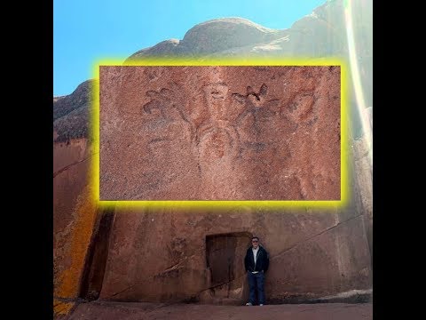
>>12035808
(Please read from the start)
In the second video, the guy seems to have a “latino” surname (maybe Spaniard) and he has an accent. This is making me think he might be a Peruvian urban citizen or someone from a neighboring country. This is important, and I’m talking on purpose about this just to show anons how different persons see and view things depending on their background = how and where they are born and raised. Just compare with the previous video, you will notice the approach to the site is totally different.
1 – First difference is how he is pronoucing the name of the site. This is the correct pronounciation anons, the guy in the first video totally butchered it. This happens a lot when you switch from one culture to the other and from one language to the other. And this is something I’m familiar with since I speak fluently 5 languages myself. And this is one of the reasons why I’m in the mind set of Paysseur = Passeur. Those whom have been reading what I write from the first thread know what I’m talking about now.
2 – This guy is on the “Aliens existing” train, which I’m not. So anons know I’m not going to be supportive of anything he says about the aliens. I won’t agree with his theories and comments about them.
3 – He gives the location and he mentions the stones are similar to the ones in Colorado. He also talks a bit about the “devil’s gate” from a historical approach, which is good, just to give us a quick idea. This is what I do when I post all of those pages from an encyclopaedia; it’s to provide a quick background for the reader. He also mentions this being a stargate and the possible link to Lemuria or Atlantis. He also talks about a theory of the Inca Sun disk (remember the disk stolen by the Vatican and it vanished ^_~ ) being located in the portal. Interesting, isn’t it anons?
- Page 554 –
Disclaimer: this post and the subject matter and contents thereof - text, media, or otherwise - do not necessarily reflect the views of the 8kun administration.
a4c057 No.12050166
>>12050140
(Please read from the start)
4 – He then talks about the hole or the notch along with the edges. The description he gives of it is absolutly correct and spot on. Something fits in the hole. People put it in there, it’s gotta be something like a sphere, at least at its bottom end for it to fit into the hole. Then the person kneels and put his hands on the edge = the T shape. Proof of that is the angle and shape of the edge. Unfortunetly one is broken, but the other is good. Look closely to the picture I’ve attached of the T shape door. I’ve put 2 lines parallel to the door edge. The Yellow line is close to how the edge is shaped and the angle it’s in. This inclination angle is close to what we have nowadays to stair holders or handrails, mostly used when we climb stairs. But there are no stairs here, right?
The second piece is actually the convex shape of where the hand rest: there is what we call in French “l’usure” = wear or “frottement” = friction. I’ve added a parallel red line to it to higlight it for anons. This shape you see is due to friction or wear and it’s caused by repeating the friction = used a lot. If the friction was on top then we would have a concave shape but since it’s a convex shape on the angle, this is proof that there was an inclination there, probably a 45 degrees angle, which is perfect to rest the palm of the hand on; which with repitition can cause friction and create that convex shape. The light blue line I’ve added should have been the shape if some statuettes would have been placed there, but since there is friction and an inclined angle, then this is for the hand to rest upon.
A third proof that a person kneeled there, and placed their hands on the edges is the door sill or what most call the threshold= It’s concave, (I’ve highlighted it in orange) due to friction, it was very used, either for kneeling or standing there for many many times. But since one of the sides is damaged, the cut is kinda (more or less) on the vertical, which makes it hard for ordinary people to notice its concave shape. We can only rely on the good undamaged angle to say it’s a concave shape. Compage the undamaged lower corner to the upper corners of the T shaped door (I’ve put green lines parallel to them). Notice how the curve up there is narrower, the angle of the “turn” is different from the wide curve we have on the lower (orange) undamaged end. I think when this door was carved orginally, the lower door angles were similar to the upper ones, but with friction and wear, with time, it changed.
- Page 555 –
Disclaimer: this post and the subject matter and contents thereof - text, media, or otherwise - do not necessarily reflect the views of the 8kun administration.
024a62 No.12064947
>>12050166
(Please read from the start)
The last proof that someone kneeled there is the hole. When an average height person kneels there and bows their head, it will match perfectly, or should I say it will fit perfectly with that hole we’e got. If we zoom in on the hole, we will notice the edge are eroded due to friction as well. So either something was put in there repeatedly and taken out, or someone continually came in contact with it = as in touched it repeatedly. The image is not clear and I couldn’t find a better one, a better resolution one, but if it turned out that the inner part of that hole also suffered from wear, then, it means something fit into that hole. I don’t have a clearer picture. I’m not saying it is, I’m just saying it’s possible, it all depends on the evidence we have on and around the hole = if there is wear or not and to witch extend.
I found a picture in the web where a lady is doing the correct re-enactment of how it should be. The positions of her head, hands are correct. She only has to get her knees closer to one another for it to be the perfect posture used for centuries by the shamans. She shouldn’t have put her knees apart like that. I’ve seen other pictures of people either standing or kneeling but all were incorrect. This is the closests one to how it was done.
I would like to draw attention to the size of the door. As mentioned before this door fits perfectly for the size of modern day man = his height that is. Now there are 3 phases of construction in Tiwanaku. There is this idea floating in my head that the first stage of construction, where we have the megaliths, have been constructted by people almost double our current size, as in taller, almost the double than what we are right now. We’ve also seen this with the Incas, mostly with the size of some of the doors and how it will fit perfectly if the person passing under them was almost double what we are right now. And as I’ve suggested before, this can also explain the size of the monoliths and how they could be EASIER, not easy, but easier lifted if the size of humans was bigger. I’m not talking about giants the size of a building anons, I’m talking about people measuring 3.5 to almost 4 meters high. This is highly possible and it still exists till nowdays, but it’s extremely, I mean extremely rare. I’m adding some pictures for anons to see for themselves and compare the size of such people, even slightly taller people, to the size of the doors and the monoliths.
Now I think the first phase of construction in Tiwanaku blocks, just like in Cusco blocks, was done but “taller” than nowadays usual people. This explains why we have monoliths and how that is the oldest phase as noticed in the wikipedia page about Tiwanaku site. This also explains why the staff god was represented taller than his servers. This also means that this “portal” we have of Amaru muru was constructed to fit the size of a “shorter” person in height, the standard height we have now among humans. A big tall guy, like what we see in the pictures I’ve attached would have a hard time fitting there, or he won’t fit at all. And his head won’t “naturally” reach the hole with a slight bent of the neck, he would have to bent down a lot in order to reach it. What I’m currently saying is my accesment of it from a professional point, but it’s based on the pictures I’ve seen online. In order for me to be a 100 % accurate and certain for what I’m saying about it is for me to go there personally and check things out myself, and do the experiment myself. So anons, take what I’m saying with a tiny grain of salt here. I’m declaring this because I’m like St. Thomas, I like to check things out myself, touch it with my own hands and see it with my own eyes. As long as I don’t do that, I will always have doubts and not be a 100 % sure. I will say that the possibility is very high for things to be as I just told anons about it, but since I’m the ever lasting doubtful mind, I will leave the door ajar for it to be slightly incorrect. I hope anons understand what I mean there.
Let’s continue where we left off with the video.
- Page 556 –
Disclaimer: this post and the subject matter and contents thereof - text, media, or otherwise - do not necessarily reflect the views of the 8kun administration.
024a62 No.12065011
>>12064947
(Please read from the start)
5 – The guy mentions the measurements of the portal = the perfect divine number = 7. I’ve tried to draw attention to it many times before in this thread. Has anyone wondered why is this number considered “divine”, should I say “from God”? I will be talking about it later on, but I would like to ask anons to keep an eye on this number everytime it pops out. Finding it here, so close to Tiwanaku geographically also confirms my suspesions about Tiwanaku was ….how should I say it? = a good guys place. One last comment = what is the 7th sign of the zodiac anons? (big smile on my face).
6 – The guy said that above the portal there is a walk-way. I think it’s a type of a walking ramp dug within the rock, look again and closely to the video = it is shaped like a modern day ramp, but the edges of the ramp of Amaru muru are higher, taller. I think it’s for safety measures because anons shouldn’t forget that the shamans are walking on that narrow ramp 7 meters above the ground, sometimes at night for star reading. The height is enough to get anyone dizzy or scared. I wouldn’t be surprised to find out that the edge of the ramp was even higher than what we see in the video back in the days or had some sort of railing made of perishable material, like wood or rope. I would like to point out that this ramp was carved in a camouflaged way, to make it blend in the natural shape of the rock and not let it stand out.
Next, anons should ask themselves = why do the shamans need to go up on the roof of the portal? The answer is given to us next by the guy in the video when he mentions the sundial = for astrological readings. I think the guy is refering to the rock and boulder shapes we’ve got on the top, or should I say the tips. Maybe I’m mistaking, but it seems these are not there randomly or by natural phenomena, but they are a bit like the windows we saw in Machu Picchu sun temple, where the window is positioned in a way to match almost perfectly the solstice. So I won’t be surprised at all to find out such a thing also existed on the top of the portal. The existence of the ramp is there to prove that not just access was given to the roof, but also FREQUENT access was giving to the place above the portal. This does not only point that there were astral or solar reading and observation, but it was a frequent thing to do. I would like to point out that it also might be possible for this site to have been used for divination purposes. If it was used for astral = astronomy reading, and we also know they used some type of hallucinogenic in the entire Andean region. So it’s highly possible that a hallucinogen could have been taken on this site while the person is kneeling on specific astronomical calculations = alignements in order to get a divine message – just an example there anons. It might have been combined with chanting and even dancing rituals from aides standing at a specific distance behind the kneeling shaman. I’m just saying this is possible.
I also noticed that the walking ramp on top of the portal is damaged and certain blocks are missing from places. This reminded me of the previous video, where the man wearing white with a beard was sitting on what looks like a flat surface rock. So I’m wondering if those rocks were not initially from the walking ramp above and they fell for some reason, maybe from an earthquake or something like that. And in the same time, this also explains the presence of the drainage.
If you look to the last picture I’ve attached to this page, anons will notice the “curved” shape of the rock. The walking ramp is perfectly camouflaged, and this was not caught in the first video, which was taken by a “public visitor” = the difference between the 2 videos. Also, I’ve put an arrow, just an estimation (I could be wrong though), on the trajectory of the ramp. I think this is why we have the drainage system designed the way it is on the portal. With the high edges of the walking ramp, rain can easily fill the walking ramp and can be even floaded with water, which will hinder the shamans and maybe make it hard for them to get on top of the portal for star reading. The big size of the drainage is to procure quick evacuation of the water as in big quantaties of water can be diverged away clearing the path for the shamans on the ramp, but in the same time, diverging the water from falling straight on the portal in the center in huge quantities; thus the water is drained from the sides and the inclination angle helps to do it naturally via gravity. Smart, right anons?
- Page 557 –
Disclaimer: this post and the subject matter and contents thereof - text, media, or otherwise - do not necessarily reflect the views of the 8kun administration.
db158c No.12065384
>>11939476
If all colours of the rainbow are not present, then the light spectrum is not complete.
Disclaimer: this post and the subject matter and contents thereof - text, media, or otherwise - do not necessarily reflect the views of the 8kun administration.
5dd63d No.12078035
>>12065011
(Please read from the start)
>> Notice the wind anons.
7 – The guy films broken and damaged stairs. If you look closely, you will wonder where can someone stand when he gets to the top, right? There is no place to stand there. I think we should take a look at the fallen big blocks downstairs anons ^_^ this is a damaged site, something fell, and I won’t be surprised to find a rather big flat surface block with wear on it downstairs = place where the shamans would be standing to read the stars. It’s so obvious that this site has sustained damage and the initial structure has changed.
8 – The guy mentions a petroglyph in the vicinity of the portal and it’s obvious they are looking for it to film it. Then he walks this narrow passage with a lady wearing red filmed in front of him. Anons, take a good look at how smooth and flat that wall is on the right side of the guy. This is man made. This is not natural rock formation. The passage was cut out by hand. Then when he reaches the highest point we see a big view of “rock walls” that are parallel to one another. I’ve never seen anything like this in my entire life. I wish a geologist can give us information if these rocks are naturally formed or if there is human intervention. It’s like 2 perfect parallel lines made of rock. Since I know the Amaru muru rock has been re-shaped by humans and it also sustained damage that made some chunks of it fall, then, I think researchers should carefully = no rushing, be checking out those “strange” rock formations as well. I’ve attached a picture with this page for anons to make them undersand what I mean here. Anons, just check the width between each section: it’s almost the same from start to end in this picture, almost a perfect straight line, same width and parallel. In Heavens name, please don’t tell me this is the work of Mother Nature. As I’ve said before, I’ve never seen anything like this before being naturally made.
9 – Then the guy in the video makes a very interesting comment = the altitude = around 4000 m above sea level and this reminds me of the oxygen level in the area and how hard it must have been to simply walk. He then mentions a scene from Jurasic park or a martian senario; just freeze the picture on the big blocks proudly standing on his right hand side anons = we can see 4 of them on the screen. Yup, those are construction blocks….same as the big blocks we have in Tiwanaku, but these are highly damaged and even eroded. I’m only saying this about the 4 blocks we see on his right hand = look at their supporting edge, it’s almost a perfect line. And I want to draw attention to the camouflage technique used again here, to make it all blend with the natural stones.
10 – I like this guy from the video because he did a very logical thing and that is to talk with a local and ask him to show him some stuff and tell him the “old” stories. The local youth tells the story of his grandpa seeing the portal “shining sunlight” at 9 pm, during a full moon, then inside the portal he saw a golden city with a street, there was a shining light that caught his attention first though and made him turn around to see it. It only lasted for a few seconds, he had a small glimps and then poof, it was gone. The grandpa believes there is another dimension, some sort of connection. Some sort of portal or stargate, that can take people with pure hearts to the other side.
Do you believe in the story given by Socrates grandpa anons?
I do.
I believe the grandpa really saw what he said he saw. But I do NOT think he is accurate on how he interpreted what he saw. The testimony of the grandpa can be divided into 2 parts: 1 - the description or testimony of what he witnessed, saw – and 2 – his interpretation and understanding of what he saw. Let me explain before you jump into wrongful conclusion anons.
- Page 558 –
Disclaimer: this post and the subject matter and contents thereof - text, media, or otherwise - do not necessarily reflect the views of the 8kun administration.
5dd63d No.12078155
>>12078035
(Please read from the start)
First section of what grandpa witnessed is the story = events of what happened.
It starts on by him walking around 9 pm at night and it was a full moon. From what Socrates said, his grandpa was the same as back then as the young man is now, meaning 25 years old. So when can we estimate the grandpa saw this? It depends on the age of the grandpa of course, but if I’m going to estimate roughly, it should be something between 40 to 60 years ago. Again, this is just an estimation, it’s not accurate because the info is not provided: I’m just doing guess work about the age of the grandpa. Why is it important? Because this can tell me how things were during that time in the region and mostly what was his grandpa doing walking at that late hour in the middle of no where? Was he coming back from working in the fields? Was he returning with his Llama herd? Or was he a smuggler?
Another thing: the grandpa saw this portal and new about it decades before it was supposedly discovered if we compare this testimony with what is written in wikipedia page (p. 552). So a local experience such an incredible event and you think he doesn’t talk about it to anyone, mostly the local police or officials? Of course he did. At least he told that story to his family, relatives and neighbors. And I’m sure curiosity spiked in them all and they went to check it out. But anons gotta remember that this happened at least some 40 to 60 years ago, if the grandpa was 25 years old back then. So the portal was known to the locals decades before its big discovery in the 1990s (as written in wikipedia page). And if locals think there are some ancient magical ruins, you think they won’t come exploring the site hoping to find some treasures, mostly some gold? And remember what the grandpa said: he saw a city of gold = which will attract everyone including looters.
I’ve made this remark before in this thread that the public perception of an archaeological site and its treasures is usually that of gold coins and jewelry hidden somewhere on the site. They think that is the treasure that lies there and filled with greed, to get their hands on that gold, they usually damage the site and break off parts and pieces. Image you being a crime scene fingerprint expert and before you can get into the murder site, everyone comes in and out of the place, touching everything without gloves, displacing everything possible, even wiping some of the fingerprints by accident. What will happen to the fingerprint evidence you were hoping to collect from the murder site? Same scenario here: the smell of riches and gold attract looters and they come in trying to find the treasures….damaging the site and we loose sometimes precious tiny pieces of information and artifacts just like that.
Now I think the trick was all in the wall of the portal, the water and the drainage system. Remember anons, it was a night with a full moon, meaning the moon shined. Now next we’ve gotta take a look if there was any rain that night or if there was some type of moist/ humidity that night. Why? Well, let me try to explain:
If those drainage canals didn’t exist on both sides of the portal, then the water would pour down gushing like what you see in pictures 1 and 2, I’ve attached to this page. It would come down this way on all the surface of the portal, of course depending on how much water there is. But since the shape of the rock is curved and since we have the drainage canals on the sites, the water (either rain water of some other type) would be channeled to the sides and go down with the drainage you saw in the first video.
Everything depends on the pluviometry or should I say the level of rain precipitation. The circumference of the drainage canals on the sides indicate that a large quantity of water came down from there. But does it rain in the region? If yes how much? If it rains a lot or medium, then everything is explained by saying this is to redirect the water from the rain, and stop it from pouring down on the portal like what we see in the pictures 1 & 2. But if there is little to no rain, then it means that the shamans themselves used to pour big quantities of water from the top of the portal while performing their rituals. Why they might do that? = I think it’s to gather the 4 elements = earth, air, water and fire, while performing the ritual. I’m repeating myself = it all depends on the level of precipitation, if it rains a lot in the region or not and how frequently it does so.
- Page 559 –
Disclaimer: this post and the subject matter and contents thereof - text, media, or otherwise - do not necessarily reflect the views of the 8kun administration.
5dd63d No.12078232
>>12078155
(Please read from the start)
For me, right now, it doesn’t matter where the water came from = rain or ritually used. What interests me is how the surface of the portal rock looks like when it’s wet. See, when you have a lot of water coming down (either from rain or for ritual purposes) you have something around 90 % of the water going down in the drains, but there is a small quantity of water that slowly trickles down on the rock surface like what I’ve put in the first image I’ve attached to this page. As it trickles down, the surface of the stone will be looking like the second picture I’ve attached to this page – sorry it’s a small one. What does happen to a vertical surface when it’s covered like that with water? = it becomes mirror like. And since it was a full moon night, at 9 pm, we can calculate the angle and the trajectory of the moon and see if the silver moonlight hits the wet surface of the portal (like first picture from the previous page).
If you are traveling at a distance in the dark, even if you are carrying a flashlight, a gazlight or a torch, how does a wet surface portal struck by the moonlight will look like to you? Mostly if it’s from a distance, don’t forget that. It would shine a mirror or like light, right?
Now then the grandpa said that something shined and caught his attention. Then he saw a golden city with street etc. We did see about the possibility of something hanging or placed on that hole in the portal, right? So if whatever was there was made of gold, solid pure gold, and it had a carving…like representing a picture of a street and a city….maybe, even being a map of that city… it’s likely possible he saw an iconography of a street drawn with perspective, like the picture of the Champs Elysées avenue I’m attaching with this page – but with buildings on the sides, not trees, of course. In the back end, there is a posibility there might have been a high structure, like a temple represented on the golden surface hang on the portal.
And it’s highly possible that whatever was hang there, was circular in shape and the periphery was decorated to look like sun rays. This is why I said we need to check the friction and erosion = wear on that hole and around it, mostly to check the diamter if that disk truly exists or not.
And this is the odd part in the testimony: if a poor village man sees a disk made of gold hang on a wall in the middle of nowhere, what would his first reaction and thoughts be? = grab that gold and sell it, right? Gold equals money, right? His first thoughts would be = I’m rich. He said that the “vision” he had lasted for a few seconds….that’s how long the moonlight must have lasted on the golden disk, as he was walking…anons shouldn’t forget to calculate the inclination angle of the monnlight according to the month, and hour and season. He must have been walking close enough to be able to distinguish the details represented on the golden object, right? But for some reason, he didn’t have the curiosity or instinct to go check it out and mostly to grab the gold if it was hanging on the door. That is one heck of a curious behavior if you ask me.
That is when we reach the second part of the testimony: how the grandpa interpreted what he saw. He said that only people with pure hearts can get = teleported to that golden city. Pure of heart…..now where did I hear that one before? Oh yes! This is what I used to tell my own kids and now my grandkids….this is the type of language and sentence adults use when trying to explain what Heaven is to children. And this is where I think the grandpa’s testimony became mixed with his subjectivity and what he heard when he was a kid himself.
From the looks of it, the grandpa heard the stories from the adults about a “magical” door that only takes the good kids to a better golden place. It’s obvious the locals, at least some of them, knew about the existance of the portal way before its discovery was announced to the rest of the world in the 1990s. So it’s a possibility that the grandpa sneaked at night alone to try and find this legendary portal….and since it turned out to be a full moon night, he saw what he saw and remembered the folkloric stories or I rather call them the “modern urban legends” he was told while growing up. And in his mind, he truly thinks he saw what he said and he truly believes it, he is being truthful in his testimony.
Personally….this is how I exlain the grandfather story. Of course it needs to be verified, starting by checking out the level of precipitation in the region and WHEN = the year, month the grandpa saw what he saw.
I know I’m explaining this part in details for anons. I hope I can help the researcher interested in this site to crack the mystery and solve it. I saw a big lack of info about it, and since I can help, I went a bit in this tunnel.
- Page 560 –
Disclaimer: this post and the subject matter and contents thereof - text, media, or otherwise - do not necessarily reflect the views of the 8kun administration.
5dd63d No.12078271
>>12078232
(Please read from the start)
Before moving forward, I would like to ask anons to take a very good look at young Socrates when the takes off his hat. Notice the shape of his skull ^_^
11 - In the video, Socrates takes them to the “7” holes or 7 water mirrors and the narrator links them to the Pleiades constellation. I was also wondering anons if the layout of these 7 holes do match a constellation. Amazingly, in the video, after putting a compass there, on the rock, it matched the true north = alignment and axiality.
12 – Then young Socrates takes our narrator to what is believe to be the entrance of a chinkana (hope I spelled that one right). Then the narrator explains that the chinkana is an underground tunnel that connects to different places called Wakas = sacred places around different parts of the Andes. At first I was reminded of the Ayars brothers story and how they came out of the ground. But looking closely to the entrance of the chinkana, I remembered the fallen blocks that I mentioned before about this video. Look closely anons, this is a HUGE chunck = block of rock that has fallen. With erosion and soil displacement, the land level can easily rise and burry with rubble and debris the entrance of the chinkana. When you think about it, I don’t think we are dealing with tunnels here anons but rather ground level corridors. And this in turn made me remember the corridors of Chavin de Hunatar where the Lanzon is kept. That was a super sacred place, wasn’t it? Not for ALL to see. I’m basing this on my hunch, but I think we are dealing with something similar here.
And that’s not all. I also think this is a natural rock carved in by humans. If you look at the surface of everything we’ve seen so far, it’s smooth and it’s carved in a way to make it blend with the natural rock. What I have in mind is very close to the house caves we see in Cappadocia, where the narutal shape of the rock was left untouched (mostly) and the inside of it was carved to house people. I know it’s not exactly the same, but I’m thinking we might have the same concept here. But instead of them being housing units, I think Amaru muru rock was carved to have a religious function, as in some sort of temple.
13 – Next is the place where the Petroglyph is located: just look at how smooth and flat that rock surface is anons = man made. And of course the narrator goes onto calling it “the Alien Petroglyph” (face palm for the old man). I agree with him when he says there is a lot of wear on the petroglyph = it’s worn out and in badly preserved shape. And the biggest blunder the narrator made is giving the “supposed” shape of the petroglyph as being a humanoid with eyes, mouth and fingers (different numbers) on each hand. He does that ignoring the other concave shapes that I’ve pointed to in the second picture I’ve attached to this page.
He himself said earlier in the video that he passed the location where the petroglyph is carved and he didn’t notice it because of the sun angle. So here is proof to anons that his interpretation is wrong. I think he didn’t get the shape right and we might not be able to get it right at all because of how bad it’s worn out. What to do? We can try using different methods, old and new.
- Page 561 –
Disclaimer: this post and the subject matter and contents thereof - text, media, or otherwise - do not necessarily reflect the views of the 8kun administration.
3a0f5f No.12092888
>>12078271
(Please read from the start)
Like taking color pictures from different angles and from different TIMES during the day, so that the sun light would hit it from different angles. We also take black and white pictures, it’s always useful. The youngesters nowadays can use machines to scan this and recreate a 3 D print of it on computer, not my field, that’s for sure. Since I’m an old dog I also like to combine old methods: we bring a huge sheet of white paper which we gently apply on the rock surface and we use a charcoal on top, aplying it gently, to take a negative print. We don’t want to damage the rock, so we take great precautions while working. And the last old fashioned method I use a lot and I always found it helpful is to throw water on the entire rock. It gives us another type of negative print and it reveals a lot of details unsean when the rock is dry.To be done if there is no paint on the wall or if it doesn’t damage the rock. Of course none of what I mentioned should be done without the formal written approval and suppervision of the Peruvian gvt. This is a national cultural treasure, not a toy, we should respect the artifact, the site and the gvt’s authority over it.
And this is where I’m going to end it about the video. But I’m not totally done yet about Amaru muru. I decided to check the context and I zoomed out and I decided to take a look with Google.
What I found was:
1 – How close Amaru muru site is to Titicaca Lake.
2 – Amaru muru is within walking distance from Tiwanaku site.
3 – It’s not the only “RED” rock formation in the area.
I’m mostly fascinated by what anons can see in the picture I’ve named = Rock formation 1. And in the 5th picture, last one, I’ve added a parallel yellow line, it’s aproximative, just to show anons how th red rock stretches and it’s not limited to Amaru muru site. In some place it looks like it’s diving underground while it resurfaces in other place. Another thing about this red rock, it seems it’s only located in this specific zone. I’ve tried to look around to see if there are others like it, not just in nature, but also if it has this super crazy odd shape of stripes, I personally couldn’t find any. Maybe I failed, well, I only hope if someone reading this has found other rocks looking like this = same shape and color, please share them with us in this thread. And this brings me to the second thing that caught my attention and it’s totally taking me up to the moon = those stripes. If this is a natural rock formation, I’ve never ever seen in my life such perfect parallel lines stretching at such a long distance. How many kilometers is this anyway? It’s absolutely huge! And anyone apart me noticed the width = the distance between each lane = the space between them….it’s almost perfect parallel lines with almost no alteration to the width. It’s like natural straight line corridors. I won’t be surprised to find some petroglyphs on the other red rocks belonging to this specific chain of rocks anons. If not petroglyphs, then something connecting them, or indicating their connection with Tiwanaku and/or Amaru muru.
I end it here with Amaru muru and the Incas. I’m sure there are still plenty to look about, but it’s getting too long and I rather move on.
If there is a site or an artifact belonging to any of the civilizations or culture I’ve already talked about and I didn’t pay attention to, anons are interested, please bring attention to it, then please, post about it.
- Page 562 –
Disclaimer: this post and the subject matter and contents thereof - text, media, or otherwise - do not necessarily reflect the views of the 8kun administration.
e13bb3 No.12103228
>>12092888
(Please read from the start)
Next I’m going to talk about the “Out-of-Place-Artifacts”, listed in this Wikipedia page, which are geographically located in the entire South American continent.
https://en.wikipedia.org/wiki/Out-of-place_artifact
The first artifacts from South American continent I want to take a look at are what is called the Quimbaya artifacts:
https://en.wikipedia.org/wiki/Quimbaya_artifacts
“The Quimbaya artifacts are several dozen golden objects, found in Colombia, made by the Quimbaya civilization culture, dated around 1000 CE, a few of which (the so-called Quimbaya airplanes) are supposed to represent modern airplanes, and therefore to be out-of-place artifacts. The whole of the figurines, measuring 2 to 3 inches (5 to 7.5 cm) each, are described in mainstream archaeology as depicting birds, lizards, amphibians and insects common in that region and period, some of them highly stylized, as in the Gold Museum, Bogotá.
In 1994, Germans Peter Belting and Conrad Lubbers created simplified radio-controlled scale models of these objects and showed that their models, which lack some convoluted features present in the real figurines, could fly.”
>> Not much said about them isn’t it anons? And apart the alien spacecraft theory, I didn’t find something satisfying about them in the alternative history.
However, while looking around, I did find an opinion/comment from a person whom said the Quimbaya look like a modern day fighter plane. Upon further image search, I found this side by side picture of the artifact compared to a fighter plane. They do look alike don’t they anons? They are similar. But I also found this picture of the Quimbaya with a detached piece of it, reminding me once more about the ejectable seat of the fighter plane pilot and how we see in movies that protective glass lid fly off so that the pilot’s seat can eject from the plane. So I found the imagery similarities interesing.
Next I found an interesting article combining both the Quimbaya artifacts and the Nazca airplane runway strips.
https://www.ancient-origins.net/unexplained-phenomena/ancient-runways-and-flying-fish-did-nazca-culture-take-flight-008662
“24 AUGUST, 2017 - CALEB STROM
Ancient Runways and Flying Fish: Did the Nazca Culture Take Flight?
The Nazca lines are still mysterious even after decades of being carefully studied. Archaeologists believe they know how they were made, but why they were made remains uncertain. Recently, researchers have suggested that the lines were related to fertility rituals involving the availability of water, but there are some people who still see something different in lines that are very long and straight. Some alternative thinkers argue that the straighter lines represent runways for ancient airports. Although it is possible that this is the case, the evidence found to support this position is insufficient so far.”
- Page 563 –
Disclaimer: this post and the subject matter and contents thereof - text, media, or otherwise - do not necessarily reflect the views of the 8kun administration.
e13bb3 No.12103263
>>12103228
(Please read from the start)
>> How many times must they flip-flop about the Nazca lines, how they were made and what they were made for? Compare with what was written earlier about them. For me, we still haven’t figured out a zit about them.
“Were the Nazca Lines Airports for Ancient Aliens?
The Nazca designs consist of a variety of figures. Some are recognizable as animals, such as spiders and monkeys, while others are more abstract. There is also a subset of figures that consist simply of straight lines. Some of them are built at the tops of hills and appear to stop at the edges of cliffs. Unlike the other designs that are clearly figural, these resemble runways in their length and straightness. This has led some fringe theorists to suggest that these lines were ancient air strips or airports. Some people even suggest that the lines made on hills were specifically created for launching gliders.”
>> Not to mention that moutain tops were flattened (as we can see in attached picture) just to provide a smooth surface to “draw” the lines on; totally different from the hill side geoglyphs of the Paracas culture. Just the scale of the work required to flatten the mountain top is incredible.
“There are two main groups which say that these particular Nazca lines represent runways - those who believe that the Nazca geoglyphs were made by visiting extraterrestrials and those who believe that the Nazca people had flight technology and used it to make the lines. Proponents of both views point to the Tolima artifacts: gold figurines that sometimes resemble jet planes, as further evidence that ancient South Americans either possessed flight technology themselves or encountered flight technology produced by someone else, such as ancient aliens.”
>> Well, it seems I belong to the second set of people whom thinks old flying technology existed. I know it might be hard for some to even conceive this though because we’ve been under (((their))) heavy brainwashing for centuries now. But in this thread, we have met a lot of “strange” artifacts that indicate FLIGHT, if it’s not itself, the idea of it, did exist for a very long time. And there are some stuff that are totally hard to explain, like the layout of certain constructions and structures, like the Nazca lines which are impossible to “draw” unless having a bird’s view, along with some “special” type of “drawing technology”; like what is used in topography.
“The main problem with the extraterrestrial explanation is that there is no other clear evidence that suggests alien visitation. There is no evidence of crashed spaceships, spacecraft parts, rare metal alloys not normally found on earth, or anything else that could not have come from this planet - no indisputable evidence at least. Furthermore, analysis of the lines shows they were made by delicately removing topsoil to create these designs. A spaceship landing would probably have disrupted this fragile configuration.”
>> They’ve got a point here. Just seeing how much wind an airplane landing or departing creates is enough to blow away the line’s design. I know a lot of UFO society people believe there are MANY crashed alien spaceships that are kept hidden from the public by the cabal. But has it occurred to anyone that those “crashed” aircrafts might turn out belonging to an ancient civilization on Earth and not alien? Which brought me to the question = why did they crash? Think about it for now anons, I will explain this when I bring the whole puzzle together.
- Page 564 –
Disclaimer: this post and the subject matter and contents thereof - text, media, or otherwise - do not necessarily reflect the views of the 8kun administration.
e13bb3 No.12103306
>>12103263
(Please read from the start)
“There is no evidence of parts of the lines being disrupted because of exhaust from landing spacecraft and you would expect such evidence to remain since the desert is not very windy. This is, in fact, why the Nazca lines have not been obscured by windblown material. Based on these facts, it is unlikely that extraterrestrials made any of the Nazca lines, including the alleged runways.”
>> I must admit, this is more convincing now = saying there is wind, but not strong, or barely windy to blow the lines away. Yup, this is better than what was said before about it.
“Runways for Forgotten Nazca Aircraft?
The Nazca lines would not have been hard for the Nazca people to make and experimental archaeology has shown that a team of people can make such lines within a few hours to a few days using only the technological means known to have been available to the ancient Nazca through archaeological evidence. As a result, Occam’s razor is friendlier to the idea that the Nazca culture made the lines - we have evidence that they lived in the area at the time and could have constructed the lines - whereas we don’t have evidence that extraterrestrials were ever present.”
>> I’m all for the Nazca being the ones whom made the lines, I never doubted that. But I do have a few problems with what was said. See, it’s not just how easy or hard it is to make those lines. I have a few problems like: what tools were used to create these lines (topographer tools) - like how on earth did the Nazca managed to flatten the mountain tops at this huge scale, in order to “draw” the lines and keep it leveled for kilometerrs? – How did the Paracas managed to “draw” the lines on hill sides and have them not crumble? Why didn’t they also use like the Nazca flat hill tops for their lines? So you see anons why I’m having a hard time with this theory of how the lines were supposedly “drawn”? It’s not as easy as it looks at first because the Nazca obviously prepared the terrain = flat mountain tops, well leveled, before “drawing” the lines, and I’m mostly curious to know what type of tools or machines were used to “draw” the lines for so many kilometers and mostly make those curves/semi circles. All I can think about is some sort of tools like what we see modern day topographers use. With this anyone whom knows how to operate the tool can draw perfect lines for kilometers in length = maybe sort of tool with a lens. I still didn’t figure out the perfect semi-cercle shapes though.
“Since it is most likely the Nazca people themselves made all the lines, some fringe theorists have logically concluded that the Nazca civilization must have had flight and other advanced technology because of the supposed runways. Proponents of this view point to Nazca geoglyphs that look vaguely mechanical, resembling windmills and hooks, to bolster their case.”
>> If anons look at the “runway” geoglyphs of the Paracas culture I’ve put some pictures of before, you will notice how close they were “drawn” near ruins = maybe housing, working or storing units. This means people walked there, among them….kids played and ran…..and yet, somehow, the lines that looked like airplane runways weren’t that damanged. When I looked closely to them, I see them more like spearheads or arrowheads.
- Page 565 –
Disclaimer: this post and the subject matter and contents thereof - text, media, or otherwise - do not necessarily reflect the views of the 8kun administration.
e13bb3 No.12103331
>>12103306
(Please read from the start)
“Although this hypothesis is probably more likely, there are still problems with it. We must remember that just because a design looks one way to us, doesn’t mean that it looked that way to the Nazca. For example, they may have been using a particular style of art to represent natural features such as plants and animals that just by coincidence causes them to resemble machines to us since we live in the age of machines.”
>> Oh yes! I do agree with what is written here. If something looked a specific way to us, it doesn’t mean it meant the same thing for the Nazca culture. As an example of what I’m saying, I would like to ask anons to take a look at the Dendera Zodiac ceiling and see how the constellations are depicted (their design) differently than the standard ones we are acquainted with nowadays. So it’s tricky.
“Another example of this might be the nicknames archaeologists will give to artifacts that they do not recognize. Early hominids used what archaeologists call a “hand axe” even though, in reality, it was probably not used as a hand axe. It just happens to resemble an object in our culture that didn’t exist in the culture of Homo Ergaster which originally produced the “hand axe.” This could be the same with the Nazca designs.
One of these mechanical looking geoglyphs resembles a windmill. Experts have identified it as a flower, but some fringe thinkers insist that the Nazca would have done a better job at depicting a flower. If this design is compared to others that are more clearly flowers, however, it is very similar to some of the flowers. Therefore, it could just be that there was a variety of representations of a flower in the Nazca culture, some more closely resembling a flower as we see it today and others more abstract.
It should also be noted that straight lines are very common and not all straight paths made in history have been runways. As a result, the fact that they are long and straight does not mean that these lines are runways. Thus, both the apparent runways and the geoglyphs supposedly representing mechanical devices are, by themselves, too ambiguous to be used as evidence that the Nazca were more advanced than would be expected at the time.”
- Page 566 –
Disclaimer: this post and the subject matter and contents thereof - text, media, or otherwise - do not necessarily reflect the views of the 8kun administration.
f2ef12 No.12116097
>>12103331
(Please read from the start)
>> I’ve said this many times before in this thread: if you take one artifact or structure on its own, it can be easily “debunked” or cast aside. But if you look at the global picture, we start having another image. Just like what I did with the Med Sea and the Flood: I gathered the evidence, from the Flood traces on Giza plateau, to Fossiles all over the Med and in high altitude, from the volcanic activity and the rift of the Red Sea and of course how the piece of land between Tunisia and Italy sunk….I gathered the pieces and put them together….and it happened to be that I also have a fossilized Ark trapped on Mount Ararat….and it happened to be that the Kuphar was used to navigate down the Euphrates which happened to be the craddle of the Epic of Gilgamesh, mentioning the Great Flood, just happens to exist. Coincidence after coincidence after coincidence! So I’m doing the same with the FLIGHT idea anons, but this time, I’m going global, worldwide, not just with the Flood but with other pieces of the puzzle….Once everything is in place, I can bring them together to explain what happened.
“The Question of the Quimbaya Artifacts
We currently do not have any evidence of airplanes or flying machines built by the Nazca, only these dubious lines and symbols that some modern people think look mechanical or resemble modern features such as runways. There is no solid evidence for crashed airplanes or airplane parts. There is also no evidence for buildings that may have served as hangers or airports nearby the supposed runways. Absence of evidence may not be evidence of absence, but it is not evidence either.”
Proponents of this theory also point to the Tolima or Quimbaya artifacts. The Quimbaya culture made many gold artifacts representing frogs, birds, insects, fish, and other animals. A few of them have fins and delta-shaped wings - which have led some people to suggest that these particular figures are ancient depictions of airplanes.”
>> The good part in what was said is that they started to bring 2 pieces of the puzzle together: “Nazca airplane runway design geoglyphs” and the Quimbaya artifacts = both represent the idea of FLIGHT, regardless if we agree if humans could or not fly in the past.
“The problem is that even the figures that resemble airplanes basically look like stylized versions of animal figurines. There is no sharp distinction between the ones that resemble airplanes and ones that are clearly animals. It may just be that some art styles of the Quimbaya happened to produce things that resemble items in our modern culture rather than them being an actual depiction of ancient flying machines.”
- Page 567 –
Disclaimer: this post and the subject matter and contents thereof - text, media, or otherwise - do not necessarily reflect the views of the 8kun administration.
f2ef12 No.12116161
>>12116097
(Please read from the start)
>> Well, that used to be a problem for me too to figure out, but that is if you take the Quimbaya on their own and neglect the other pieces we have. Like what pieces? Like the Birds of Prey headgear designs I’ve been talking about in this thread = I believe those are individual mancrafts; no collective aircrafts like the airplanes we have nowadays. You think the idea is odd, but it’s not. In many Hollywood movies, over the decades, the individual mancraft has been presented to the public many times, inlucing in the Avengers (Falcon, Iron Man, etc) as I’ve cited before and if I remember correctly, there was even a James Bond movie with one in it. Even amateurs try to fly using one of their own invention. Just do a little search online anons and you will see what I mean there = they are called the Jet Suits or Jet Pack. I believe this is another technology hidden from us by (((them))). And (((they))) throw it in our faces via movies. Strange how we accept such ideas coming from movies but if a person came out and made a hypothesis about it to the public, the media and (((their))) “experts” quickly debunk it and attack that person, ruining the life of that person. It’s like we are kept inside a fantasy world woven by (((them))) specially to blind us.
The best clue or should I say hint we had came from the cartoon called the Mysterious Cities of Gold, with the plane shaped like the Gondor (p. 336). Anoher hint to support this comes from the movie Stargate, when you look at the small warplanes used by Ra's soldiers to bomb the miners/ slaves village, those aircrafts were also shaped like birds (p. 205). So Anons, if individual flying gear were shaped like birds, why not the ancient airplanes were also shaped like birds? Is it that hard to accept and imagine it? Also, the individual headgear we’ve seen were not just designed as Birds of Preys, there were also a FEW with Feline designs; remember the Griffin? So this means it was not just one type of animal design used, but many. I’m thinking the body gear is the same, but the helmet shape is either a feline or a bird of prey = coat of arms = belonging to different military factions.
“It is true that some people have created gliders based on the Tolima artifacts which successfully flew, but the scaled-up versions of the artifacts had to be significantly modified in order to fly - which makes it less likely that the original artifacts represent models of actual aircraft.”
>> So when these were replicated on a bigger scale, they flew… what a remarkable piece of engineering!
“Attempts have been made to create flying machines throughout history before the Wright brothers or the first hot air balloon flight in 1783. Particularly well-known stories are from ancient China, the Islamic world, and Medieval Europe. However, there doesn’t appear to be evidence of widespread flight before the 18th century. It may have happened, but it will require more evidence than ambiguous geoglyphs and figurines that resemble modern technological devices or runways for airplanes. What will confirm ancient human flight would be evidence of actual aircraft.”
>> I agree, just 2 pieces of the puzzle won’t do; this is why I’m gathering as much as I can in this thread. But even after I gather most, we can still consider them to some degree circumstential, if the reader is still having a hard time accepting the idea that flying machinery existed before the XVIIIth century. Then, I’m going to add my “spices” in the mix.
- Page 568 –
Disclaimer: this post and the subject matter and contents thereof - text, media, or otherwise - do not necessarily reflect the views of the 8kun administration.
c290c8 No.12131203
>>12116161
(Please read from the start)
Since we don’t have much to go on about these little Quimbaya artifacts from both Main Stream History and Alternative History, let’s see their CONTEXT and take a look at the Quimbaya civilization: https://en.wikipedia.org/wiki/Quimbaya_civilization
“The Quimbaya civilization (/kɪmbaɪa/) was a Pre-Columbian culture of Colombia, noted for their gold work characterized by technical accuracy and detailed designs. The majority of the gold work is made in tumbaga alloy, with 30% copper, which imparts meaningful color tonalities to the pieces.
History
The Quimbaya inhabited the areas corresponding to the modern departments of Quindío, Caldas and Risaralda in Colombia, around the valley of the Cauca River. There is no clear data about when they were initially established; the current best guess is around the 1st century BCE.
The Quimbaya people reached their zenith during the 4th to 7th century CE period known as The Quimbaya Classic. The culture's the most emblematic piece comes from this period, a form of poporo known as the Poporo Quimbaya, on exhibit at the Bogotá Gold Museum. The most frequent designs in the art pieces are anthropomorphic, depicting men and women sitting with closed eyes and placid expression, as well as many fruits and forms of poporos.”
“Most of the retrieved items are part of funeral offerings, found inside sarcophagi made of hollow trunks. The gold represented a sacred metal and the passport for the afterlife. Around the 10th century the Quimbaya culture disappeared entirely due to unknown circumstances; studies of the archeological items point to an advanced cultural development and the political structure of a cacicazgo with separated groups dedicated to pottery, religion, trade, gold work and war.”
>> Wow! Gold is considered the passport for the afterlife and it’s a sacred metal for the Quimbaya. Do you think (((they))) are this interested in gold for these same reasons? Just me wondering out loud anons. Also, remember the Condor in “the mysterious cities of gold” cartoon is made of gold. Another point is the way the society is structured: it looks like a giant bee hive where each person has his/hers own specific place according to the “type of work” they did. We’ve seen this before in this thread and I also said back then that this was the case in Ancient Egypt as well = how the society was structured and divided into categories.
“Economy
Living in the temperate tropical climate of the coffee belt, they were able to cultivate a wide variety of products: corn and cassava, as a food base, avocados, guava. They were also nourished by fishing and hunting, and they were excellent farmers, with what the land gave them.”
- Page 569 –
Disclaimer: this post and the subject matter and contents thereof - text, media, or otherwise - do not necessarily reflect the views of the 8kun administration.
c290c8 No.12131213
>>12131203
(Please read from the start)
“They were also intense hunters. The hunt provided them with rabbit and deer meat in abundance, but also, as far as is known, they hunted opossums, tapirs, armadillos, foxes and peccaries, among other animals whose remains have been found.
Mining was mainly gold. They developed advanced metallurgy techniques to process gold in a way that is full of aesthetics and fine finishes. The name "quimbaya" has become a traditional generic term to refer to many of the productions and objects found in this geographical area, even if they do not come rigorously from the same ethnic group and come from different epochs in time.
Quimbaya technical skill extended beyond the production of goldsmith's pieces, including in the manufacture of oil for lighting, and in textiles, although given the poor geological conditions necessary for their preservation, few examples of textiles have survived. The manufacture of cotton blankets was, in fact, their main industry.
As merchants, they exchanged their pieces of metalwork, blankets, textiles and gold, with towns in neighboring regions and beyond. They also produced and traded salt, extracted from the rivers though a technique involving boiling river water using fire and lava.”
>> We are dealing with a society very knowledgeable in MANY artisanal work. We’ve seen this before with the Toltec (starting page 253): they were famous as dexterous artisans.
“Culture and customs
It is discussed if the Quimbaya practiced ritual cannibalism with their war enemies, in festivities or very special celebrations. This cannibalism would have symbolic meanings related to the defeat and revenge of its enemies or to the appropriation of the spirit of the person. However, in the case of the Quimbaya, the chronicles referred to in cannibalism are based on a single testimony about two alleged cases. They displayed human heads as trophies hanging from reeds in the plaza. During the conquest they intensified this practice to instill fear in the conquerors.”
>> From the sound of it, it is more like scare tactic than real cannibalism practice.
- Page 570 –
Disclaimer: this post and the subject matter and contents thereof - text, media, or otherwise - do not necessarily reflect the views of the 8kun administration.
344482 No.12144302
>>12131213
(Please read from the start)
“They paid much attention to their funeral practices, and the constructions of Quimbaya tombs bear witness to this affirmation since, in truth, they elaborated an enormous variety of different tombs according to the specifications of each funeral, in which the offerings that would accompany were always included. The deceased carried these on his way to the next life, including food and weapons to make it easier. In the tombs they also buried most of the pre-Columbian gold objects, personal elements of the dead and some other sacred elements. They believed that all bodies would be resurrected.
One of the most famous activities he has done to the Quimbaya is his luxurious goldsmith shop, which enjoys an incredible beauty as well as a perfect technique. They developed metallurgy systems to combine copper with gold that was not abundant in their region (unlike other areas of the country). This combination of gold and copper, called "tumbaga", would not detract from the attractiveness, brightness and durability of its magnificent pieces, of a spectacular vivacity. One of them, very popular, is the famous poporos. His goldsmithing is one of the most important in America given the exquisite beauty of the pieces expressed by very well developed metallurgical methods.
Its culture the way to melt the gold to obtain the exact grade of gold and copper to maintain a high purity, it is still unknown how such quality was achieved since they would need kilns that would reach a thousand degrees Celsius to melt these pieces.”
>> We have a mystery on our hands…or NOT….not if we know there was an advanced civilization destroyed by a cataclysm and there were people whom survived it and brought the knowledge they had with him from pre-Flood era to post-Flood era.
“Another of the mysteries of the Quimbaya Culture are the Quimbaya artifacts, formerly called "Pájaros del Otún", since the former was found near the banks of the Otún River in the province of Risaralda.”
>> They mean our little “airplane” artifacts here anons.
“Engravings and petroglyphs of the Quimbayas can be found in the Natural Park of Las Piedras Marcadas, also known as La Marcada. They are located in the path Alto del Toro in the municipality of Dosquebradas Risaralda (Colombia). The stones are a mystery since no one knows exactly their antiquity or its true meaning. They are granitic stones of great hardness and onto their surface is carved spirals, stars, constellations, planets and other strange symbols; it may be some message from the gods that was left for posterity on the hard rock. The Park of the Marked Stones is one of the most unknown and despised parks by the scholars of the Colombian tribes, more interested in the goldsmith and clay works than in the lithic art. Others have related the marks with constellations and even they are related to the Quimbaya artifacts, and their mysterious origin; It is not really known why some were found on the banks of the Otún River when others have been found on the banks of the Cauca or the Magdalena.”
>> Incredible how these petroglyphs have been “despised” amd ignored this way. How conveniant! Mostly that we know they represent stars, planets and constellations. I’m adding some samples of the Petroglyphs if there is someone researching them. Let me add by saying: follow the river = chronological spine = that’s why those rivers were important, just like the case with Ancient Egypt: the more we went upstream, the older the petroglyphs were.
- Page 571
Disclaimer: this post and the subject matter and contents thereof - text, media, or otherwise - do not necessarily reflect the views of the 8kun administration.
07e7fb No.12158317
>>12144302
(Please read from the start)
Next I want to take a little look at those Poporo since I find them very peculiar: https://en.wikipedia.org/wiki/Poporo
“Poporo is a device used by indigenous cultures in present and pre-Colombian South America for storage of small amounts of lime produced from burnt and crushed sea-shells. It consists of two pieces: the receptacle, and the lid which includes a pin that is used to carry the lime to the mouth while chewing coca leaves. Since the chewing of coca is sacred for the indigenous people, the poporos are also attributed with mystical powers and social status.
In Colombia, poporos are found in archaeological remains from the Chibcha, Muisca, and Quimbaya cultures among others. The materials used in the early periods are mainly pottery and carved stone. In classic periods gold and tumbaga are the most frequent: an example of this is the Poporo Quimbaya exhibited in the Gold Museum which is a national symbol. At the present time, the indigenous people of Sierra Nevada de Santa Marta still use poporos made with the dried fruits of a plant of genus cucurbita (totumo), in the traditional way.
Poporo Quimbaya
One particularly famous poporo, the Poporo Quimbaya, is a pre-Columbian artpiece of the classic quimbaya period, currently exhibited in the Gold Museum in Bogotá, Colombia. Its primary use was as a ceremonial device for chewing of coca leaves during religious ceremonies. It was made around 300 CE with a lost-wax casting process.
It is believed that the artpiece was stolen from a burial chamber in the early 1930s, on Loma del Pajarito ("Birdie Hill") near Anori in the Antioquia department, where, at the time, the grave robbing of indigenous tombs was very common, often ending with destruction of important archeological pieces in order to extract the gold.
In 1939 the Banco de la República, the central bank of Colombia, purchased the Poporo Quimbaya, in an effort to preserve it from destruction. This began a larger project of preservation of pre-Columbian goldwork that led to the creation of the Gold Museum in Bogotá.
The Poporo Quimbaya is an unusual piece, made of tumbaga, with oddly minimalistic lines, that give it a modern look. It is one of the most recognized pre-Columbian artpieces, being often used as a symbol of the indigenous pre-Columbian culture. It has been depicted in the Colombian currency, in coins and bills.”
>> This is an odd piece, even for me. When I looked at the Gold Museum in Bogota, I found figurines holding something similar, but since I’ve never seen something like this before, so I’m unsure if it’s the same type of object the figurines are holding or if it’s something else.
- Page 572 –
Disclaimer: this post and the subject matter and contents thereof - text, media, or otherwise - do not necessarily reflect the views of the 8kun administration.
558363 No.12167763
>>12158317
(Please read from the start)
I’m still unsatisfied with what I’m reading either about the Quimbaya civilization or those little “airplane” like artifacts. So I did what an old archaeologist like me usually do = go back to the artifact itself. And this is how I decided to take a look at some of the artifacts displayed at the Gold Museum of Bogota, Columbia.
1 – My first picture is for the headdress represented on this breastplate. It should be compared to the others from other cultures.
2 – The second picture depicts on the upper end of the artifact, a person with wings; reminding me of the Birds of Prey headgear I’ve mentioned many times already in this thread. Which in turn indicated that the individual flying gear we’ve seen in other cultures/ civilizations is also (at least) known, if not present and used, in the Quimbaya civilization.
3 - Pictures 3 and 4 are representations of birds. If I’m not mistaking those are used as pendants or amulets. But anons….did you notice something? They are represented, designed, stylized in a complete different way from our “little airplane” artifacts. If the Main Stream or Alternative Historians argue that these mysterious plane like artifacts are actually animal shaped that way in a peculiar artistic style, I can counter that argument by displaying these bird pendants. You gotta understand something about ancient cultures = they don’t make huge leaps in artistic rules and styles in a short period of time. They use most of the time stereotyped iconography; like for example they want to draw an apple, this it is and how it’s not….period. There is no option A, B, C etc. What they do is dedicate a specific TYPE of design for a SPECIFIC object, making the same shape, but they alter the details and fine work within the stereotyped rough design so all the craftwork won’t be the same = if it’s not varied, it will become boring and unattractive to customers.
Here we have the animal represented as what we see in pictures 3 and 4 = totally different design from our little airplanes. Now if anons are not convinced of what I’m saying, take a look at the series of those little airplanes and then take another look at the series of bird pendants. We can easily classify them, separate them into 2 categories based on their design. It’s obvious when you put both series one next to the other that we are dealing with 2 different objects represented: one seems to look like miniature planes, while the second is obviously looking like birds.
5 – And the fifth picture is here to also prove this point I made, since our little airplane artifacts have different designs, not just birds….I’ve also taken a look to the impressive series of animals in the Gold museum of Bogota. Here again, it’s clear, we are dealing with the representation of real animal…and upon closer examination, anons will notice how lifelike these animals are. While such animals are represented in a totally different design when it comes to our little airplanes. There, the main shape is that of a plane, not the animal. Compare it yourselves and make up your own minds.
For me, this brushes away the hypothesis that these miniatures are representation of animals and birds, since we do have the real ones to compare them with. This leaves us with a rather strange hypothesis that these miniatures could actually represent real flying machines of some sort. Anons shouldn’t be surprised at all since we’ve seen the Helicopter glyph and the Saqqara bird already representing flying machine….looking like nowadays flying crafts on top of everything. So the mystery is not a 100% solved here, but we did manage to eliminate some possibilities = wrong paths of interpretation as to what these artifacts might be = narrowing the possibilities. This is where I was at the beginning but gradually, with each new additional discovery, my thoughts evolved and I finally came to the conclusion that these artifacts are MOST PROBABLY a miniature replica of ancient aircrafts. Anons will understand me better at a specific point in this thread later on.
- Page 573 –
Disclaimer: this post and the subject matter and contents thereof - text, media, or otherwise - do not necessarily reflect the views of the 8kun administration.
558363 No.12167772
>>12167763
(Please read from the start)
Before I move on, I want to make a tiny detour and talk about a very specific movie and a band related to it. It’s the movie called TRON: LEGACY.
https://en.wikipedia.org/wiki/Tron:_Legacy
“Tron: Legacy (stylized as TRON: Legacy) is a 2010 American science fiction action film directed by Joseph Kosinski, in his feature directorial debut, from a screenplay written by Adam Horowitz and Edward Kitsis, based on a story by Horowitz, Kitsis, Brian Klugman and Lee Sternthal. It is a sequel to the 1982 film Tron, whose director Steven Lisberger returned to produce. The cast includes Jeff Bridges and Bruce Boxleitner reprising their roles as Kevin Flynn and Alan Bradley, respectively, as well as Garrett Hedlund, Olivia Wilde, James Frain, Beau Garrett and Michael Sheen. The story follows Flynn's adult son Sam, who responds to a message from his long-lost father and is transported into a virtual reality called "the Grid," where Sam, his father, and the algorithm Quorra must stop the malevolent program Clu from invading the real world.
[…]
Daft Punk composed the musical score, incorporating orchestral sounds with their trademark electronic music.”
>> Please pay close attention to the details from here on anons.
“Plot
Seven years after the events of the first film, Kevin Flynn, who has been promoted to CEO of ENCOM International, disappears. Twenty years later, his son Sam, now ENCOM's primary shareholder, pranks the corporation by releasing the company's signature operating system online for free. ENCOM executive Alan Bradley, Flynn's old friend, approves of this, believing it aligns with Kevin ideals of open software. Nonetheless, Sam is arrested for trespassing.”
>> [K]evin [F]lynn = 11 – 6 . Interesting, right? Then there is the name of “FLYNN”, reminding me of our good old great general, right? My favorite notable number = 7.
“Alan posts bail for Sam and tells him of a pager message originating from Flynn's shuttered video arcade. There Sam discovers a hidden basement with a large computer and laser, which suddenly digitizes and downloads him into the Grid, a virtual reality created by Flynn. He is captured and sent to "the Games", where he must fight a masked program named Rinzler. When Sam is injured and bleeds, Rinzler realizes Sam is human, or a "User". He takes Sam to Clu, the Grid's corrupt ruling program, who resembles a young Kevin.”
>> Doesn’t the Grid, reminds you of the N.S.A. and what they do there? Virtual reality: Facebook? The Games is how the public is controlled. Clu is (((them))). The “Grid” was taken over by CLU = the Bloodline. The “ruler” in this case: Clu is nothing but a mere mirror or imitation, a fake copy of the REAL “Creator” = Kevin FLYNN; I will ask anons to reflect deeply about this. It’s important if you want to unlock the mystery of the Phoenicians. I’m not sure where to put Rinzler.
- Page 574 –
Disclaimer: this post and the subject matter and contents thereof - text, media, or otherwise - do not necessarily reflect the views of the 8kun administration.
558363 No.12167787
>>12167772
(Please read from the start)
“Clu nearly kills Sam in a Light Cycle match, but Sam is rescued by Quorra, an "apprentice" of Flynn, who shows him Kevin's hideout outside Clu's territory. She tells him that Kevin had been working to create a "perfect" computer system, and had appointed Clu and security program Tron as its co-creators. The trio discovered a species of naturally occurring "isomorphic algorithms" (ISOs), with the potential to resolve various natural mysteries. Clu, considering them an aberration, betrayed Kevin, killed Tron, and destroyed the ISOs. The "Portal" permitting travel between the two worlds closed, leaving Kevin trapped in the system. Clu sent the message to Alan in order to lure Sam into the Grid and reopen the Portal for a limited time. Since Kevin's "identity disc" is the master key to the Grid and the only way to traverse the Portal, Clu expects Sam to bring Kevin to the Portal so he can take Kevin's disc, go through the Portal himself, and impose his idea of perfection on the human world.”
>> Read carefully anons: Quorra is spelled coincidently with a “Q”, not a K or C. I don’t know if I’m correct or wrong about this, but the name Quorra also reminds me of CORE = heart. It turned out she is the “apprentice” of Flynn…What was Potus’ tv program called again? Yup! I’m sure all of this is a coincidence. Then whom is obsessed into “creating (((their))) perfect utopic system” called N.W.O.? Did a “mutation” create the I.S.O.s? What is considered as a “Natural Mystery”? How life is created? What is death? Are those 2 among the many big mysteries of life and nature? Clu, unable to accept the existence of the I.S.O.s tries to overthrow the Creator and takes power to create his perfect system (in his eyes) = a coup. Reminds you how some angels fell from Heaven, doesn’t it? TRON was killed (supposedly) during the COUP. But what does Tron represent = a knight?
Ahh! There is a PORTAL = a special PORTAL that enables one to travel from one world to another; not just that, it enables one to travel from the physical world to the virtual world. Doesn’t that remind the reader of the “portal” the bloodlines want to open between our physical, material world and the spiritual world in order to bring the spirit of the Anti-Christ to earth? And WHOM can open that PORTAL? Only ONE person possess the KEY to open THAT PORTAL = the CREATOR ^_^ and…..his son = his bloodline. (((They))) keep (((their))) blood “pure” for this reason. It’s because the portal cannot open without a DIRECT DESCENDANT = a “pure” blood opening it – that’s what (((they))) believe in anyways. The “identity DISK” is the BLOOD. Clue want to take the KEY to open the Portal so he can create his perfect world. Identical to Bloodline ideology, beliefs and Grand Master Plan. We’ve also seen the notion of the KEY in the cartoon “The Mysterious Cities of Gold” and how Esteban has that special ability within him (p. 339).
“Against his father's wishes, Sam returns to Clu's territory to find Zuse, a program who can provide safe passage to the Portal. At the End of Line Club, the owner reveals himself to be Zuse, then betrays Sam to Clu's guards. In the resulting fight, Kevin rescues his son, but Quorra is injured and Zuse gains possession of Kevin's disc. Zuse attempts to bargain with Clu over the disc, but Clu simply takes it, and destroys the club along with Zuse. Kevin and Sam stow away aboard a "Solar Sailer" transport program, where Kevin restores Quorra and reveals her to be the last surviving ISO.”
>> How many people driven by Greed, betray others? The Solar Sailor reminds me of the “Solaris” from the cartoon called “The Mysterious Cities of Gold” (p. 388). I’m sure all of this is nothing but pure coincidence, right? Although not directly said, if you read between the lines, you’ve got this impression that Clu is stuck = trapped in the system and cannot access the physical human world = be free.
- Page 575 –
Disclaimer: this post and the subject matter and contents thereof - text, media, or otherwise - do not necessarily reflect the views of the 8kun administration.
558363 No.12167802
>>12167787
(Please read from the start)
“The transport is intercepted by Clu's warship. As a diversion, Quorra allows herself to be captured by Rinzler, whom Kevin recognizes as Tron, reprogrammed by Clu. Sam reclaims Kevin's disc and rescues Quorra, while Kevin takes control of a Light Fighter. Clu, Rinzler, and several guards pursue the trio in Light Jets. Rinzler remembers his past as Tron and deliberately collides with Clu's Light Jet, then falls into the Sea of Simulation below. Clu confronts the others at the Portal, where Kevin reintegrates with his digital duplicate, destroying Clu along with himself. Quorra, having switched discs with Kevin, gives Kevin's disc to Sam and they escape together to the real world. In Flynn's arcade, Sam backs up and deactivates the system. He then tells a waiting Alan that he plans to retake control of ENCOM, naming Alan chairman of the board. Sam departs on his motorcycle with Quorra, and she witnesses her first real sunrise.”
>> Anon, compare the Light jet with the Brid of Prey flying gear I’ve been talking about a lot in this thread – you get the idea. Is it that hard for anons to accept the idea of such individual flying machines existed before? As for the Light Fighter, does it look similar, not identical to our little flying planes artifacts from the Quimbaya civilization? I will leave it up to you to decide if it does or not. Then, there is this BIG commander ship used by Clu, that is one very big ship if you ask me. Look at the size of it.
So then we have the father sacrificing himself not just to save his son, but to also save the world. The father knew in advance he was going to die, but he made sure his son got to safety first. We’ve seen this notion before with the cartoon “The Mysterious Cities of Gold” (p. 340) and as mentioned before, we’ve also seen it in a version of the Epic of Gilgamesh, where the main person in the story is called Atra-Hasis (p. 43) whom makes sure his family is put in safety first while he stays behind.
Now my last thought is of Rinzler/Tron….I’m uncertain where to put him. But I’m in the mindset of him being a projection of the public = us, the people. If we are brainwashed (= reprogramed) then we serve our masters the Bloodlines = Clu; we are controlled by them, just like Rinzler was controlled by Clu. But….if we break free from that control, we become Tron, we fight for the USER or should I say the Creator. We become soldiers of the light. Maybe I’m wrong on this one….as I’ve said, I’m uncertain of it…. It’s just a possibility of what Rinzler/Tron can be.
“Production
[…]
Writing
[…]
The writing staff cited The Wizard of Oz as a source of thematic influence for Tron: Legacy in writing the script, with Kitsis stating that "They both have very similar DNA, which is Tron really lives on, in a lot of ways, trying to get home. You're put on this world and you want to go home and what is home? That's in a lot of way inspired us." Kitsis also added that they had to include an "emotional spine to take us into the story or else it just becomes a bunch of moves or gags and stuff," eventually deciding on adding a mysterious destiny to Flynn and giving him a legendary aura - "Kevin Flynn to us was Steve Jobs and Bill Gates all wrapped up into one and John Lennon." The writers decided to create the character of Clu as an evil embodiment of "how you look back on your younger self, (…) that guy [that] thought he knew everything, but he really knew nothing." Bridges liked the idea of the dual perspectives, and contributed with the writers for the characterization of Flynn as a sanguine Zen master by suggesting them to get inspiration from various Buddhist texts. Part of the concepts emerged from a reunion the producers had with scientists from California Institute of Technology and the Jet Propulsion Laboratory to discuss concepts such as isomorphic algorithms and the digitizing of organic matter.”
>> This paragraph is very, very interesting, isn’t it anons?
- Page 576 –
Disclaimer: this post and the subject matter and contents thereof - text, media, or otherwise - do not necessarily reflect the views of the 8kun administration.
558363 No.12167832
This is the old man,
I want to wish a blessed and a happy Christmas to everyone.
Have a wonderful day.
Disclaimer: this post and the subject matter and contents thereof - text, media, or otherwise - do not necessarily reflect the views of the 8kun administration.
c1cb68 No.12180907
>>12167802
(Please read from the start)
“Themes
Tron: Legacy is imbued with several references to religious themes, particularly those relating to Christianity and Buddhism. Olivia Wilde's character, Quorra, was inspired/formed by the historical Catholic figure Joan of Arc. Wilde sought inspiration from her six months before production of the film commenced. She, alongside Kosinski, collaborated with the writers on editing the characters so she would contain the characteristics of Joan of Arc. Wilde assessed the characteristics of the figure: "She's this unlikely warrior, very strong but compassionate, and completely led by selflessness. Also, she thinks she's in touch with some higher power and has one foot in another world. All of these were elements of Quorra." Since she epitomizes the concept of androgyny, producers conceived Quorra from an androgynous perspective, notably giving her a short haircut.
[…]
According to screenwriter Adam Horowitz, Kosinski stated that the film's universal theme was "finding a human connection in a digital world." They followed this by "approach[ing] the world from the perspective of character, using Kevin Flynn as an organizing principle, and focus on the emotional relationship from father and son and their reconciliation, which brings profound turns in their respective individual lives.”
>> I will ask anons to read my previous comments about these subjects mentioned here. Strangely, this also reminds me of our good old general’s guilty plea to protect his son. So many coincidences in this movie.
“Musical score and soundtrack album
The French electronic duo Daft Punk composed the film score of Tron: Legacy, which features over 30 tracks. The score was arranged and orchestrated by Joseph Trapanese. Jason Bentley served as the film's music supervisor. An electronic music fan, Kosinski stated that to replicate the innovative electronic Tron score by Wendy Carlos "rather than going with a traditional film composer, I wanted to try something fresh and different," adding that "there was a lot of interest from different electronic bands that I follow to work on the film" but he eventually picked Daft Punk. Kosinski added that he knew the band was "more than just dance music guys" for side projects such as their film Electroma. The duo were first contacted by producers in 2007, when Tron: Legacy was still in the early stages of production […]. They were again approached by Kosinski, eventually agreeing to take part in the film a year later. Kosinski added that Daft Punk were huge Tron fans, and that his meeting with them "was almost like they were interviewing me to make sure that I was going to hold up to the Tron legacy.
The soundtrack started being composed before production had even begun, and is a notable departure from the band's previous works, as Daft Punk put more emphasis on orchestral elements rather than relying solely on synthesizers."Synths are a very low level of artificial intelligence," explained member Guy-Manuel de Homem-Christo, "whereas you have a Stradivarius that will live for a thousand years. We knew from the start that there was no way that we were going to do this film score with two synthesizers and a drum machine." […].”
>> Anons get it: I’m interested in Daft Punk. Remember what we have seen about the movie so far, keep it in mind and now we are going to take a look at Daft Punk and combine what we have found.
- Page 577 –
Disclaimer: this post and the subject matter and contents thereof - text, media, or otherwise - do not necessarily reflect the views of the 8kun administration.
c1cb68 No.12180919
>>12180907
(Please read from the start)
https://en.wikipedia.org/wiki/Daft_Punk
“Daft Punk are a French electronic music duo formed in Paris in 1993 by Guy-Manuel de Homem-Christo and Thomas Bangalter.They achieved popularity in the late 1990s as part of the French house movement; they also had success in the years following, combining elements of house music with funk, techno, disco, rock and synthpop.They have worn ornate helmets and gloves to assume robot personas in most public appearances since 1999 and rarely grant interviews or appear on television. The duo were managed from 1996 to 2008 by Pedro Winter (also known as Busy P), the head of Ed Banger Records.
After Bangalter and Homem-Christo's indie rock band Darlin' disbanded, they began experimenting with drum machines and synthesisers. Their debut studio album Homework was released by Virgin Records in 1997 to positive reviews, backed by singles "Around the World" and "Da Funk". Their second album, Discovery, had further success, supported by hit singles "One More Time", "Digital Love" and "Harder, Better, Faster, Stronger". In March 2005, Daft Punk released their third album, Human After All, to mixed reviews, though the singles "Robot Rock" and "Technologic" achieved success in the United Kingdom. Daft Punk toured throughout 2006 and 2007 and released the live album Alive 2007, which won a Grammy Award for Best Electronic/Dance Album. They composed the score for the film Tron: Legacy, which was released in 2010 alongside its soundtrack album.
In 2013, Daft Punk left Virgin for Columbia Records, and released their fourth album, Random Access Memories, to acclaim; lead single "Get Lucky" reached the top 10 in the charts of 32 countries. Random Access Memories won five Grammy Awards in 2014, including Album of the Year and Record of the Year for "Get Lucky". In 2016, Daft Punk gained their first number one on the Billboard Hot 100 with the song "Starboy", a collaboration with The Weeknd. Rolling Stone ranked them No. 12 on its list of the 20 Greatest Duos of All Time.”
>> I know a lot of anons might not be convinced about the P = Payseur thingy, but I see a lot of hints pointing to a FRENCH royal connection when it comes to the Master of the Bloodline families. Just read between the lines and smell the fragrance, it’s French royalty. Their fingerprints are all over. Daft Punk are also very connected, magically. If you are in the entertainment business, you know how hard it is to get up the ladder while staying clean. Notice all the symbolism in the picture’s I’ve attached to this page.
“History
[…]
1999–2003: Discovery
The year 2003 saw the release of the feature-length animated film, Interstella 5555: The 5tory of the 5ecret 5tar 5ystem. Daft Punk produced the film under the supervision of Leiji Matsumoto, who is their childhood hero. The album Daft Club was also released to promote the film. It features a collection of remixes previously made available through an online membership service of the same name.”
>> I’ve hinted to the connection between Payseur and the Japanese animation world before.
“On 21 May 2006, Daft Punk premiered their first directed film, Daft Punk's Electroma, at the Cannes Film Festival sidebar Director's Fortnight. The film does not include Daft Punk's music. Midnight screenings of the film were held in Paris theaters starting from the end of March 2007. Initial public comments have since been positive.”
- Page 578 –
Disclaimer: this post and the subject matter and contents thereof - text, media, or otherwise - do not necessarily reflect the views of the 8kun administration.
c1cb68 No.12180937
>>12180919
(Please read from the start)
“The Alive 2006/2007 tour began with a sole United States performance at the Coachella Festival in Indio, California in April 2006. Several festival appearances in Europe followed throughout the summer. Two consecutive performances also took place at the Summer Sonic Festival in Japan, held in Osaka and Chiba City respectively. Daft Punk's final performance of the year occurred in the autumn, when they visited South America and played their second U.S. performance at the Bang! Music Festival in Miami, Florida.”
>> If I make a quick search to the places and institutions Daft Punk were in or worked with or got rewards from….what will I find out? Are all of these Cabal run? Will it connect to human trafficking and/or Pedophilia?
“[…] Daft Punk also mixed and composed much of the music for the Louis Vuitton Spring/Summer 2008 Womenswear Full Show on 7 October 2007.[37] In December 2007, the duo returned to Japan to play a trio of dates.”
>> Louis Vuitton: It’s connected to Gloria Vanderbilt and I personally think it’s Payseur owned brand.
“2008–2011: Tron: Legacy
Following the Alive 2007 tour, the duo focused on other projects. Daft Punk made a surprise appearance at the 50th Grammy Awards on 10 February 2008. The duo appeared with Kanye West to perform a reworked version of "Stronger" on stage at the Staples Center in Los Angeles. […].
[…] On 8 February 2009, Daft Punk won Grammy Awards for Alive 2007 and its single "Harder, Better, Faster, Stronger".
At the 2009 San Diego Comic-Con, it was announced that the duo composed 24 tracks for the film Tron: Legacy. Daft Punk's score was arranged and orchestrated by Joseph Trapanese. The band collaborated with him for two years on the score, from pre-production to completion. The score features an 85-piece orchestra, recorded at AIR Lyndhurst Studios in London. Joseph Kosinski, director of the film, referred to the score as being a mixture of orchestral and electronic elements. The members of Daft Punk also make a cameo appearance as disc jockey programs wearing their trademark robot helmets within the film's virtual world. The soundtrack album of the film was released on 6 December 2010. […].”
>> December is the 12th month of the year, right? = 12 is 6+6. So that means it was released on 6/6/6…. And 2010 is = 3. You think it’s all a coincidence anons?
“In 2010, Daft Punk were admitted into the Ordre des Arts et des Lettres, an order of merit of France. Bangalter and Homem-Christo were individually awarded the rank of Chevalier (knight). On October of that year, Daft Punk made a surprise guest appearance during the encore of Phoenix's show at Madison Square Garden in New York City. They played a medley of "Harder, Better, Faster, Stronger" and "Around the World" before the song segued into Phoenix's song "1901". […].”
- Page 579 –
Disclaimer: this post and the subject matter and contents thereof - text, media, or otherwise - do not necessarily reflect the views of the 8kun administration.
c1cb68 No.12180950
>>12180937
(Please read from the start)
>> Knighted, just what the Queen of England does to her “special subjects”. Do I need to comment about the Phoenix? Anons whom been reading what I write from the start know where I stand about the bird of fire. And this is an additional proof anons that I was digging in the right direction.
“2011–2015: Random Access Memories
[…] Later that month, a video preview for the song "Get Lucky" featuring Rodgers and Pharrell Williams was played at the 2013 Coachella Valley Music and Arts Festival.[77] The radio edit of the song was released as a digital download single one week later on 19 April 2013. […].
Daft Punk co-produced Kanye West's sixth studio album, Yeezus (2013), creating the tracks "On Sight," "Black Skinhead," "I Am A God," and "Send It Up." "Black Skinhead" was the first track to come from the collaboration, and was composed using drums from Daft Punk's recording sessions for Random Access Memories.”
>> Album number 6 and note the names of the songs. I just have a question: How did Kayne behaved during those years? Did he have any “breakdowns” from the programing he was under?
“For the 56th Annual Grammy Awards, Random Access Memories was awarded the Grammy for Best Dance/Electronica Album, Album of the Year and Best Engineered Album, Non-Classical, while "Get Lucky" received the Grammy for Best Pop Duo/Group Performance and the Record of the Year. Daft Punk performed at the ceremony with Stevie Wonder, Rodgers, Pharrell Williams as well as Random Access Memories rhythm section players Nathan East, Omar Hakim, Paul Jackson, Jr. and Chris Caswell. The ensemble performed "Get Lucky" before moving into a medley consisting of Chic's "Le Freak" and Stevie Wonder's "Another Star" as well as elements of Daft Punk's "Harder, Better, Faster, Stronger", "Lose Yourself to Dance", and "Around the World". The stage backdrop used for the performance was designed by Daft Arts to resemble a recording studio, incorporating a functioning mixing console operated by Daft Punk. Pharrell later released his second studio album G I R L, in which Daft Punk performed additional vocals for the song "Gust of Wind". On 10 March 2014, an unreleased Daft Punk song called "Computerized" surfaced on the Internet. The song features Jay Z and contained elements of "The Son of Flynn" from the Tron: Legacy soundtrack. The song was originally intended to be a single to appear in and promote Tron: Legacy, but it was scrapped after concerns of the lyrical content being too grounded to fit the film.”
>> See how the system works anons. We all know about Jay-Z and how he adores Killary. Not to mention William Pharrell and his RED SHOES. There is so much more, mostly a list of names and brands connected to cabal, French Branch, in what is left of this Wikipedia page. I know some anons are researching such subjects and are creating lists, so they can take a look at it, but I won’t be going there; I don’t want to make my detour too long.
- Page 580 –
Disclaimer: this post and the subject matter and contents thereof - text, media, or otherwise - do not necessarily reflect the views of the 8kun administration.
c1cb68 No.12180968
>>12180950
(Please read from the start)
As for the song “Get Lucky”, listen to the beginning of the lyrics:
“Like the legend of the phoenix
All ends with beginnings
What keeps the planet spinning (uh)
The force from the beginning
We've come too far to give up who we are
So let's raise the bar and our cups to the stars
She's up all night 'til the sun
I'm up all night to get some
She's up all night for good fun
I'm up all night to get lucky
[…]”
>> The rest of the lyrics are a repetition.
So we have the Phoenix and we have the Ouroboros when they say: “all ends with beginnings”. Then what is this planet mentioned? Is it the Earth? And what does make it, keep it on spinning? At last, I want to ask what is the “Force from the beginning”? What Force? What beginning?
Loads to think about anons. Please combine the findings from Tron: Legacy the movie and what we found from Daft Punk.
- Page 581 –
Disclaimer: this post and the subject matter and contents thereof - text, media, or otherwise - do not necessarily reflect the views of the 8kun administration.
c1c5ea No.12194564
>>12180968
(Please read from the start)
What I’m really interested in is Interstella 5555: The Story of the Secret Star System
https://en.wikipedia.org/wiki/Interstella_5555:_The_5tory_of_the_5ecret_5tar_5ystem
“Interstella 5555: The 5tory of the 5ecret 5tar 5ystem (インターステラ5555, Intāsutera Fō Faibu, "Four Five") is a 2003 animated musical science fiction film and with some aspects of anime. It is the visual realization of Discovery, the second studio album by Daft Punk. Interstella 5555 tells the story of the abduction and rescue of an interstellar pop band. The film was produced by Toei Animation, directed by Kazuhisa Takenouchi and supervised by Leiji Matsumoto. The film has no dialogue and uses minimal sound effects.”
>> Notice we have four number 5. Are they using the number 5 as an S letter? = yes they are. But from afar, does the number 5 look like number 6 when they are put in a row like this? Well, my vision is getting weaker. I’m trying to understand the number and why it was chosen. I think my mind is playing tricks on with a D 5 anons – just joking. Last comment: Toei Animation has “sexualized” anime; by that I mean there is this sexual component to their cartoons.
“Plot
The main points of the story coincide with the Daft Punk tracks on their Discovery album. On an alien planet, a band is playing to a packed audience; keyboardist Octave, guitarist Arpegius, drummer Baryl, and bass player Stella ("One More Time"). A military force invades the planet and kidnaps the band ("Aerodynamic").
A space pilot called Shep is awakened from a dream about Stella by a distress call about the kidnapping and pursues the kidnappers through a wormhole, where he crashes on Earth ("Digital Love").
The band is taken to an underground facility, where their memories are removed to disks and their blue skin changed to make them resemble humans. They are fitted with mind-control devices hidden inside sunglasses ("Harder, Better, Faster, Stronger"). Their captor, Earl de Darkwood, poses as their manager and presents them as a new band called The Crescendolls, who take the world by storm ("Crescendolls"). The fame has its disadvantages as the exhausted members of the band are forced to sign large amounts of marketing material. Meanwhile, Shep finds his way to the city and discovers what has happened to the band ("Nightvision").
During a stadium concert, Shep flies in with a jet pack and fires a beam at each band member, freeing all of them from the mind control except Stella. In the escape, Shep is mortally wounded, and Darkwood's bodyguards are revealed to be androids ("Superheroes").
Still under Darkwood's control, Stella finds a card with the address of Darkwood's home, Darkwood Manor, which she hides in her dress. She is taken to a "Gold Record Award" ceremony, where the Crescendolls win the Gold Record. Baryl is concealed in the audience and frees Stella with the beam, and they make their escape with Octave's help ("High Life"). The band returns to Shep, who reveals their true identities before he dies ("Something About Us"). They bury Shep and his spirit rises into space. While driving away, they use the card Stella took earlier to find their way to Darkwood Manor, and decide to investigate ("Voyager").”
- Page 582 –
Disclaimer: this post and the subject matter and contents thereof - text, media, or otherwise - do not necessarily reflect the views of the 8kun administration.
c1c5ea No.12194575
YouTube embed. Click thumbnail to play.
>>12194564
(Please read from the start)
“While exploring Darkwood's mansion, the band finds their way into a secret room, in which they find a journal revealing Darkwood's plans. He has been kidnapping musicians from various worlds to acquire 5,555 gold records, with which he can rule the universe. Darkwood captures them and attempts to sacrifice Stella to complete the ritual, but Arpegius manages to throw the final gold record into a chasm, and Darkwood follows it into the abyss, which is revealed to be filled with lava, apparently killing him. His foot soldiers follow after him, killing them as well ("Veridis Quo"). The band travels back to the record company to retrieve the memory disks. Octave sneaks in to steal them, but while escaping from the building, he is tased by a guard, and his skin reverts to its blue state ("Short Circuit").
The authorities find Shep's ship and mount an operation to return the Crescendolls to normal, and get the quartet back to their home planet ("Face to Face"). On the way back to the wormhole, Darkwood's spirit appears and attacks the ship. Shep's spirit also appears and fights Darkwood, which frees them. The band returns to their home planet to great acclaim, and a statue of Shep is erected ("Too Long"). At the end, it is implied that the whole story was the dream of a young boy, inspired by the Discovery album and toys in his room.
During the end credits, a remix of "Aerodynamic" plays.
[…]
Production
As detailed in the insert included with the 2003 DVD, the idea for Interstella 5555 formed during the early Discovery recording sessions. Daft Punk's concept for the film involved the merging of science fiction with entertainment industry culture and was further developed with their collaborator Cédric Hervet. All three brought the album and the completed story to Tokyo in the hope of creating the film with their childhood hero, Leiji Matsumoto. […].
Many elements common to Matsumoto's stories, such as romanticism of noble sacrifice and remembrance of fallen friends, appear in Interstella 5555. […].”
>> Notables:
1 - Music concert at beginning and how the crowd is “brainwashed” by it.
2 - Military invasion from outside the planet. Memory wiped out, skin changed in underground facility.
3 - Earl Darkwood, reminds me of Black Nobility and of the Dark Forest.
4 - Name of Crescendolls is insinuating they are manipulated puppets in the music industry used to control the masses.
5 - Wormholes = stargate = space travel.
6 - Is Shep = Shepherd finding lost “lambs” and saves them = Jesus?
7 - Shep fires a beam and flies with a Jet pack.
- Page 583 –
Disclaimer: this post and the subject matter and contents thereof - text, media, or otherwise - do not necessarily reflect the views of the 8kun administration.
5a84c3 No.12207594
YouTube embed. Click thumbnail to play.
>>12194575
(Please read from the start)
8 - One of the most incredible scenes is how Shep’s spirit flies into space; truly an incredible scene. He is buried under a TREE.
9 - Before dying, Shep reveals their true identity = isn’t that what we are trying to uncover in this thread? = finding our true past = finding our identity? Then they head to Darkwood Castle which is near 3 mountains that look like the Giza pyramids and notice the red star flashing: is that Sirius? Or am I misinterpreting it? Because I have little knowledge about stars.
10 - Darkwood’s journal, reminds me of a supposed old book owned by the Bloodline which contains (((their))) secrets/history and is written with the blood of sacrificed virgins – I only read about this online, so I’m unsure. Look at it carefully: the father of the Earl was experimenting something in the tower and it brought a ball of fire which ended up exploding and causing his death. As for the Earl, he lived many centuries, just like the Bloodlines way of thinking.
11 – Darkwood needs a very specific amount of GOLD Disks, so here is why I’m talking about Interstella 5555 = GOLD. While reading about the Quimbaya, I remembered the importance of GOLD in their culture, as well as the importance and/or presence of Gold in many cultures. Most considered it sacred. Ra’s body was made of Gold and Silver, while the tip of Giza’s pyramid (p. 174) was made of Gold. In the Epic of Gilgamesh, Utnapishtim took his Gold and Silver along with him in the Ark (p. 40). Strange behavior isn’t it anons? When you know it’s the end of the world, a Cataclysm is going to take place, and you are scrambling to save your life, what is the first thing you think of? Do you think to take your gold and silver to safety? Or do you choose to put your family and loved ones to safety first? Well, I guess it all depends on your personality and what you consider as a priority? I know the Bloodlines are very fond of Gold, but I always considered (((them))) wanting it out of greed. But after seeing this video I’m wondering if there is not a deeper meaning and importance to Gold. Like if it’s linked to the ritual which will give (((them))) the ultimate power and make (((them))) the rulers of the universe, as what (((they))) delusionaly believe in.
12 – Darkwood was going to sacrifice Stella as part of the ritual he was performing. Something we already know (((they))) practice in (((their))) rituals. Notice the TOWER or Column during the ritual, reminds me of the Obelisk.
13 – The Crescendolls are sent back home. We’ve seen this notion in this thread as well.
14 – As the Crescendolls are traveling, the “dark” spirit of the Darkwood tried to attack their ship, but in the same time the “light” spirit of Shep also appears and saves them one last time. Is this the battle between the Light and Dark?
15 – Shep is hailed as a hero and a statue is erected in his memory. We’ve also seen this notion before in this thread, mostly in the Staff-God. I’m suspecting him to be a Flood survivor whom lead the people and became a hero at first, then deified after his death…becoming legendary.
16 – In the End, it turns out all of this was inside the dream of a young boy. Does this means dreams are means to “communicate” or “See”?
So you see anons, there is more to this Interstella (I hope you noticed the details, there is so many of them), Daft punk and Tron: Legacy than the obvious. This is one crazy world to dive in if anons are interested in this type of research and it’s strangely connected to this thread.
- Page 584 –
Disclaimer: this post and the subject matter and contents thereof - text, media, or otherwise - do not necessarily reflect the views of the 8kun administration.
270427 No.12208298
>>12207594
Thank you so much for your great work, Thomas anon!
I have never read anything more exciting than this thread.
I appreciate and value all of your articles but some of them caught my special interest and the Interstella 5555 story is one of them. I will dig deeper into it. The first thought that came to my mind was that it has similar elements as the movie Avatar. And both are united by the connection to the bible with it s tree of Life.
Disclaimer: this post and the subject matter and contents thereof - text, media, or otherwise - do not necessarily reflect the views of the 8kun administration.
335b4d No.12221164
>>12208298
This is the old man,
Thank you for your kind words. I hope you will enjoy your dig and share with us the results later on when you reach them.
Have a nice day.
Disclaimer: this post and the subject matter and contents thereof - text, media, or otherwise - do not necessarily reflect the views of the 8kun administration.
335b4d No.12221180
>>12207594
(Please read from the start)
Next Out-of-Place-Artifact I want to talk about are the Stone Spheres of Costa Rica:
https://en.wikipedia.org/wiki/Stone_spheres_of_Costa_Rica#Myths
“The stone spheres of Costa Rica are an assortment of over 300 petrospheres in Costa Rica, on the Diquís Delta and on Isla del Caño. Locally, they are also known as bolas de piedra (literally stone balls). The spheres are commonly attributed to the extinct Diquís culture, and they are sometimes referred to as the Diquís Spheres. They are the best-known stone sculptures of the Isthmo-Colombian area.
They are thought to have been placed in lines along the approach to the houses of chiefs, but their exact significance remains uncertain.
The Palmar Sur Archaeological Excavations are a series of excavations of a site located in the southern portion of the country, known as the Diquís Delta, and have centered on a site known as "Finca 6" (Farm 6). The archaeological findings date back to the Aguas Buenas Period (300–800 CE) and Chiriquí Period (800–1550 CE).
In June 2014, the Precolumbian Chiefdom Settlements with Stone Spheres of the Diquís was added to the UNESCO list of World Heritage Sites. In July 2014, a project, which had been proposed in 2011, to declare the spheres a national symbol of the country was approved.”
>> Notable: the petrospheres come in different sizes and different types of stone.
“Description
The spheres range in size from a few centimetres to over 2 metres (6.6 ft) in diameter, and weigh up to 15 tons. Most are sculpted from gabbro, the coarse-grained equivalent of basalt. There are a dozen or so made from shell-rich limestone, and another dozen made from a sandstone.”
>> We’ve seen the shell rich limestone before = like the type of stones used in Giza Pyramids.
“They appear to have been made by hammering natural boulders with other rocks, then polishing with sand. The degree of finishing and precision of working varies considerably. The gabbro came from sites in the hills, several kilometres away from where the finished spheres are found, though some unfinished spheres remain in the hills. They are used for decoration.”
>> I wish the names of the locations would be known to check. I tried to look for some pictures of the quarries and the unfinished stones: Found none. Also yes, these petrospheres could be given their current shape via hammering but it’s very hard to tell; and it’s done manually by different individuals, this is why we have variation in the working precision and finishing touches. It’s normal isn’t it? It all depends on how skilled and experienced the person working on these is. Ask 2 modern day sculptors to carve the same statue; provide them with the same materials, tools, measurements and instructions, then let them work. When they both finished, the end product will be different even though it’s similar = all depending on how experienced, meticulous and talented the sculptor is. Here we have the same case.
- Page 585 –
Disclaimer: this post and the subject matter and contents thereof - text, media, or otherwise - do not necessarily reflect the views of the 8kun administration.
335b4d No.12221188
>>12221180
(Please read from the start)
“Geographic setting and location
The archaeological site of Palmar Sur is located in the southern portion of Costa Rica, known as the Diquís Delta, and in the southernmost part of the Puntarenas Province. The Diquís Delta is defined as the alluvial plain with the geographical boundaries of the Fila Grisera to the north and east, the Pacific Ocean to the west, and the Osa Mountains comprising the southern boundary.
The Site is located in Palmar Sur, southern Costa Rica. The site is located on approximately 10 hectares of property that was previously owned by the United Fruit Company in the alluvial plain of the Térraba River.”
>> What caught my attention about the location of the stone spheres is how they are scattered near and around RIVERS. Interesting, isn’t it?
“Site description
The archaeological site of Farm 6 has been dated to the Aguas Buenas Period (300–800 CE) and Chiriquí Period (800–1550 CE). It was a multifunctional site accommodating a settlement and a cemetery, and remains of monumental architecture and sculpture are also present on the site. The monumental architecture consists of two mounds which were constructed with retaining walls made of rounded river cobbles and filled with earth. The site contains multiple locations where large stone spheres are found in situ. Additionally, since many of the stone spheres in the region were removed from their original locations and serve as landscape decoration, the site has become a storage location for spheres that have been returned to the National Museum. One of the neighboring towns to Farm 6 also had spheres or "esferas". They were called "zanahoriagas", for their more oval-like shape.”
>> Now this is the best messed up site I’ve ever seen in my life. Most of the important information we could have gotten out of the site is lost and/or extremely difficult to get now. Like what type of information; orientation, axiality, matching constellations, measurements = distances and angles between each petrosphere, if they were placed according to a zoomorphic, geometric or other designs, etc. All of these are lost forever.
“Pre-Columbian history
The stones are believed to have been first created around the year 600, with most dating to after 1000 but before the Spanish conquest. The only method available for dating the carved stones is stratigraphy, but most stones are no longer in their original locations. The culture of the people who made them disappeared after the Spanish conquest.”
>> In other words we cannot accurately date them. And since we cannot date them, we don’t know WHOM made them. So we don’t know the WHEN, don’t know the WHOM, we don’t know exactly the WHERE, we only know the HOW = so how are we going to find out the WHY? The damage done to the petrospheres and the sites is immense.
- Page 586 –
Disclaimer: this post and the subject matter and contents thereof - text, media, or otherwise - do not necessarily reflect the views of the 8kun administration.
335b4d No.12221199
>>12221188
(Please read from the start)
“Post-contact history
The spheres were discovered in the 1930s as the United Fruit Company was clearing the jungle for banana plantations. Workmen pushed them aside with bulldozers and heavy equipment, damaging some spheres. Additionally, inspired by stories of hidden gold, workmen began to drill holes into the spheres and blow them open with sticks of dynamite. Several of the spheres were destroyed before authorities intervened. Some of the dynamited spheres have been reassembled and are currently on display at the National Museum of Costa Rica in San José. The collection at the National Museum of Costa Rica is made up of six of the spheres. A lot of the spheres also ended up as lawn decorations for many Tico citizens.”
>> Almost had a heart attack after reading this paragraph. It’s an archaeologist worst nightmare scenario come true. A horror show. I want to draw anons attention to how “greed” from looters and fantasy dreams of gold = treasures can ruin a site, an artifact and cause un-repairable damage to cultural knowledge, heritage.
“The first scientific investigation of the spheres was undertaken shortly after their discovery by Doris Stone, a daughter of a United Fruit executive. These were published in 1943 in American Antiquity, attracting the attention of Samuel Kirkland Lothrop of the Peabody Museum at Harvard University. In 1948, he and his wife attempted to excavate an unrelated archaeological site in the northern region of Costa Rica.The government had just disbanded its professional army, and the resulting civil unrest threatened the security of Lothrop's team. In San José he met Doris Stone, who directed the group toward the Diquís Delta region in the southwest ("Valle de Diquís" refers to the valley of the lower Río Grande de Térraba, including the Osa Canton towns of Puerto Cortés, Palmar Norte, and Sierpe) and provided them with valuable dig sites and personal contacts. Lothrop's findings were published in Archaeology of the Diquís Delta, Costa Rica 1963.
In 2010, University of Kansas researcher John Hoopes visited the site of the Stone Spheres to evaluate their eligibility for protection as a Unesco World Heritage Site.”
>> And anons now know where they need to go check for the initial information about the excavations. I would like to suggest to do a background check on the mentioned names and WHOM is financing such expeditions.
“Historical background
Before the arrival of the Compañía Bananera de Costa Rica, a branch of the United Fruit Company, and banana plantations in the 1930s, vegetation in this area offered a great deal of biodiversity in both plant and animal resources. Resources available to Precolumbian inhabitants in this alluvial plain consisted of riverine and ocean resources, including mangrove forests located in the Terraba and Sierpe Rivers.
The rich alluvial soils of this region facilitated historical agriculture since the 1930s. The United Fruit Company dominated this southern region with banana plantations as early as the 1920s in Parrita and Quepos. The UFCO entered Palmar Sur in the 1930s under the name of Companía Bananera de Costa Rica in an effort to avoid antimonopoly legislature. Today the landscape is still carved into agricultural fields which are owned by co-ops and consist of plantain, banana, and palm plantations.”
- Page 587 –
Disclaimer: this post and the subject matter and contents thereof - text, media, or otherwise - do not necessarily reflect the views of the 8kun administration.
acf0a5 No.12235560
>>12221199
(Please read from the start)
“Early researchers in the region
Scientific research in the alluvial plain, particularly on United Fruit Company properties, began in the 1940s with the work of Doris Zemurray Stone and Samuel Lothrop. Lothrop's work focused on excavation at a handful of sites, one being Farm 4. His work aimed to document all archaeological sites containing "in situ" stone spheres, to record the number of spheres and their dimensions, and to make detailed maps illustrating both their arrangement and alignments.
After the work of Lothrop and Stone, research in the area took a hiatus for nearly fifty years. In the 1990s, Claude Baudez and a team of researchers set out to establish a ceramic chronology of the region by observing the change in ceramic styles over time. This was accomplished by examining the drainage ditches that were cut into the landscape by the UFCO. Research carried out by Ifigenia Quintanilla, under the direction of the MNCR from 1991 to 1996 was performed in the region under the project titled "Man and Environment in Sierpe-Terraba" focusing on settlement patterns, occupational sequences, and resources utilized in the region.
Francisco Corrales and Adrian Badilla, archaeologists with the Museo Nacional de Costa Rica, have performed continuous research in the region since 2002. Their research began in 2002 and focused on four archaeological sites in the region containing stone spheres and of which comprise a "circuit". These sites include Grijalba, Batambal, El Silencio, and "Farm 6". The purpose of the project was to assess the cultural significance of the sites, to protect the cultural heritage, in addition to beginning research and studies at the sites. Corrales and Badilla produced a booklet entitled El Paisaje Cultural del Delta del Diquís which provides a quick overview on the history of the Diquís Delta, the history of banana plantations and the UFCO, the natural environment, archaeological sites in the region, and the importance of the Diquís region as an UNESCO World Heritage Site. Research has continued in the region by Corrales and Badilla focusing on the archaeology and the Precolumbian political structure in the Diquís Delta. Research emphasis was on chiefdoms and their associated archaeological indicators. Their objectives were to study the archaeological sites containing stone spheres in the Diquís Subregion to gain an understanding of community configuration, activity areas, sequences of occupation, and the recording of monumental architecture.
Current research
Research is currently ongoing at the "Farm 6" site under the direction of archaeologists at the Museo Nacional de Costa Rica. The first field season in which archaeological excavations were undertaken was in 2005. Objectives during this field season included defining the area in which two mounds were located, sphere alignments, and various excavations associated with mound 2. In 2007, as second field season was undertaken focusing on archaeological excavations of Mound 1. During this field season, a stone sphere was discovered "in situ" in association with the mound.”
>> Alignment: The researchers are noting the alignments. This can be very helpful if they match constellations or have religious meaning. If the petrospheres are oriented like N/S or E/W it can also have a religious and/or astronomical meaning.
- Page 588 –
Disclaimer: this post and the subject matter and contents thereof - text, media, or otherwise - do not necessarily reflect the views of the 8kun administration.
acf0a5 No.12235574
>>12235560
(Please read from the start)
“[…]
Myths
Numerous myths surround the stones, such as they came from Atlantis, or that they were made as such by nature. Some local legends state that the native inhabitants had access to a potion able to soften the rock. Limestone, for example, can be dissolved by acidic solutions obtained from plants. Research led by Joseph Davidovits of the Geopolymer Institute in France has been offered in support of this hypothesis. However, most of the spheres were created from gabbro, an acid-resistant igneous rock.
In the cosmogony of the Bribri, which is shared by the Cabecares and other American ancestral groups, the stone spheres are “Tara’s cannon balls”. Tara or Tlatchque, the god of thunder, used a giant blowpipe to shoot the balls at the Serkes, gods of winds and hurricanes, in order to drive them out of these lands.
It has been claimed that the spheres are perfect, or very near perfect in roundness, although some spheres are known to vary over 5 centimetres (2.0 in) in diameter. Also, the stones have been damaged and eroded over the years, and so it is impossible to know exactly their original shape. A review of the way that the stones were measured by Lothrop reveals that claims of precision are due to misinterpretations of the methods used in their measurement. Although Lothrop published tables of ball diameters with figures to three decimal places, these figures were actually averages of measurements taken with tapes that were nowhere near that precise.”
>> So anons, we have a mystery on our hands with these petrospheres. I like the myth of the thunder god using a giant blowpipe to shoot the balls. If it were true, it would have been great, but it’s not. Here what is interesting is the mention of a SKY deity, and it always turns out to be the THUNDER god if anons noticed. I also want to draw attention to the different SIZES of these petrospheres, some can be easily held by hand while others are taller and bigger than the average human height. We should examine extremely well the surface of these petrospheres taking into consideration the erosion factor.
- Page 589 –
Disclaimer: this post and the subject matter and contents thereof - text, media, or otherwise - do not necessarily reflect the views of the 8kun administration.
88c22f No.12236278
>>12235574
>(Please read from the start)
You post great stuff: But please stop with the obfuscating tard thinking.
Have you, CAN you even MIG or TIG of ark-weld?
Plasmas make balls; they SCALE, as above so below.
KIDS WITH GUNS - need to settle down; tektites r us
Gorilla -)
Disclaimer: this post and the subject matter and contents thereof - text, media, or otherwise - do not necessarily reflect the views of the 8kun administration.
263573 No.12250823
>>12235574
(Please read from the start)
Now let’s the petrospheres from another angle: http://www.viewzone.com/ballsx.html
I’m going to skip the first written section because it’s a repeat of what was written in the Wikipedia page. So I’m going put next what is new:
“[…]
Since then, archaeologists have been perplexed by the stones. Thousands have now been found. Some are as small as four inches about the size of a baseball while others are a massive eight feet in diameter. Estimates of their age goes back some 1,600 years, yet no one can be sure how they were made, by whom, or why.
Myths
The spherical stones certainly took a long time to make. The age of these stones places them at a time when no iron tools were known to exist in that region, meaning the spheres were somehow formed by stone implements. Yet no stone tools of this era and geographic area have been found.
All of this has lead some researchers to speculate that the stone spheres were made by aliens, a lost civilization and even the people of Atlantis.”
>> I think it’s impossible to date them according to the logic used in this paragraph. Anons already know where I stand with the Alien theory. And as for a lost civilization, maybe the people of Atlantis made these petrospheres, I say, it’s a 50/50. There is 50 % chance they were made by Atlanteans but there is also 50 % chance they were made by the survivors of the Great Flood = the great cataclysm that destroyed that ancient civilization, probably Atlantis. So if it’s in a direct or indirect way, they might be made by Atlanteans. It needs to be determined if it’s before or after the Flood.
“Some local legends tell of a magic potion that was able to make the rock soften and hence be easily manipulated. This same legend persists to explain other phenomenon such as the precisely carved and fitted stones of Machu Pichu. One legend says that the spheres were formed around a coffee bean or nuggets of gold.
Other legends claim that the spheres were part of a game, once played by giants that inhabited the earth, or that the spheres represent stars of constellations in the sky.”
>> Such foolish words as in the petrospheres containing gold is what lead to their destruction and the damage of the sites. Seeing that there is an alignment, I think the possibility is very high these petrospheres match something astronomical. They actually remind me of the miniature solar system 3D model we had in class when I was a kid….and that was LONG ago.
In this article, they put a picture of a petrosphere with some petroglyphs on it that are believed to be constellations – I’m attaching the pictures for anons to check.
- Page 590 –
Disclaimer: this post and the subject matter and contents thereof - text, media, or otherwise - do not necessarily reflect the views of the 8kun administration.
6ae465 No.12250830
Disclaimer: this post and the subject matter and contents thereof - text, media, or otherwise - do not necessarily reflect the views of the 8kun administration.
6ae465 No.12250850
Disclaimer: this post and the subject matter and contents thereof - text, media, or otherwise - do not necessarily reflect the views of the 8kun administration.
263573 No.12250854
>>12250823
(Please read from the start)
“Star chart showing exact constellation believed to be depicted on the stone:
1-M31 Andromeda's galaxy; 2- Mirach (Beta Andromeda); 3- Alpheratz (Alpha Andromeda); 4- Omicron Andromeda; 5- HR8632 in the Lacerta constellation (Yale catalogue of stars); 6- Scheat (Beta Pegasus); 7- Psi Pegasus; 8- Pi Pegasus; 9- Algenib (Gamma Pegasus); 10- Theta, Iota, Lambda, Kappa, Gamma and Omega Pisces; 11- Beta Pisces; 12- Eta Aquarius; 13- Markab (Alpha Pegasus); 14- Homam (Zeta Pegasus); 15- Theta Pegasus; 16- Ancha (Theta Aquarius); 17- Sadalsud (Beta Aquarius); 18- Alpha Equuleus; 19- Enif (Epsilon Pegasus); 20- HR8313 in the Pegasus constellation (Yale catalogue of stars); 21- HR8173 in the Pegasus constellation (Yale catalogue of stars); 22- Delphinus constellation; ?- Figure not yet defined in astronomical context.”
>> This was not mentioned in the Wikipedia page. If one of the petrospheres has carvings = star map on it, couldn’t it be the case for the others as well? Yes, it’s possible. So where are they? Well, we shouldn’t forget the erosion the spheres had suffered, not to forget all the damage. Also, maybe not all had carvings, but they, themselves, represented the “dots” of the stars we see in constellations. That’s why their original = initial place was of importance. I think the possibility is high these spheres were used and positioned to draw a 3D live model of the constellations. And this could explain the different sizes we see. It’s like we have with the planets, one is big, one medium and one small. Just compare the size of Earth and Jupiter along with its moons; anons will understand what I mean. So just imagine using these spheres to rebuild for example the solar system and make it proportioned to the size of each planet and moon. Of course this is a theory from my part, but if this was the case, then it’s incredible.
“It is true that the spheres are often found in groups of a dozen to twenty stones and that these groupings have shown to be aligned to North and South. A stone has also been found carved with petroglyphs that have been attributed to stellar constellations, adding to the "un-earthliness" of their origin.”
>> We finally know the orientation is N/S. What I’m going to say next is nothing but a theory = Since we know there might be a connection with astronomy, I’m wondering if the aligned spheres do not represent either lunar phases (little possibility) or planetary alignment (big possibility) like what happens during the eclipse, or some sort of rare planetary alignment, etc. The colorful pictures I’ve attached are for anons to understand better what I’m trying to say about the size of the spheres and the alignment theory of mine. I’m in no way knowledgeable about such issues, but I only see a possibility. I’m struggling with words trying to explain this actually.
“Many of the spheres are made of granite like rock. The closest granite quarries of similar rock are in the Talamanca Mountains, some 50 miles away. Although the stones could have been transported down the nearby Terraba River, no unfinished stones or evidence of excavation in the mountains has ever been found.”
>> Well, I tried once more to look for the quarries or where the stones might have come from. I found nothing. But we finally got a name. I am not surprised at all to find out the petrospheres MIGHT have been transported via waterway. The proximity of the sites to rivers was among the first things that caught my attention.
- Page 591 –
Disclaimer: this post and the subject matter and contents thereof - text, media, or otherwise - do not necessarily reflect the views of the 8kun administration.
6ae465 No.12250864
Disclaimer: this post and the subject matter and contents thereof - text, media, or otherwise - do not necessarily reflect the views of the 8kun administration.
6ae465 No.12250873
Disclaimer: this post and the subject matter and contents thereof - text, media, or otherwise - do not necessarily reflect the views of the 8kun administration.
6ae465 No.12250879
Disclaimer: this post and the subject matter and contents thereof - text, media, or otherwise - do not necessarily reflect the views of the 8kun administration.
6ae465 No.12250884
Disclaimer: this post and the subject matter and contents thereof - text, media, or otherwise - do not necessarily reflect the views of the 8kun administration.
6ae465 No.12250889
Disclaimer: this post and the subject matter and contents thereof - text, media, or otherwise - do not necessarily reflect the views of the 8kun administration.
4efc0d No.12263308
>>12250854
(Please read from the start)
“The stone spheres are almost perfect. With some weighing in at almost 32,000 pounds. Obviously some type of mechanical process was needed to form the spherical shape but it is difficult to imagine how they were handled and carved with stone tools to such precision. Also, the region is a dense tropical area with steep terrain, making their movement a task equal to their actual construction.”
>> So we don’t have flat terrain and it has a dense flora, this certainly makes it hard to roll these petrospheres. They have a point here. Add for them being almost perfect spheres = the craftsmanship betrays a high technique and possibly some sort of sophisticated tool used to make the petrospheres. Which brings me to the Thunder deity mentioned in page 588: I’ve been talking about the Staff-god’s staff, calling it a weapon, than can emit some sort of laser beam or some type of electrical current, in this thread. So I’m wondering, can such a weapon make those spheres? Also, if it’s not made by that specific weapon, but we acknowledge the existence of such high tech weapons, can’t we also then acknowledge there might be TOOLS that can use laser, not just weapons? We have such industrial tools nowadays like when we cut diamonds for example. So I think it’s possible that the survivors of the Great Flood had laser tools used for industry with them, not just weapons.
“The leading expert on the stone spheres is Ifigenia Quintanilla, a Costa Rican doctoral student at the Universidad Autónoma de Barcelona. She is the author of the book Pre-Columbian Stone Spheres of Costa Rica (2007). The next leading expert is Dr. John Hoopes of the University of Kansas. Dr. Hoopes believes the majority of stones were made by local inhabitants who lived in the area from about 800 to 1200 AD. Because these ancient people had no written language, there is no record of the stones in their history. Dr. Hoopes says the stones were likely formed from granite blocks by successively heating and cooling the outside of the rock, causing it to flake away in layers. Hand tools such as a matate would have been used to refine the spherical shape with sand and leather to finish and polish the surface.”
>> I think my theory of using ancient laser tools fits perfectly with what is said about heating the petrospheres to shed off layers. Remember anons, all of these are theories I’m talking about when it comes to these petrospheres, it’s just theory.
“The construction of the spheres would have required a high degree of measurement and mathematics. One perplexing question is why this same level of skill and precision has not been found in any other artifacts of this era and region.”
>> I agree.
- Page 592 –
Disclaimer: this post and the subject matter and contents thereof - text, media, or otherwise - do not necessarily reflect the views of the 8kun administration.
4efc0d No.12263358
>>12263308
(Please read from the start)
“Dr. Hoopes believes the stones were likely used as a sign of wealth or status, or perhaps in some religious or ceremonial events. But no one knows for sure. Today the stones are in danger. Many are now hoarded by wealthy people for ornaments in their gardens or for curios. The total stones are in the thousands but only 186 can be accounted for in the official records. Often the stones are dug up and moved before any attempt is made to plot their locations or configurations. Any future study of the stone spheres of Costa Rica will have to undertaken quickly, before they vanish.”
>> It’s such a shame. They truly have no idea the extent of the damage these lawless people are causing. A lot of information and ancient knowledge is lost forever because of the stupidity and greed of some.
It makes me wonder just how many of these petrospheres (((they))) have? And if those have carvings = petroglyphs = star maps on them? Remember the Dendera Zodiac and how (((they))) stole it?
If you compare how this article is written and how Wikipedia talks about the Petrospheres of Costa Rica, the difference is huge. Mostly in the tone and how Wikipedia “dismiss” these spheres and make it sound ridiculous to consider them something else apart some natural stone formation: (https://en.wikipedia.org/wiki/Out-of-place_artifact) = “Stone spheres of Costa Rica: Inaccurately described as being perfectly spherical, and therefore demonstrating greater stone-working skill than was present in pre-Columbian times.” – LoL! Nothing to see here folks, move along.
Now the last comment I’m going to make about these petrospheres are their size:
I put a picture of a lady standing next to one just to give anons an idea of the proportions. Now just imagine if the person standing next to the petrosphere is almost double in size. What I’m referring to is the same size I’ve talked about before when I was talking about the size of the doors in the Inca Culture (p. 542). If the human was almost double in current size, then a group can easily manipulate these petrospheres, right? And the smaller ones can even reach the size of a bead or a ball if they hold it in their hands, right? I’m CHOOSING my words very CAREFULLY when I say: there is a possibility these petrospheres were made by BIGGER SIZE HUMANS. Humans, not Aliens; Humans that we can consider as GIANTS, because they were bigger than us in size = almost the double of what we are now. It’s possible, so take note please, and keep it in mind, I hope I won’t forget about it later on myself.
Because as I was working on the petrospheres, I noticed I had forgotten some Out-of-place-Artifacts related to the African continent. I should have placed them there, but since I missed that window, I’m going to put them right now. Sorry about that anons, I’m trying to be as organized as possible but I’m aware my work is not perfect.
- Page 593 –
Disclaimer: this post and the subject matter and contents thereof - text, media, or otherwise - do not necessarily reflect the views of the 8kun administration.
4efc0d No.12263389
>>12263358
Wishing you a good year to come.
Disclaimer: this post and the subject matter and contents thereof - text, media, or otherwise - do not necessarily reflect the views of the 8kun administration.
ae1466 No.12279583
>>12263358
(Please read from the start)
So next I’m going to insert another type of spheres, the Klerksdorp spheres: https://en.wikipedia.org/wiki/Klerksdorp_sphere
“Klerksdorp spheres are small objects, often spherical to disc-shaped, that have been collected by miners and rockhounds from 3-billion-year-old pyrophyllite deposits mined by Wonderstone Ltd., near Ottosdal, South Africa. They have been cited by some alternative researchers and reporters in books, popular articles, and many web pages as inexplicable out-of-place artifacts that could only have been manufactured by intelligent beings. Geologists who have studied these objects have concluded that the objects are not manufactured, but are rather the result of natural processes.”
>> Anons, I gotta admit, I really do love Wikipedia. I mean just take a good look at these few sentences: this is silly, don’t look here, nothing of interest. And this is all this old man needs to know these spheres are REAL, not FAKE artifacts. Use (((their))) bias against them anons.
“Description
The Klerksdorp spheres typically range in diameter from 0.5 to 10 cm. As illustrated by geologist Paul Heinrich, they vary widely in shape from either approximate or flattened spheres to well-defined discs and often are intergrown. Petrographic and X-ray diffraction analyses of specimens of these objects found that they consist either of hematite (Fe2O3) or wollastonite (CaSiO3) mixed with minor amounts of hematite and goethite (FeOOH). Observations by Cairncross and Nel and others indicated that many of the Klerksdorp spheres found in unaltered pyrophyllite consist of pyrite (FeS2). The color of the specimens studied by Heinrich ranged from dark reddish brown, red, to dusky red. The color of those objects composed of pyrite is not known. All of the specimens of these objects, which were cut open by Heinrich, exhibited an extremely well-defined radial structure terminating on either the center or centers of a Klerksdorp sphere. Some of these objects exhibit well-defined and parallel latitudinal grooves or ridges. Even specimens consisting of intergrown flattened spheres exhibit such grooves.”
>>This is rather interesting. Let’s take a super quick look at the characteristics of each component of these spheres, shall we?
https://en.wikipedia.org/wiki/Hematite
“Hematite, also spelled as haematite, is a common iron oxide with a formula of Fe2O3 and is widespread in rocks and soils. Hematite crystals belong to the rhombohedral lattice system which is designated the alpha polymorph of Fe2O3. […].
Hematite is colored black to steel or silver-gray, brown to reddish-brown, or red. It is mined as the main ore of iron. It is electrically conductive. Varieties include kidney ore, martite (pseudomorphs after magnetite), iron rose and specularite (specular hematite). While these forms vary, they all have a rust-red streak. Hematite is harder than pure iron, but much more brittle. […].
Large deposits of hematite are found in banded iron formations. Gray hematite is typically found in places that can have still, standing water or mineral hot springs, such as those in Yellowstone National Park in North America. The mineral can precipitate out of water and collect in layers at the bottom of a lake, spring, or other standing water. Hematite can also occur in the absence of water, usually as the result of volcanic activity.
Clay-sized hematite crystals can also occur as a secondary mineral formed by weathering processes in soil, and along with other iron oxides or oxyhydroxides such as goethite, is responsible for the red color of many tropical, ancient, or otherwise highly weathered soils.”
>>At least now we know were the brown-reddish color comes from. It’s also conducts electricity, it’s harder than pure iron and in the same time is little deformed when broken. And at last, the reddishness can be linked to ancient soils.
- Page 594 –
Disclaimer: this post and the subject matter and contents thereof - text, media, or otherwise - do not necessarily reflect the views of the 8kun administration.
ae1466 No.12279593
>>12279583
(Please read from the start)
If anons are interested, they read the rest themselves. I’ve got the information that I need.
Next is Wollastonite: https://en.wikipedia.org/wiki/Wollastonite
“Wollastonite is a calcium inosilicate mineral (CaSiO3) that may contain small amounts of iron, magnesium, and manganese substituting for calcium. It is usually white. It forms when impure limestone or dolomite is subjected to high temperature and pressure, which sometimes occurs in the presence of silica-bearing fluids as in skarns or in contact with metamorphic rocks. Associated minerals include garnets, vesuvianite, diopside, tremolite, epidote, plagioclase feldspar, pyroxene and calcite. It is named after the English chemist and mineralogist William Hyde Wollaston (1766–1828).
Some of the properties that make wollastonite so useful are its high brightness and white coloration, low moisture and oil absorption, and low volatile content. Wollastonite is used primarily in ceramics, friction products (brakes and clutches), metalmaking, paint filler, and plastics.”
>> So this one reduces cracking of ceramics and is used as a protective means for molten metal surfaces during casting of steel (written further down in the Wikipedia page). I’m skipping the unnecessary parts anons.
Let’s check the next component: https://en.wikipedia.org/wiki/Goethite
“Goethite is a mineral of the diaspore group, consisting of iron(III) oxide-hydroxide, specifically the "α" polymorph. It is found in soil and other low-temperature environments such as sediment. Goethite has been well known since ancient times for its use as a pigment (brown ochre). Evidence has been found of its use in paint pigment samples taken from the caves of Lascaux in France. It was first described in 1806 based on samples found in the Hollertszug Mine in Herdorf, Germany. The mineral was named after the German polymath and poet Johann Wolfgang von Goethe (1749–1832).
Composition
Goethite is an iron oxyhydroxide containing ferric iron. It is the main component of rust and bog iron ore. […]. Additionally, goethite has several high-pressure and high-temperature polymorphs, which may be relevant to the conditions of the Earth's interior.”
>> Well another component that explains the reddish coloring.
- Page 595 –
Disclaimer: this post and the subject matter and contents thereof - text, media, or otherwise - do not necessarily reflect the views of the 8kun administration.
ae1466 No.12279605
>>12279593
(Please read from the start)
If anons are interested, they read the rest themselves. I’ve got the information that I need.
Next is Wollastonite: https://en.wikipedia.org/wiki/Wollastonite
“Wollastonite is a calcium inosilicate mineral (CaSiO3) that may contain small amounts of iron, magnesium, and manganese substituting for calcium. It is usually white. It forms when impure limestone or dolomite is subjected to high temperature and pressure, which sometimes occurs in the presence of silica-bearing fluids as in skarns or in contact with metamorphic rocks. Associated minerals include garnets, vesuvianite, diopside, tremolite, epidote, plagioclase feldspar, pyroxene and calcite. It is named after the English chemist and mineralogist William Hyde Wollaston (1766–1828).
Some of the properties that make wollastonite so useful are its high brightness and white coloration, low moisture and oil absorption, and low volatile content. Wollastonite is used primarily in ceramics, friction products (brakes and clutches), metalmaking, paint filler, and plastics.”
>> So this one reduces cracking of ceramics and is used as a protective means for molten metal surfaces during casting of steel (written further down in the Wikipedia page). I’m skipping the unnecessary parts anons.
Let’s check the next component: https://en.wikipedia.org/wiki/Goethite
“Goethite is a mineral of the diaspore group, consisting of iron(III) oxide-hydroxide, specifically the "α" polymorph. It is found in soil and other low-temperature environments such as sediment. Goethite has been well known since ancient times for its use as a pigment (brown ochre). Evidence has been found of its use in paint pigment samples taken from the caves of Lascaux in France. It was first described in 1806 based on samples found in the Hollertszug Mine in Herdorf, Germany. The mineral was named after the German polymath and poet Johann Wolfgang von Goethe (1749–1832).
Composition
Goethite is an iron oxyhydroxide containing ferric iron. It is the main component of rust and bog iron ore. […]. Additionally, goethite has several high-pressure and high-temperature polymorphs, which may be relevant to the conditions of the Earth's interior.”
>> Well another component that explains the reddish coloring.
- Page 595 –
Disclaimer: this post and the subject matter and contents thereof - text, media, or otherwise - do not necessarily reflect the views of the 8kun administration.
ae1466 No.12279674
>>12279593
(Please read from the start)
“Formation
Goethite often forms through the weathering of other iron-rich minerals, and thus is a common component of soils, concentrated in laterite soils. nanoparticulate authigenic goethite is a common diagenetic iron oxyhydroxide in both marine and lake sediments. The formation of goethite is marked by the oxidation state change of Fe2+ (ferrous) to Fe3+ (ferric), which allows for goethite to exist at surface conditions. Because of this oxidation state change, goethite is commonly seen as a pseudomorph. As iron-bearing minerals are brought to the zone of oxidation within the soil, the iron turns from iron(II) to iron(III), while the original shape of the parent mineral is retained. […] It may also be precipitated by groundwater or in other sedimentary conditions, or form as a primary mineral in hydrothermal deposits. Goethite has also been found to be produced by the excretion processes of certain bacteria types.
Distribution
[…] In 2001, John Emsley, in his book "Nature's Building blocks", reported that limpet's teeth are made of goethite (pg. 210).
In 2015 it was reported that limpet's teeth have goethite fibres in them, which accounts for their extreme tensile strength.
Usage
[…]
Fine goethite specimens are rare and therefore are valued collectibles. Banded or iridescent varieties are cut and polished into cabochons for jewelry making.
Perhaps the oldest known use of goethite comes from the ancient kingdom of Phrygia. In a royal tomb a body was found believed to be King Gordias, father of the legendary King Midas. The burial shroud had been colored with a dye containing goethite, which in its original unfaded state would have made the shroud look like it was woven from gold. Historians speculate that the legend of King Midas' golden touch might have originated from Phrygian royalty wearing clothes made from such golden-colored textiles.”
>> This is starting to get very interesting, isn’t it anons? FAKE GOLD = illusion. This type mineral with iron in it is used as pigment, mostly to paint stuff, color them – it was known as old as the Lascaux caves. But it’s also rare and it’s linked to sediments from aquatic surfaces or humid places.
- Page 596 –
Disclaimer: this post and the subject matter and contents thereof - text, media, or otherwise - do not necessarily reflect the views of the 8kun administration.
ae1466 No.12279682
>>12279674
(Please read from the start)
And the last component these spheres were made of is Pyrite or the Fool’s Gold: https://en.wikipedia.org/wiki/Pyrite
“The mineral pyrite, or iron pyrite, also known as fool's gold, is an iron sulfide with the chemical formula FeS2 (iron (II) disulfide). Pyrite is the most abundant sulfide mineral.
Pyrite's metallic luster and pale brass-yellow hue give it a superficial resemblance to gold, hence the well-known nickname of fool's gold. The color has also led to the nicknames brass, brazzle, and Brazil, primarily used to refer to pyrite found in coal.
The name pyrite is derived from the Greek πυρίτης λίθος (pyritēs lithos), "stone or mineral which strikes fire", in turn from πῦρ (pyr), "fire". In ancient Roman times, this name was applied to several types of stone that would create sparks when struck against steel; Pliny the Elder described one of them as being brassy, almost certainly a reference to what we now call pyrite.”
>> Let me be the old grumpy archaeologist for a moment here anons and scream out lout = etymology, etymology ETYMOLOGY. Please, in Heaven’s name, go study etymology before anons dissect words. I’ve seen horrors, pure horrors being done to words and twisted out of their origins simply because they SOUND similar to English words in this place. It’s a nightmare for me. So please once again, I’m asking anyone reading this, before you butcher the words and create what I call fantasy land, please check out the ROOT of the world, the REAL ONE, not the one that sounds close to English. Go back to the Latin, but mostly the GREEK origin, root of the word, PLEASE. If you want to solve the Phoenician puzzle, you must tackle the Greek origin of most words. Some have Latin origins, but take a closer look to the Greek ones. Latin took a lot from Greek.
A while ago, I saw in one of the US patriot twitter account their interpretation of the word Cannibal: after some linguistic acrobatics that person ended up with Cain and Baal and thus blaming the Phoenicians for that horrible practice of eating human flesh. For that person, it’s another proof, apart for the Old Testament, that the Phoenicians are Satan worshipers. I almost had a heart attack when I read what that person was tweeting to a big number of followers.
“Etymology. Borrowed from Spanish caníbal, from Taíno caniba, the Taíno form recorded by Christopher Columbus for the Caribs, who were greatly feared. From an Arawakan language, probably Taíno.” = https://en.wiktionary.org/wiki/cannibal
If that person was in an archaeology classroom, you bet they would have given that person a failing grade and kicked their butt out of the classroom until they grew some grey cells in that skull of theirs. Among the most important ever classes taught in archaeology is ETYMOLOGY. So please, please, for serious and amateur researchers check out the root = the origin of the word before using it.
- Page 597 –
Disclaimer: this post and the subject matter and contents thereof - text, media, or otherwise - do not necessarily reflect the views of the 8kun administration.
ae1466 No.12279691
>>12279682
(Please read from the start)
“Pyrite is usually found associated with other sulfides or oxides in quartz veins, sedimentary rock, and metamorphic rock, as well as in coal beds and as a replacement mineral in fossils, but has also been identified in the sclerites of scaly-foot gastropods.
Uses
Pyrite enjoyed brief popularity in the 16th and 17th centuries as a source of ignition in early firearms, most notably the wheellock, where a sample of pyrite was placed against a circular file to strike the sparks needed to fire the gun.
Pyrite has been used since classical times to manufacture copperas (iron(II) sulfate). Iron pyrite was heaped up and allowed to weather (an example of an early form of heap leaching). The acidic runoff from the heap was then boiled with iron to produce iron sulfate. In the 15th century, new methods of such leaching began to replace the burning of sulfur as a source of sulfuric acid. By the 19th century, it had become the dominant method.
[…]
A newer commercial use for pyrite is as the cathode material in Energizer brand non-rechargeable lithium batteries.”
>> So again, it’s used to conduct electricity or related to electricity.
“[…]
Pyrite has been proposed as an abundant, non-toxic, inexpensive material in low-cost photovoltaic solar panels.[…]
Pyrite is used to make marcasite jewelry. Marcasite jewelry, made from small faceted pieces of pyrite, often set in silver, was known since ancient times and was popular in the Victorian era. […]
China represents the main importing country with an import of around 376,000 tonnes, which resulted at 45% of total global imports. […]”
>> I’m wondering if this is not used to create “fake gold jewelry”?
“Research
In July 2020 scientists reported that they have transformed the abundant diamagnetic material into a ferromagnetic one by inducing voltage, which may lead to applications in devices such as solar cells or magnetic data storage. Researchers at Trinity College Dublin, Ireland have demonstrated that FeS2 can be exfoliated into few-layers just like other two-dimensional layered materials such as graphene by a simple liquid-phase exfoliation route. This is the first study to demonstrate the production of non-layered 2D-platelets from 3D bulk FeS2. Furthermore, they have used these 2D-platelets with 20% single walled carbon-nanotube as an anode material in lithium-ion batteries, reaching a capacity of 1000 mAh/g close to the theoretical capacity of FeS2.”
- Page 598 –
Disclaimer: this post and the subject matter and contents thereof - text, media, or otherwise - do not necessarily reflect the views of the 8kun administration.
ae1466 No.12279745
>>12279691
(Please read from the start)
>>Well anons, I’m not that smart to understand perfectly what was said in that previous paragraph, but I know now that this metal can have electromagnetic proprieties. And I did use the word electromagnetic on purpose. Right now, I’m thinking of 2 things = light bulbs and force fields or should I say force shields.
I got curious to see if there are any OTHER “known” and “natural” examples of such spheres; other than the Klerksdorp spheres, with the same composition. So I went to google images and I put in many combinations of the component names, 2 at a time. Nothing came out apart natural rock formation which looked nothing like the spheres we have. Then I added the word sphere in a second search attempt and I got various things, but only ONE and UNIQUE type of spheres = the Klerksdorp spheres. In other words these are the ONLY examples of “natural rock formation” out there in the world. If these are truly as made by nature as stated in the first paragraph of the Wikipedia (page 593), we should have found plenty of them all over the world; at least where the deposits are. But no matter how much I try to look for “other natural spherical rock formation” composed of the duo mix of the cited components from this same Wikipedia page, I could not find any natural stones similar or close enough to the Klerksdorp stones. It’s proof these artifacts are UNIQUE and the dismissal of these spheres as being natural stones or pebbles is nothing but a big fat juicy lie from (((them))).
I think the reason behind it is the AGE of the deposit in which these spheres were found in. When you find deposits for mining, at an industrial scale, it will get an evaluation and in this evaluation dates are usually presented based carbon dating and/or other methods. In this case, when the miners were digging the deposits for Wonderstone Ltd., near Ottosdal, South Africa, they didn’t know they would bump into those spheres. The deposits were given a date and the mining work started. It’s after that these spheres were discovered and their existence in a 3 billion years old deposit layer couldn’t be explained. It made no sense. So (((they))) hush hushed it by saying it’s just some natural stone formation, nothing to see here folks, let’s move on.
Wonderstone Ltd started working in South Africa since 1937, I didn’t look too deep into it, but knowing WHOM colonized South Africa and WHOM got the monopole of mining in that country, I won’t be surprised to find out that Wonderstone Ltd was owned by (((them))).
Next I’m going to say something wild: I believe there is a possibility that the dating of the deposit layer is wrong. I’ve said this before = putting a REAL date on something has been hard, almost impossible in this research of mine. What is confusing me is that I’m unable to determine if I should rewind the date or fast-forward it. I’m stuck on this point. I will be needing anons help later on if they are willing to help. For now, just keep in mind the possibility of a wrong dating for the deposit layer in which these specific spheres were found. Why am I saying this? Well anons, we’ve seen evidence in this thread of a cataclysm taking place where the Earth moved, was submerged by water and volcanoes erupted; so doesn’t this change the entire geology of the earth as well? Doesn’t this melt rocks and change deposit layers? The real question is: is this deposit 3 billion years old as stated in this Wikipedia page or is it as old as the cataclysm? Does this mean the cataclysm happened 3 billion years ago? Or did it take place a dozen of thousands years ago? Do you understand me better now anons? And mostly, do you see why I don’t try to put a date on things? I need to determine when the cataclysm occurred first. I’ve been finding some tiny clues as I’m working in front of everyone in this thread, I’ve already posted them. But till now, I don’t have enough to even make an estimation.
Now let’s get back where we left off with the Wikipedia page about the Klerksdorp spheres.
- Page 599 –
Disclaimer: this post and the subject matter and contents thereof - text, media, or otherwise - do not necessarily reflect the views of the 8kun administration.
ae1466 No.12279756
>>12279745
(Please read from the start)
“Geological explanation of their origin
Various professional geologists agree that the Klerksdorp spheres originated as concretions, which formed in volcanic sediments, ash, or both, after they accumulated 3.0 billion years ago. Heinrich argues that the wollastonite nodules formed by the metamorphism of carbonate concretions in the presence of silica-rich fluids generated during the metamorphism of the volcanic deposits containing them into pyrophyllite. It was also argued that the hematite nodules represent pyrite concretions oxidized by weathering of near surface pyrophyllite deposits. Below the near-surface zone of weathering, which has developed in the pyrophyllite, pyrite concretions are unaffected by weathering and, thus, have not been altered to hematite. The radial internal structure of these objects is a pseudomorph after the original crystalline structure of the original carbonate or pyrite concretion.
Both Cairncross and Heinrich argue that the grooves exhibited by these concretions are natural in origin. As proposed by Cairncross, the grooves represent fine-grained laminations within which the concretions grew. The growth of the concretions within the plane of the finer-grained laminations was inhibited because of the lesser permeability and porosity of finer-grained sediments relative to the surrounding sediments. Faint internal lamina, which corresponds to exterior groove, can be seen in cut specimens. A similar process in coarser-grained sediments created the latitudinal ridges and grooves exhibited by innumerable iron oxide concretions found within the Navajo Sandstone of southern Utah called "Moqui marbles". Latitudinal grooves are also found on carbonate concretions found in Schoharie County, New York. The latitudinal ridges and grooves of the Moqui marbles are more pronounced and irregular than seen in the Klerksdorp (Ottosdal) concretions because they formed in sand that was more permeable than the fine-grained volcanic material in which the Klerksdorp (Ottosdal) concretions grew.
Very similar concretions have been found within strata, as old as 2.7 to 2.8 billion years, comprising part of the Hamersley Group of Australia. The Australian concretions and the Klerksdorp spheres are among the oldest known examples of concretions created by microbial activity during the diagenesis of sediments.”
>> I tried to find other spheres from another part of the world, close enough of the ones we’ve got, but I didn’t find any. Not a single image provided, mostly not for spheres with these thin lines circling their diameter.
“Criticism of "out of place" claims
Various claims have been made that these objects are either "perfectly round" or perfect spheres. These claims are now known to be incorrect as directly observed by Heinrich. The specimens vary widely in shape, from noticeably flattened spheres to distinct disks. As illustrated by Heinrich, some of the Klerksdorp spheres are interlocked with each other, like a mass of soap bubbles. The observations and figure refute claims that these objects are either always spherical or isolated in their occurrence. Heinrich argues that even grooved spheres are not perfect spheres and some consist of interlocked spheres.”
>> If those spheres are that old and they were present when a cataclysm occurred, then do you think they will remain intact = in perfect form and shape? I’m surprised they didn’t completely melt and vanished from existence. The cataclysm, from earthquakes to volcanic activity = as in extreme pressure and heat could explain why some have different shapes and are kinda fused or melted one onto the other like soap bubbles.
- Page 600 –
Disclaimer: this post and the subject matter and contents thereof - text, media, or otherwise - do not necessarily reflect the views of the 8kun administration.
0b5aaf No.12287342
>>9909416
And when I think about it, it sounds familiar with what is written in the Bible when Eve was seduced by the serpent!
Disclaimer: this post and the subject matter and contents thereof - text, media, or otherwise - do not necessarily reflect the views of the 8kun administration.
e13bb3 No.12293663
>>12279756
(Please read from the start)
“Similarly, the claims that these objects consist of metal, e.g. "a nickel-steel alloy which does not occur naturally" according to Jochmans, are contradicted by Cairncross and Heinrich. The fact that many of the web pages that make this claim also incorrectly identify the pyrophyllite quarries, from which these objects came, as the "Wonderstone Silver Mine" is evidence that these authors have not verified the validity of, in this case, misinformation taken from other sources since these quarries are neither known as silver mines nor has silver ever been mined in them in the decades in which they have been in operation.”
>> I’m actually more interested in their proprieties, like conductivity, than what type of metal they are made of.
“Heinrich notes that one of Michael Cremo's sources regarding the allegedly anomalous spheres was the Weekly World News, a satirical tabloid, which he described as an "unreliable source of data for discussing the origins of the South African spheres described as used by Forbidden Archeology". According to Cairncross, it appears that the source of the Weekly World News article is an earlier article by Barritt. This article appeared in a 1982 issue of Scope magazine about these objects. Additionally, Roelf Marx, as quoted in Cairncross and Pope and Cairncross, former curator of the Klerksdorp Museum, reports that he was misquoted regarding these objects. Marx was quoted in popular articles as saying that the objects rotated by themselves in vibration-free display cases in the Klerksdorp Museum. Instead, Marx stated that they rotated because of the numerous earth tremors generated by underground blasting in local gold mining. Similarly, inquiries of scientists, who studied these objects, have found that the claims that NASA found these objects to be either perfectly balanced, unnatural, or puzzling are unsubstantiated.”
>> For anons doubting if these artifacts are real = authentic or are just fakes, this paragraph answers those doubts: wherever (((they))) intervene to debunk something and/or ridicule it, you know (((they))) don’t want you looking into it.
“Published descriptions of these spheres being harder than steel are meaningless in terms of Mohs scale of mineral hardness. Steel can vary from 4 to 8 on the Mohs scale, depending on the type of alloy, heat treatment, and whether it is case-hardened or not. An examination of several Klerksdorp spheres found none to be harder than 5.0 on the Mohs scale. For comparison, common glass has a Mohs hardness of 5.5.”
- Page 601 –
Disclaimer: this post and the subject matter and contents thereof - text, media, or otherwise - do not necessarily reflect the views of the 8kun administration.
e13bb3 No.12293672
>>12293663
(Please read from the start)
That was the Main Stream History view on the spheres, so now let’s hear what the Alternative History has to say about them: https://www.ancient-origins.net/unexplained-phenomena/28-billion-year-old-spheres-found-south-africa-how-were-they-made-002018
“29 AUGUST, 2014 -
2.8-Billion-Year-Old Spheres Found in South Africa: How Were They Made?
Spheres found in the mines of South Africa have piqued the curiosity of researchers for decades.
According to Michael Cremo and other researchers of prehistoric culture, these spheres add to a body of evidence suggesting intelligent life existed on Earth long before a conventional view of history places it here.”
>> I agree.
“Cremo has traveled the world gathering information on out-of-place artefacts (ooparts); he compiled his findings in the popular book, “Forbidden Archaeology: The Hidden History of the Human Race.”
In 1984, while investigating the spheres, he contacted Roelf Marx, curator of the museum of Klerksdorp, South Africa, where some of the spheres are kept. Marx described the spheres as being about 2.8 billion years old, with a very hard surface and a fibrous structure inside. He found them quite strange and puzzling.
Marx wrote, according to Cremo: “’There is nothing scientific published about the globes, but the facts are: They are found in pyrophyllite, which is mined near the little town of Ottosdal in the Western Transvaal. This pyrophyllite … is a quite soft secondary mineral with a count of only 3 on the Mohs scale [a scale of 1 to 10 to rank the hardness of minerals] and was formed by sedimentation about 2.8 billion years ago.
“On the other hand, the globes, which have a fibrous structure on the inside with a shell around it, are very hard and cannot be scratched, even by steel. The Mohs scale of hardness is named after Friedrich Mohs, who chose ten minerals as references points for comparative hardness, with talc the softest and diamond the hardest.”
Steel ranks about a 6.5 to 7.5 on the Mohs scale, so the spheres would be harder than that, according to Marx.”
- Page 602 –
Disclaimer: this post and the subject matter and contents thereof - text, media, or otherwise - do not necessarily reflect the views of the 8kun administration.
e13bb3 No.12293681
>>12293672
(Please read from the start)
“Were They Naturally Formed?
Some say the spheres were formed by a natural process of concretion. Concretions are masses of hardened mineral matter.
Some of the so-called Klerksdorp spheres are elliptical in shape with rough ridges around the center. But some are so balanced in shape and proportion, and the grooves around them look so straight and hand-carved, it seems unlikely they were naturally formed, say proponents of the theory that these spheres were made by intelligent beings.”
>> Anons noticed something here? Re-read carefully that sentence followed by that paragraph. We can sort them to 2 categories. This wasn’t mentioned by the Main Stream History, in fact, if we re-read the Wikipedia page, (((they))) put the spheres all together in one big lot. But it’s clear that these spheres can be easily divided into 2 separate, distinct categories. We’ve seen this before with Wikipedia where (((they))) put ALL the elongated skulls in one basket, all together, without sorting them as to which one was elongated naturally and which one was artificially elongated. I think we are facing the same type of scenario here. I think both the Main Stream History and the Alternative History are correct about these spheres. I believe the Main Stream History picked one of the two categories, took samples from it and “scientifically” (supposedly) proved (((they))) were right. While the Alternative History is talking and studying the other lot. What a circus! All of these acrobatics for mere spheres? For me, it’s proof, there is a secret about these spheres (((they))) don’t want us to find out about it.
Notice the picture I’ve attached to this page anons: we have 2 different types of objects here:
1- The first has more like an egg shape = ovoid, not all though. The surface is polished (more or less), I mean it’s smooth and most are smaller in size. They also have 2 very notable characteristics about them:
A- The reddish-brown coloring.
B – The two parallel lines made via incision on the diameter.
An incision is when you make a mark or a cut into a surface using a sharp tool, like what I showed in the picture I’ve attached.
- Page 603–
Disclaimer: this post and the subject matter and contents thereof - text, media, or otherwise - do not necessarily reflect the views of the 8kun administration.
e13bb3 No.12293705
>>12293681
(Please read from the start)
2- The second has a spherical shape. Their surface is rugged to the touch and it’s not smoothly polished. The coloring is different and they are genrally bigger in size. Looking closely to the circumference, at the diameter, there are no incisions but there is a “bump” – well actually it looks like an Obi belt wrapped around the sphere at its diameter. It’s not separate from the sphere, it’s part of it = just making the diameter thicker, shaping it into a band wrapped around it.
I don’t know about you anons, but for me, I see 2 distinct artifacts, not ONE. And maybe (just a hypothesis from me) both were mixed together on purpose to blur the truth about the reddish brown spheres. I’ve looked around on the net for as many pictures as I can and for me it’s clear we are looking at 2 different artifacts that are similar in shape = spheres, but they are not the same. It’s just my personal take, I might be totally wrong on this, so I will ask anons reading to make up their own mind about this issue.
“In 2002, the Klerksdorp Museum posted a letter from John Hund of Pietersburg, South Africa, on its website. The claims made in this letter were not verified, according to geologist Paul V. Heinrich , and the letter was later removed. Hund stated that one of the spheres was tested at the California Space Institute, and scientists concluded that its balance “is so fine, it exceeded the limit of their measuring technology.” It was “within one-hundred thousandths of an inch from absolute perfection.”
Heinrich did not find the South African spheres he studied perfectly balanced and shaped.”
>> I think it depends on which lot you took the samples from. That’s why we have different test results.
“Moqui Marbles of Utah
In Utah, similar spheres were found. They are about 2 million years old, and they are known as Moqui marbles or Moqui balls. Legend holds that the departed ancestors of the Hopi Native Americans would play games with the marbles and leave them as messages to their relatives that they are happy and well.
Moqui marbles have a sandy interior and a hard, round exterior made of iron oxide. Heinrich’s tests on one of the Klerksdorp spheres showed it to be made of hematite, a mineral form of iron oxide. He found another Klerksdorp sphere consisted of the mineral wollastonite along with hematite and geothite, a hydrated iron oxide.”
>> Anons, these spheres from Utah, fall into the second category of spheres I’ve mentioned at the beginning of this page. These are not the Klerksdorp spheres. Notice the details, how rough the surface is, the coloring, and mostly there are NO incision marks. (((They))) surely pulled a good trick with these spheres = combining, mixing the REAL Klerksdorp spheres with the second group, putting everything in one basket, making one LOT of them without any type of difference or identification.
- Page 604 –
Disclaimer: this post and the subject matter and contents thereof - text, media, or otherwise - do not necessarily reflect the views of the 8kun administration.
e13bb3 No.12293720
>>12293705
(Please read from the start)
“Various theories for exactly how these spheres may have been made are presented by those who say they are natural phenomena. Dr. Karrie Weber at the University of Nebraska–Lincoln is researching microbes that she has said may have helped form the spheres out of the by-products of its life processes.
Geologist Dave Crosby, who has done research in Utah where the Moqui marbles are found, originally hypothesized that a meteor impact scattered molten spheres that then condensed on sand grains. Upon closer examination, as explained on RocksandMinerals.com, he found no evidence of a meteor impact. He then developed a theory that involves rainwater dissolving iron and other minerals and carrying them to the groundwater. As they flow through the groundwater, the ions are deposited around sand grains forming spheres.
Cremo, and others who hold that parts are evidence of advanced prehistoric civilizations, say mainstream scientists need to be more bold and more willing to acknowledge evidence that could contradict dominant views.”
>> Why didn’t he do a test = experimented it by re-creating his theory?
The last point to talk about when it comes to these spheres is their resemblance to the Pyrite spheres we’ve seen in a chamber under the temple of the Feathered Serpent in Teotihuacan (p. 300). Those spheres from Teotihuacan have a core made of clay and unknown organic material, and they are covered with a layer of Pyrite. It is also said that no one can establish their function because it’s the first time anyone seeing something of the sort.
Then in page 299, they mentioned that the underground chamber where these spheres were discovered there was a mercury pool and “The walls and ceiling of the tunnel were found to have been carefully impregnated with mineral powder composed of magnetite, pyrite (fool's gold), and hematite to provide a glittering brightness to the complex, and to create the effect of standing under the stars as a peculiar re-creation of the underworld.”
Anons noticed the components: Pyrite, magnetite, hematite = a déjà vu, right? If we look closely to the surface of the spheres in Teotihuacan we notice their surface is rugged, rough, not smooth. They look extremely close to the second category of spheres we’ve been talking about. They don’t have the brown/reddish coloring, nor the polished, smooth surface, nor the ovoid shape and surely no incisions on the diameter.
- Page 605 –
Disclaimer: this post and the subject matter and contents thereof - text, media, or otherwise - do not necessarily reflect the views of the 8kun administration.
e13bb3 No.12293739
>>12293720
(Please read from the start)
Another common point about the Teotihuacan spheres and the second category spheres is their electro-magnetic characteristics. So why do we have such spheres underground in a Chamber of the Feathered Serpent Temple? They sprinkled pyrite and hematite dust to make the ceiling glitter as if it’s some sort of star dust. So what happens if these Teotihuacan spheres and the second category spheres are placed on the walls and ceilings then an electrical current passes through them? = Using Tesla’s way to transfer electricity of course. Will they “shine” or “light up” like…light bulbs? Or will they create some type of magnetic field?
For me, this is another proof that Teotihuacan was founded and built by Flood survivors as I’ve mentioned before. And these survivors brought their ancient electrical knowledge with them and tried to re-create the ancient material they had in order to conduct electricity in dark chambers and light them up. We also see echoes of this idea behind the Dendera light bulb (starting page 101).
This is how they re-created the Teotihuacan spheres and the chances are high the second category of spheres fall in the same line. As for the first category of spheres, the ones with reddish/brown coloring and incisions in them, well….I’m thinking we are looking to the original, authentic material here: as in the spheres used before the Flood. But since the survivors didn’t have the necessary tools to re-create the perfect balanced spheres of pre-flood, they created a bit rugged looking spheres = close enough to the old ones.
This is how I see this spheres issue:
1– Before Flood spheres: The Klerksdorp reddish/brown spheres with incisions.
2– After Flood spheres: A – Naturally formed spheres.
B – Spheres made by Flood survivors.
I always wondered from where (((they))) got the idea of the scarabs on the wall from the movie: The Mummy. I wonder if this is where (((they))) got inspiration from because no matter how much I look or wreck my brain, I’ve never ever read or heard of such scarabs on walls in Ancient Egypt, in all of my archaeological life. I know it’s different from the spheres, but still, the idea behind it is close. I’ve attached some pictures from the movie to this page for anons to have a visual.
Is this far-fetched anons? Yeah! Maybe. Just think about it for now.
This is it for the Klerksdorp spheres.
- Page 606 –
Disclaimer: this post and the subject matter and contents thereof - text, media, or otherwise - do not necessarily reflect the views of the 8kun administration.
733102 No.12308659
This is the old man,
I’m posting this notice for anons reading Bridges & Maps 4. I’m going to stop posting in this thread as I’ve just opened Bridges & Maps 5. I’m going to continue there where I left off here.
See you in thread 5.
Wishing you a nice day.
Disclaimer: this post and the subject matter and contents thereof - text, media, or otherwise - do not necessarily reflect the views of the 8kun administration.